Search the Community
Showing results for tags 'xcodr'.
Found 2 results
-
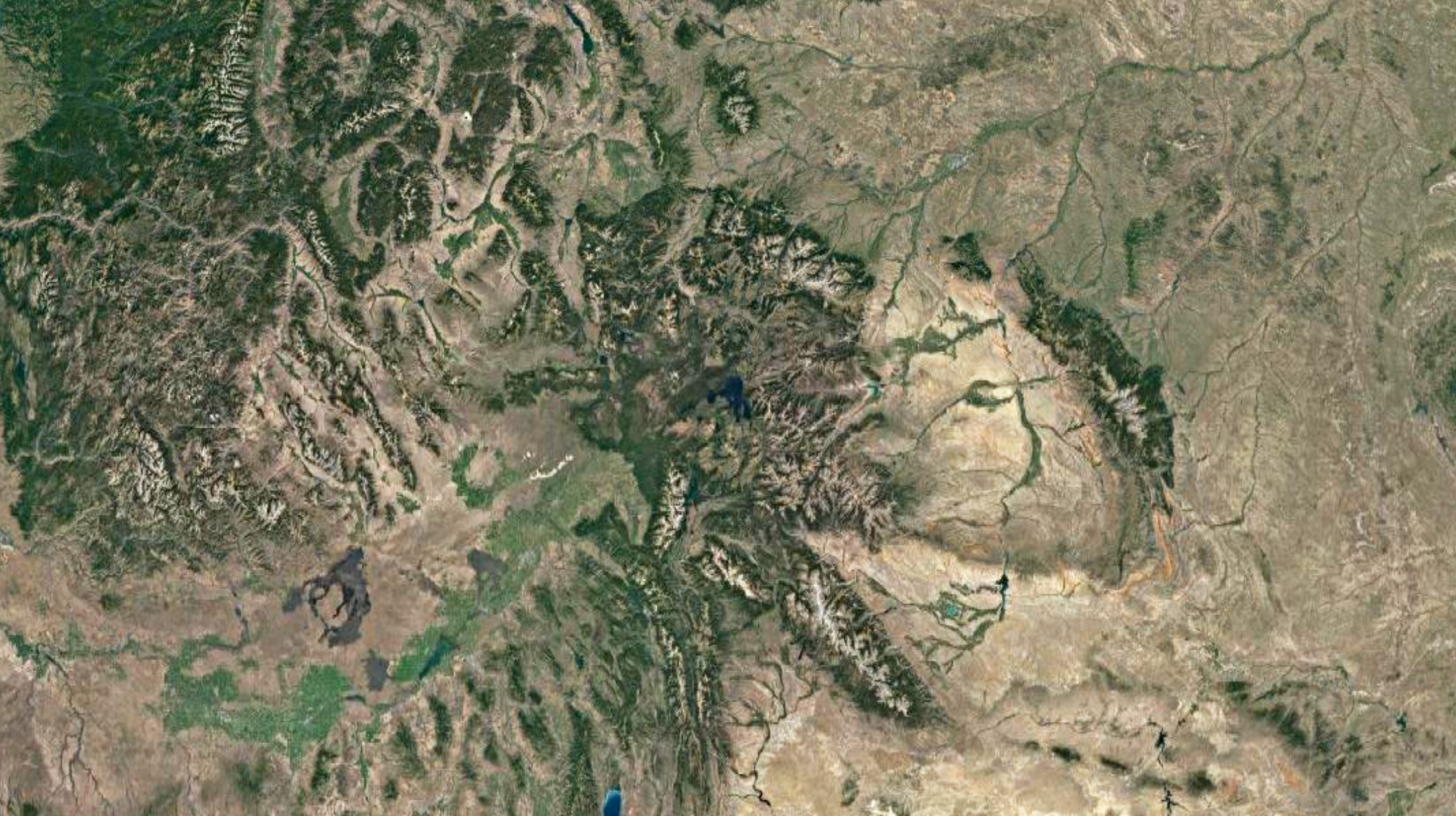
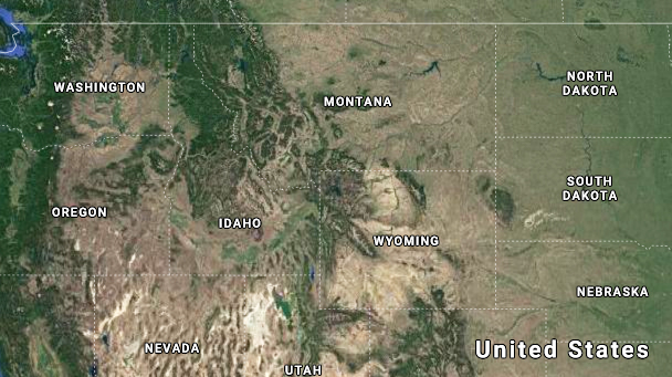
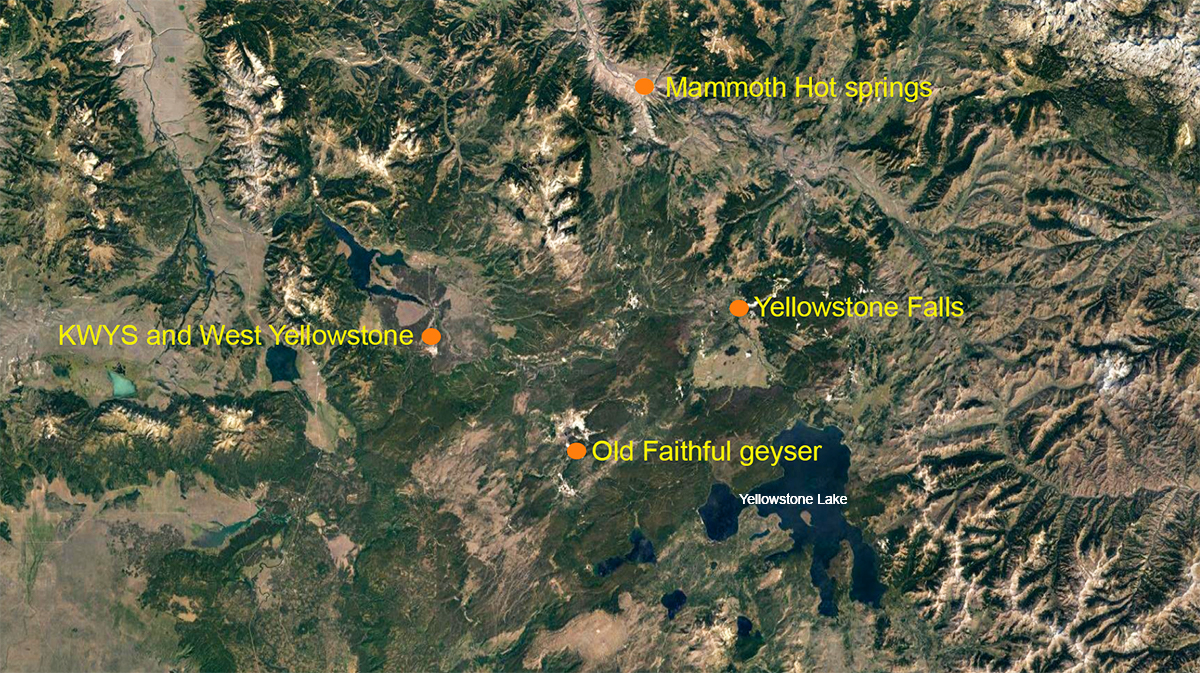
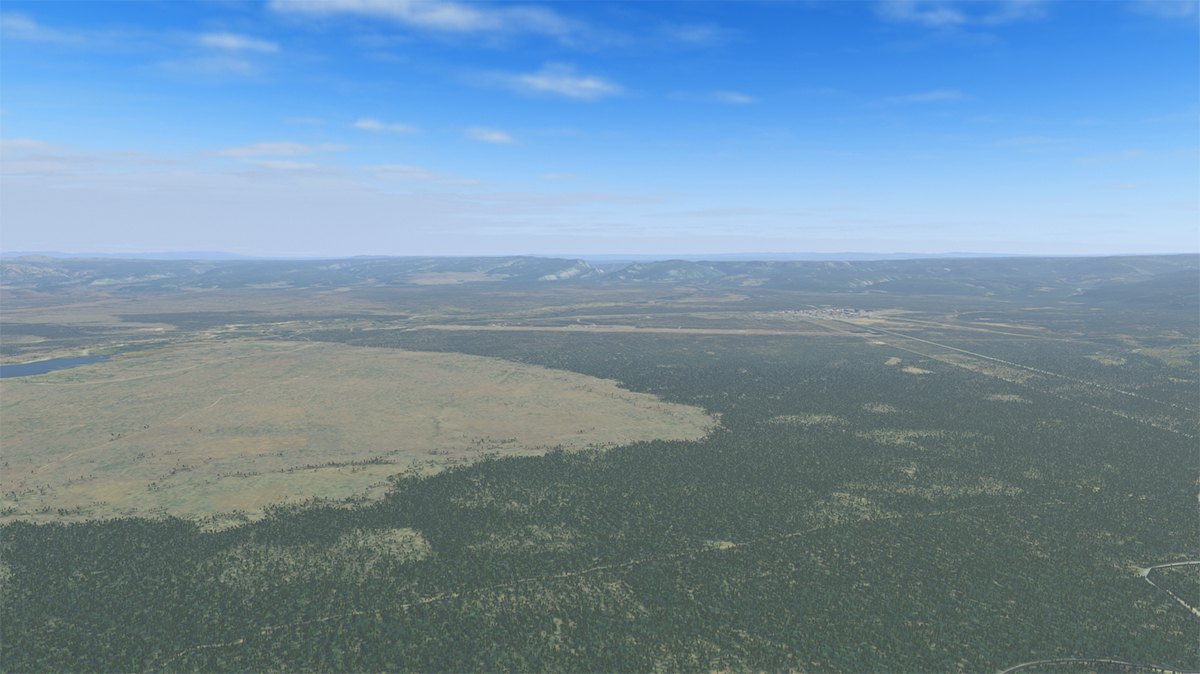
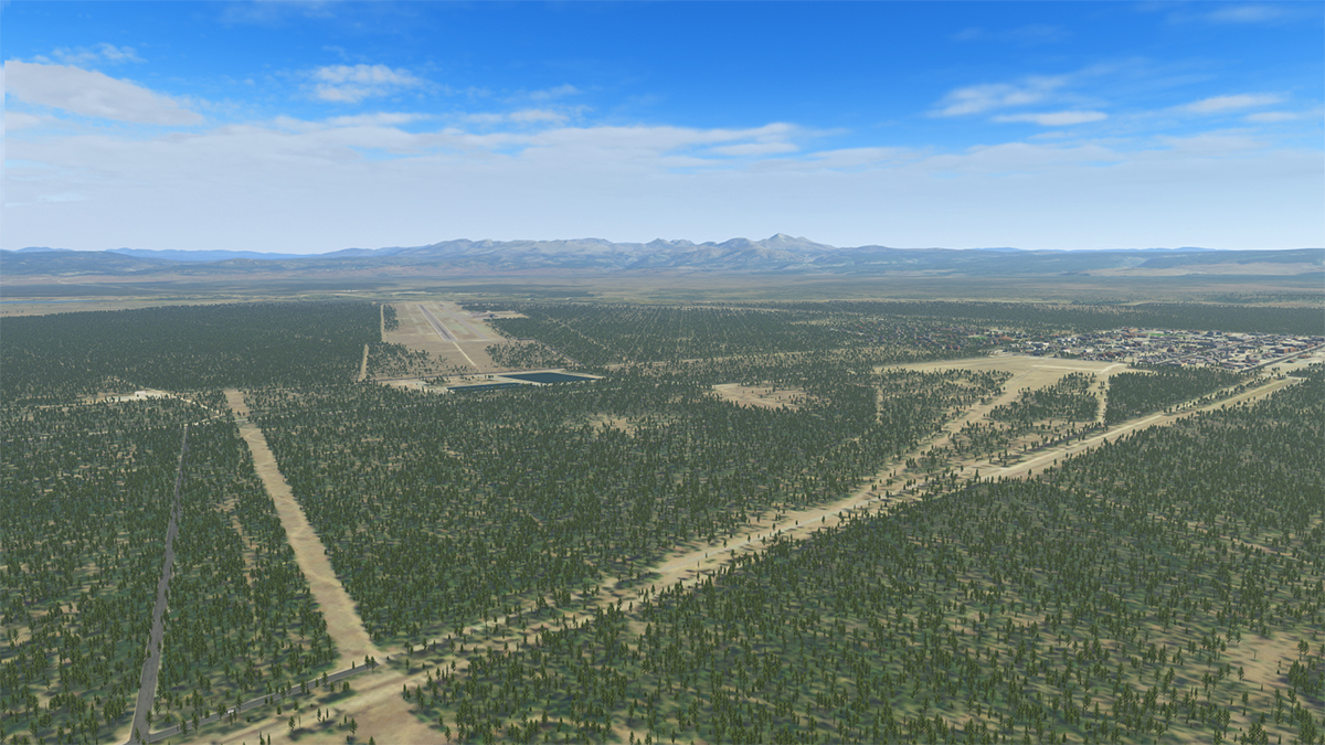
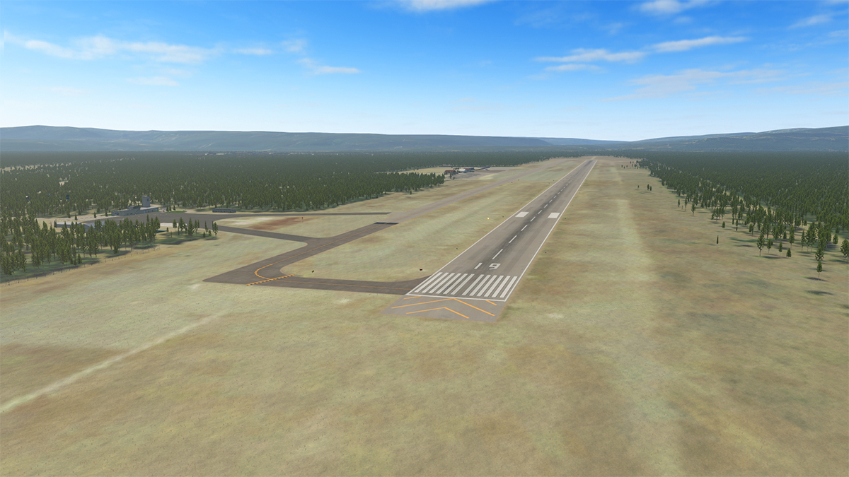
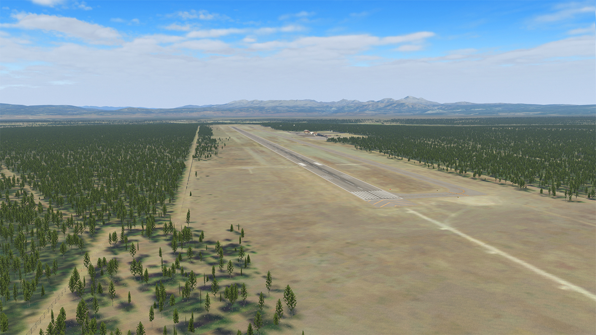
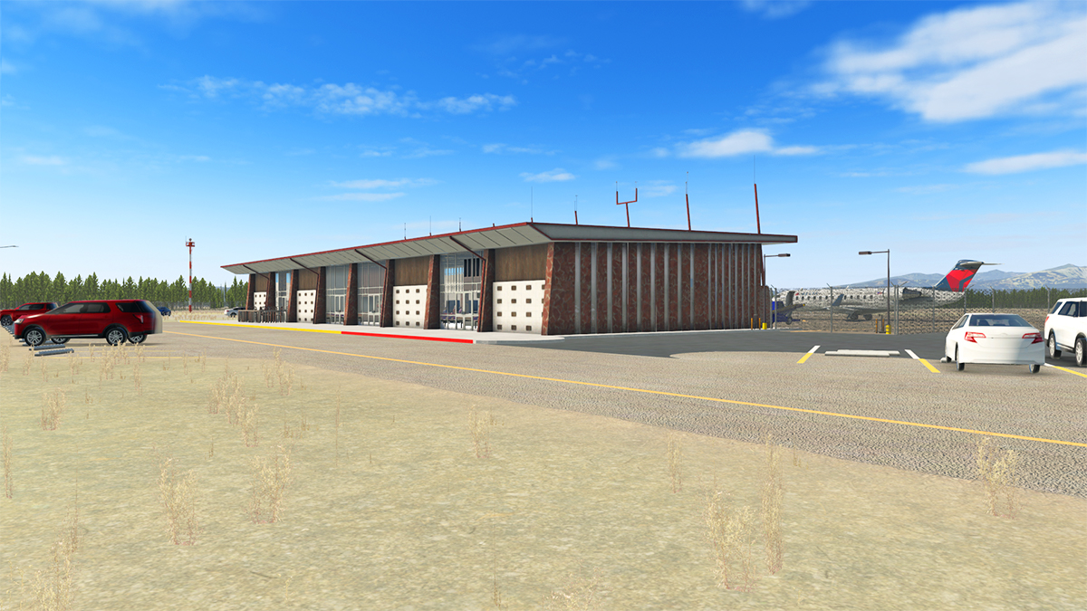
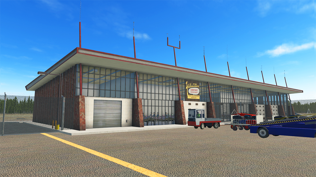
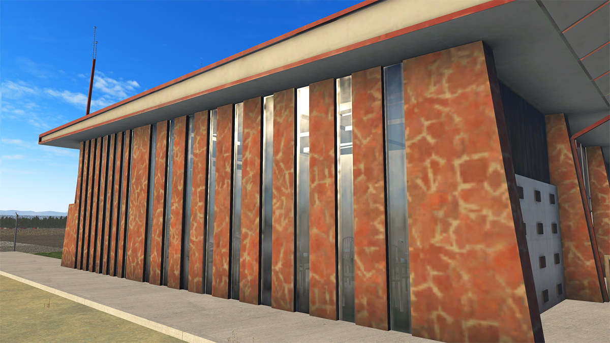
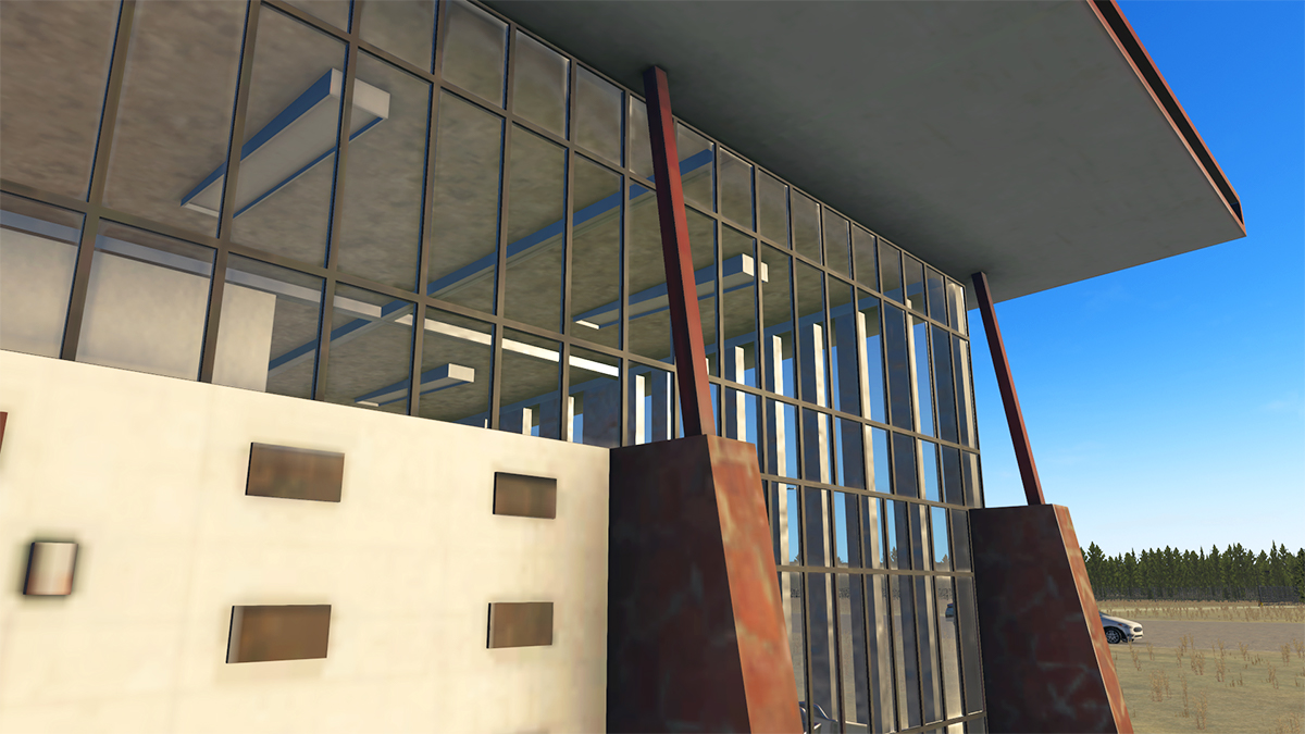
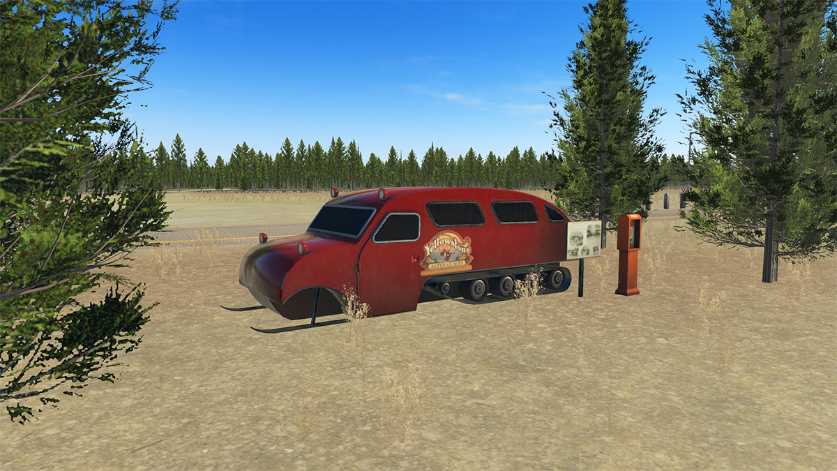
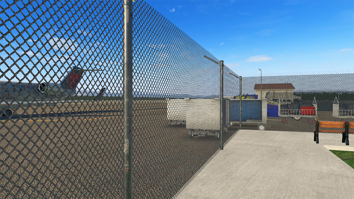
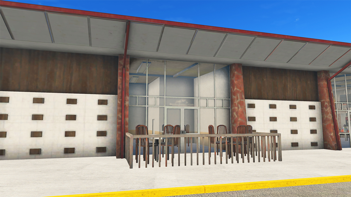
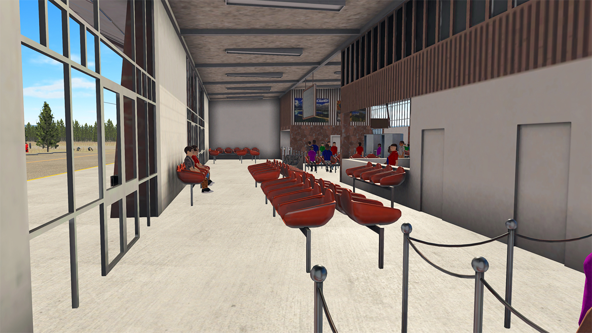
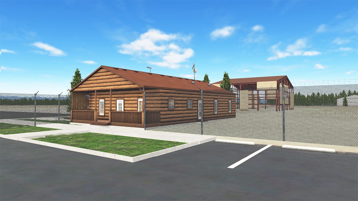
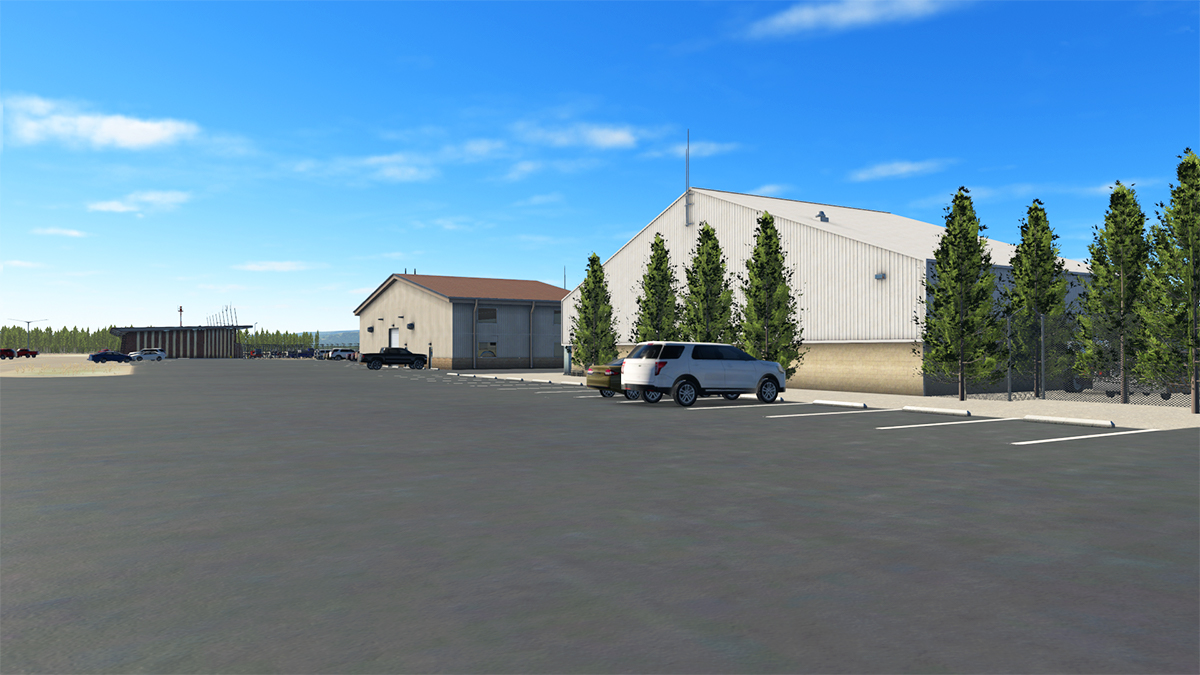
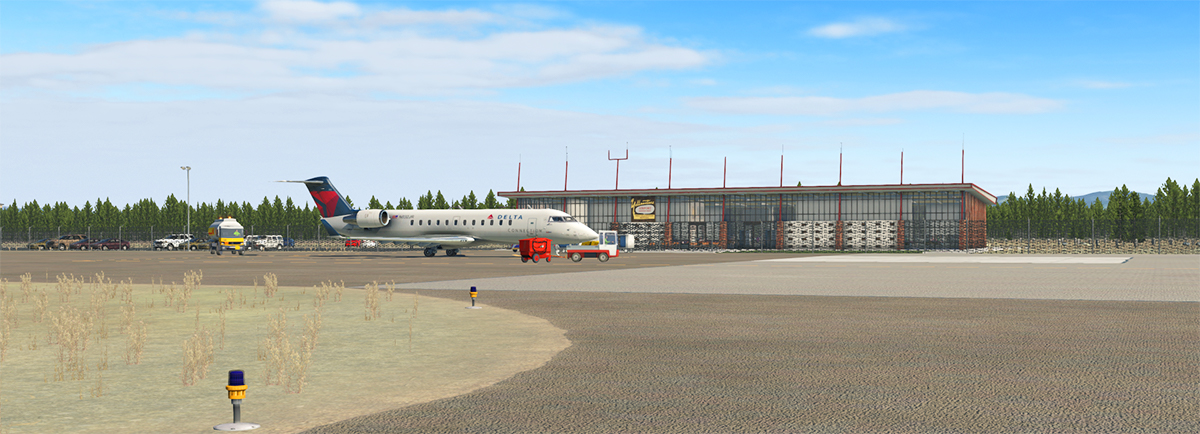
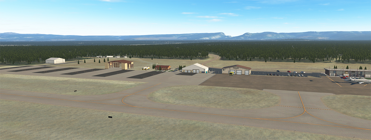
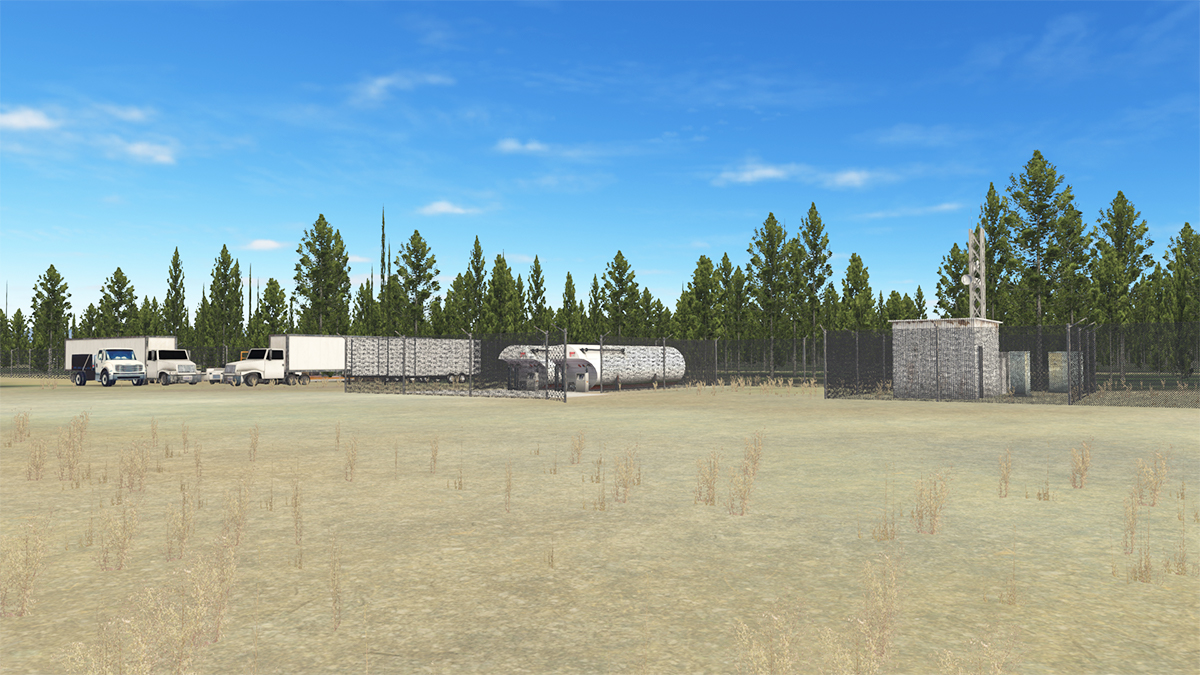
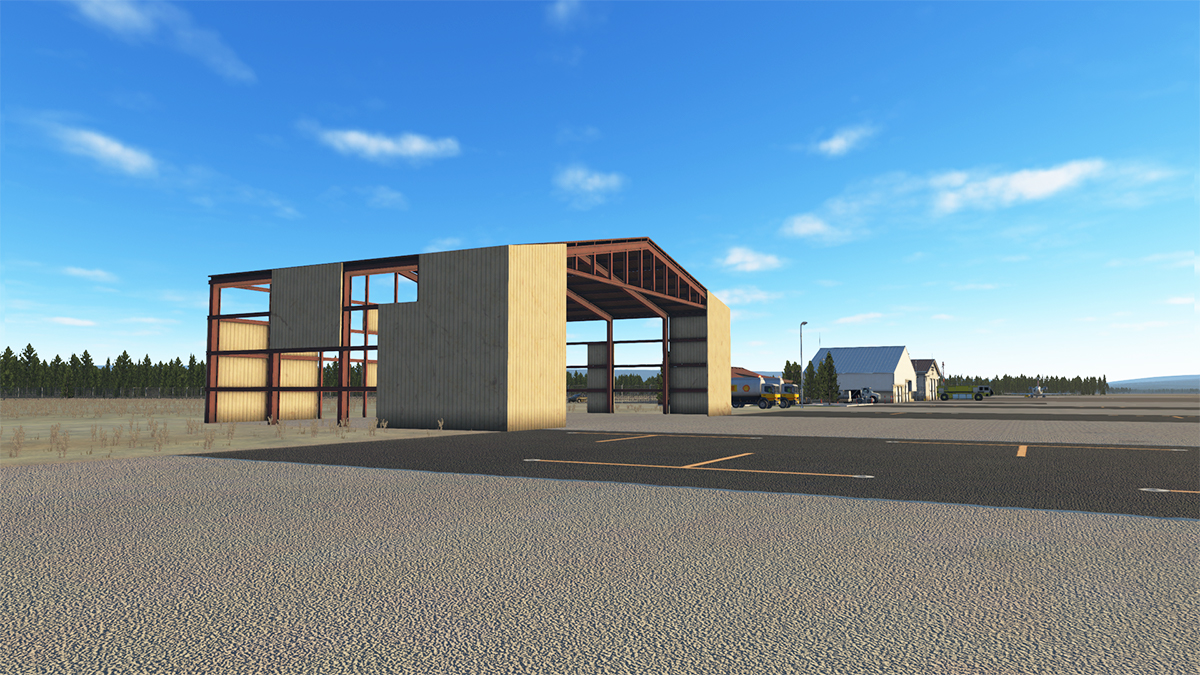
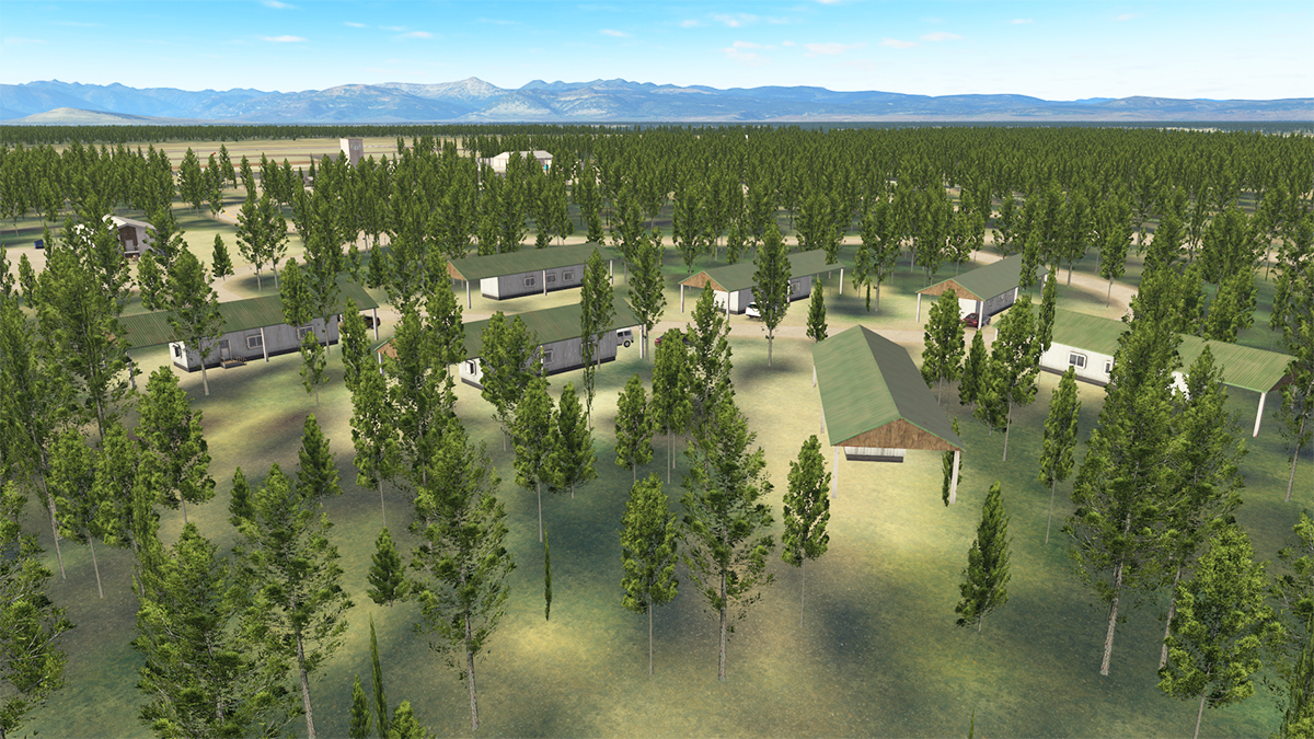
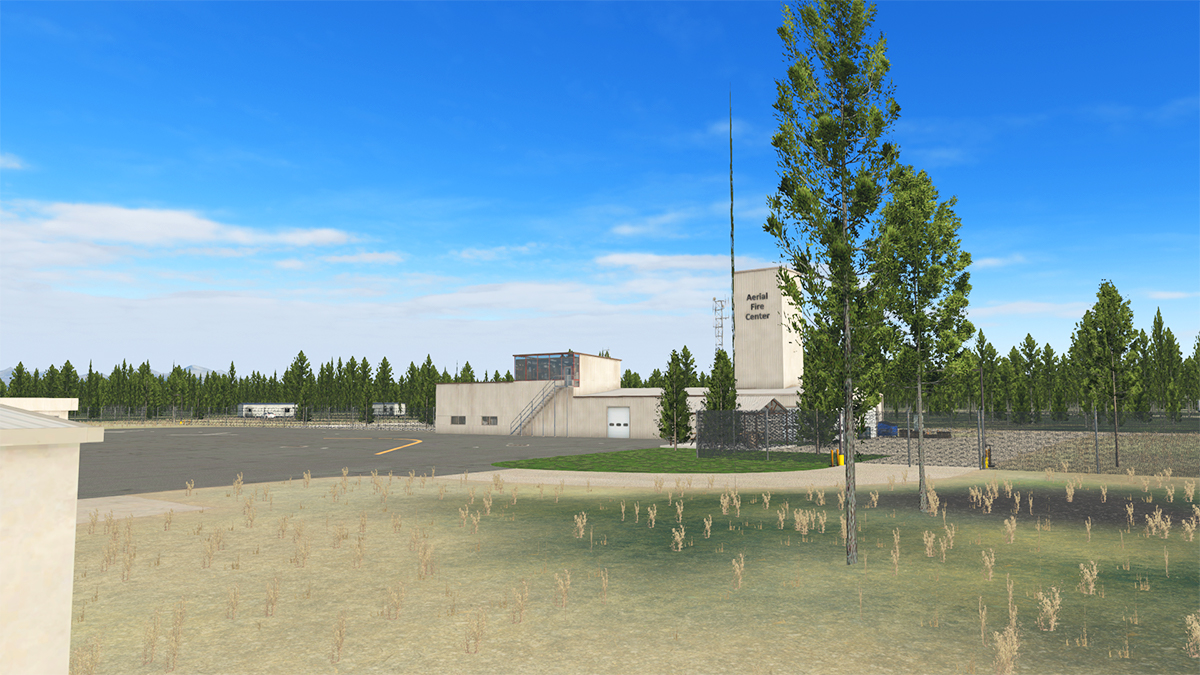
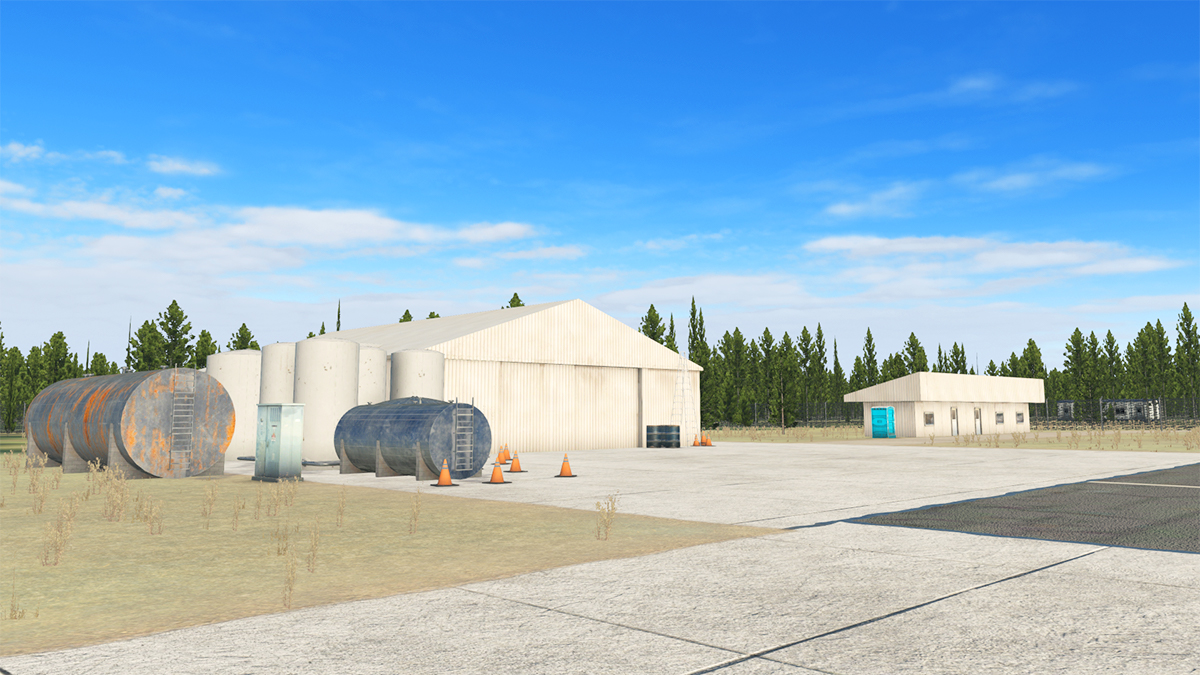
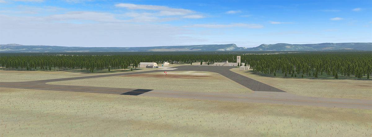
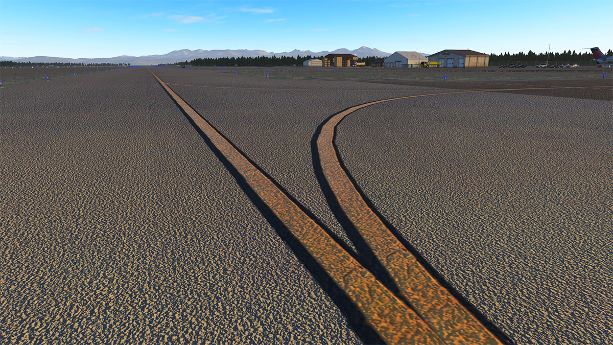
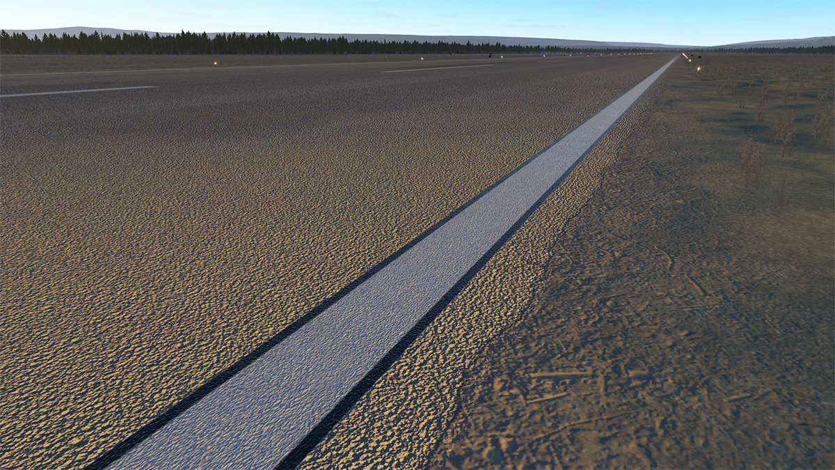
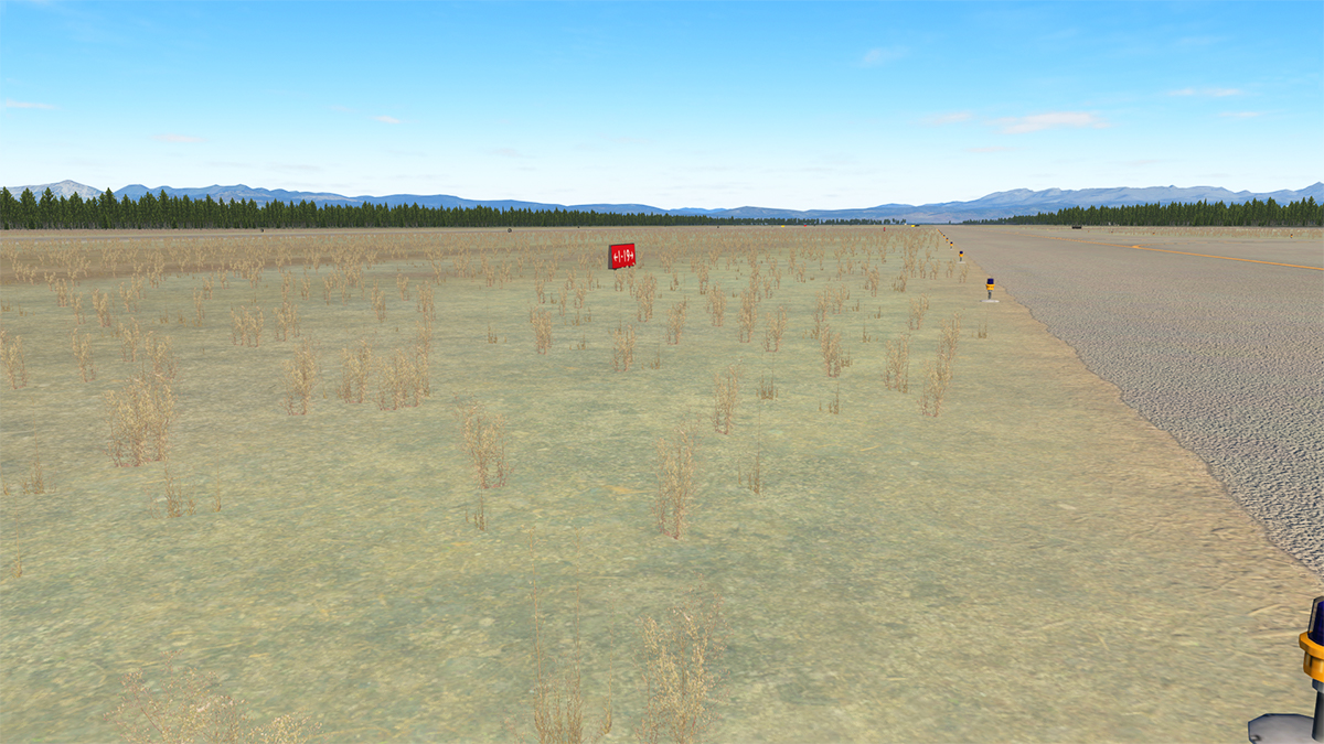
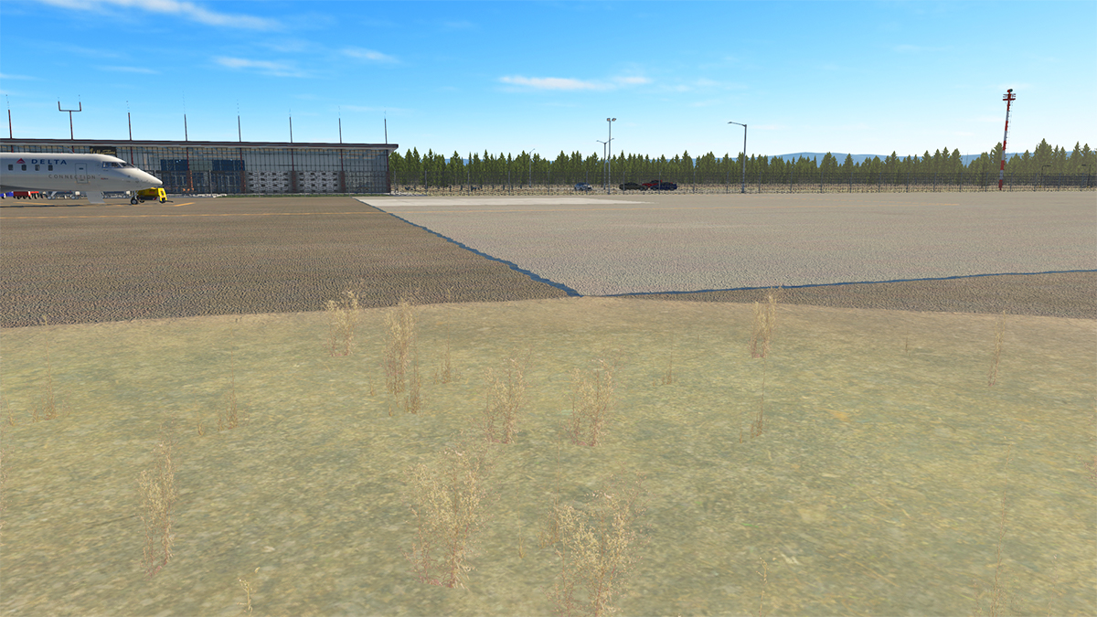
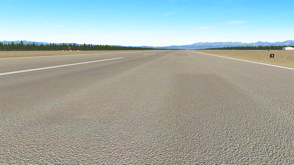
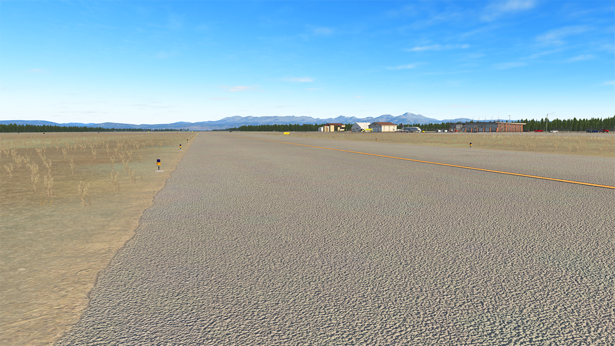
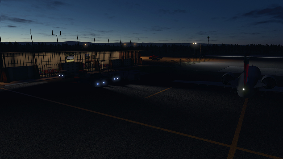
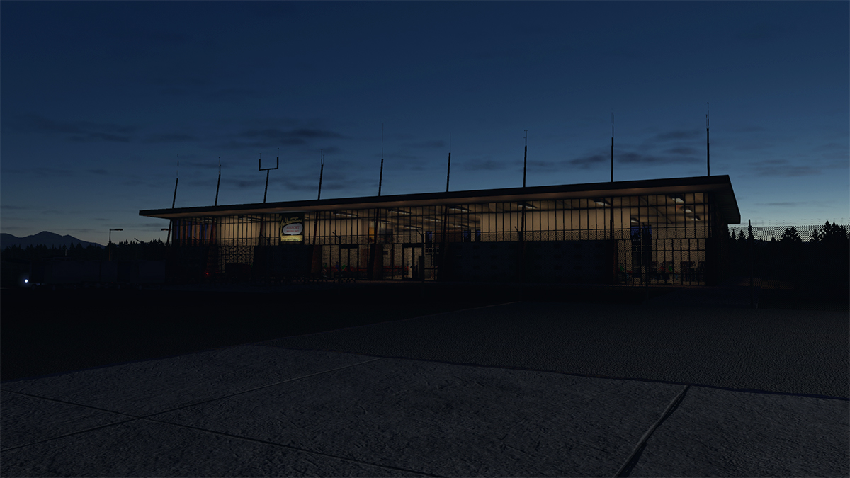
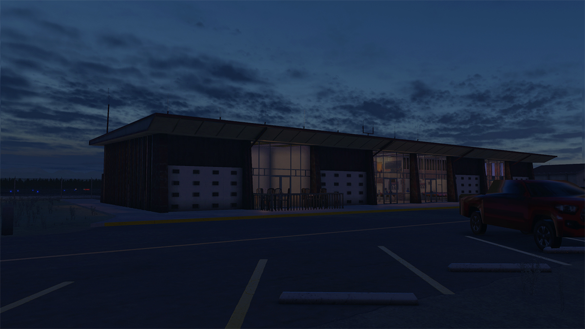
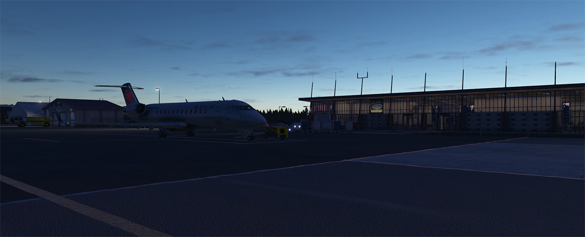
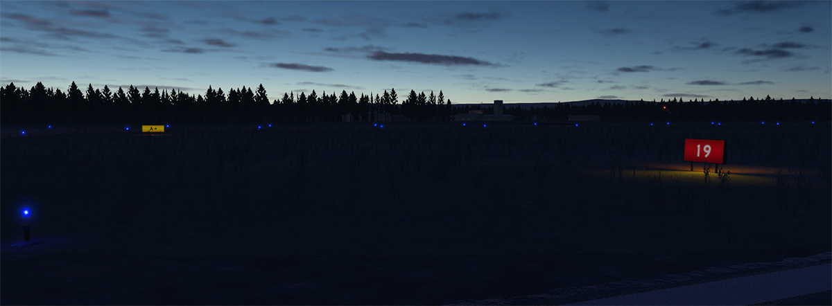
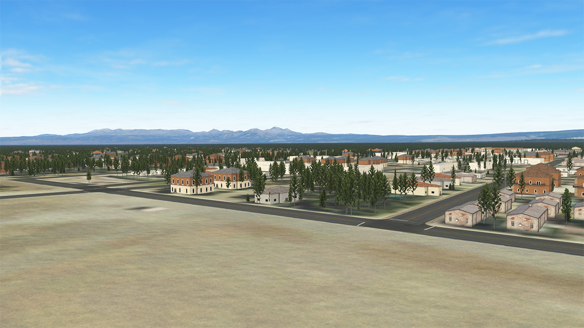
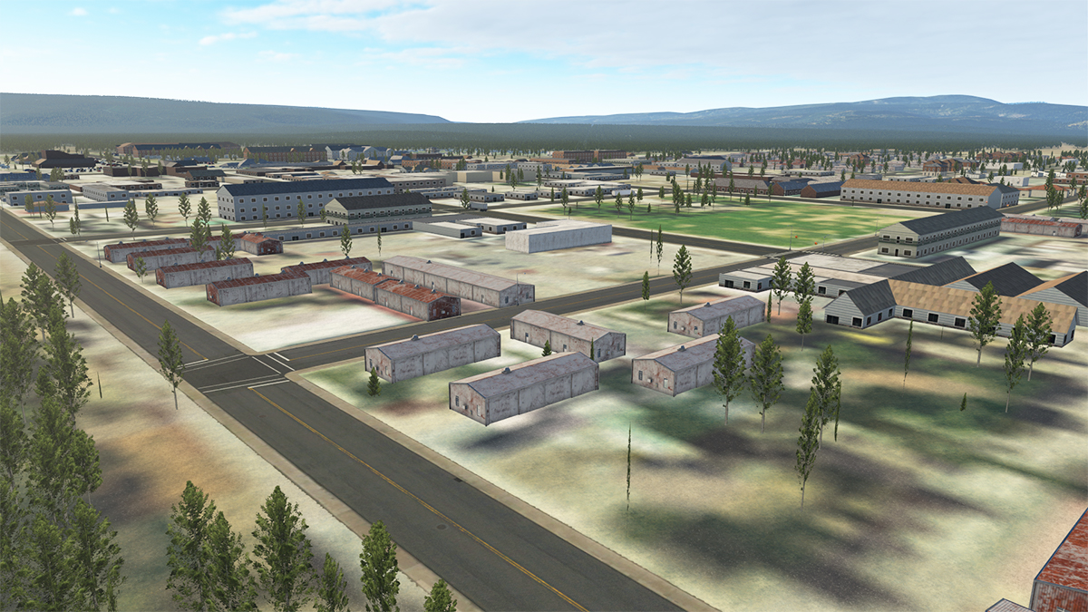
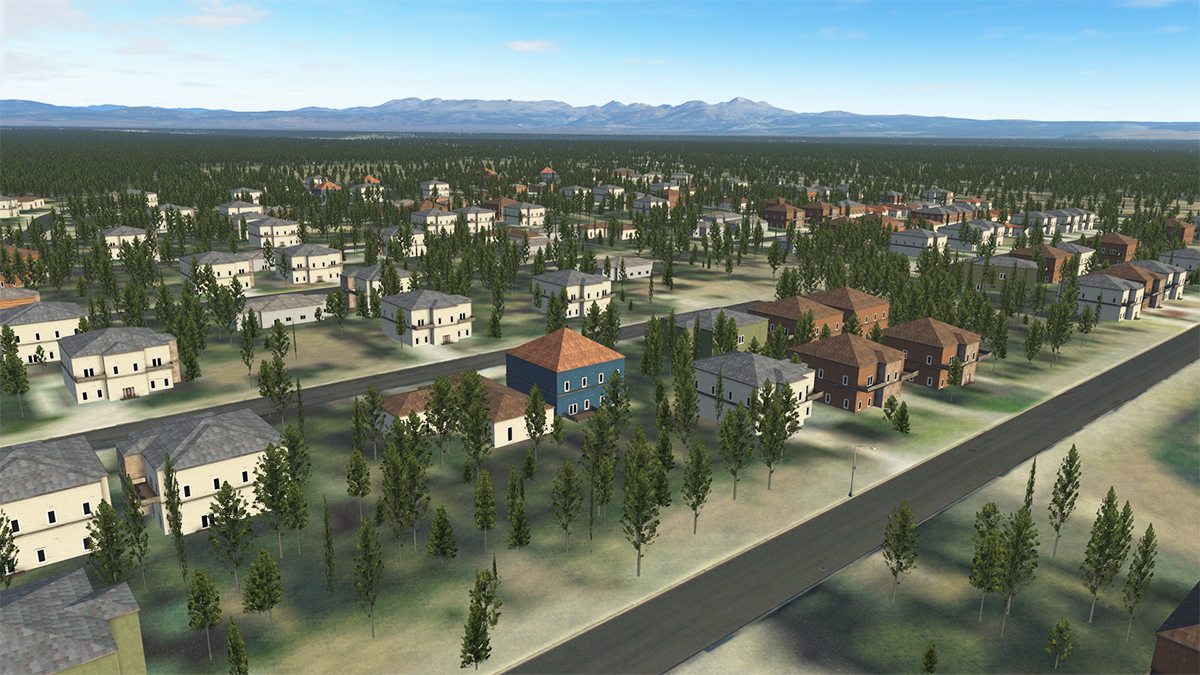
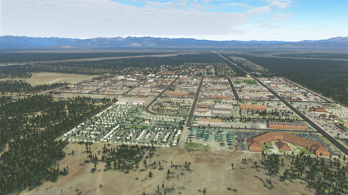
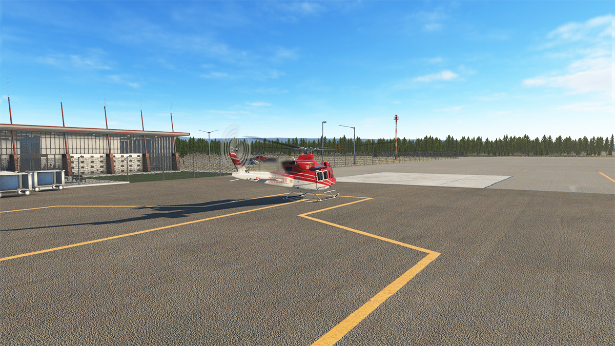
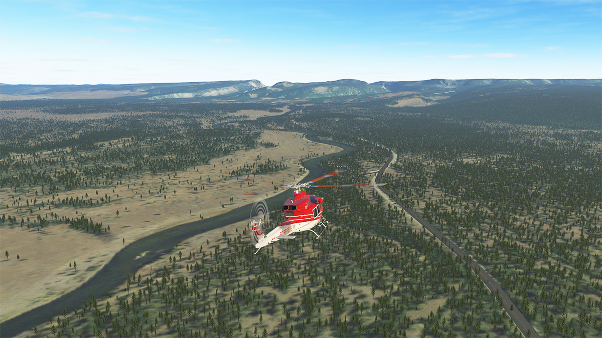
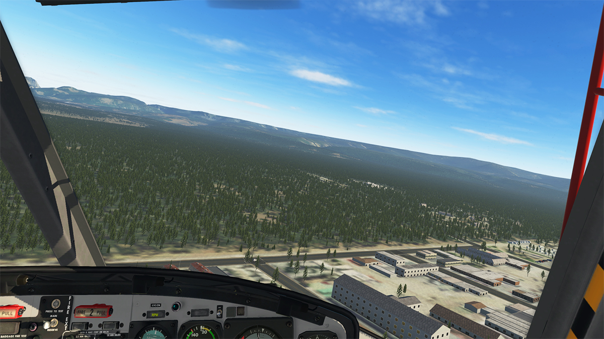
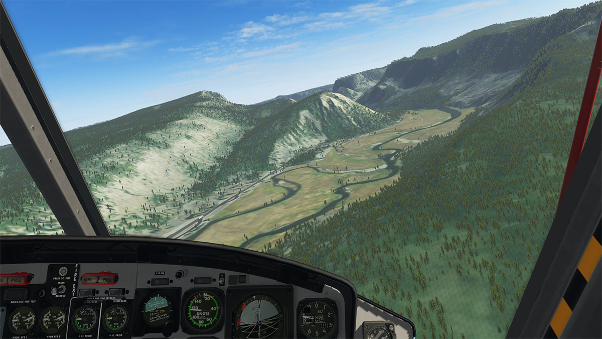
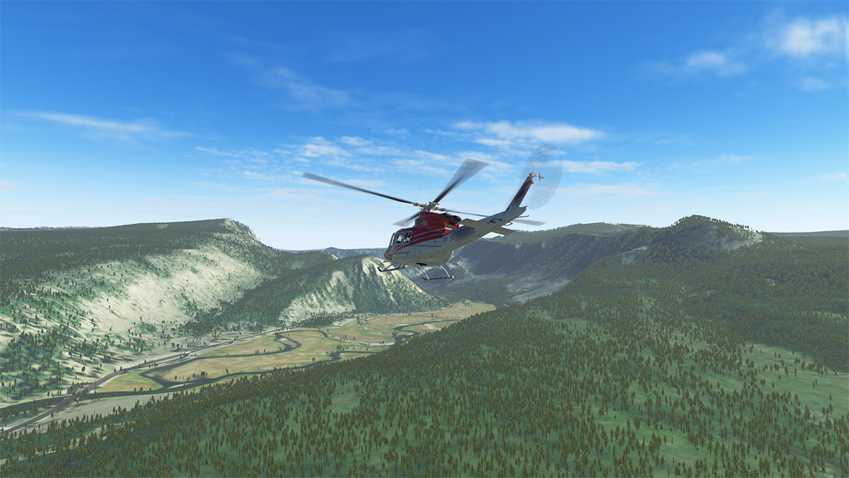
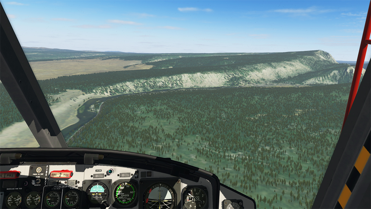
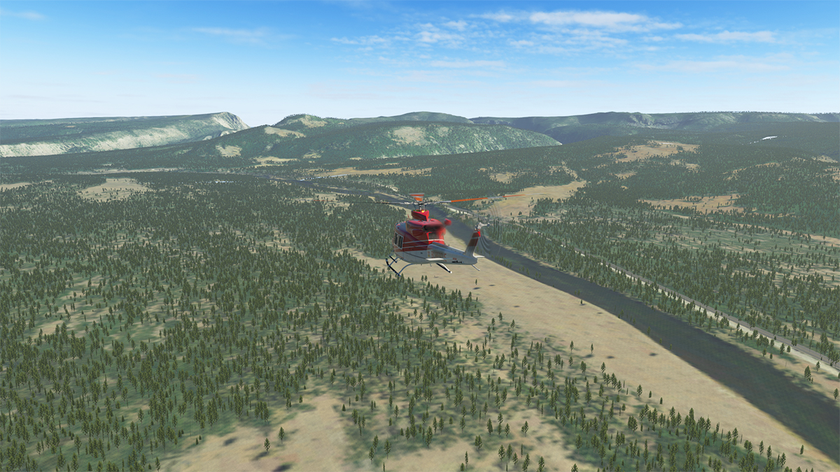
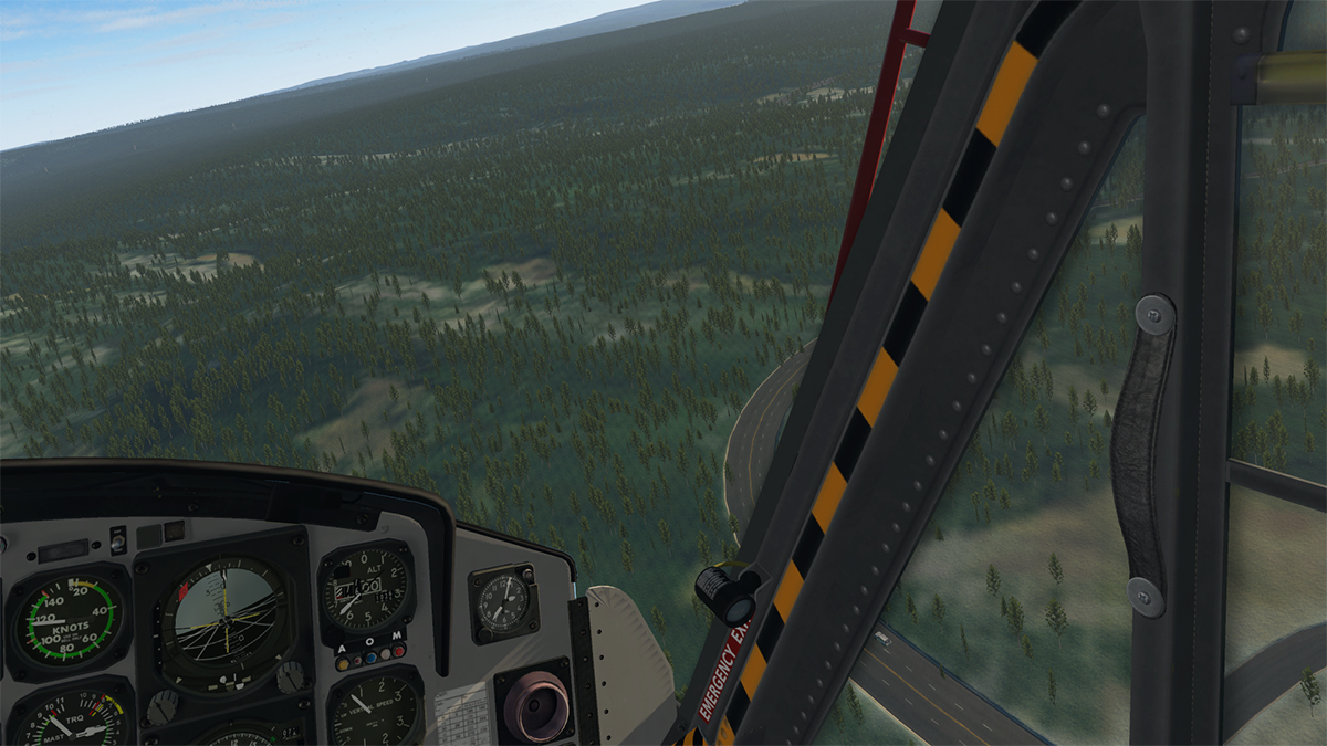
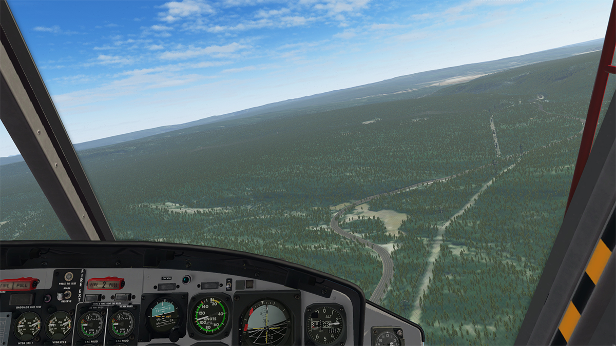
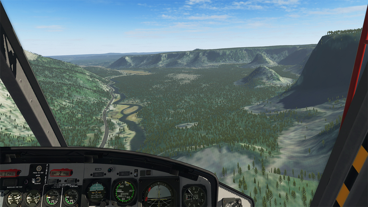
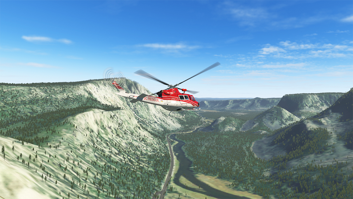
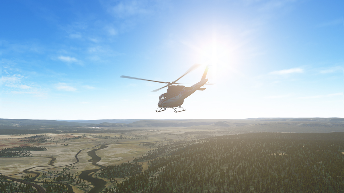
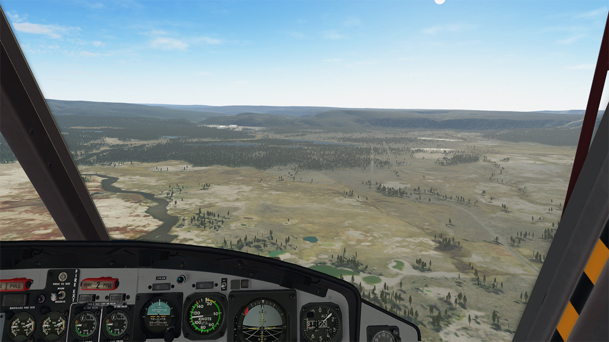
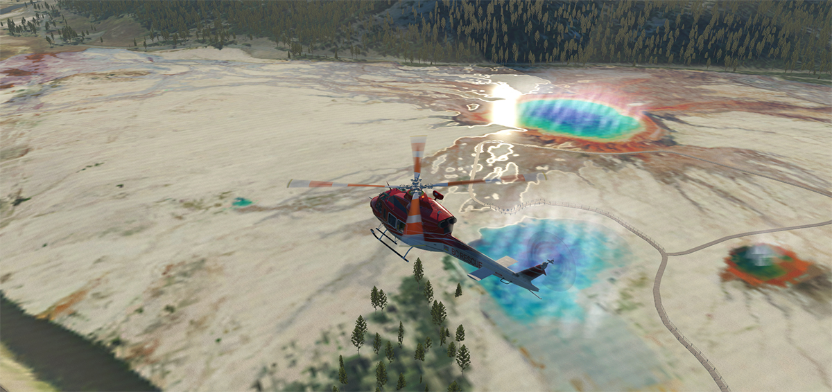
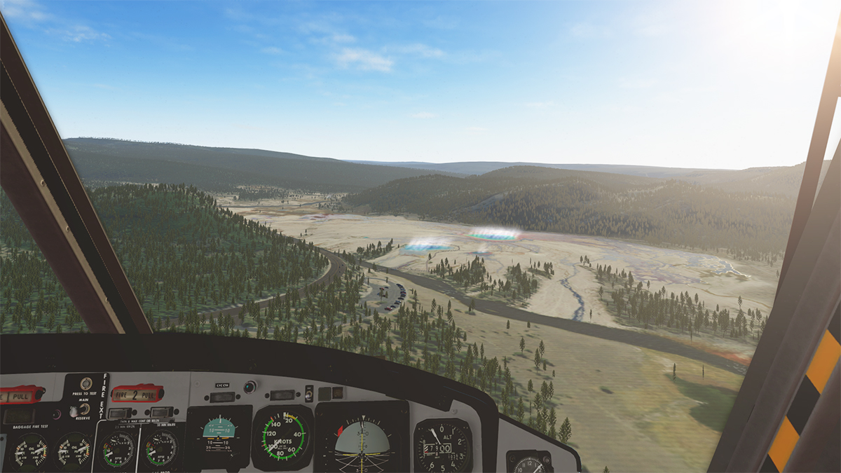
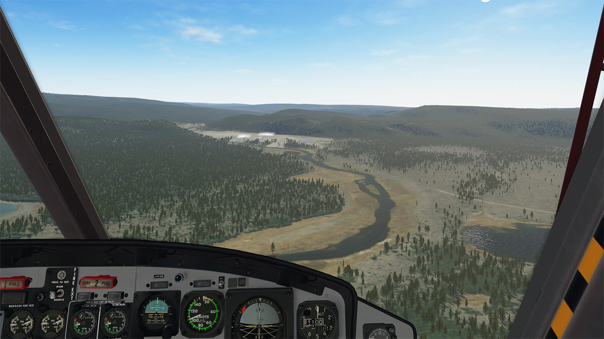
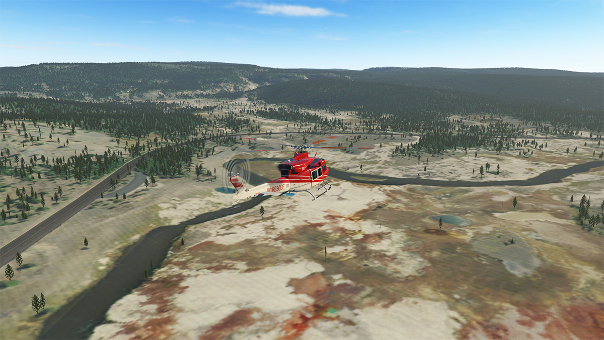
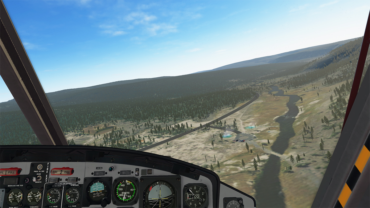
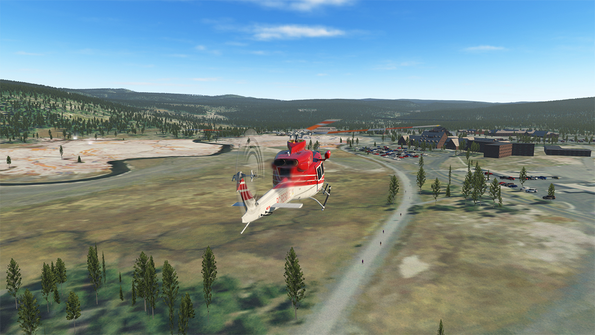
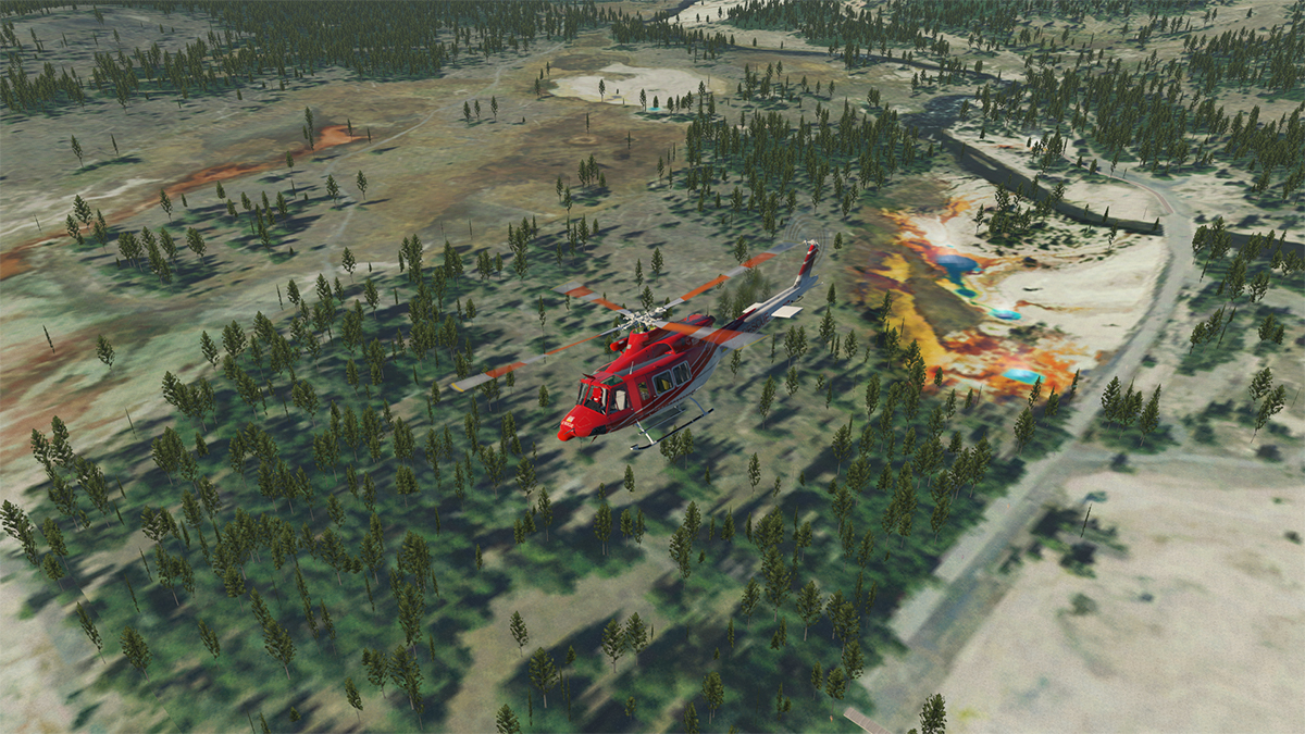
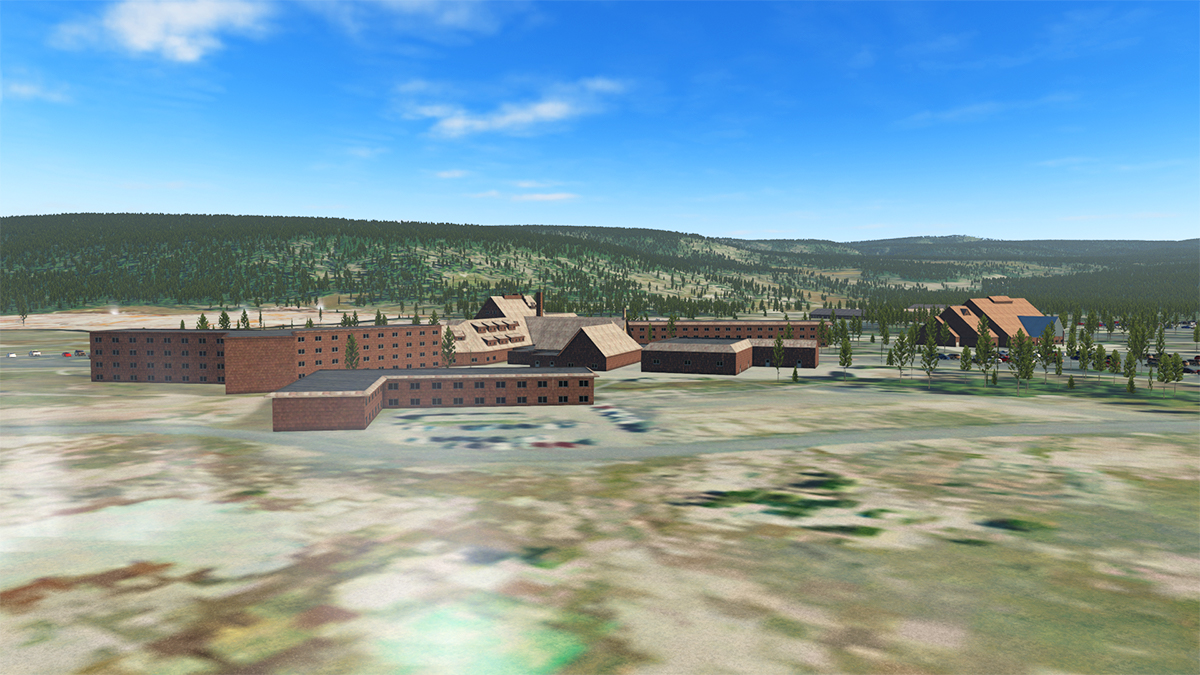
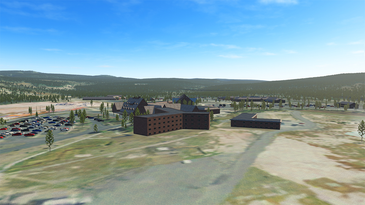
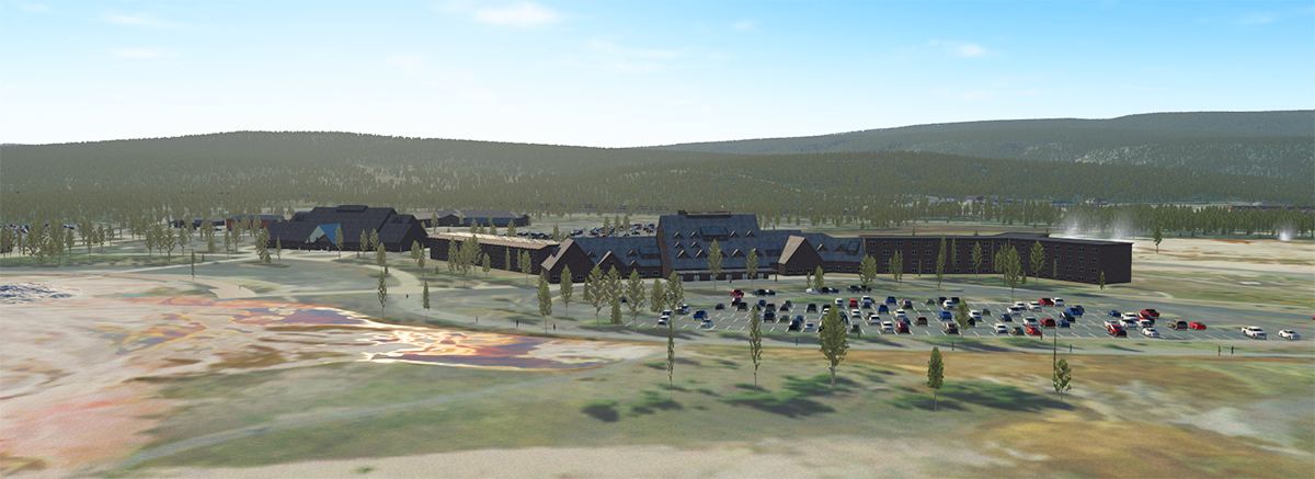
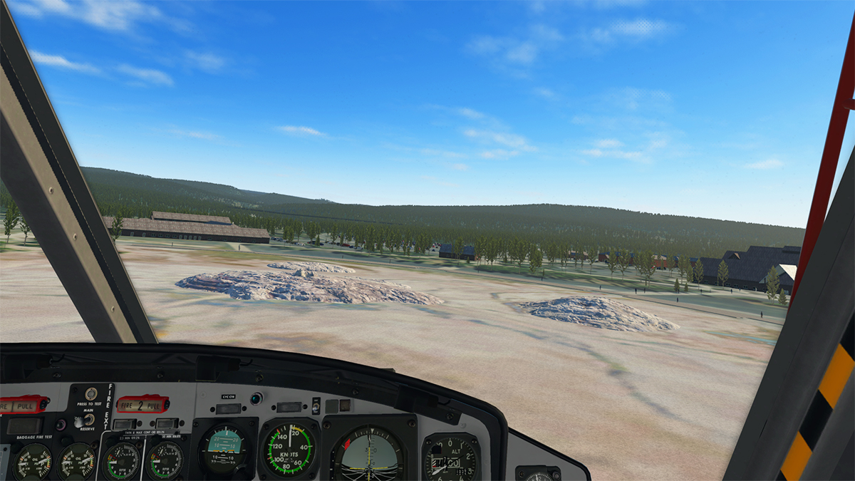
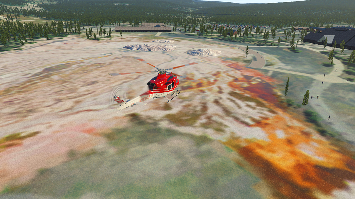
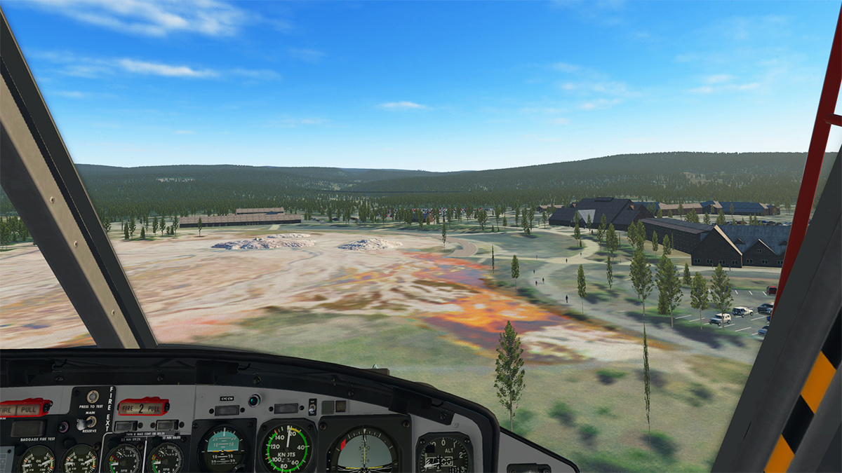
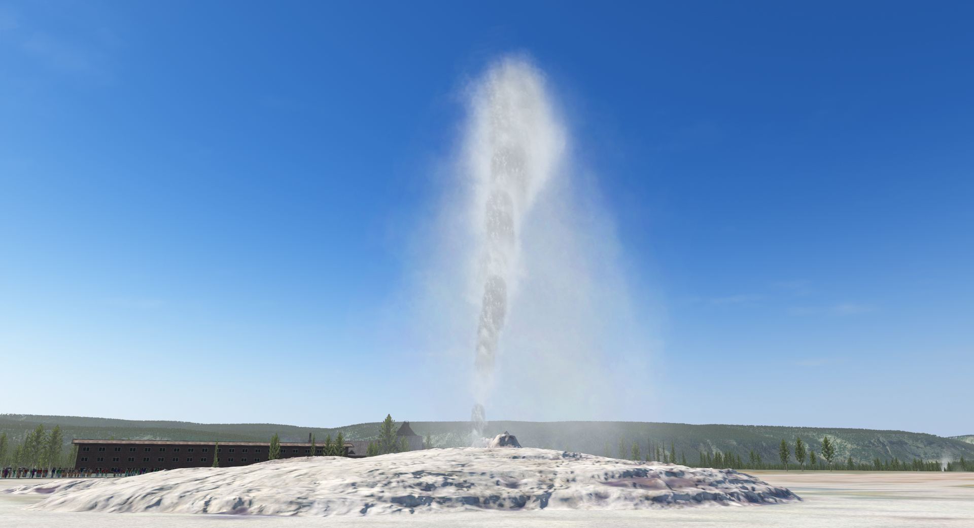
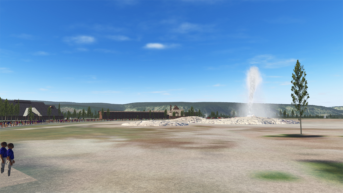
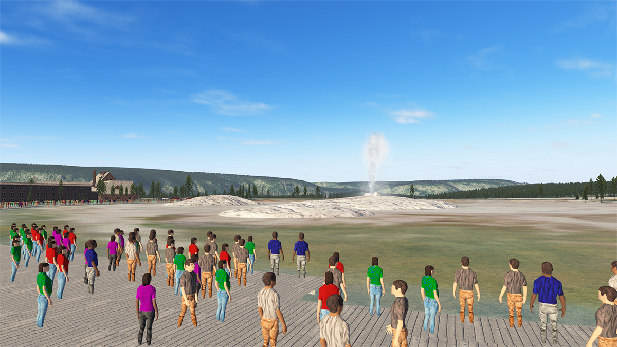
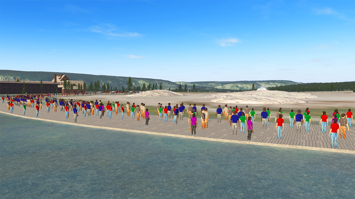
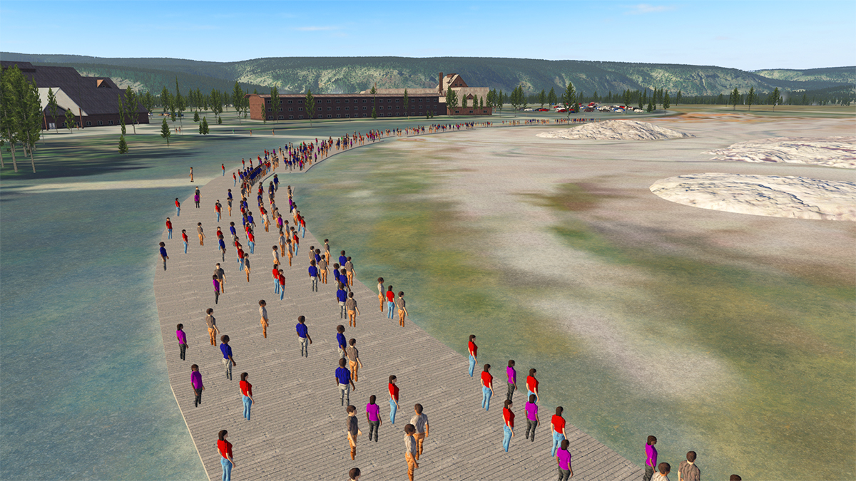
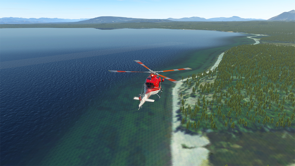
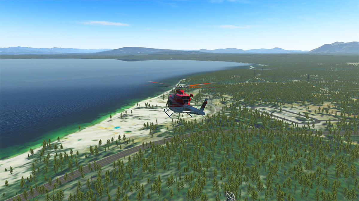
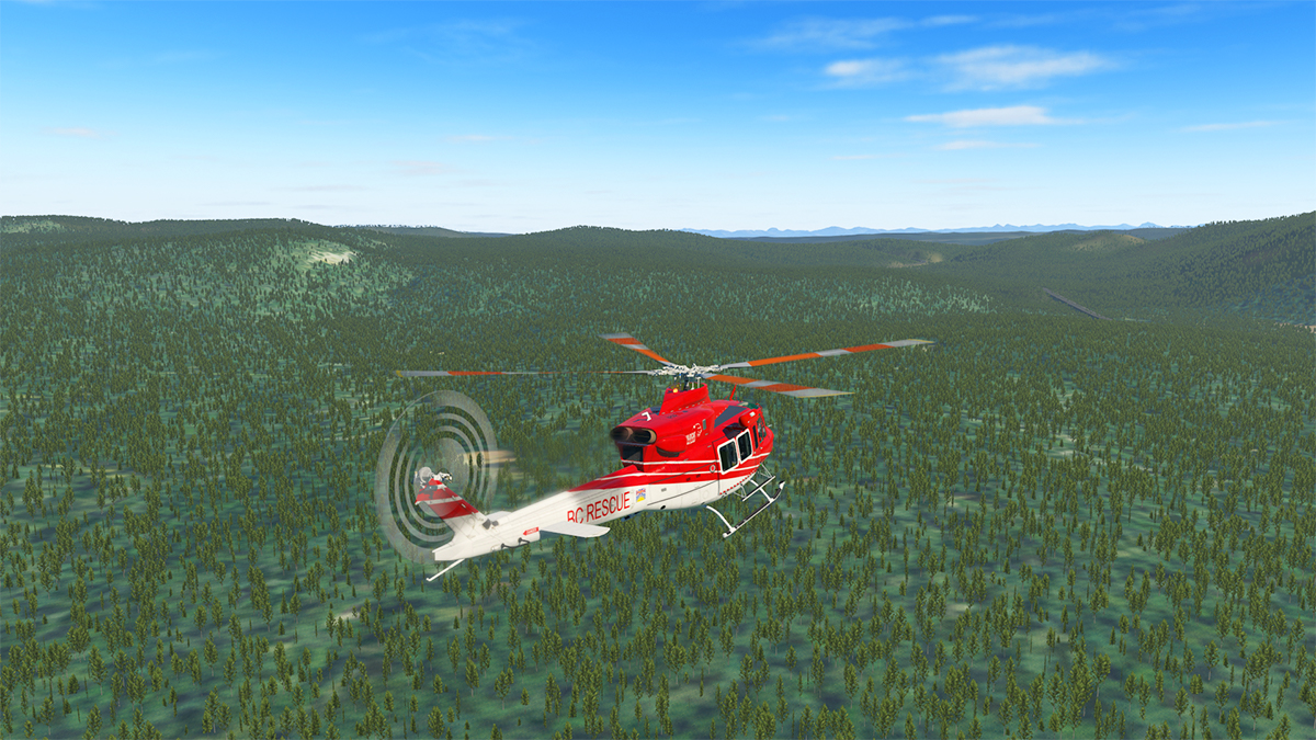
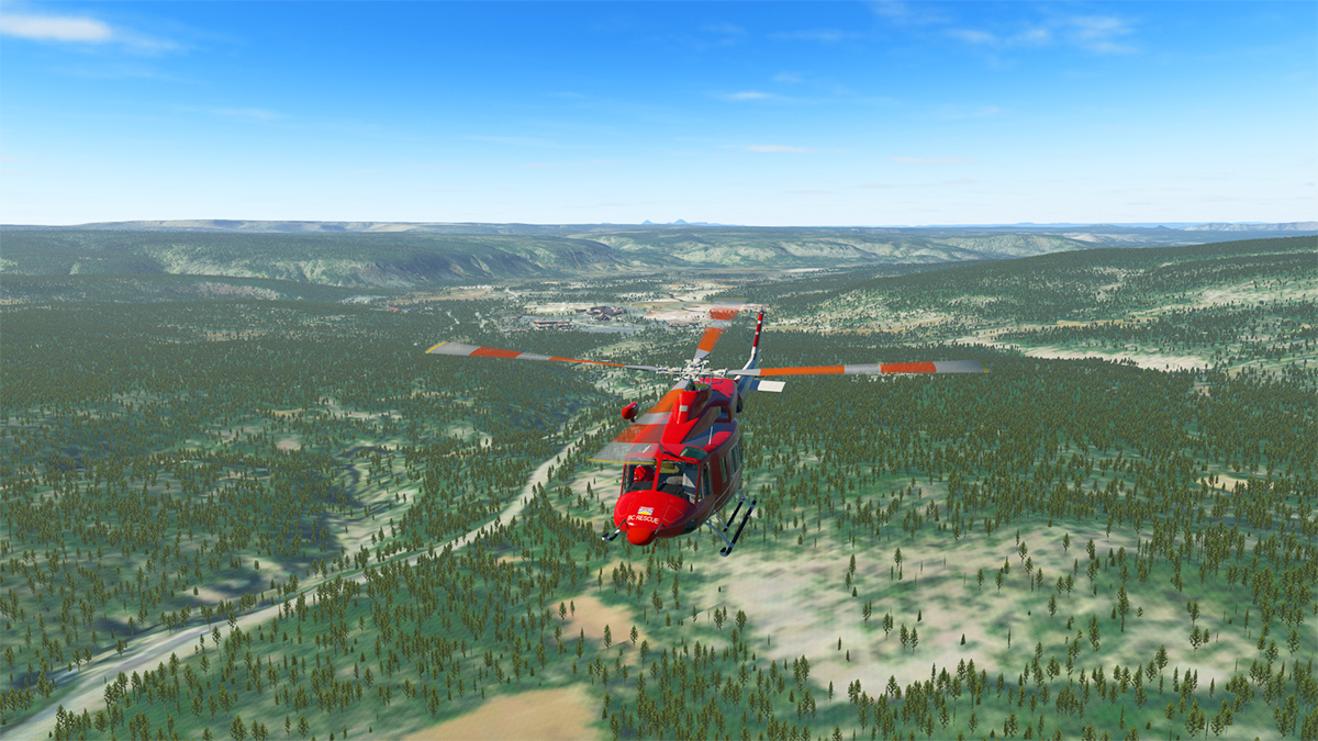
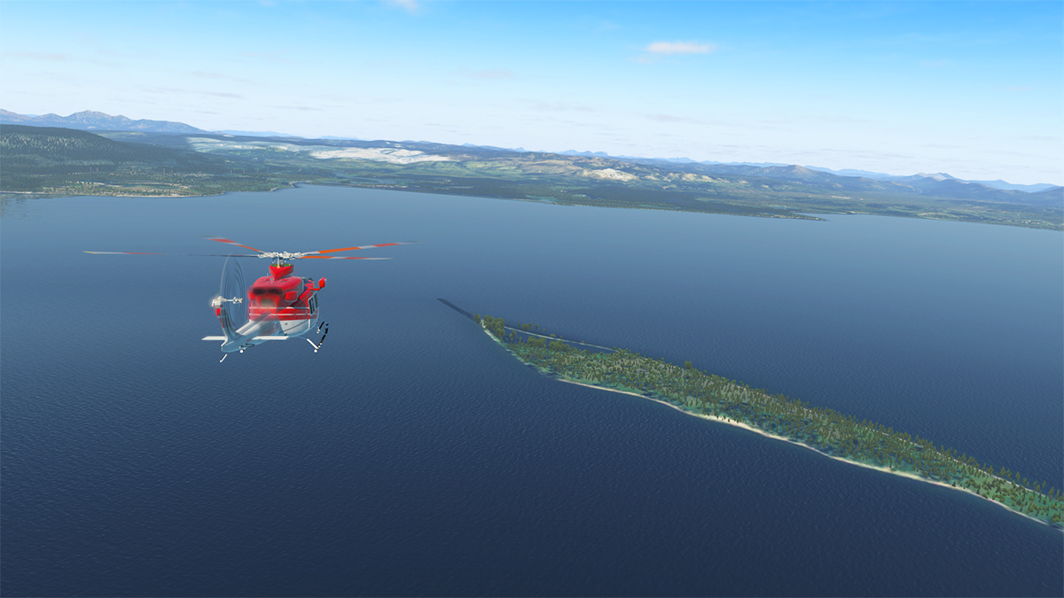
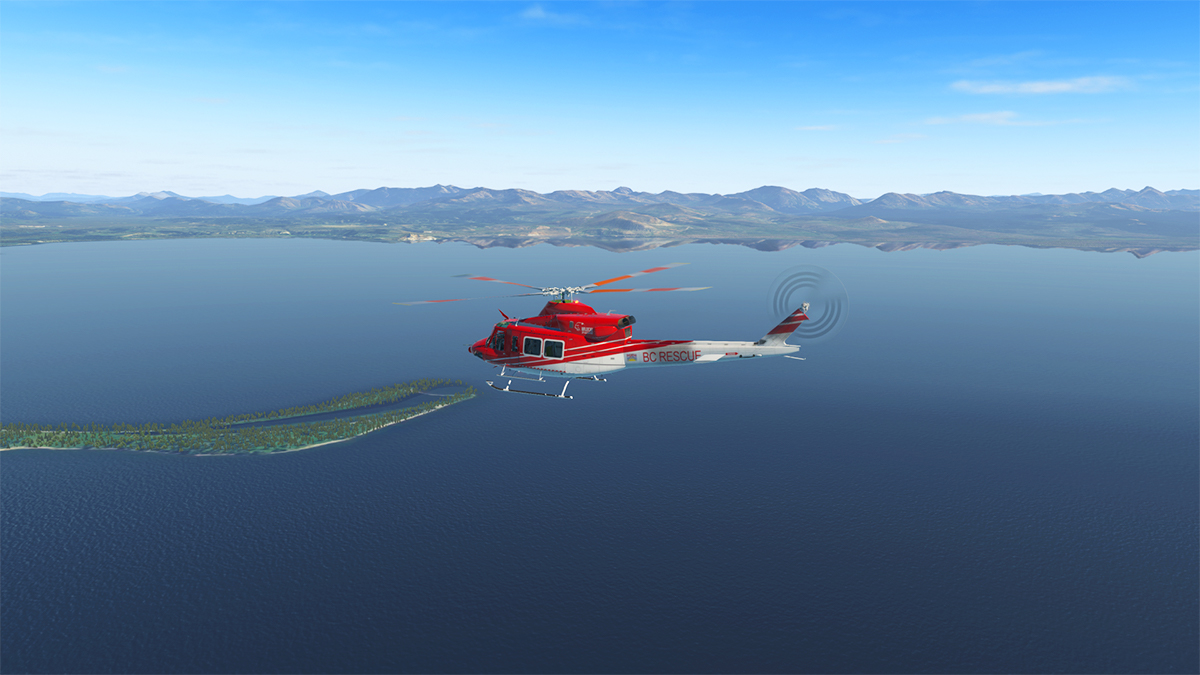
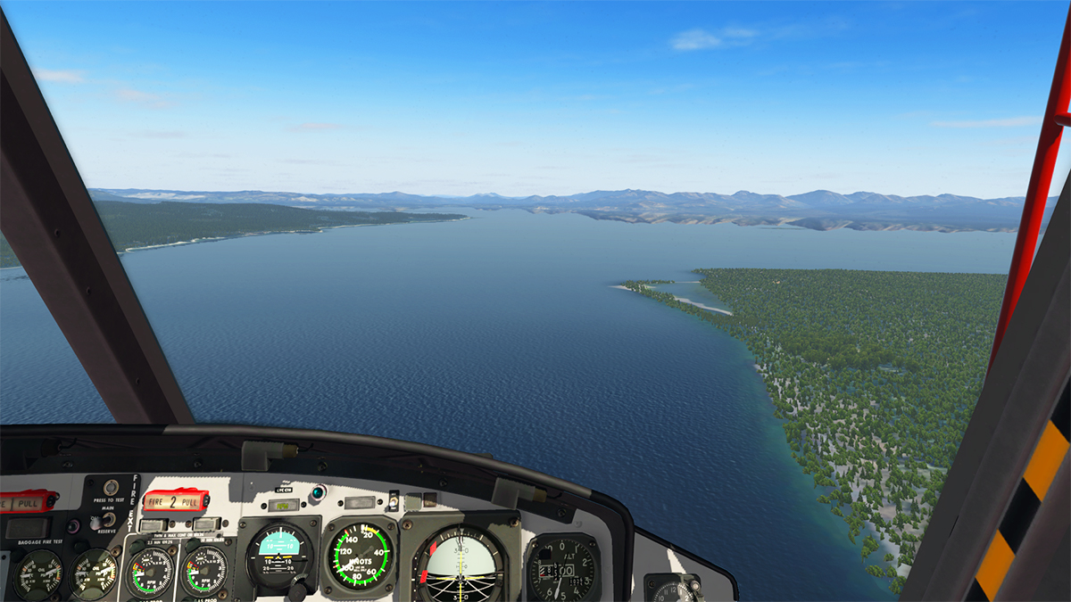
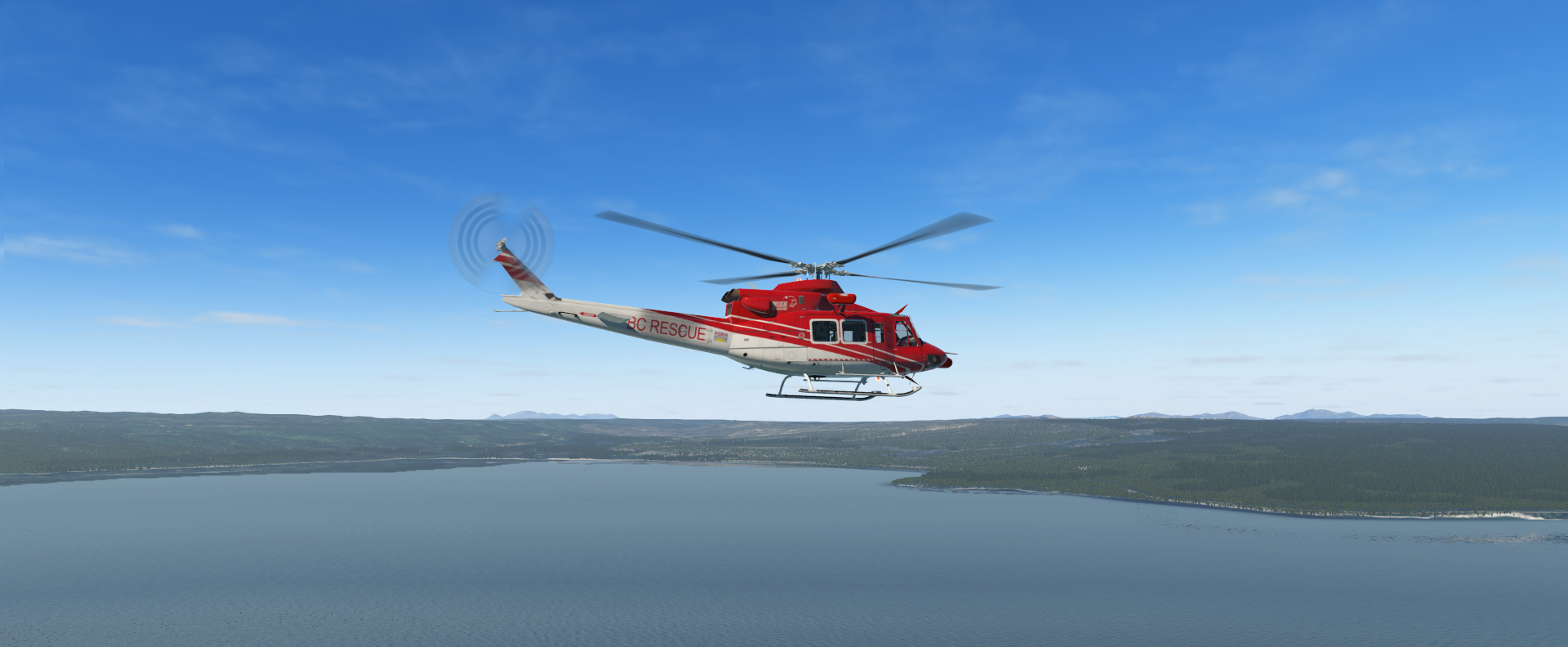
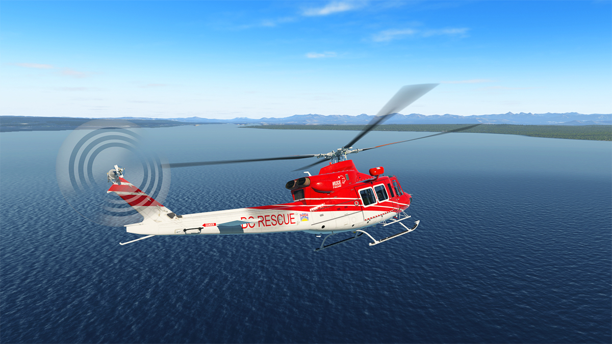
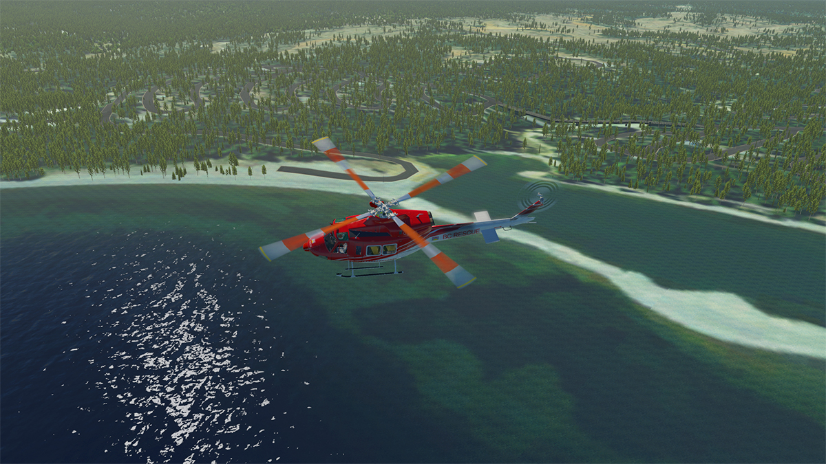
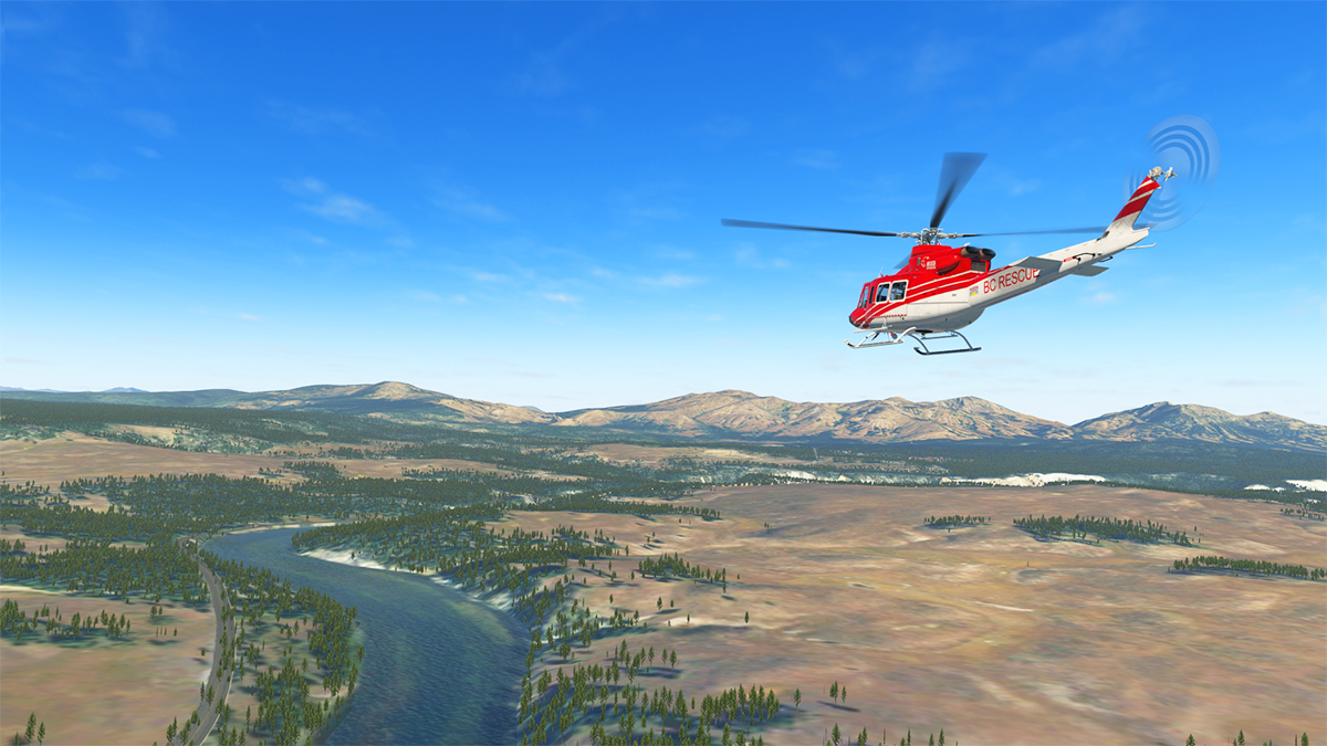
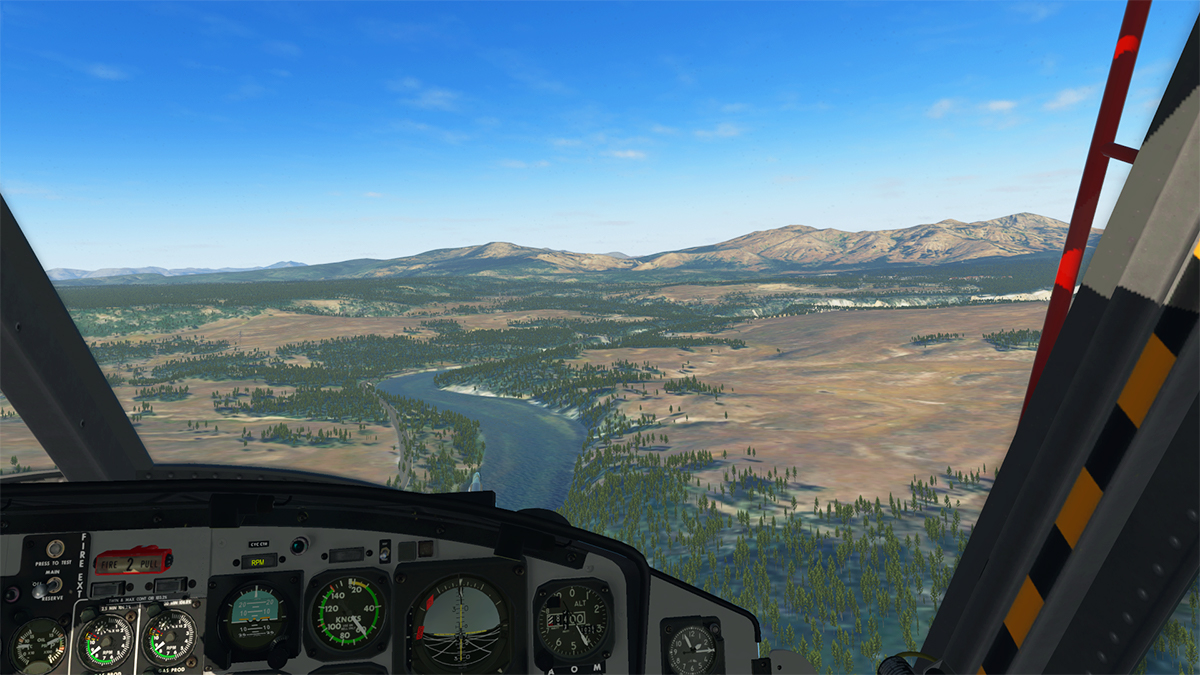
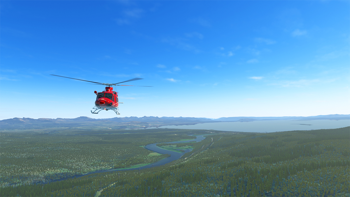
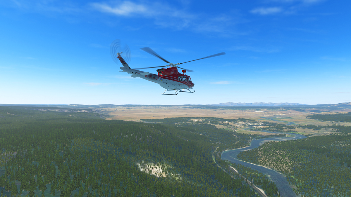
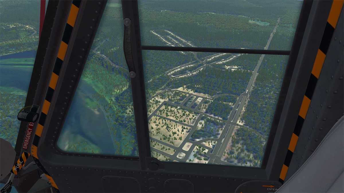
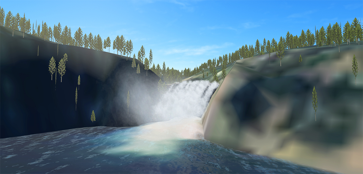
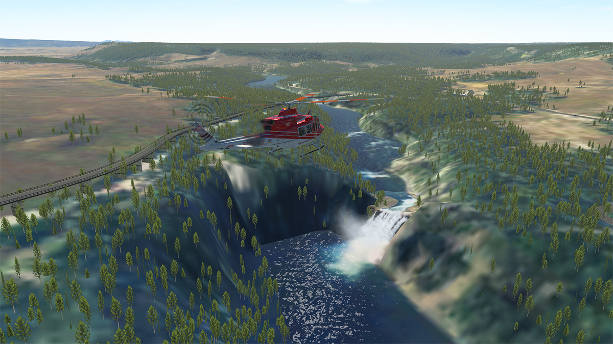
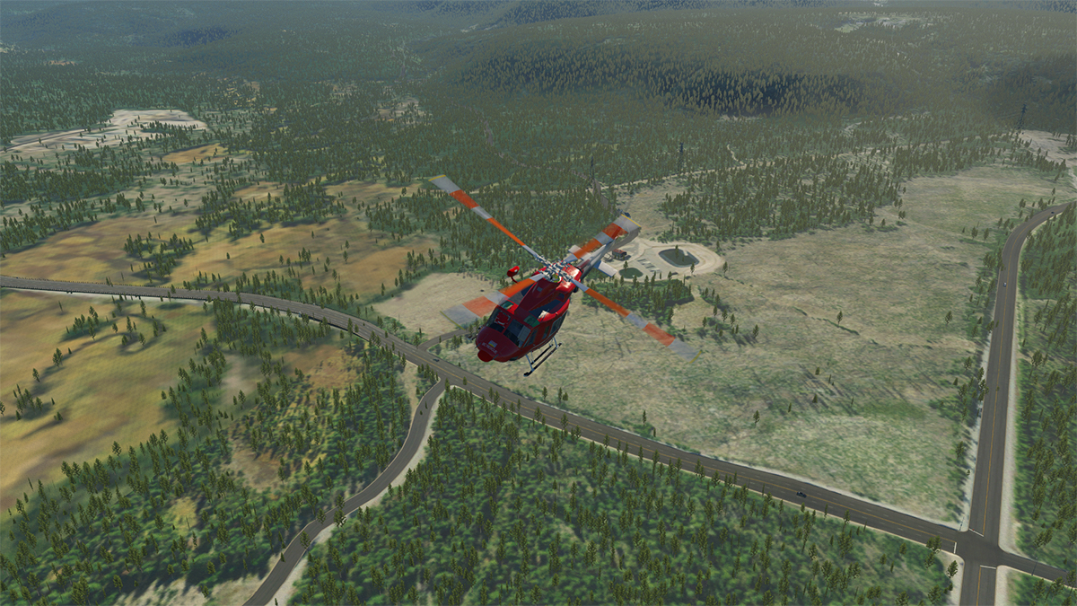
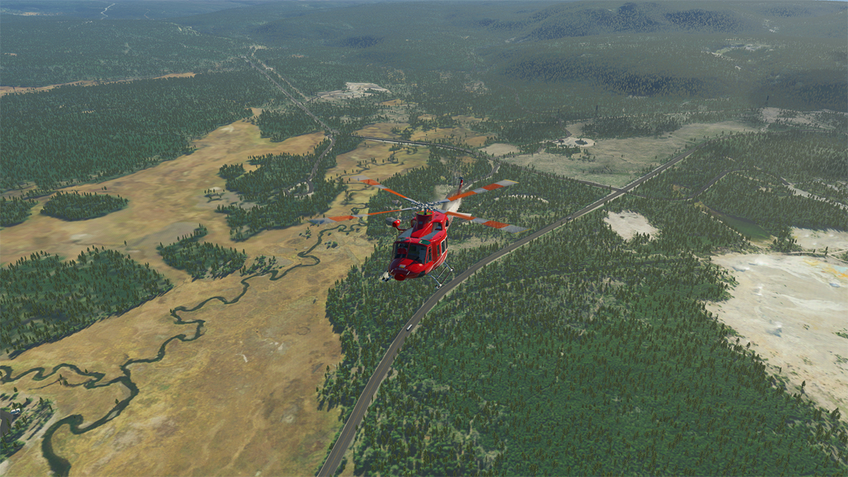
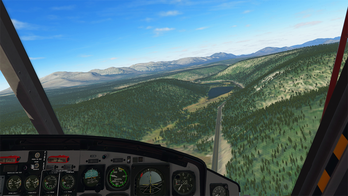
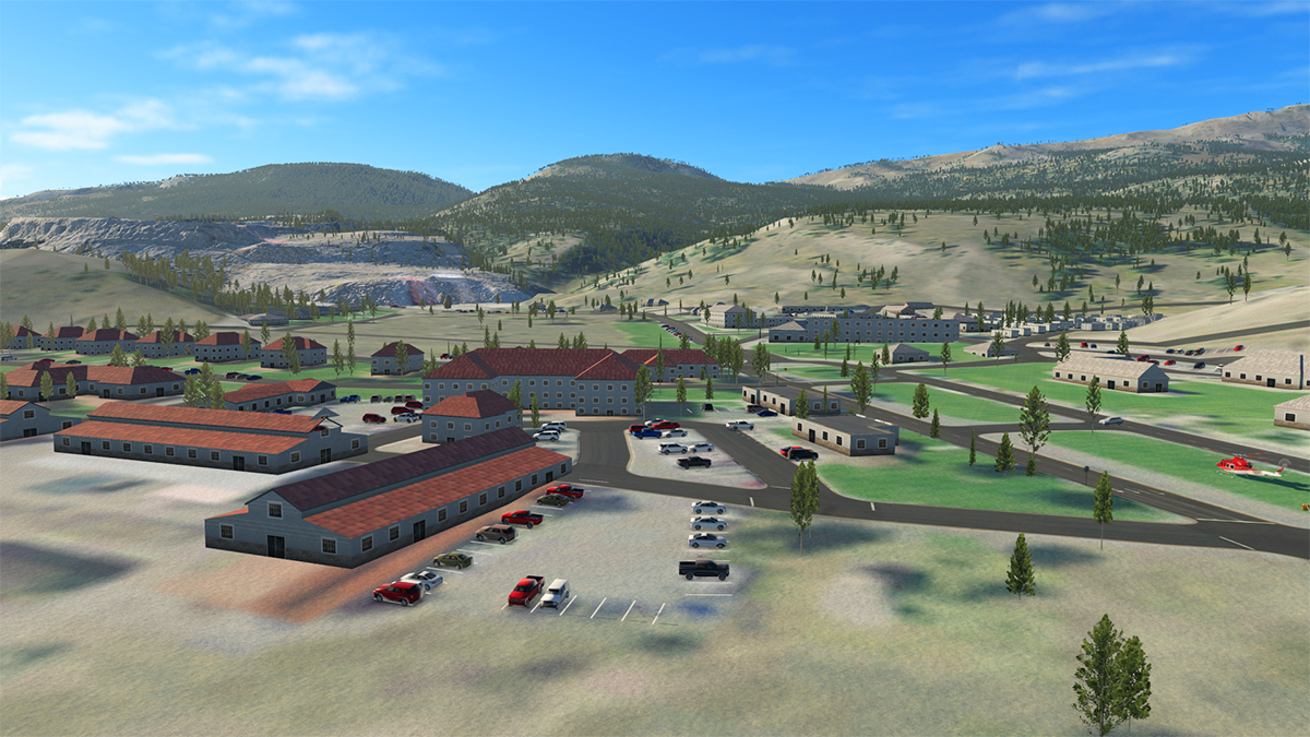
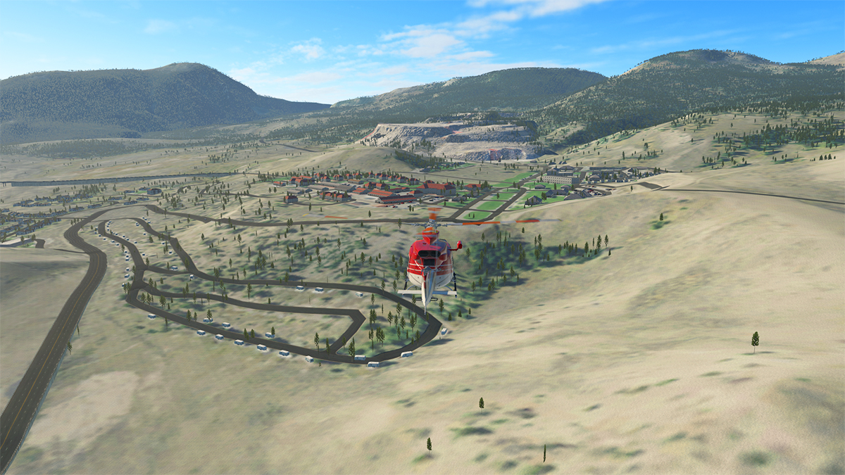
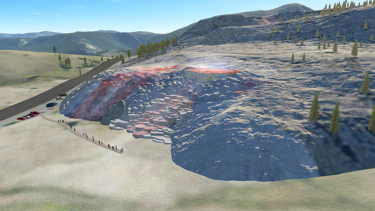
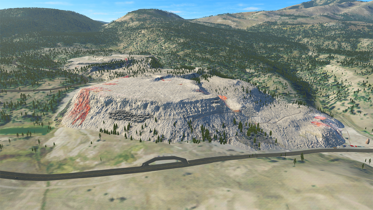
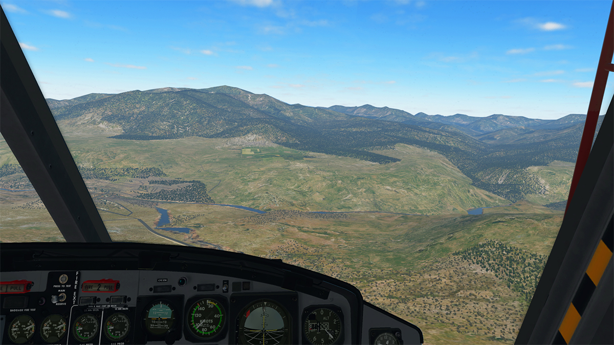
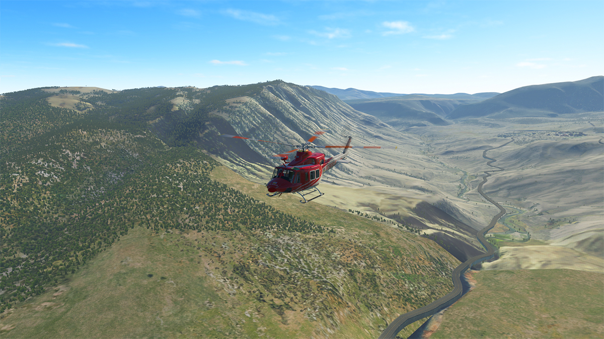
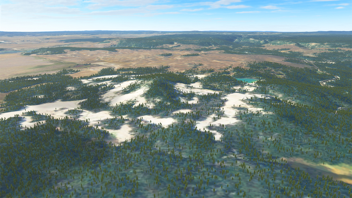
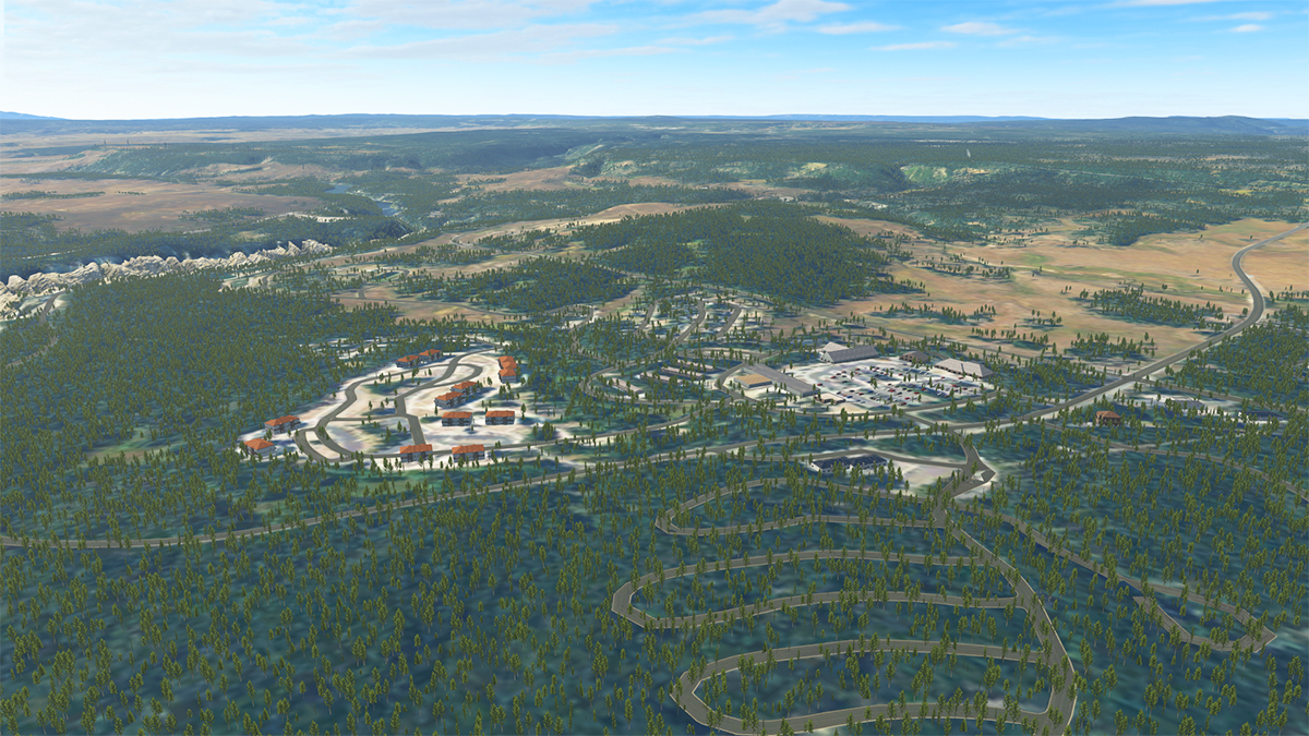
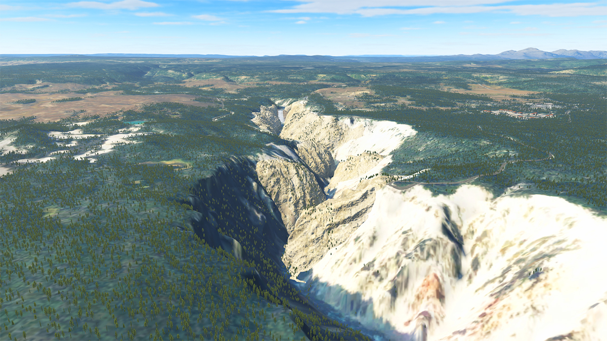
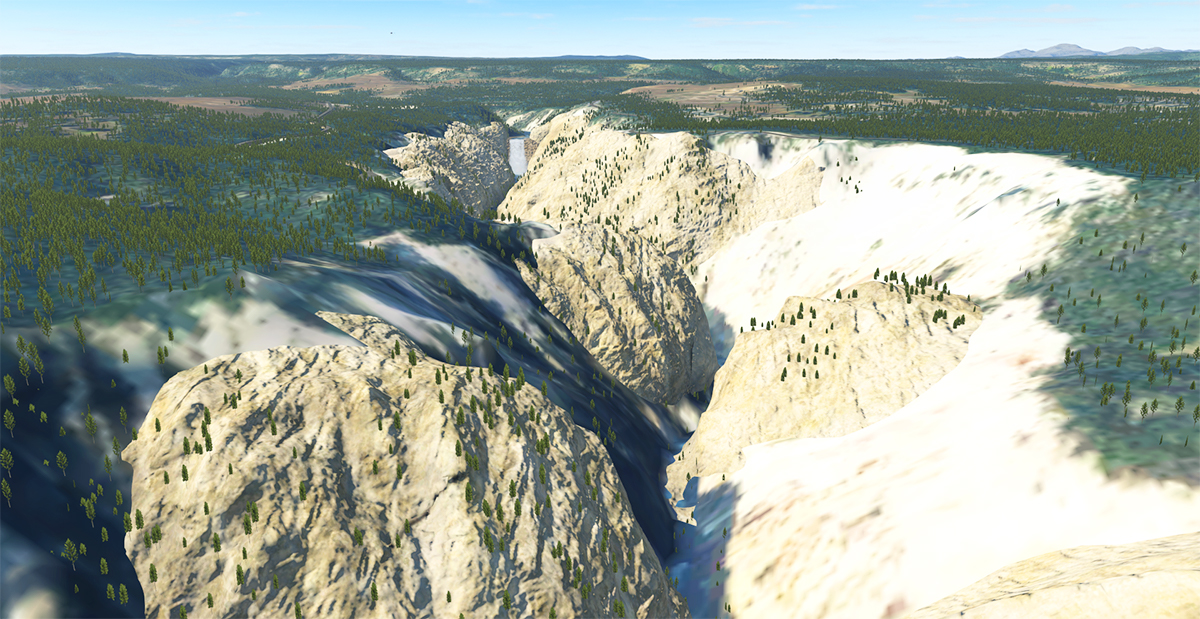
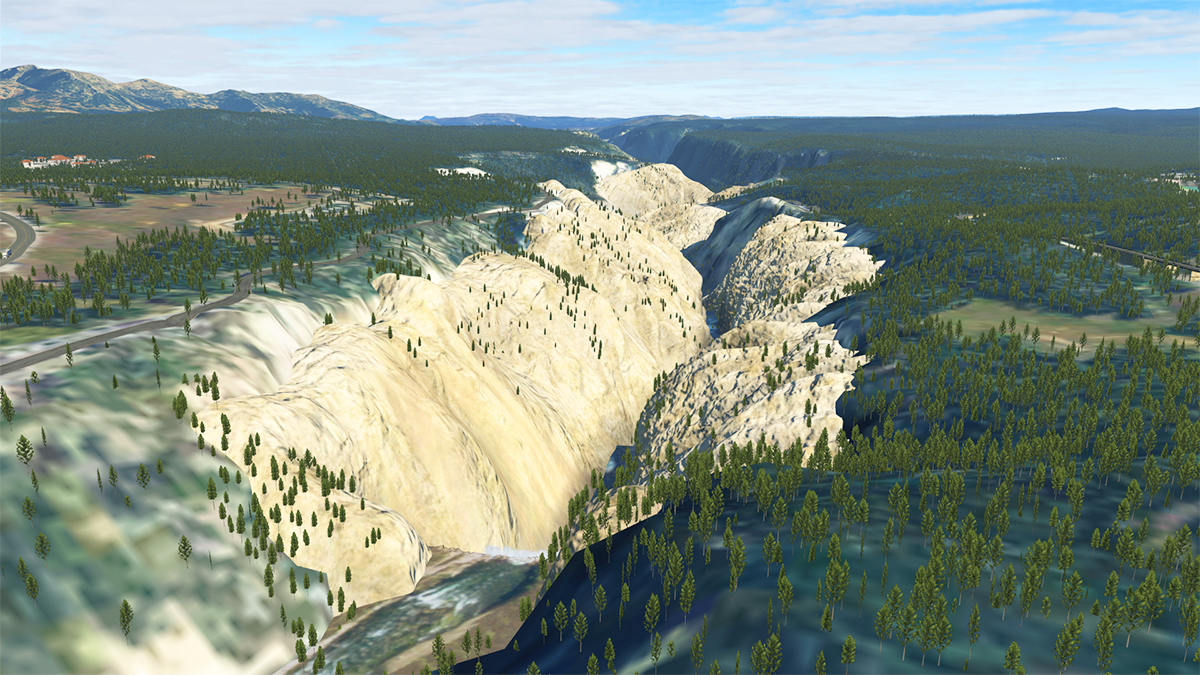
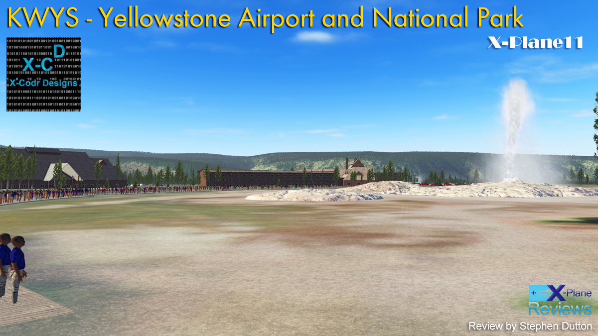
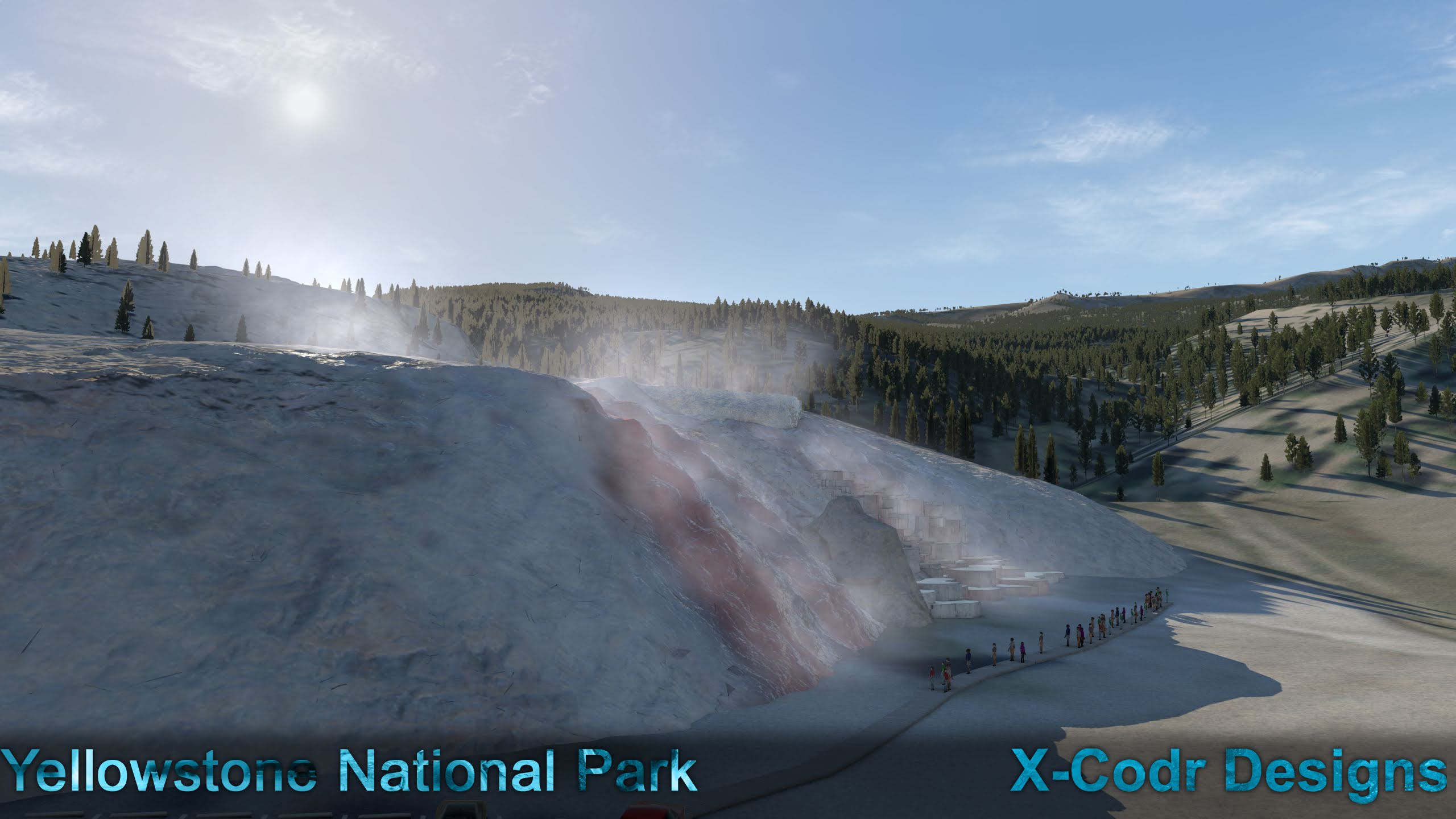
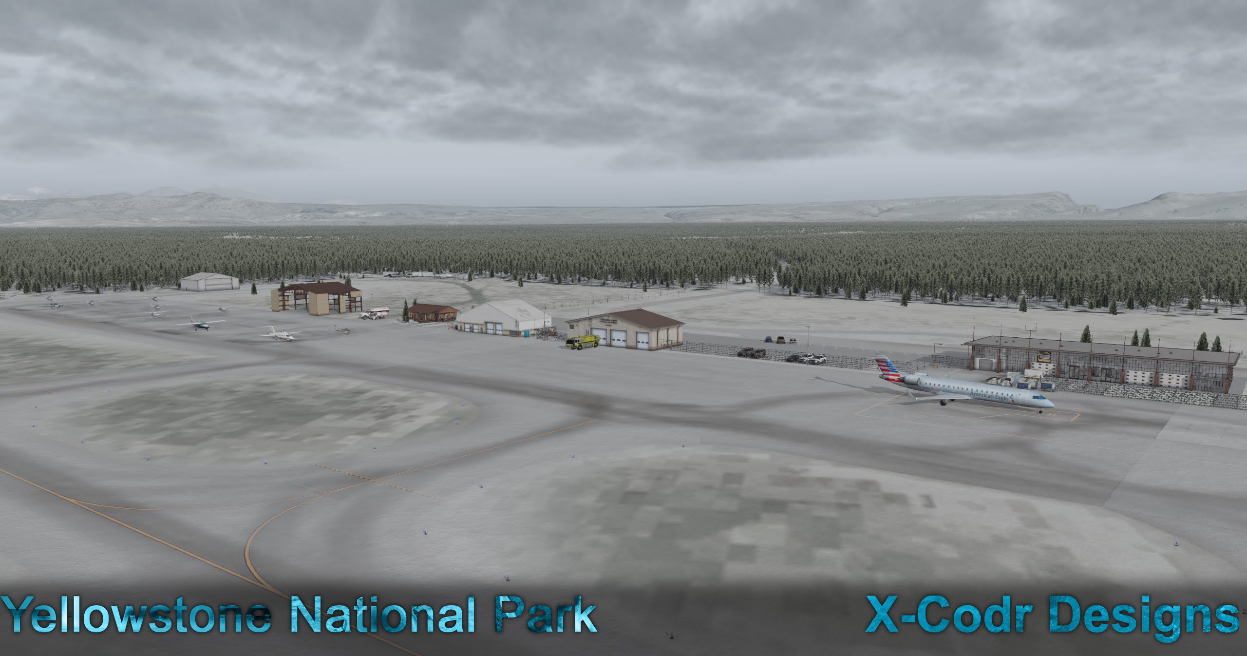
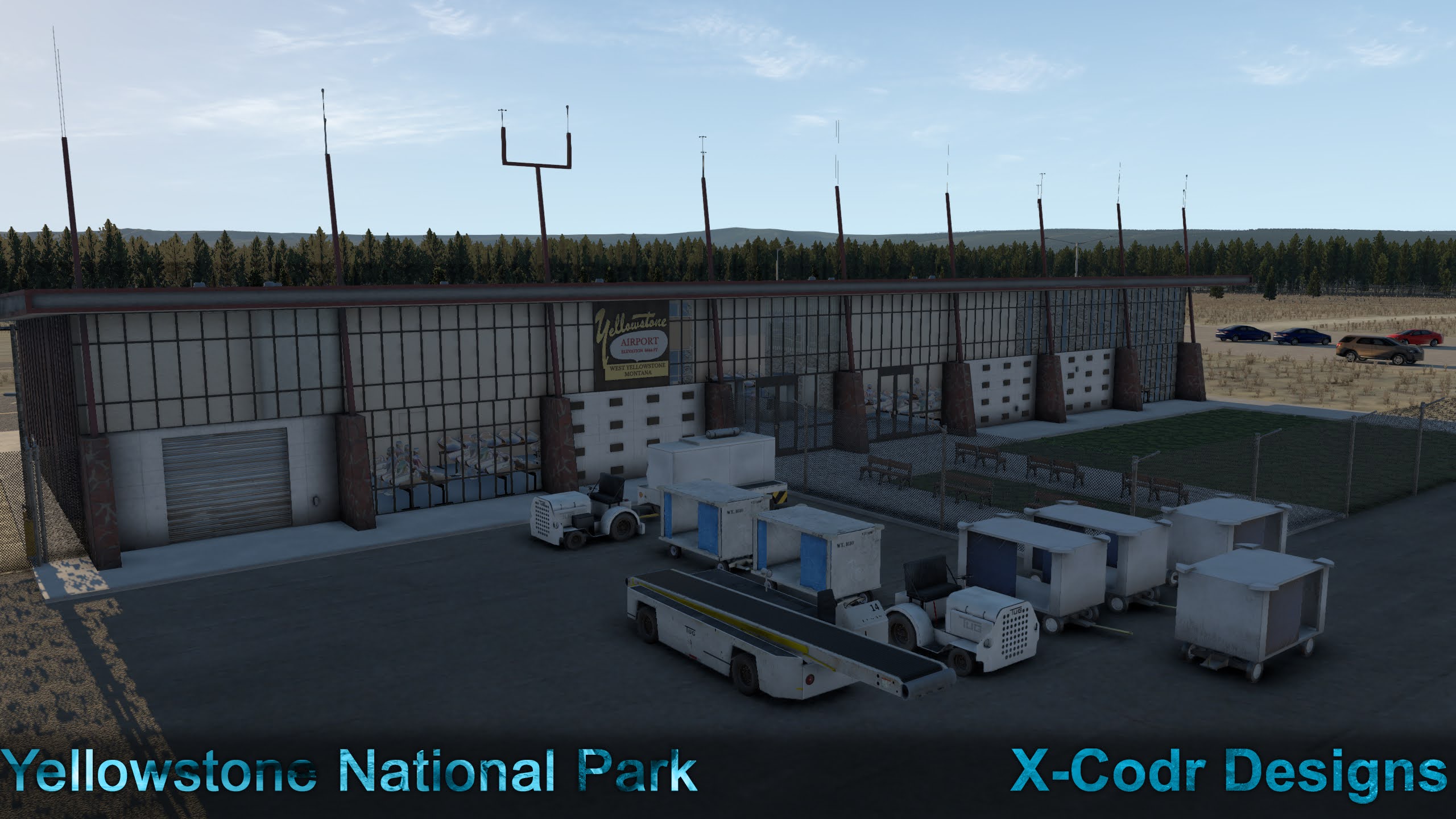
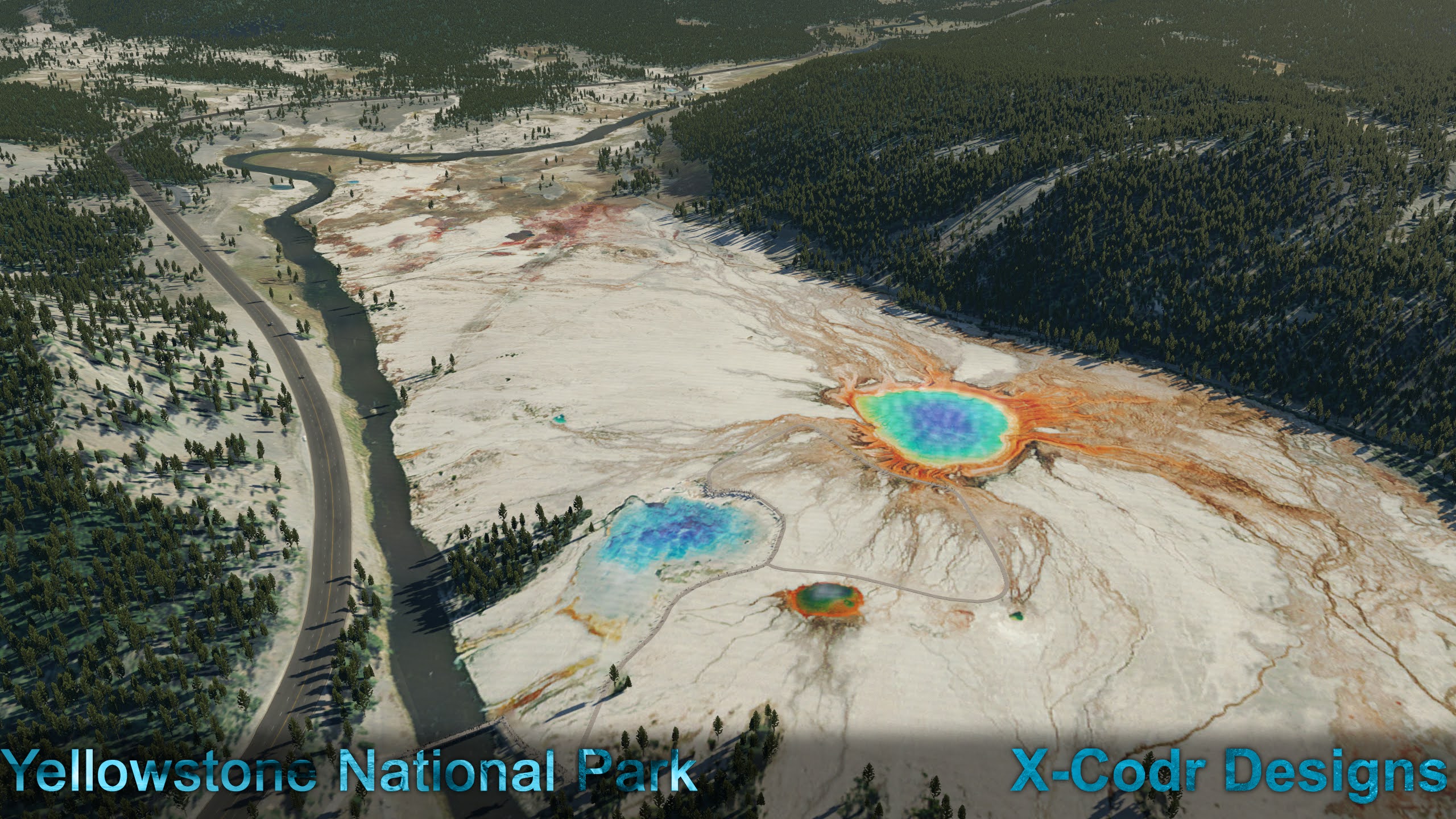
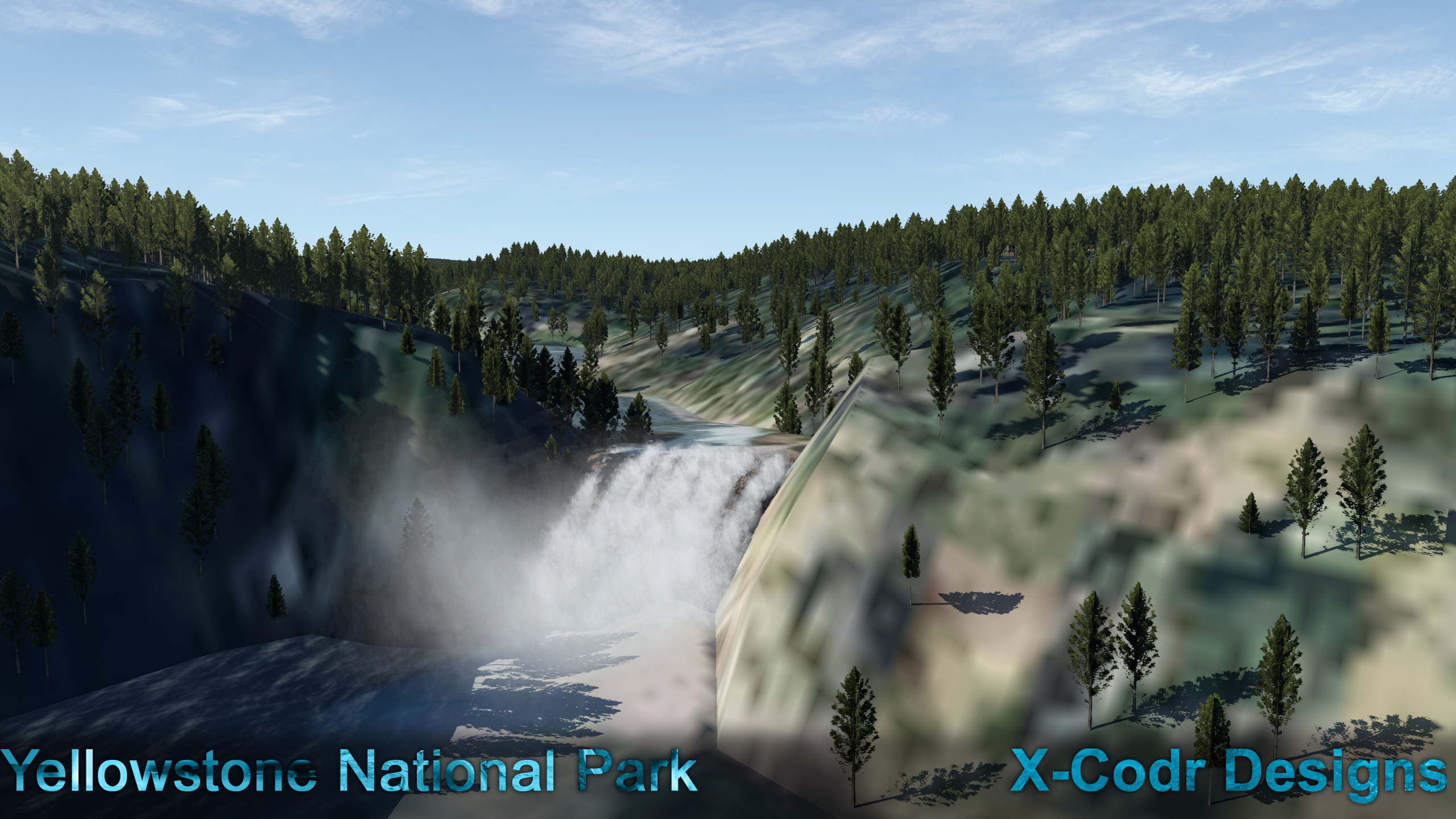
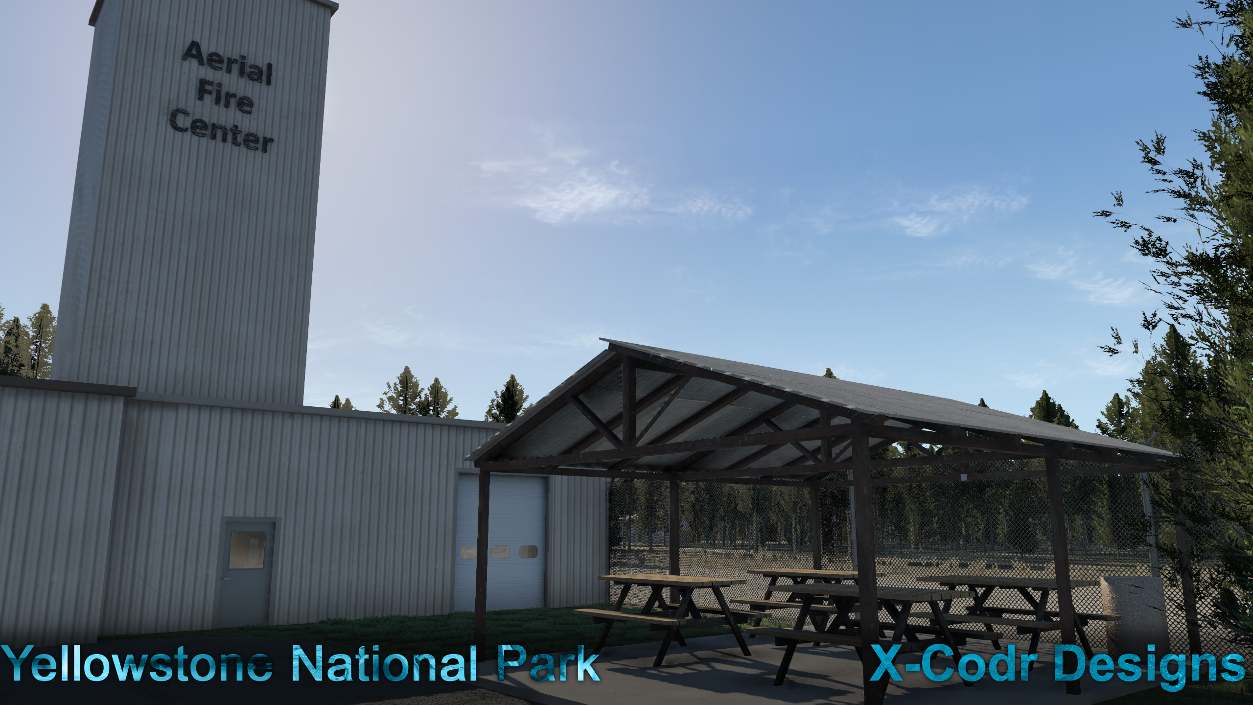
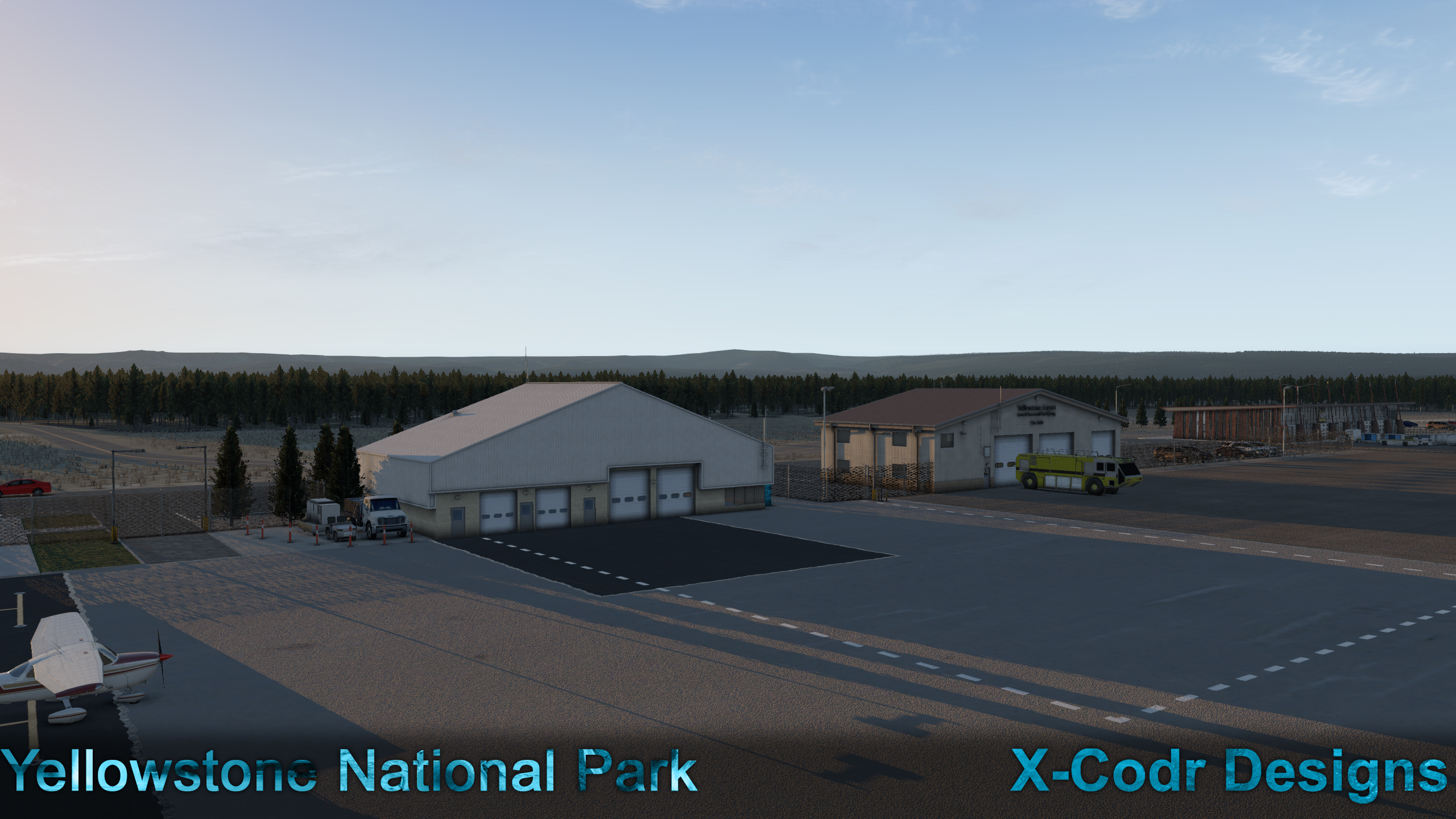
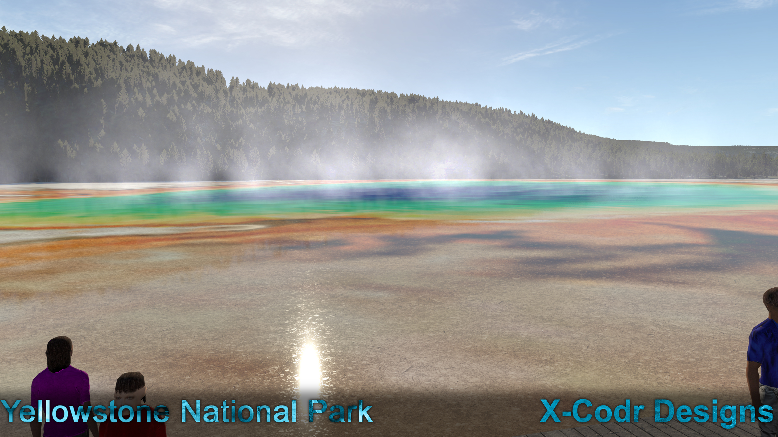
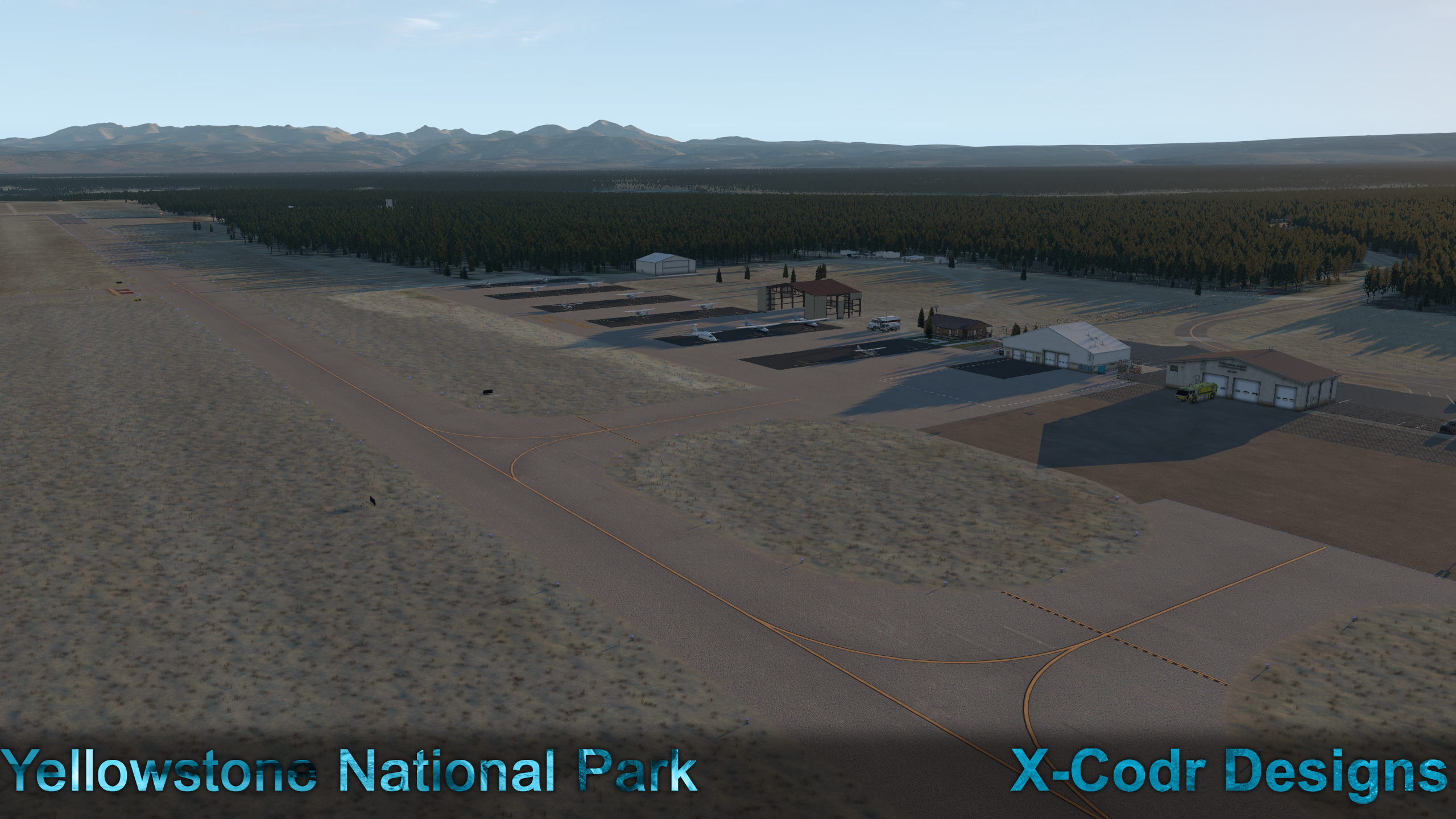
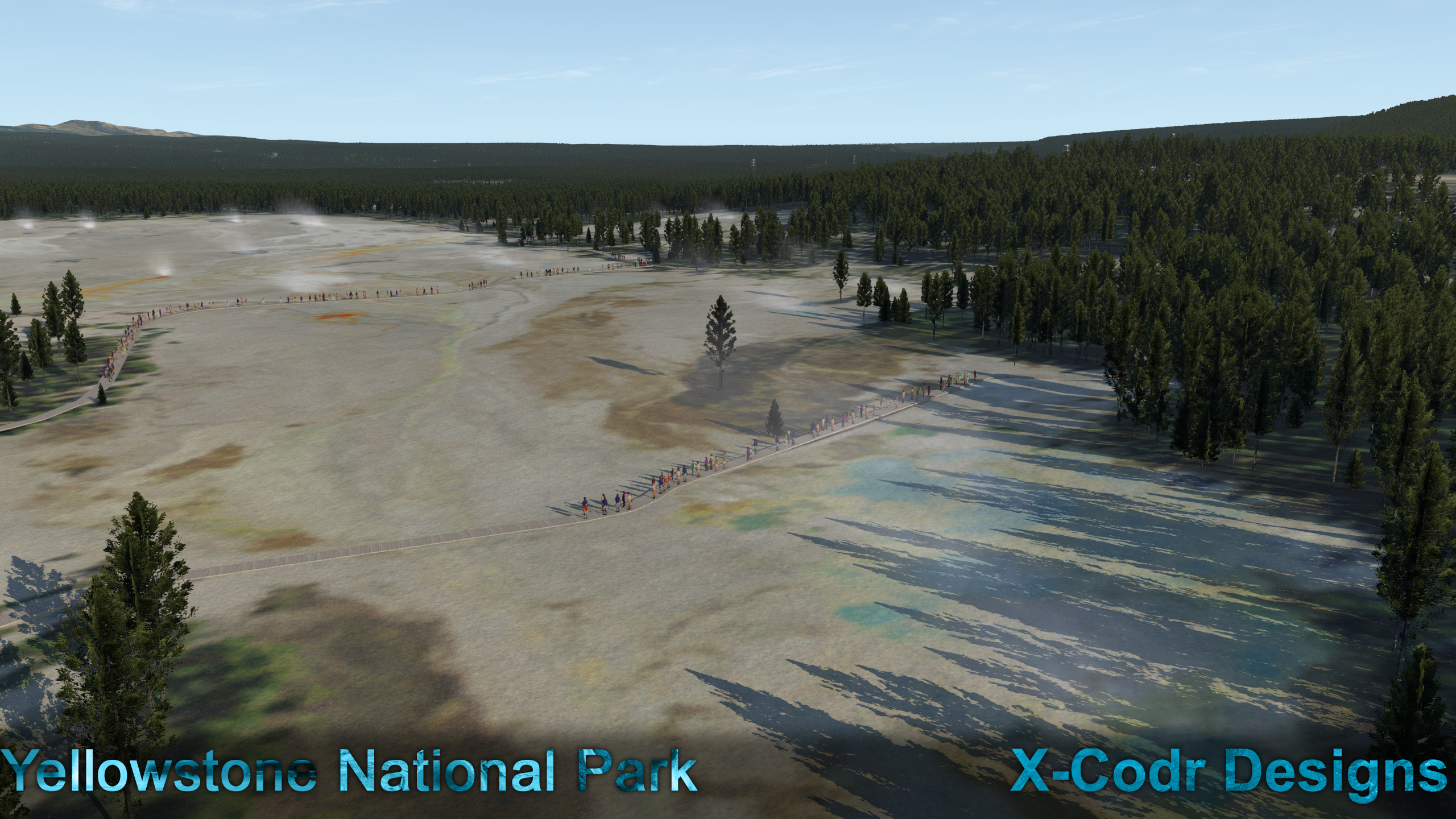
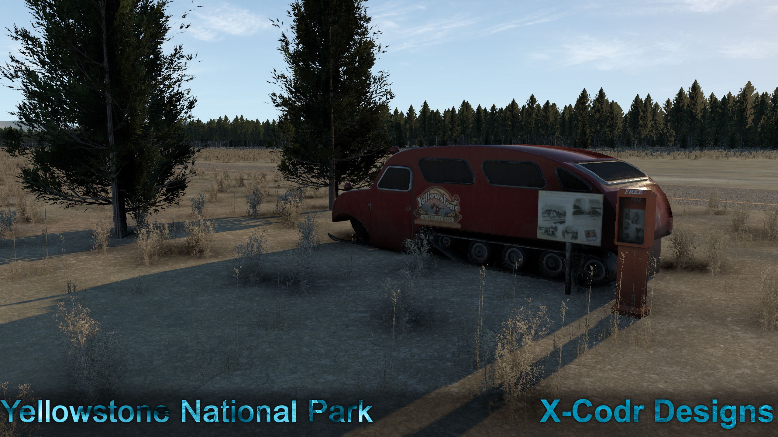
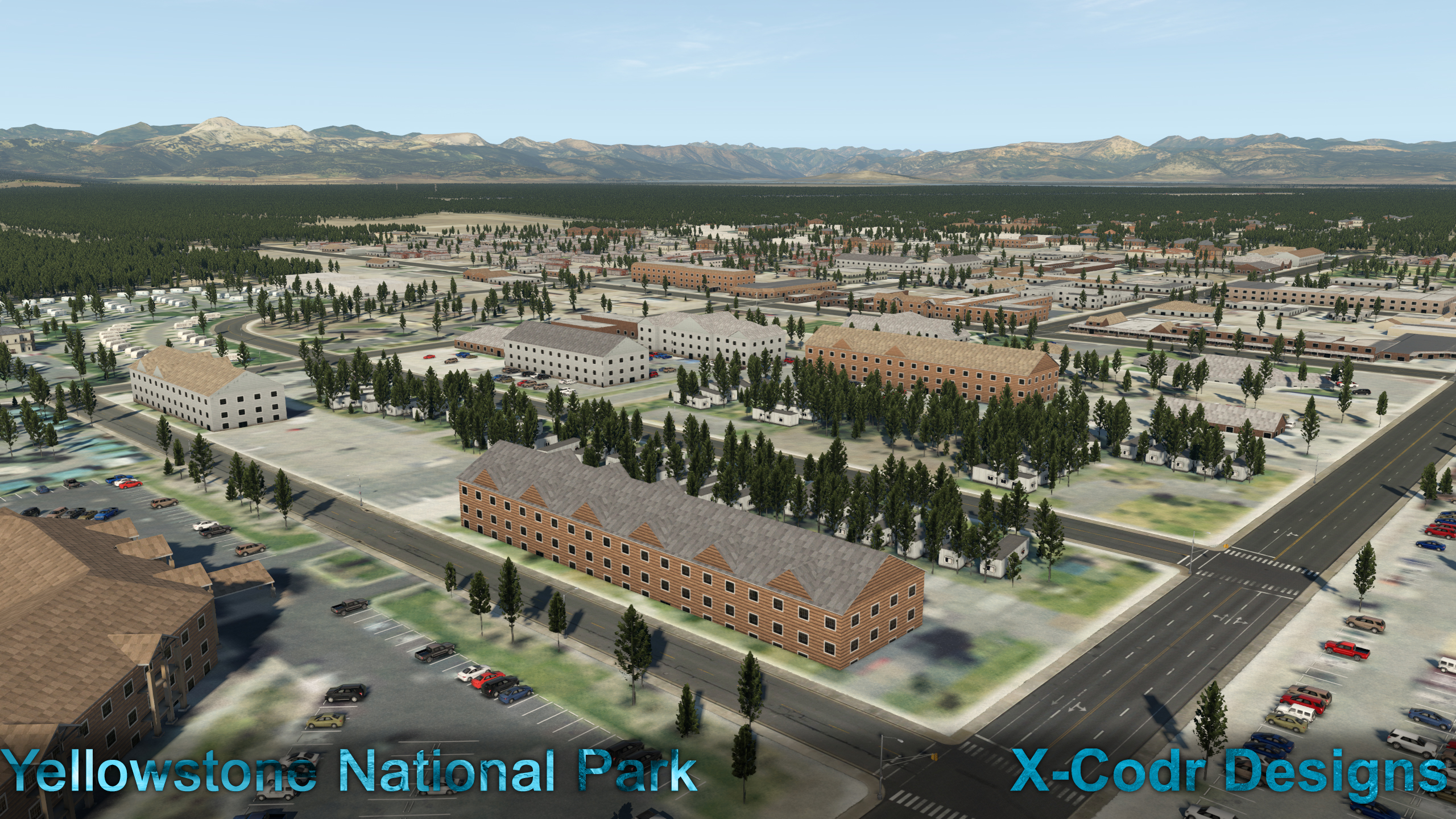
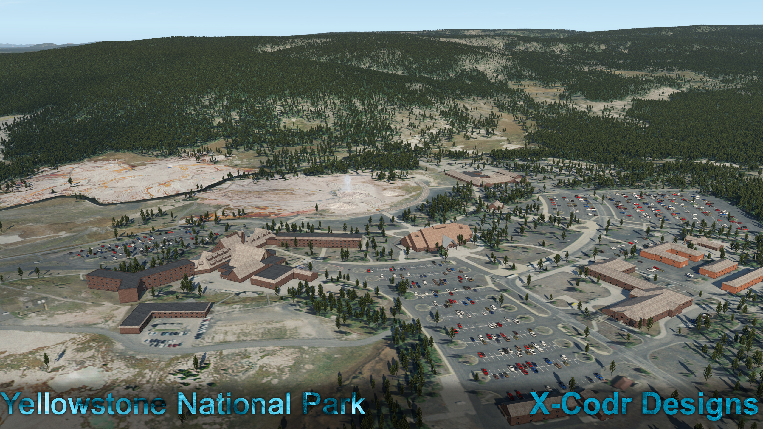
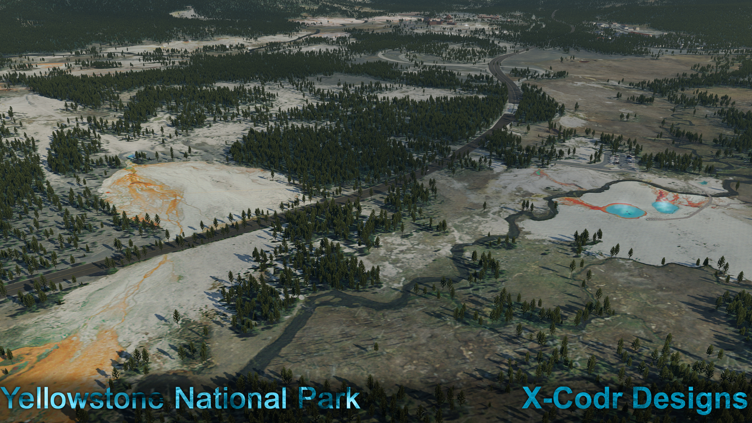
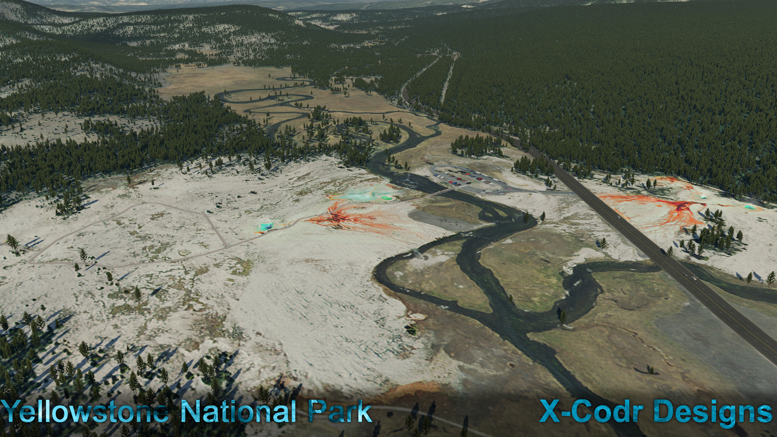
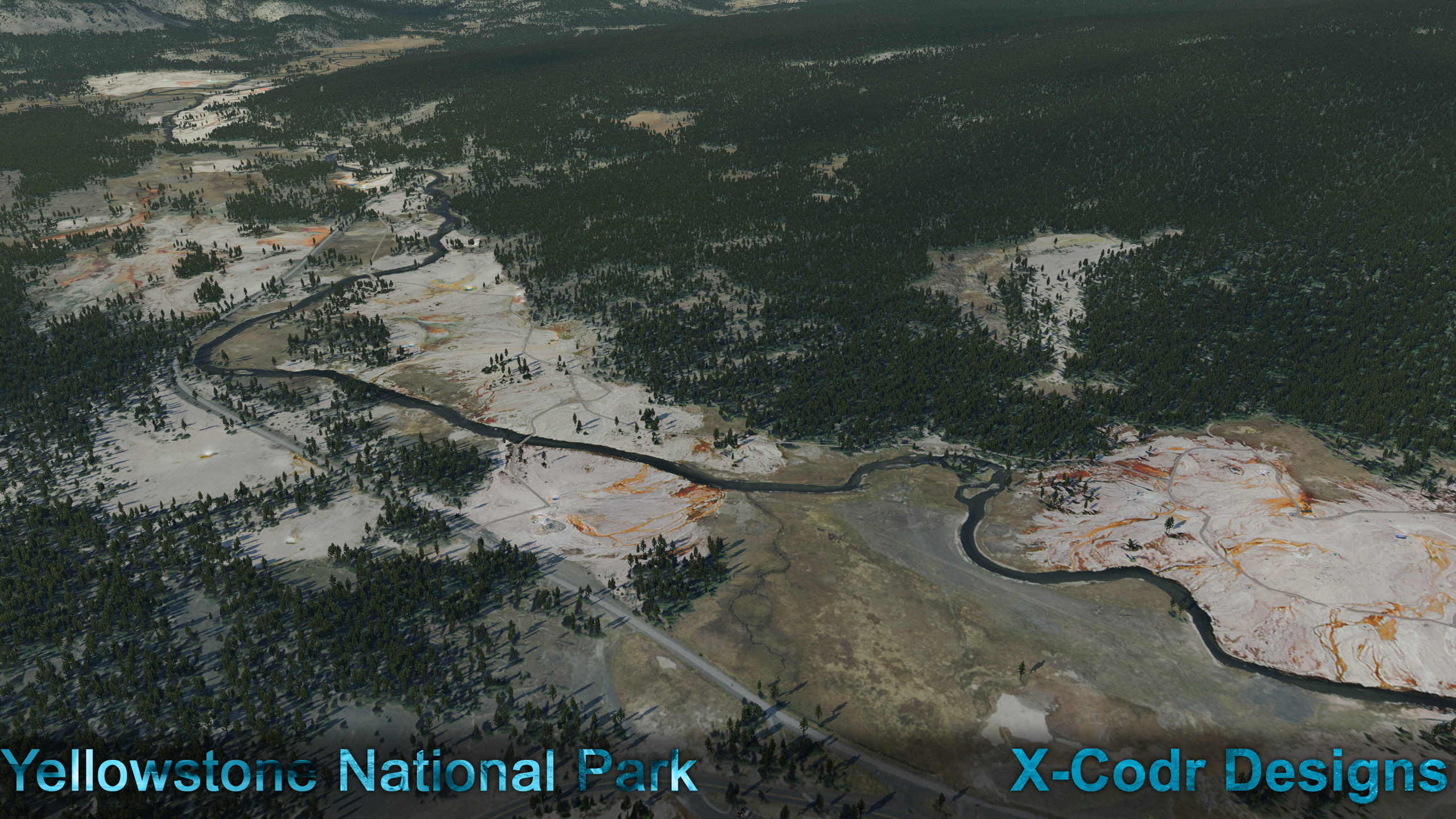
 Scenery Review : KWYS - Yellowstone Airport and National Park by X-Codr Designs Yellowstone National Park is an American national park located in the western United States, largely situated in the northwestern corner of Wyoming and extending into Montana and Idaho. It was established by the U.S. Congress and signed into law by President Ulysses S. Grant on March 1, 1872. Yellowstone is notable as the first national park in the U.S. and is also widely held to be the first national park in the world. Yellowstone National Park spans an area of 3,468.4 sq mi (8,983 km2), and comprising of lakes, canyons, rivers, and mountain ranges. Yellowstone Lake is also one of the largest high-elevation lakes in North America and is centered over the Yellowstone Caldera, the largest supervolcano on the continent. The caldera is considered a dormant volcano. It has erupted with tremendous force several times in the last two million years. Well over half of the world's geysers and hydrothermal features are active in Yellowstone, fueled by this consistent ongoing volcanism. Lava flows and rocks from volcanic eruptions cover most of all the land area of Yellowstone. The park is the centerpiece of the Greater Yellowstone Ecosystem, the largest remaining nearly-intact ecosystem in the Earth's northern temperate zone. In 1978, Yellowstone was named a UNESCO World Heritage Site. In reality you its simply quite easy to find the centre of Yellowstone Park, as the huge Yellowstone lake is the central point in being the remains of one of the many Calderas that makeup the supervolcano (the most recent one), and from a distance the huge circumference of the supervolcano is quite easy to identify around the Yellowstone Lake. Note the intersection of the three US States; Montana, Idaho and Wyoming within the park, the Continental Divide also weaves it's own way through the same park location. The scenery has six major areas of attractions or features. KWYS Airport and West Yellowstone, the Firehole River geysers with the famous Old Faithful geyser, the Yellowstone falls, Yellowstone Grand Canyon, Norris geysers and finally the Mammoth Hot Springs to the north. This scenery is developed by X-Codr, known for his excellent KDEN - Denver scenery: Scenery Update : KDEN - Denver International Airport HD v1.5 by X-Codr Designs and other various US western mountain airport sceneries. Usually clever and very innovative, X-Codr delivers these very unique areas of the United States. Installation It is quite a complex download and install of this Yellowstone package. There are first three different packages to download, and all quite large in Gb terms... Package No.1 is the "KWYS and Yellowstone National Park" (2.53Gb), then the KWYS Mesh (1.3Gb) and then finally the "X-Codr Designs Library Package" (1.25Gb). Package No.1 contains two folders in; KWYS - Forests KWYS - Yellowstone To be installed in your Custom Scenery Folder The Mesh package also has two folders in; Z KWYS Mesh Y KWYS Overlay Again in the Custom Scenery folder. You will need however to go into your .INI Scenery_Packs txt list to make sure both of these mesh folders are; One, below the above main No.1 folders, and Two, in the correct Z the Y order as well. Finally is the; X-Codr Designs Library Again make sure you overwrite any old X-Codr library items as there are a few new items included to install for this Yellowstone scenery. We haven't finished yet... there are options (Alternates), in a "No Seasons" version, that removes the Winter Season from the scenery, or the "Original Version" that resets it all back to default, they both have changes to the "KWYS - Yellowstone" and "Z KWYS Mesh" folders. Another point, is not to rename any of the folders or titles, the built in (effects) plugins require the correct folder addresses to work correctly. I found the install, mostly of the KWYS - Yellowstone folder (transfer) install quite slow, over the huge amount of single objects the computer had to transfer through (thousands), so be prepared to go and have a cup of coffee or a meal while the computer processes it all, oddly the huge mesh folders wizzed through quickly? Yellowstone Airport KWYS and West Yellowstone West Yellowstone and the accompanying airport is just outside the West entrance to the National Park, so we will start there. It does feel like (Montana) "Big Sky" country, with its wide open spaces, surrounded by the distant mountains. The scenery in total uses ZL16 NAIP ortho (photo) imagery, that covers over 3,000 square miles of surroundings. So being here does feel slightly different than the default X-Plane textures as are the millions of custom trees in the scenery, overall the look and feel is very good, if a bit washed out and dry looking. I noted in the "News" announcement of sceneries that allow you to "Fly-In", then "Fly-Around", which works very well here. Use a regional aircraft service to KWYS-Yellowstone, then fly-around via a Helicopter. Fixed wing, can work with the "Fly-In" aspect, but in reality you are better served flying a Helicopter around the sights, yes a small General Aviation aircraft is fine, but you won't see close up the features in the scenery... A chopper it needs to be. Yellowstone Airport (YWS) covers an area of 735 acres (297 ha), and sits at an elevation of 6,649 feet (2,027 m) above mean sea level. It has one runway designated 01/19 with an asphalt surface measuring 8,400 by 150 feet (2,560 x 46 m), which is nice long piece of hard stuff to land on. Both Delta Connection/Salt Lake City and United Express/Denver seasonally service the airport. The single terminal is excellent, with a nice fusion of glass, brick and stonework, it also has a nicely detailed interior. Structure detail is superb, nice glass frames and the glass is perfect with great Physically-Based Rendered (PBR) reflections and it's specular highlights. The surrounding fencing is amazing (yes I can get really excited about fencing!), perfectly modeled metal poles and great mesh detail, the best fencing I have seen yet... ... an abandoned historical ski-track vehicle, is also a nice welcome touch to the airport. One real oddity though are the set of chairs and tables outside and inside the terminal... ... as they quite a larger scale to the rest of the terminal's furniture and buildings? Seats for local mountain giants perhaps, very odd? Internally the terminal is excellent... well laid out with loads of detail, waiting passengers and local signage. This Yellowstone airport scenery is certainly detailed enough to do a walk-around inspection... there are a lot of nice details and areas to discover. Basically there are two areas, with one immediately north of the terminal, then another zone far north by the threshold of Rwy 19. Mostly the immediate north zone is for General Aviation operations, with first a very nicely done "Aircraft Rescue & Fire Fighting" weathered Hangar and a smaller companion, then is the Choice Aviation (Training/Flight School/Maintenance) log building.... .... last hangar is abandoned (or being built?), but as noted there are a lot of very nice area details to take in and enjoy including the rear fuel depot and ILS system. Far north by the threshold of Rwy 19, is the "Aerial Fire Fighting Centre", (Fire Fighting is serious business in these areas) the base is for the "West Yellowstone Smoke Jumpers", again the area and buildings are beautifully modeled with great detail. Officially the base is called to give it's full title; "The federal West Yellowstone Interagency Fire Center". ... the base also has accommodation for the Smokejumpers, hidden behind in the trees. Ground Textures The ground textures are excellent, with great and various surfaces with lovely weathered knobbly textures created by very good burnt in ambient occlusion effects with great realistic edges... there is only very light grunge, oil and rubber dirt here (unlike the very grungy X-Codr KDEN), but works well in a light traffic airport like WYS... ... note the nice apron tar joins. Foliage is also very good (not so much as grass but wild flowers really), but well matched to the Ortho-photo base Surface lighting is also very, very good, reflective and nicely wet when required. Lighting KWYS's lighting is very good, if a little limited. There is a RAIL Approach lighting on Rwy 01 (and ILS (110.70 ILOW), but nothing and only RNav approach on Rwy 19. Runway lighting is very good, but no centre line (normal out here), and Navigation board lighting is excellent with ground reflections.. Airport and apron lighting is sporadic, so much so the single aircraft parking zone is only lit by the headlamps of apron vehicles, still too dark for reasonable operations at night... Other overhead lighting on the aprons is limited, but the Terminal has simply excellent lighting, and the best seen for a fair while. West Yellowstone West Yellowstone is a town in Gallatin County, Montana, United States, adjacent to Yellowstone National Park and is only 2km from the airport. The population was 1,271 at the 2010 census. West Yellowstone offers lodging, gift shops, and other services to travelers visiting the nearby Yellowstone National Park via the West Entrance. the town receives a large amount of tourism, especially from China. To cater to these tourists, the town has commercial signage in Mandarin as well as six Chinese restaurants. It is estimated to receive more than half its annual business from Chinese tourists. The custom buildings cover the Ortho-images quite well, but there are areas that show the blurred underbelly of the photos. Most buildings here are very generic, but work well in context, but only a few in the WorldMark West and American named "Yellowstone Grizzly RV Park", truly stand out as local features.... not a Maccas in sight! Yellowstone National Park As noted there are basically four significant areas to explore in the Yellowstone National Park... Firehole River geysers with the famous Old Faithful geyser, Norris, the Yellowstone falls and it's close by Grand Canyon and finally the Mammoth Hot Springs to the north. Departing from KWYS airport, you become suddenly quite aware some significant aspects that are missing from this scenery... H Pads? There are none listed or placed anywhere around in the scenery, which is a significant missing feature. The developer would note that there are no H Pads in the park, but that is not the point here, without them, it is simply impossible to find the major attractions in the scenery? Your guide can (or could be) be the X-Plane local map, but the whole area is a blank, with no defining features, so in this case totally useless. There are a few good Yellowstone Park Maps on the net, but overall you have to work it all out yourself? Marking features by using the H-Pads, helps in locating them in the local map, and they are also handy as a place to actually land the aircraft when you get there. One option is to follow the road network, but it can go the long way around, or even get lost in the trees that fill it in, in certain areas. So overall it is your best bet and works in this case. Also be aware that your elevation is very high up here, at 6,900 ft above sea level, you are already sitting quite high, and are going higher... well you are on top of a supervolcano after all. Best idea is to pick up the US Highway 101 that heads out east from West Yellowstone, the National Park's West gate is situated just out of the township, but not represented in the scenery, which is odd... in fact all the decorative stone park entrances are not represented? Hwy 101 follows the Madison River to it's left and into the Madison Valley, basically your aiming for the valley cut by the Madison directly ahead, you can cheat and go right and directly to the open plateau, but the ride through the pass and by way of Madison is worth the extra time. The pass is actually not hard to pick out as the surrounding Ortho-photo underlay, as it is notably quite different. It has a very light green tint, that to be honest is not very realistic? I understand that stitching together complex photo-images to create a landscape, is not at all easy... .... and the different colour matching is an art in itself, but the green-tinted elevations, just looks odd and slightly out of character here to the surroundings. Mount Haynes is on your left, and Purple Mountain is on your right (not very purple)... the photo-images make the pass sides very blurry and flat close up, but in context it is realistic. Once onto the named Central Plateau, you are now looking for the join of Hwy 191 and the picking up Hwy 89 at "National Park Mountain" on the right exit of Madison Valley, you still however follow Hwy 191 as it turns south and eventually meets up with the Firehole River... ... Now your focus is on something completely different, set out on the horizon! They look like two white fluffs, but get closer and it is steam, rising from volcanic ponds. The landscape also changes dramatically as you get closer... You are sitting on the top of an active volcanic thermal vane, the steam simmers (via some clever X-Plane particle effects), and the colours are quite beautiful. This is "Lower Geyser Basin"... ... moving down more of the Firehole River brings next Fountain Geyser, Midway Geyser Basin, in fact loads of sprouting water holes... ... now there also appears wooden walkways with animated people walking around and all of them looking at the geysers. There are groups of people and cars around most of the active holes, and there is even the odd bison walking around!... again the colours are absolutely spellbinding, there is a lot to look at and absorb... ... finally at the end you reach volcanic activity central, or a large looking lodge, called the "Old Faithful Visitor and Education Center". There is an actual lodge here as well, and very well represented and modeled as the whole complex is... ... I hover in for a closer look at what all the fuss is about, and I was quite disappointed, it was just a few piles of volcanic rock with steam coming out? I retreated and landed the Helicopter at a safe distance, which is actually a good idea (pick really anywhere, as there is no H-Pad to land on, so I head to the carpark).... you do however notice a building of loads of people waiting and they are all focusing and watching the dormant piles? Then more and more come and wait until it is quite packed of people, all waiting for something to happen... and soon it does... ... slowly and gradually "Old Faithful" comes alive, with some really clever particle effects that makes the geyser, well gush high into the air. There have been more than 1,000,000 eruptions that have been recorded by Old Faithful. Harry Woodward first described a mathematical relationship between the duration and intervals of the eruptions in 1938. Old Faithful is not the tallest or largest geyser in the park; those titles belong to the less predictable Steamboat Geyser. But the reliability of Old Faithful can be attributed to the fact that it is not connected to any of the other thermal features of the Upper Geyser Basin. Eruptions can shoot 3,700 to 8,400 US gallons (14,000 to 32,000 L) of boiling water to a height of 106 to 185 feet (32 to 56 m) lasting from 1+1⁄2 to 5 minutes. The average height of an eruption is 145 feet (44 m). Intervals between the eruptions can range from 60 to 110 minutes, averaging 66.5 minutes in 1939, slowly increasing to an average of 90 minutes apart today. And as quickly as "Old Faithful" blew the predictable geyser gradually disappears again.... you can't over emphasise how clever the effects are in this scenery... Yellowstone Lake and Falls Leaving behind the very active "Upper Geyser Basin" and you head east and you feel the peak of the volcano beneath you as you slightly climb, and soon you reach the huge hammer shaped Yellowstone Lake and the smaller inlet of "West Thumb" at what is left of the original Caldera. I looked for both the significant interest points of West Thumb and Grant Village, and West Thumb does have a small but significant "West Thumb Geyser Basin", The Geysers are there, but West Thumb is not represented in the scenery, odd because the developer has a load of generic items to use to recreate them? The lovely turquoise lake edging is however very nice So a turn to the north, and the long ride is to the northern edge of the Yellowstone Lake... ... Yellowstone Lake is up to 400 feet (120 m) deep and has 110 miles (180 km) of shoreline. At an elevation of 7,733 feet (2,357 m) above sea level, Yellowstone Lake is the largest high elevation lake in North America. Forests comprise 80 percent of the land area of the park; most of the rest is grassland. Flying right across the lake takes time, but the outstanding view makes it all worthwhile... use the X-Plane reflections detail feature to get the best spectacular views, you only need the "High" setting to get the results you need as seen here. Then you are looking for the mouth of the Yellowstone River on the north bank of the Lake, it can be very hard to find, but the northern point of Stevenson Island is the perfect direct guide to where it is. The Ortho-Photo images are quite spectacular of the start of the Yellowstone River, swirling blues and greens, and they look magnificent from the air, but I do notice something that there is no X-Plane Autogen popping up over the same images, so you get all the road grids, but no housing? The Central Plateau again shows to your right, but your focus is still on the twisting river... ... coming along the Yellowstone River south to north, it is very, very easy to overfly the next feature... The Yellowstone Falls Yellowstone Falls consist of two major waterfalls on the Yellowstone River. As the Yellowstone river flows north from Yellowstone Lake, it leaves the Hayden Valley and plunges first over Upper Yellowstone Falls and then a quarter mile (400 m) downstream over the Lower Yellowstone Falls, at which point it then enters the Grand Canyon of the Yellowstone, which is up to 1,000 feet (304 m) deep. Again the particle effects are excellent, with real water flowing over the falls, and this is a great new feature for the simulator, the added spray adds into the realism. Many moons ago I reviewed a Niagara Falls Airport (not KIAG, but Buffalo KBUF), and looked over the pathetic (and flat) Niagara Falls... this technology could change X-Plane in areas that were once very much off limits.... you hear Laminar. The Grand Canyon of the Yellowstone River, has also been recreated with the site of the Canyon Village also represented on the western bank, on the eastern side are the nearby geysers ... The Canyon is highly detailed and well recreated here with a lot of rough wall craggy detail... the canyon is approximately 24 miles (39 km) long, between 800 and 1,200 ft (240 and 370 m) deep and from .25 to .75 mi (0.40 to 1.21 km) wide. Sadly there is nowhere to land, so we move on. Our next and two final destinations are Norris and the Mammoth Hot Springs, situated way again to the north. There are several ways to get there... one, follow the same Hwy 191 route from West Yellowstone through the Madison Valley from West Yellowstone Airport, but at the join, instead take the left Hwy 89 road through Gibbon Falls (and Gibbon River) to Norris, or if at Yellowstone Falls, then cut directly west over the Central Plateau again to Norris. Norris is noted in the scenery (below) with the "Norris Geyser Basin', which is well done and active. Basically you keep following the Hwy 89 north, but the Norris Canyon Road joins here from Canyon Village (Yellowstone Falls). The scenery is still very picturesque, next up the road is "Twin Lakes" and then "Beaver Lake". Again the area again opens out with another dramatic change and feel of scenery... This is the Blacktail Deer Plateau, with the Gallatin Range to the left and the Absaroka Range (Montana) to the right... You pass through "Indian Creek" and the startling "Sheepeater Cliff"... ... until Bunsen Peak 8,564 feet (2,610 m) shows itself dead ahead. ... closing the gap, you then get your first sights of Mammoth Hot Springs, via a huge wall of granite and another part of the Gallatin Range with Mount Everts 7,846 feet (2,391 m) as the most prominent mountain peak in the range. Mammoth Hot Springs is situated at the foot of the range. The white and red volcanic mess on the west side of the township is the famed "Mammoth Hot Springs"... I decided to land (in a park) in Mammoth to get a closer look. The central part of the town is historic, called the "Mammoth Hot Springs Historic District" which is also the Yellowstone National Park administrative center for the park, the park headquarters is now housed in the original double cavalry barracks (constructed in 1909), and is composed of two major parts: Fort Yellowstone, which is also the prior military administrative center between 1886–1918, and now a noted National Historic Landmark, and a concessions district which provides food, shopping, services, and lodging for park visitors and employees. Fort Yellowstone has been recreated here, but not say detailed, detailed but represented, as the photo-images are of a larger scale for any real significant quality detail, but overall it has the right feel and look of the area. Mammoth Hot Springs is a large complex of hot springs on a hill of travertine. It was created over thousands of years as hot water from the spring cooled and deposited calcium carbonate (over two tons flow into Mammoth each day in a solution). Because of the huge amount of geothermal vents, travertine flourishes. Although these springs lie outside the caldera boundary, their energy has been attributed to the same magmatic system that fuels other Yellowstone geothermal areas. The hot water that feeds Mammoth comes from Norris Geyser Basin after traveling underground via a fault line that runs through limestone and roughly parallel to the Norris-to-Mammoth road (Hwy 89). The limestone from rock formations along the fault is the source of the calcium carbonate. Shallow circulation along this corridor allows Norris's superheated water to slightly cool before surfacing at Mammoth, generally at about 170 °F (80 °C). Algae living in the warm pools have tinted the travertine shades of brown, orange, red, and green. Thermal activity here is extensive both over time and distance. The thermal flows show much variability with some variations taking place over periods ranging from decades to days. Terrace Mountain at Mammoth Hot Springs is the largest known carbonate-depositing spring in the world. Again the Mammoth Hot Springs formations have been exceptionally created, and you have the same excellent particle effects oozing out of the hot pink rocks, but the photo images do cut off a bit too early on the right side of the formation, maybe because of a shade in the original image, but it does stand out quite noticeably. Another notable factor is fly more north out of Mammoth (into Montana) and the custom photo-images also cut off very quickly, and suddenly you are back into the standard X-Plane default terrain, which is quite a contrast to the custom layers, but at least the autogen is back! There has to be comparisons with this Yellowstone Park to the same sort of scenery packages of Frank Dainese & Fabio Bellini. Of which I have extensively reviewed. In many aspects the Yellowstone scenery is certainly as good in scale and features, but several points are noticeable. Dainese & Bellini use more highly detailed or DEM data at a finer scale in the most important visible areas, I'm not saying that sort of detail is required here, but in the same sort of canyons or valleys the photo-stretch technique is highly noticeable, compared to the Dainese & Bellini more intimate detail, more of the inner points of filling in with villages and other areas with objects, with the lost covered autogen is also noticeable as well. The main areas are of course done, but not a lot of the other significant points of interest, as with the lake side towns and villages. Finally is my biggest gripe of no H Pads, in this respect Dainese & Bellini gave you a great navigation tool, that I didn't realise was so significant until it was taken away. _____________________ Summary The Yellowstone National Park is an American national park located in the western United States, largely situated in the northwest corner of Wyoming and extending into Montana and Idaho. It was established by the U.S. Congress and signed into law by President Ulysses S. Grant on March 1, 1872. Yellowstone is notable as the first national park in the U.S. and is also widely held to be the first national park in the world. Yellowstone National Park spans an area of 3,468.4 sq mi (8,983 km2), and comprising of lakes, canyons, rivers, and mountain ranges. Yellowstone Lake is one of the largest high-elevation lakes in North America and is centered over the Yellowstone Caldera, the largest supervolcano on the continent. This Yellowstone National Park scenery is certainly, because of the sheer scale a very highly ambitious project for X-Codr Designs, renowned for their excellent KDEN-Denver International Airport scenery. The scenery has all the important attractions included. West Yellowstone Airport and West Yellowstone township, the Firehole River geysers with the famous "Old Faithful geyser", the Yellowstone falls, Yellowstone Grand Canyon, Norris geysers and finally the Mammoth Hot Springs to the north. Highlights of the scenery are certainly the very active and visual effects, with steam and water sprouting or resting on the geysers and hot springs, the timed (clever) eruption of the Old Faithful geyser, and the excellent waterfall of the Yellowstone falls. KWYS Airport is very well recreated with a very highly detailed terminal with also internal detail, and also has airport walkaround surroundings, but the apron lighting is a bit average. The Yellowstone scenery uses ZL16 NAIP ortho (photo) imagery that covers over 3,000 square miles of surroundings, so the flying internally within the package area is huge, but some areas are noticeable in their flat photo reproduction and odd green-tinted hues, but the main feature areas have been recreated in 3D detail. The missing (yes I know I have mentioned this aspect extensively) H Pads are a real negative point in the scenery, as they not only point to the most significant points of interest in the scenery and useful in the local map guidance, but also gives you focus place to actually land when you get there... real or virtual, they are really needed here. Downloads are large Gb files and the complex install has to be followed to the letter, but it does all work when done correctly, a side note was that I never got the winter textures working? Is it the SAM system? but the SAM plugin disappears when using the scenery? Changing the date, month or temperature didn't work either? Outwardly you would think I why I would enjoy so much these feature area based sceneries. But like the excellent Dainese & Bellini style location sceneries, they are all very interesting and knowledgeable in the same context. You search and find details that have been replicated from their famous real-world counterparts, but the clever effects on show here delivers another level of realism in this exceptional package of the famous Yellowstone National Park. Exploring and finding places of interest and learning the actual geograpthy and orientation of the area as it is can also give you a lot of interesting aspects and even down to have a lot rightsided fun. Yes, great value and a great addition to your X-Plane world collection.... Yellowstone National Pack is a must have, Highly Recommended. ___________________________________ Yes! the KWYS - Yellowstone Airport and National Park by X-Codr Design is now available from the X-Plane.Org Store here : KWYS - Yellowstone Airport and National Park Price is US$24.95 Features Include: • Detailed rendition of KWYS: All buildings feature ultra-high-resolution textures. All buildings feature advanced PBR normal maps for realistic reflections and bump mapping. All buildings are highly detailed, down to even door handles. All buildings feature "lite" interiors to give windows more depth. Detailed ground textures with large scale realistic wear. All ground textures feature realistic normal maps. Realistic 3d vegetation for the entire airport. • Living scenery: Wet ground textures for the airport. Automatic snowy winter textures when it is snowing. Ground equipment automatically serves your aircraft upon request. Animated rain drops. • Custom Rendition of Yellowstone National Park Custom modeled accurately erupting Old Faithful geyser Custom modeled Mammoth Hot springs. Custom modeled animated Yellowstone Falls. Numerous custom modeled features throughout the park. Animated people and bison near Old Faithful. High resolution high quality NAIP color corrected ortho imagery with normal maps covering all popular areas ZL16 NAIP ortho imagery covering over 3,000 square miles of surroundings. X-Plane 11 Particle System accessed via plugin (Windows 10 Only) X-Plane 11 Particle System is used for animated geysers, waterfalls, and geyser steam. Unique feature that requires developers to write and compile c++ plugins to implement. • All models optimized for maximum performance. • Custom generic rendition of West Yellowstone Town. • Over 1,200 square miles of forests accurately placed via procedural algorithm using NAIP ortho imagery data. • Custom 10 meter mesh with HD Overlays (courtesy AlpilotX and his HD Mesh V4. Used with his permission) Requirements X-Plane 11 Windows, Mac or Linux 4GB VRAM Minimum - 8GB+ VRAM Recommended Download Size: 3.9 GB (2 files) Current and Review version: 1.0 (June 14th 2021) Installation and documents: Downloads consists of; KWYS and Yellowstone National Park (2.53Gb) KWYS Mesh (1.3Gb) X-Codr Designs Library Package (1.25Gb) Package No.1 KWYS and Yellowstone National Park contains two folders in; KWYS - Forests KWYS - Yellowstone The Mesh package also has two folders in; Z KWYS Mesh Y KWYS Overlay Again in the Custom Scenery folder. You will need however to go into your .INI Scenery_Packs txt list to make sure both of these mesh folders are; One, below the above main No.1 folders, and Two, in the correct Z the Y order as well. X-Codr Designs Library Notes: Disabling Ground Traffic: Some users may experience stuttering around Old Faithful. This is due to Ground Traffic. Alternates are also included, in a "No Seasons" version, that removes the Winter Season from the scenery, or the "Original Version" that resets it all back to default, they both have changes to the "KWYS - Yellowstone" and "Z KWYS Mesh" folders. Full Installation in your Custom Scenery folder is: 7.84Gb Documents Manual is provided and required reading for the complex installation (6 Pages) KWYS Manual.pdf ________________________________________ Scenery Review by Stephen Dutton 24th June 2021 Copyright©2021: X-Plane Reviews Disclaimer. All images and text in this review are the work and property of X-PlaneReviews, no sharing or copy of the content is allowed without consent from the author as per copyright conditions) All Right Reserved Review System Specifications: Computer System: Windows - Intel Core i7 6700K CPU 4.00GHz / 64bit -32 Gb single 1067 Mhz DDR4 2133 - ASUS GeForce GTX 1080 8Gb - Samsung Evo 1TB SSD Software: - Windows 10 - X-Plane 11.53 Plugins: Environment Engine by xEnviro US$69.90 : RK Apps XPRealistic v2 - US$34.99 Scenery or Aircraft - Agusta Bell AB512 by X-Trident (X-Plane.OrgStore) - US$35.95
-
News! - Scenery Released : KWYS - Yellowstone Airport and National Park by X-Codr Designs I call them fly-in, fly-around sceneries. Which means you fly in via usually a commuter aircraft, and then take in the local experiences via a smaller GA or Helicopter, and if you wish, then fly-out again. The focus here in this case is the fly-in airport KWYS, and the fly-around visual aspects of the famous Yellowstone National Park. This scenery is developed by X-Codr, known for his excellent KDEN - Denver scenery: Scenery Update : KDEN - Denver International Airport HD v1.5 by X-Codr Designs. KWYS and Yellowstone National Park is a sprawling scenery, covering over 1,200 square miles in custom forests and over 3,000 miles in high resolution colour corrected NAIP ortho imagery. In addition, numerous points of interest throughout the park are included such as an accurately erupting Old Faithful, Grand Prismatic Spring, Mammoth Hot Springs, and even Yellowstone Falls. And of course, KWYS - West Yellowstone Airport, the town of West Yellowstone, and numerous others geothermal features and points of interest throughout the park are included in the scenery. Features • Detailed rendition of KWYS: All buildings feature ultra-high-resolution textures. All buildings feature advanced PBR normal maps for realistic reflections and bump mapping. All buildings are highly detailed, down to even door handles. All buildings feature "lite" interiors to give windows more depth. Detailed ground textures with large scale realistic wear. All ground textures feature realistic normal maps. Realistic 3d vegetation for the entire airport. • Living scenery: Wet ground textures for the airport. Automatic snowy winter textures when it is snowing. Ground equipment automatically serves your aircraft upon request. Animated rain drops. • Custom Rendition of Yellowstone National Park Custom modeled accurately erupting Old Faithful geyser Custom modeled Mammoth Hot springs. Custom modeled animated Yellowstone Falls. Numerous custom modeled features throughout the park. Animated people and bison near Old Faithful. High resolution high quality NAIP color corrected ortho imagery with normal maps covering all popular areas ZL16 NAIP ortho imagery covering over 3,000 square miles of surroundings. X-Plane 11 Particle System accessed via plugin (Windows 10 Only) X-Plane 11 Particle System is used for animated geysers, waterfalls, and geyser steam. Unique feature that requires developers to write and compile c++ plugins to implement. • All models optimized for maximum performance. • Custom generic rendition of West Yellowstone Town. • Over 1,200 square miles of forests accurately placed via procedural algorithm using NAIP ortho imagery data. • Custom 10 meter mesh with HD Overlays (courtesy AlpilotX and his HD Mesh V4. Used with his permission) Note the clever use of the X-Plane 11 Particle System that used for animated geysers, waterfalls, and geyser steam and winter textures. Actual Yellowstone National Park and West Yellowstone township are also included within the scenery... a perfect Fly-in and Fly-around scenery. After 9 months of development, KWYS - Yellowstone Airport and National Park by X-Codr Designs, is now now available from the X-Plane.OrgStore. Images are courtesy of X-Codr Designs _____________________________________ Yes! KWYS - Yellowstone Airport and National Park by X-Codr Designs is available from the X-Plane.Org Store here : KWYS - Yellowstone Airport and National Park Price is US$24.95 Requirements X-Plane 11 Windows, Mac or Linux 4GB VRAM Minimum - 8GB+ VRAM Recommended Download Size: 3.9 GB (2 files) Current version: 1.0 (June 14th 2021) ___________________________ News by Stephen Dutton 15th June 2021 Copyright©2021: X-Plane Reviews (Disclaimer. All images and text in this review are the work and property of X-PlaneReviews, no sharing or copy of the content is allowed without consent from the author as per copyright conditions) All Rights Reserved