Search the Community
Showing results for tags 'charts 8'.
Found 1 result
-
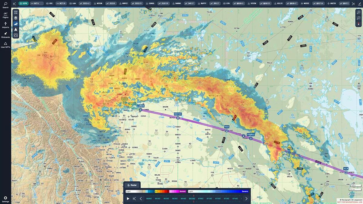
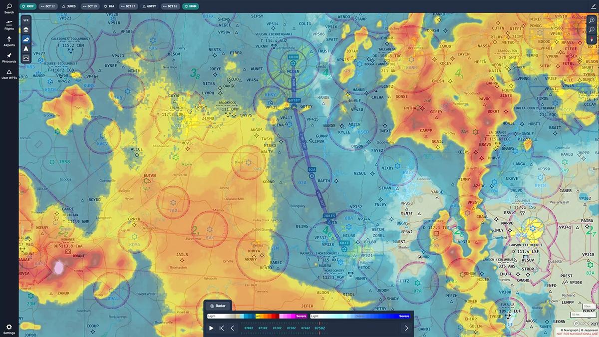
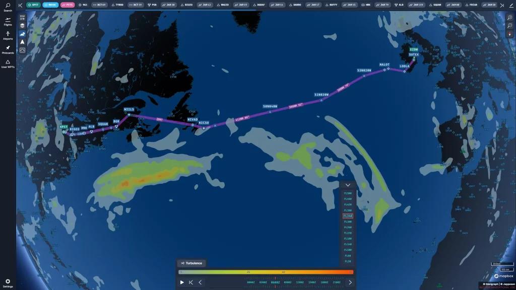
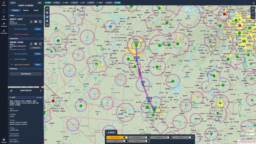
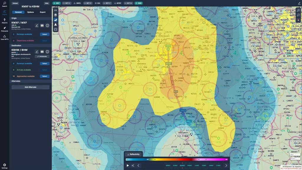
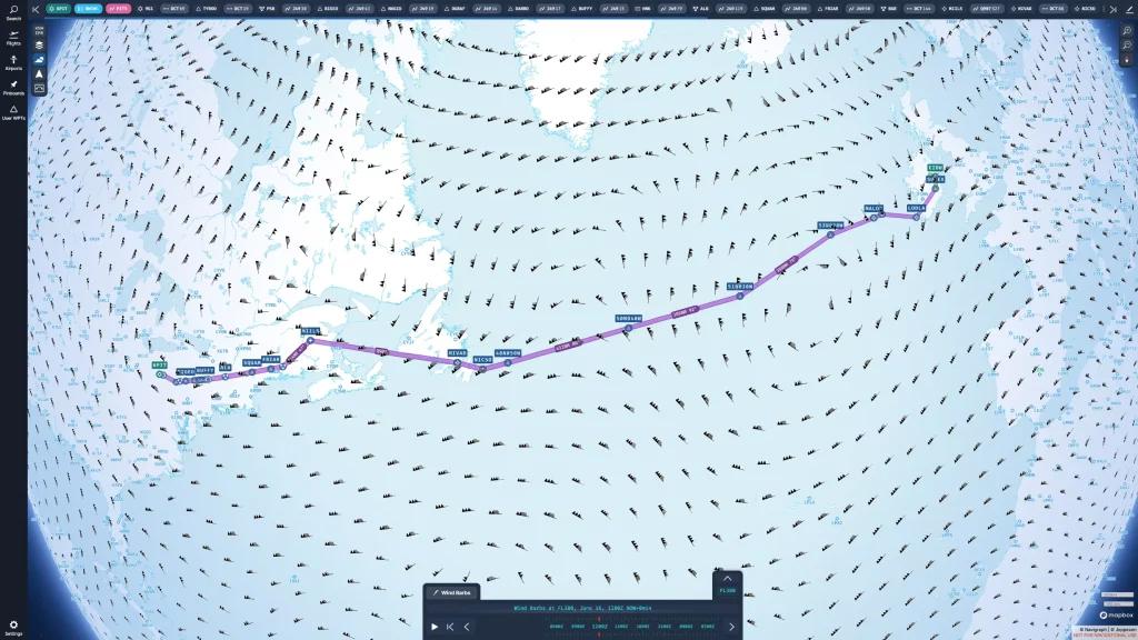
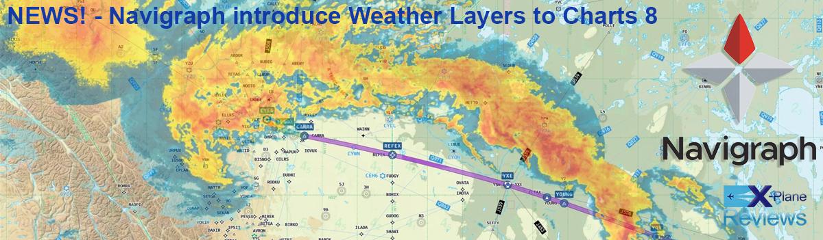
 NEWS! - Navigraph introduce Weather Layers to Charts 8 One application that has been very innovative and has changed almost entirely has been the Charts tool from Navigraph. Initially Navigraph only provided simulator navigation data, the monthly AIRAC, then later Jeppesen's worldwide IFR and VFR charts. Then they created applications to use charts and mapping world wide, and the biggest change was with the Charts 7 release. Then a complete rewrite bought Charts 8 in November 2022. This comprehensive update provided; – Worldwide VFR Charts – Drag and Drop Route Construction (only Desktop and Cloud in initial release) – Seamless Zoom – 3D Globe Projection – Autopinning of Procedure Charts – Airport Crosswind and Weather Information – Vector Charts Now added into Charts 8 is another new feature.... Weather layers. Dynamic weather layers now in Charts 8 provides up-to-date meteorological insights. From AIRMETs/SIGMETs and wind barbs to radar and convective cloud layers, and all can be used for planning and decision-making for VFR and IFR simmers. Radar – Monitor real-time precipitation and storm activity. The weather radar also supports a 2 hour playback to facilitate the anticipation of weather conditions for your flight. AIRSIGMET / CWA (AIRman’s METeorological Information / SIGnificant METeorological Information / Center Weather Advisory) – Stay informed about significant weather hazards and hazardous flying conditions such as thunderstorms, turbulence and icing across your route. METAR (METeorological Aerodrome Report) – Display real-time meteorological aerodrome report information such as temperature, dewpoint, wind and ceiling to gauge current weather conditions at airports around the world. Turbulence – Identify regions of potential turbulence along your flight path to ensure a smoother journey. Icing (Severity) – Understand the severity of icing conditions in different regions and adjust your flight plan accordingly. Reflectivity – Gain insights into precipitation by visualizing areas of precipitation and their severity. Cloud Cover – Evaluate cloud coverage and make informed decisions based on ceiling conditions displayable from FL20 up to FL500. ISA (International Standard Atmosphere) Temperature – Gain a better general understanding of the regional temperatures and plan your flights more accurately by incorporating International Standard Atmosphere temperature variations. Tropopause – Identify the upper limit of the troposphere to gain a better understanding of weather at high altitudes. Convective Cloud Top Level – Visualize the top levels of convective clouds to assess the potential for severe weather. High Cloud Top Level – Identify the altitude of high-level clouds, allowing for a better understanding of high altitude weather. Visibility – Display regions with low visibility to ensure safe and efficient navigation. MSL (Mean Sea Level) Pressure – View mean sea level pressure to understand the regional atmospheric conditions. Jet Streams – Discover the location of jet streams at different altitudes and plan your flights accordingly. Wind Barbs – Observe wind directions and strength with wind barbs at different altitudes for increased situational awareness and accurate flight planning. A 24-hour forecast is available for all layers except AIRMETs/SIGMETs, METAR, and radar; A 6-hour playback is available for all layers but AIRMETs/SIGMETs and METAR, while the radar offers a 2-hour playback. There is a video provided by Navigraph to explain all the various Weather Layers you can use. Navigraph Charts are not free as you need to subscribe to Navigraph on a monthly or yearly basis or EUR 9.05 / mo or EUR 81.64 / year, so you could do a month update of the AIRAC cycle and then drop out again. But lately I have been leaving my monthly subscription active all the time. As the whole system since acquiring SimBrief last year is just all so brilliant... now even indispensable tools as they are both now highly intergrated. NEWS! - SimBrief updated by Navigraph Just so brilliant... at only a slight cost per month. _____________________________________ Yes! Navigraph v8.0 with Weather Layers is now Available Navigraph Subscription only on a monthly or yearly basis or EUR 9.05 / mo or EUR 81.64 / year Download Download applications are available for both Windows and Mac. SimLink is also available for download and in inserted into your X-Plane Plugins folder.... Internet connection is required for this application. SimBrief is now also intergrated into the Navigraph application, get it here: SimBrief Navigraph Charts Review version v8.28.0 _____________________________________ Application NEWS! by Stephen Dutton 20th June 2023 Copyright©2023 : X-Plane Reviews (Disclaimer. All images and text in this review are the work and property of X-PlaneReviews, no sharing or copy of the content is allowed without consent from the author as per copyright conditions)