Search the Community
Showing results for tags 'cami de bellis'.
Found 9 results
-
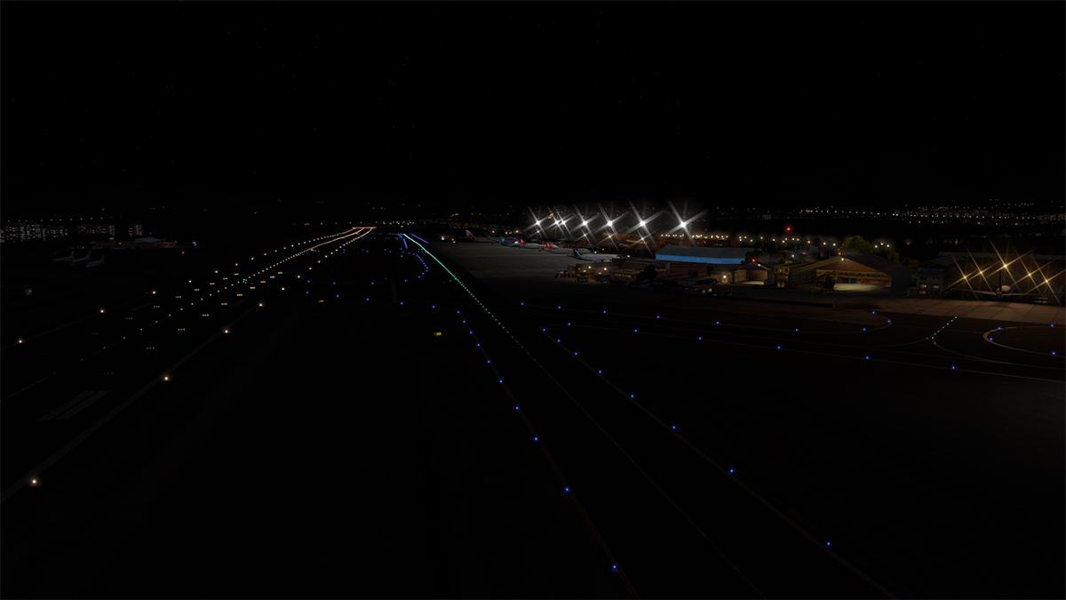
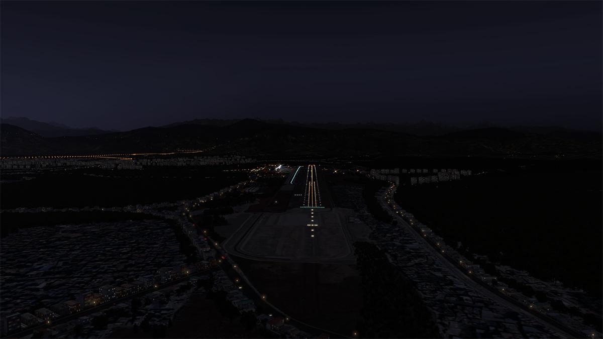
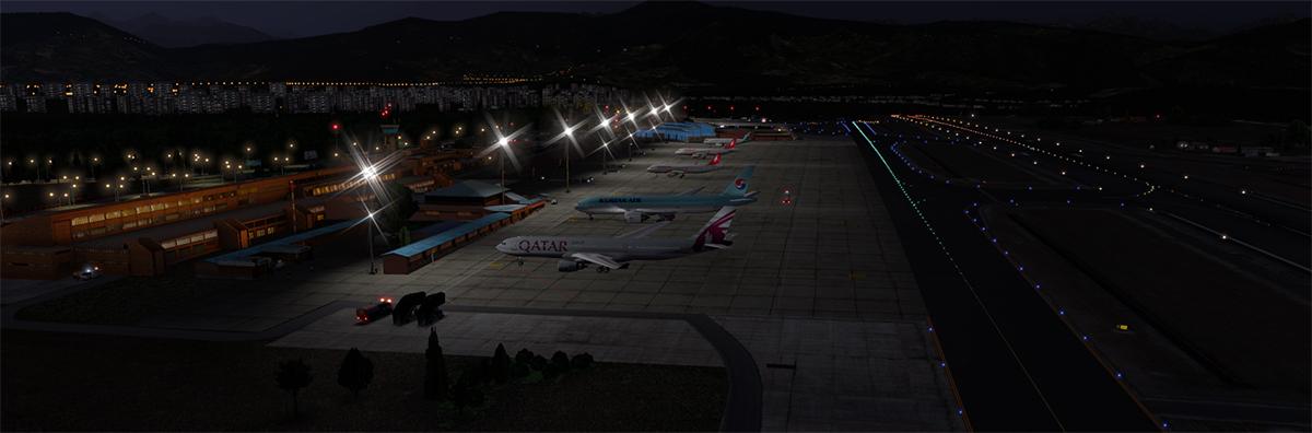
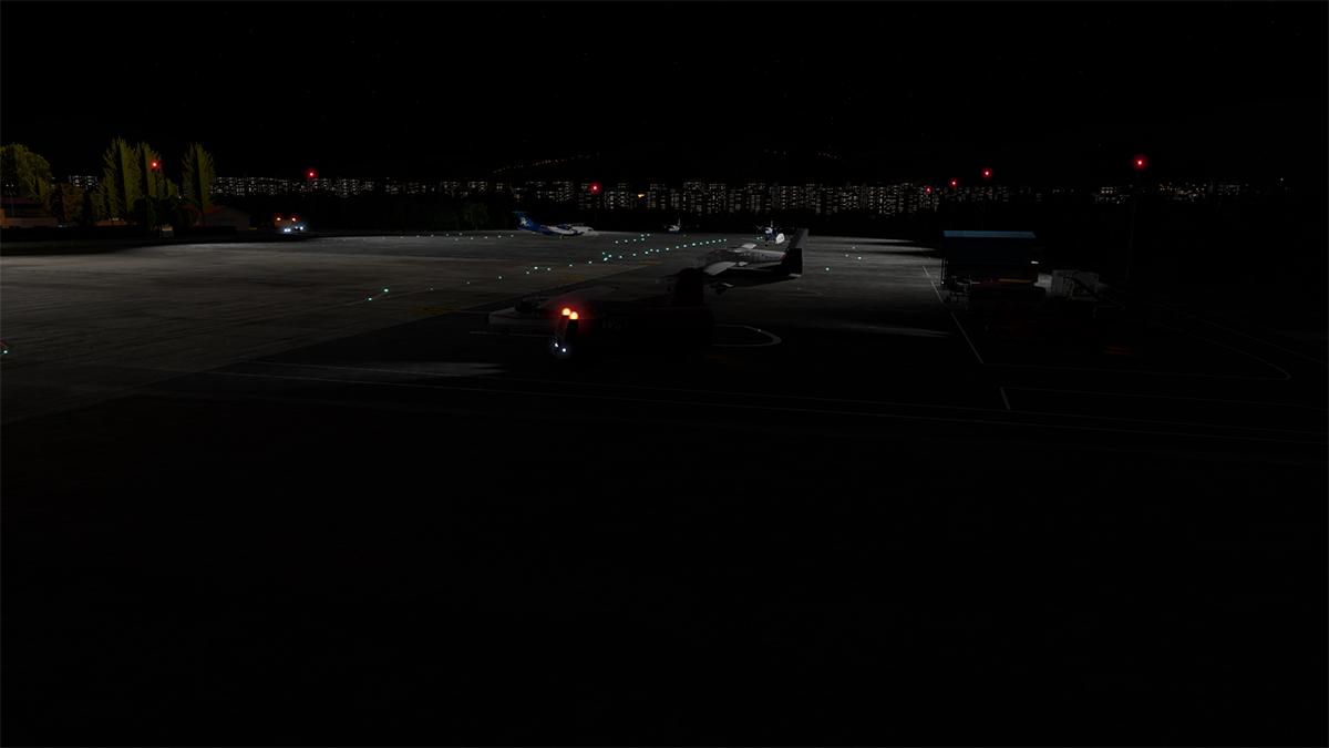
 NEWS! - Scenery Released : LICD- Lampedusa Airport and Linosa Island, Italy by Cami de Bellis Where is it? It's an Italian Island, but in reality it is nowhere near the Southern Italian coastline, more adjacent to Tunisia, Africa than Europe. Lampedusa is the largest island of the Italian Pelagie Islands in the Mediterranean Sea. The Pelagie Islands from the Greek pélagos meaning "open sea", are the three small islands of Lampedusa, Lampione, and Linosa, located in the Mediterranean Sea between Malta and Tunisia, south of Sicily. To the northwest lie the island of Pantelleria and the Strait of Sicily. All three islands are part of the commune of Lampedusa. Geologically, part of the archipelago (Lampedusa and Lampione) belongs to the African continent; politically and administratively the islands fall within the Sicilian province of Agrigento and represent the southernmost part of Italy. Despite pockets of agriculture, the islands are unnaturally barren due to wanton deforestation and the disappearance of the native olive groves, juniper and carob plantations. Fifty years ago much of the landscape was farmland bounded by dry stone walls, but today, the local economy is based on sponge fishing and canning, supplemented by tourism in Lampedusa. Here is another detailed Cami de Bellis scenery with the addition of complete terrain mesh for the entire islands of Lampedusa and Linosa by Maps2XPlane, yes the same Maps2XPlane that did the excellent islands coverage of Faroe and Savlbard. So obviously you have a great combination of skills and quality scenery here. Features Highly accurate scenery for LICD- Lampedusa Airport and Linosa Island with all buildings modeled. Over 160 custom objects all with Ambient Occlusion Custom Terrain Mesh for the entire island of Lampedusa and Linosa by Maps2XPlane Custom Overlay/Autogen Scenery based on CDB assets by Maps2XPlane" Photo real textures on buildings, vehicles, trees… Photorealistic ground textures based on a satellite image 50 cm. Detailed airport objects and GSE vehicles Custom textured taxiways, runways, and apron Custom surrounding buildings Custom airport lights HD Custom Overlay High-resolution building textures – all in 2K and 4K Excellent night effects World Traffic 3 compatible Native characters and vehicles created specially Ground traffic The terrain mesh is complemented with custom overlays: dense vegetation and country-typical autogen, as well as custom road networks with dynamic traffic. Two heliports, for those fans of helicopters. One at the beautiful Linosa Island, and the other on the US Loran Station Base. This LICD scenery is X-Plane 12 only Images of LICD- Lampedusa Airport and Linosa Island are courtesy of Cami de Bellis ________________ Yes! LICD- Lampedusa Airport and Linosa Island by Cami de Bellis is Available now from the X-Plane.Org Store here : LICD- Lampedusa Airport and Linosa Island Price Is US$18.90 Requirements X-Plane 12 (not for XP 11) Windows, Mac or Linux 8 GB+ VRAM Recommended Download Size: 2.7 GB Current version 1.0 (January 11th 2024) ________________ NEWS! by Stephen Dutton 12th January 2024 Copyright©2024: X-Plane Reviews (Disclaimer. All images and text in this review are the work and property of X-PlaneReviews, no sharing or copy of the content is allowed without consent from the author as per copyright conditions) All Rights Reserved
-
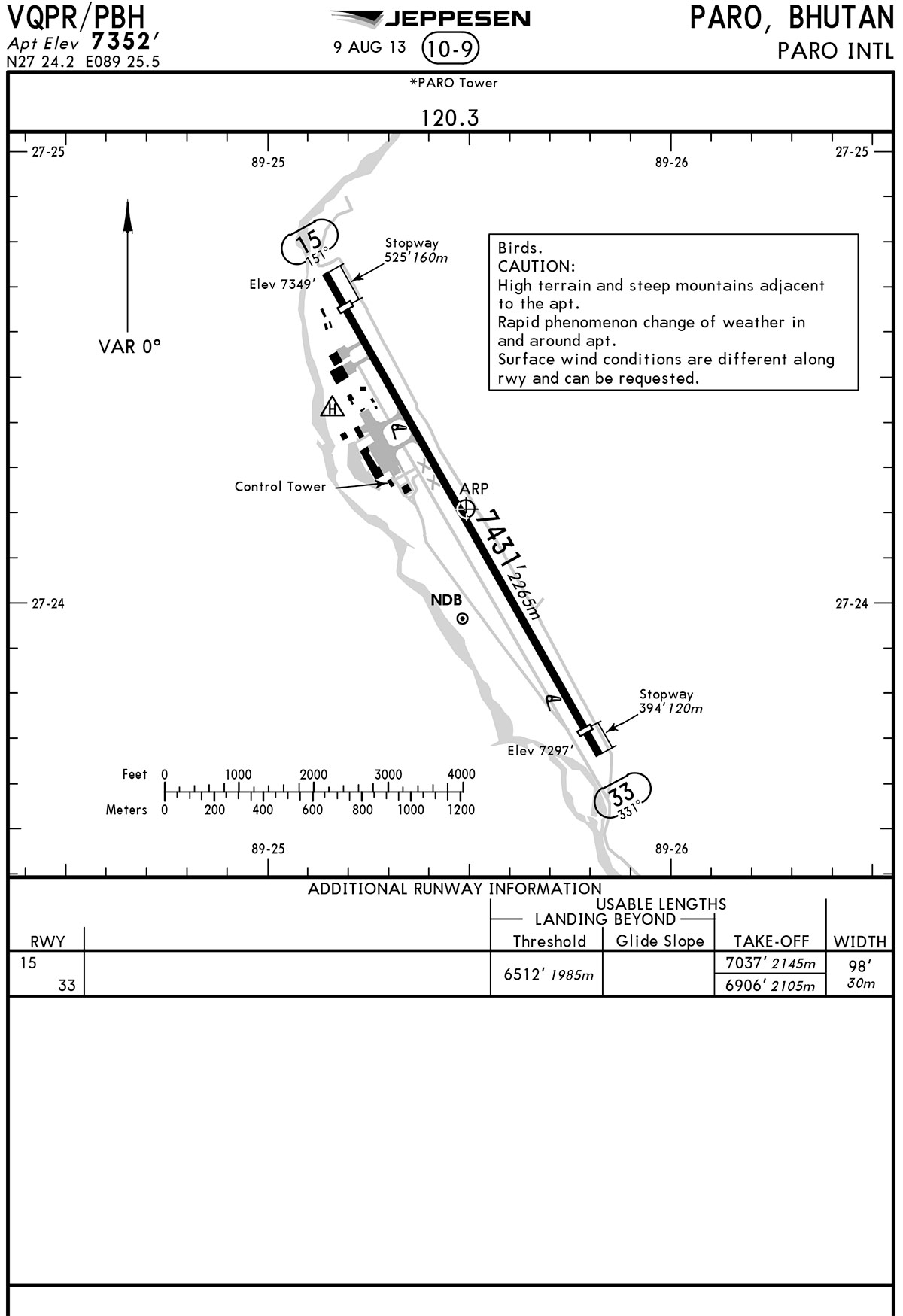
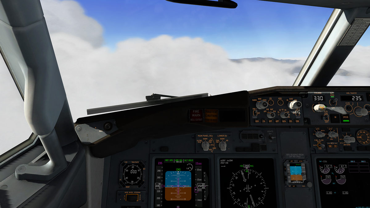
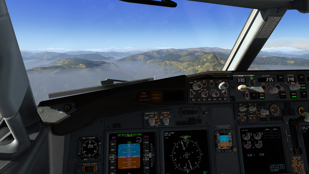
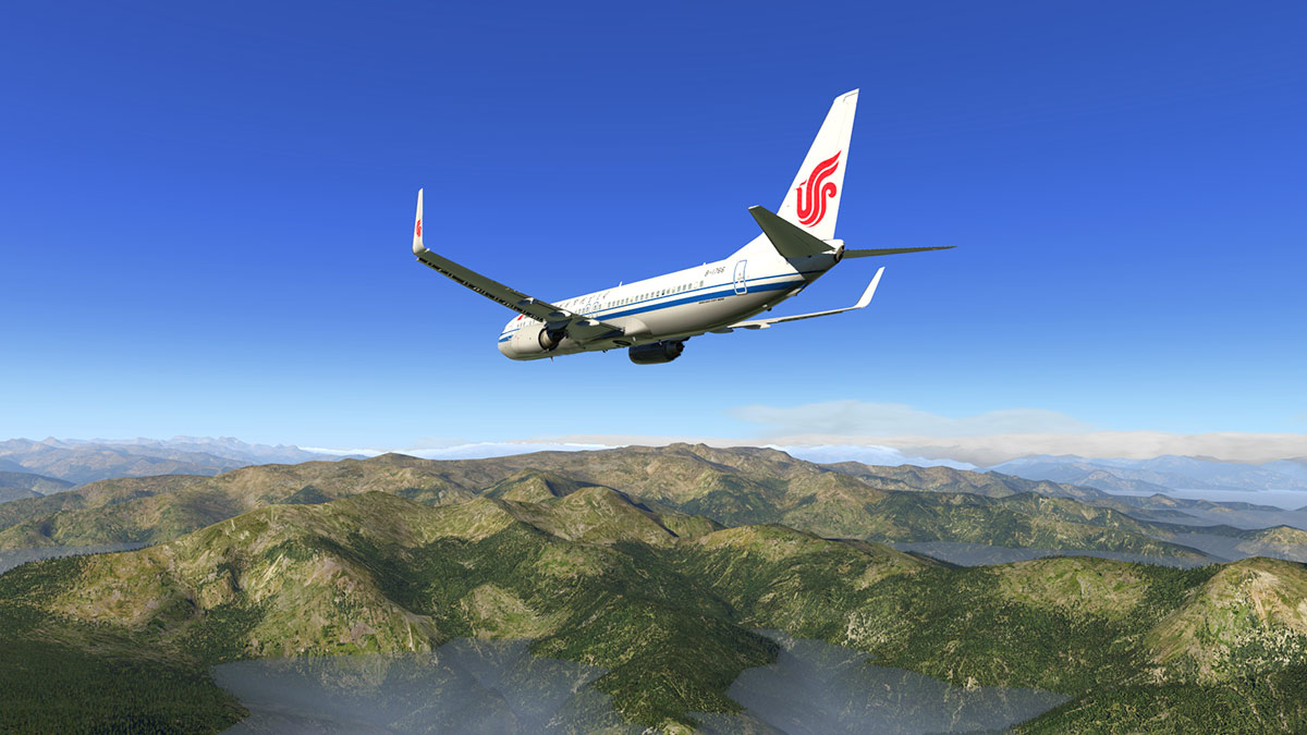
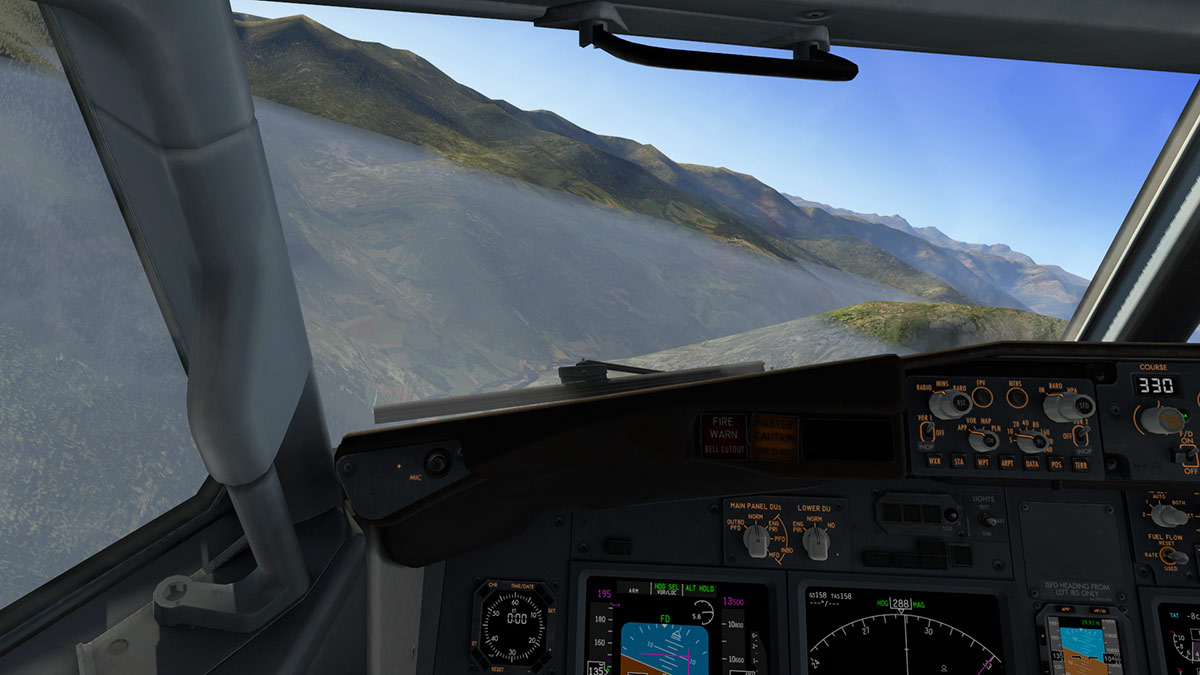
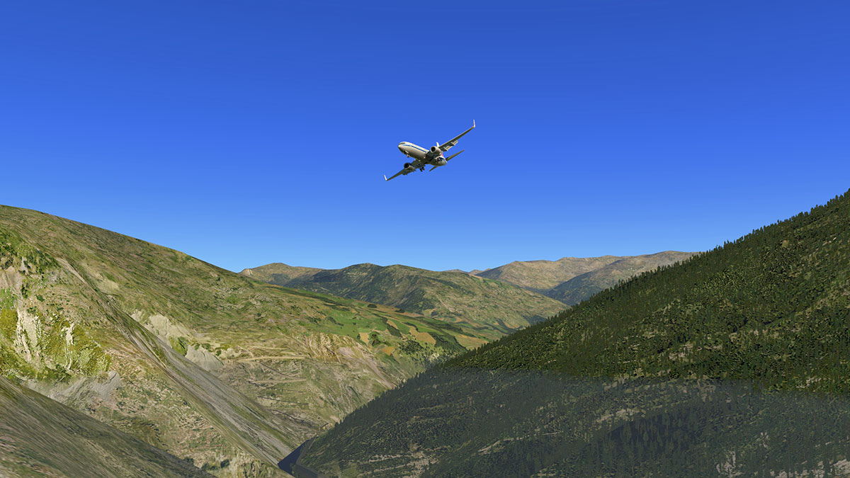
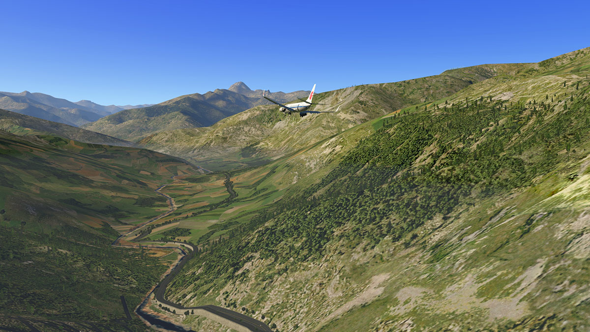
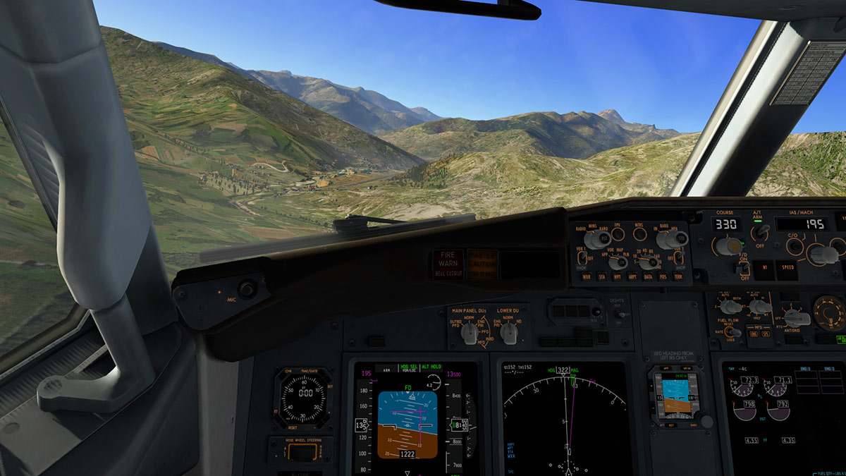
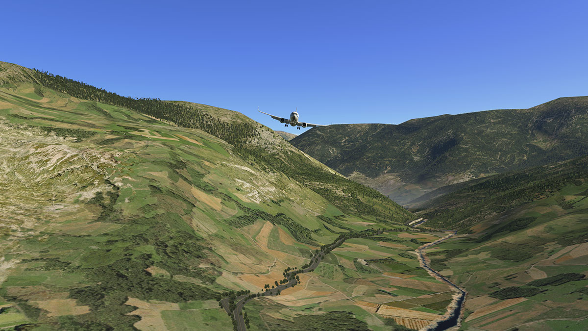
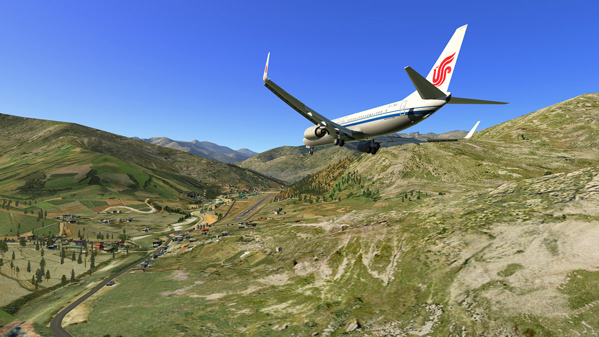
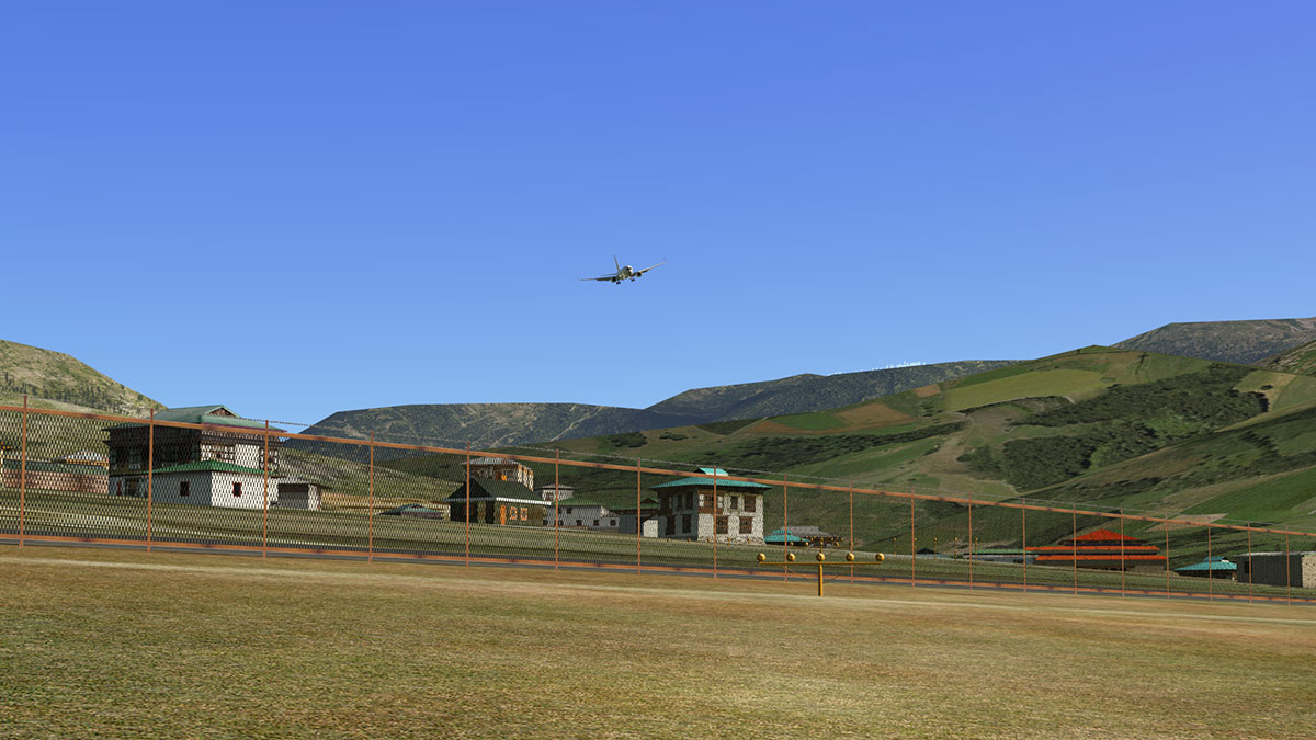
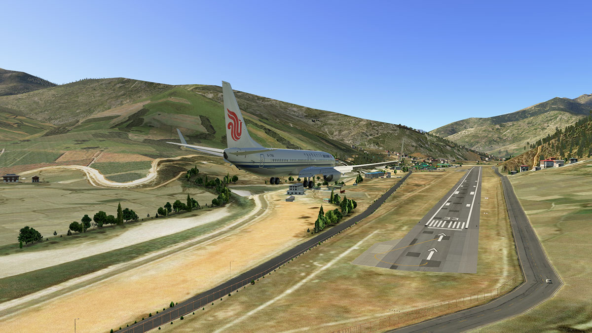
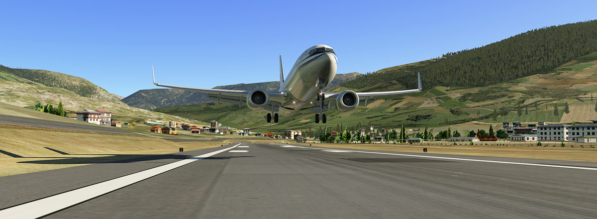
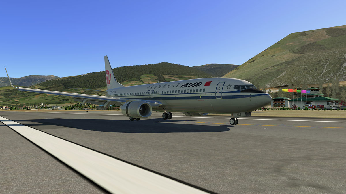
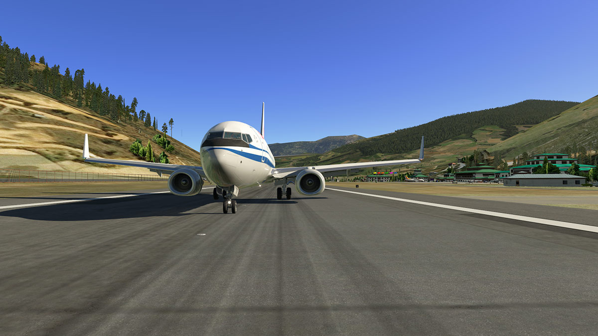
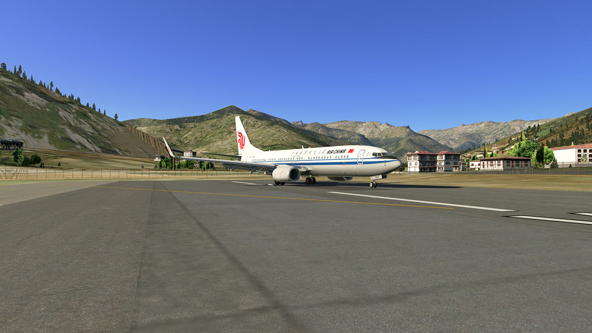
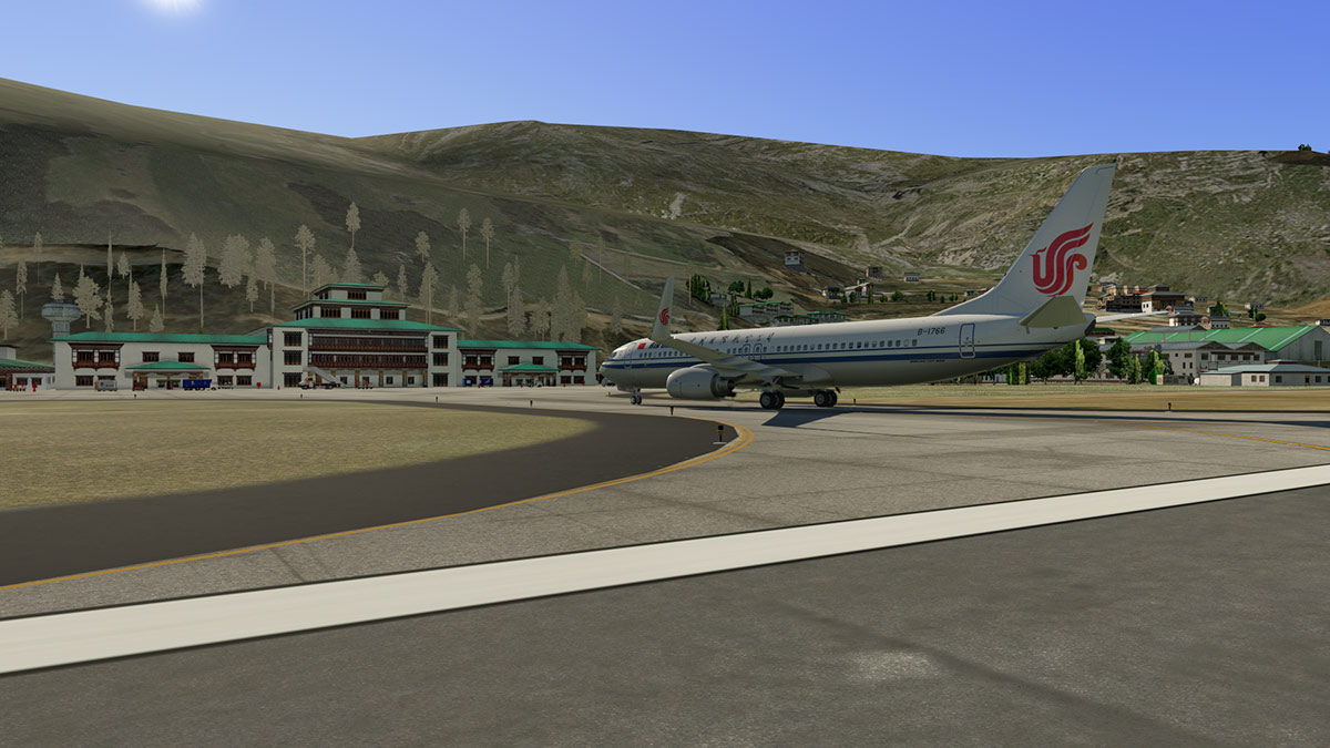
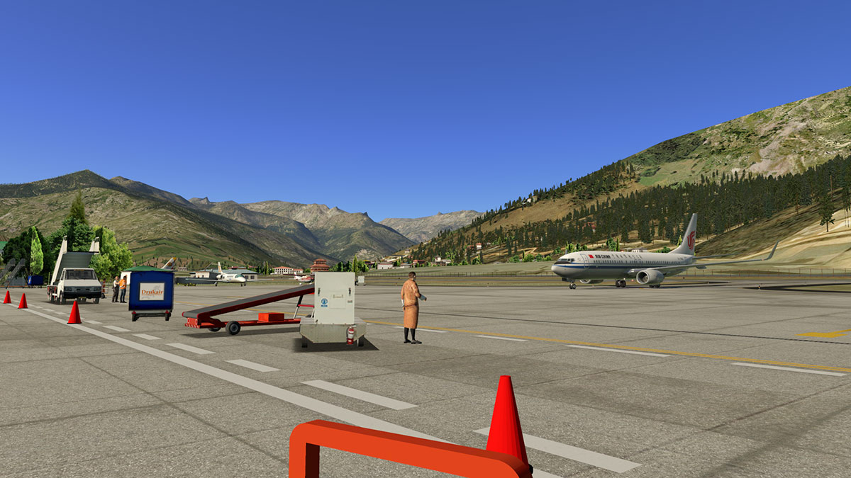
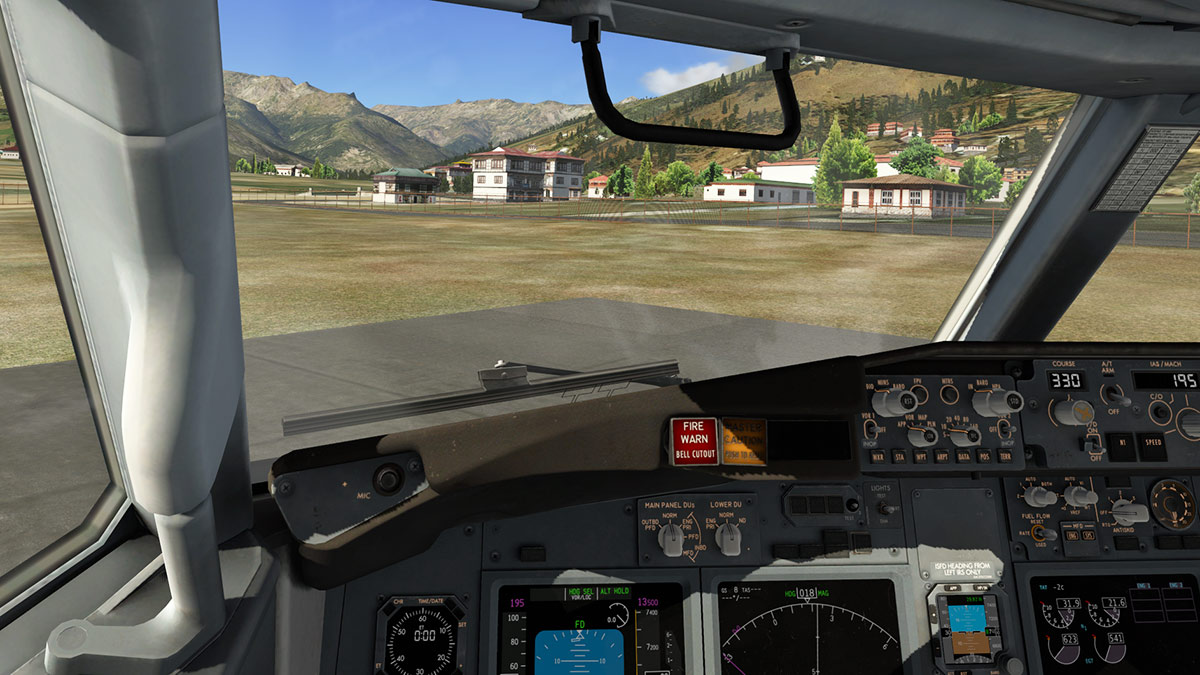
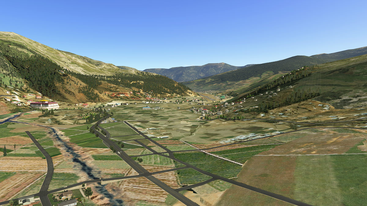
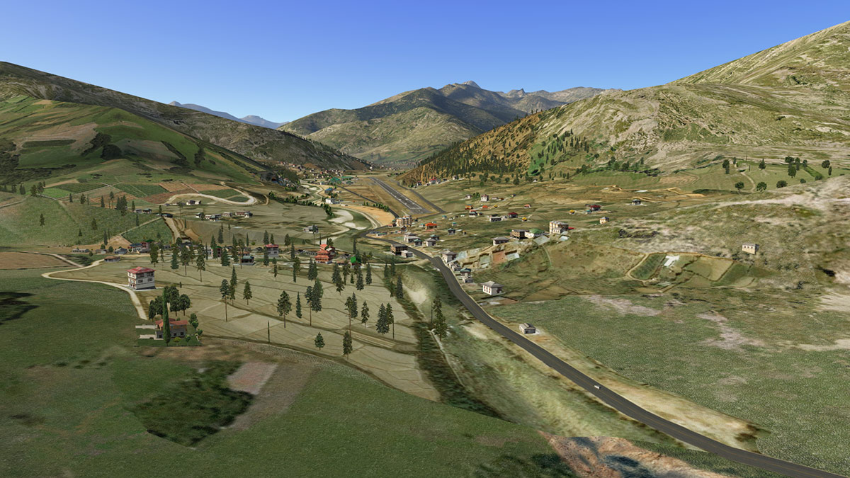
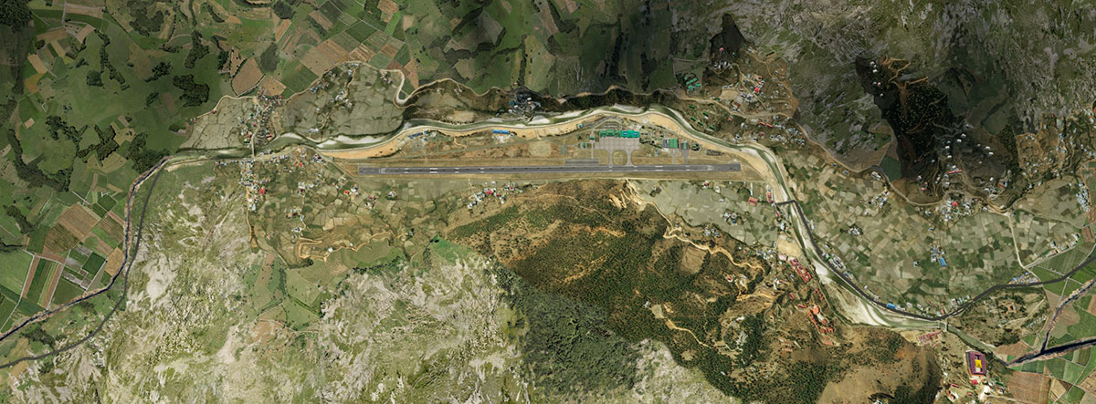
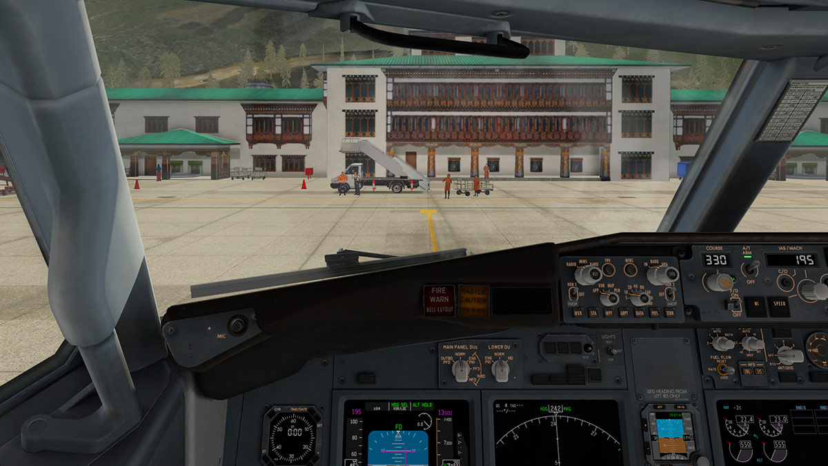
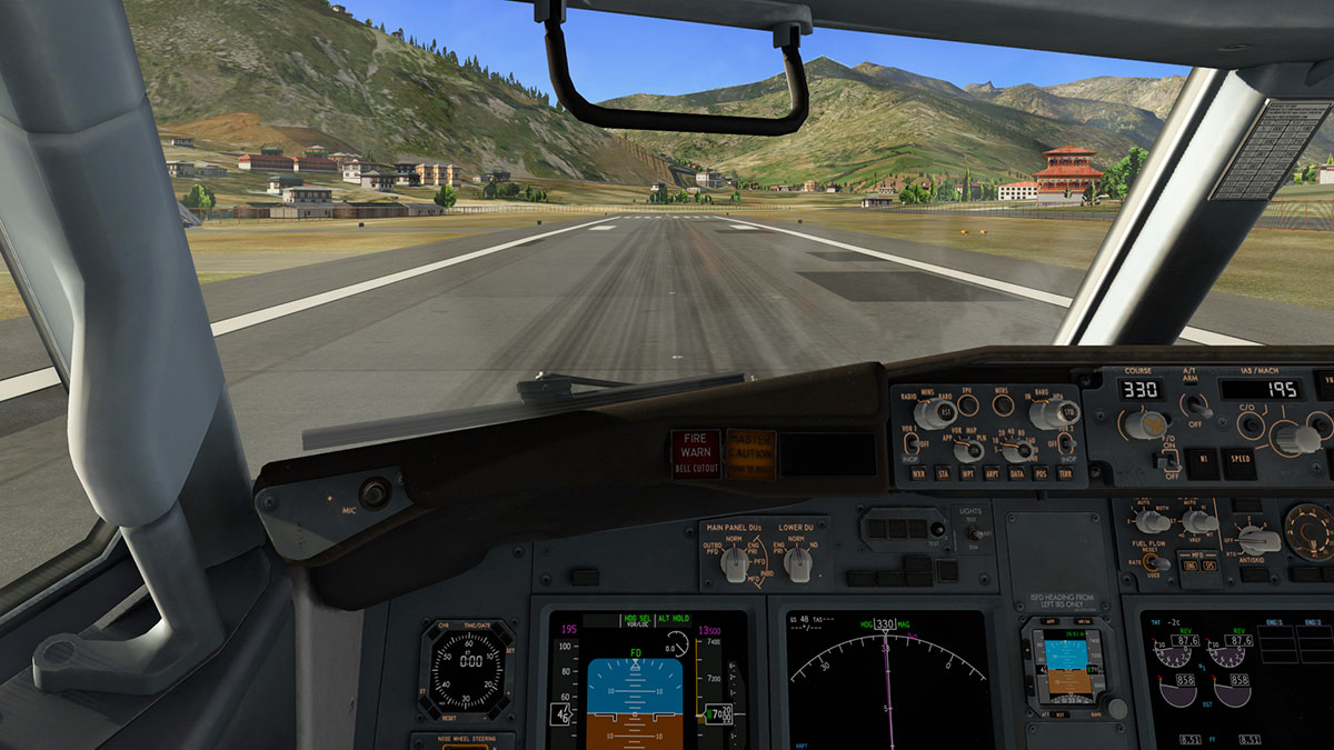
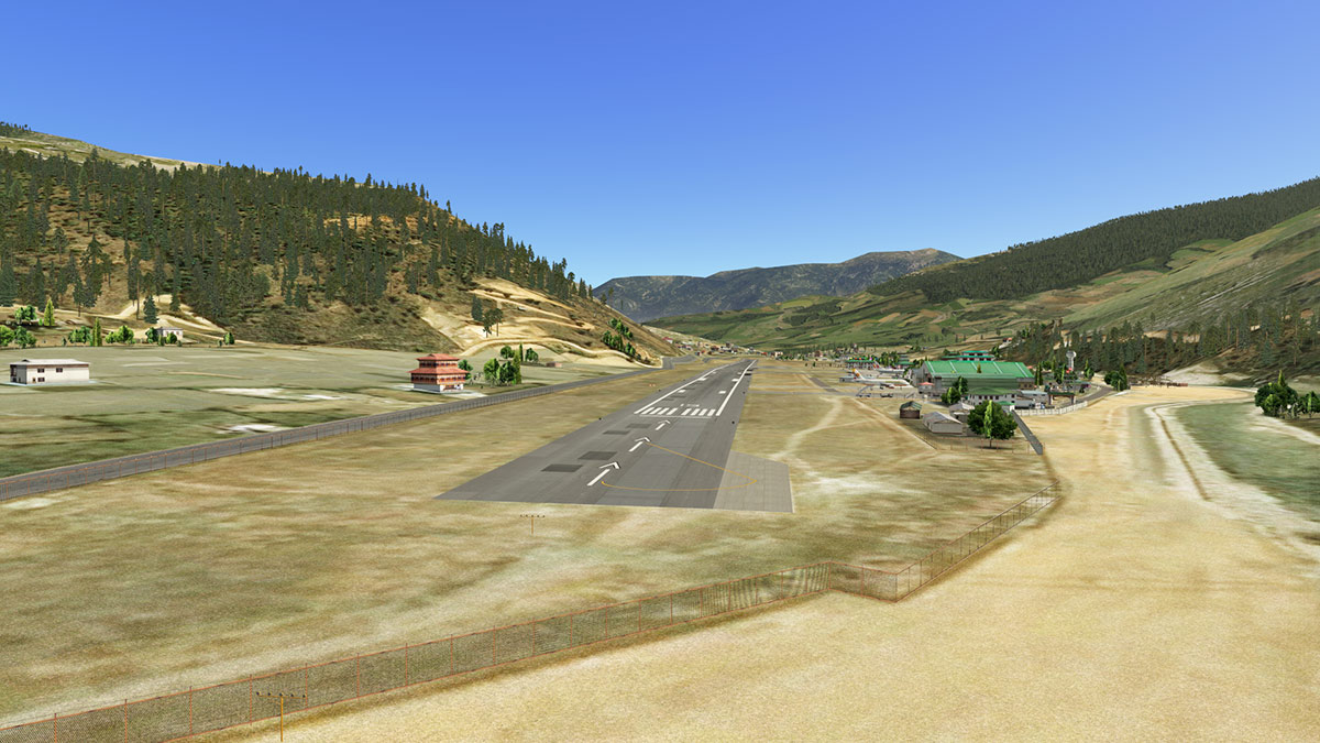
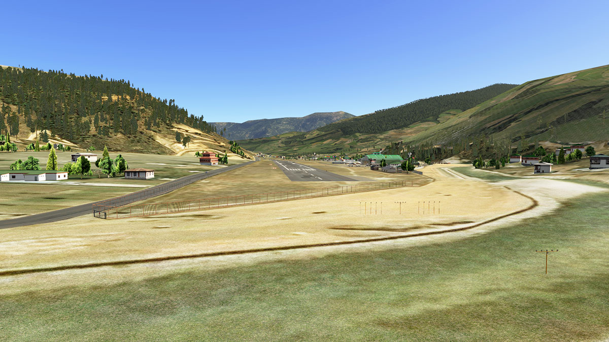
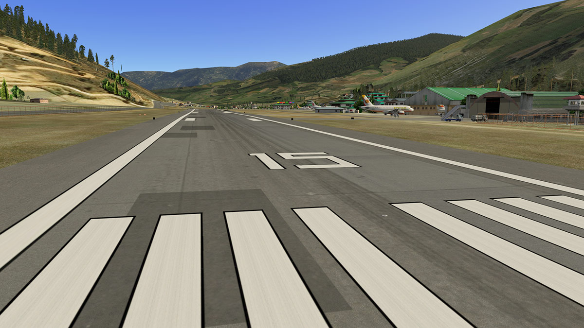
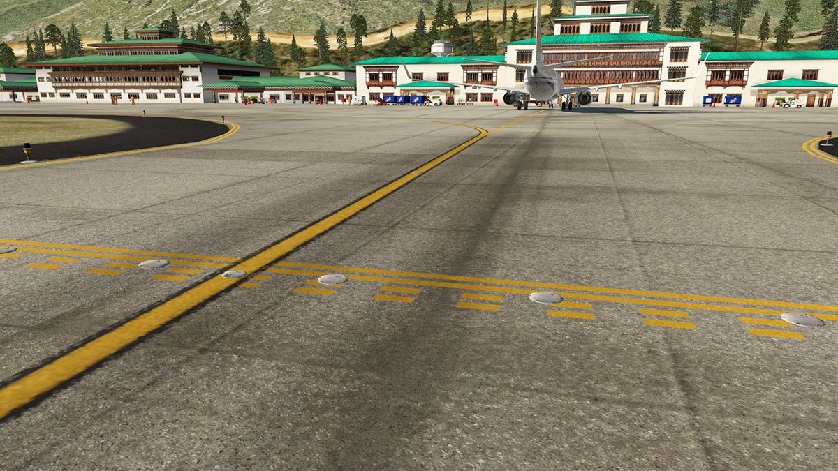
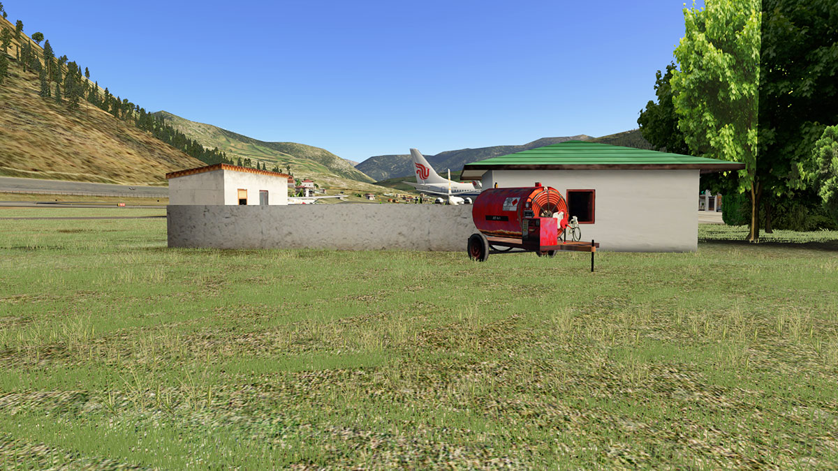
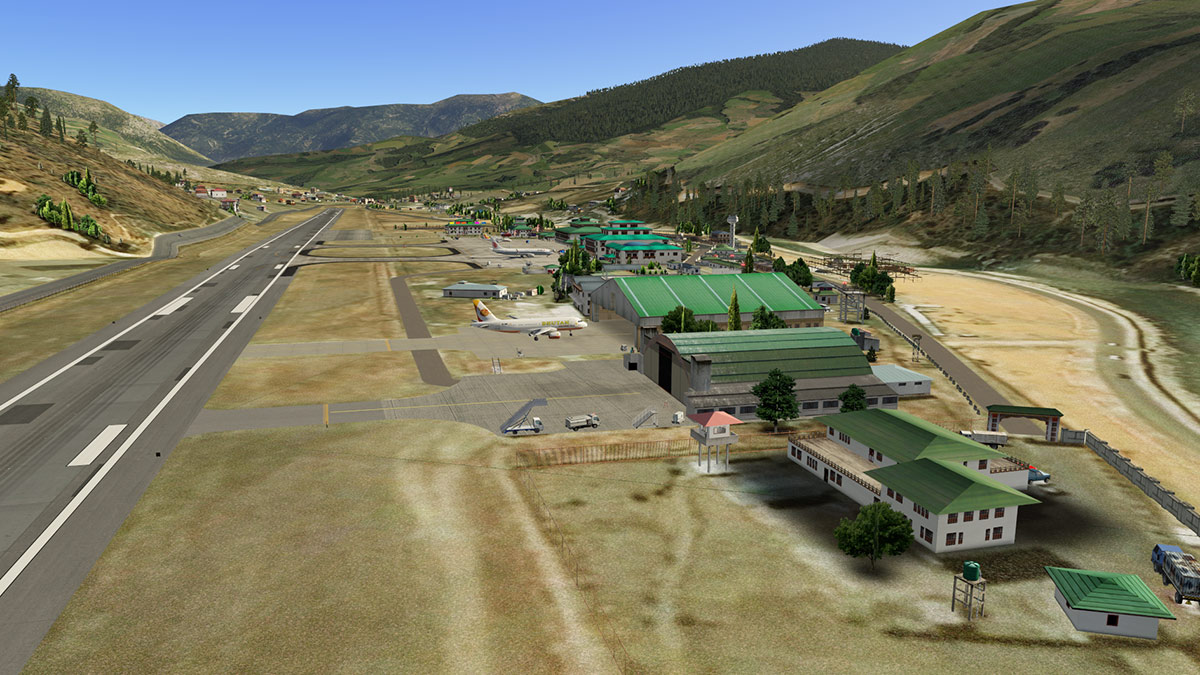
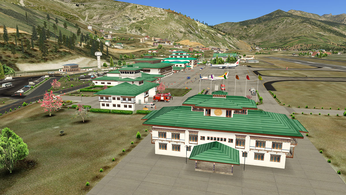
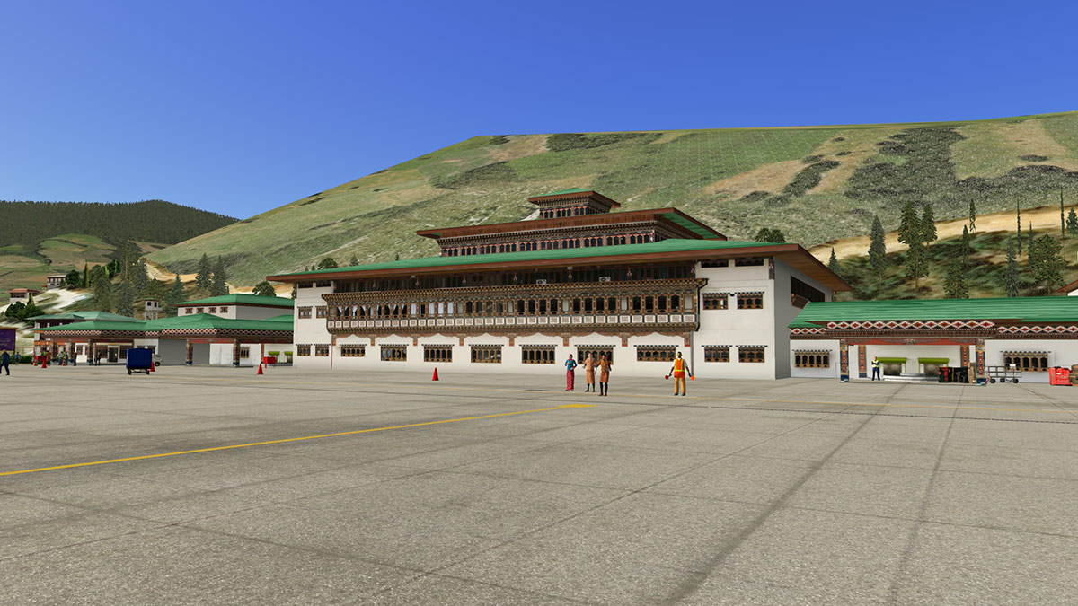
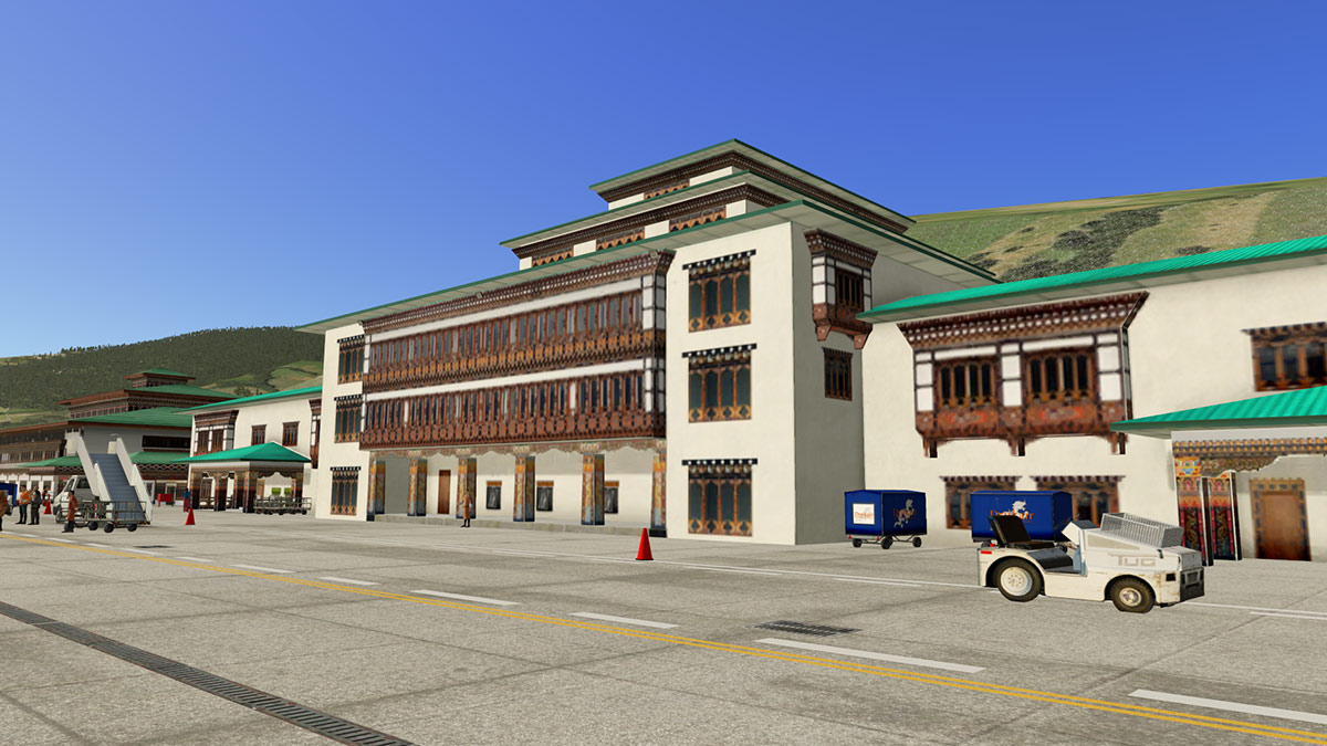
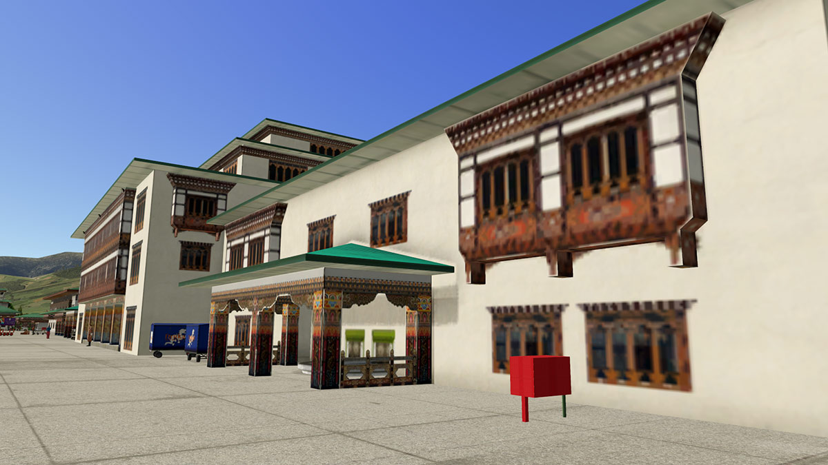
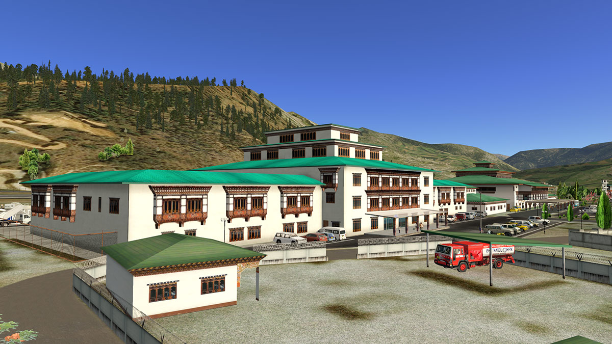
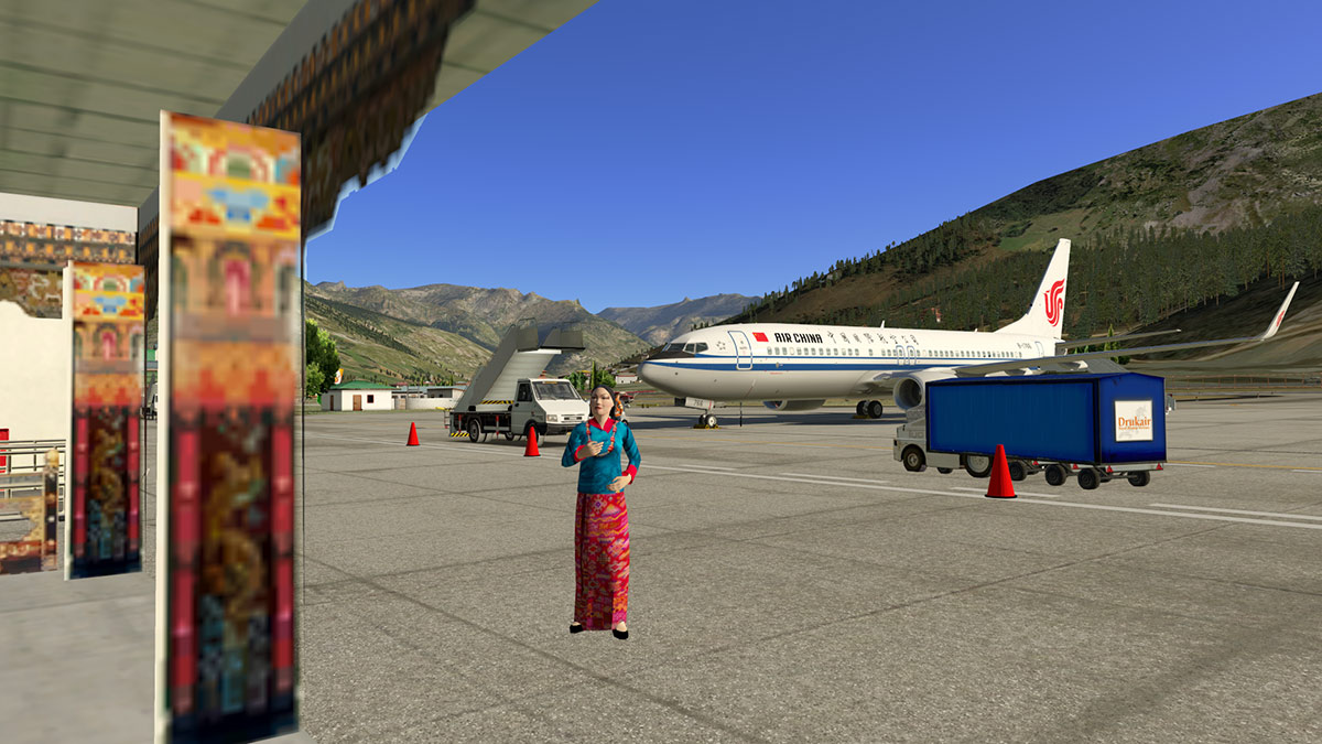
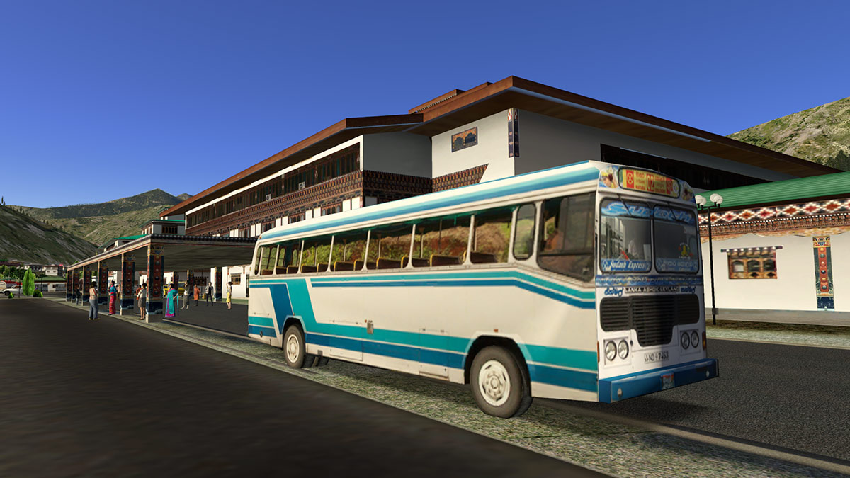
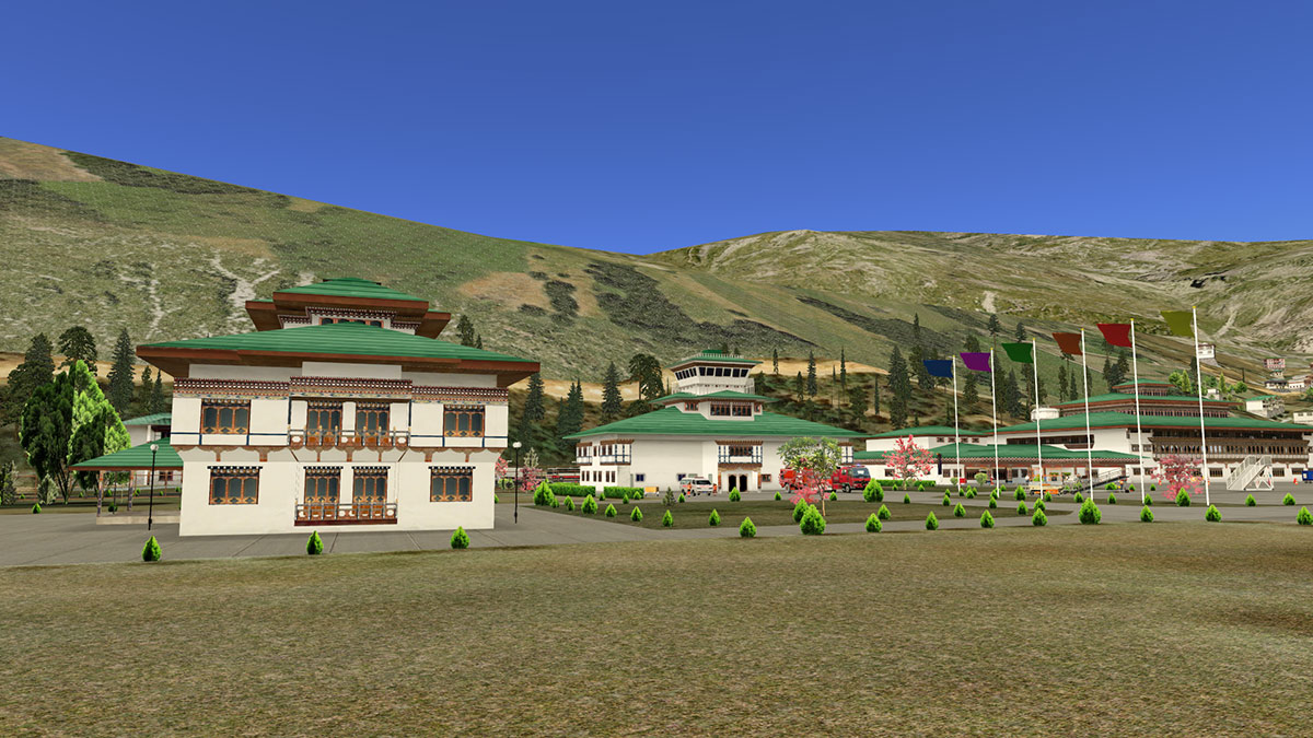
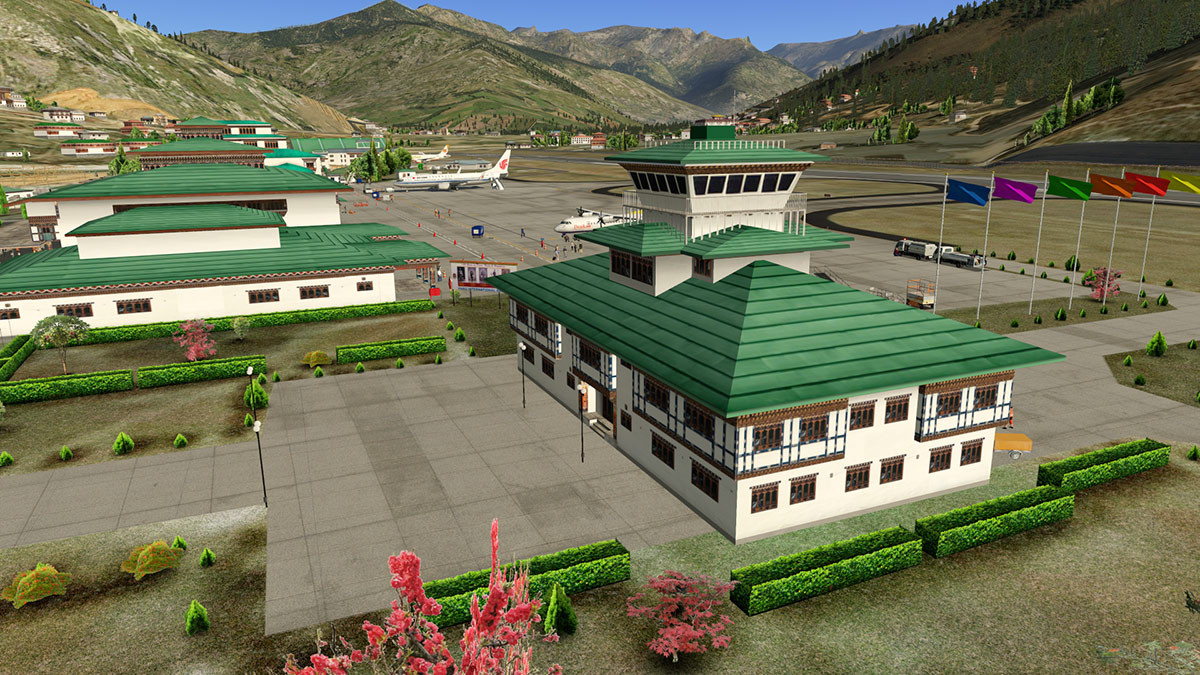
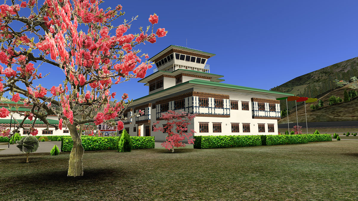
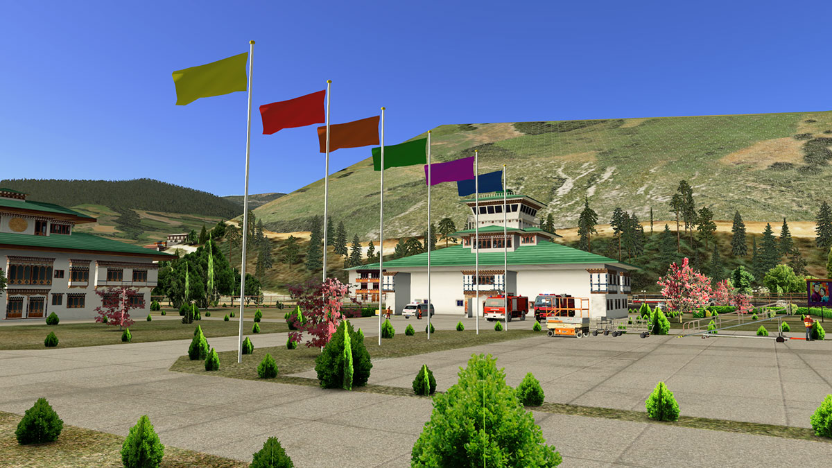
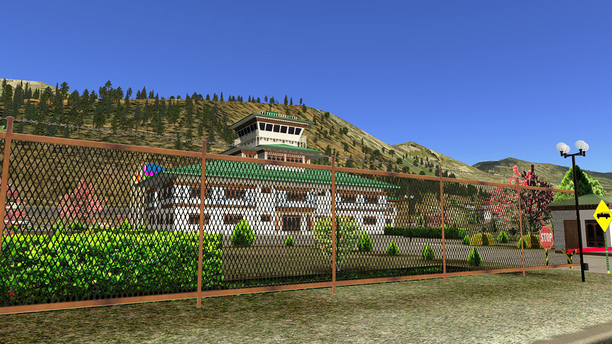
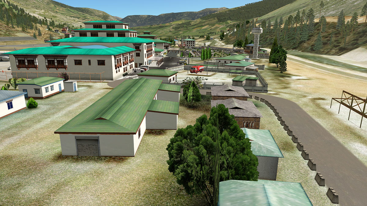
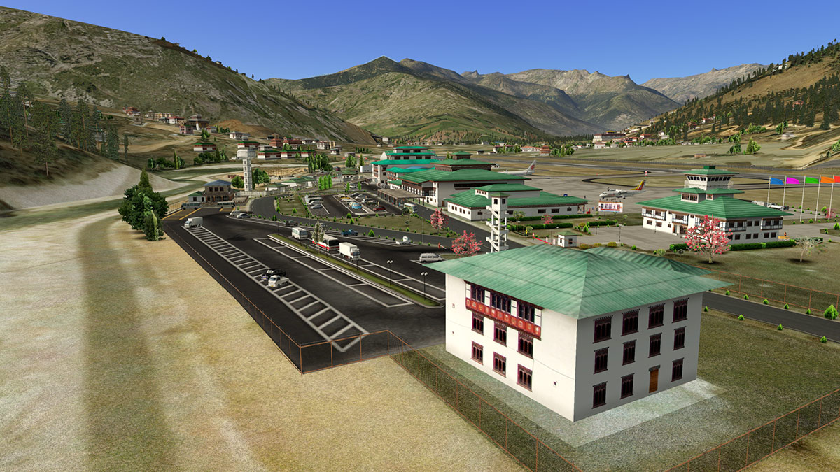
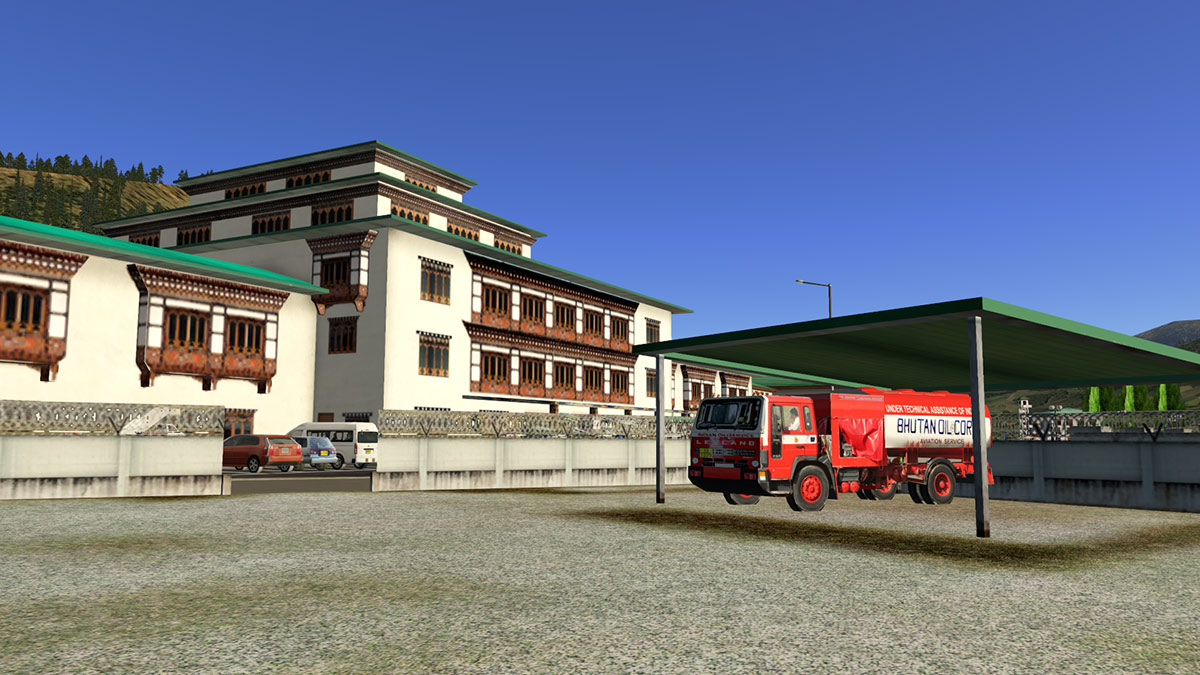
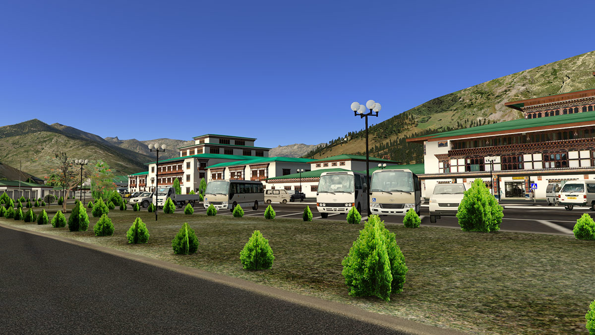
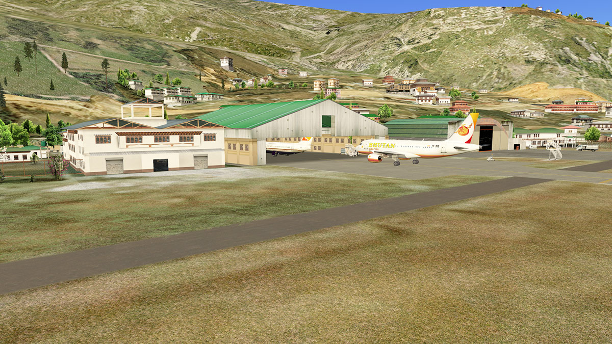
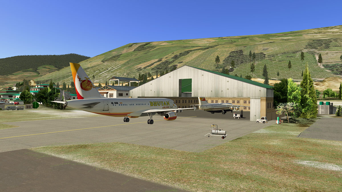
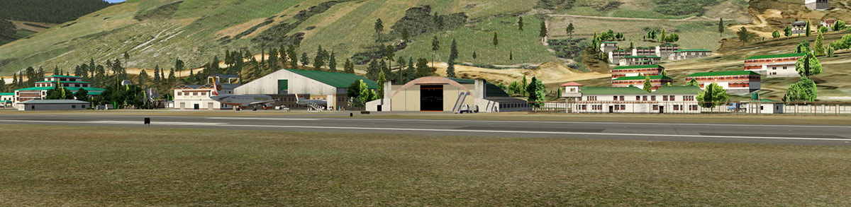
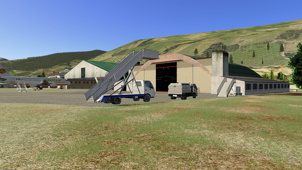
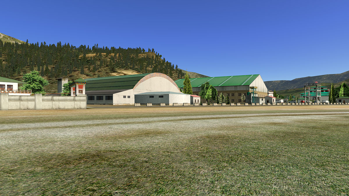
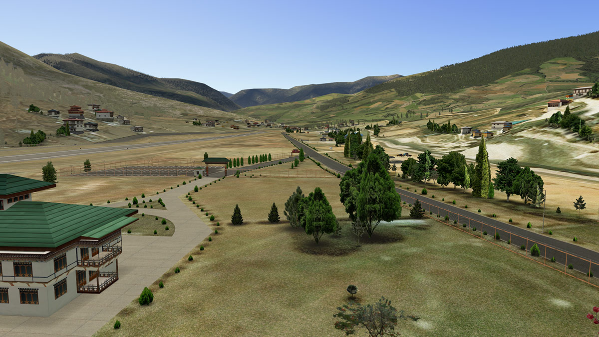
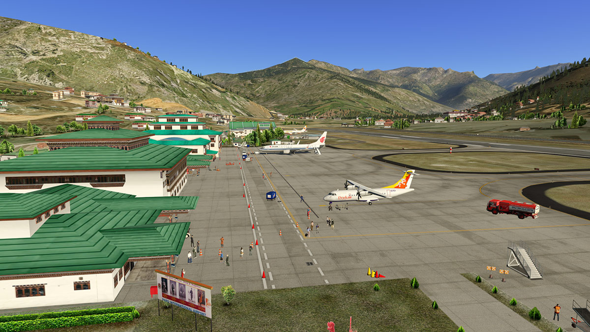
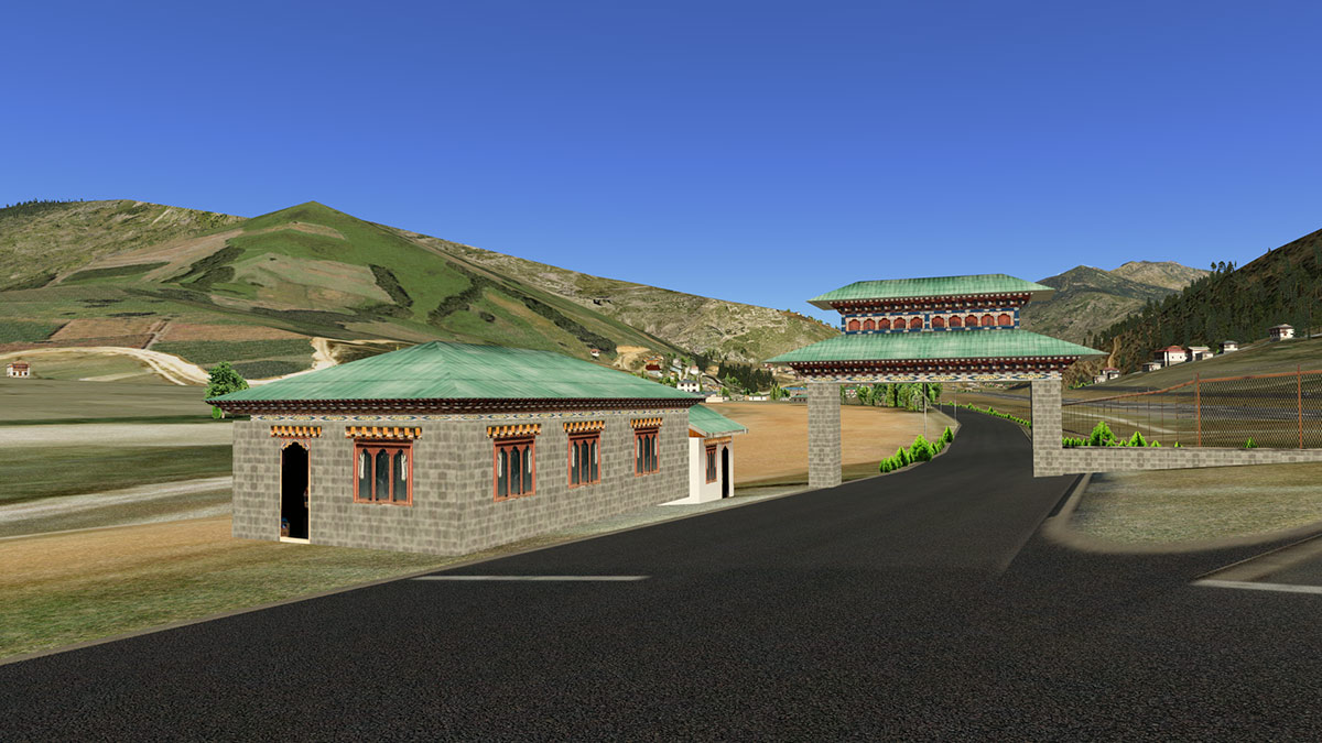
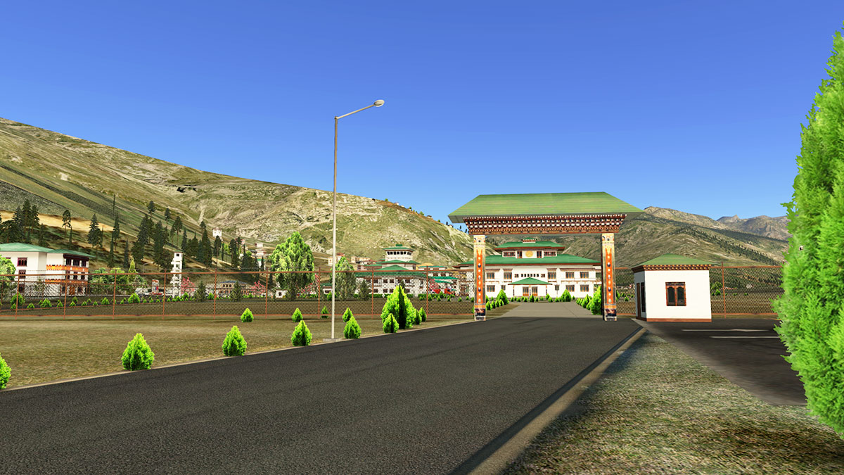
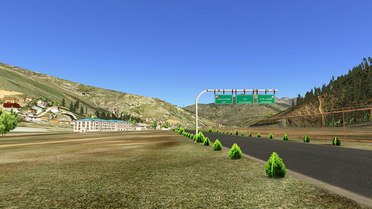
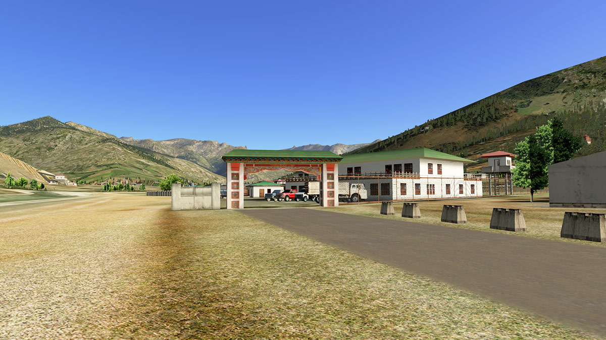
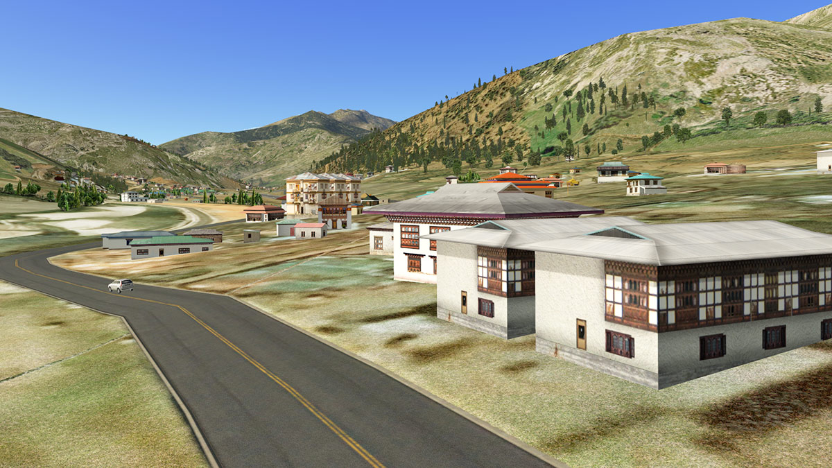
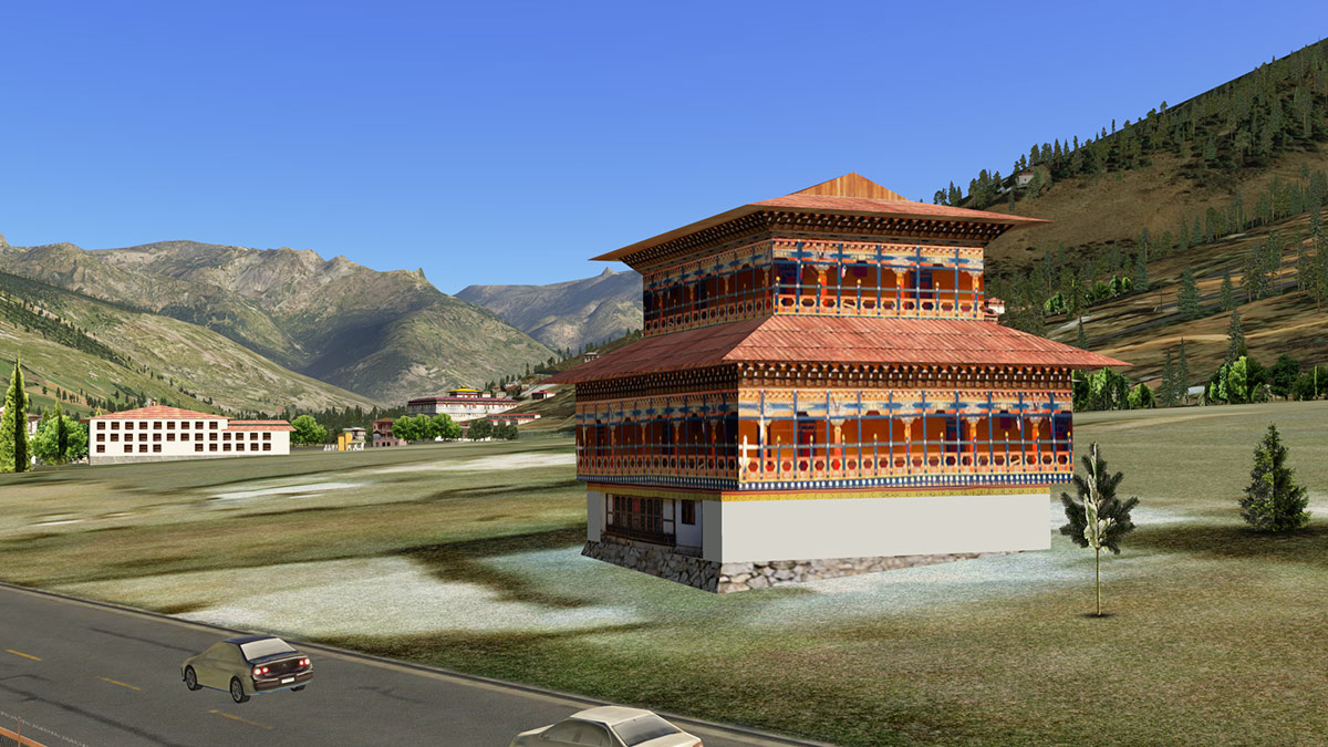
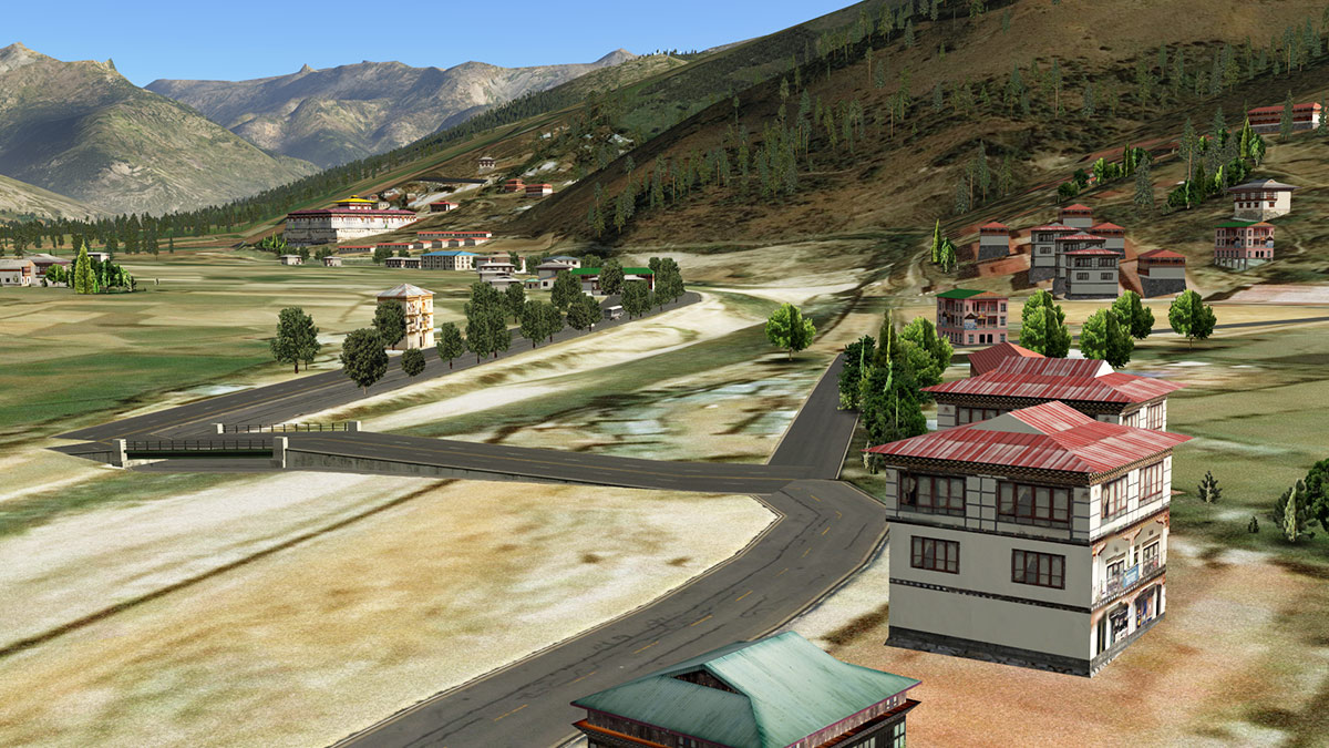
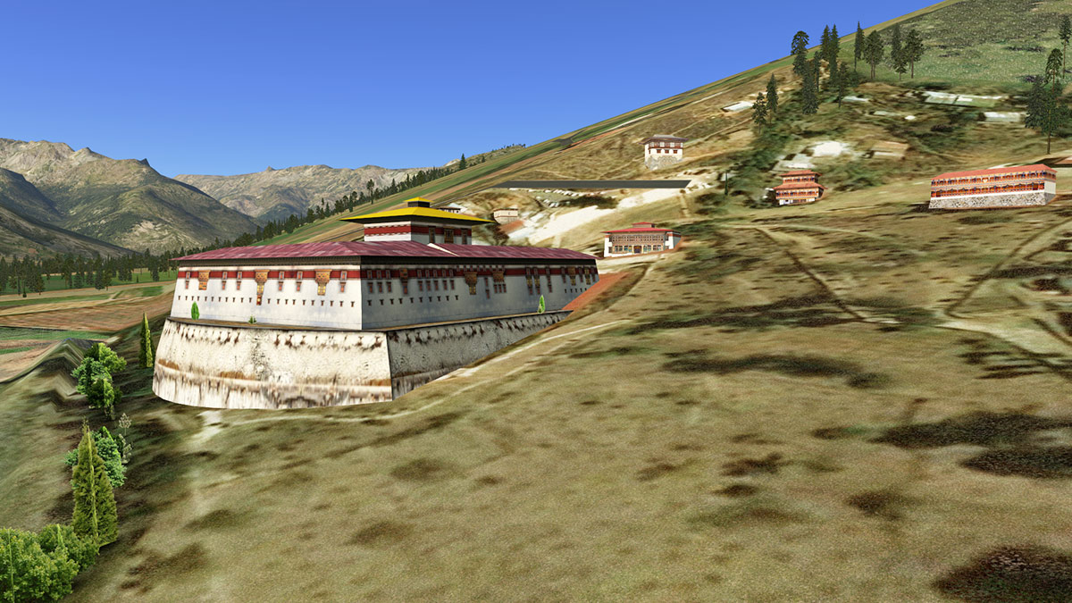
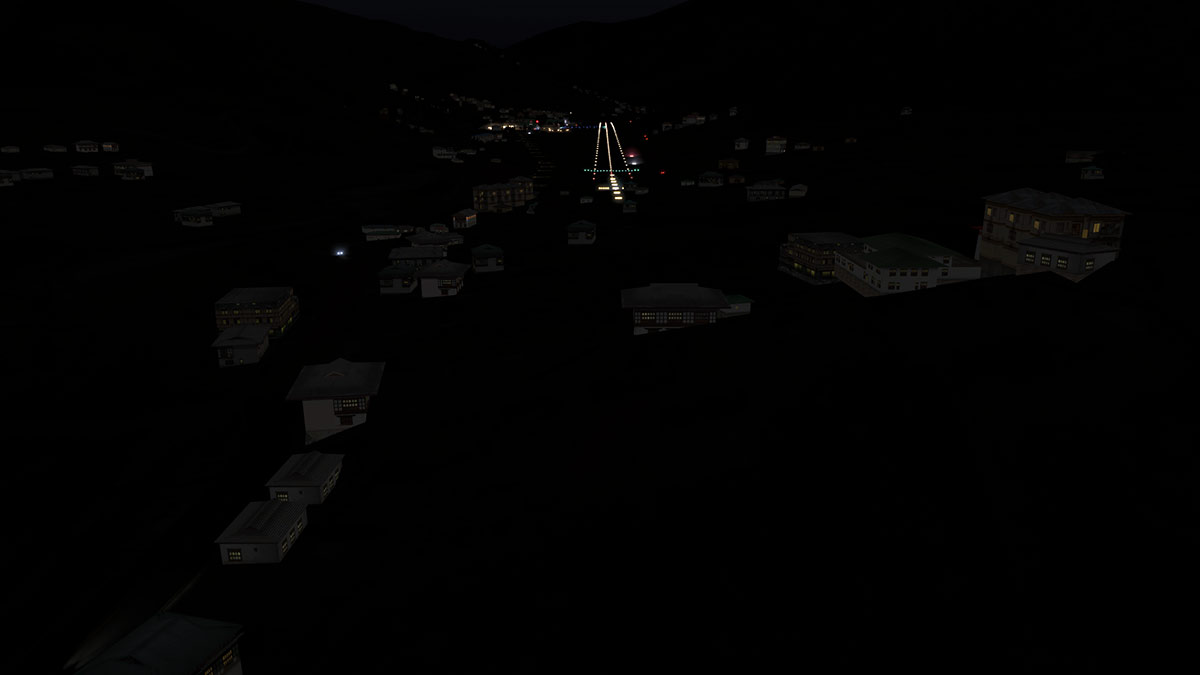
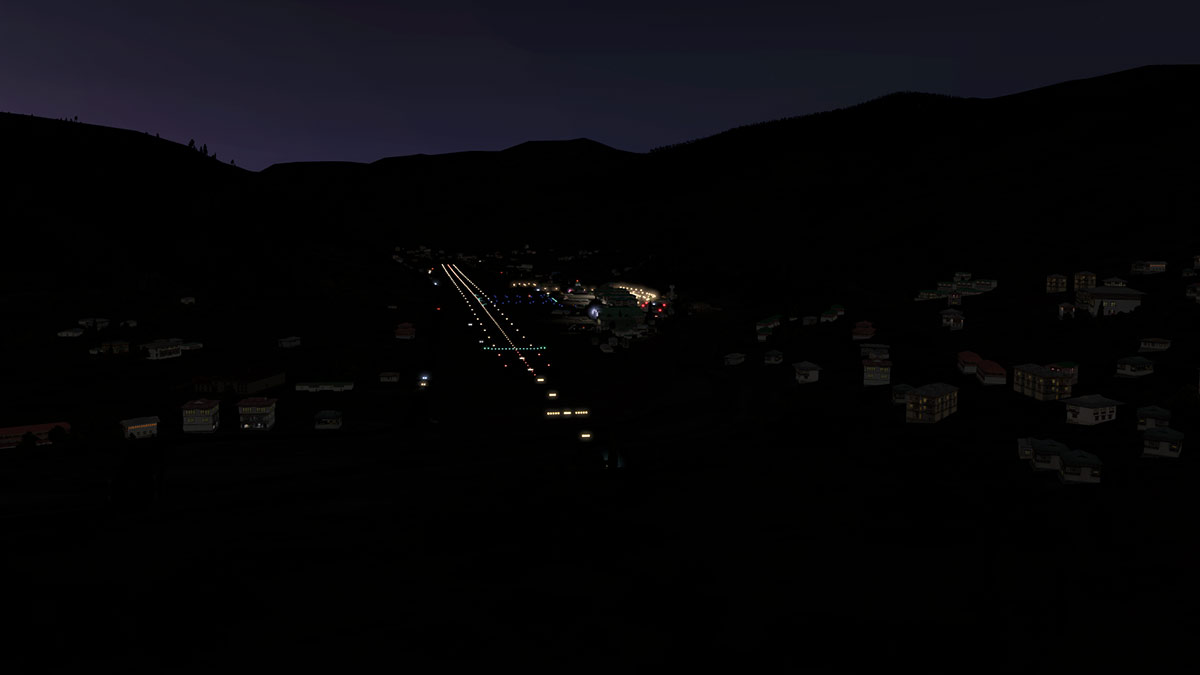
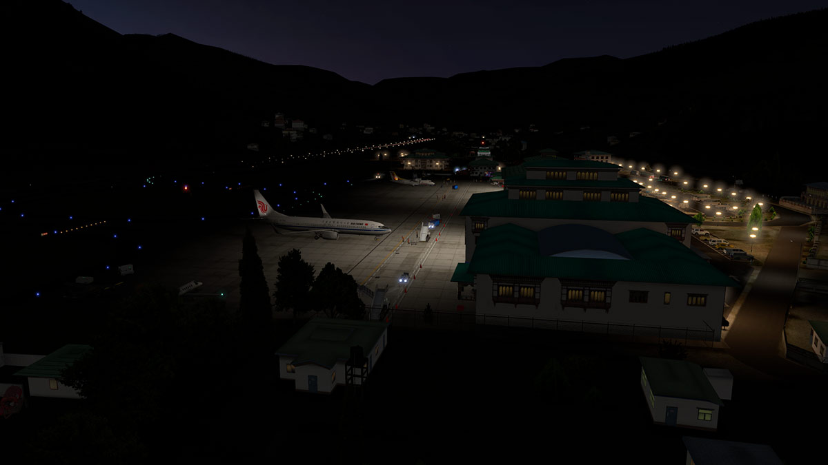
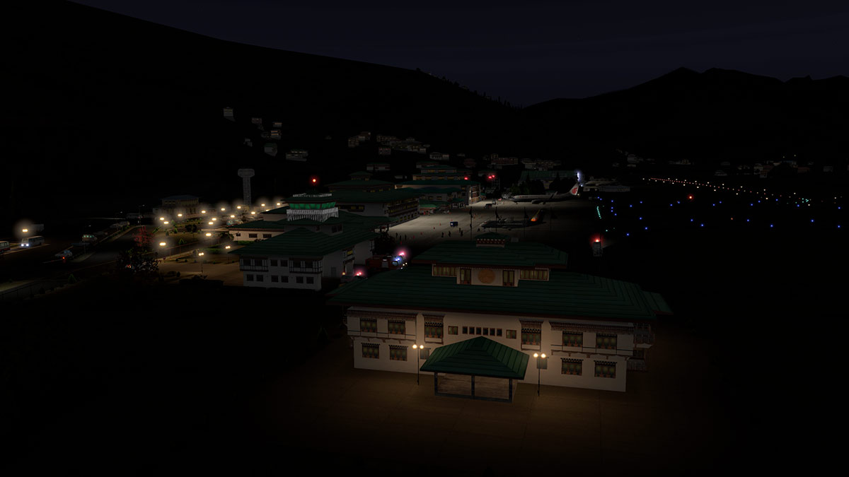
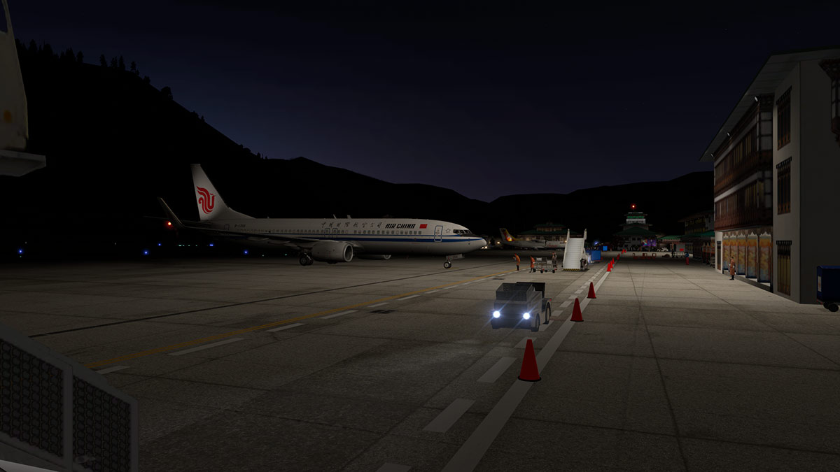
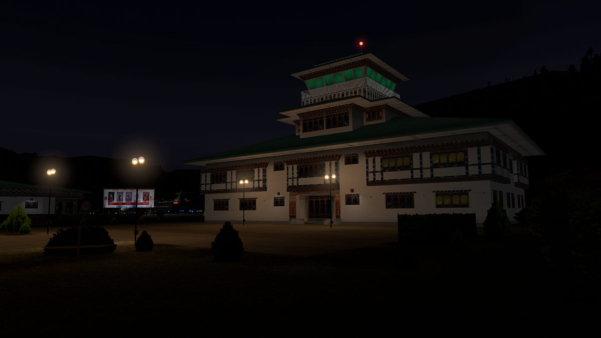
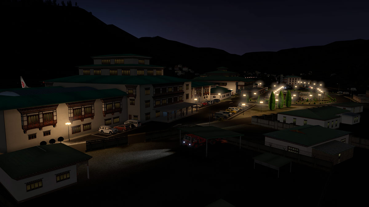
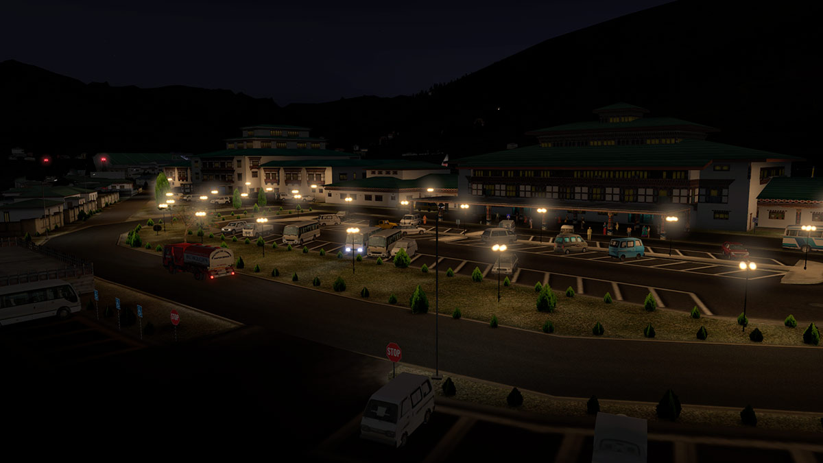
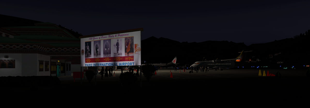
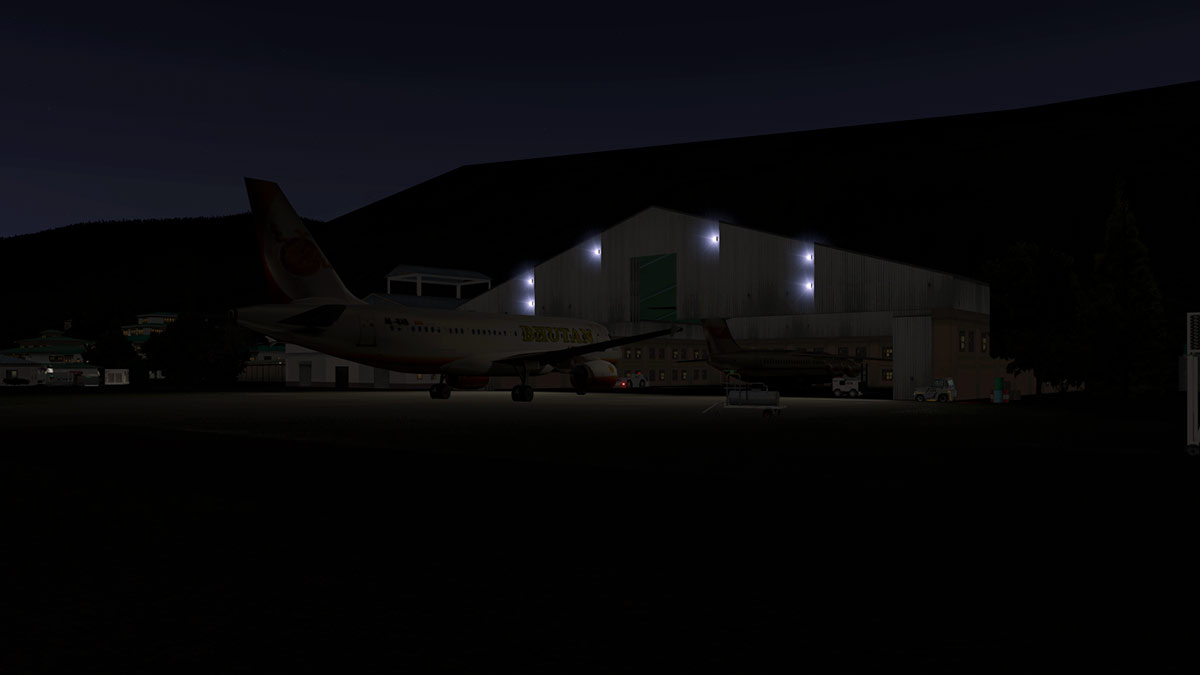
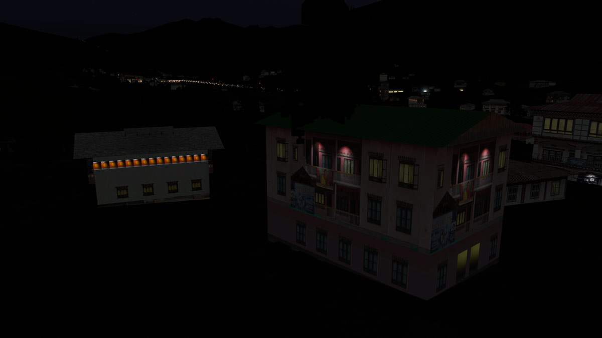
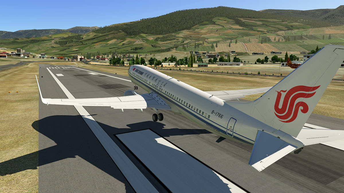
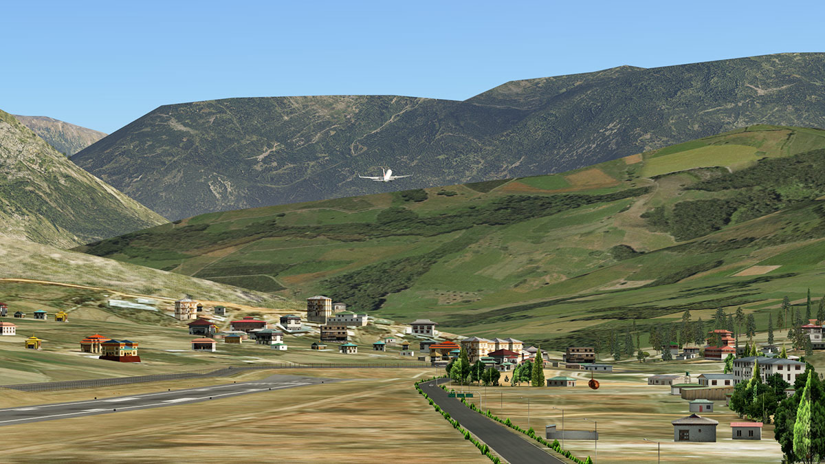
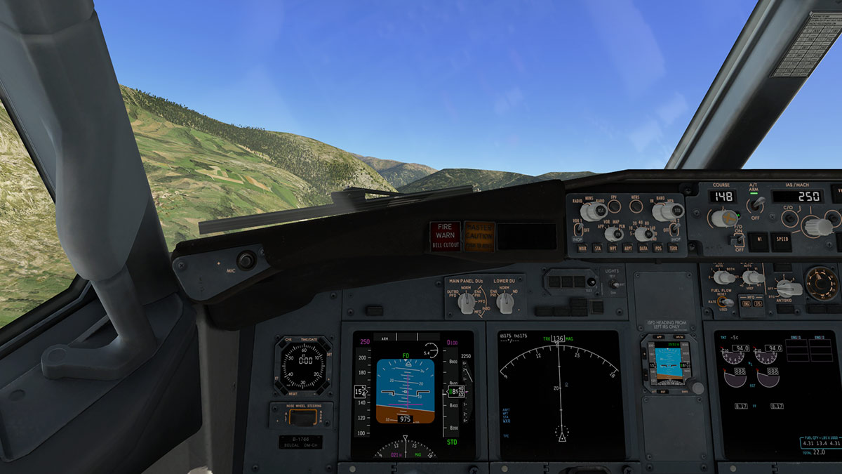
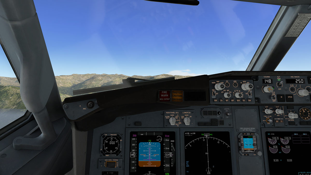
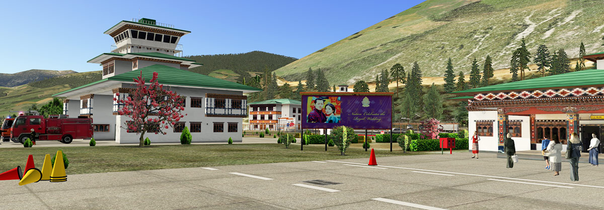
 Scenery Review: VQPR Paro International Airport XP12 by Cami De Bellis By Nick Garlick Introduction Every virtual pilot has that one destination, a place that beckons with the allure of adventure and the thrill of the unknown. For many, it's the quest for their personal Shangri-La, a utopia hidden amidst the digital landscapes of X-Plane. Shangri-La, a term immortalised by James Hilton in his 1933 novel “Lost Horizon”, speaks of an earthly Eden, untouched by time and far removed from the chaos of modern life. But what if such a place existed not just in literature but within the very confines of your flight sim world? Enter Bhutan, a landlocked gem nestled in the eastern Himalayas. A realm where the concept of time feels abstract, as if you're miles away from yesterday and yet, just a step shy of tomorrow. Bhutan, with its monasteries perched on cliff edges and valleys echoing with ancient folklore, feels like a page straight out of Hilton's masterpiece. And at the heart of this enigmatic nation lies our destination: VQPR Paro International Airport. An airport that promises not just a flying challenge but a journey into a world that celebrates serenity, culture, and nature's unbridled beauty. Cami De Bellis of CDB Sceneries has been a beacon in the X-Plane community since 2008. Her dedication to creating realistic and immersive sceneries shines through in this rendition of VQPR. This airport, initially released around six years ago, has undergone several updates. The most recent one, as of June 2023, brought further refinements, including corrections to certain objects and the addition of more dynamic elements like ground traffic vehicles and vegetation. So, fasten your seat belts as we embark on this virtual adventure, exploring the nuances, challenges, and charms of VQPR Paro International Airport for X-Plane 12. Install & Documentation Stepping into the world of VQPR Paro International Airport starts with a straightforward installation process. Once you've extracted the contents from the zip file, it's as simple as copying the folder named 'VQPR_Paro_Bhutan V3' and pasting it into your XP12 custom scenery directory. However, a crucial point to note is the dependency on Cami’s CDB Library V2.6. While the scenery package is more compact without this library, it's essential for the full experience. For ease of access, the accompanying manual provides a direct hyperlink to this library found at the Org. If you're new to this wonderful community, creating an account might be necessary to access this file. Documentation comes in the form of an easy-to-follow single PDF, and whilst it primarily offers installation instructions, it also provides guidance on how to get the most out of the scenery. Though brief, it covers all the essential points and is well worth reading. Main Airport - VQPR Paro International Nestled amongst the rugged contours of the Paro Valley, VQPR Paro International Airport is a beacon of modernity set against a backdrop of ancient mountains. The airport's location presents not just visual allure but an undeniable challenge to pilots. Its reputation as one of the world's most demanding airports is well-deserved, as the approach into VQPR is fraught with challenges, made even more intense by the sudden gusts of wind that can veer an aircraft off its course. Only a handful of real-world pilots boast the qualification to land here. Their number is so limited that they could be counted on one's fingers, perhaps with a toe or two to spare. The airport's altitude, sitting almost as high above sea level as its runways are long, adds another layer to its complexity. With a runway length of 6,500ft and an altitude of 7,300ft, even a cursory glance at the airport charts underscores the challenges posed. X-Plane's default mesh does a reasonable job at recreating the intimidating terrain that envelops the Paro valley. This serves as more than just a picturesque backdrop; it's a constant reminder of the flying challenge that awaits would-be pilots. Ground Markings The runway textures at the airport, whilst of decent quality, come off as slightly too pristine. While they feature the expected rubber marks from landings, a touch more weathering could have added to their realism, given the wear and tear runways typically experience. In contrast, the taxiways do exhibit weathering, enhancing their authentic appearance, as does the apron and the surrounding areas close to the maintenance buildings. Main Terminal and Adjacent Structures The main terminal of Paro International Airport is a blend of modern functionality and traditional Bhutanese architecture. Intricately carved wooden cornices, vibrant patterns, white walls, and a multi-coloured sloped roof reminiscent of Bhutan's fortresses (Dzongs) set the terminal apart. Directly in front of the terminal is a car park, catering to both short-term and long-term parking needs. A frequent sight here are the local buses, waiting to ferry passengers to nearby towns and landmarks, all faithfully reproduced to enhance realism. Bustling Environment Cami's trademark use of 3D characters is prominently showcased in this scenery. From locals in traditional attire to bustling passengers and diligent airport staff, the variety is commendable. Together, these diverse figures, albeit static, breathe life into the scenery, replicating the vibrant atmosphere typically associated with international airports. The inclusion of such details not only adds depth to the environment but also enhances the immersion for virtual pilots. Surrounding Area The allure of VQPR Paro International Airport doesn't end at its runways; it extends to the rich tapestry of landscapes and landmarks that envelop it. Unfortunately, X-Plane’s dated ground textures fail to do this part of the scenery justice, so I highly recommend using Ortho4XP or AutoOrtho to increase the realism. While the scenery captures the essence of Bhutan's beauty, it's important to note that certain iconic structures close to the airport, like the Paro Taktsang monastery, also known as Tiger’s Nest, are not part of this rendition, as the coverage does not extend that far. However, the Rinpung Dzong or 'Fortress of Heap of Jewels is included in the package and is beautifully represented. Improvements While the scenery largely succeeds in capturing Bhutan's unique allure, there are a few distinct areas that could benefit from further refinement. Firstly, while the landscape mostly blends seamlessly with X-Plane's default mesh, some inconsistencies are evident, especially in the surrounding hills and slopes. Secondly, expanding the ortho-photo coverage would lessen the jarring contrast between X-Plane's somewhat dated default ground textures and Cami's finely modelled structures. Lastly, incorporating X-Plane 12's advanced capabilities, such as its new 3D trees and vegetation, could elevate the level of immersion and authenticity, although this would understandably require additional development effort. Night Lighting As evening settles over VQPR Paro International Airport, Cami's attention to lighting comes to the forefront. The aprons, taxiways, and runways are well-lit, making after-dark operations straightforward. While the airport's windows rely on baked lit textures rather than dynamic lighting, the effect is still convincing. It adds a layer of realism that enhances the overall atmosphere, especially in low light conditions. Conclusion Exploring the vast horizons of the X-Plane universe reveals many hidden gems, and Cami's rendition of VQPR Paro International Airport in Bhutan undoubtedly shines among them. This scenery captures the very essence of Bhutan, a country synonymous with tranquillity, spiritual richness, and breathtaking landscapes. While many sceneries boast of high-resolution textures and an overload of pixel-perfect details, Cami's work stands out for its balance. The focus isn't on mere visual spectacle but on creating a genuine, immersive experience. VQPR is a delightful blend of simplicity and authenticity, emphasizing the serene charm of Bhutan while leveraging some of X-Plane 12's advanced features. However, just like any other scenery, there's always potential for growth. Whilst the custom buildings and landmarks mostly work well with X-Plane's default terrain, enhancing this integration could resolve some glaring inconsistencies, especially on uneven terrain like hills and slopes. Furthermore, the scenery's authenticity could be elevated by the addition of higher-resolution ortho-photos or even the use of photo-realistic textures. In the same vein, tapping into the advanced capabilities of X-Plane 12, such as its new 3D trees and vegetation, could offer an even more refined and immersive experience. But these suggestions don't overshadow the undeniable allure of this scenery. Cami's VQPR offers virtual pilots not just a landing challenge but an invitation to explore a country that celebrates happiness as a state policy. It's a journey into a world where the modern meets the ancient, where nature's raw beauty intertwines with rich cultural heritage. For those seeking a serene escape coupled with a flying challenge, VQPR Paro International Airport is an unmissable destination. As we await more such adventures from the talented Cami De Bellis, this rendition of VQPR stands as a testament to her dedication to the X-Plane community. So, until the next virtual adventure beckons, it's a heartfelt 'Pip, Pip, Tally Ho!' from me. ________________________ VQPR Paro Intl Airport, Bhutan, XP12 by Cami De Bellis is now available from the X-Plane.Org Store here: VQPR Paro Intl Airport, Bhutan, XP12 Priced at $19.95 Features Exact reproduction 3D of the airport buildings, houses, hangars, Dzong, Pagodas and others Detailed textures and custom objects Reproduction of staff and local people 3D Hand placed 3D trees Volumetric grass Complete reconstruction of the airport's lighting equipment Detailed ground markings Custom night lighting Many Animations in and around airport Very detailed 3D Models covering the whole airport Ground Traffic by Marginal Requirements X-Plane 12 Windows, Mac, or Linux 4 Gb VRAM Minimum. 8 Gb+ VRAM Recommended CDB-Library is required Current version 3.0 (June 15th, 2023) Review System Specifications Windows 10, Intel 4790K liquid-cooled, overclock to 5GHz, 32GB DDR3 1600MHz RAM, Nvidia GTX 1070ti, Titanium HD Audio Card. __________________________________ Scenery Review by Nick Garlick 19th October 2023 Copyright©2023: X-Plane Reviews (Disclaimer. All images and text in this review are the work and property of X-PlaneReviews, no sharing or copying of the content is allowed without consent from the author as per copyright conditions).
-
NEWS! - Scenery Released : St Helena Airport by Cami De Bellis Saint Helena is a British overseas territory located in the South Atlantic Ocean. It is a remote volcanic tropical island 1,950 km (1,210 mi) west of the coast of south-western Africa, and 4,000 km (2,500 mi) east of Rio de Janeiro in South America. It is one of three constituent parts of the British Overseas Territory of Saint Helena, Ascension and Tristan da Cunha. It's famous for... In that the British government selected Saint Helena as the place of exile for Napoleon Bonaparte, after the Battle of Waterloo, his second abdication (on 22 June 1815) and his final surrender, to Captain Frederick Maitland, on HMS Bellerophon (15 July 1815). He was taken to the island in October 1815. Initially Napoleon stayed at the Briars pavilion on the grounds of the Balcombe family's home, until his permanent residence at Longwood House was completed in December 1815. He died there on 5 May 1821. After a list of upgraded scenery to X-Plane 12, including VNKT - Kathmandu Tribhuvan Intl, VNDP - Dolpa Airport Nepal and La Tontouta Noumea - New Caledonia. Here is a new fully created scenery of FHSH St Helena Airport from Cami de Bellis, note the extensive interview with Cami by Dominic Smith here; Developer Spotlight Feature Cami De Bellis With a celebration of Cami's 15 Years of creating X-Plane Scenery. Features Include: Highly accurate scenery for FHSH -St Helena Airport with all buildings modeled. Over 80 custom objects all with Ambient Occlusion Terrain mesh created and modified to fix bump terrain and set and correct the topography of the Airport’s area Custom Terrain Mesh for the entire island of Saint Helena by Maps2XPlane Custom Overlay/Autogen Scenery based on CDB assets by Maps2XPlane" Photo real textures on buildings, vehicles, trees… Photorealistic ground textures based on a satellite image. Detailed airport objects and GSE vehicles Custom textured taxiways, runways, and apron Custom surrounding buildings Custom airport lights HD Custom Overlay High-resolution building textures – all in 2K and 4K Excellent night effects World Traffic 3 compatible Native characters created specially The terrain mesh is complemented with custom overlays: dense vegetation and country-typical autogen, as well as custom road networks with dynamic traffic. Two fictional heliports, for those fans of helicopters. One at the beautiful Longwood House, and the other on the shores of the island’s main port; Ruperts Wharf. As Saint Helena is more than 2,000 kilometres (1,200 mi) from the nearest major landmass. Prior to the opening of the airport, the island was only reachable by sea, making it one of the most remote populated places on earth, measured as travel time from major cities. Sea journeys used to take five days from Cape Town, with departures once every three weeks. The first consideration of an airport on St Helena was made in 1943 by the South African Air Force, which undertook a survey on Prosperous Bay Plain from October 1943 until January 1944, but concluded that, while technically feasible, an airport was not a practical proposition. From the 1960s, there was an idea to build an airport on the Island. In 1999, this was taken up by the island government. The construction of the runway was finished in 2015 and the airport opened in 2016. The inaugural scheduled flight was delayed but general aviation, charter, and medical evacuation flights were able to serve the airport from May 2016. The airport began scheduled commercial services on 14 October 2017, when the South African carrier Airlink inaugurated a weekly service from O. R. Tambo International Airport in Johannesburg, South Africa, via Walvis Bay Airport, Namibia, using an Embraer E190-100IGW, or about one and a half years after the originally expected inauguration date, and with a smaller-sized aircraft, because of wind shear problems affecting the airport. Additionally, monthly charter flights now operate between Ascension Island and Saint Helena. This FHSH scenery is X-Plane 12 only Images of FHSH - St Helena Airport are courtesy of Cami de Bellis ________________ Yes! FHSH - St Helena Airport by Cami de Bellis is Available now from the X-Plane.Org Store here : FHSH - St Helena Airport by Cami De Bellis Price Is US$16.95 Requirements X-Plane 12 (not for XP 11) Windows, Mac or Linux 4 GB VRAM Minimum. 8 GB+ VRAM Recommended Download Size: 1.5 GB CDB-Library is required Current version 1.0 (August 28th 2023) ________________ NEWS! by Stephen Dutton 28th August 2023 Copyright©2023: X-Plane Reviews (Disclaimer. All images and text in this review are the work and property of X-PlaneReviews, no sharing or copy of the content is allowed without consent from the author as per copyright conditions) All Rights Reserved
-
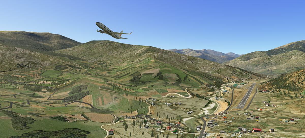
Scenery Review: Dolpa Airport for XP12 by Cami De Bellis By Dominic Smith Introduction Welcome to the world of Cami De Bellis, a seasoned scenery developer for X-Plane whose footprint spans a remarkable fifteen years. Known for her precision and high attention to detail, Cami is a respected figure within the X-Plane community, with a notable portfolio of predominantly tropical sceneries. In addition to the multitude of freeware sceneries she has contributed over the years, Cami is also the creative mind behind the CDB library, aptly named after her. A tool set crafted for fellow developers, the CDB library enables the creation of unique freeware sceneries, encouraging a collaborative and creative space within the X-Plane universe. One of Cami's recent additions to her collection is the payware scenery of VNDP - Dolpa Airport Nepal for X-Plane 12. This follows her successful renditions of the challenging topographies of Paro Intl Airport in Bhutan and Kathmandu Tribhuvan Intl in Nepal, further cementing her expertise in recreating airports located in the complex terrains of the Himalayan region. Dolpa Airport, also known as Juphal Airport, is a small domestic hub situated within Nepal's Dolpa District, a region renowned for its rough and rugged landscapes. It plays a vital role in connecting the remote region with the rest of the country. Opened to the public in 1966, the airport resides at an impressive altitude of 8,200 feet, offering a unique and challenging environment for pilots. It's the gateway to the Upper Dolpa and Shey-Phoksundo National Park, making it a vital hub for both local transportation and eco-tourism. With an array of features including highly accurate airport buildings, over 40 custom objects, and mesh modifications for accurate topography, this scenery reflects the breadth of Cami's expertise. Other highlights offered by the scenery package, include photorealistic textures, custom-textured taxiways, runways, aprons, and on the surrounding buildings, and much more. I've admired Cami’s work for quite some time, as her attention to detail and quality of execution has never failed to impress, so the promise of such intricacy and detail at Dolpa, only served to heighten my anticipation. But, as with all X-Plane sceneries, there was an essential first step to take care of – the installation process. With that in mind, let's get started on this exciting journey. Installation The installation process, much like many X-Plane sceneries, was relatively straightforward. Upon purchase, two separate download links were provided, one for X-Plane 12, and another for X-Plane 11. At first glance, the relatively small file size of the scenery (just 290MB), might raise a few eyebrows, given its promised complexity. However, this is due to the required installation of Cami's CDB Library, a resource already widely used and appreciated by the X-Plane community. To further enhance the scenery, the download of a custom Ortho4XP mesh tile for the specific area (+28+082) was required, along with two additional but optional scenery tiles. These ranged from between five and six gigabytes, so if you have a slow internet connection, be prepared for a wait. Once all the required and optional files were downloaded, unzipped, and then placed into my Custom Scenery folder, the final step of the process was to adjust the scenery load order within the scenerypacks.ini file. Once this was accomplished, I was all set to embark on my journey through VNDP - Dolpa Airport, Nepal. Walkabout My exploration of Dolpa Airport began at altitude, presenting a broad view of the airport embedded within its vast natural landscape. The custom mesh and photographic scenery, impressive in its magnitude, provided a striking backdrop to the airport. As I lowered towards the airport, the textures of the runway, taxiways, and apron came into clearer focus. The markings were suitably done, contributing to the realistic feeling that resonated throughout the area. Also worth noting was the way in which the mesh had been used to shape smooth surfaces and adjust the airport area topography, an important aspect, especially considering Dolpa’s challenging location. Moving closer to ground level, the surrounding 3D vegetation came into view. While there were some slight irregularities with the trees, the overall visual impact was minimal and didn't detract from the scene's immersive atmosphere. At ground level, the array of 3D people and animal models added a lively touch to the scenery. The variety of characters, including passengers, locals, and even cows and pets, brought a sense of realism to the setting, reminiscent of a bustling small-town airport. The local buildings, all meticulously modelled in 3D, caught my eye as I walked around the airport. The texturing was notably detailed, with some surfaces featuring a weathered appearance. There were a couple of unintentional texture mishaps, but never enough to become an issue. The closeness of the buildings, coupled with the mountainous terrain, must have represented a considerable challenge to get right, but it all works well. The high-resolution 2K textures enhanced the visual experience, creating a detailed and realistic local environment. My last stop was Dolpa Airport’s main terminal, the largest building in the scenery and one that stood out amongst the smaller structures in the village. The attention to detail was consistent with the rest of the airport, maintaining a unified look across the scenery. While the lack of interior modelling might not appeal to all, it felt like a considered decision, aimed at preserving performance and fluidity during flight operations. Night Lighting Unlike many airports seen worldwide, which are often lit up like Christmas trees, Dolpa's nighttime lighting may initially seem underwhelming to some. However, upon reflection, it appears to be in line with the reality of the actual airport. Given the location, it's reasonable to assume that local power supplies may limit the scale of illumination, setting a more modest expectation for night-time lighting. That said, what lighting is present, is implemented well. Buildings are illuminated sufficiently without being overly bright, offering a sense of realism, instead of standing out like sore thumbs in the night, an issue that some other sceneries have fallen into. As for the runway, it's important to note that there's no lighting available. As the saying goes, discretion is the better part of valour; so, it would be prudent not to entertain any ambitious landing plans after sundown. All in all, the night lighting feels authentic and true to the location, rather than underwhelming, adding another layer of immersion to the experience. Winter Textures X-Plane 12's enhanced weather engine allows for the creation of picturesque winter landscapes, and it would have been remiss not to experience Dolpa's unique winter rendition. Given its geographical location, it was almost a given that the scenery would transform with a sprinkle of snow and the presence of some overcast clouds. The results were nothing short of impressive. The landscape underwent a striking transformation, turning from the usual inviting ambience to something that felt somewhat more daunting, yet visually appealing. While the snow-covered landscape took on a different, more austere look, it maintained an undeniable charm that locals would surely appreciate. Performance Throughout my testing, spanning various weather conditions and times of day, I found the performance to be more than acceptable, a benefit largely owed to its geographically unique location. Despite the high detail within the village and immediate surroundings, the absence of other settlements or large forested regions, allowed the scenery to provide excellent framerates. Conclusion As I journeyed through this delightful scenery, it was evident that Cami’s talent and dedication have yet again created a compelling and immersive scenery. Its intricate detail, from the faithful modelling of buildings to the considerate night lighting, all attest to its high-quality craftsmanship. Enhanced by X-Plane 12's seasonal capabilities, the scenery beautifully captures Dolpa's unique location. Despite the absence of bustling city lights or crowded terminals, it delivers a unique experience that genuinely captivates. Performance-wise, it excels, promising a smooth journey throughout, allowing users to fully appreciate the scenery's depth without worrying about taxing their systems. In short, Dolpa Airport is an impressive feat of design, a must-explore destination for any X-Plane user, and stands as a testament to Cami’s expertise, underscoring her reputation as a truly valuable contributor to the X-Plane community. ________________________ VNDP - Dolpa Airport Nepal XP12 by Cami De Bellis is now available from the X-Plane.Org Store here: VNDP - Dolpa Airport Nepal XP12 Priced at US$19.95 Features Highly accurate scenery for VNDP- Dolpa/Juphal Airport with all buildings modelled Over 40 custom objects all with Ambient Occlusion DSF mesh created and modified to fix bump terrain and set and correct the topography of the airport’s area Fully compatible with Ortho4XP_meshes Photo real textures on buildings, vehicles etc. Detailed airport objects and vehicles Custom textured taxiways, runways, and apron Custom surroundings buildings Custom forest and flora trees High-resolution building textures – all in 2K Excellent night effects Requirements X-Plane 12 or X-Plane 11 Windows, Mac, or Linux 4 GB VRAM Minimum - 8 GB+ VRAM Recommended Download Size: 2.1 GB Current version: 1.1 (April 18th, 2023) Review System Specifications Intel i5 10400 – 32GB RAM - Nvidia Asus RTX 3060 – Windows 10 Home 64 Bit __________________________________ Scenery Review by Dominic Smith 29th June 2023 Copyright©2023: X-Plane Reviews (Disclaimer. All images and text in this review are the work and property of X-PlaneReviews, no sharing or copying of the content is allowed without consent from the author as per copyright conditions).
-
NEWS! - Cami de Bellis updates Kathmandu Tribhuvan Intl and Paro Intl Airport, Butan to X-Plane 12 Known for her intricate, well detailed sceneries. Cami de Bellis has a big reputation as a quality scenery developer for the X-Plane Simulator. Now another two of her say "Greatest hits" of quality scenery have been upgraded for the latest interpretations of Tribhuvan International Airport in Kathmandu and VQPR Paro International Airport in Butan, both to X-Plane 12. Notable is that both sceneries are "Upgrades", so a new purchase is required, however both sceneries are 40% discounted for the upgrade. Also the custom CBD library is required for both sceneries. Tribhuvan International Airport Kathmandu Tribhuvan International Airport VNKT, colloquially referred to as TIA, is an international airport located in Kathmandu, Bagmati, Nepal. It has a tabletop runway, a domestic terminal and an international terminal. As a main international airport, it connects Nepal to over 40 destinations in 17 countries around the world.. The airport is a hub for two international airlines, the flag carrier Nepal Airlines and Himalaya Airlines, along with multiple domestic carriers. The airport is considered as a starting point for Mount Everest international tourists, with several daily flights to Lukla. Several airlines also offer Everest sightseeing flights out of Kathmandu. Scenery details are; Highly accurate scenery for VNKT-Kathmandu Tribhuvan Airport with all buildings modeled Over 220 custom objects all with Ambient Occlusion DSF mesh created and modified to fix bump terrain and set and correct the topography of Airport’s area Photo real textures on buildings, vehicles etc. Photorealistic ground textures based on a satellite image Professional ortho imagery 50cm – 25 km square meters – with share license authorization Detailed airport objects and vehicles Custom textured taxiways, runways, and apron Custom surroundings buildings Custom airport lights HD Custom forest and flora trees High resolution building textures – all in 2K and 4K Excellent night effects World Traffic 3 compatible Native characters created specially X-PlaneReviews Tribhuvan Intl X-Plane 11 review is here; Scenery Review : VNKT - Kathmandu Tribhuvan Intl Airport by Cami De Bellis Paro International Airport Welcome to the "Land of the Thunder Dragon"... Paro International Airport (VQPR) is the sole international airport of the four airports in Bhutan. It is 6 km (3.7 mi; 3.2 nmi) from Paro, set in a deep valley on the bank of the river Paro Chhu. With surrounding peaks as high as 5,500 m (18,000 ft), it is considered one of the world's most challenging airports. Flights to and from Paro are allowed under visual meteorological conditions only and are restricted to daylight hours from sunrise to sunset. Paro airport was the only airport in Bhutan until 2011 Paro Airport is accessible by road, 6 km (3.7 mi; 3.2 nmi) from Paro city, and 54 km (34 mi; 29 nmi) from Thimphu by Paro-Thimphu road. Scenery details are; Exact reproduction 3D of the airport buildings, houses, hangars, Dzong, Pagodas and others Detailed textures and custom objects Reproduction of staff and local people 3D Hand placed 3D trees Volumetric grass Complete reconstruction of the airport's lighting equipment Detailed ground markings Custom night lighting Many Animations in and around airport Very detailed 3D Models covering the whole airport Ground Traffic by Marginal X-PlaneReviews Paro International Airport review is here; Scenery Review : VQPR - Paro International Airport by Cami De Bellis Images of VNKT and VQPR are courtesy of Cami de Bellis ________________ Yes! both Kathmandu Tribhuvan Intl and Paro Intl Airport, Butan by Cami de Bellis is Available now from the X-Plane.Org Store here : VNKT - Kathmandu Tribhuvan Intl Airport XP12 Price Is On sale: $27.95 US$16.75 40% off Requirements X-Plane 12 Windows, Mac or Linux 4 Gb VRAM Minimum. 8 Gb+ VRAM Recommended CDB-Library is required Download Size: 1 GB Current version 12 (June 15th 2023) ________________ VQPR Paro Intl Airport, BHUTAN XP12 Price Is On sale: $19.95 US$11.97 40% off Requirements X-Plane 12 Windows, Mac or Linux 4 Gb VRAM Minimum. 8 Gb+ VRAM Recommended CDB-Library is required Current version 3.0 (June 15th 2023) ________________ NEWS! by Stephen Dutton 21st June 2023 Copyright©2023: X-Plane Reviews (Disclaimer. All images and text in this review are the work and property of X-PlaneReviews, no sharing or copy of the content is allowed without consent from the author as per copyright conditions) All Rights Reserved
-
NEWS! - Cami de Bellis updates La Tontouta Noumea and Dolpa Nepal Airport to X-Plane 12 Known for her intricate, well detailed sceneries. Cami de Bellis has a big reputation as a quality scenery developer for the X-Plane Simulator. Now two of her say "Greatest hits" of quality scenery have been upgraded for the latest interpretations of La Tontouta Noumea and Dolpa Nepal Airport to X-Plane 12. Notable is that both sceneries are "Upgrades", so a new purchase is required, however both sceneries are 40% discounted for the upgrade. Also the custom CBD library is also required for both sceneries. La Tontouta Noumea La Tontouta International Airport (NWWW), also known as Nouméa – La Tontouta International Airport is the main international airport in New Caledonia, France and the military base for the French Air Force based in New-Caledonia. The airport is in the municipality of Païta, approximately 52 km (32 mi) northwest of Nouméa. A major expansion of the airport's terminal was completed in here 2012 after several years of work. The project resulted in a significant increase in the terminal's size and included a new arrivals area, a larger check-in area and the installation of two jetbridges. Scenery details are; Highly accurate scenery for NWWW with all buildings modeled Animated airport vehicles (GroundTraffic) Autogate by marginal Mesh of airport corrected exclusively for this scenery, created by Matthias Seewald/Maps2Xplane and expressly authorized by Austin Meyer Photoscenery for the entire Airport area Detailed airport objects and vehicles Custom textured taxiways, runways and apron Custom surroundings buildings Custom airport lights High resolution ground textures / Custom runway textures High resolution building textures – all in 2K and 4K Excellent night effects World Traffic 3 compatible Manual included X-PlaneReviews La Tontouta X-Plane 11 review is here; Scenery Review : NWWW La Tontouta Noumea - New Caledonia by Cami de Bellis ________________ Dolpa Airport Also known as Juphal Airport is a domestic airport (VNDP) located in Juphal, Thuli Bheri serving the Dolpa District, a district in Karnali Pradesh in Nepal. It is the only airport of the district. The airport resides at an elevation of 8,200 feet (2,499 m) above mean sea level. VNDP has only one runway designated 15/33 measuring 663 by 30 metres (2,175 ft × 98 ft). Scenery details are; Highly accurate scenery for VNDP- Dolpa/Juphal Airport with all buildings modeled Over 40 custom objects all with Ambient Occlusion DSF mesh created and modified to fix bump terrain and set and correct the topography of Airport’s area Fully compatible to Ortho4XP_meshes Photo real textures on buildings, vehicles etc. Detailed airport objects and vehicles Custom textured taxiways, runways, and apron Custom surroundings buildings Custom forest and flora trees High resolution building textures – all in 2K Excellent night effects Images of NWWW and VNDP are courtesy of Cami de Bellis ________________ Yes! both La Tontouta Noumea and Dolpa Nepal by Cami de Bellis is Available now from the X-Plane.Org Store here : NWWW La Tontouta Noumea - New Caledonia XP12 Price Is On sale: $22.40 US$13.44 40% off Requirements X-Plane 12 or X-plane 11 Windows, Mac or Linux 4Gb VRAM Minimum. 8Gb+ VRAM Recommended CDB-Library is required Download Size: 425 MB Version 12 (June 13th 2023) ________________ VNDP - Dolpa Airport Nepal XP12 Price Is On sale: $19.95 US$11.95 40% off Requirements X-Plane 12 or X-Plane 11 Windows, Mac or Linux 4 Gb VRAM Minimum. 8 Gb+ VRAM Recommended CDB-Library is required Current version 12 (June 14th 2023) ___________________________ News by Stephen Dutton 15th June 2023 Copyright©2023: X-Plane Reviews (Disclaimer. All images and text in this review are the work and property of X-PlaneReviews, no sharing or copy of the content is allowed without consent from the author as per copyright conditions) All Rights Reserved
-
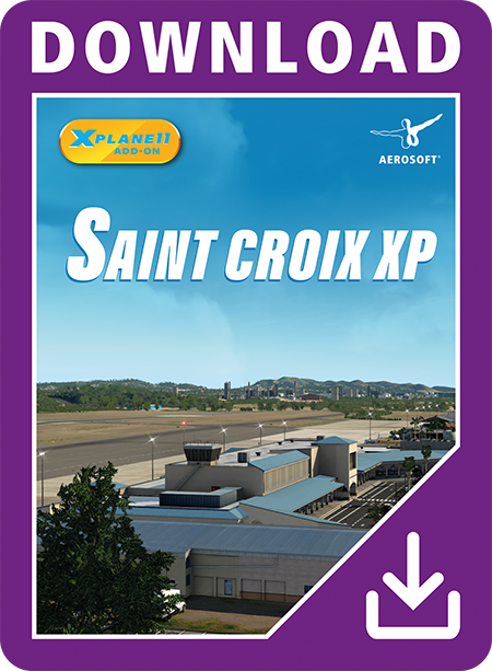
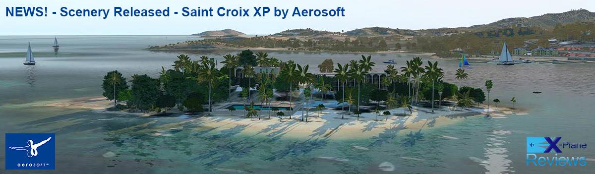
NEWS! - Scenery Released - Saint Croix XP by Aerosoft There is a lot of scenery currently being released by Maps2Xplane and CDB (Renowned Cami De Bellis) Design, but branded under the Aerosoft banner. This one is a small island in the Caribbean Sea... Saint Croix. As per usual for Maps2Xplane (of Faroe Island fame) in that there is a full custom Photo-Terrain-Mesh covering of Saint Croix and of all the surrounding islets, with also a custom overlay of the scenery in Vegetation, Road Networks and Autogen Buildings. Saint Croix is an island in the Caribbean Sea, and a county and constituent district of the United States Virgin Islands (USVI), an unincorporated territory of the United States. St. Croix is the largest of the islands in the territory. However the capital, Charlotte Amalie, is located on St. Thomas. The island's highest point is Mount Eagle, at 355 meters (1,165 ft). St. Croix's nickname is "Twin City", for its two towns, Frederiksted on the western end and Christiansted on the northeast part of the island. Henry E. Rohlsen Airport (TISX) is a public airport located six miles (10 km) southwest of Christiansted. The airport is named after Henry E. Rohlsen, a St. Croix native who was one of the Tuskegee Airmen during World War II. It is a small international airport that hosts mainly inter-Caribbean flights. The airport, which was a hub for Aero Virgin Islands in the 1970s and 1980s, has the capability to receive jets up to the size of the Boeing 747s. Prior to 1996 the airport was known as "Alexander Hamilton International Airport", and was renamed that same year. Features: Highly detailed rendition of Henry E. Rohlsen Airport on Saint Croix Accurate models of terminals, hangars and other buildings and objects Custom ground textures, taxiway signage, static aircraft and vehicles Detailed ground markings based on recent airport diagrams and charts Realistically sloped terrain profile for the runway and entire airport Custom Photo-Terrain-Mesh covering Saint Croix and surrounding islets Custom Overlay-Scenery: Vegetation, Road Network and Autogen Buildings Renditions of Christiansted and Frederiksted incl. selected landmarks Rendition of the Christiansted Seaplane Base incl. selected buildings Images are courtesy of Aerosoft ______________________________________ Yes! the Saint Croix XP by Aerosoft is now available from the X-Plane.Org Store here : Saint Croix XP Price is US$24.95 Requirements X-Plane 11 Windows, Mac or Linux 4 GB VRAM Minimum - 8 GB+ VRAM Recommended Current Version : 1.0 (October 27th 2021) ___________________________ News by Stephen Dutton 29th October 2021 Copyright©2021: X-Plane Reviews (Disclaimer. All images and text in this review are the work and property of X-PlaneReviews, no sharing or copy of the content is allowed without consent from the author as per copyright conditions) All Rights Reserved
-
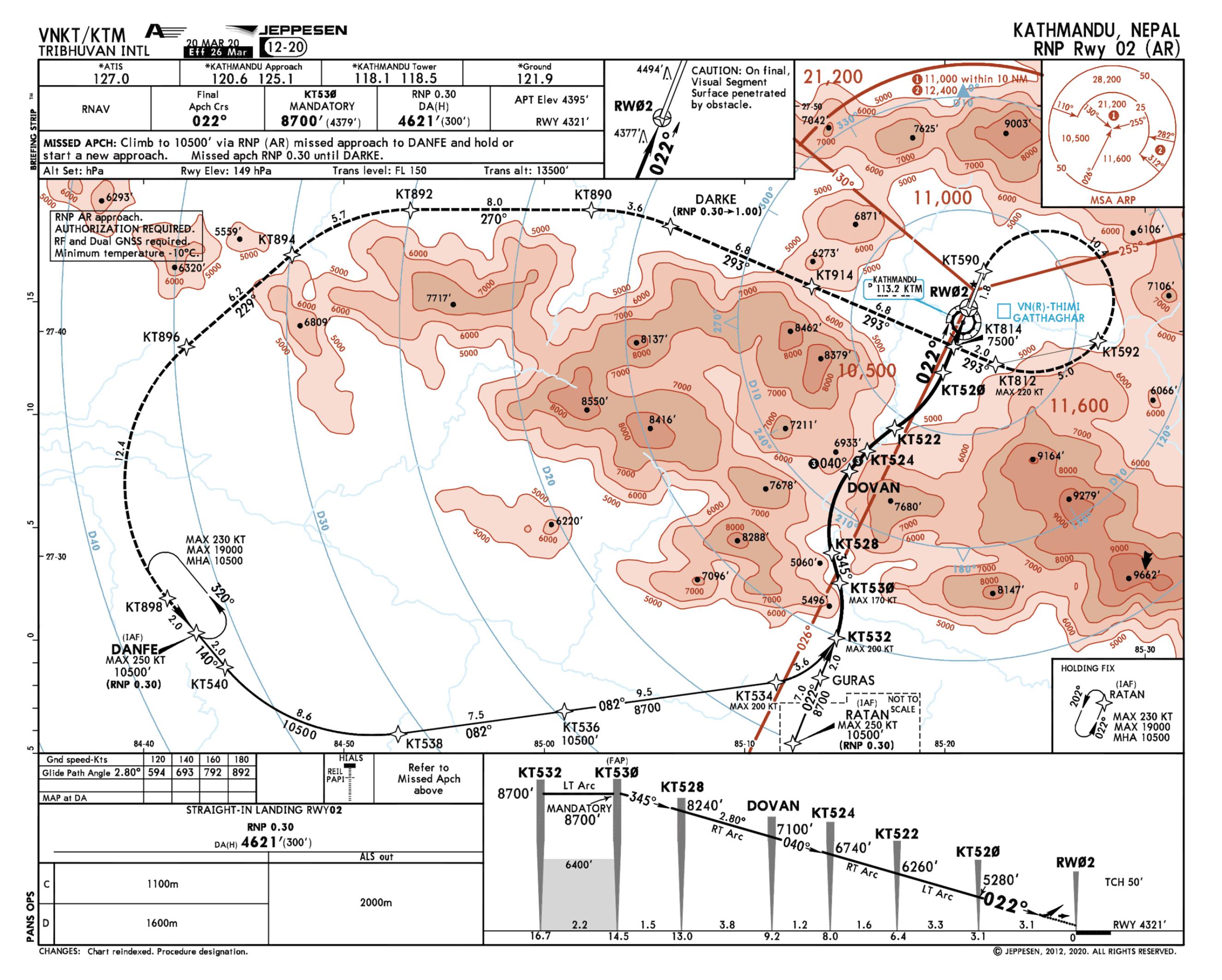
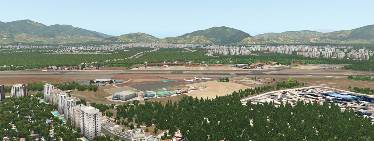
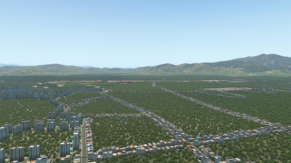
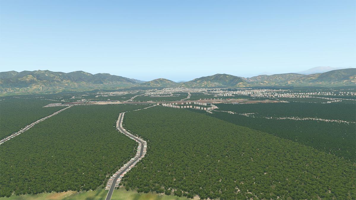
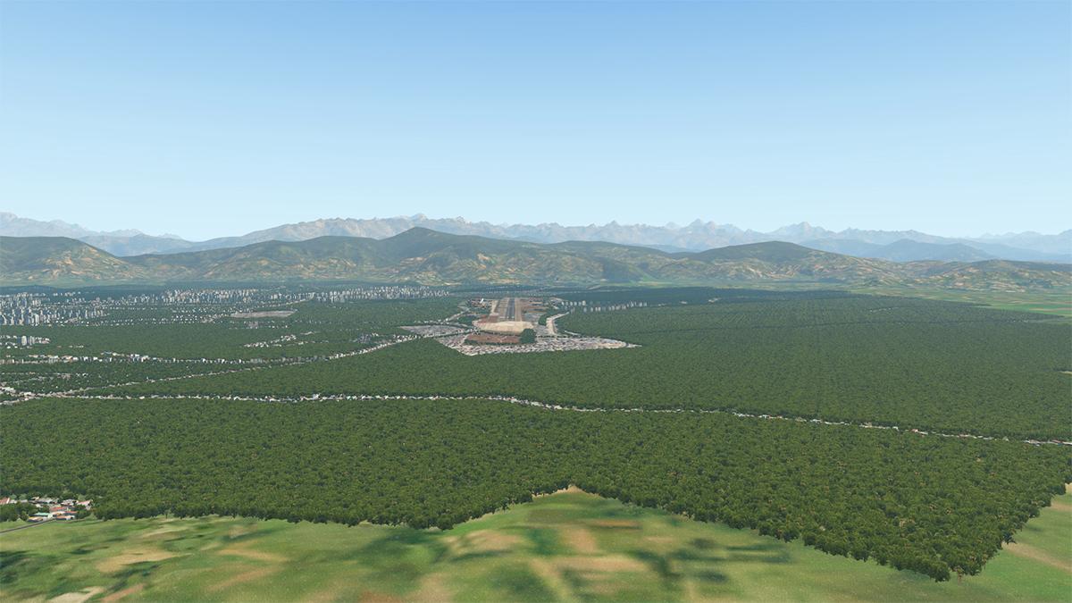
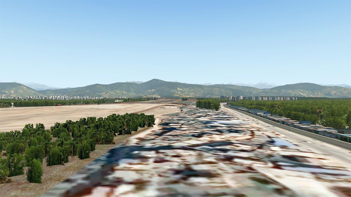
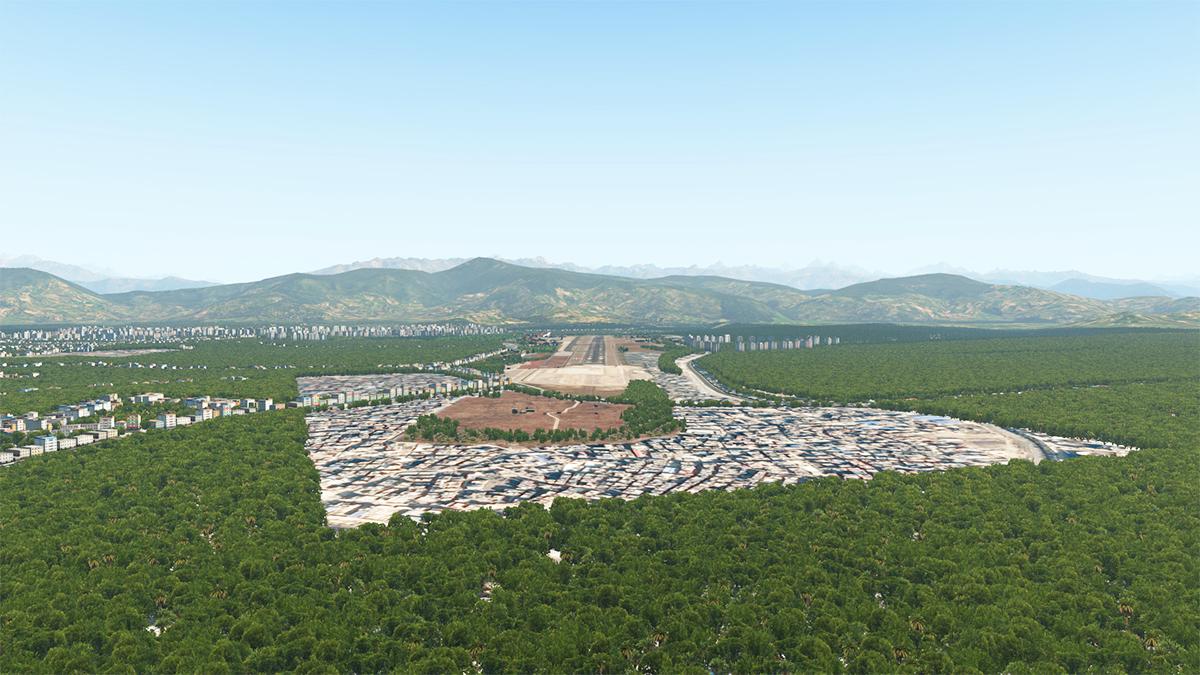
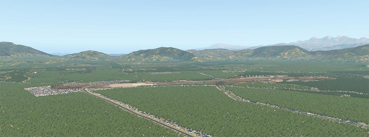
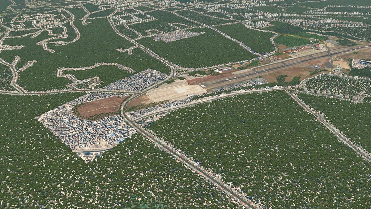
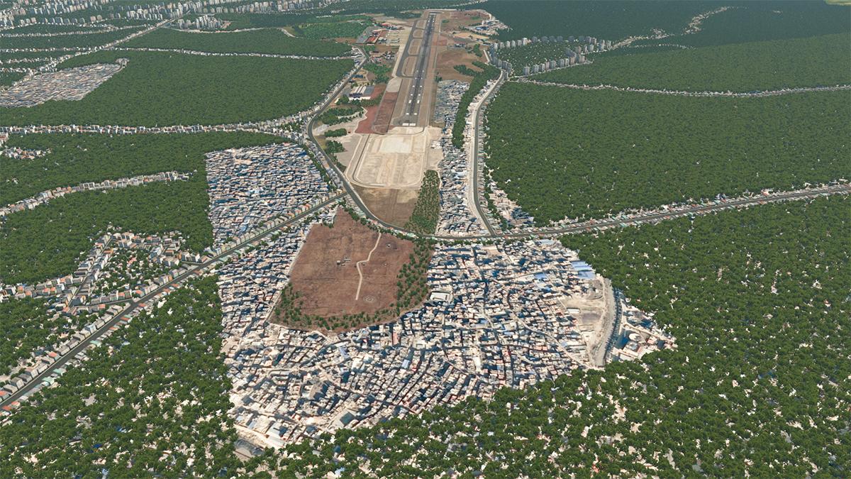
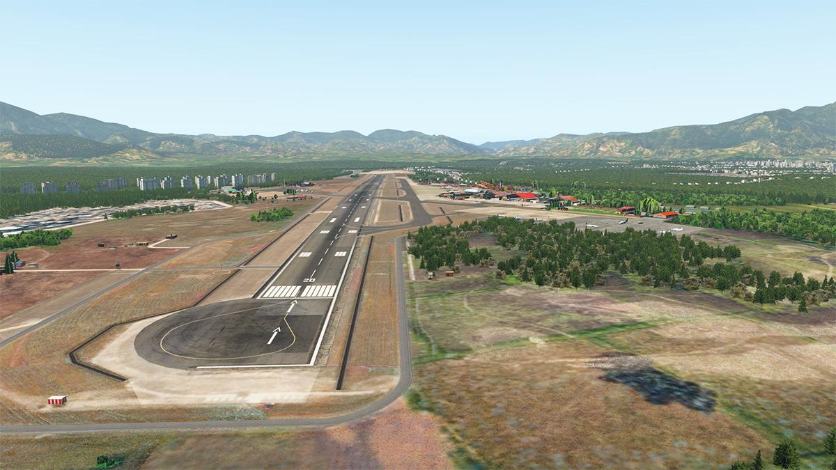
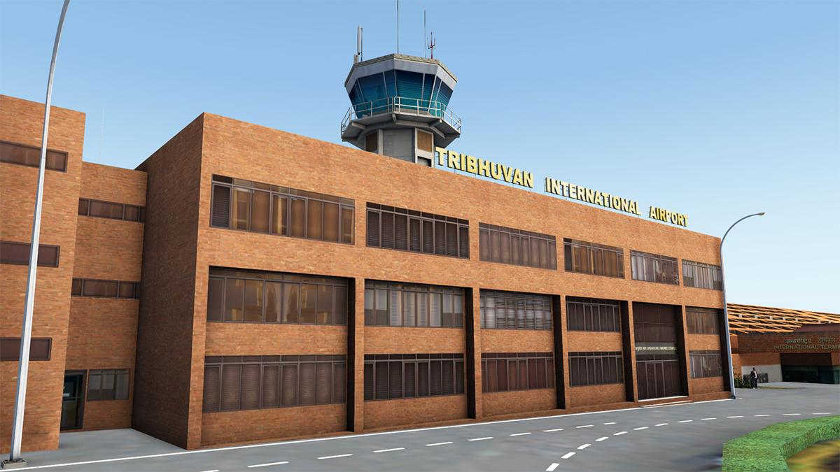
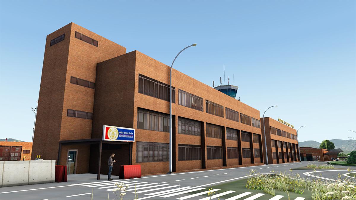
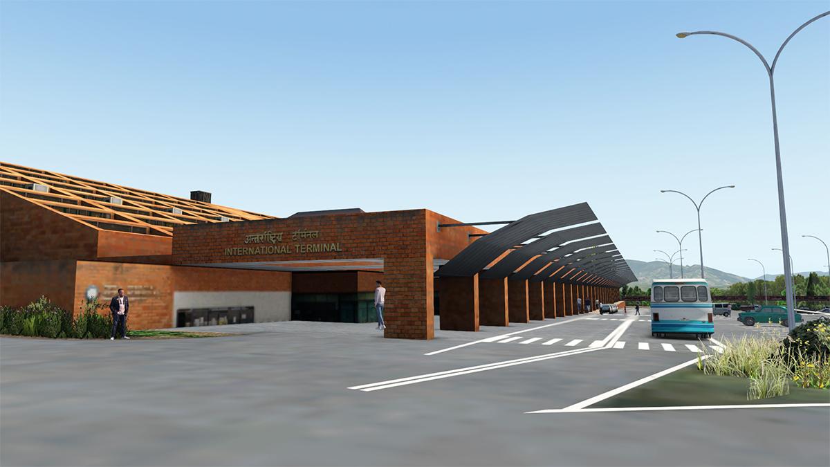
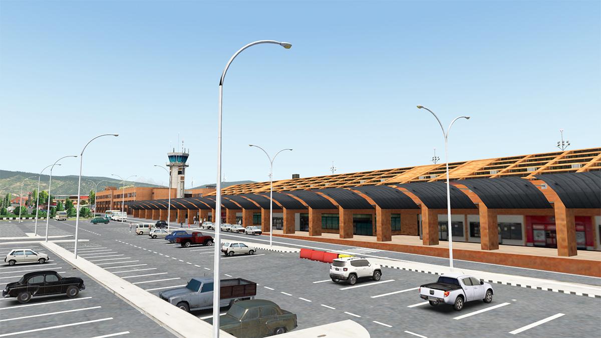
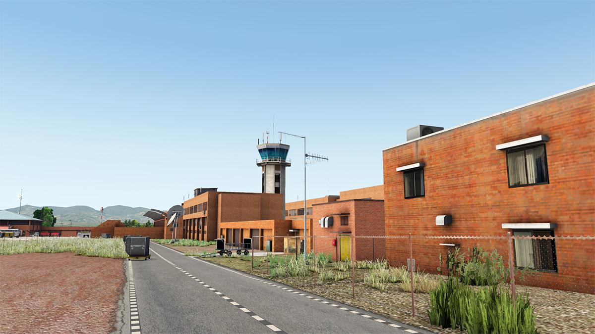
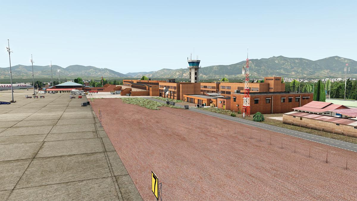
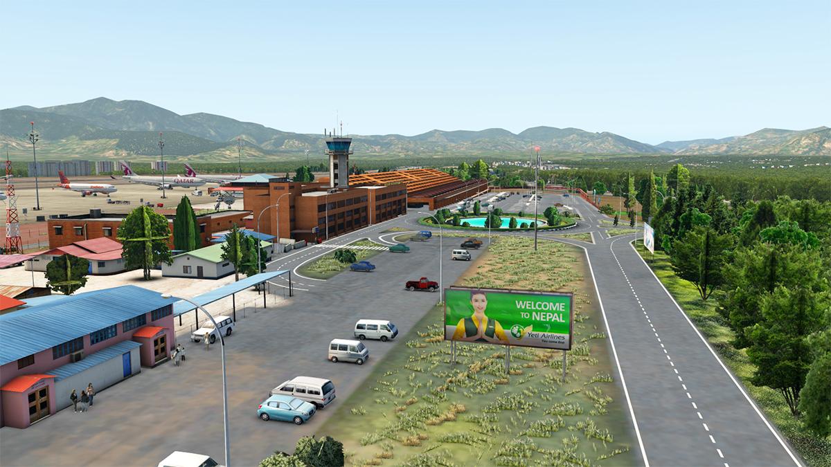
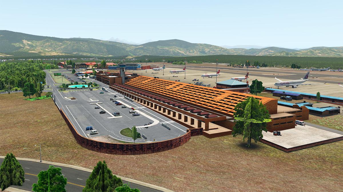
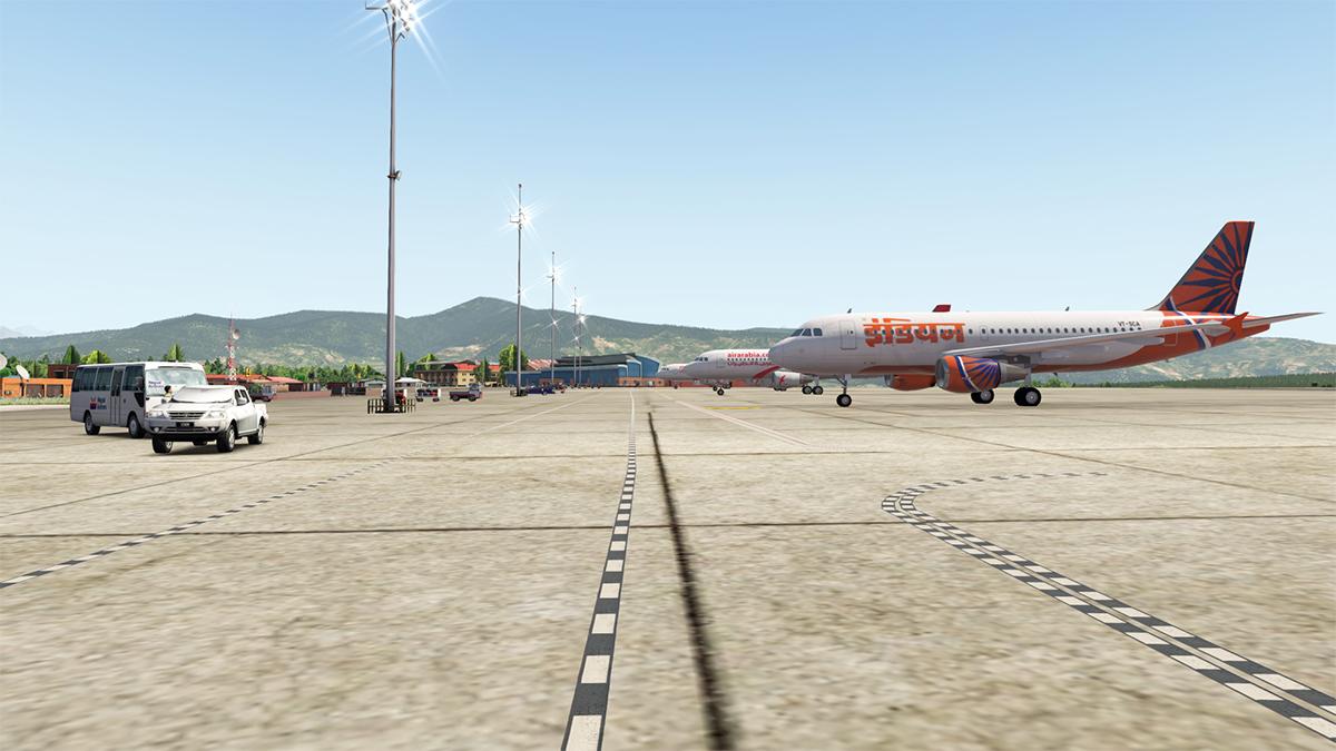
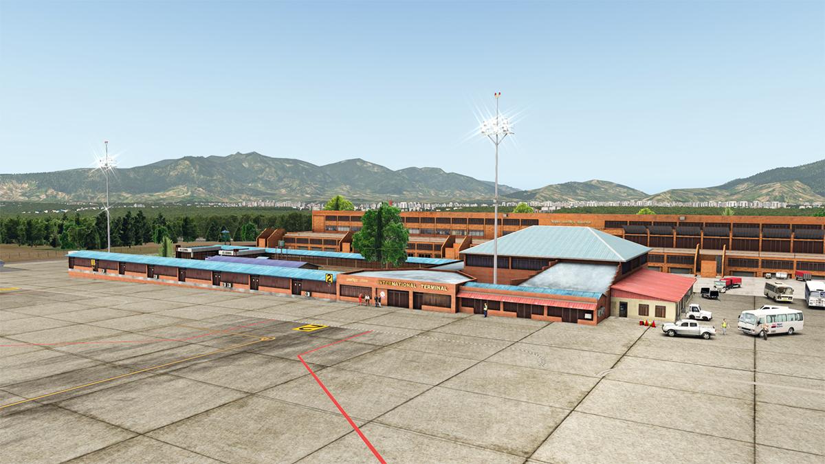
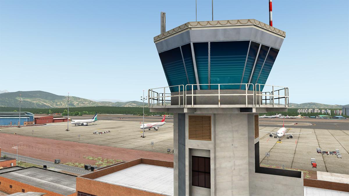
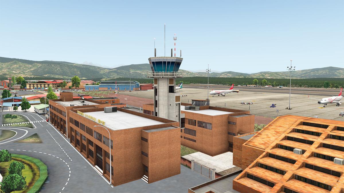
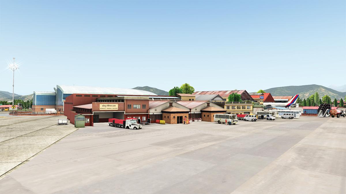
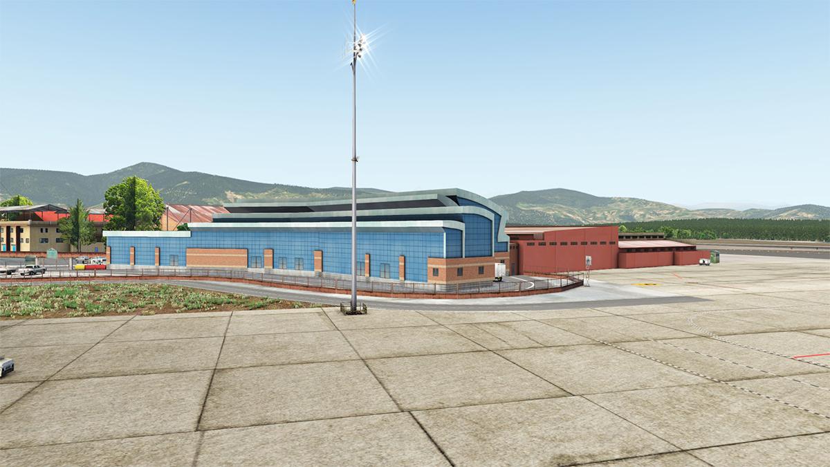
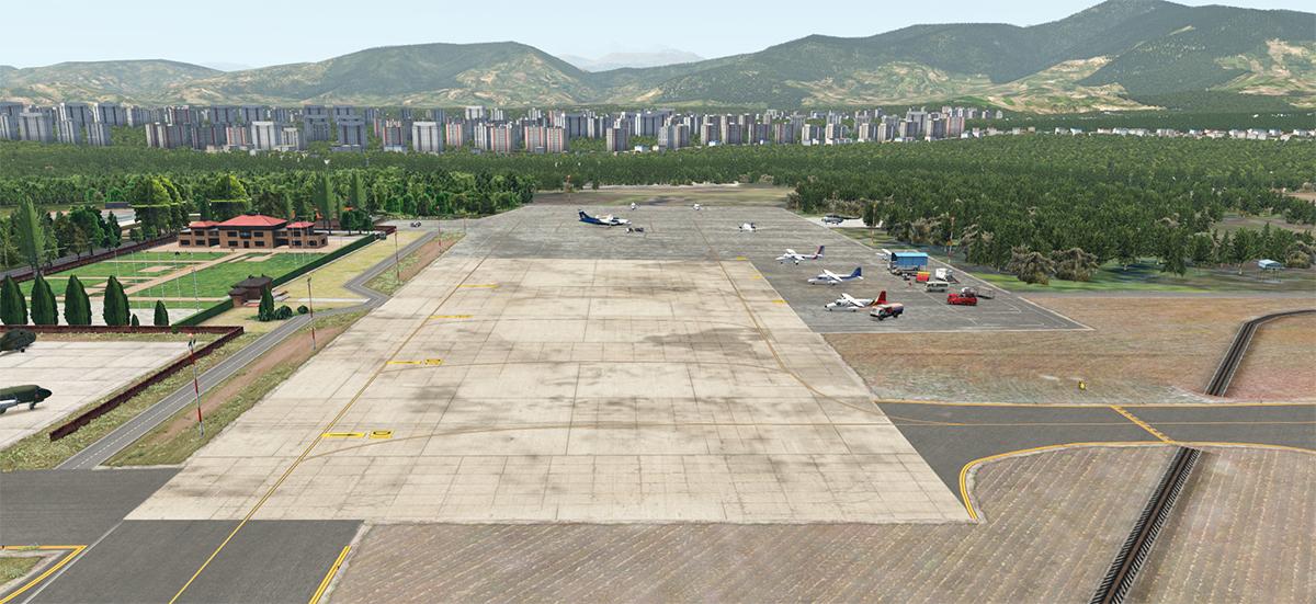
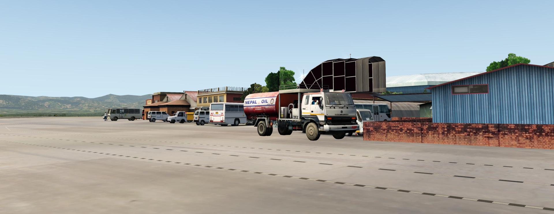
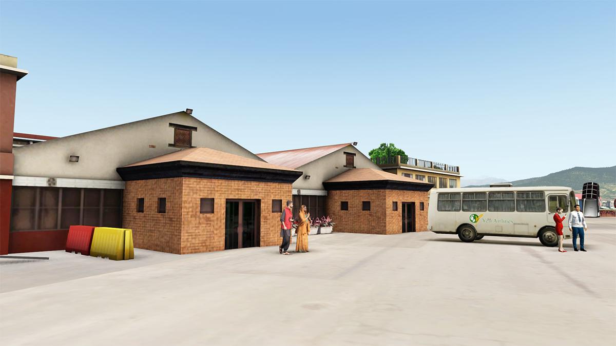
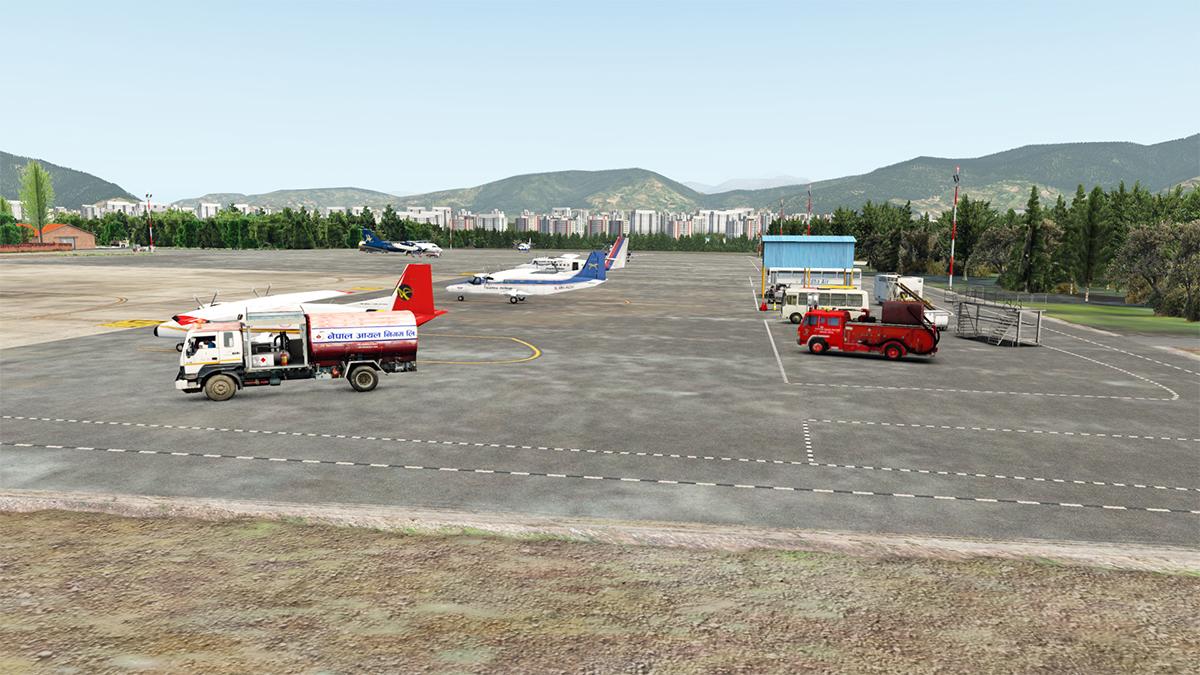
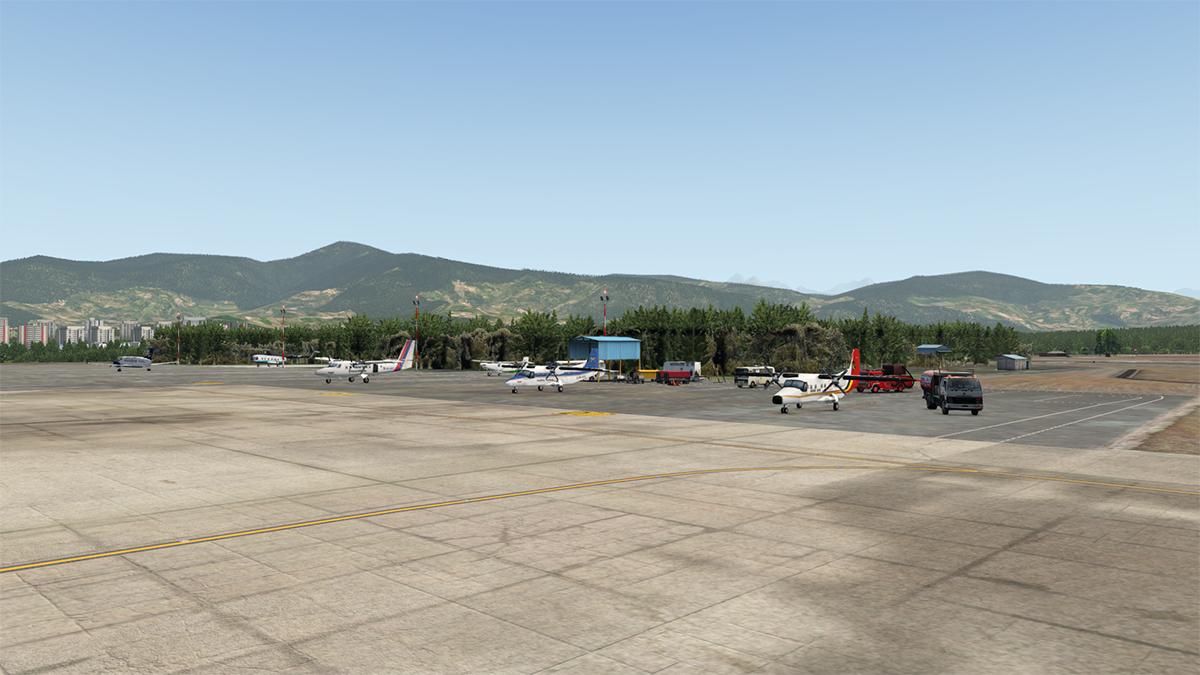
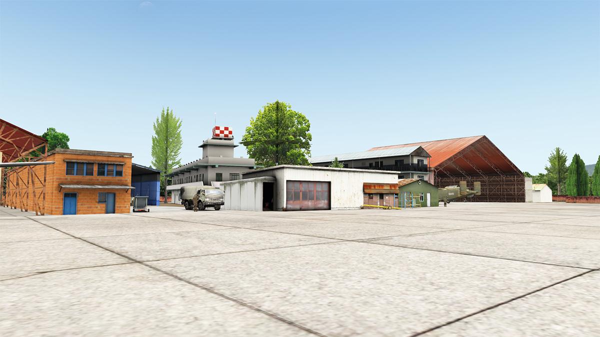
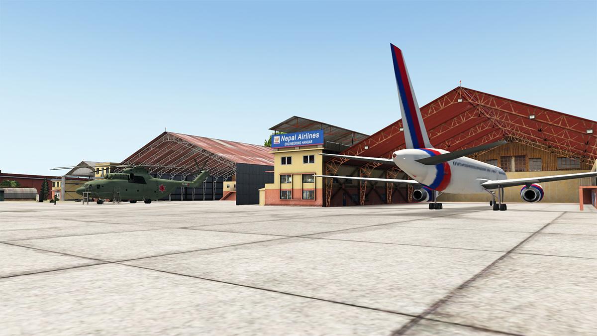
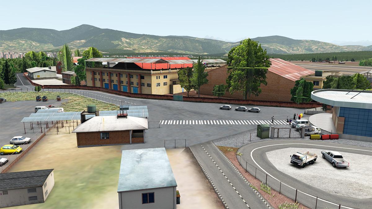
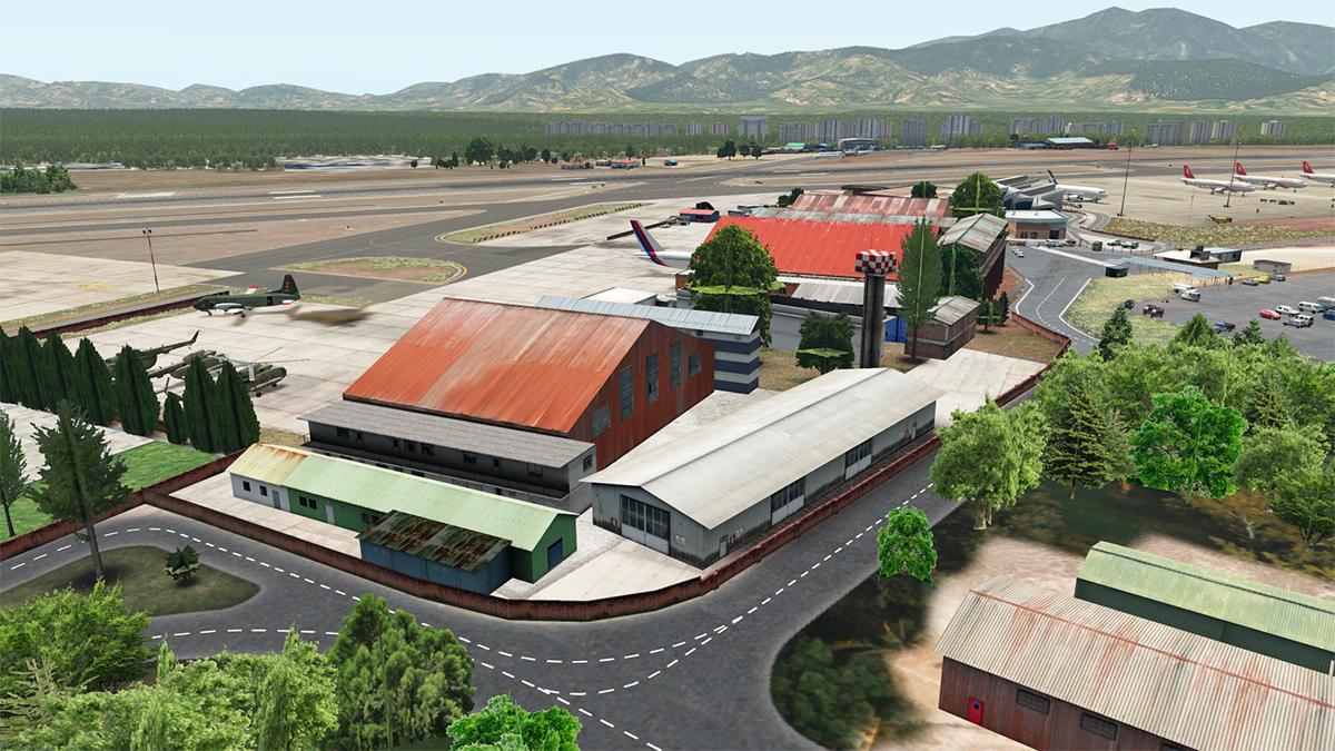
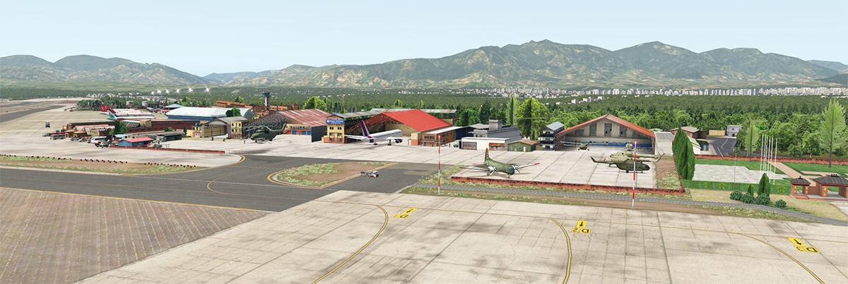
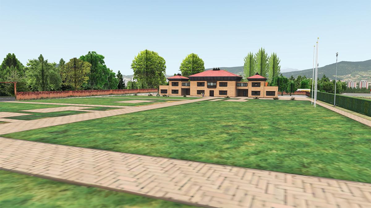
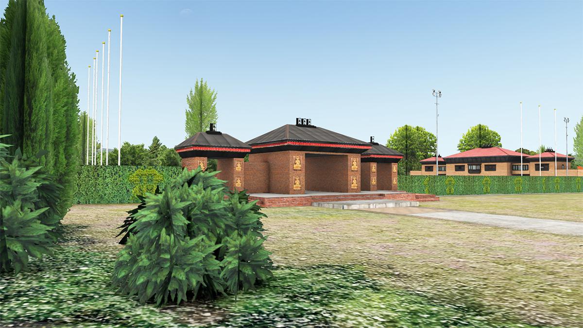
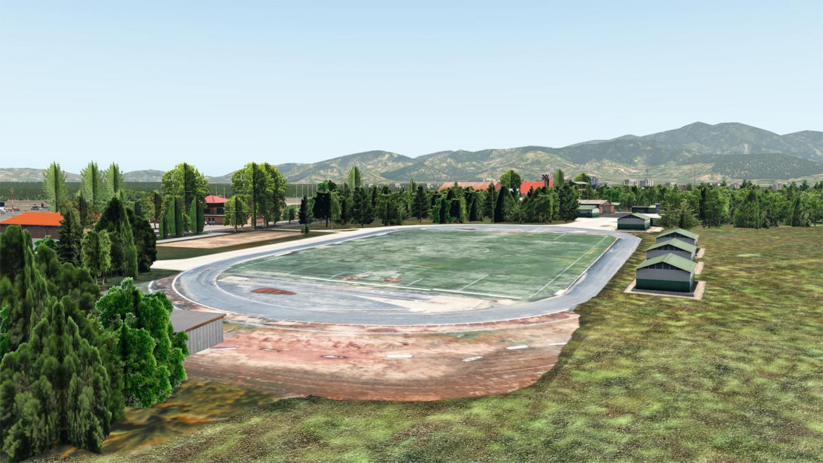
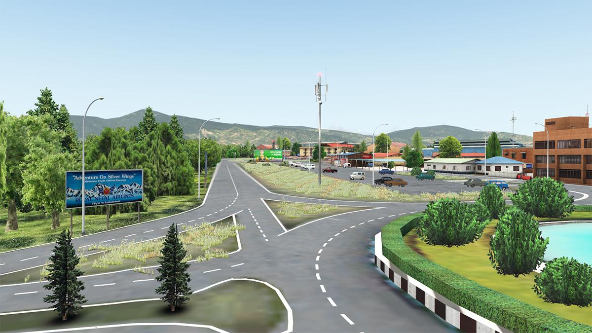
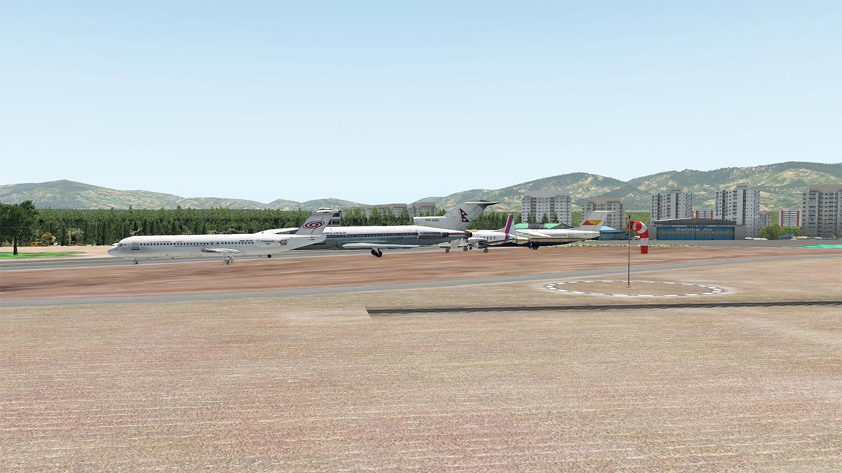
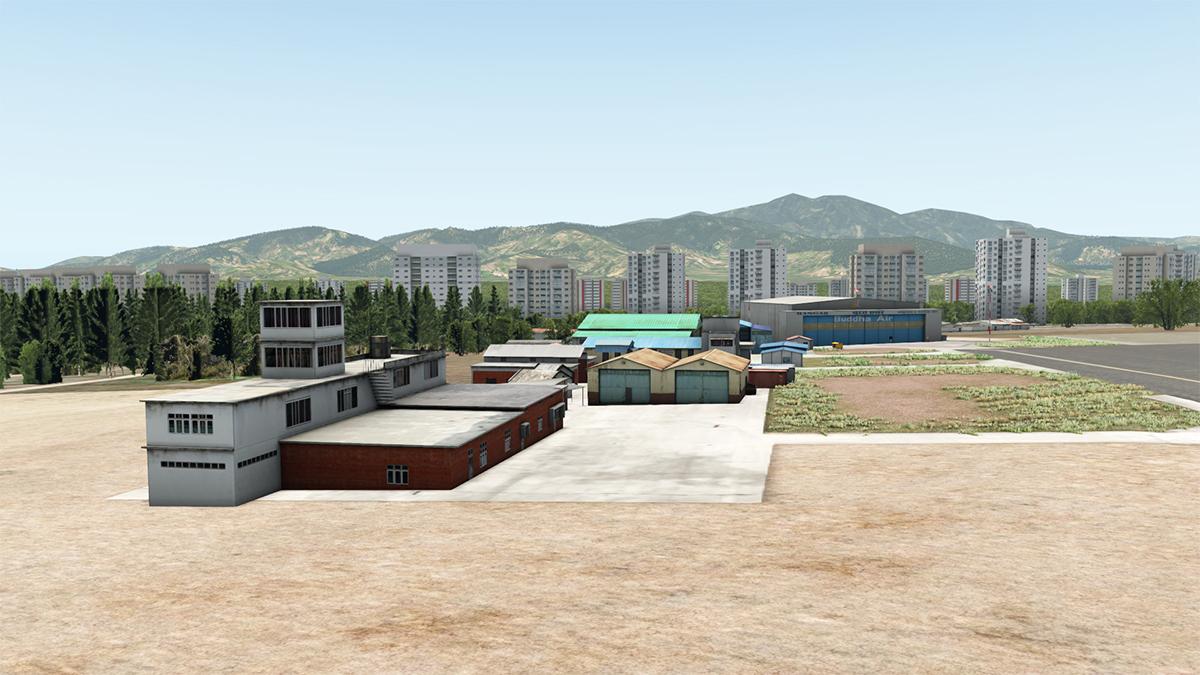
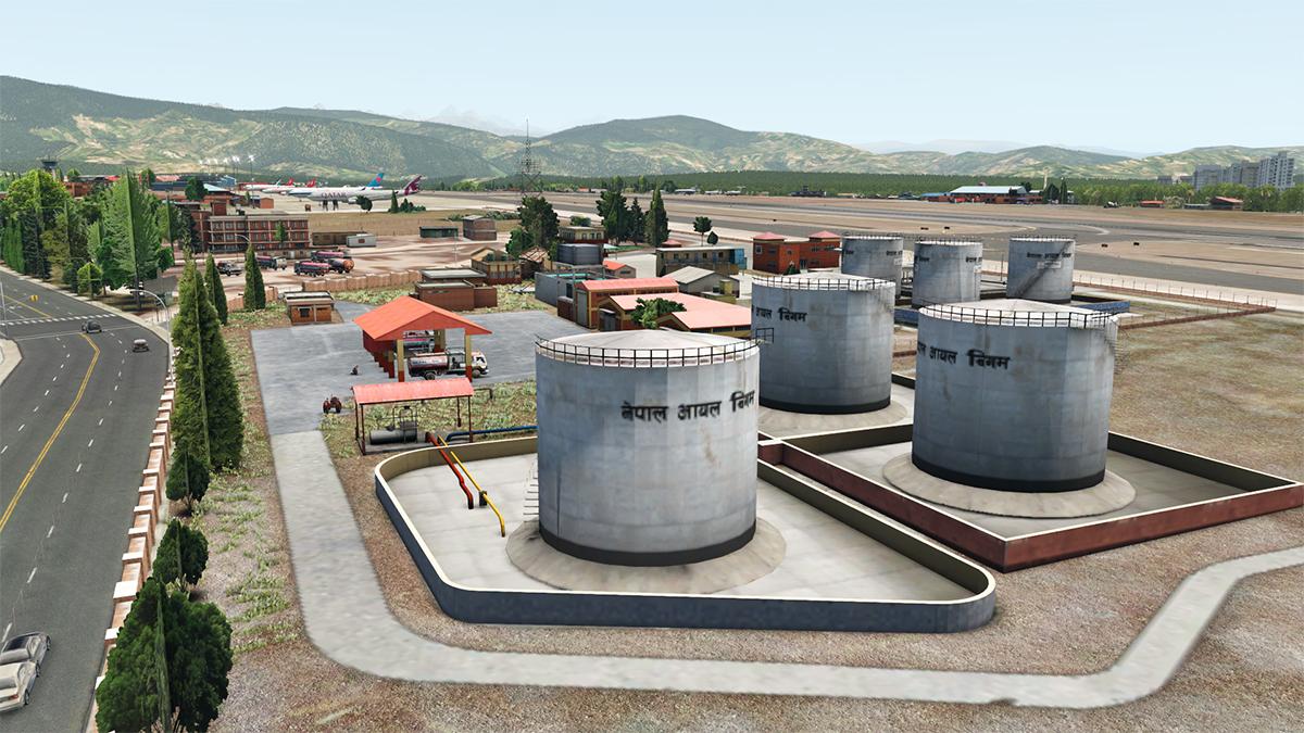
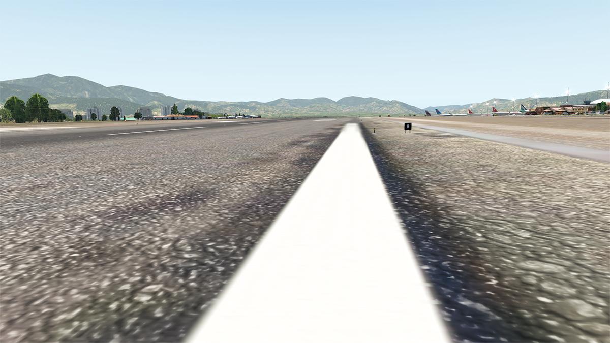
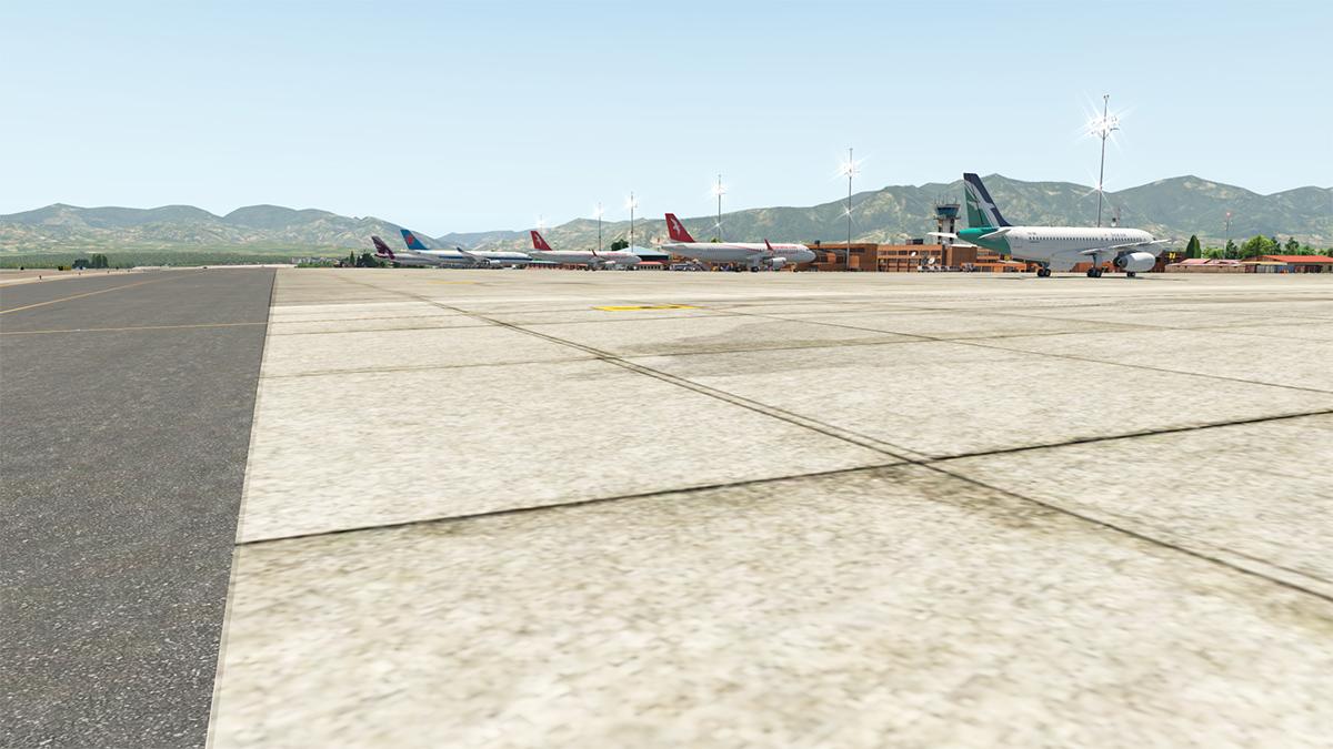
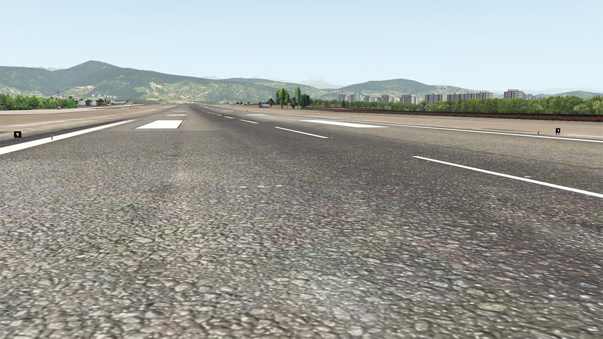
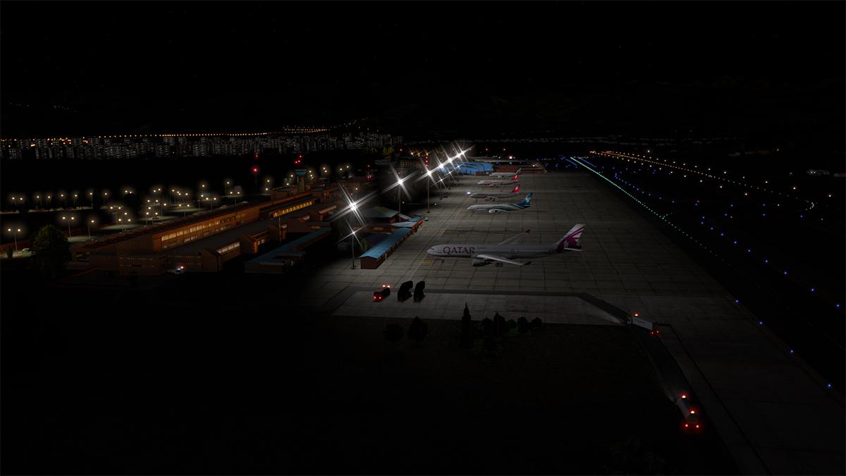
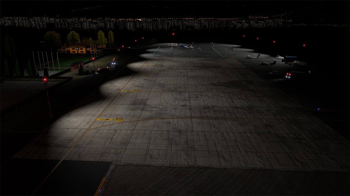
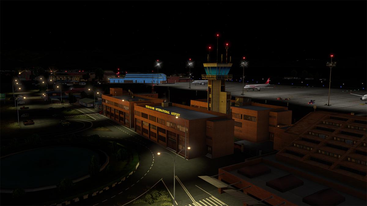
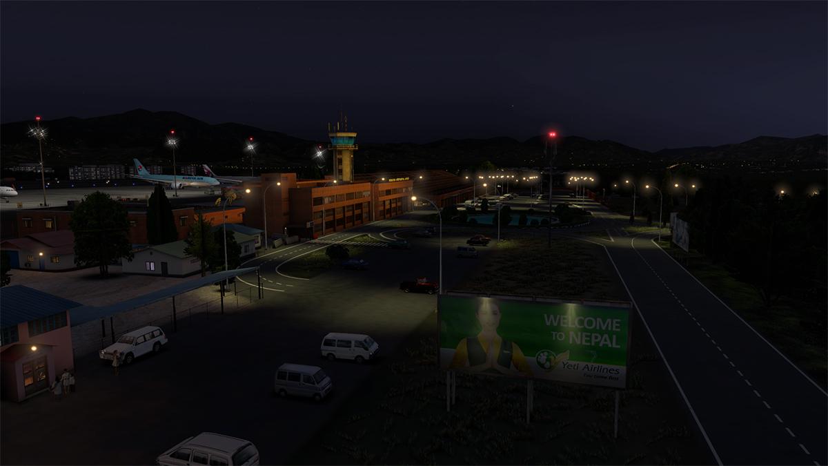
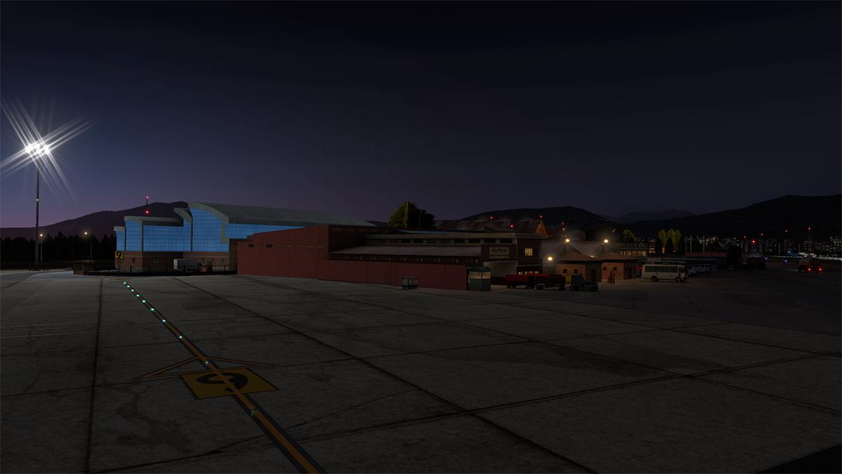
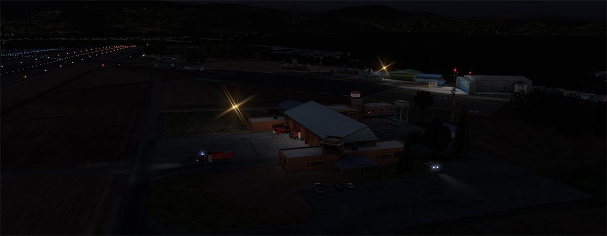
Scenery Review : VNKT - Kathmandu Tribhuvan Intl Airport by Cami De Bellis One thing always stood out with VNKT - Katmandu Airport and that it was hard, I mean it is a really very hard place to to get into and then out of. In a propeller aircraft it wasn't that bad with some tight turns and their low speeds, but in any heavy it was a nightmare as the airport is basically situated in a valley with walls of mountains surrounding any entrance or escape. The various real crashes of aircraft flying into mountainsides around Tribhuvan also highlights the danger (Air Crash Investigations). There is actually only two ways into VNKT - Katmandu, directly or from the west and both approaches go into RWY 02, the opposite end of RWY 20 is really a non-starter and is usually never used. So any approach requires planning and perfect altitude calls to get the approach absolutely darn perfect as the DOVAN approach is as snaky as they come.... so take a look at the approach chart to really understand the difficulty and planning required of flying the bigger machines around Katmandu Airport, and note the airport altitude at 4395 ft ASL (navigraph) Cami de Bellis has been around X-Plane for many, many years and has covered a lot of scenery in that time, but lately she has turned pro with now three sceneries as part of her portfolio... First was the Bhutan VQPR - Paro International Airport scenery, then NWWW La Tontouta Noumea - New Caledonia of which I really liked, this Katmandu returns her to the mountains and is more similar to the Bhutan feel. VNKT - Kathmandu Tribhuvan Intl Airport by Cami De Bellis I will note that in these views I am using the SFD (ShortFinal) local autogen, but in Katmandu I wonder if it reflects the wrong landscape? Yes Katmandu has high-rise buildings, but more colourful old Hong Kong than the more modern Rio de Janeiro look and feel we have here? Take out the SFD autogen and it is far more greener (below) aspect, but you lose the Katmandu skyline of buildings as well. A second note is that Cami provides a full downloadable (2.4gb) Ortho4XP version of the area, but most of the detailed ortho it provides is buried under the foliage. Overall my first impressions of VNKT were very good as Cami is very diligent in the way she creates her sceneries, but the approach to RWY 02 was not good? AS there is a very flat ortho image zone right sitting on the threshold of RWY 02, and the flat images also go right up the east side of the runway, both zones don't give any viewing pleasure on arrival at VNKT, which makes it all a very odd business? It doesn't work from in the air either because it looks like a set in rectangle, it looks like Google Maps, and it is not far from the truth? As with most airports around Asia they are in part very old and part new, and so it is the case with Tribhuvan Intl. Tribhuvan International Airport त्रिभुवन अन्तर्राष्ट्रिय विमानस्थल IATA: KTM - ICAO: VNKT 02/20 - 3,050m (10,007ft) Asphalt Elevation AMSL 4,390 ft / 1,338 m Development of the international terminal building was commenced in 1987, when the construction of the Airlines Operation and Control Tower building was completed and the taxiway was later overlaid in1989, the final construction of the terminal building was completed and opened on 18th February 1990. Many a freeware artist has try to create this TIA terminal over the years out of generic objects. But the terminal design and layout is simply too complex and far to diverse to try to recreate unless it is totally custom made. Notably the detail is required here for this elaborate design is simply off the chart and Cami has done a very good job of recreating the style and feel of this brick terminal and triumphs where most past were doomed to fail. Cami's detail is very good, even with local aspects like cars, buses and signage. The cars are imported Indian Hindustan Ambassadors based on the UK Morris Oxford series III model and they give the airport a very authentic look. Everything here is walk-on, walk-off even with a very long walk or to bussed out to the aircraft as it is laid out like a flightline. There are nine stands 1-9 in a line, so not an airbridge in sight. Control Tower is set mid-terminal and is quite exquisite and nicely done here. Tower view is correct, but there are a few obstructions... Domestic Terminal The Domestic Terminal is well separated from the actual parking apron, so again everyone is bussed over to the aircraft... There are seventeen stands D1 - D17 on the large apron... ... domestic terminal is two-faced in being a very modern facade on arrival, but a chaotic dated mess on the other airside, detail here is very good and again very local and I love the detail. Out on the apron again the detail is again first rate, worn trucks but again local liveries give a very authentic air to the scene. There are a lot of nice static aircraft to fill in the visual impact, mostly Twin-Otters and ATRs. Set as part of the Domestic Apron is the Government of Nepal's VIP-Terminal, looking more like a local temple it is a very nice place to receive international guests, like Queen Elizabeth II who landed in a Dakota plane for her first visit to Nepal in 1961. I am not crazy about a lot of the larger trees that are set around these parts of TIA, very cardboard looking and not very realistic in most lighting conditions, they stand out for all the wrong reasons. Between the Domestic Terminal and it's remote apron is a collection of motley maintenance hangars... more military focused than civil, the name however is "Nepal Airlines Engineering". Excellent roof lattice construction again highlights the great detail. It is really well done, because every building is very different and complex in design, worn and age are well conveyed for realism, so the overall aspect is authentic. Various MIl's in Russian helicopters and the odd Russian transport aircraft also fill out the scenario. Landside is very good with what you expect from Cami in again a lot of detail... carparks, billboards, signage are all first rate, and TIA has one of the most elaborate entrances to an airport in the world. On the eastern side of RWY 02/20 is a collection of buildings, a major maintenance hanger for Budda Airways and some nice if abandoned airliners... ... highlight is the remains of a 10 May 1973, a Douglas DC-3 operated by Thai Airways that overran the runway on landing with 100 of passengers and 10 crew on board, there was one fatality (the actual aircraft was a DC-8) that sits next to the very well done Fire Station. Southwest is a large fuel deport and airport support facilities, again the detailing here is very good and highly realistic... Ground Surfaces All the runway surfaces at VNKT are excellent, and there are a lot of various areas to replicate as well, stony shoulders and oily parking areas are all well realised... highlight is the threshold turnaround zone at the start of RWY 02. Lighting Overall the lighting is very good at VNKT. Approach and taxiway lighting is very good as is the navigation signage. Ramp lighting is very good with great apron coverage, the domestic apron is good as well but there are a few stand dark areas like with stand D-17. International Terminal lighting is very good considering the complexity and the terminal looks authentic at night. The control tower's windows are a bit too bright (they can't see out into the dark with bright lights inside) but the modern side of the Domestic terminal does not look like it is part of this scenery at all? it stands out, but in all the wrong ways. This is a personal viewpoint as I really don't like this sort of ex-Fsx early era glass colouring, and again I think it doesn't work here in context either... I understand why it was done this way, but I am not a big or even a fan at all of the bland artificial colouring look. Airside Domestic is very good as is the maintenance hangers, in that some are lit nicely inside. East side has minimal lighting but fine. WT3/Traffic Global. There are no WT3 ground routes that come with the scenery. A generation is good, but don't expect a lot of traffic up here Traffic Global works fine and fills up the airport, but there is not much actual action? _________________________ Summary Tribhuvan International Airport (TIA) in Katmandu is the only International airport in Nepal, and is set high in the Himalayan ranges. So the exotic placed scenery always deserved a good custom modeled version for such a prized destination in the X-Plane simulator. This is Cami de Bellis's third professional scenery after Bhutan's VQPR - Paro and NWWW La Tontouta Noumea in New Caledonia, and we know that any scenery from this long and experienced developer also comes with a lot of dedication, love and an outstanding focus on detail. Overall VNKT - Kathmandu Tribhuvan Intl is excellent, with detailed complexly rendered terminals and a very authentic reproduction of the Tribhuvan International airport, all the aspects are well documented with all terminals, International, Domestic and the VIP-Terminal all represented with the motley collection of maintenance hangars also well reproduced. Plenty of active traffic and very good lighting adds in to overall a great package. Aprons and ground textures are also first rate as is the landside detail, in fact all the detail is excellent and very local for that exotic Nepalese feel is very present. But several points do tend to overwhelm the scenery, with in one the approach (RWY 02) ortho textures are flat and highly visible in the wrong way, the idea again is correct, but it doesn't work in reality? Domestic terminal lighting (modern landside) again overwhelms all the other low key lighting of TIA, and there are also various floating objects landside and some of the larger trees again stand out for all the wrong reasons. Challenging and certainly in any approach and departure from NVKT, this a welcome addition to the X-Plane collection of places you need to go to to experience the full dynamics of the simulator. Cami de Bellis is also highly regarded within the X-Plane community and we all love her outstanding work as it comes from absolutely the right place... Highly recommended. _____________________________________ Yes! VNKT - Kathmandu Tribhuvan Intl Airport by Cami De Bellis is available from the X-Plane.Org Store here : VNKT - Kathmandu Tribhuvan Intl Airport Price is US$26.00 Features: Highly accurate scenery for VNKT-Kathmandu Tribhuvan Airport with all buildings modeled Over 220 custom objects all with Ambient Occlusion DSF mesh created and modified to fix bump terrain and set and correct the topography of Airport’s area Photo real textures on buildings, vehicles etc. Photorealistic ground textures based on a satellite image Professional ortho imagery 50cm – 25 km square meters – with share license authorization Detailed airport objects and vehicles Custom textured taxiways, runways, and apron Custom surroundings buildings Custom airport lights HD Custom forest and flora trees High resolution building textures – all in 2K and 4K Excellent night effects World Traffic 3 compatible Native characters created specially Requirements: X-Plane 11 Windows, Mac or Linux 4 Gb VRAM Minimum. 8 Gb+ VRAM Recommended CDB-Library v.2.4 is required Current and Review version 1.0 (May 9th 2020) Installation Download scenery file size is 980mb: VNKT_Kathmandu_by_CDB There is an optional Ortho4XP download available at 2.48gb. VNKT-Mesh VNKT-Kathmandu_Tribhuvan_Intl NEPAL Total scenery installation is quite big (excluding the Ortho4XP) : 2.74gb CDB-Library v.2.4 is required for this scenery Documents One extensive manual in both .pdf and rtf. English with notes (5 pages) but no charts. Ortho4XP download and install details. Ortho4XP.txt VNKT-Kathmandu NEPAL.pdf VNKT-Kathmandu NEPAL.rtf _____________________________________________________________________ Scenery Review by Stephen Dutton 13th May 2020 Copyright©2020 : X-Plane Reviews (Disclaimer. All images and text in this review are the work and property of X-PlaneReviews, no sharing or copy of the content is allowed without consent from the author as per copyright conditions) Review System Specifications: Computer System: Windows - Intel Core i7 6700K CPU 4.00GHz / 64bit - 32 Gb single 1067 Mhz DDR4 2133 - ASUS GeForce GTX 1080 8Gb - Samsung Evo 1TB SSD Software: - Windows 10 - X-Plane 11.41 - tested v11.50.b6 (fine) Addons: Saitek x56 Rhino Pro system Joystick and Throttle : Sound - Bose Soundlink Mini Plugins: Traffic Global (Just Flight) US$52.99 Scenery or Aircraft - Airbus A319 by ToLiSS (X-Plane.OrgStore) - US$69.00
-
Scenery Review : VQPR - Paro International Airport by Cami De Bellis Could you live in the "happiest Place on Earth", and no it isn't Disneyland either? It is actually Bhutan, and yes it does have officially the happiest population on earth as noted daily by Bhutan's "Happiness Indicator" in Bhutan's capital Thimphu. The Kingdom of Bhutan (འབྲུག་རྒྱལ་ཁབ་ Druk Gyal Khap) is a landlocked country in South Asia and is located in the Eastern Himalayas, and is the place to go to if you want to convert to Buddhism or seek out the truth and become Batman. The Kingdom, also restricts tourism, as only a select number of tourists per year are allowed to visit the Kingdom and then they are tightly, highly regulated and controlled. Entrance to the Kingdom is also restricted by there only being one major international airport at Paro which is 54 km from the capital of Thimphu. And with so few tourists, being totally landlocked from commercial interests including most of the modern infrastructure, stress and bad western television, you can see why they are so happy out there. The Bhutan's also love to have fun with anyone who insists of actually going there, because the only way into and out of Bhutan is via Paro and it is one of the most dangerous landings and takeoffs in the aviation world, and yes VQPR did make it to number 6 of the "most extreme airports of the world" and number 1 was to Antarctica and landing on sea ice. Cami De Bellis To anyone that has been around X-Plane for a number of years then our dear Cami is well known to most of us since 2008. This nice lady has turned out ton's of wonderful scenery over the years in the mostly the Caribbean Islands and the South Pacific. Her work is usually highly populated with people and objects, but this is Cami's first payware scenery in the VQPR - Paro International Airport in Bhutan. Paro International Airport སྤ་རོ་གནམ་ཐང༌། IATA: PBH - ICAO: VQPR 15/33 - 1,964m (6,445ft) Asphalt Elevation AMSL 2,235 m / 7,332 ft Paro International Airport There are two major (If you call them a major carriers) in Druk Air and Bhutan Airways (2 A319-100's) based at Paro. Druk Air has been the Bhutan airline for longer since 1981 and started with a Dornier 228 and then switched to a BAe 146 which as you know are both STOL aircraft. But Druk Air now has three A319-100's and one ATR-500 and in 2012 over 181.000 pasengers passed through airport. The very early flights were also constricted by the exact time of landing, the number of passengers on board and even the direction the aircraft was parked on the airport apron being predetermined by the high lama of Paro Dzong, which means he was also the airport's operations manager in another capacity. Your first thought was going to be the "oh easy, I've landed on an aircraft carrier with a Boeing 747 and so I can do that Paro place". But to be a professional pilot of getting passengers in and out of Paro (Not to be confused with Faro Airport) is a tricky business. The above chart shows you what you have to contend with, plus the valleys are well known for their strange winds effects, in fact the winds can vary considerably at various points along the actual runway not considering also on the actual approach paths. There is no ILS here either and nav aids are restricted to just two in a VOR (PARO - 108-40 PRO) and a NDB (410 PR). This is all hand flying folks, no RNAV or computerised help is available either. "Your on your own" and if the weather is its usual changeable self (mostly to the bad) then you have to deal with that as well. Night flying here is strictly not available. In real flying you need a special certificate to be able to land at Paro. Airbus A320's and Boeing A737's can land here but rarely do so because of that required ticket. More importantly is that aircraft of that size would have to very aware of weight and load factors as we shall see, so the A319 is the best aircraft between size and weight here to get the job done. South Approach So I am going to try the south approach to RWY 33, the rules are very strict, almost carrier like in what to do in an aborted run, you really just climb hard and get yourself quickly out of there. The first part of the approach made me nervous as there was a lot of cloud around with mountain tops breaking through the tops. My equipment is the default Boeing 737-800, a bit big, but easy to handle. Your aim is the PRO "PARO" VOR and note it is listed at 11,483ft, Paro Airport is at an altitude of 7,332 ft so there is a difference of 4000ft, but you have to fly over PRO, so you are going to have to still descend a lot more than 4000ft in a very short distance. Thankfully the cloud cover cleared as I approached the VOR. Speed is absolutely critical as you go over PRO, your lowering flaps and wanting to go as slow as you can as you head down deep into the Esuna Valley and your aim is 165kts. You turn right then left as you swing down the valley and expecting Paro to be in front of you, but it is not, as the airport it is still hidden by Bongde at 8000ft, however you can descend from 11,000ft to 8500ft to take most out of the altitude for landing, however makes sure you don't go too low as Bongde is still there in between you and the airport. Gear down at this point as you approach Bongde for the drag, and as you go around Bongde the top of your speed needs to by around 145kts (stall is 130kts depending on your weight). Then like on a roller-coaster as you go over, or slightly around and down to the left and then swing to the right to finally see RWY 33 still way down below you in the valley.... time to descend, steeply. It is a crucial point here as your speed will increase quickly as you fall and you need to keep it no more than 163kts to control the landing... Even if you get it right, you will still feel you are high and too fast, but RWY 15/33 does give you a fair bit of landing space to get it right and is longer than it actually looks, like I said, total speed control is the key... my final landing speed was 135knts. You could call it the "Space Shuttle" approach because that is what it feels like. You don't really have much time for sightseeing with this approach as your total focus is not over running the 6,445ft runway, which is more like 3500ft by the time you grab the tarmac... the go around if required is pure carrier operations in full throttle and a full steep climb out. There is a small left shoulder to turn around at the end of RWY 33, but it is still a tight turn for the B738, but doable. First views around you and the area is full of realistic Bhutan housing and Pagodas and located up into the far distance is the Dzong or to give the building it's formal name the "Rinpung Dzong". There are hundreds of custom Bhutan buildings in this scenery that completely fills out this part of the valley, these certainly give you the feel that you are in a very different part of the world as is the largely wooden based architecture. Bhutanese ramp workers greet you in the local costumes, which makes a big difference from the Hi-Vis jackets of norm. You will need to have your "Texture Quality" slider at "maximum" as the textures are not high quality and at anything less than the Max setting will give you a slightly blurry look on any of the buildings. At max it is fine and you can set the max, texture quality setting and get away with it in that position because autogen here is almost non-existent and the texture count here is very low as well. As approaches go, you feel like you should get your astronaut medal for landing the shuttle from space, the approach is exciting and requires skill, the visual aspects are great as well, so overall a challenging and complex arrival at a high altitude Himalayan airfield. VQPR - Paro Overall VQPR fits in well to the area. There are joins between the custom scenery and the default textures, but you have to go looking for them, and the basic default textures are a mixed set here anyway that really doesn't help the layout as they are also a very low resolution, so in context the work of intergrating the custom othro textures is well done. The runway textures are good, but not sensational. In the real images of VQPR the runways and taxiways are more dirty, harder rubbered in used and tired, with more worn patches and patchy oily areas... There is 3d grass as well, but the feature is only used in a few places. Obviously the Bhutanese like to get their lawnmowers out to keep it all spick and span for the selected guests, but 3d grass along the runway and far more other areas would have been nice and more realistic. Where it is placed it looks very good. There is also a lot of placed trees. A lot of the trees are those cross-form types that don't work very well with some sun angles (I think they look fake personally) but some trees are really quite beautiful in colour as we shall see. Terminals Paro Airport is an exquisite place for architecture. In our constant sameness of airport terminals in this day and age, then Paro is a place to be treasured. Externally and Internally then Paro can only be Bhutanese in its design and feel, it is a beautiful place full of beautiful things. Going through immigration here is a pleasure not the usual painful challenge of today, no wonder the Bhutanese are so happy there. The scenery's reproductions of the two terminals are very good, yes two terminals! The original 1999 terminal (below left) was joined by the newer slightly larger terminal that opened Mar 18, 2016 (Below right). The new terminal is for arrivals only. So this scenery is up to date and the buildings are highly detailed, but the textures are extremely low-res close up and don't reveal too much of their detailing, from a distance it is fine, but it feels texture wise slightly dated in this age of quality 4K textures. There is a huge amount of detail included with this scenery, and all very local and not just generic in context as you would expect from most designers. But then again Cami is not your usual designer and here she is in her element in giving you the feel of this very different culture. All people are 3d and a great mix of Bhutanese and Western cultures and the ramps and landside areas are busy, busy places. Very rarely do airport administration buildings look like they do at Paro, they are beautiful and part handcarved wood. But then again Control Towers don't look like this anywhere else either? The Fire Station is part of the control tower as well. Note the beautiful cherry blossom trees and the flags are animated and flap nicely in the wind. Detailing here is very well done and well conceived and highly realistic (or manicured). Note the highly realistic street lamps, and their lovely detail. Landside is very completed of objects and detail, you can feel the slight modernisation around the airport as the Bhutanese are coming more and more into the modern world. There are animated vehicles, but not many and the nice touch is that again they are locally branded and not generic. One is a fuel truck and also a baggage cart. North of the terminals and ramp areas is a maintenance area with a large shared hanger for both Bhutan Airlines and Druk Air... ... and a secondary hangar for general aviation or aviation workshop. Tower View Both approaches are excellent with the tower view. But the charts note that the control tower can't see you until you are on short-finals... ... You do however get a great overview of the ramps. Bhutan landscape The Bhutanese love their ornamental gates called "traditional entrance gates" and there is a wide variety produced here in the scenery, including the more modern traffic version. The exotic Bhutanese housing is very well represented, the buildings are very like everything else in Bhutan in being ornamental and also quite basic in design, it comes across like a sort of alpine Indian (Asia) feeling. The buildings are mostly placed along the river Paro Chhu that flows right through the valley and past the airport. The highlight of Paro is the Buddhist fortress featuring several shrines & chapels, plus wall paintings and the grand architecture of the "Rinpung Dzong". The monastery is situated northeast of the airport and can easily be seen from the ramps. The Kyichu Lhakhang, another important Himalayan Buddhist temple that is situated just north of Paro also on the Paro Chhu but is not represented in this scenery. Lighting The lighting at VQPR is excellent. Even if that flying at night here is not undertaken. You can see why with those tall dark monoliths each side of the valley and the airport, that are there and just waiting deathly as your ultimate calling card. However the runway lighting is really good and effective if you can get in and out of VQPR before the curfew. Ramps are very well lit and with the right if perfect light tone. Building lighting is excellent as well, but the standout is the four cross and two globe street lighting... ... that is used to maximum effect on the landside areas of the terminals. Maintenance hangar gets neon lighting in contrast to the rich lighting everywhere else, which is a nice touch. Paro itself is village like with no street lighting and just window illumination that works well. All signage is well lit and prominent, and gives you a very authentic feel to the scenery. Departure from VQPR Getting out of VQPR - Paro is as breathtaking as getting in... ... weight is critical to get the maximum performance out of those engines. You are already 7333ft high in altitude and thinner air, so those engine don't perform as well as they do at sea level. Hold the brakes and build up the thrust and then let the aircraft go. You climb, and you climb hard at full thrust. You are at 20º pitch and and still the mountains feel too close and riding only on pure upward thrust alone. You feel that thrust pushing you ever upwards, its a hell of a ride, Titan booster style. Finally you start to see space... oh sorry, but still 18,000ft is required as per the charts going straight up to clear the range... ... you don't want on that climb for the power to fall off, and so make sure the aircraft can produce it via the weights, finally clear air and a normal climbing pitch of 2500 feet per minute, and there is absolutely nothing normal about getting in and out of Paro, Bhutan. Services Only Bhutan airlines do most of the services in and out of Paro, and that is because it is restricted.... routes are mostly to Thailand and India, but Indonesia is in there as well, which is a fair distance from the Kingdom. Bhutan Airlines : Bangkok–Suvarnabhumi, Delhi, Jakar (suspended), Kathmandu, Kolkata, Trashigang (suspended) - Seasonal: Gaya Buddha AirCharter: Kathmandu Druk Air : Bagdogra, Bangkok–Suvarnabhumi, Delhi, Dhaka, Gelephu, Guwahati, Jakar, Kathmandu, Kolkata Seasonal: Batam, Denpasar, Jakarta-Soekarno-Hatta, Johor Bahru, Medan, Mumbai, Penang, Singapore, Trashigang (suspended) Summary From a pilot's point of view then VQPR - Paro is one of the biggest challenges in aviation. Both approach and departure requires a lot of discipline and skill in getting a medium-sized jet into and out of the airport, so it is exciting and challenging at the same time, but the trick is to do it professionally and not in a gamer sort of attitude. It is a tricky scenery to create. There is a lot of elevation changes and the basic X-Plane textures are not of the Hi-Resolution type you get say in Europe or America as there is a lot of very different texture styles trying or fighting to recreate a Himalayan landscape, which are fine for flying over at altitude, but close up are a bit of a mixed up set of sets. Then you are trying to match in your custom ortho textures into this complex patchwork of textures. In this area Cami has done a great job, but a wider set of ortho textures would have made the job easier and gave you a more proportional and smoother landscape over a bigger distance, Beti-X did that at Bella Coola for a better effect. Then there is the small issue that some textures gave offny winter line patterns behind the airport that is not there when the scenery is removed? There are no built in ground routes? So there is no access to WorldTraffic3, X-Life or the default static aircraft. No pushback or service vehicles are available either... a big omission for any payware scenery? Overall Bhutan buildings and terminals are really well done and wholly represents the airport in its current fashion, textures are low grade though and it shows up close and even at maximum texture render settings, so it feels to be slight older scenery than it actually is, the textures look a a decade out of date by current X-Plane standards. Runway and taxiway textures needed more grit and dirt, as this runway gets some hard landings and it shows in the real world images, but overall at a distance the buildings work and feel fine as they are very colourful and cheerful, just like Bhutan. As expected with Cami, detailing and sheer object numbers are in placement is excellent with both ramp equipment and 3d people and all areas both airside and landside are covered, the valley is full cultural Bhutan buildings and their also the lovely traditional entrance gates. Overall this is very good scenery, and the bonus of those approach and departure challenges gives you great value for your investment, certainly more other connecting airports in India and Kathmandu in Nepal, would give you more access to the scenery on a route basis, but even as a standalone it is very good scenery to use in X-Plane... so great work by Cami De Bellis, well done and this scenery is a great entrance to the "land of the Thunder Dragon". ______________________________________________________________________ Yes! the VQPR - Paro International Airport by Cami De Bellis is Available now from the X-Plane.Org Store here : VQPR - Paro Intl Airport, Bhutan Your Price is US$19.95 Features Exact reproduction 3D of the airport buildings, houses, hangars, Dzong, Pagodas and others Detailed textures and custom objects Reproduction of staff and local people 3D Hand placed 3D trees Volumetric grass Complete reconstruction of the airport's lighting equipment Detailed ground markings Custom night lighting Many Animations in and around airport Very detailed 3D Models covering the whole airport Ground Traffic by Marginal Requirements X-Plane 11 or X-Plane 10.50+ Windows, Mac or Linux 2Gb VRAM Minimum. 4Gb+ VRAM Recommended Installation : Download scenery file size is 59.60mb. With the full installation installed at 198.60mb in your custom scenery folder. The CDB-Library v.2.4 is required. Documents Readme.txt But no Charts supplied. These charts are the best I could find for VQPR -Paro: VQPR_CHARTS WT3 : No ground routes was created for the scenery, so WT3 does not work here? ______________________________________________________________________ Review by Stephen Dutton 13th December 2017 Copyright©2017: X-Plane Reviews (Disclaimer. All images and text in this review are the work and property of X-PlaneReviews, no sharing or copy of the content is allowed without consent from the author as per copyright conditions) Review System Specifications: Computer System: Windows - Intel Core i7 6700K CPU 4.00GHz / 64bit - 16 Gb single 1067 Mhz DDR4 2133 - ASUS GeForce GTX 1080 8Gb - Samsung Evo 512gb SSD Software: - Windows 10 - X-Plane 11.10 Addons: Saitek x52 Pro system Joystick and Throttle : Sound - Bose Soundlink Mini Plugins: Environment Engine by xEnviro US$69.90 : XPRealistic Pro v1.0.9 effects US$19.95 Scenery or Aircraft - Boeing 737-800 Default by Laminar Research (Free with X-Plane11)


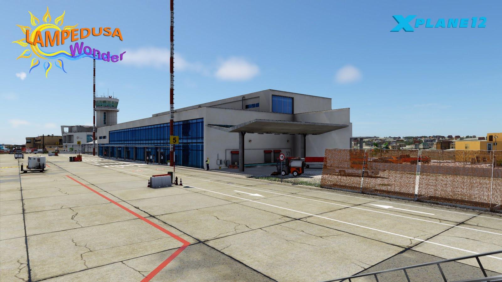
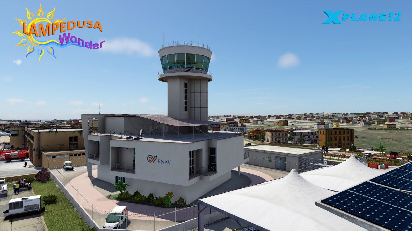
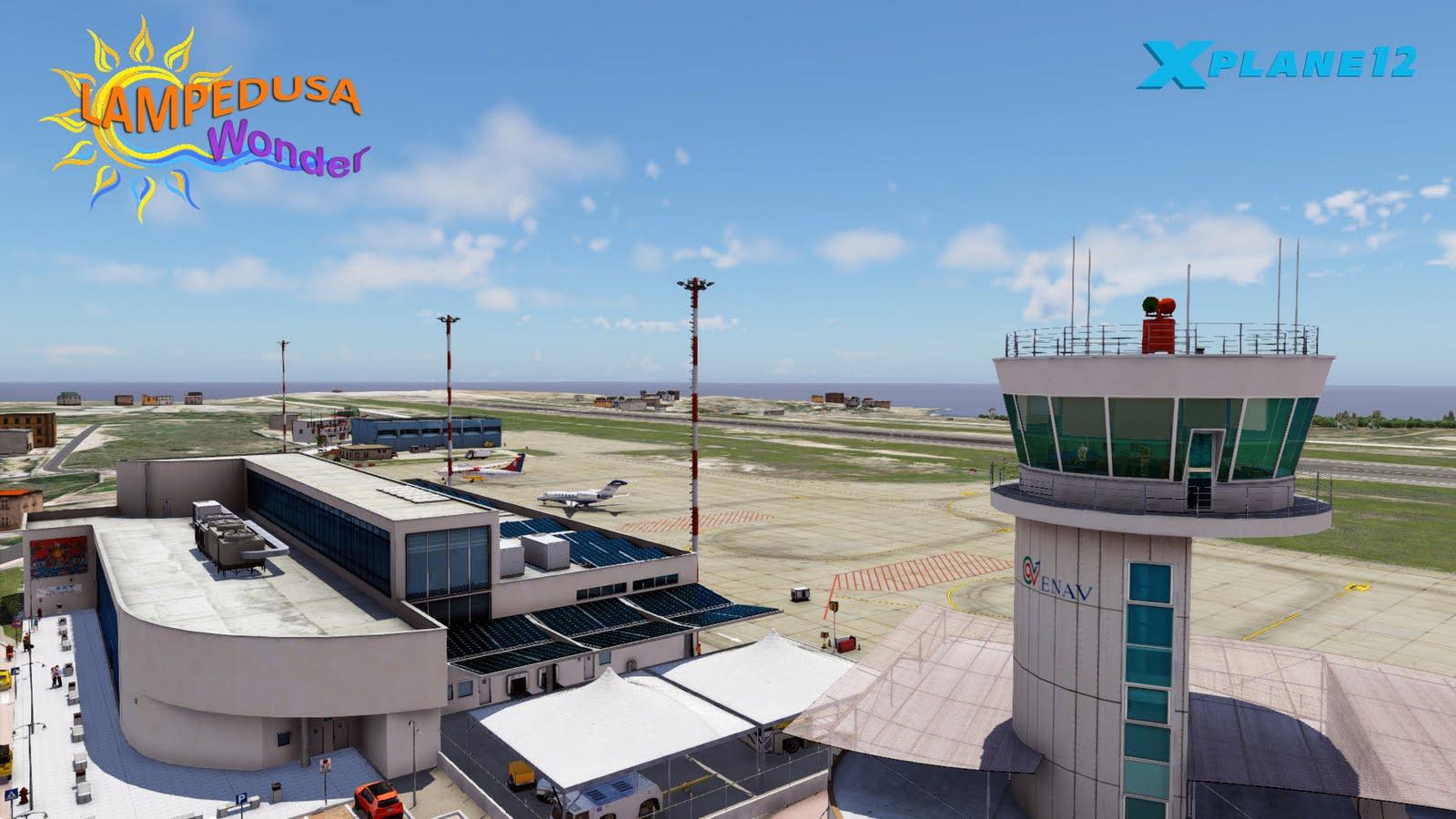
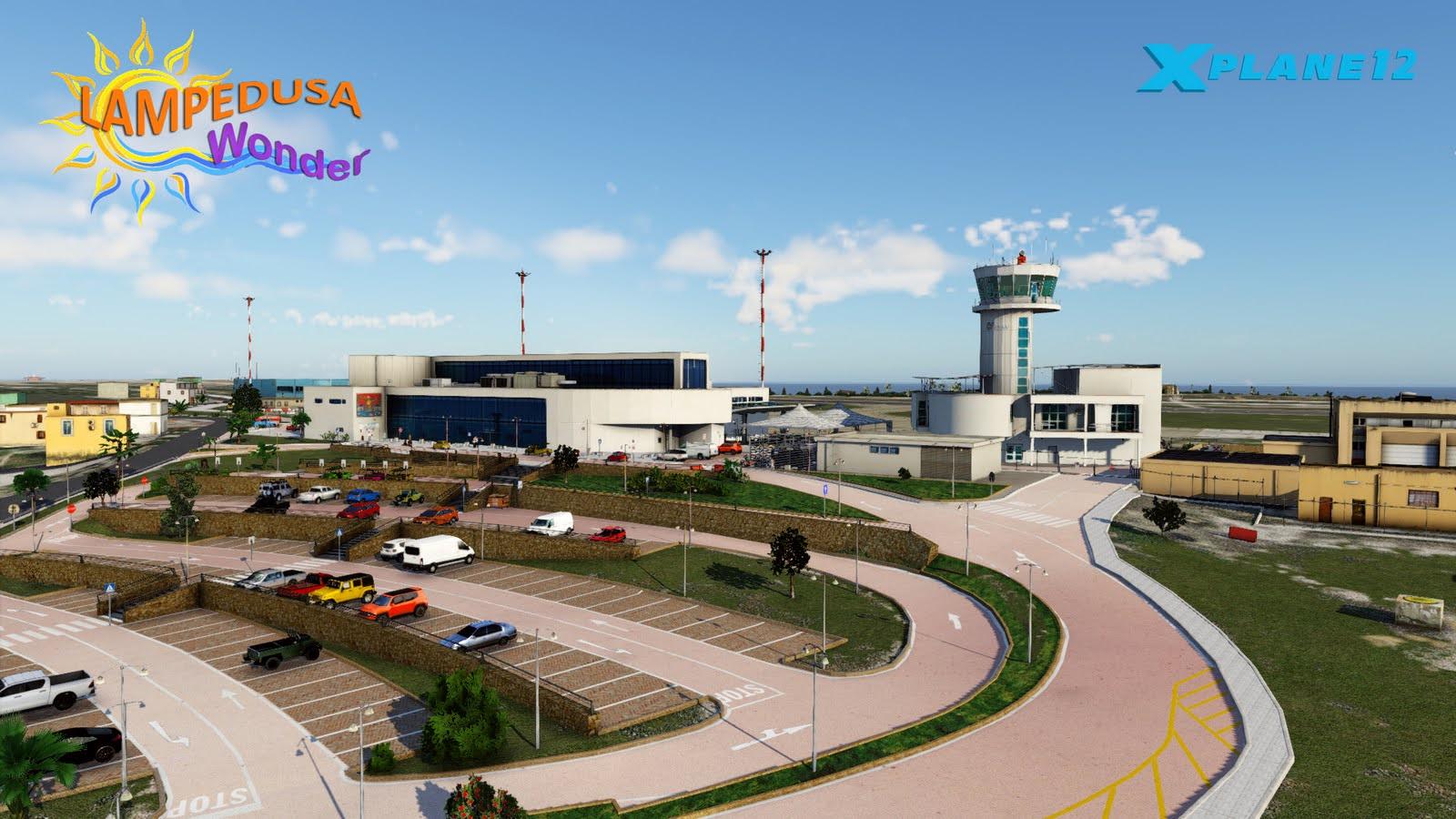
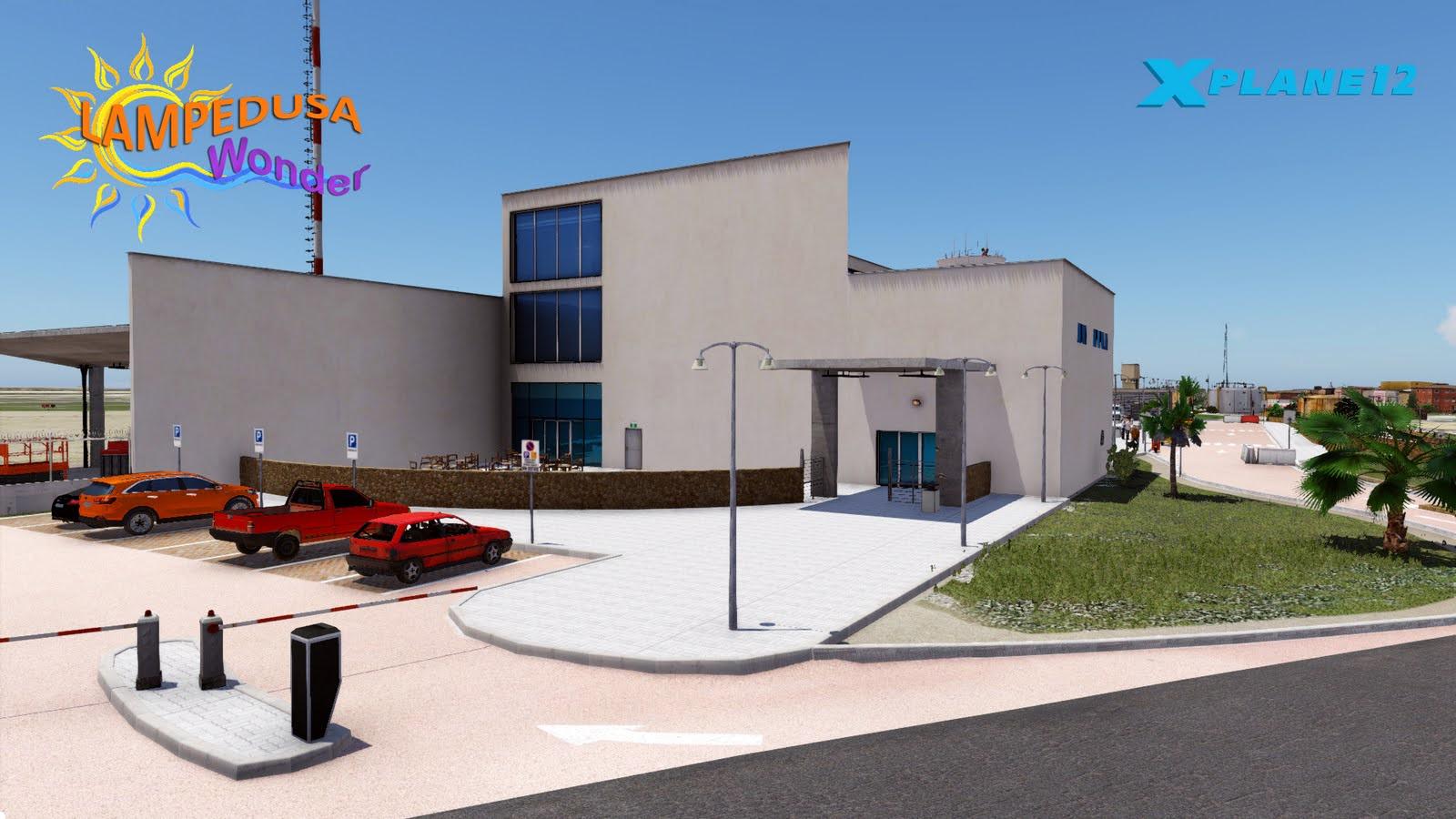
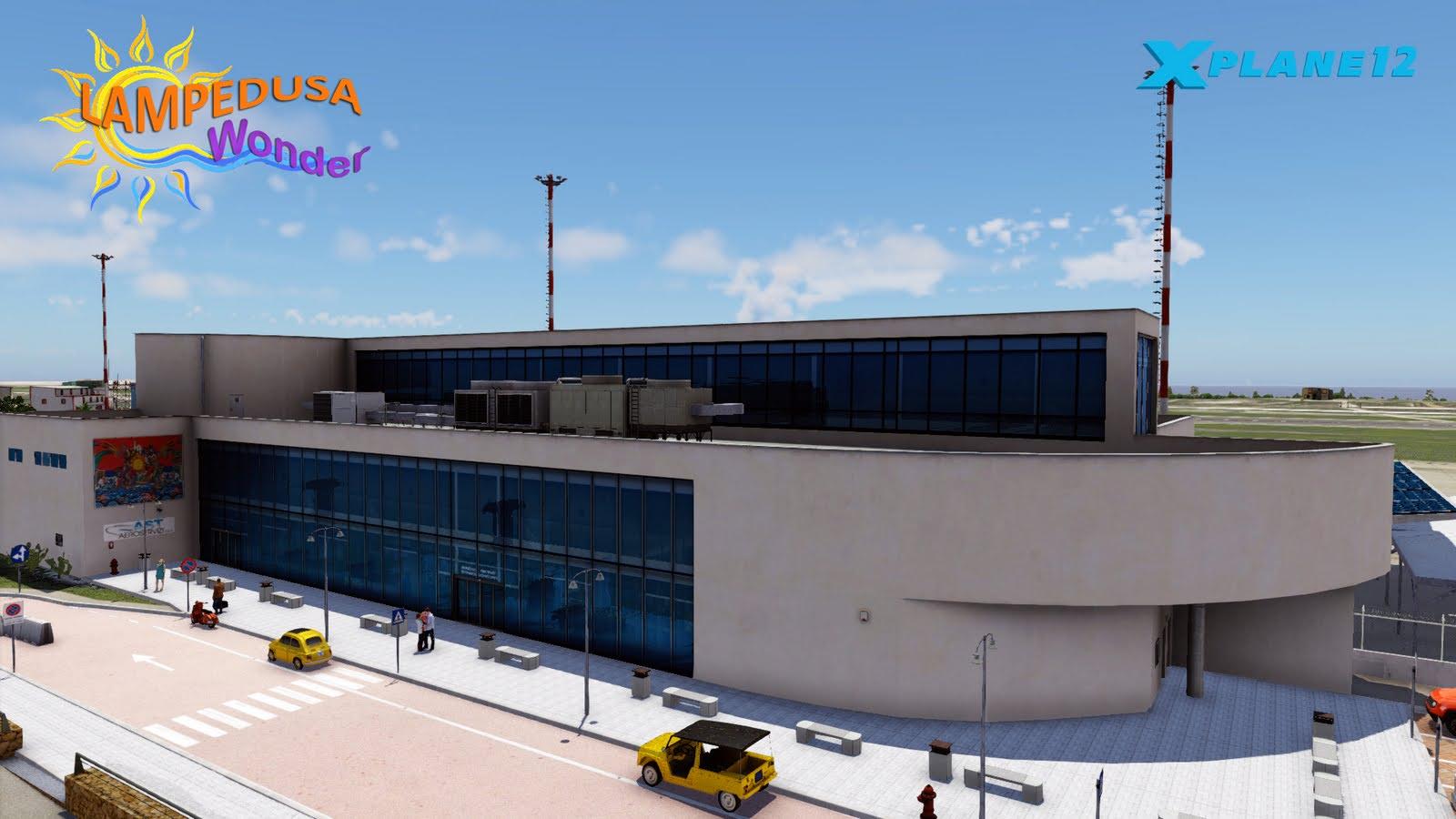
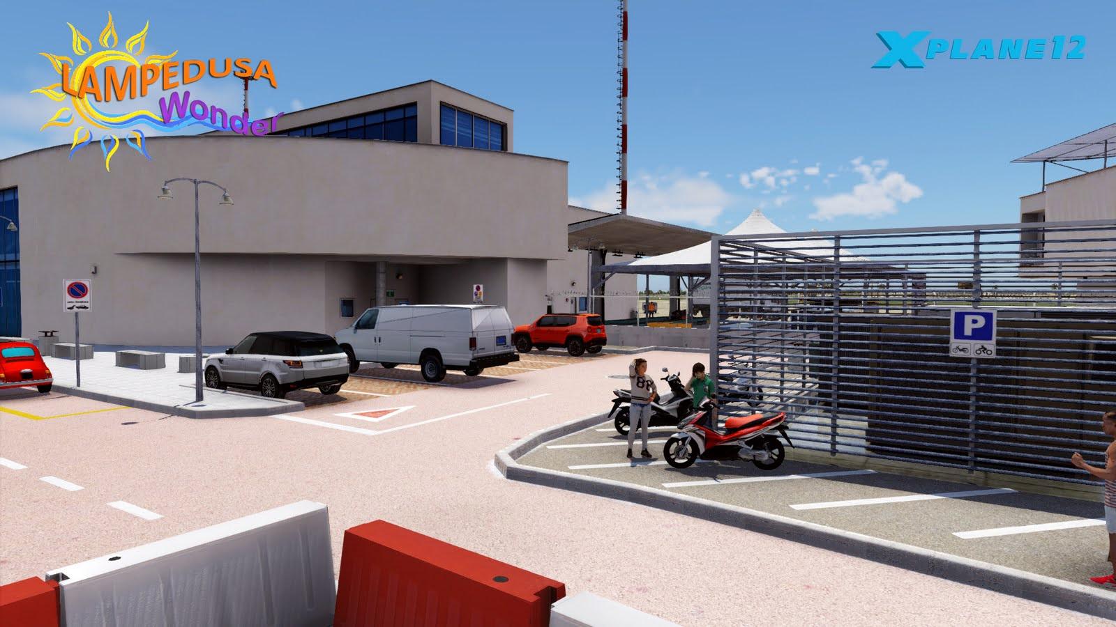
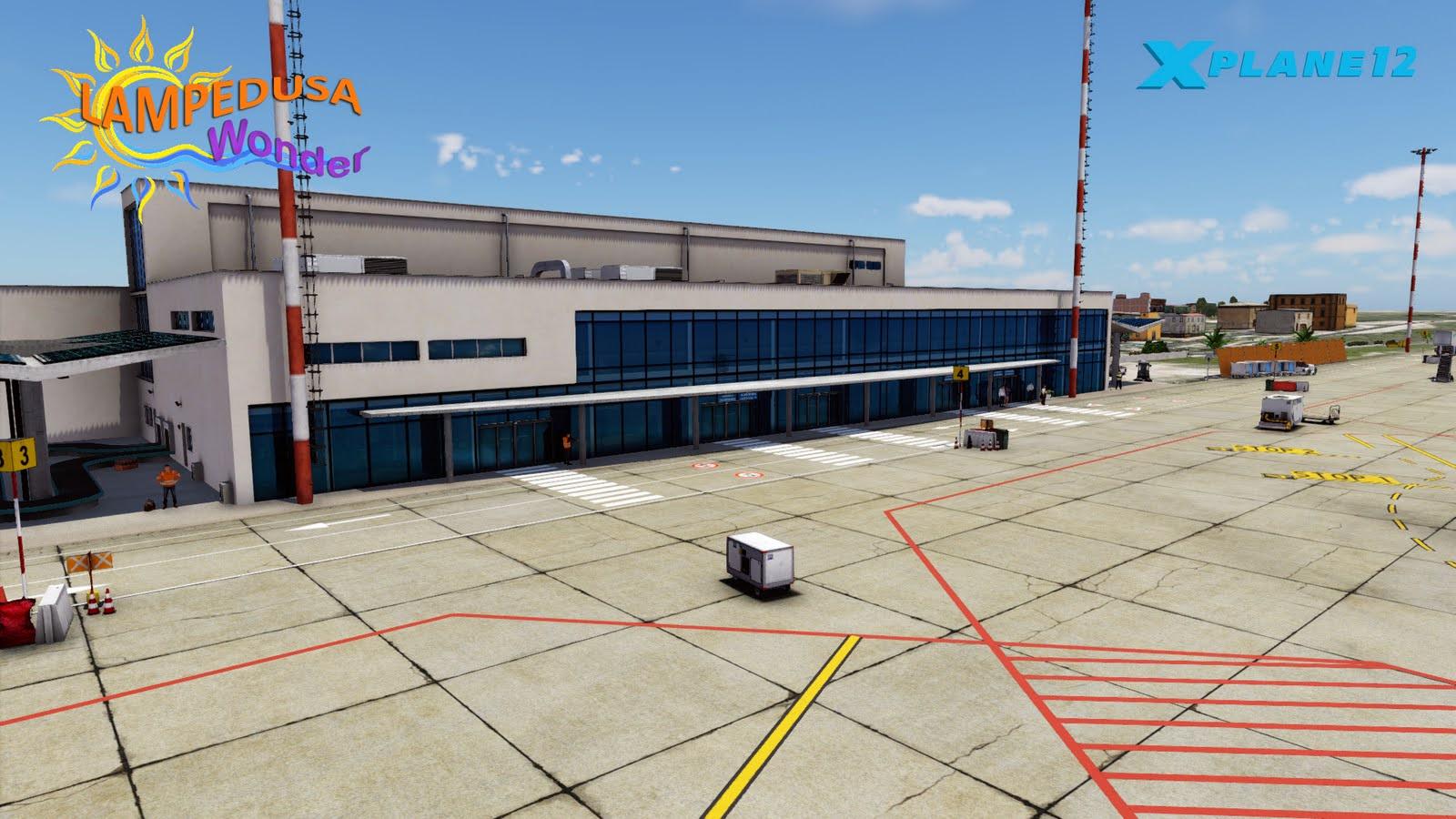
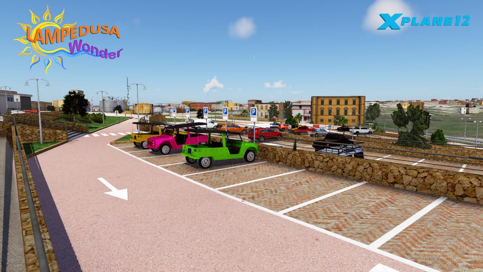
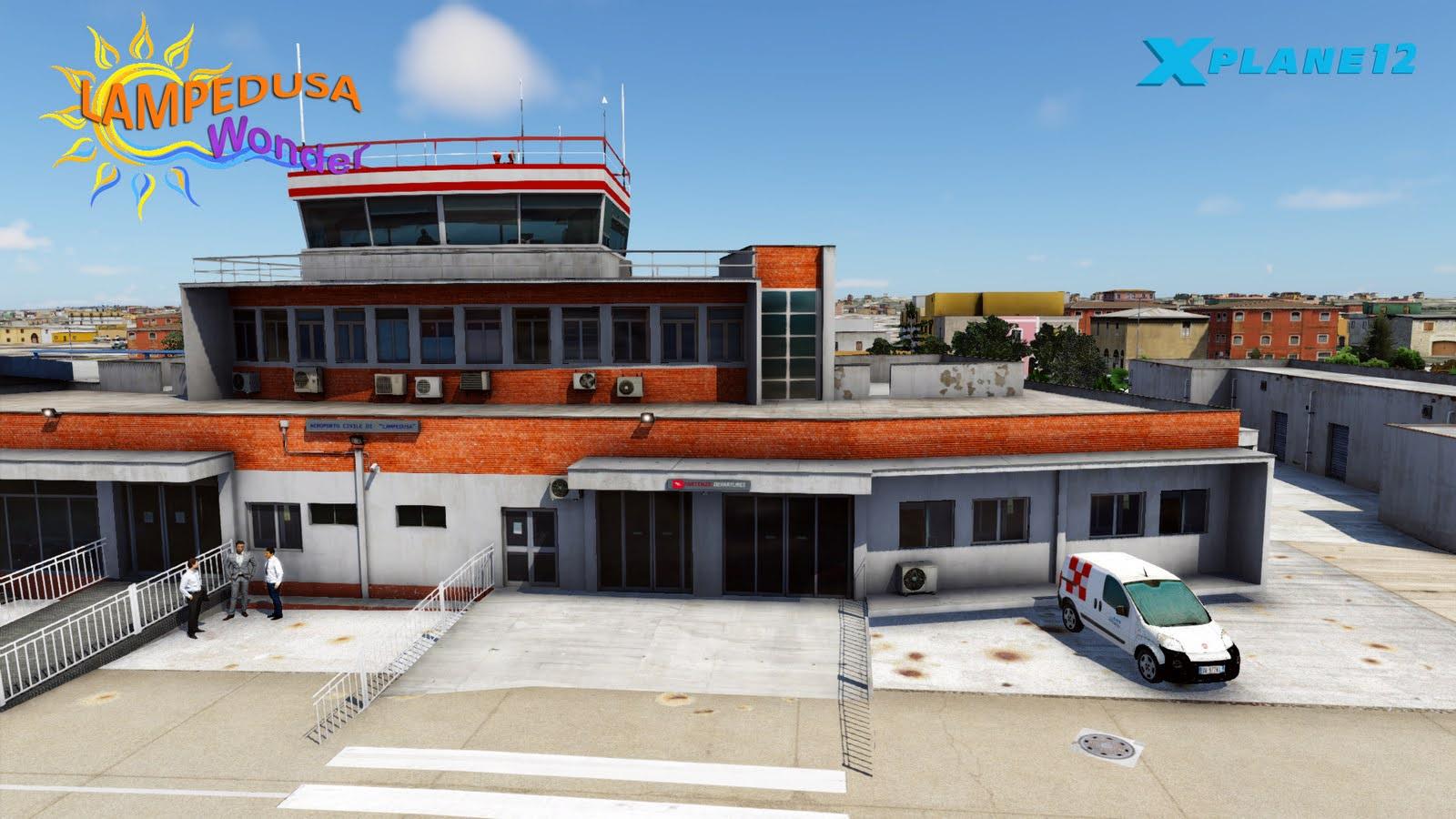
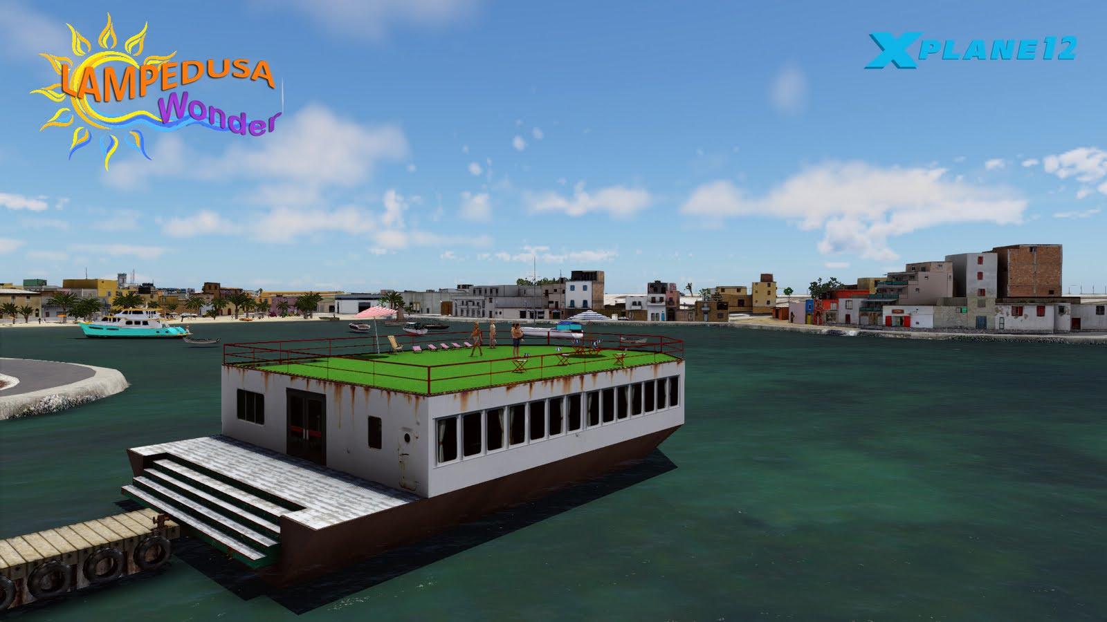
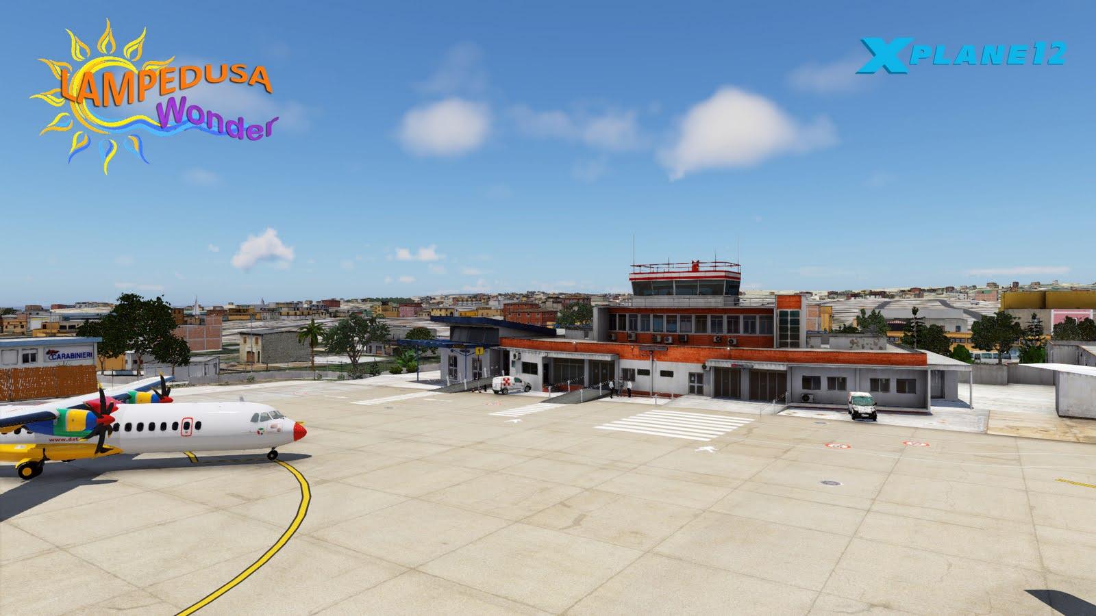
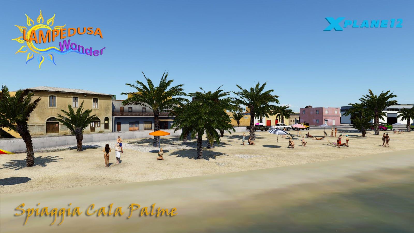
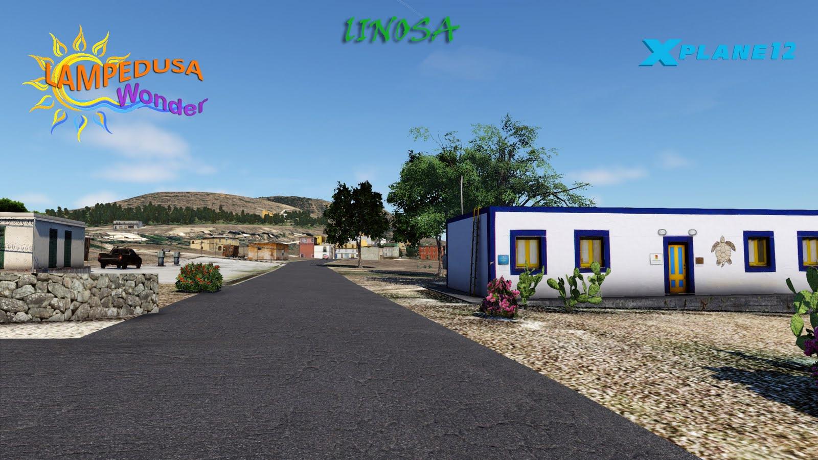
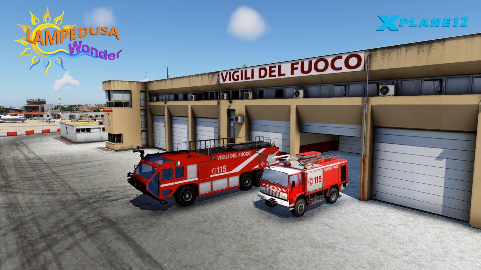
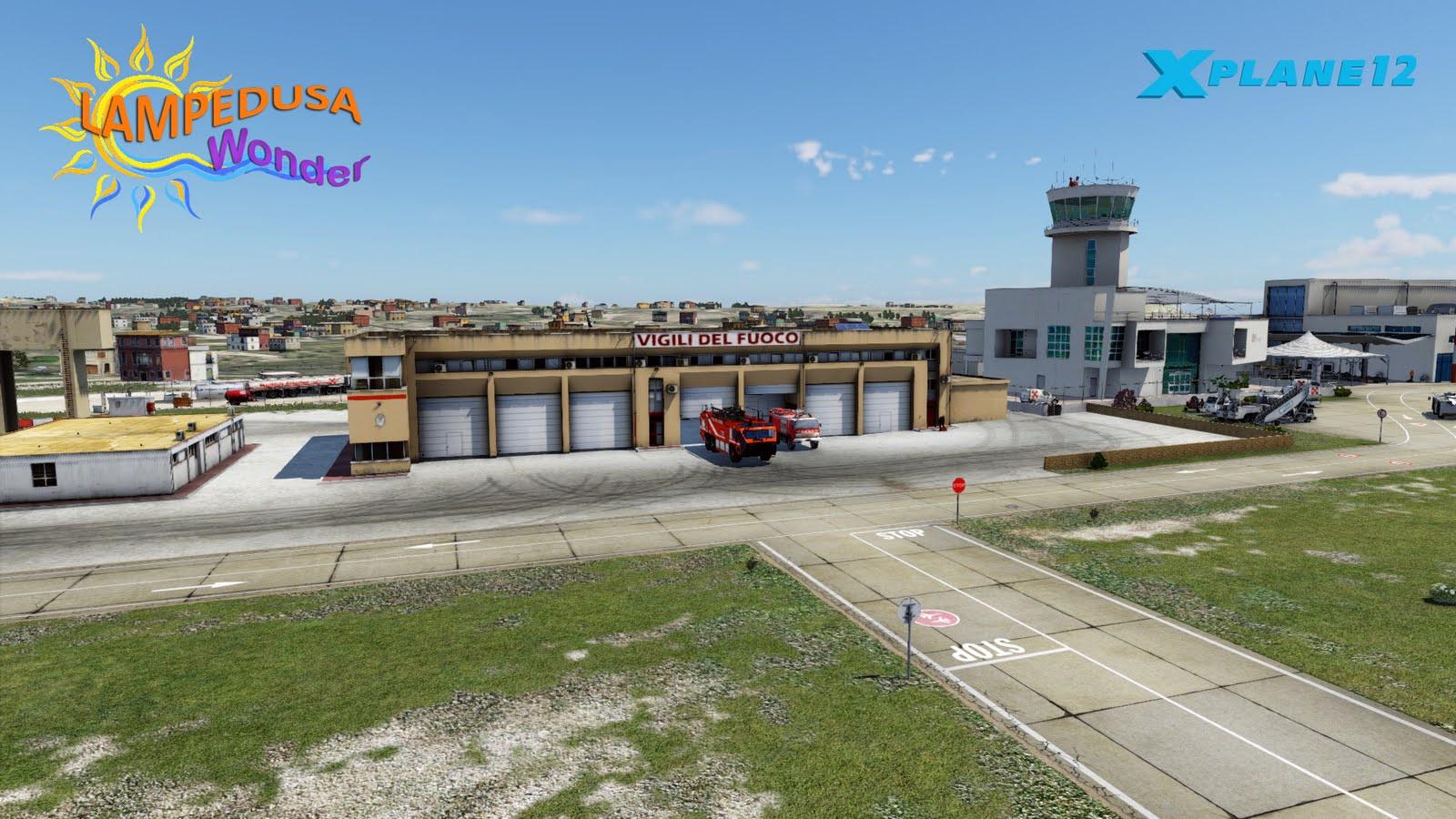
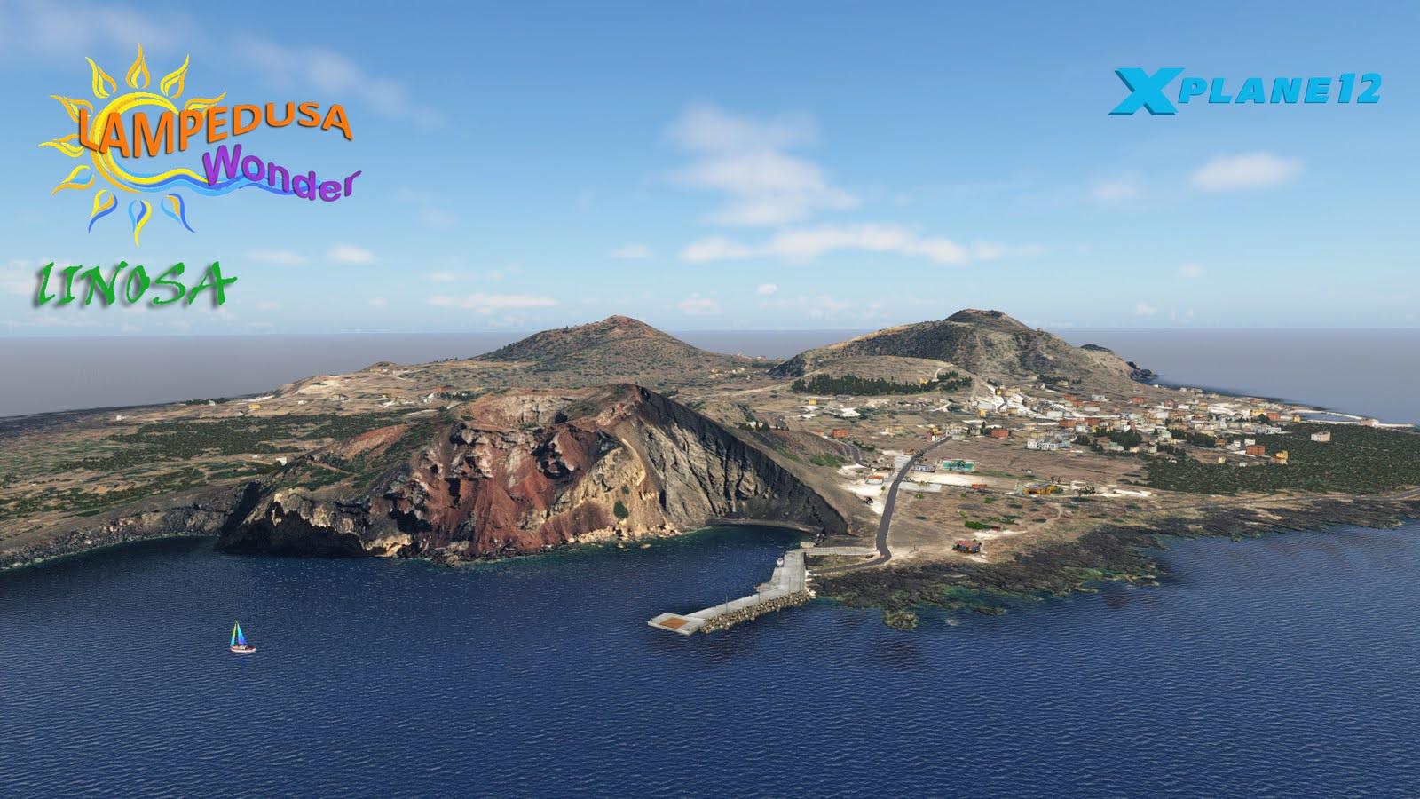
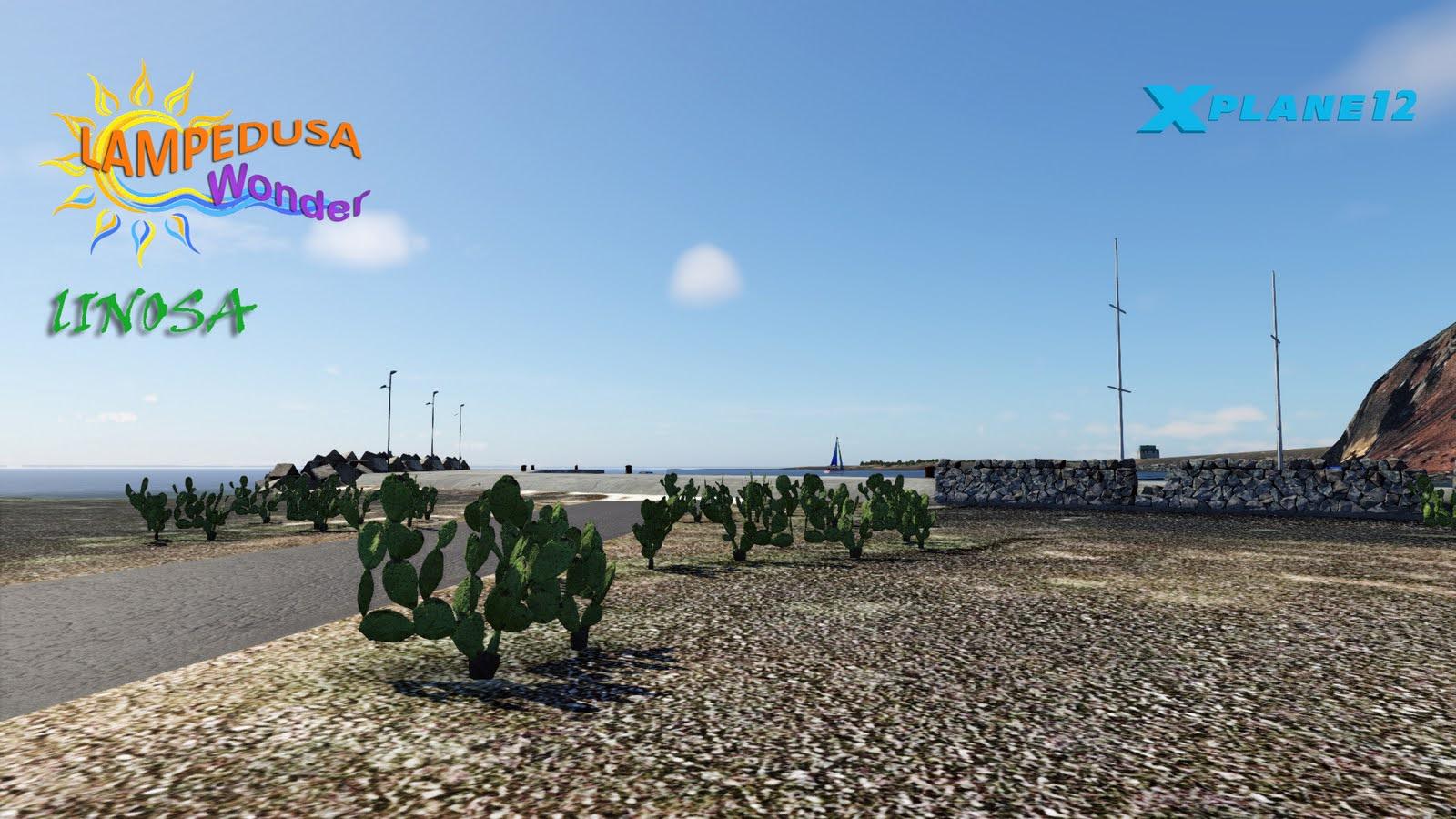
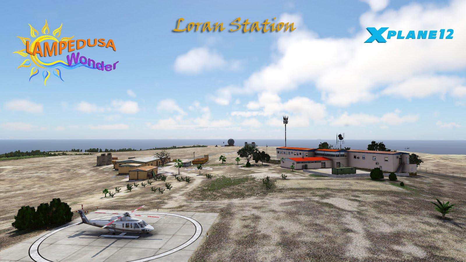
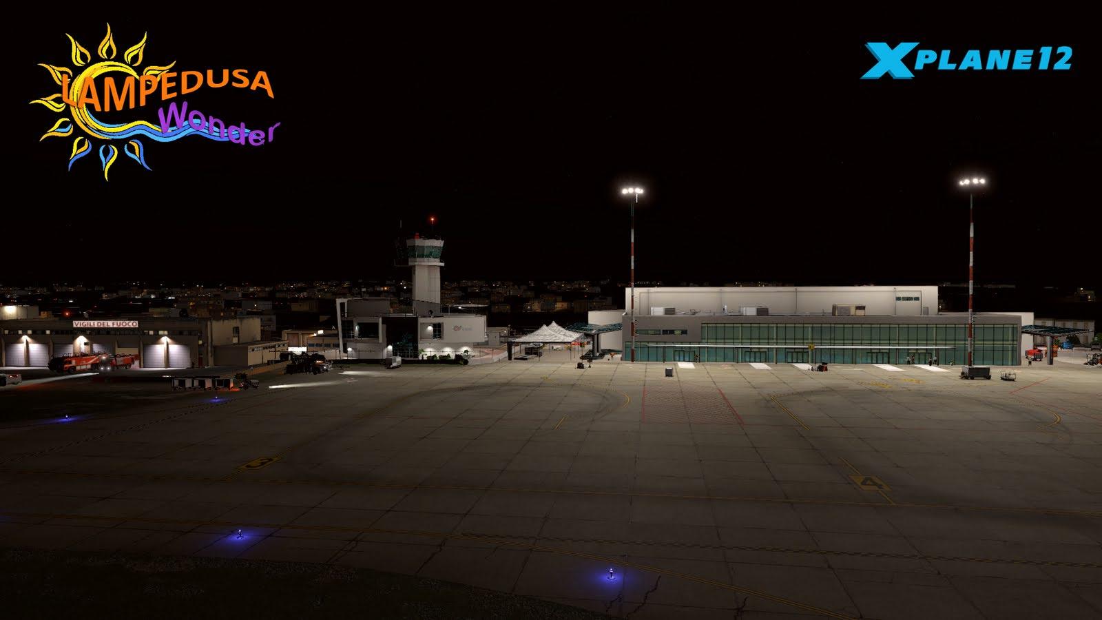
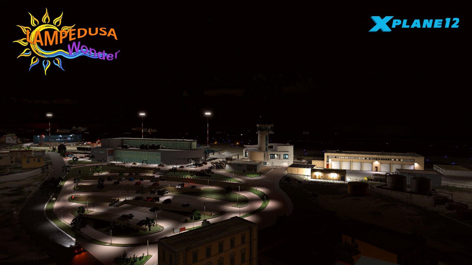
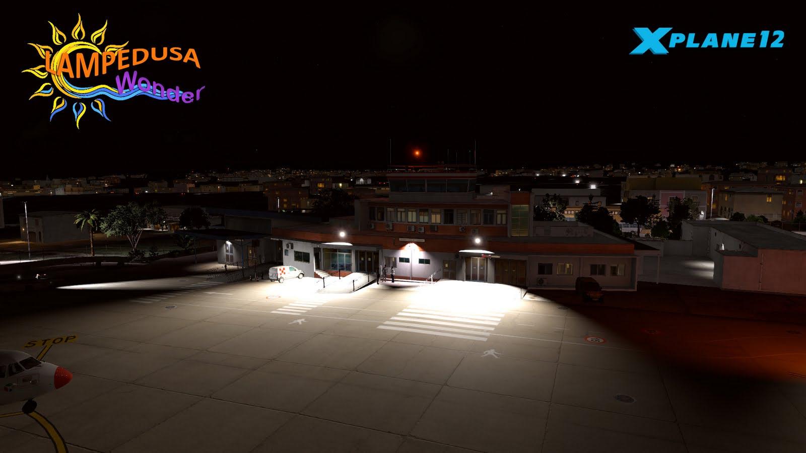
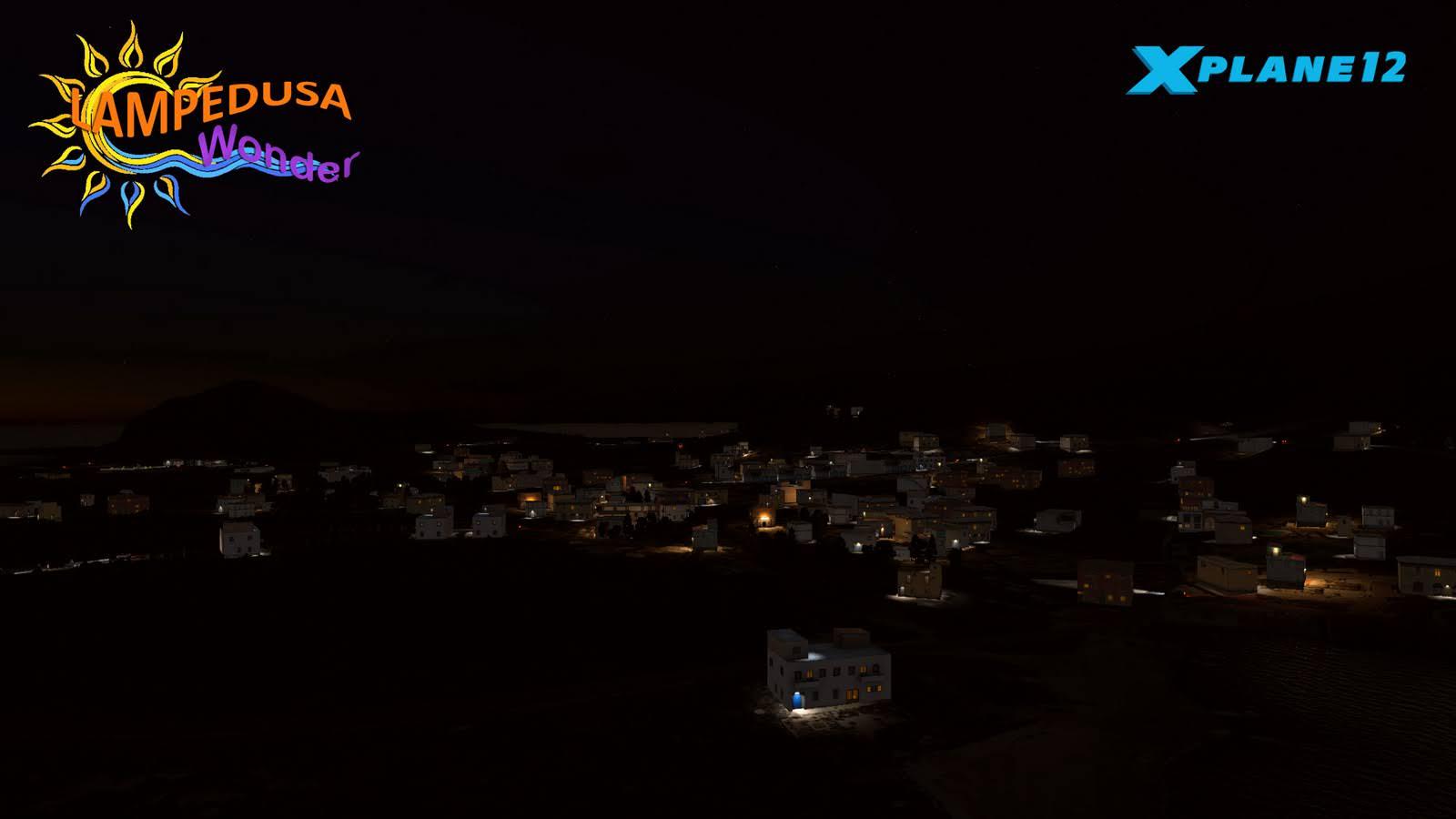
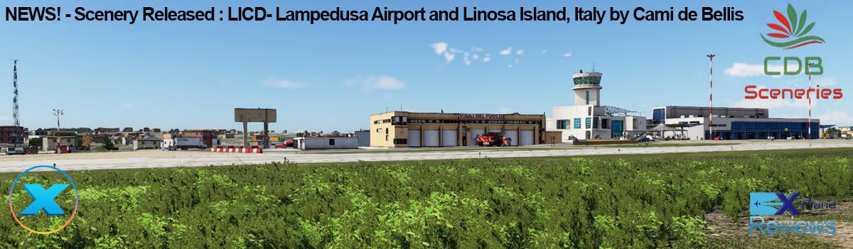


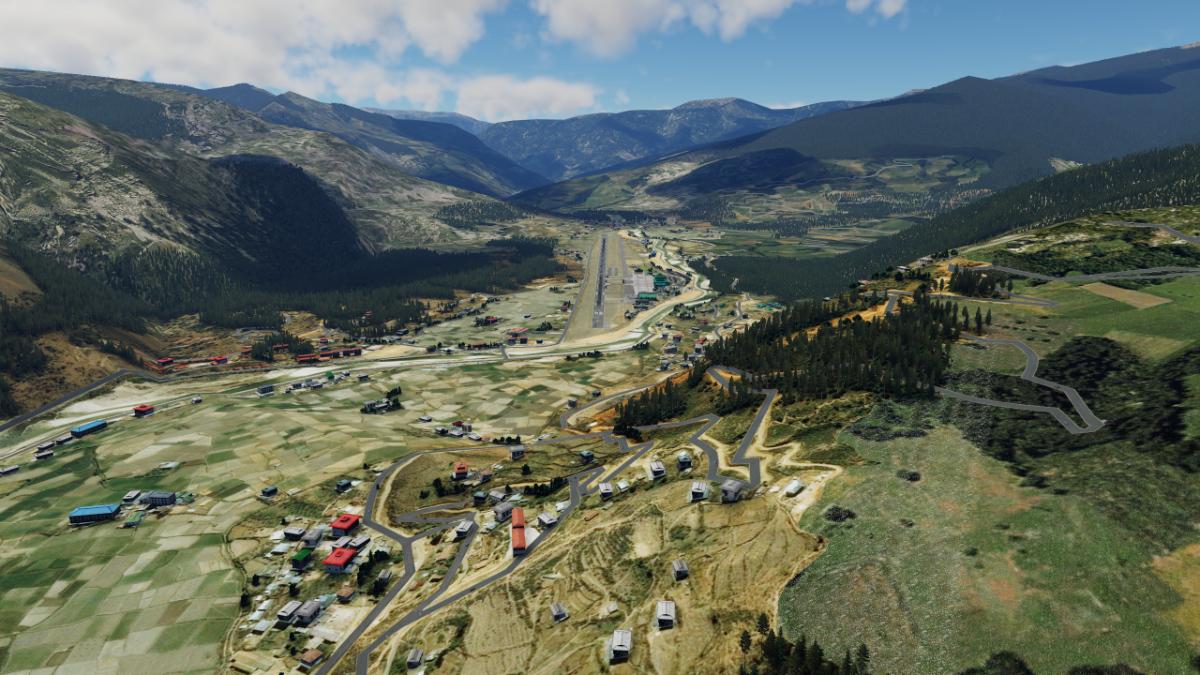
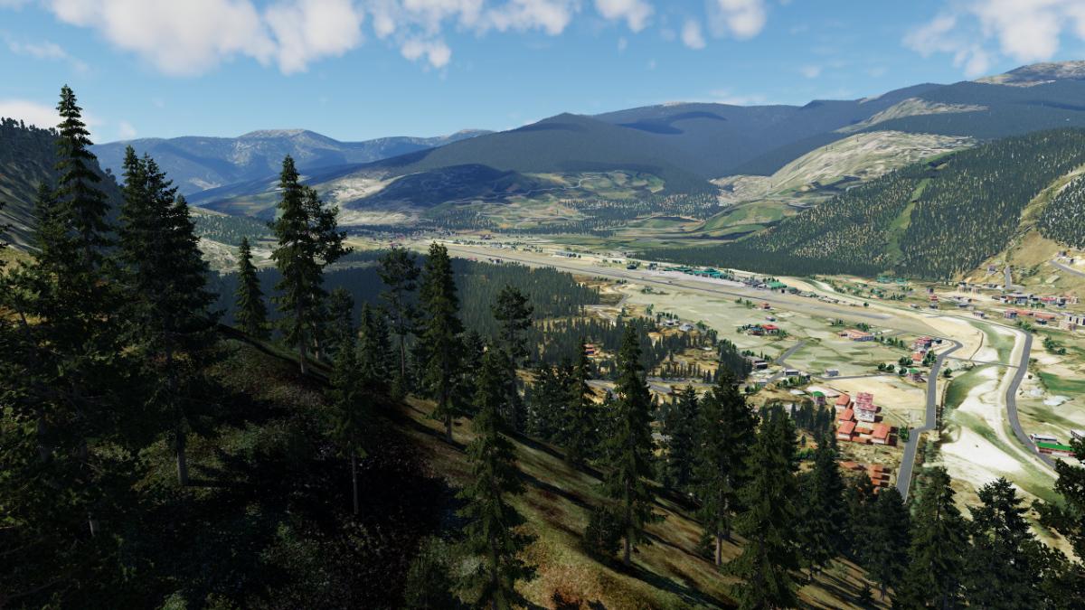
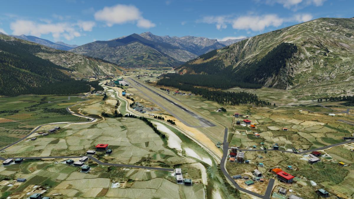
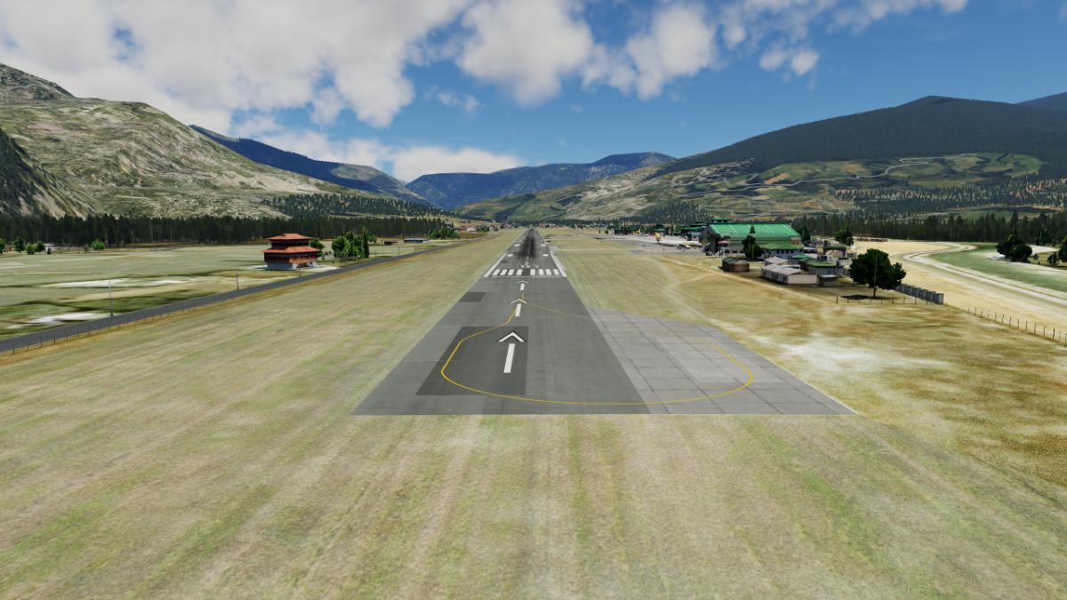
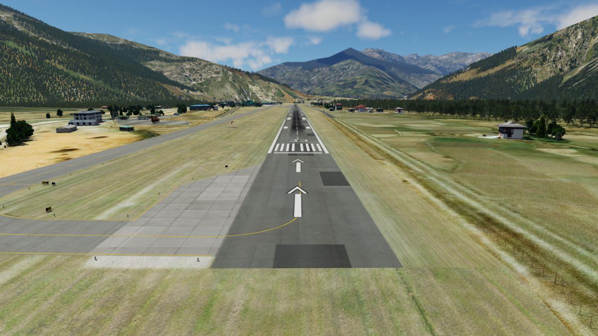
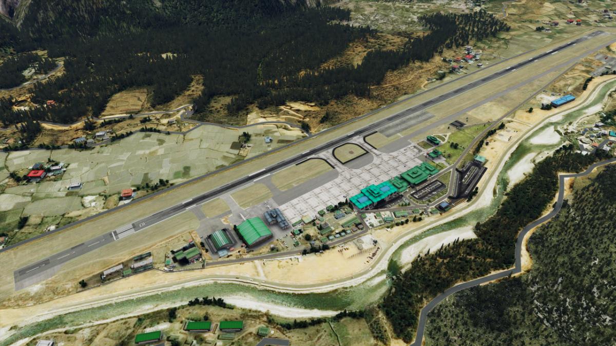
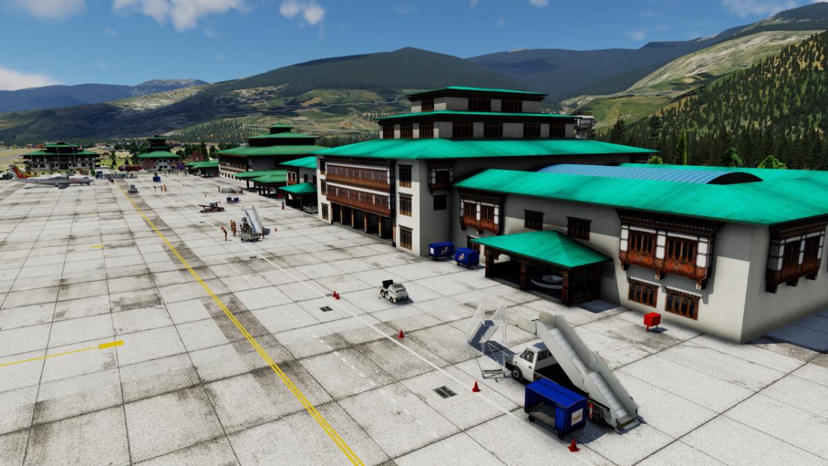
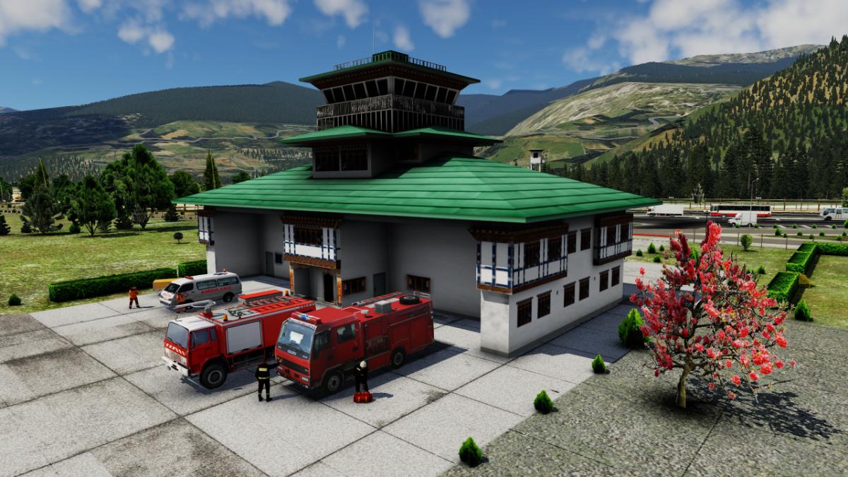
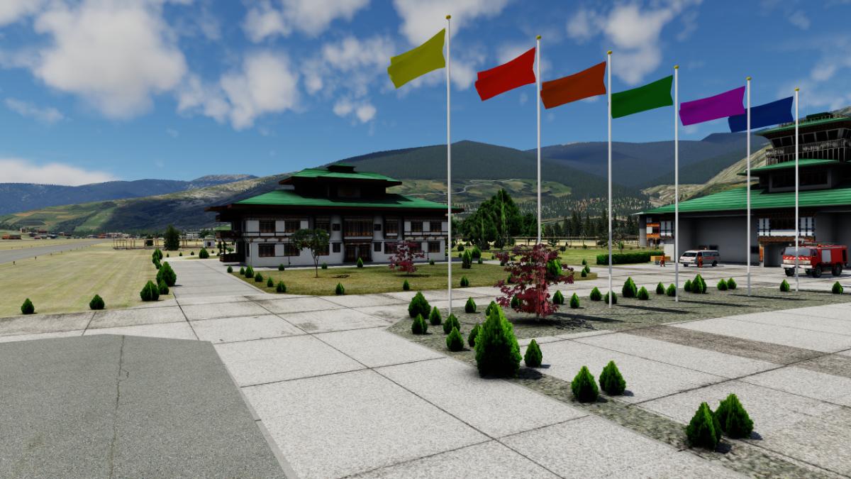
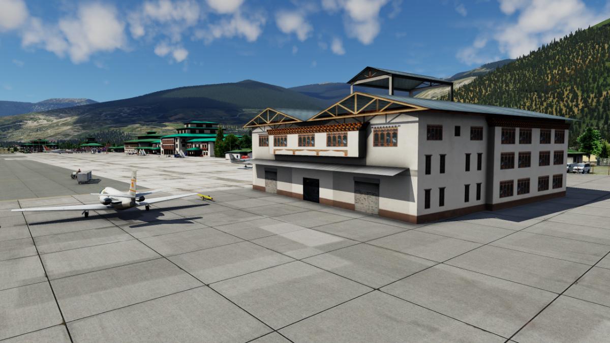
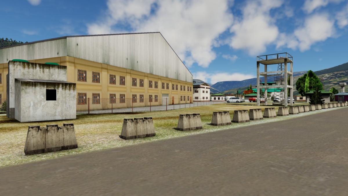
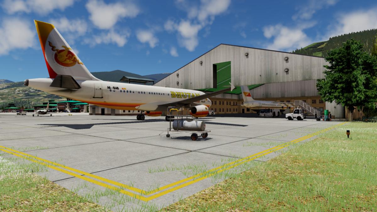
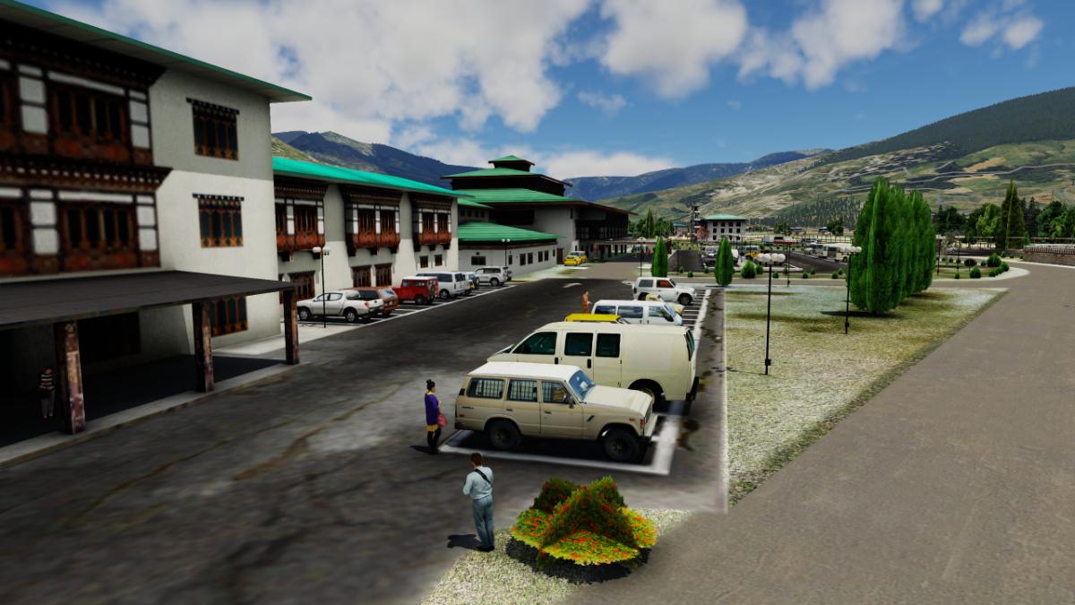
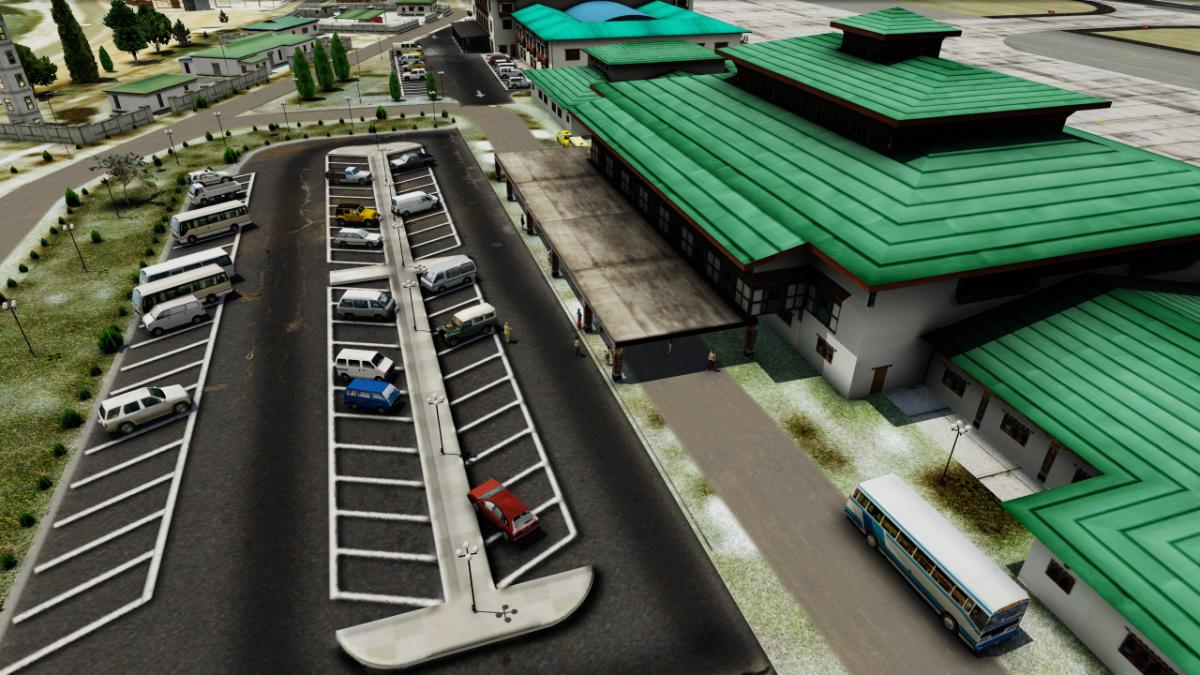
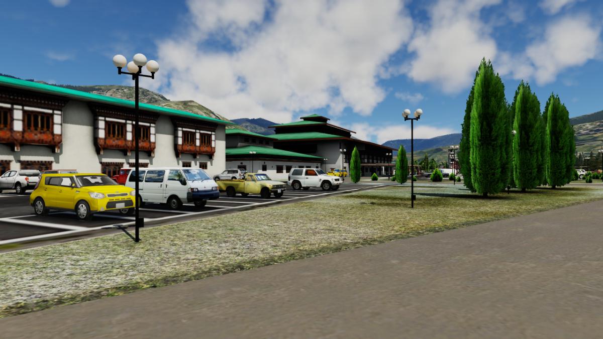
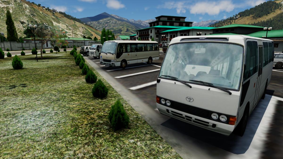
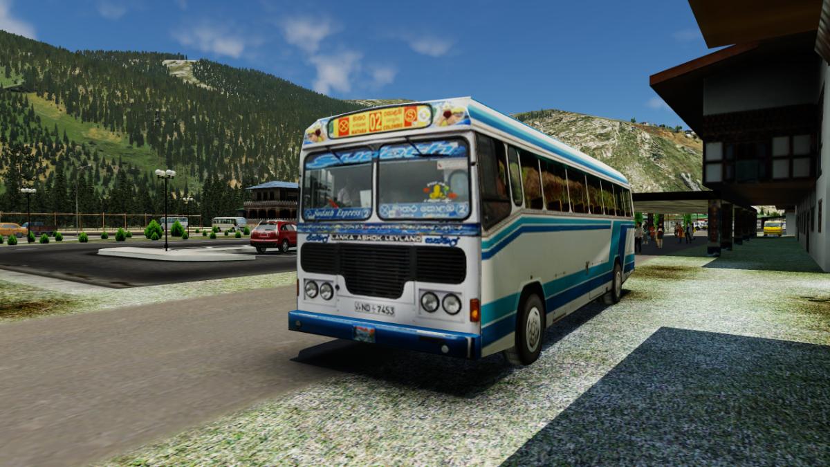
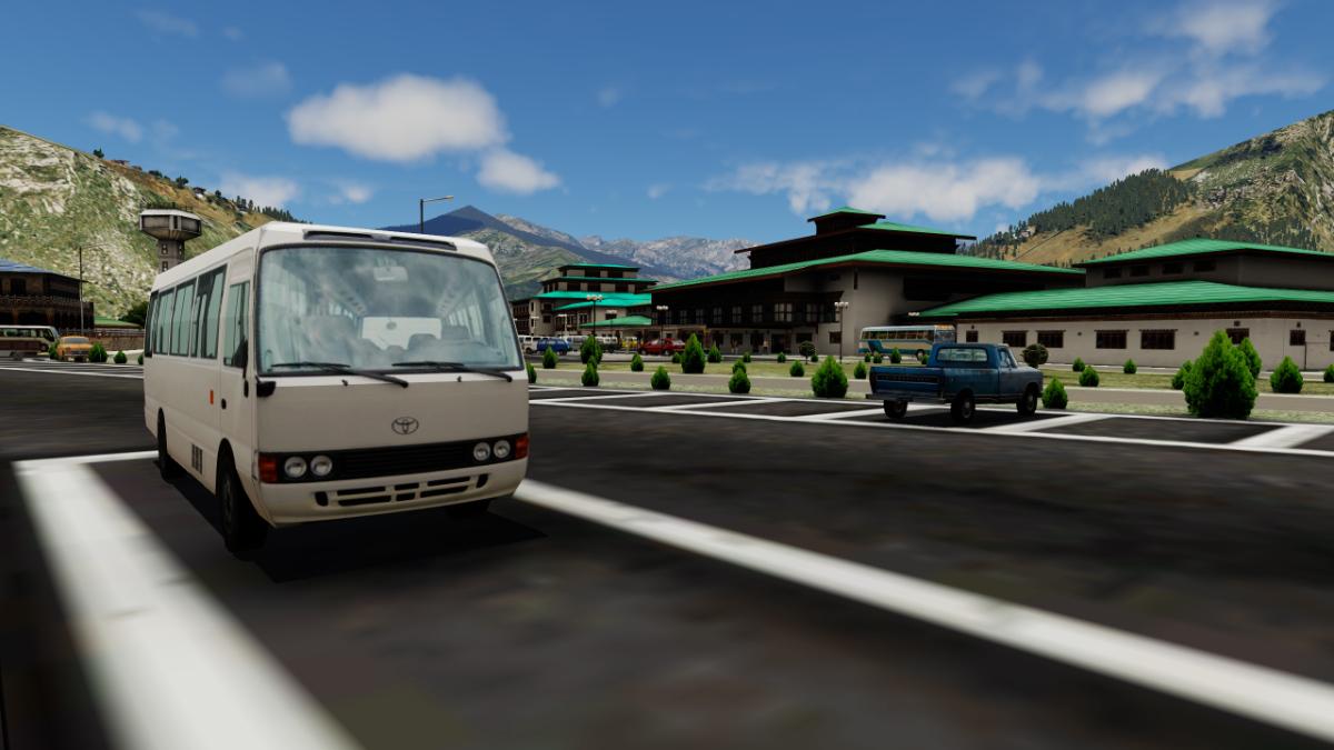
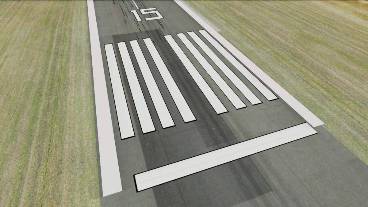
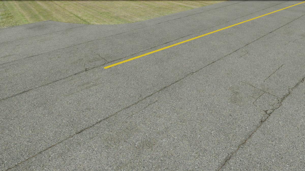
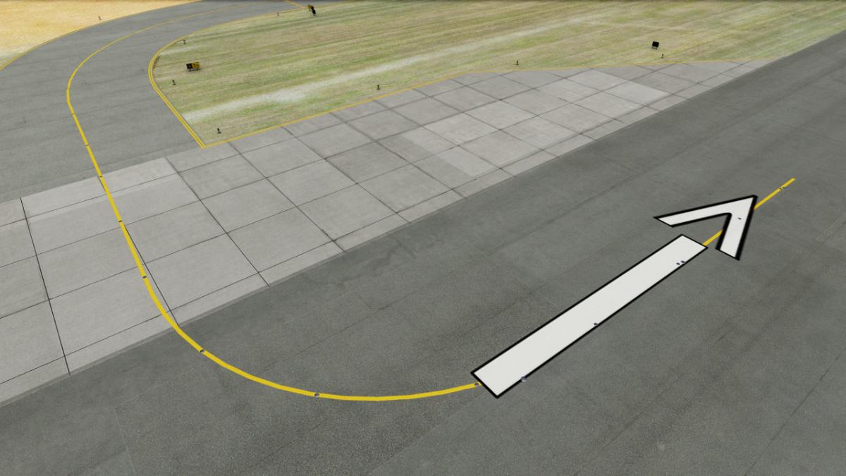
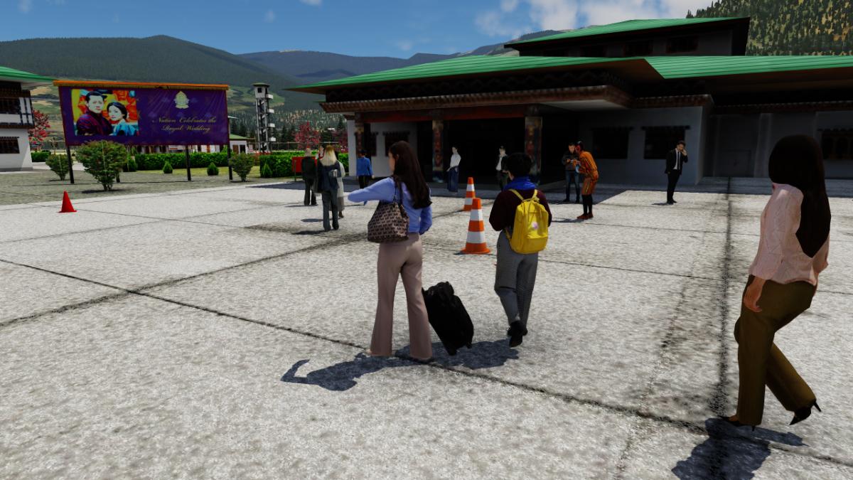
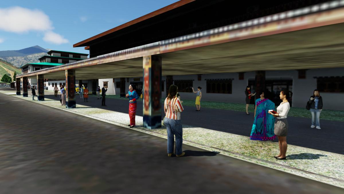
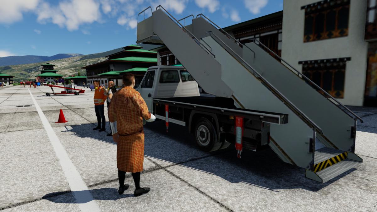
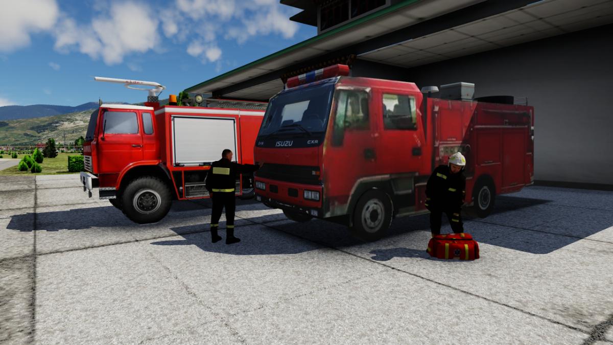
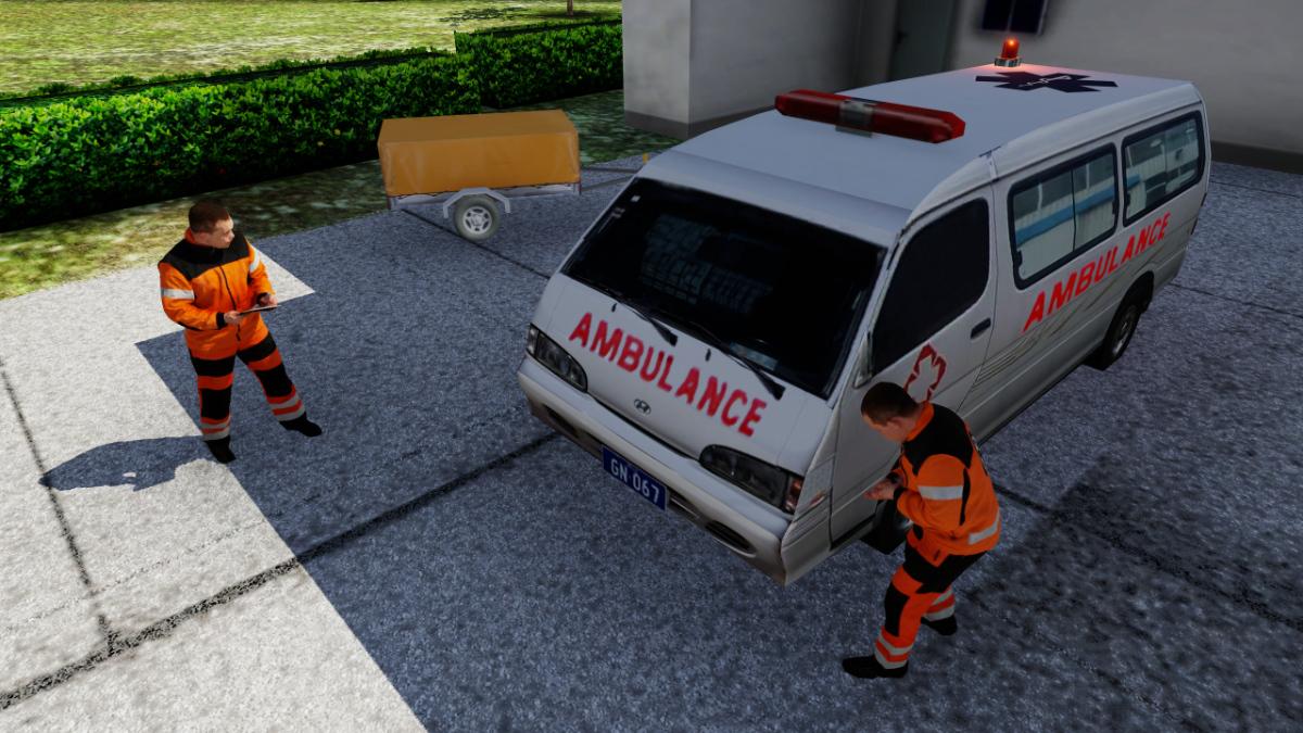
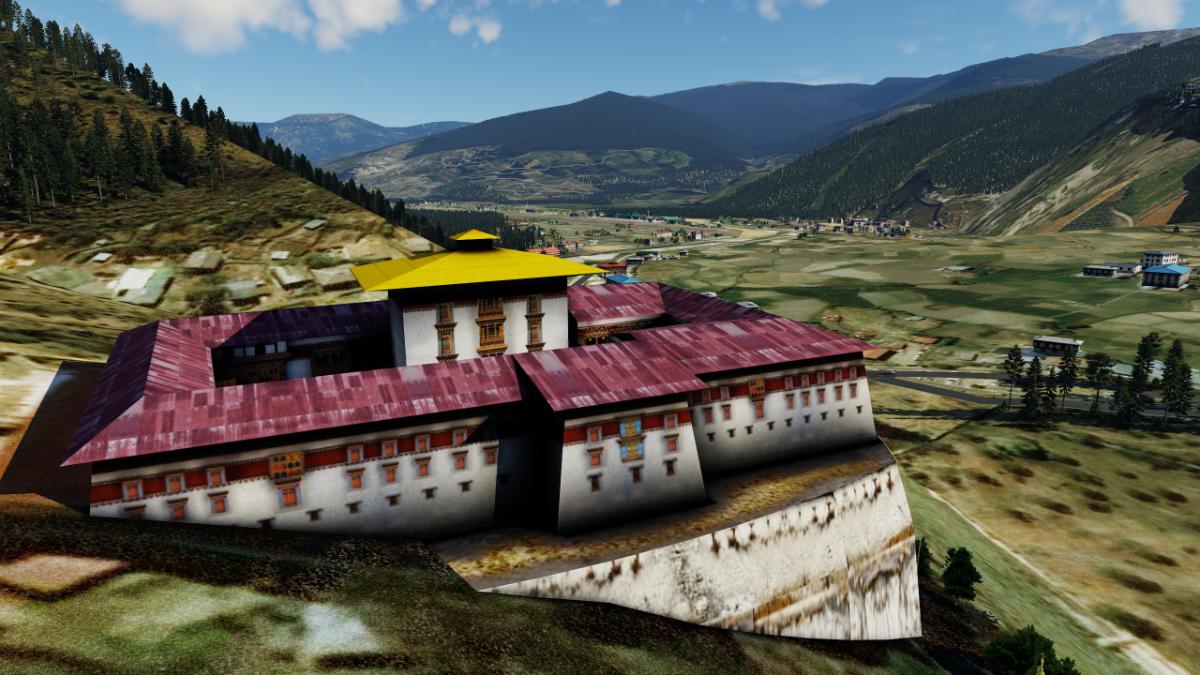
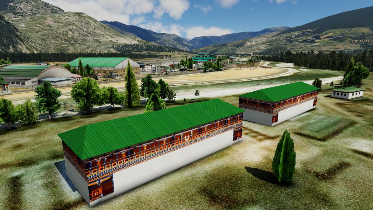
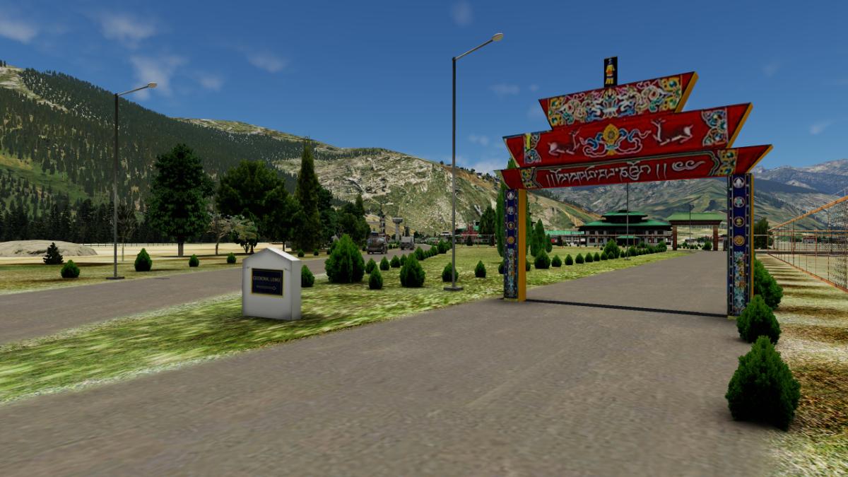
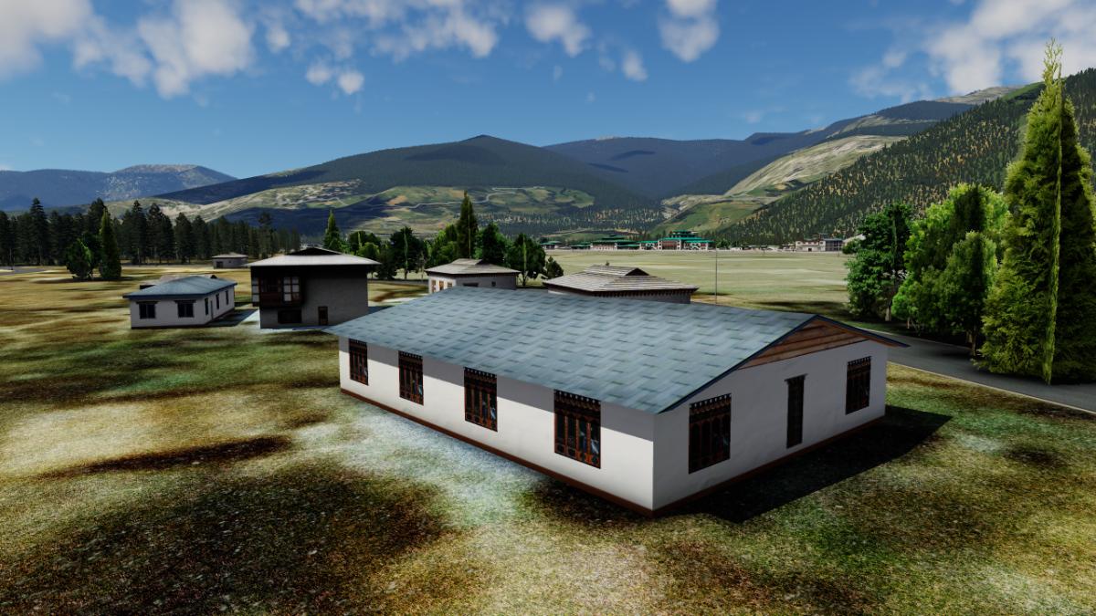
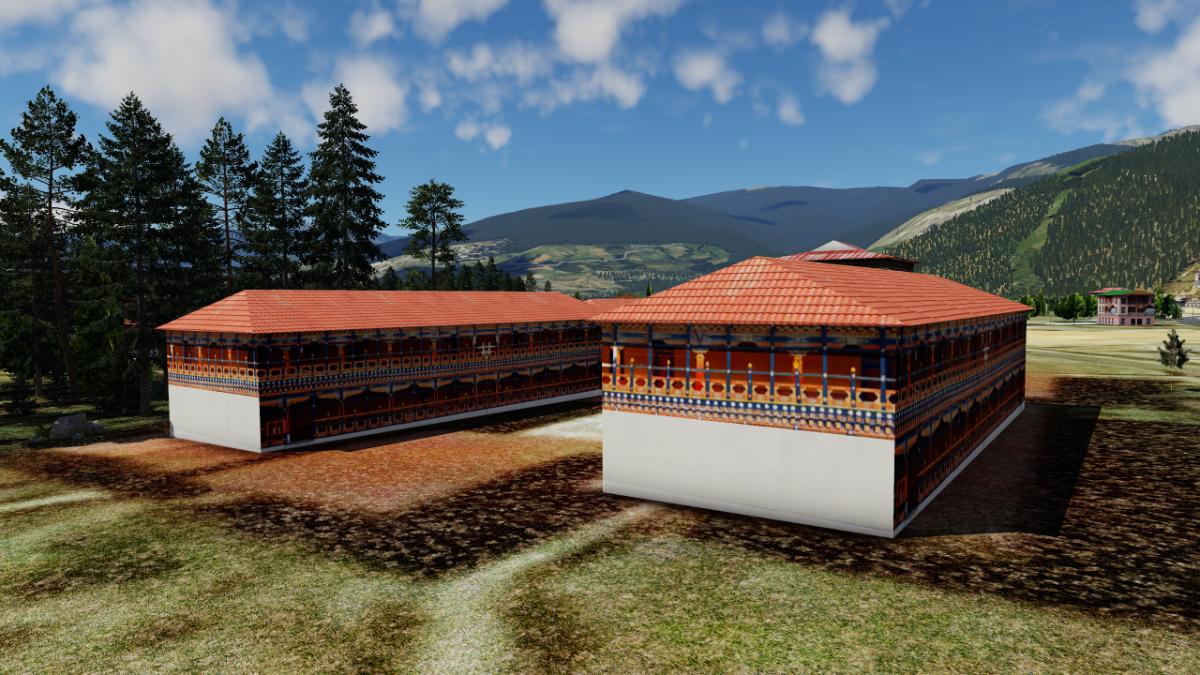
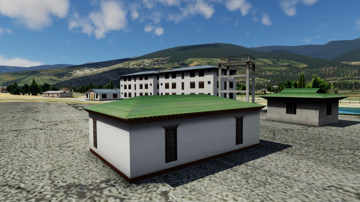
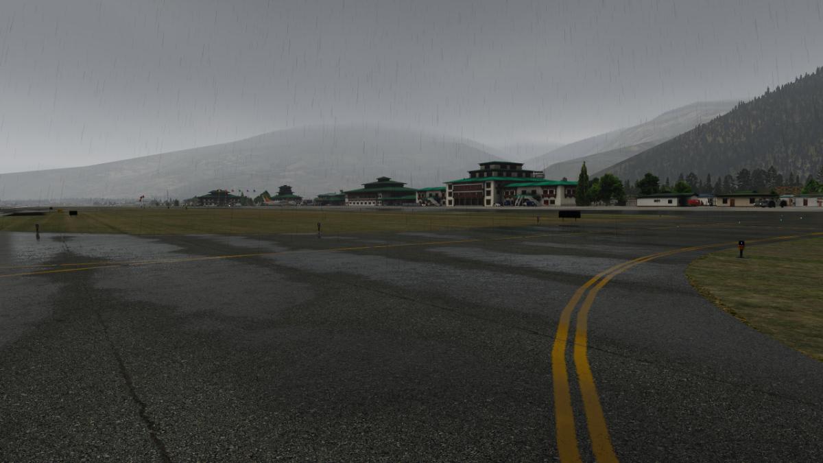
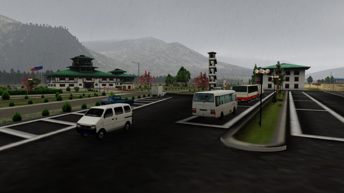
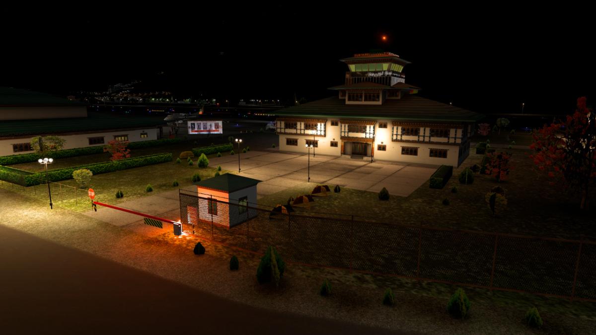
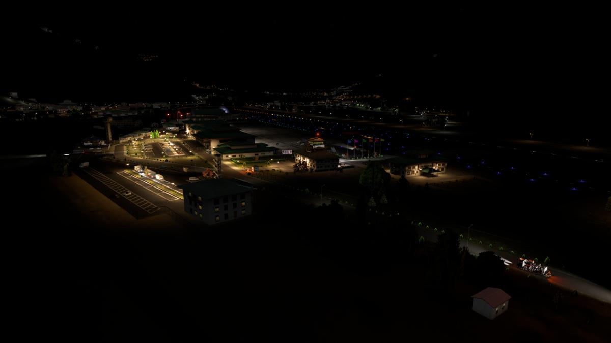
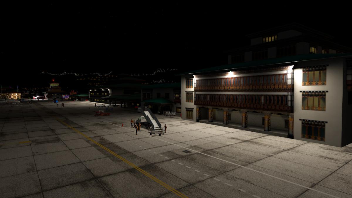
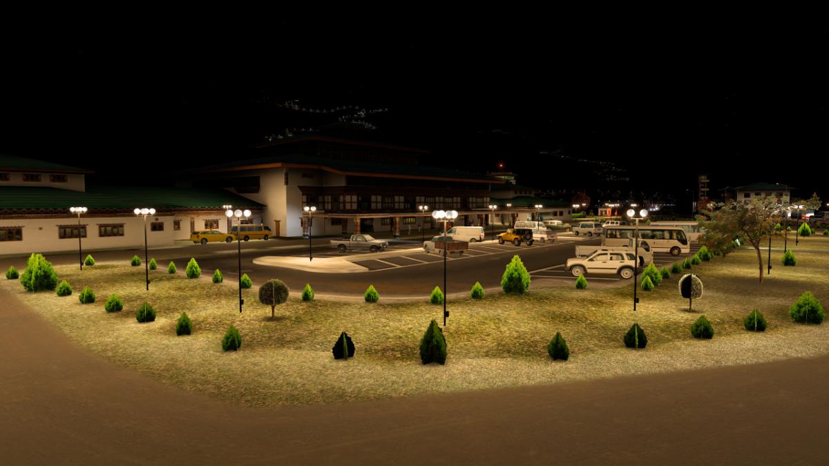
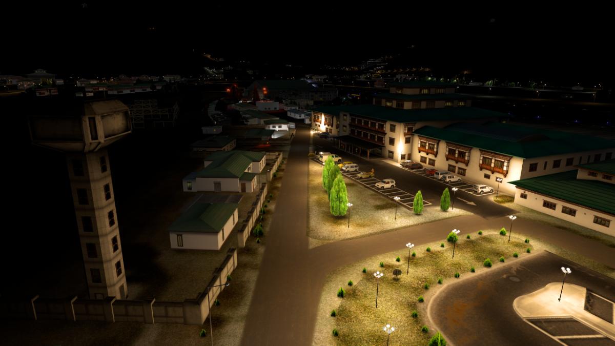
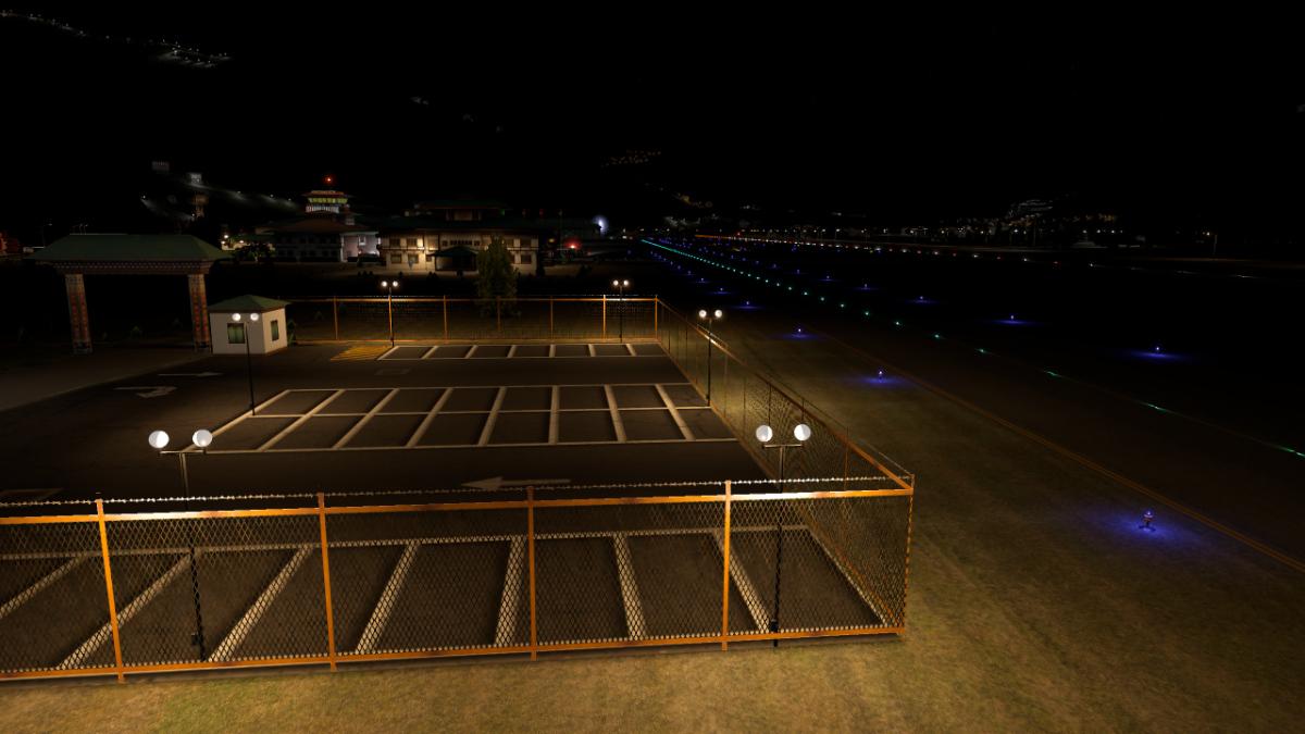


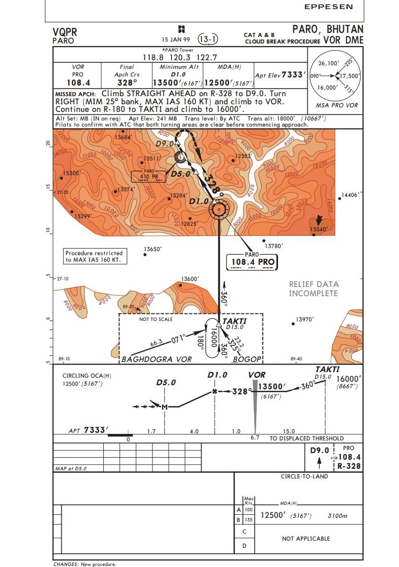
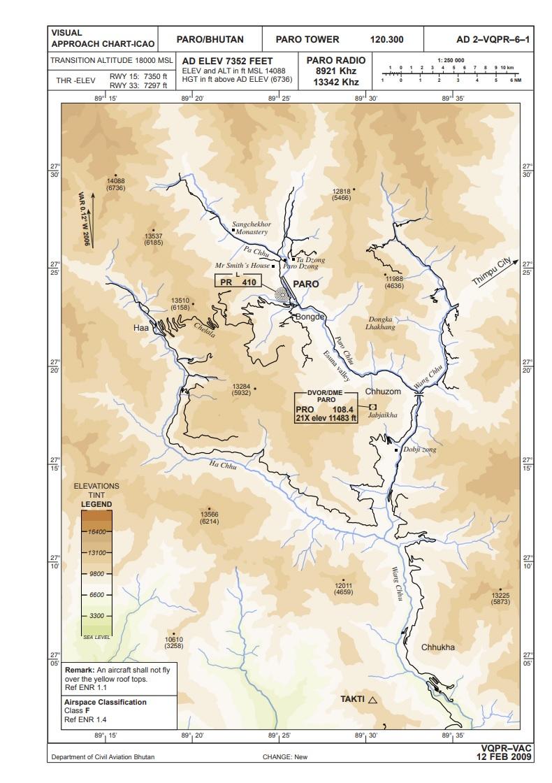
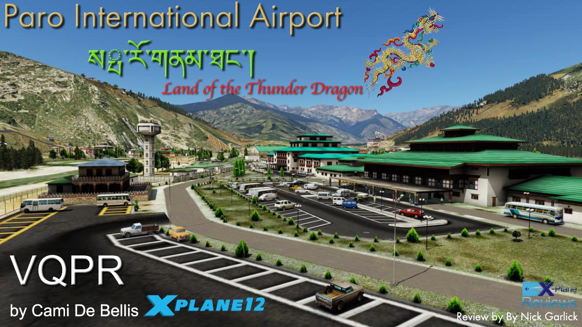
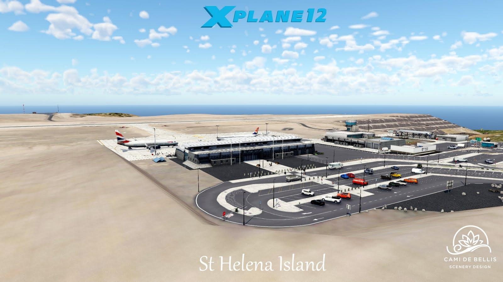
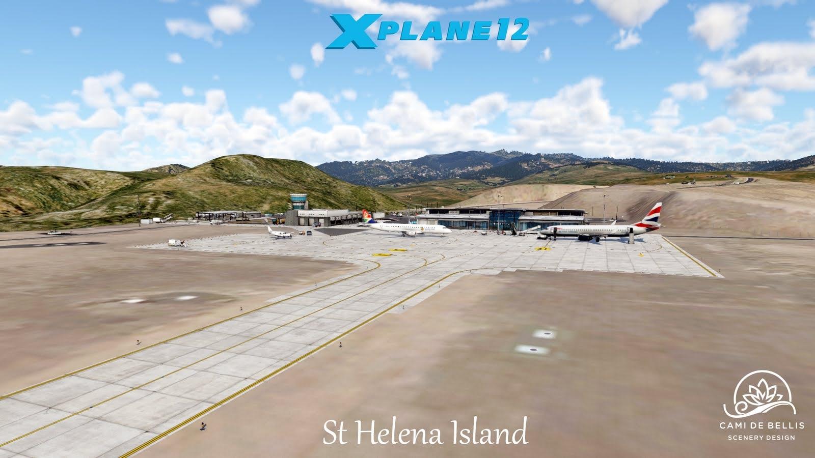
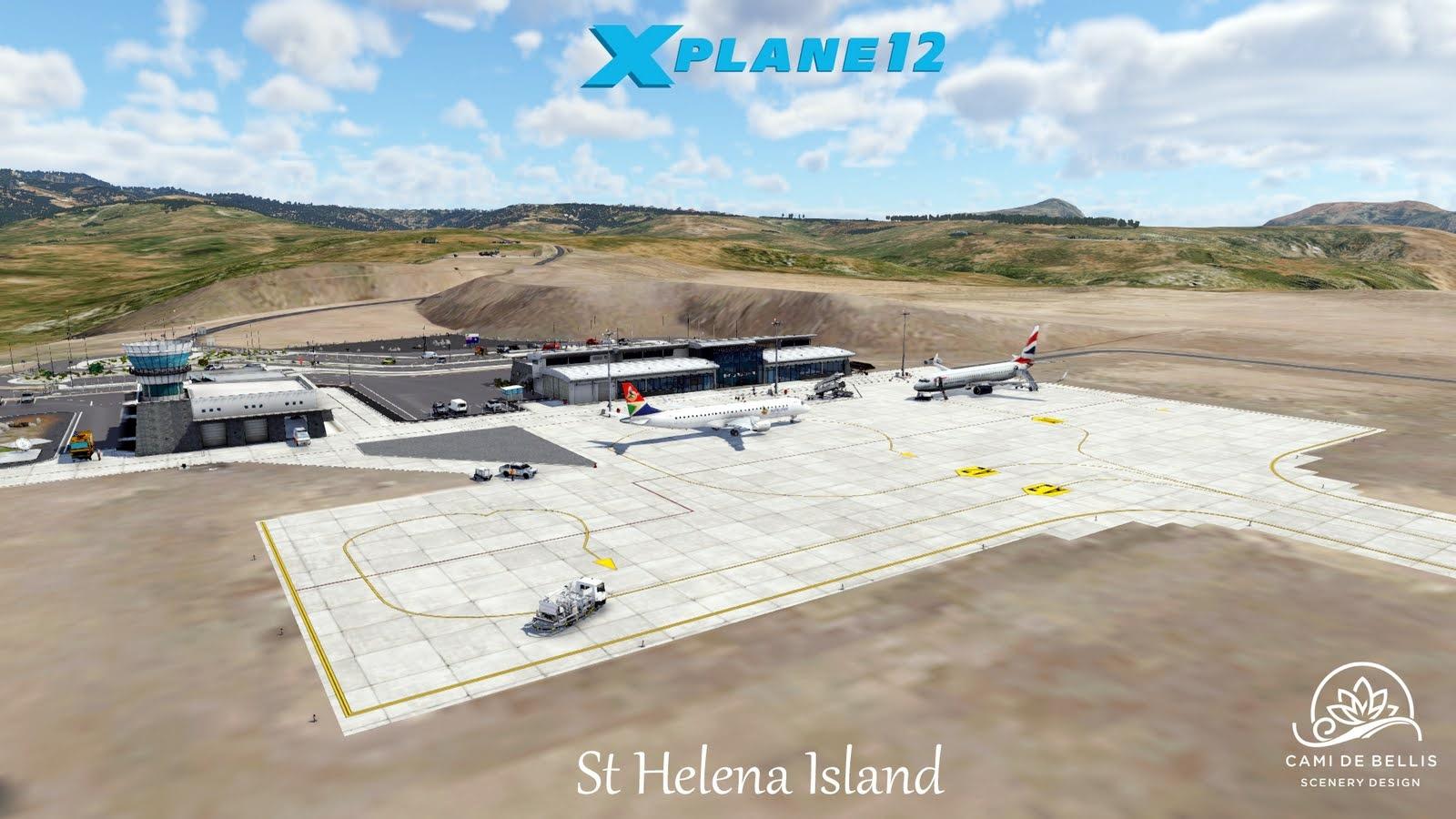
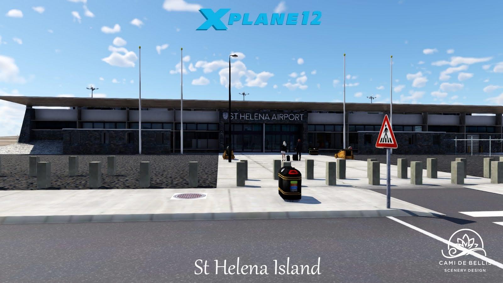
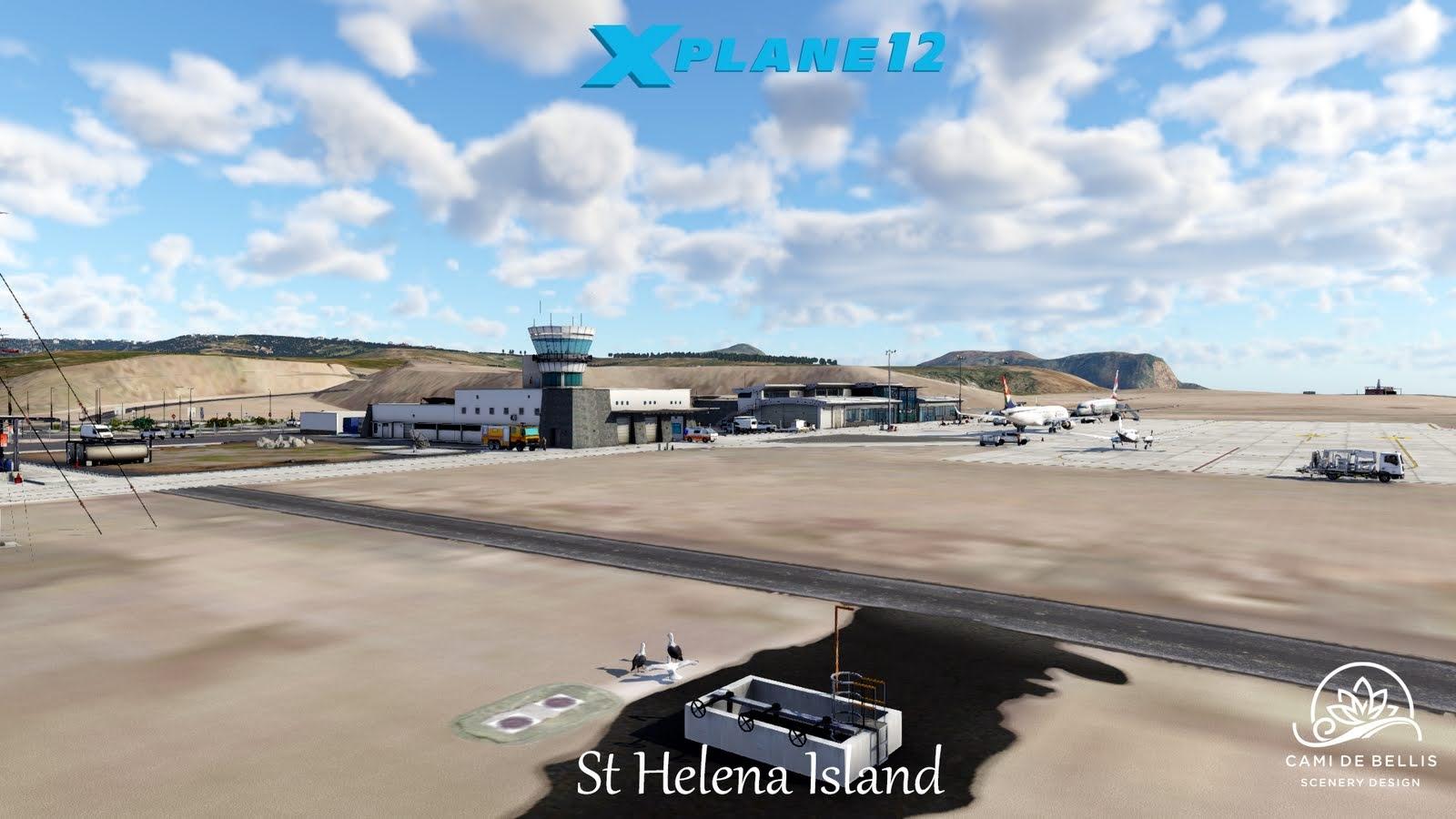
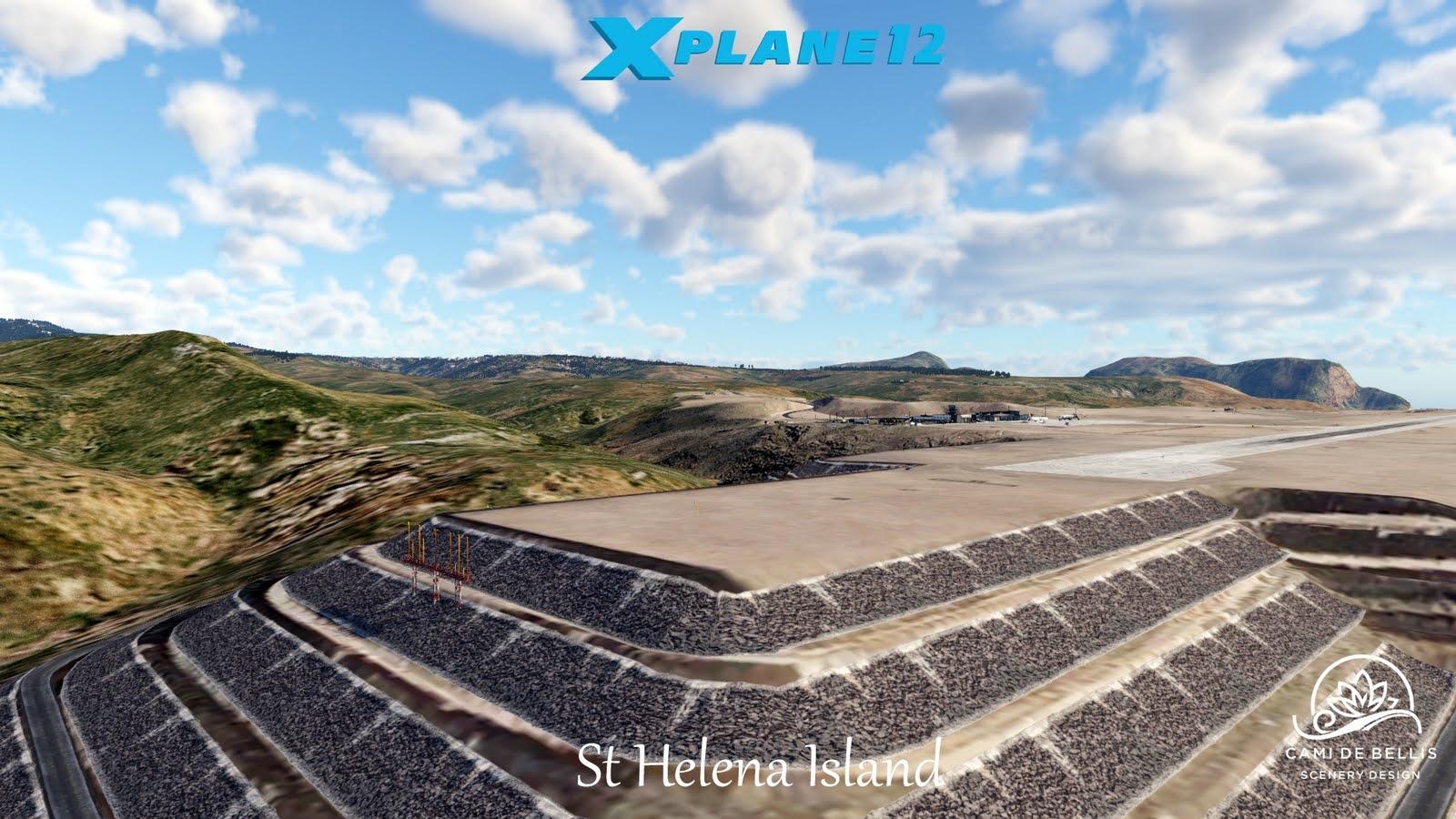
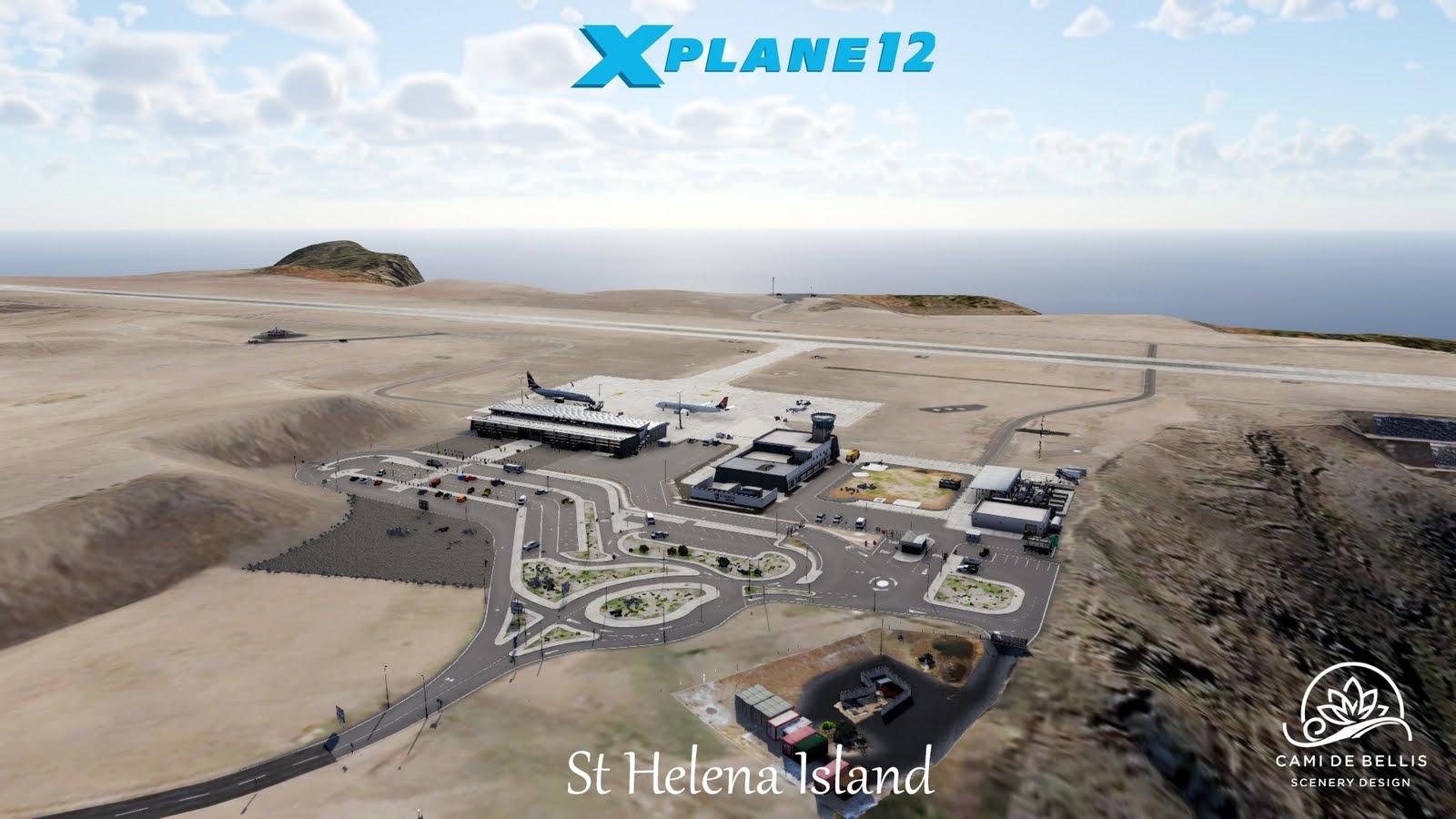
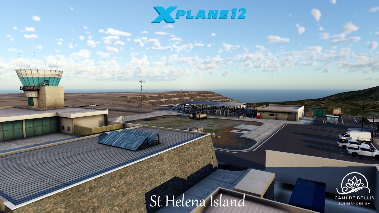
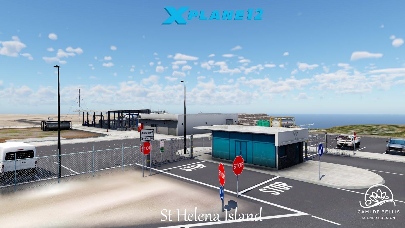
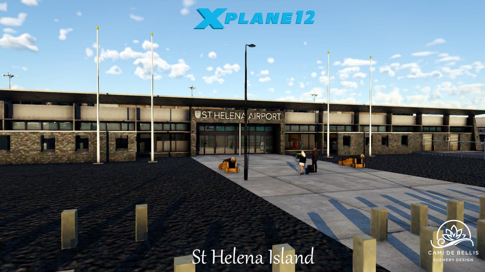
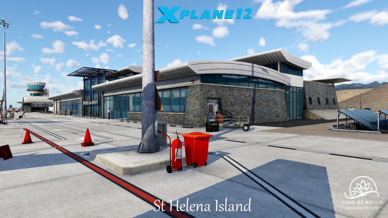

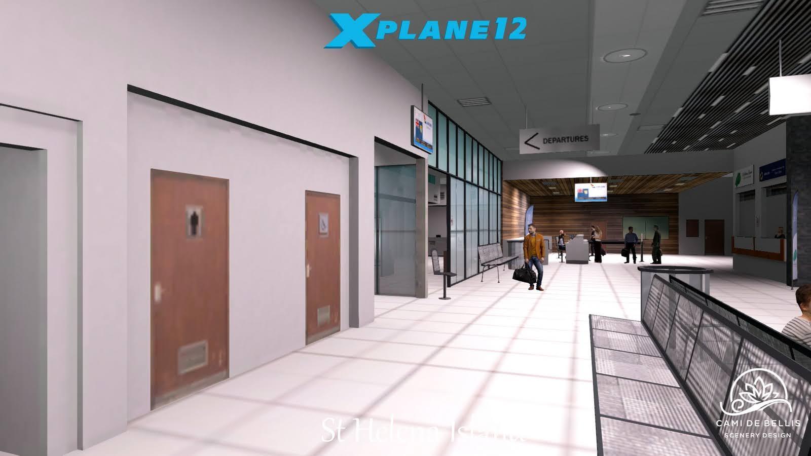
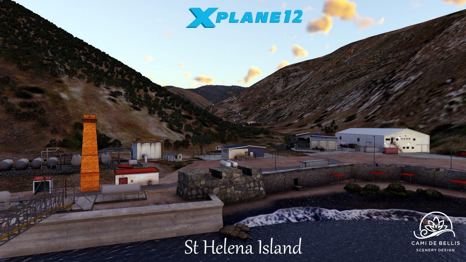
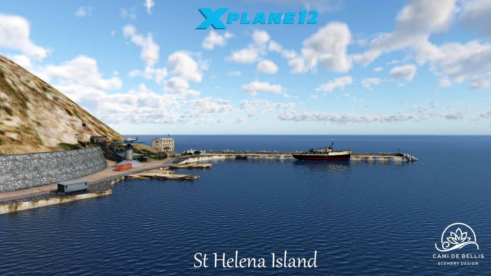
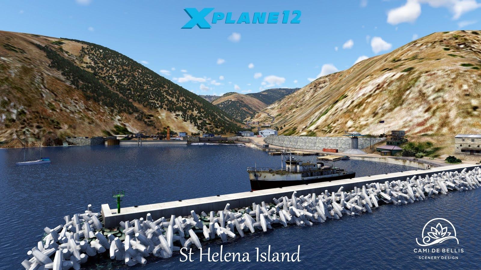
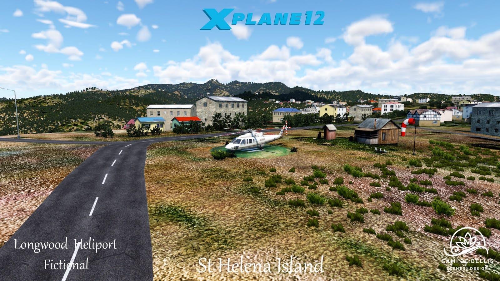
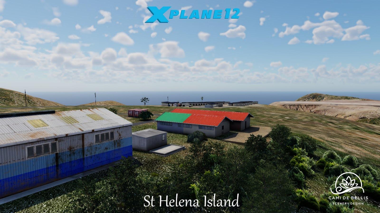
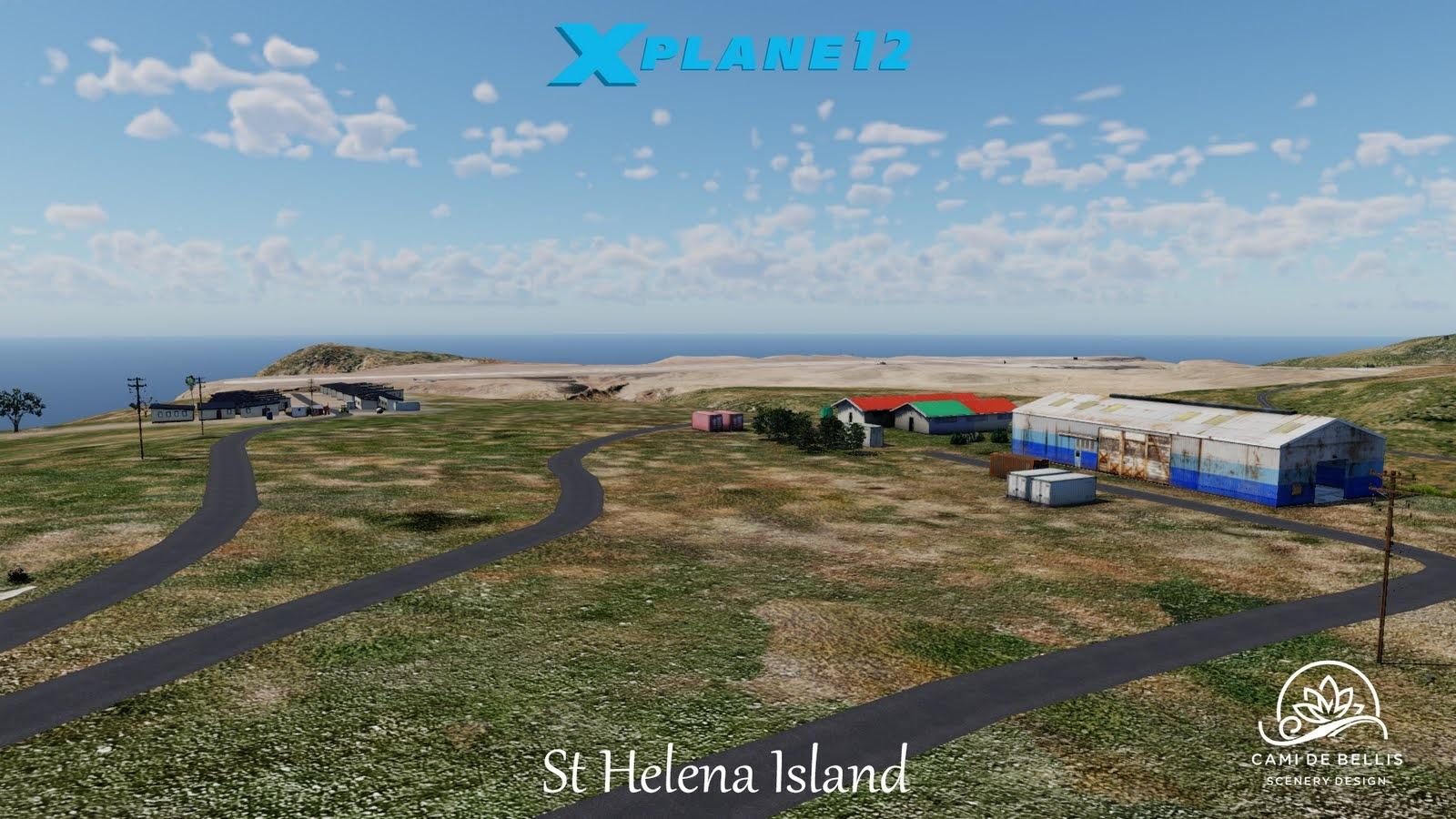
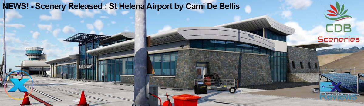


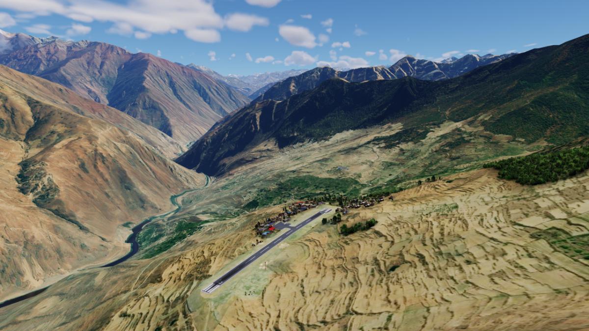
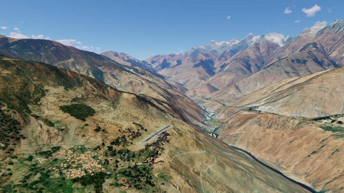
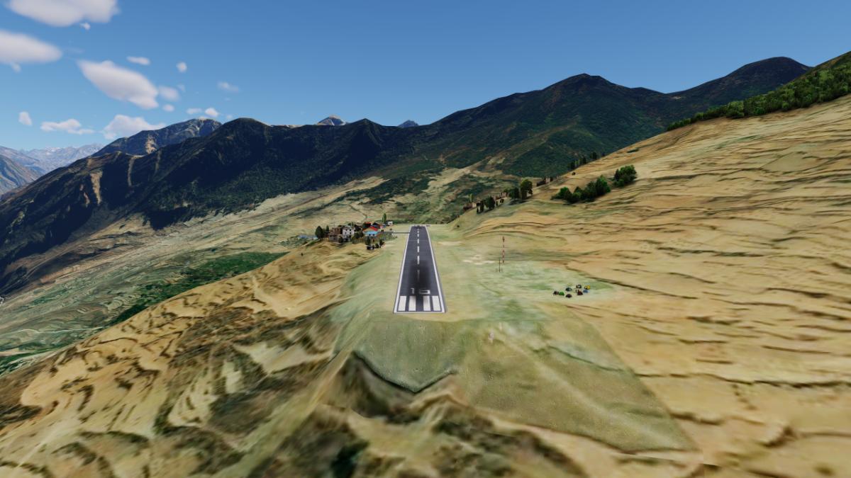
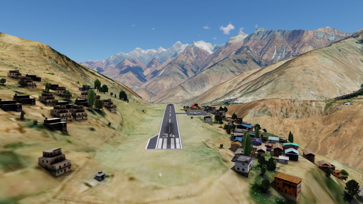
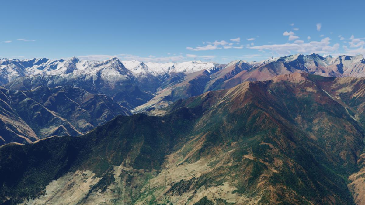
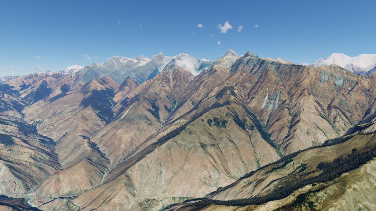
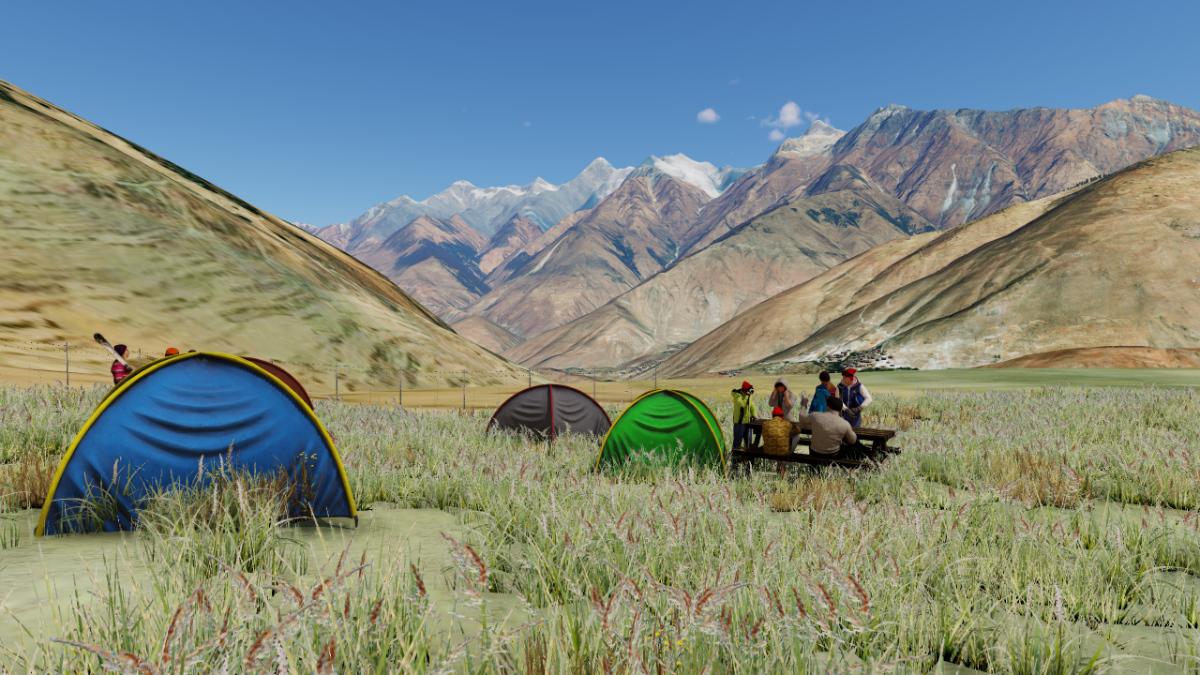
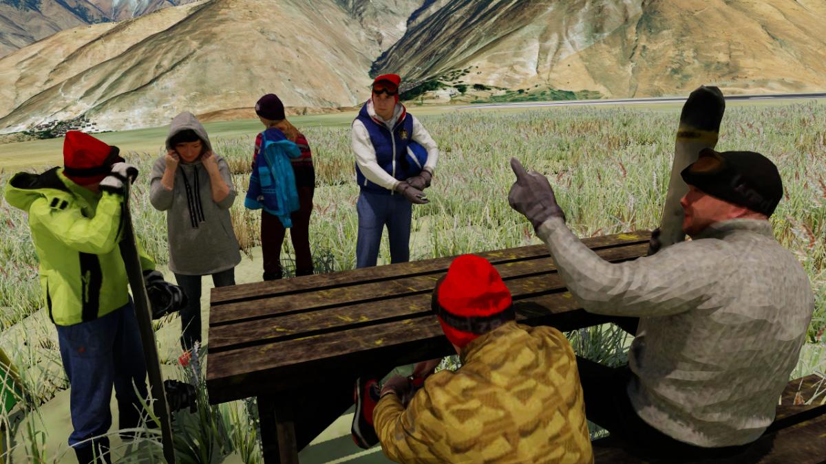
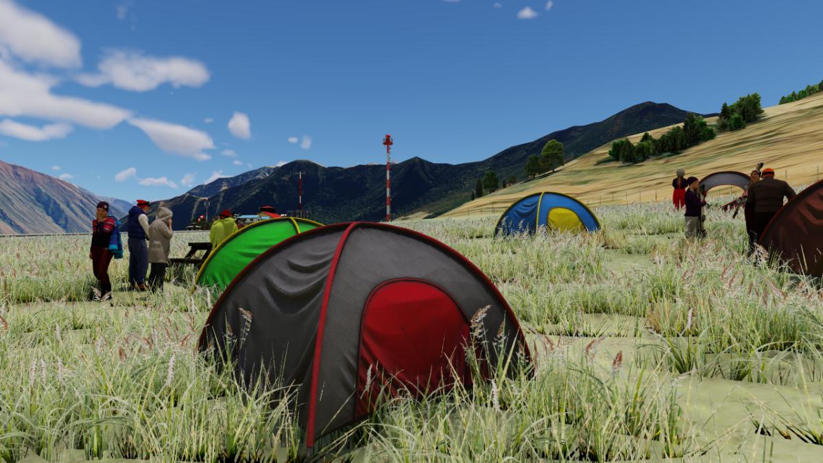
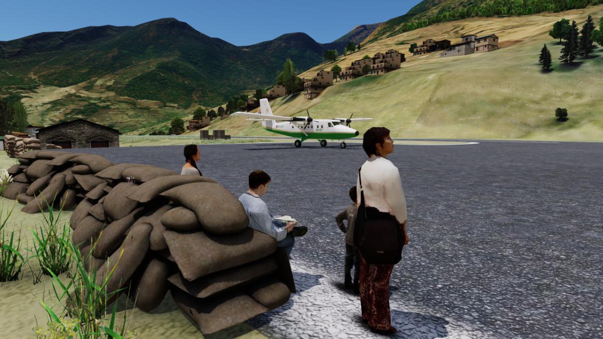
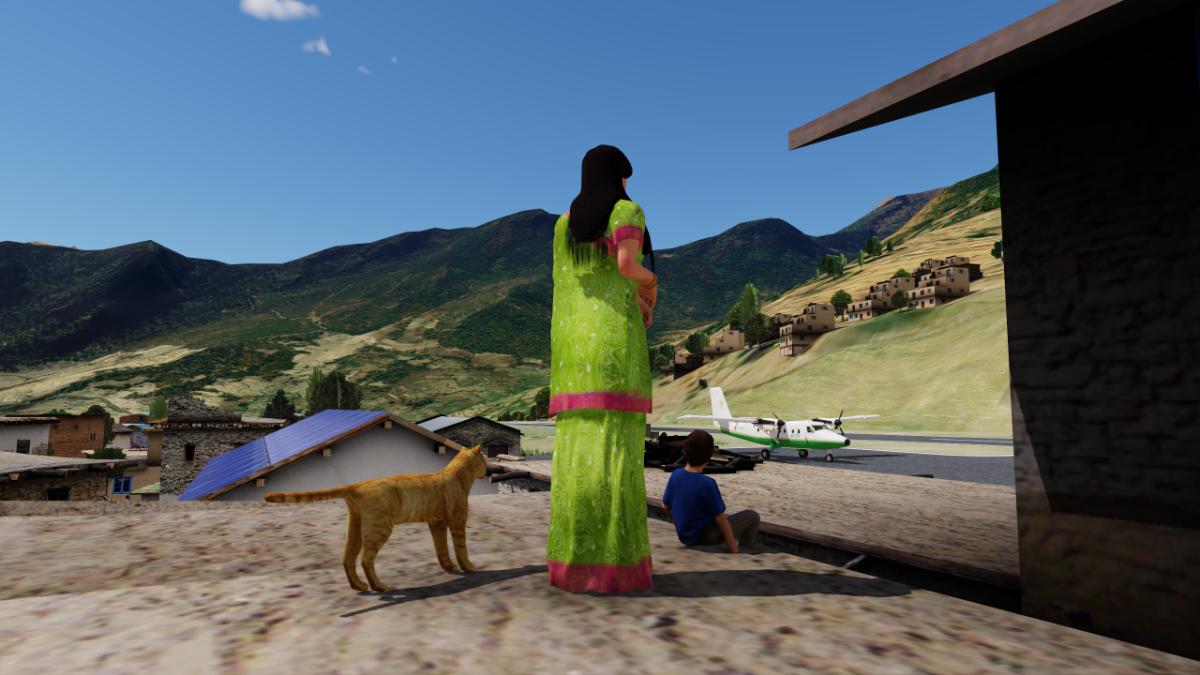
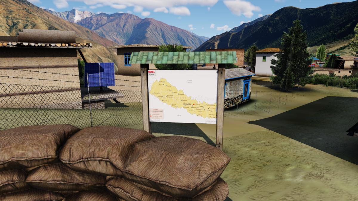
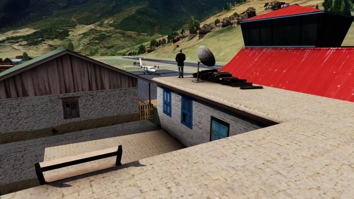
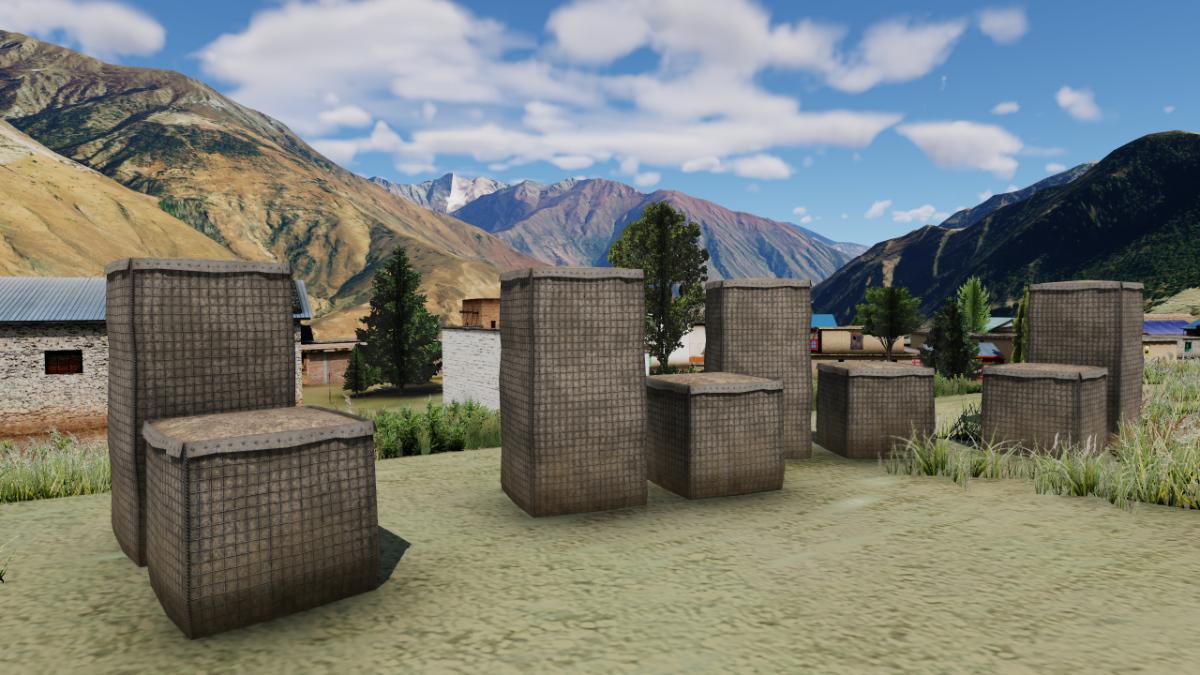
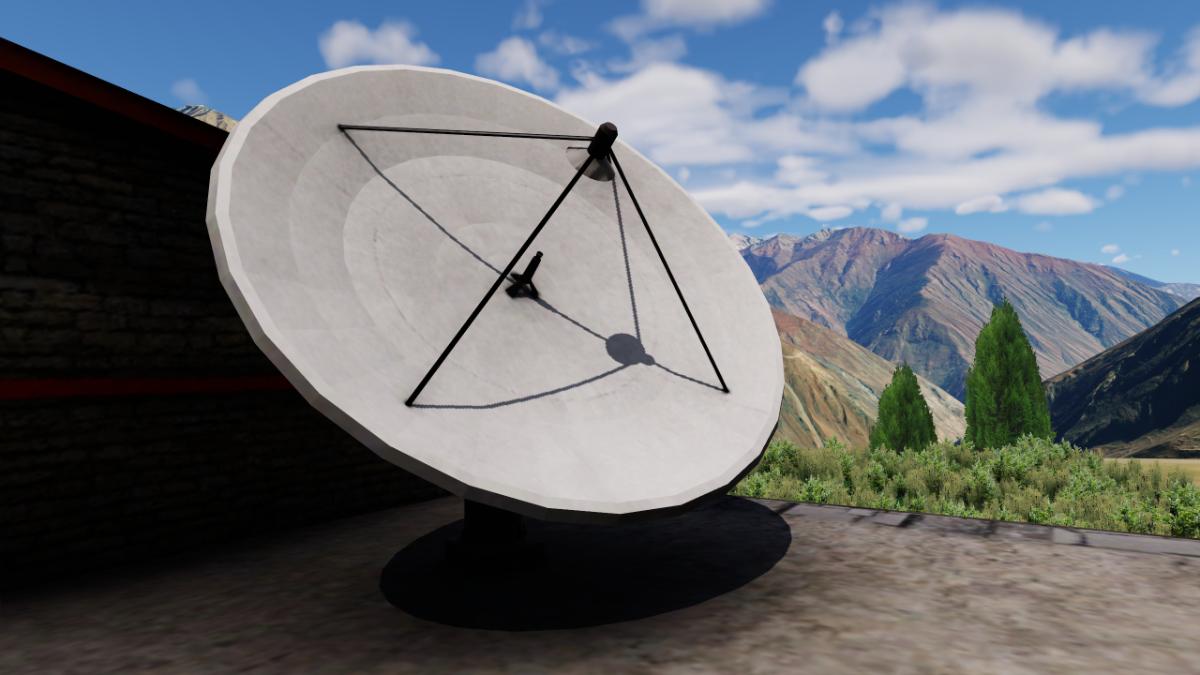
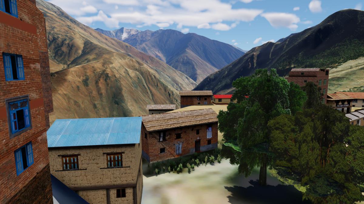
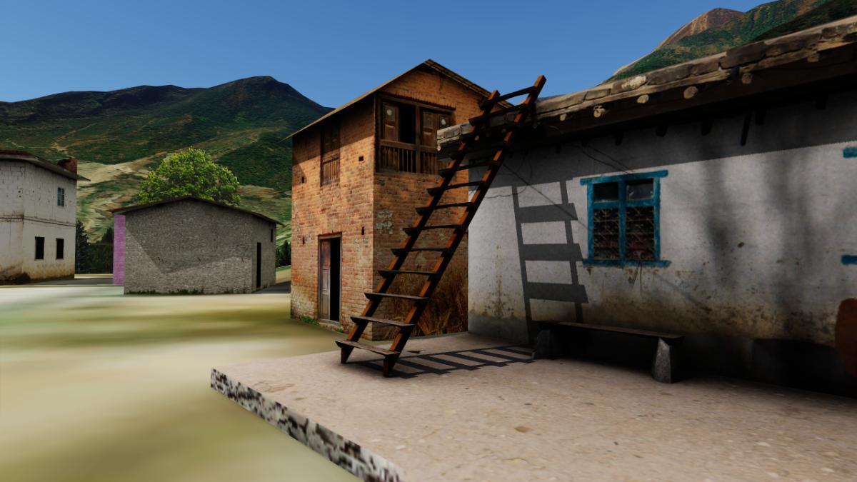
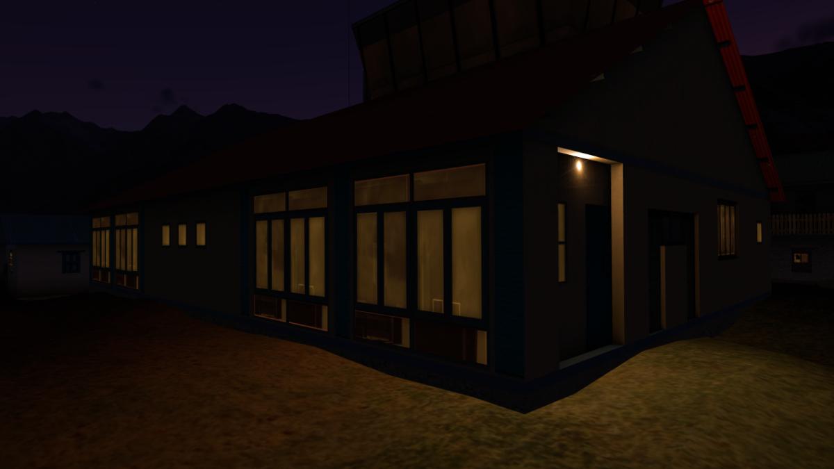
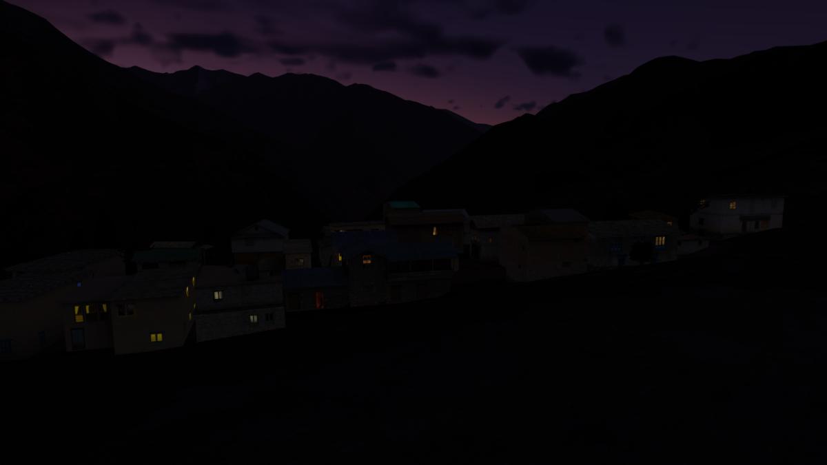
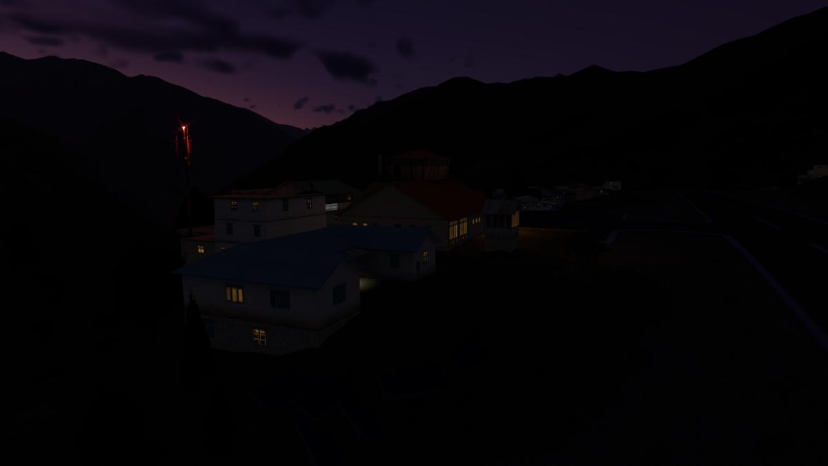
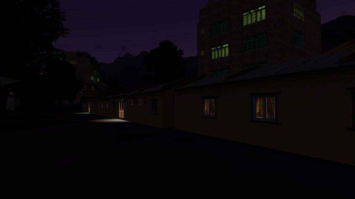
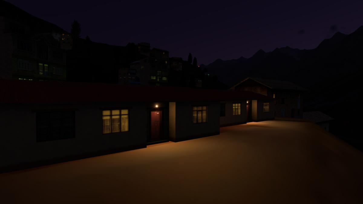
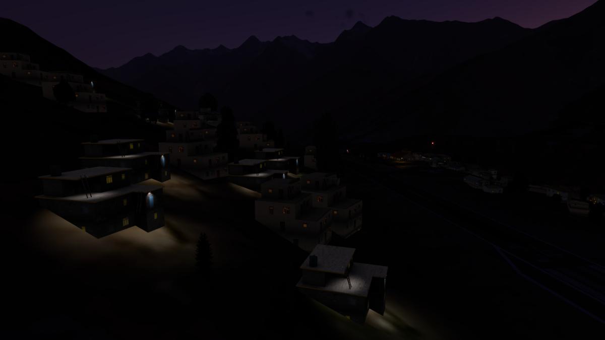
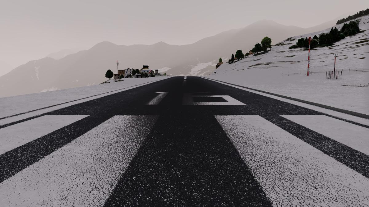
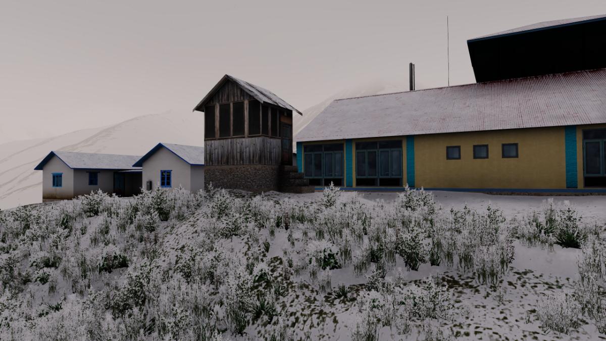
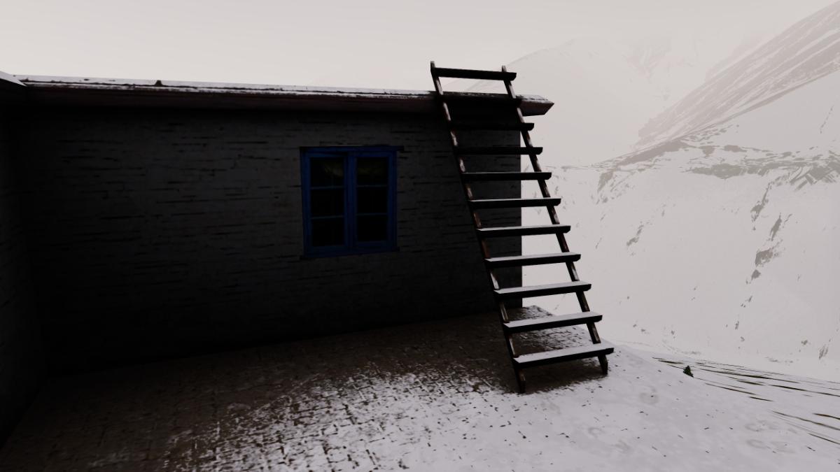
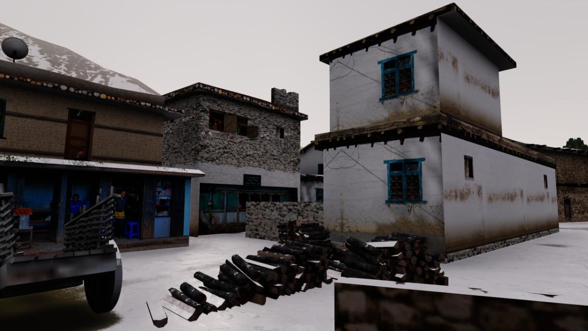
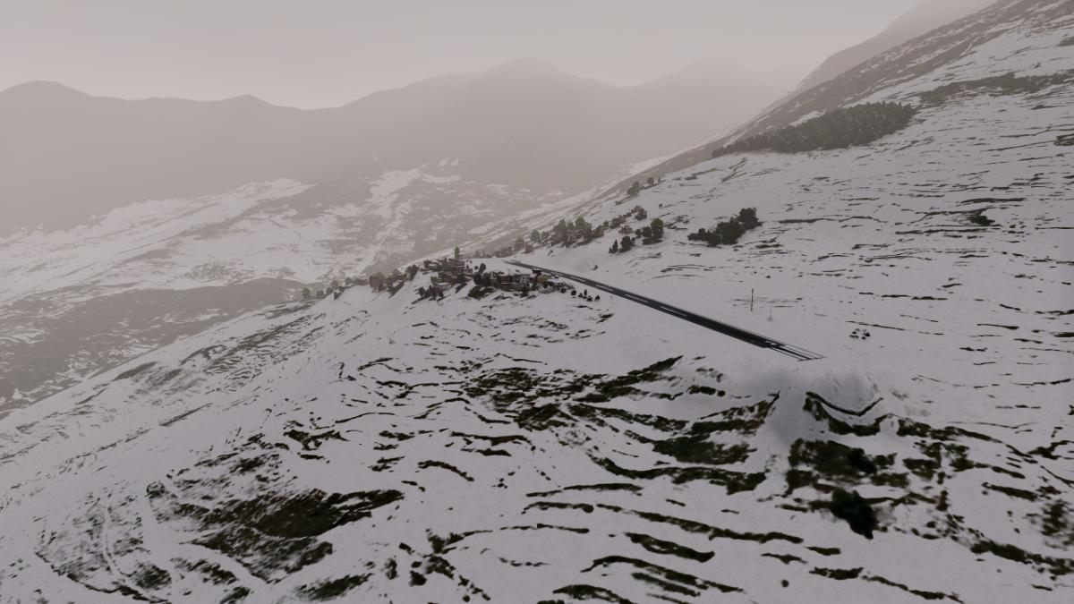
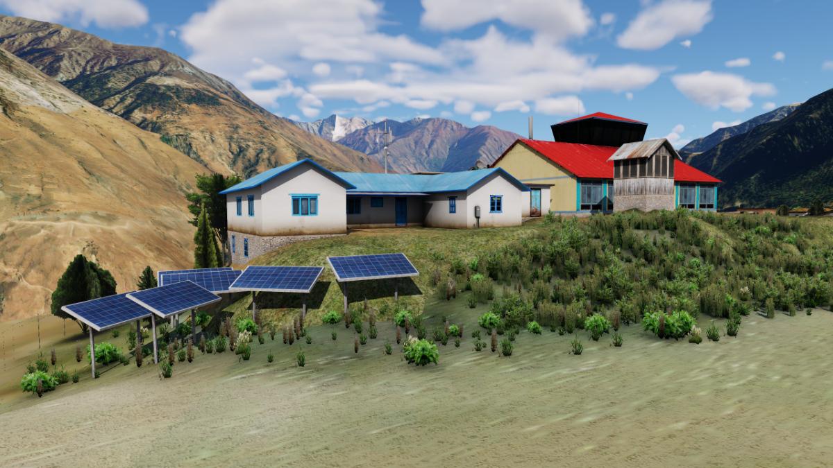
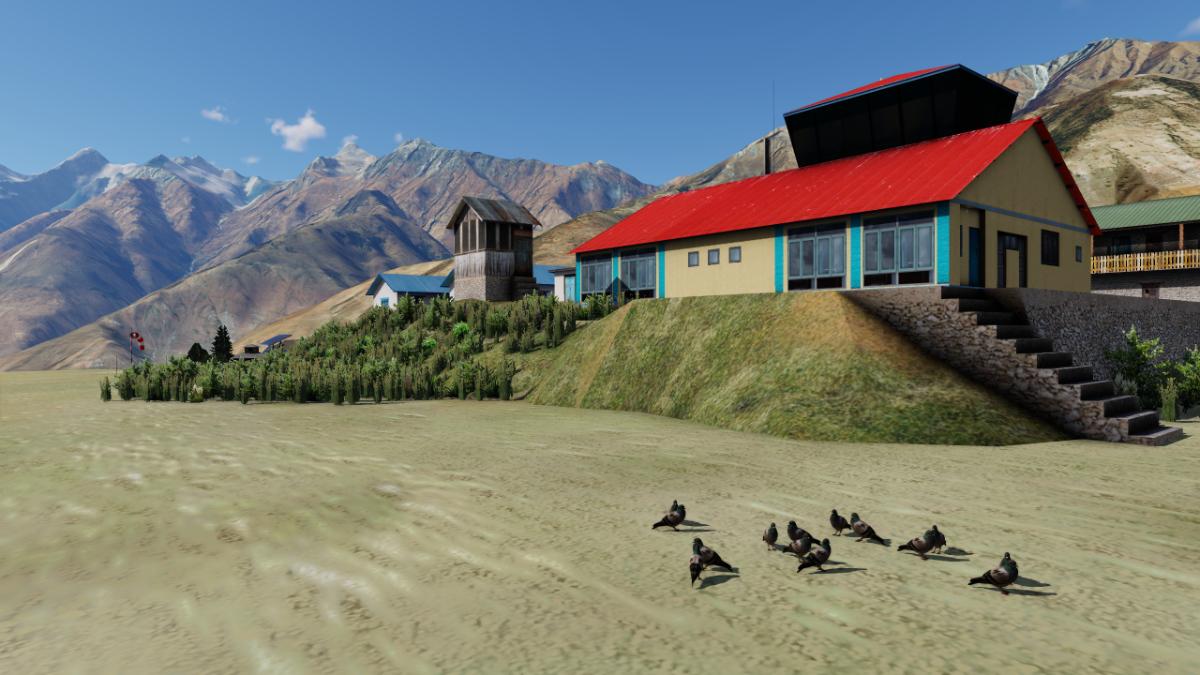
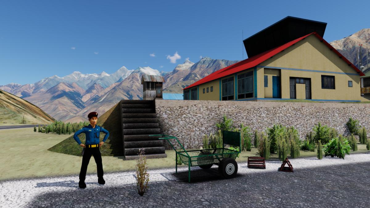
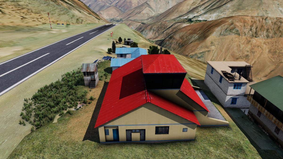
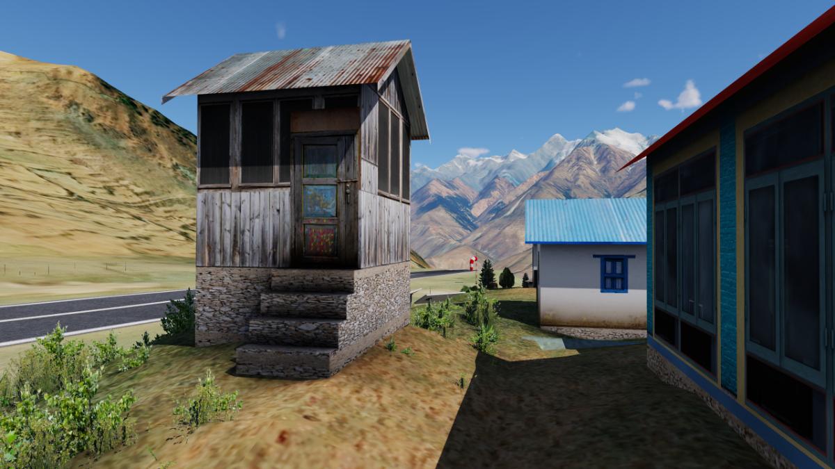
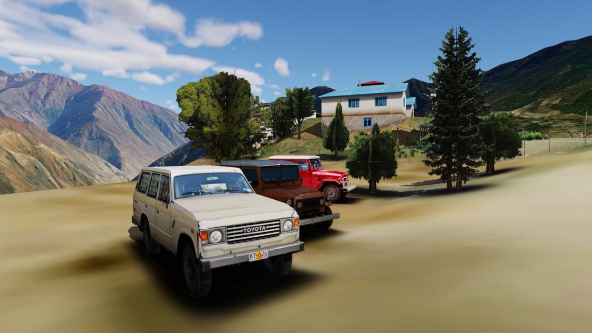
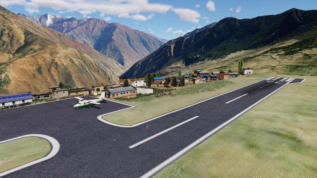

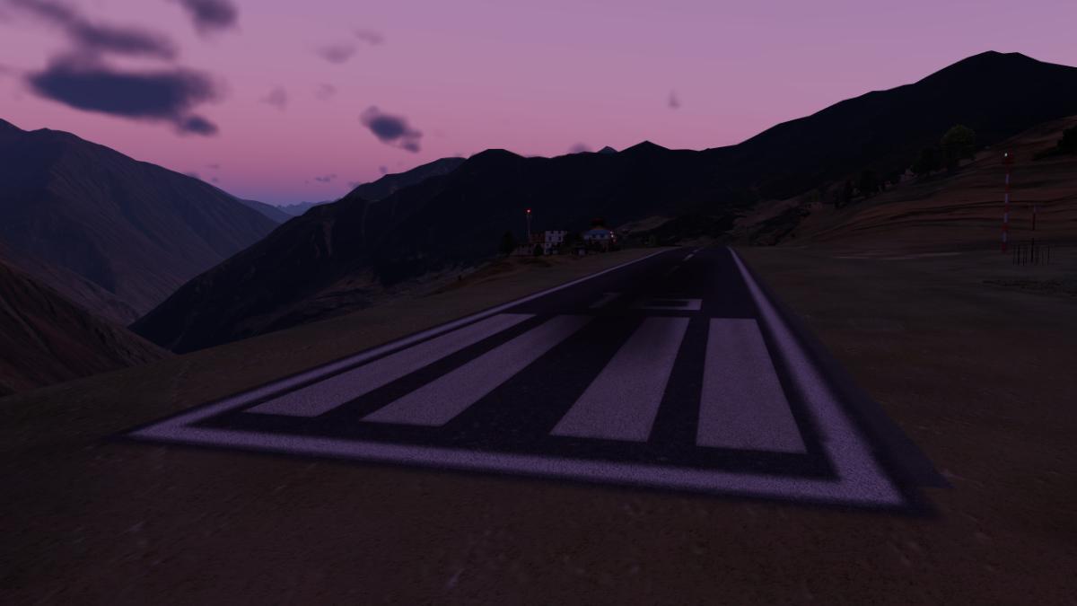
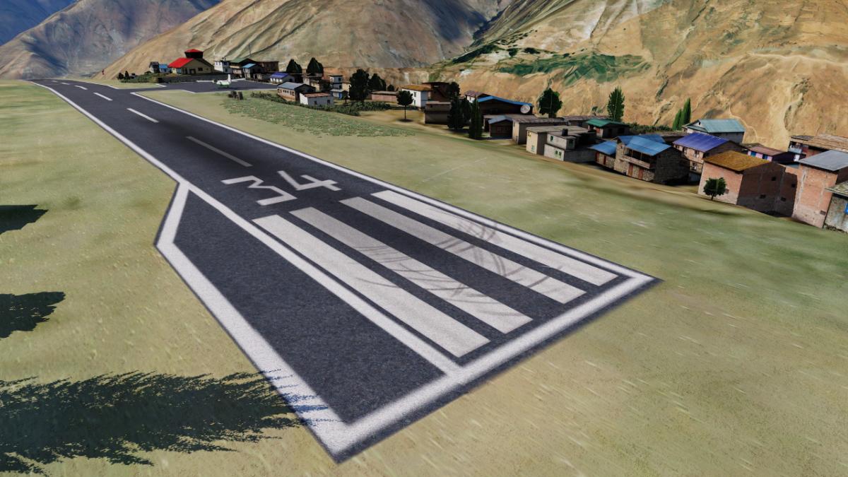

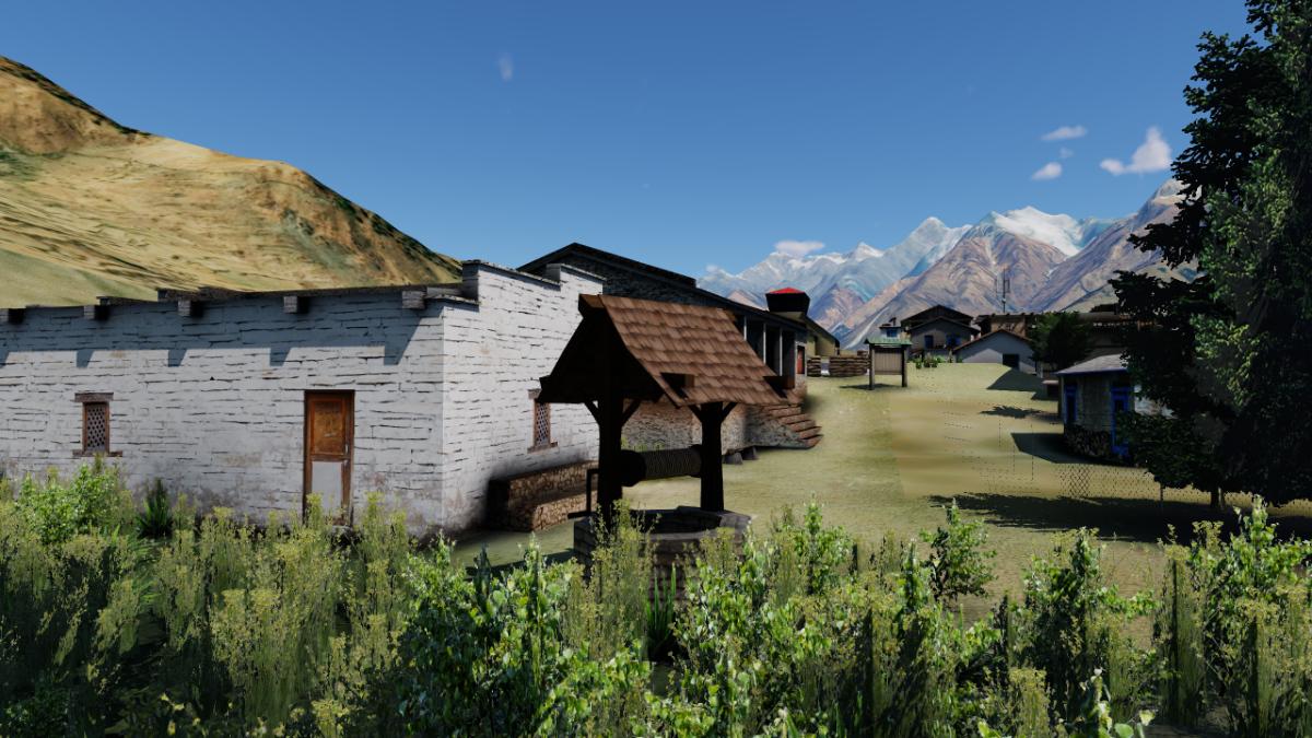
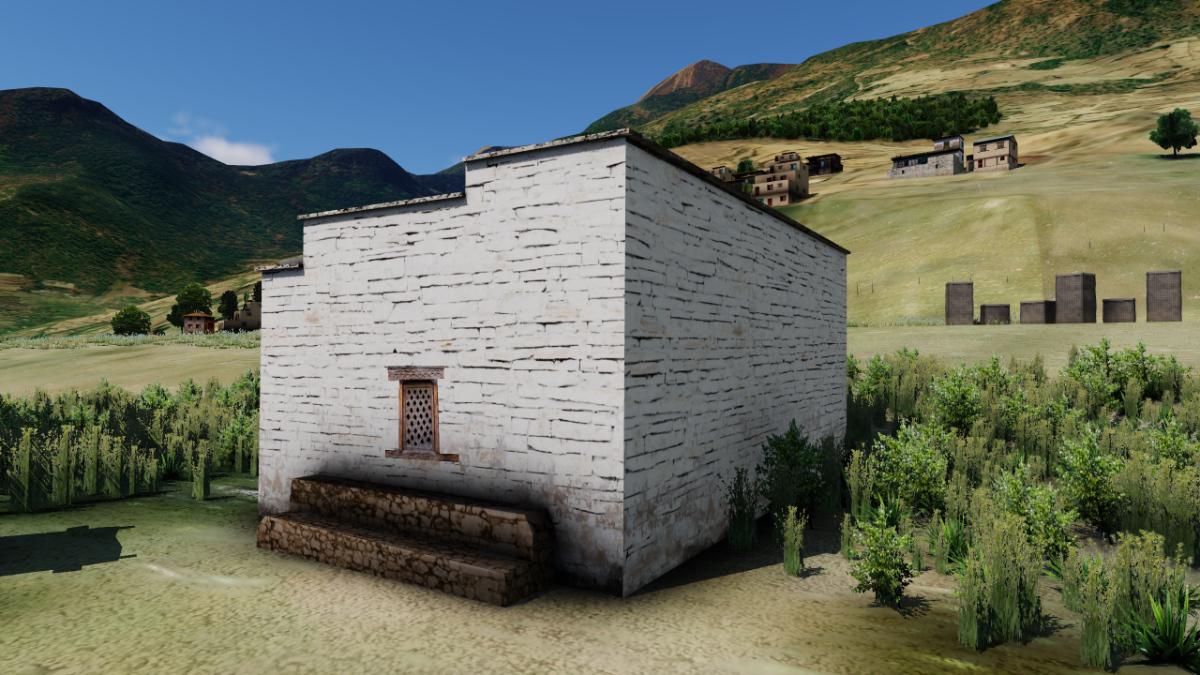
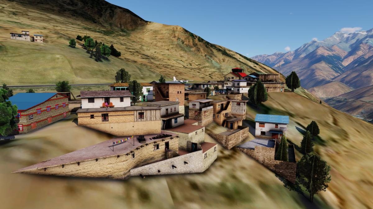
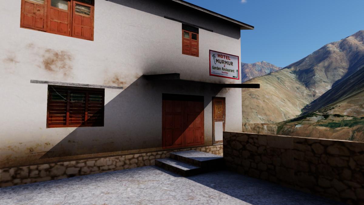
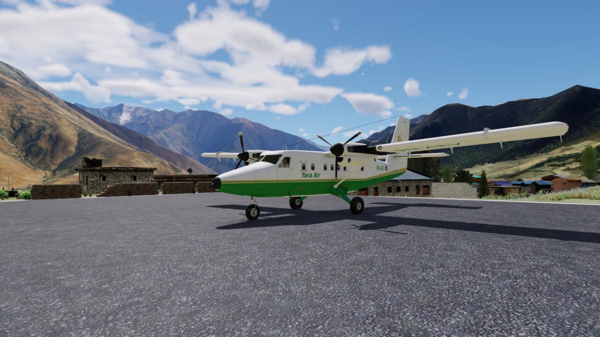
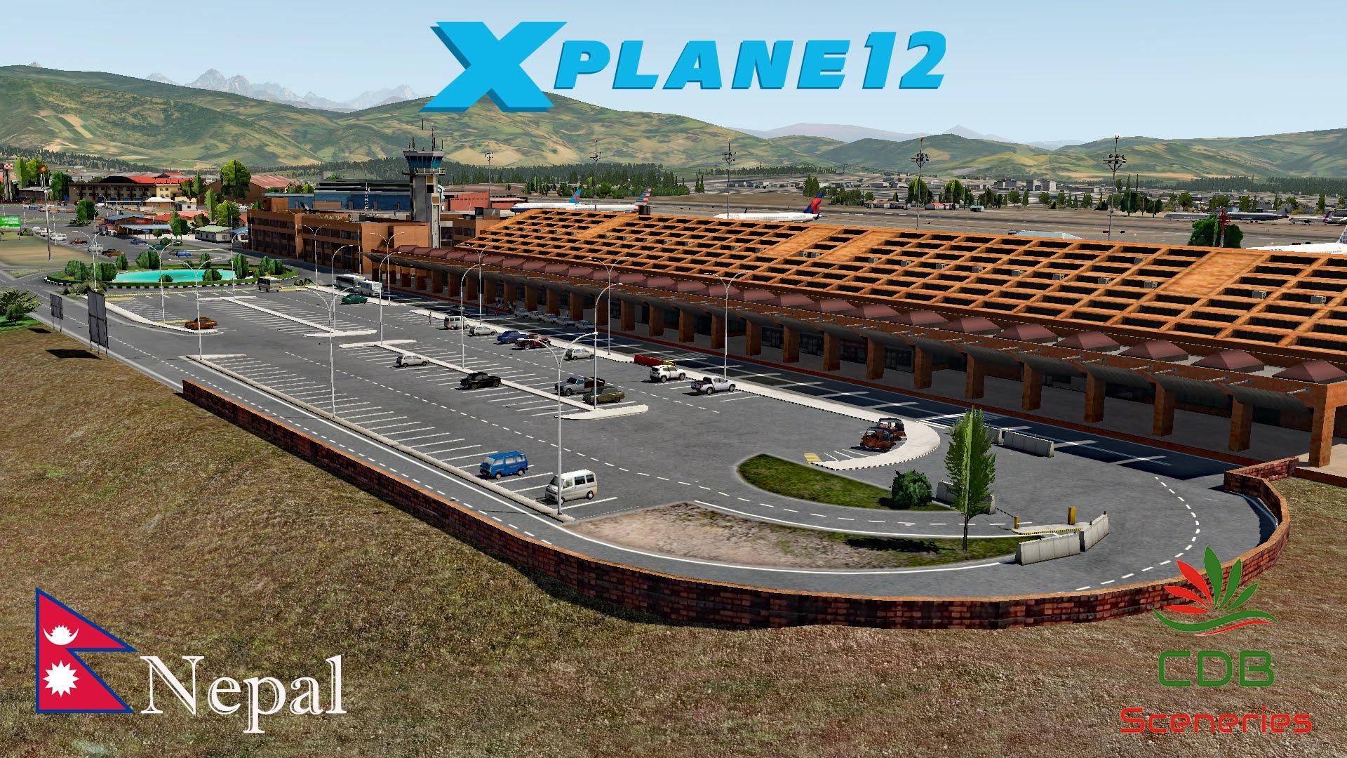
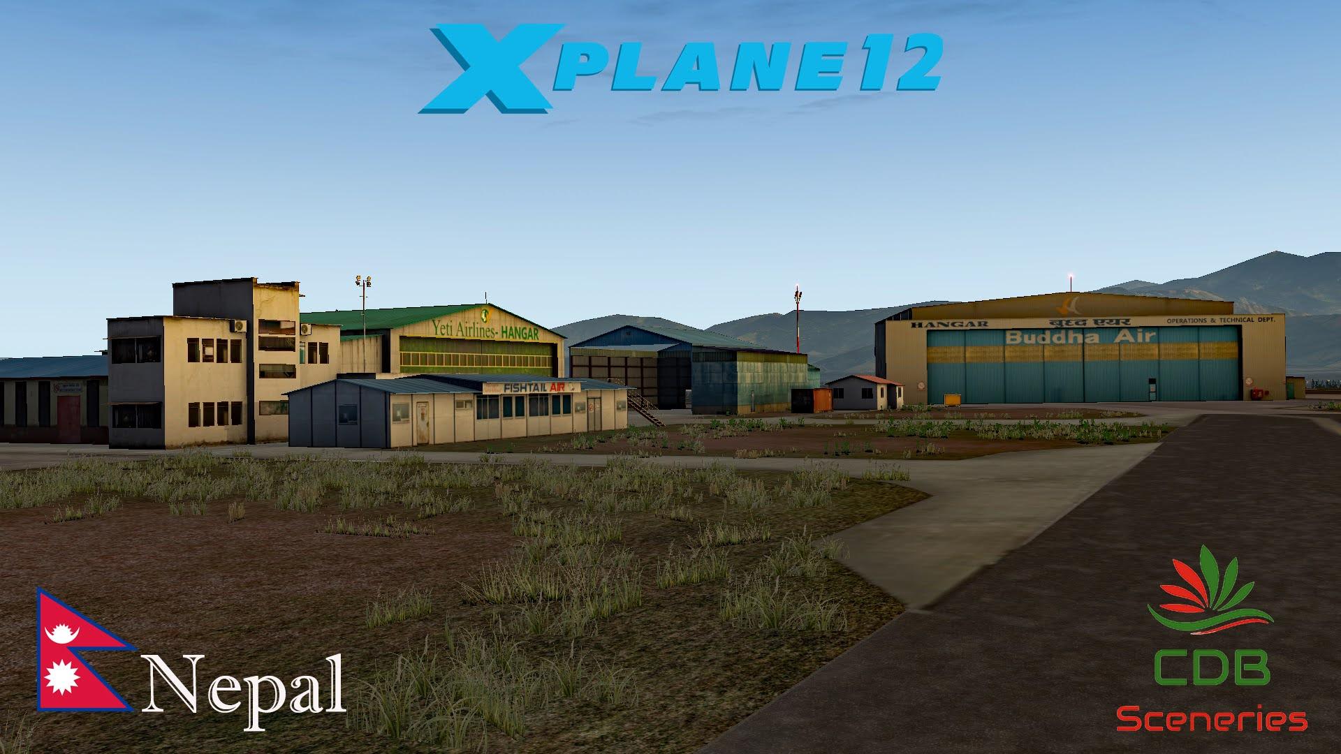
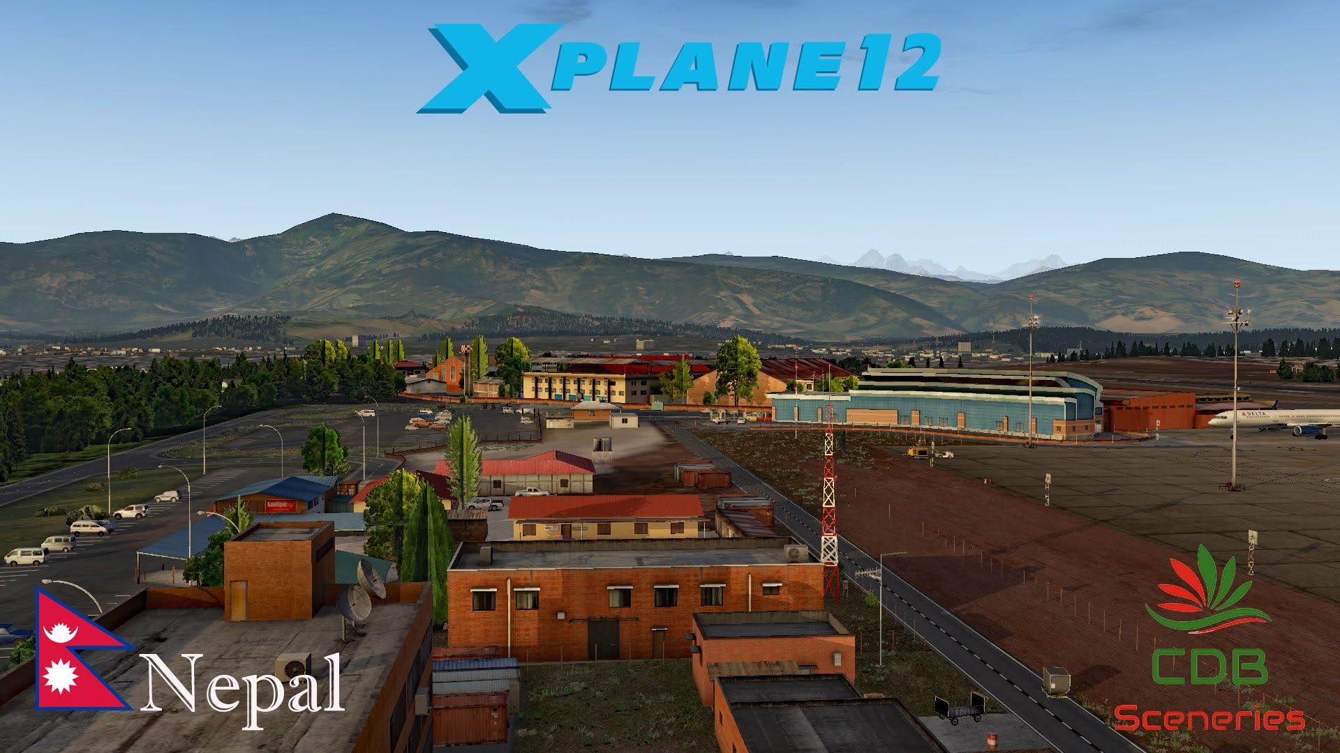
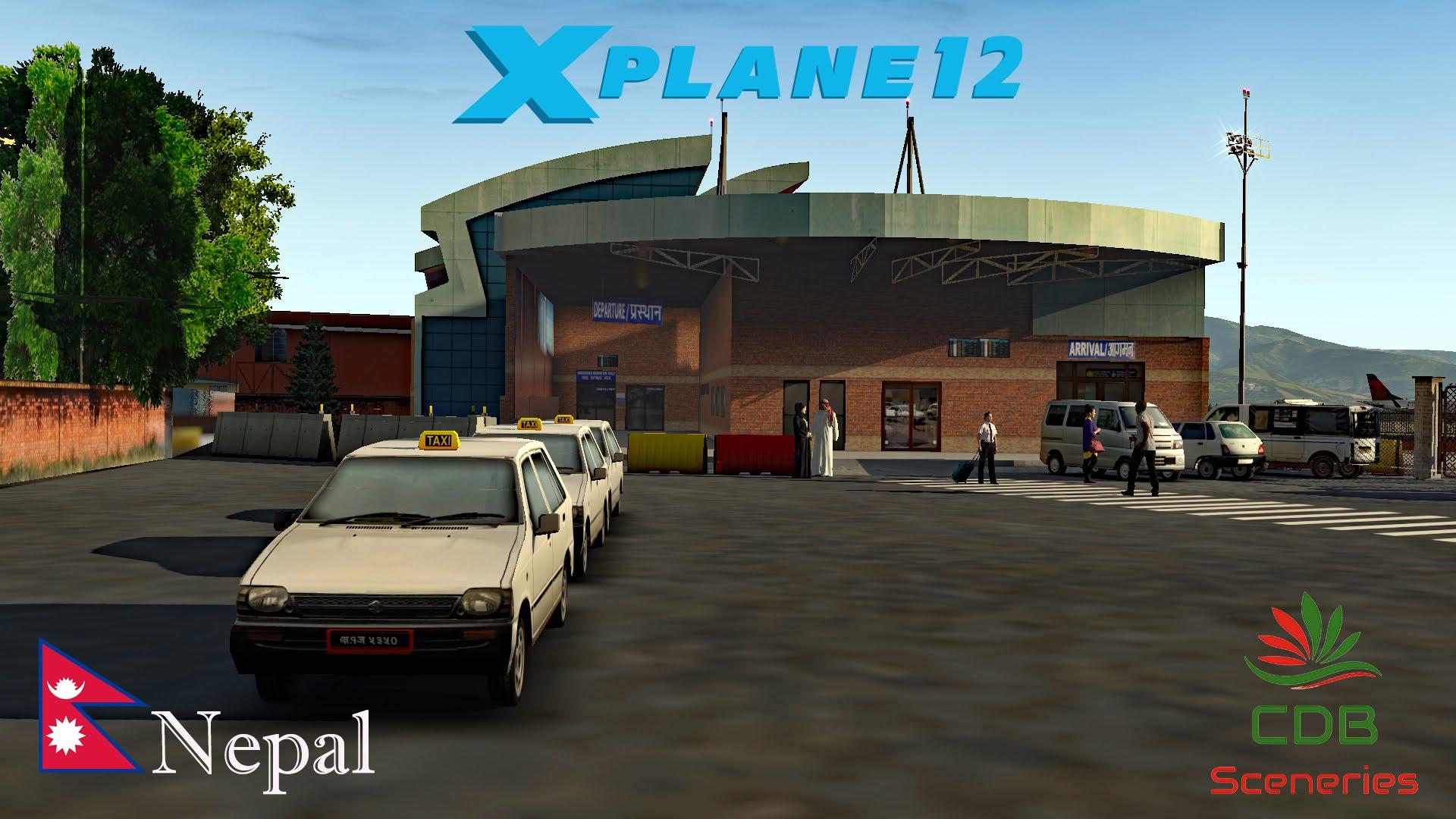
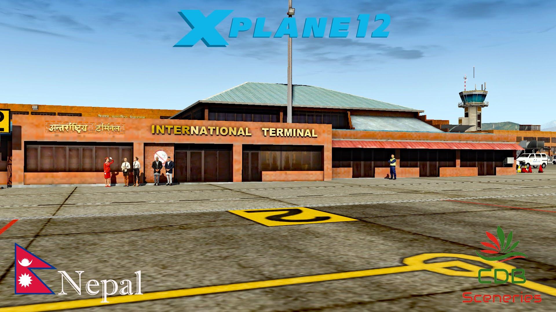
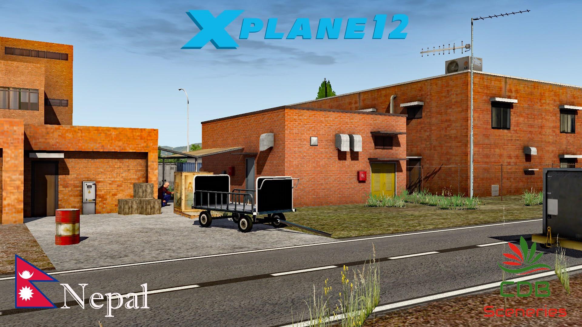
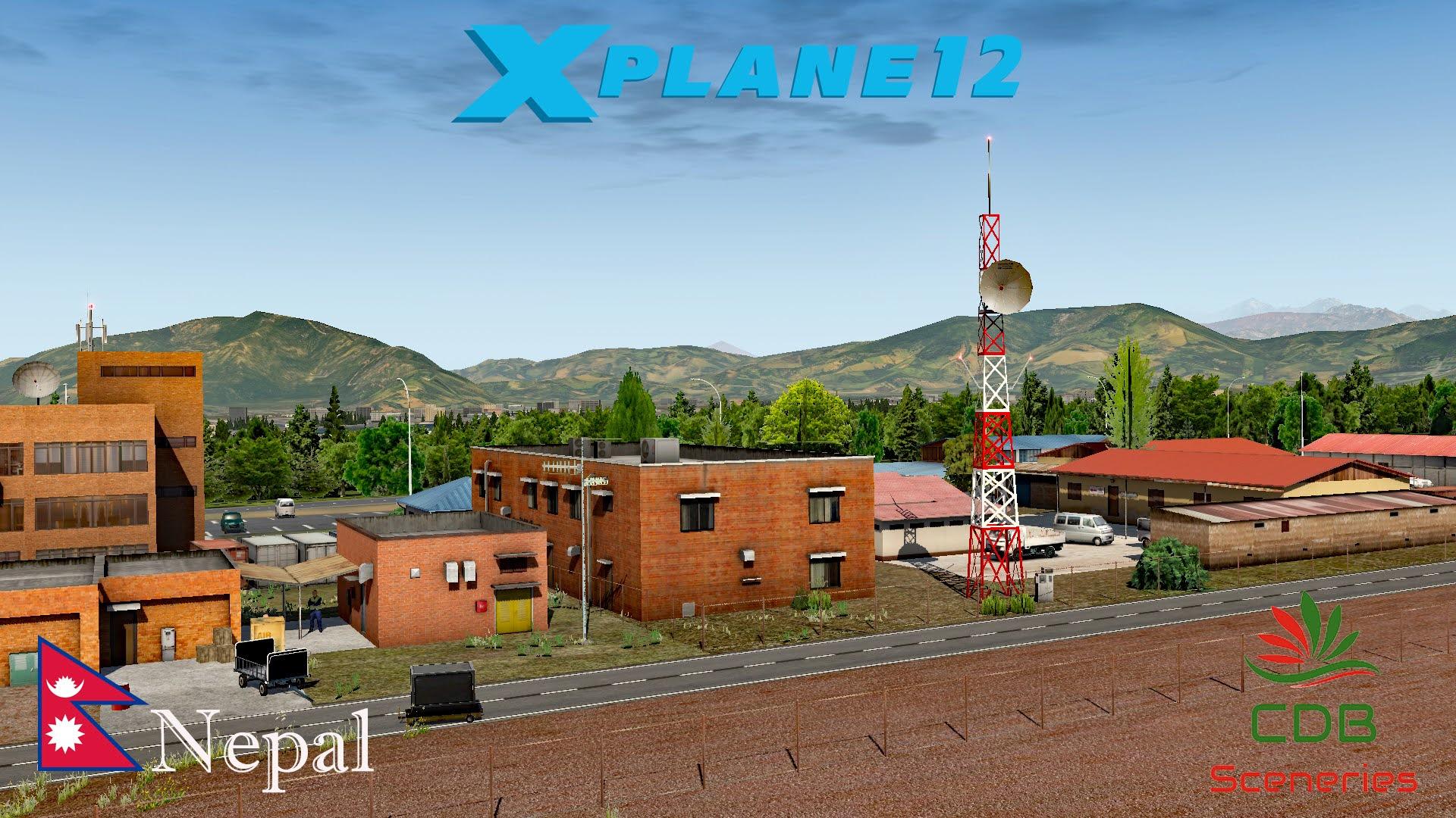
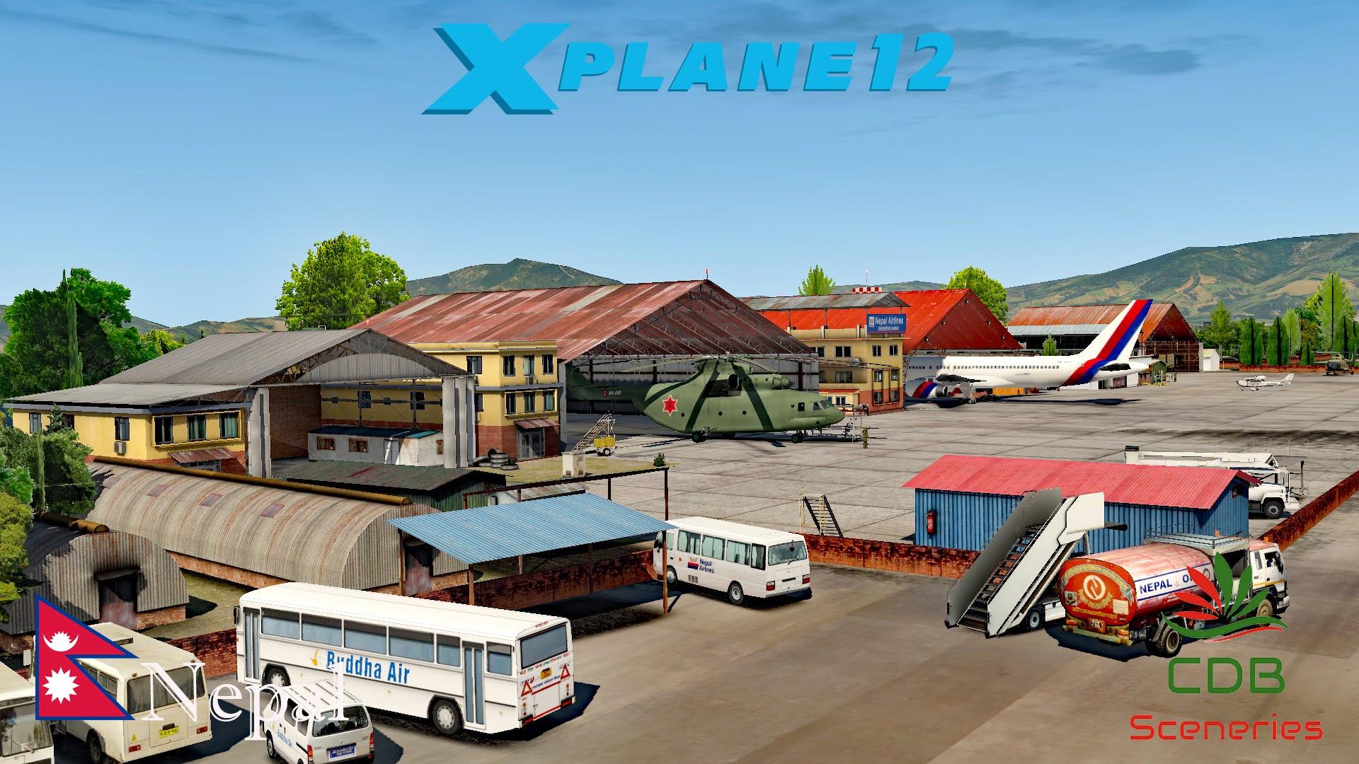
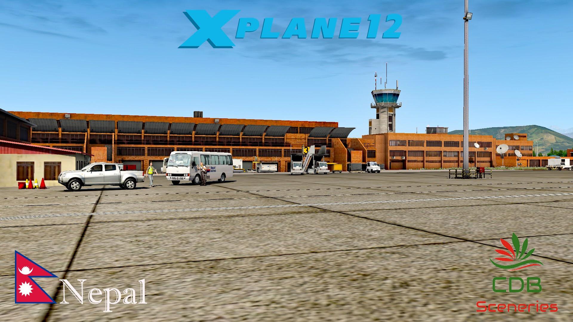
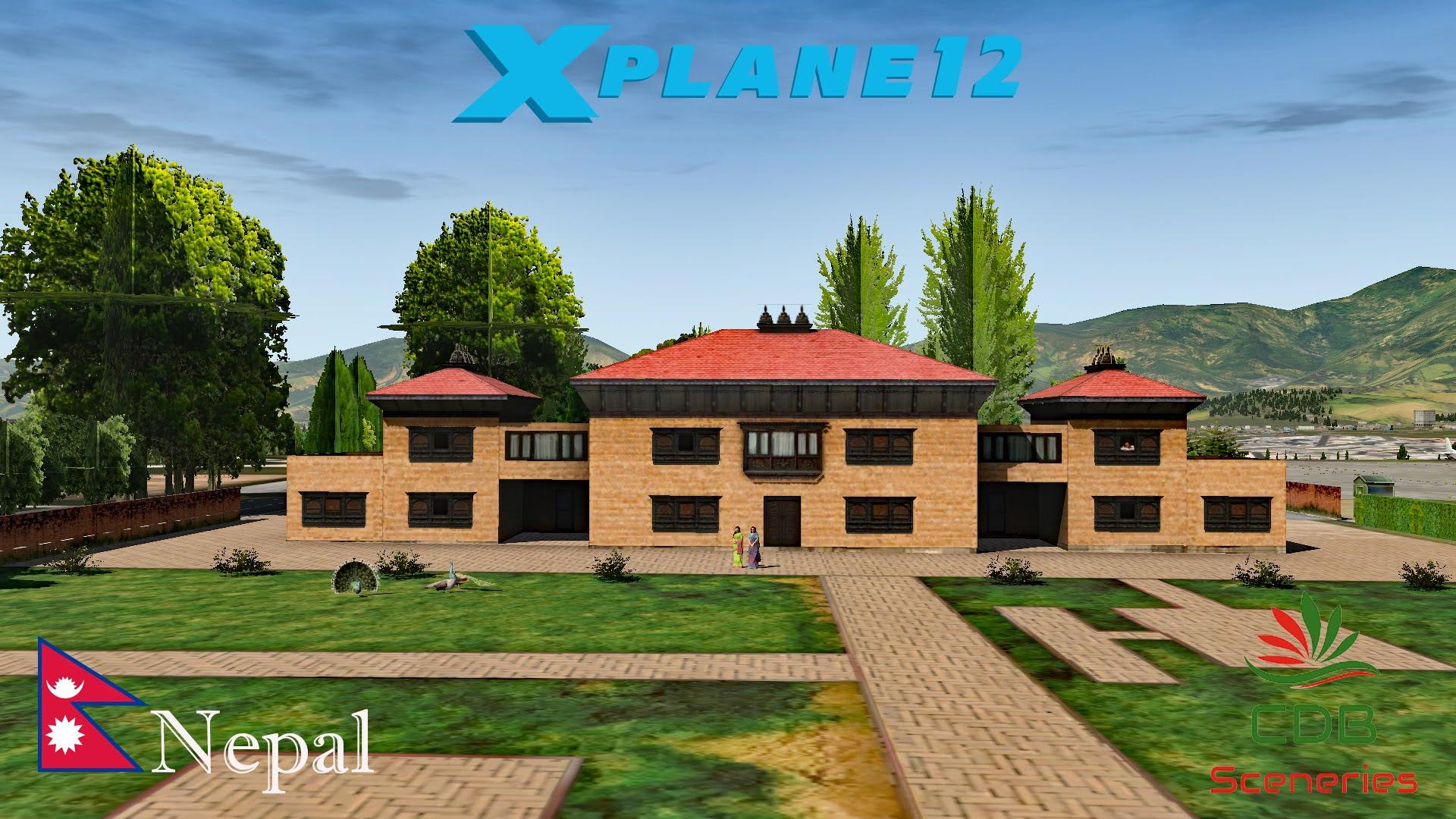
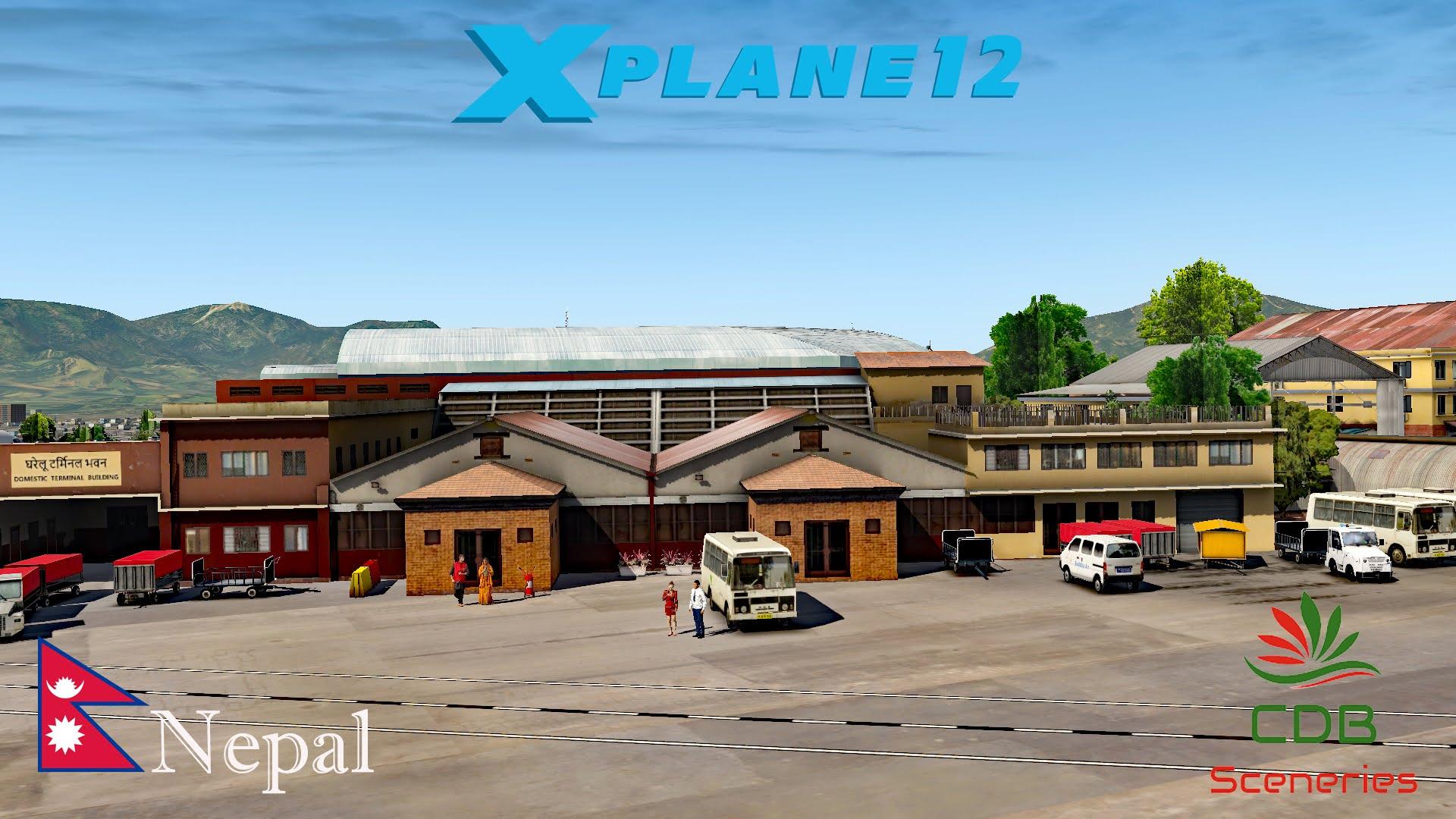
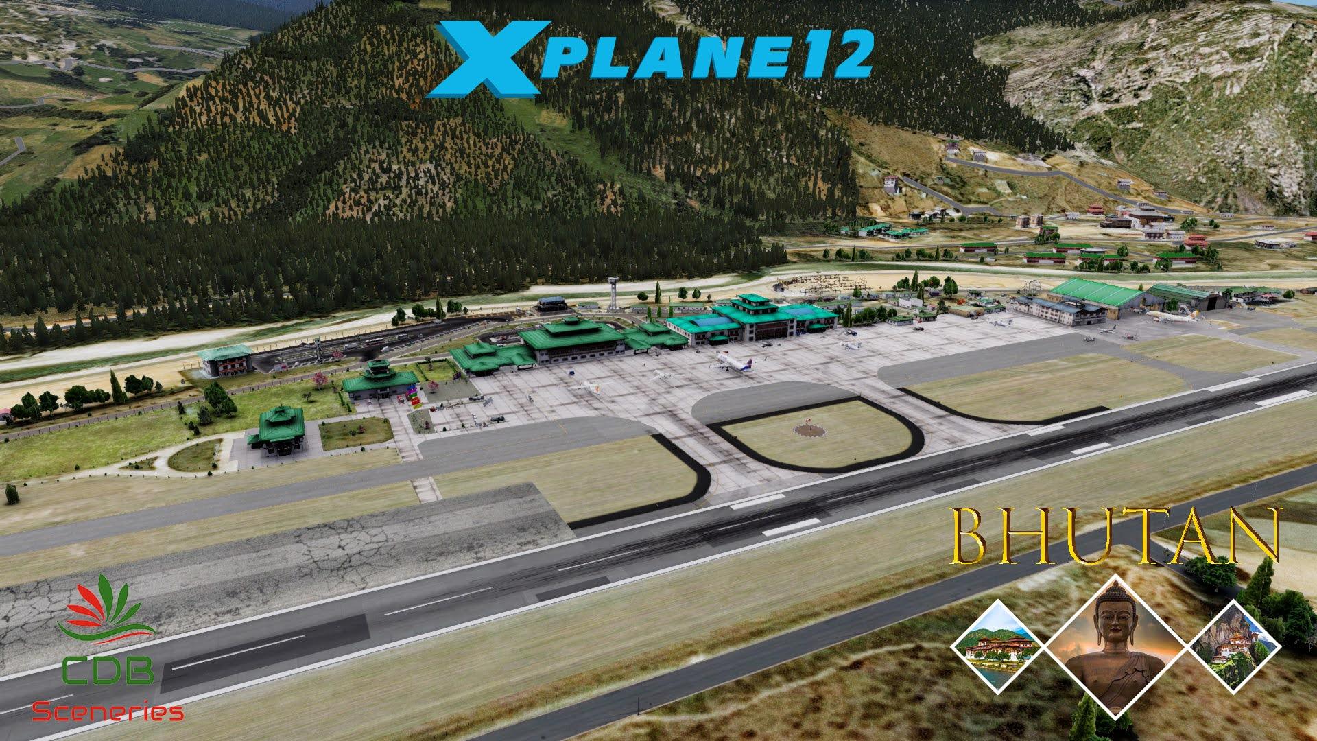
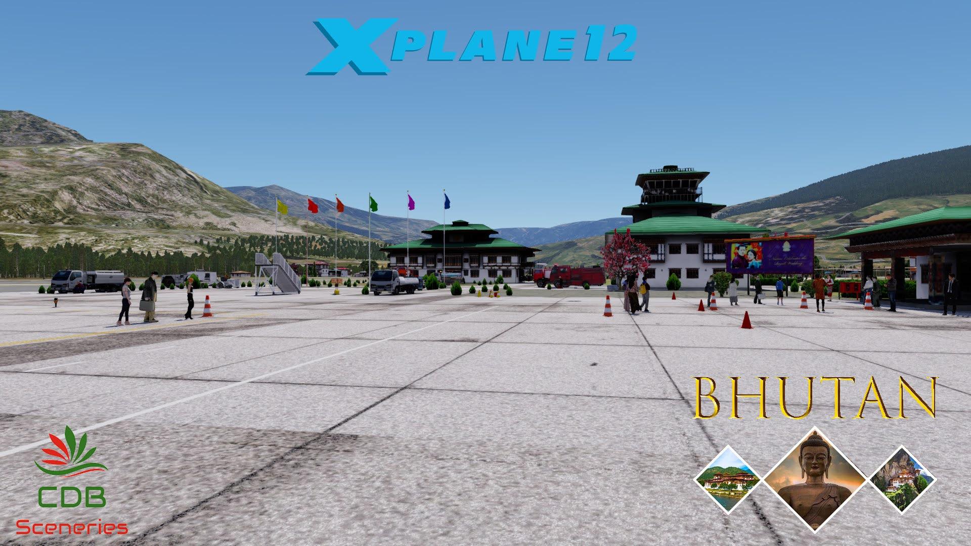
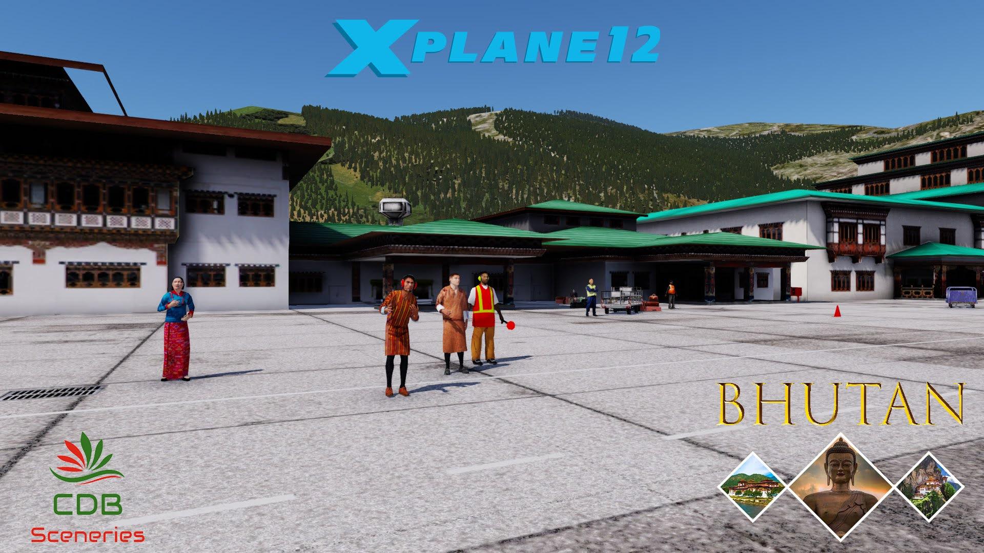
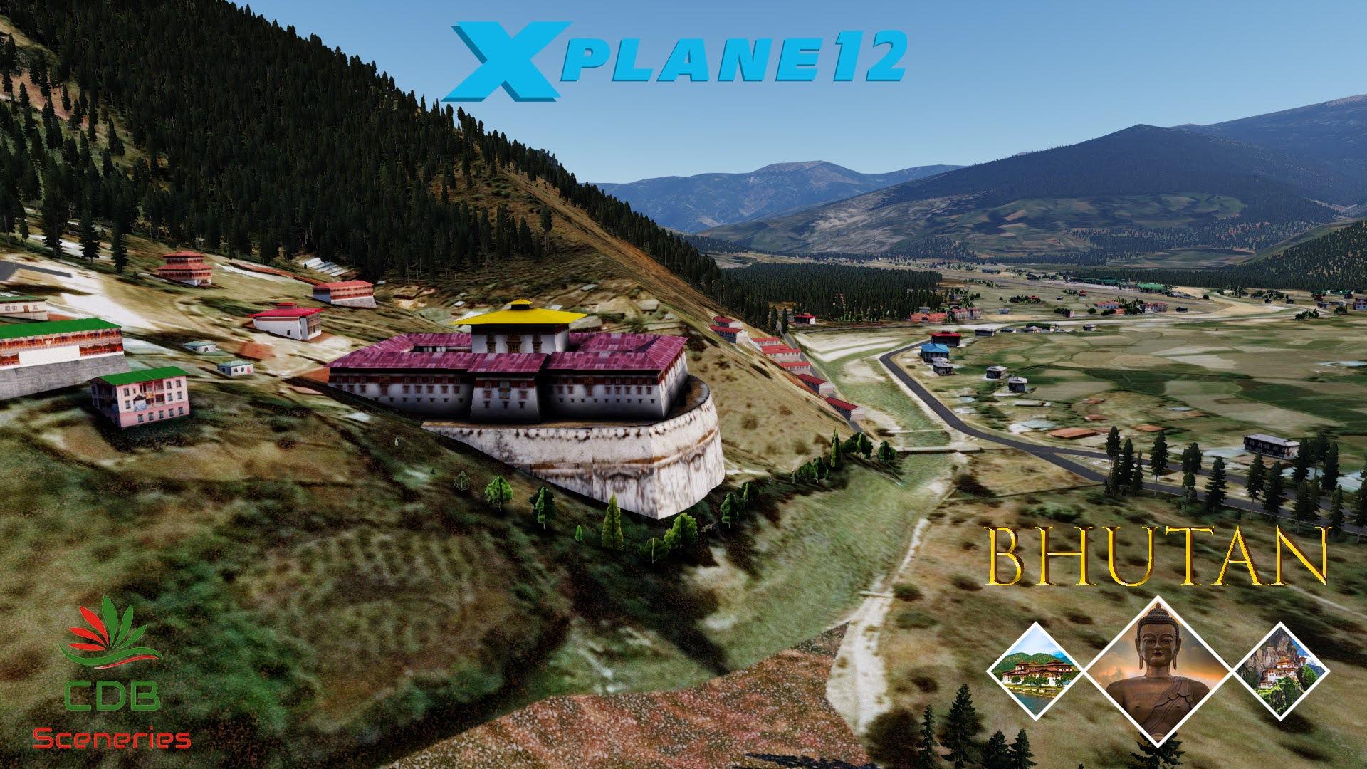
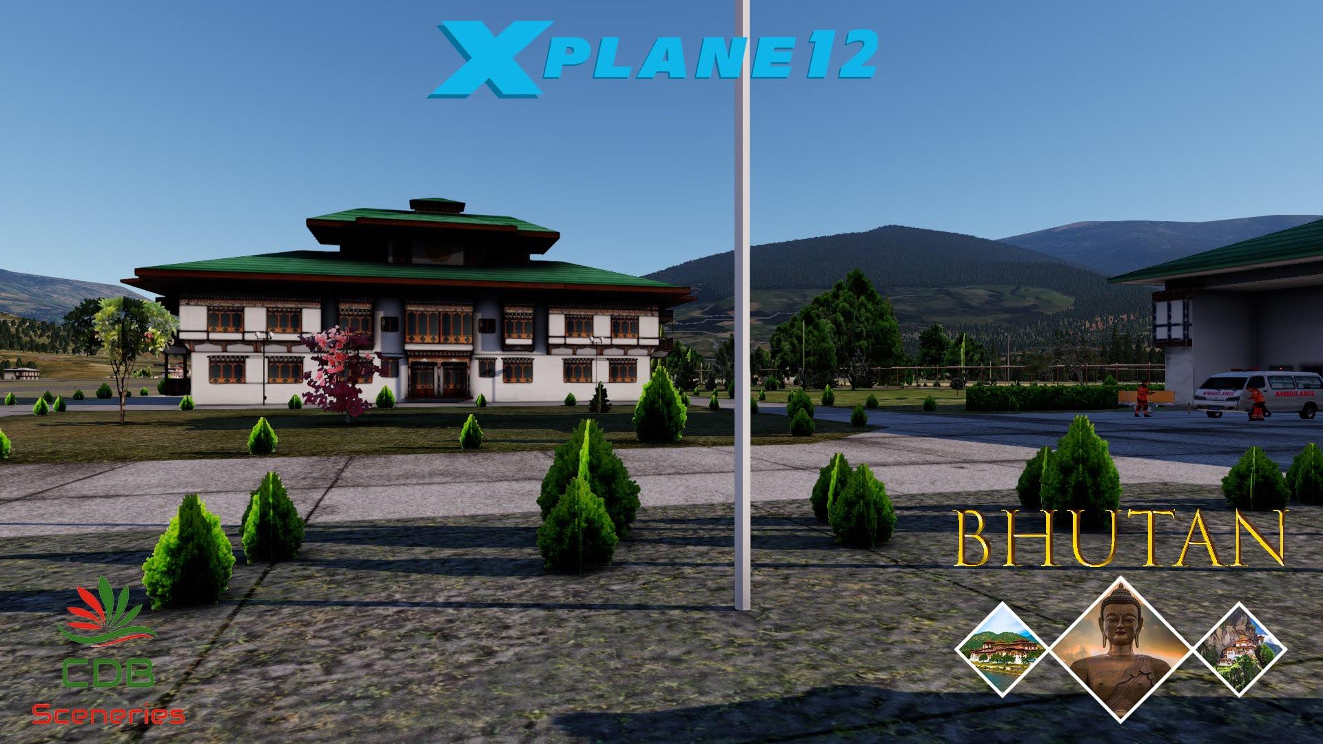
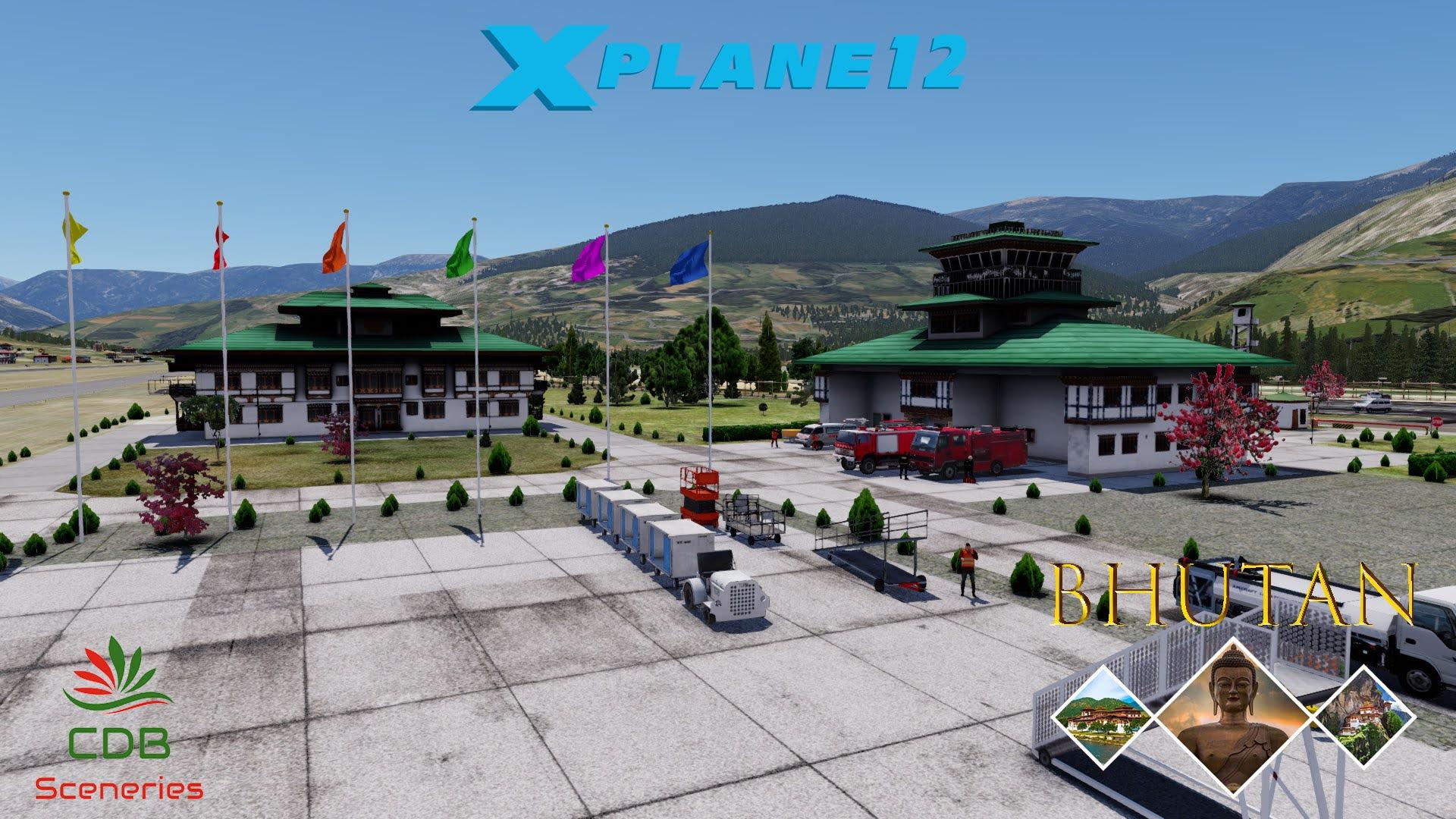
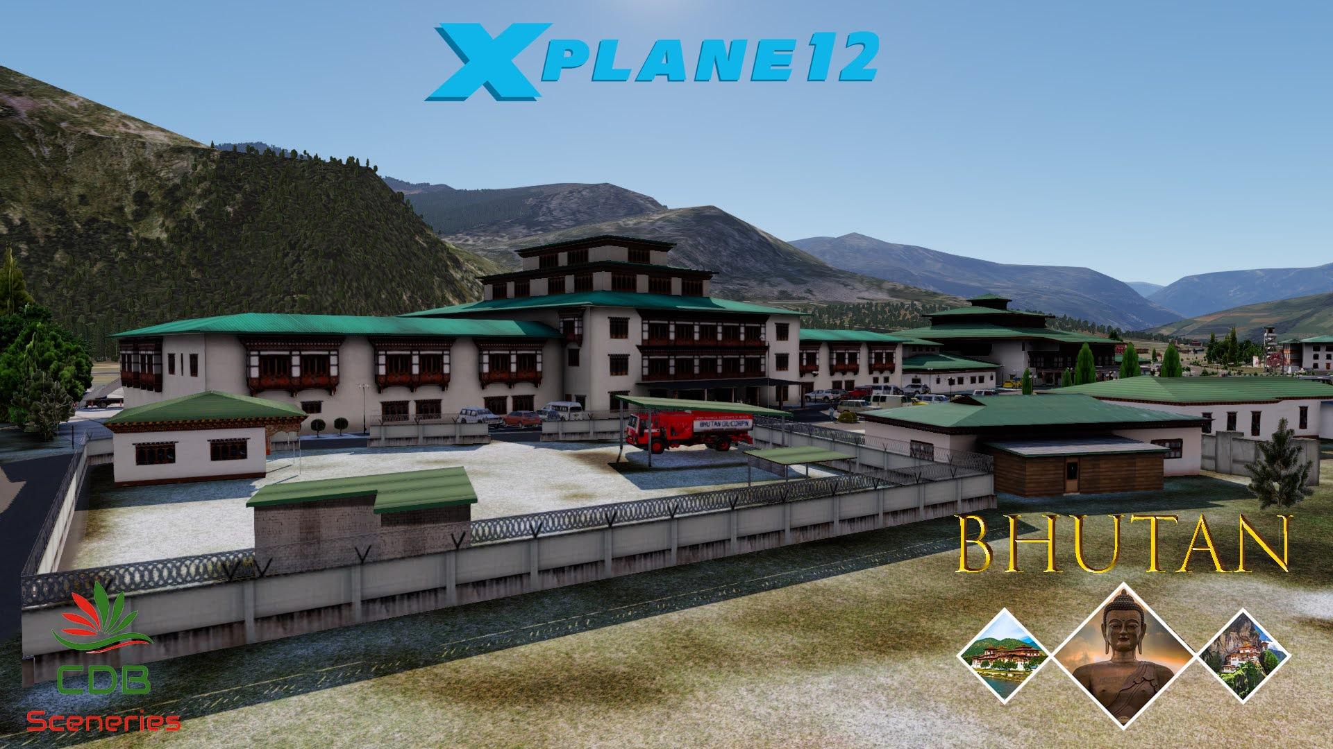
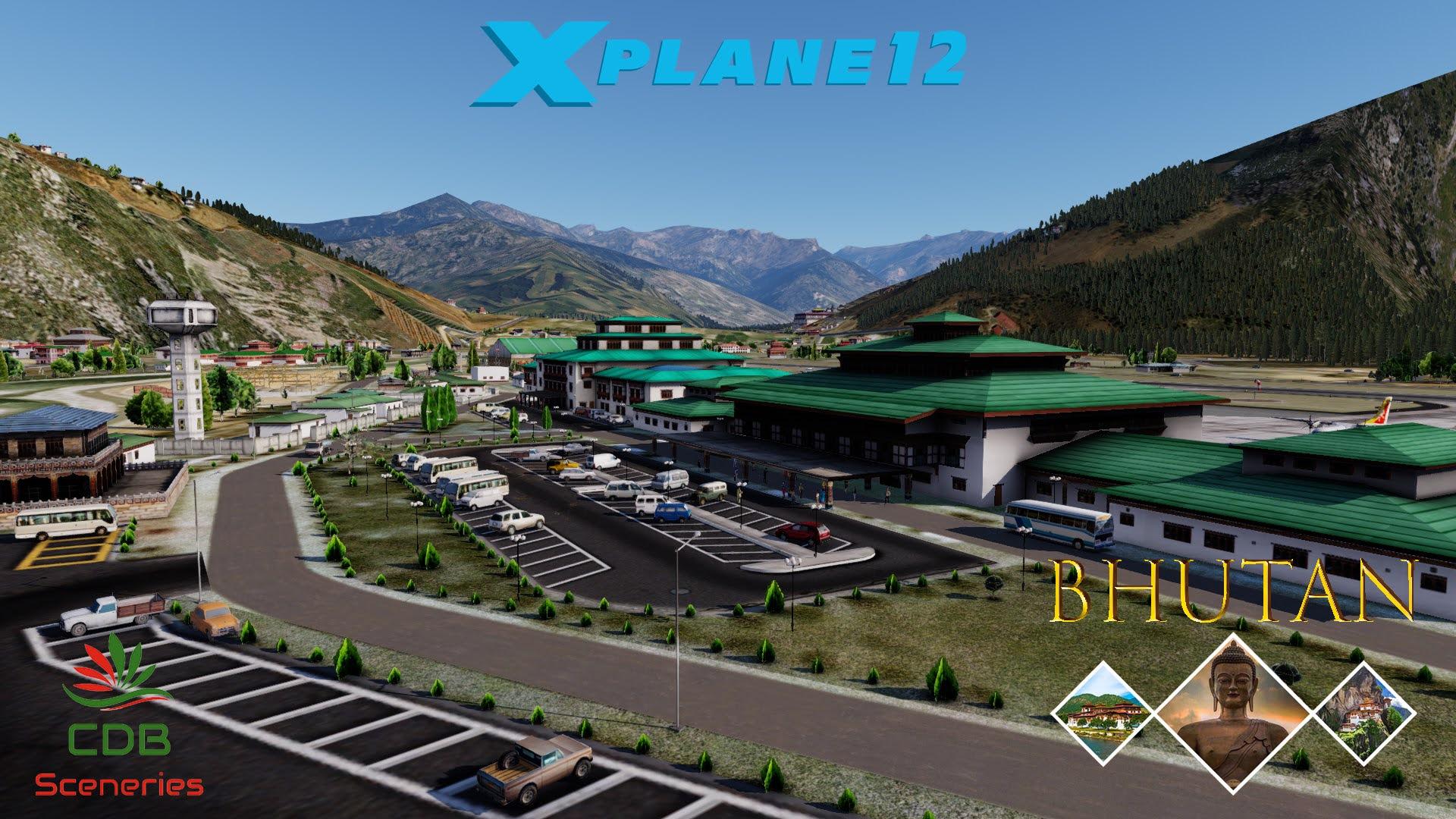
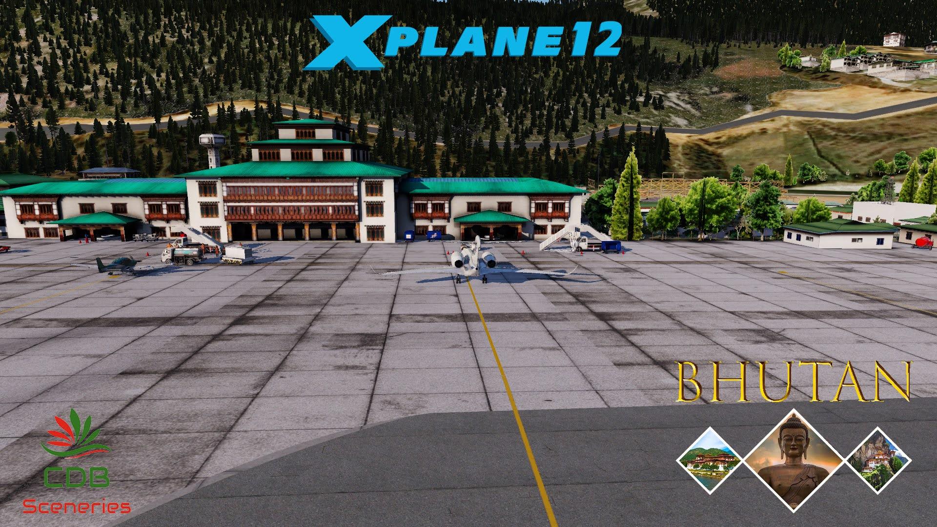
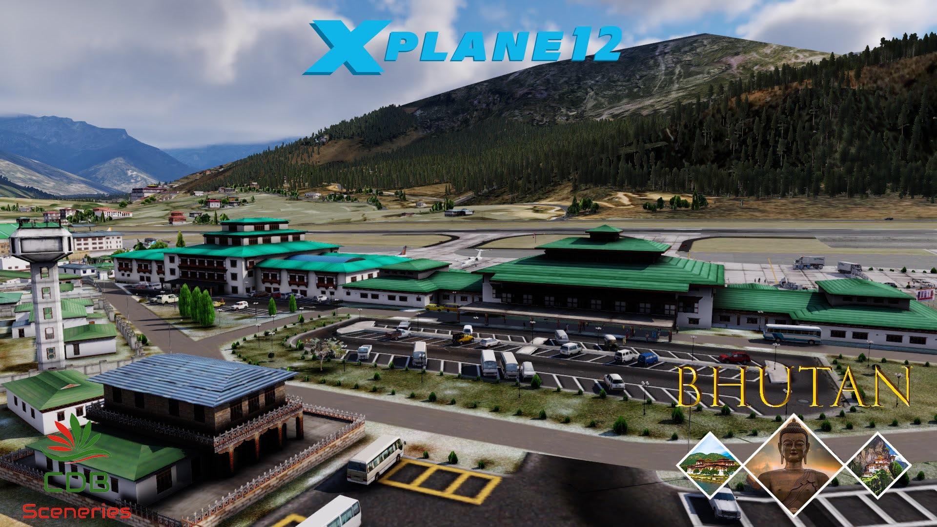
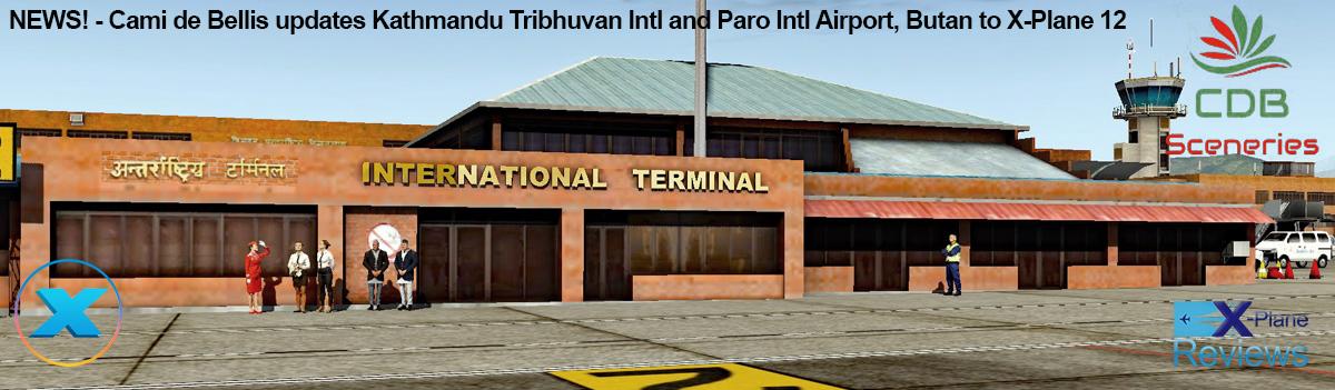
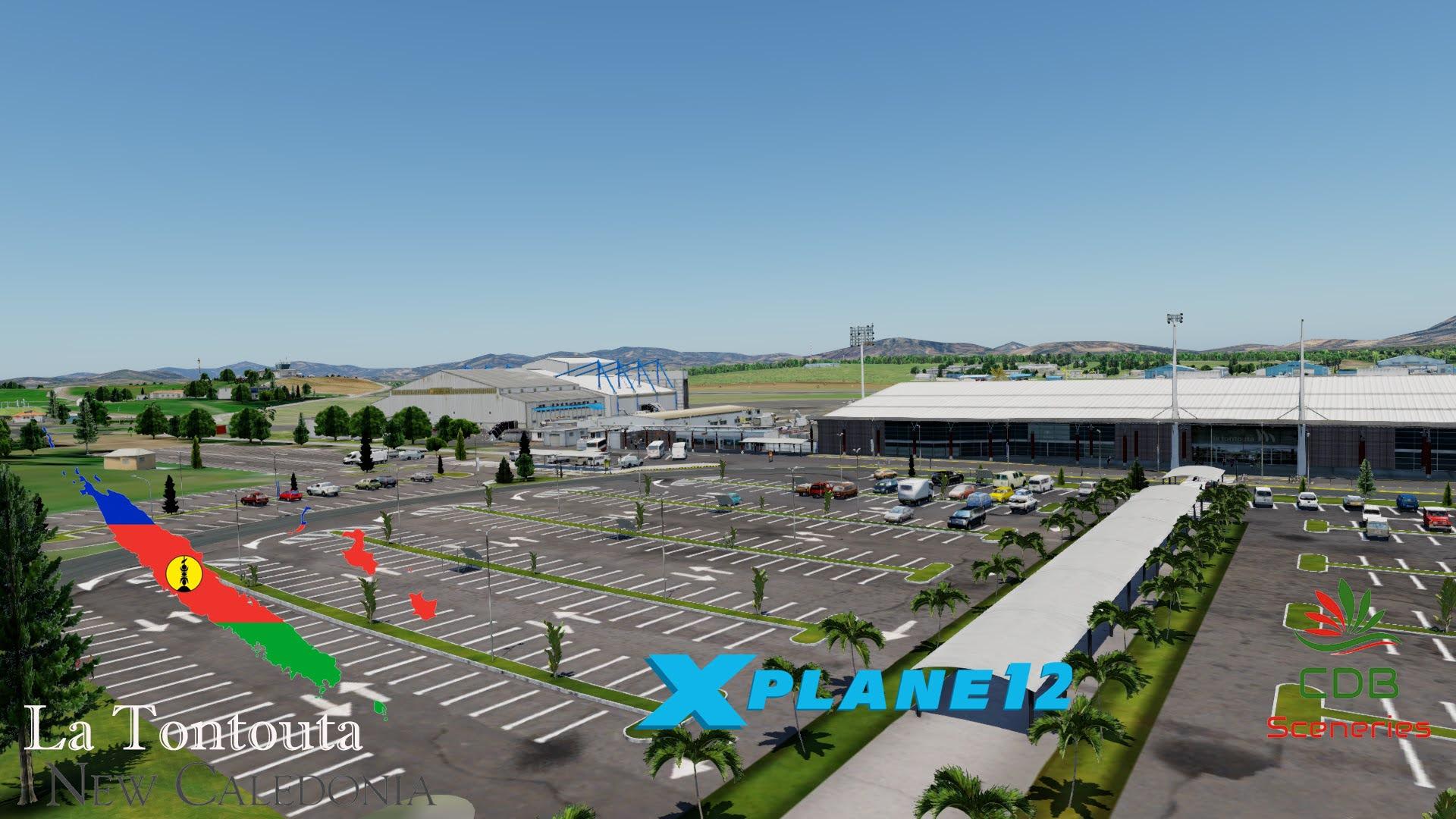
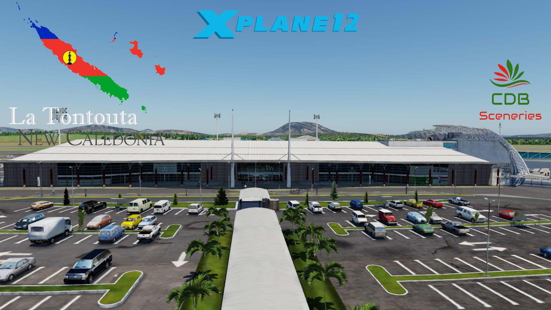
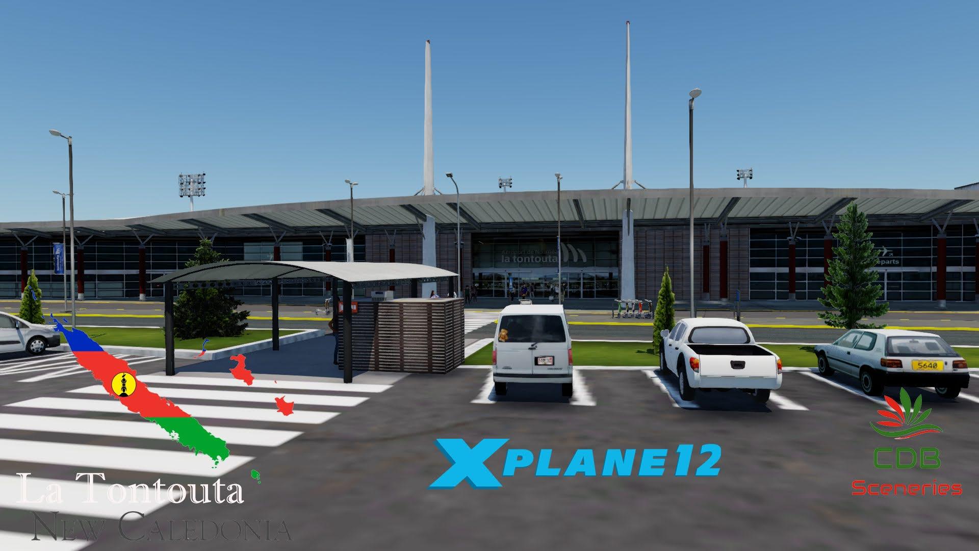
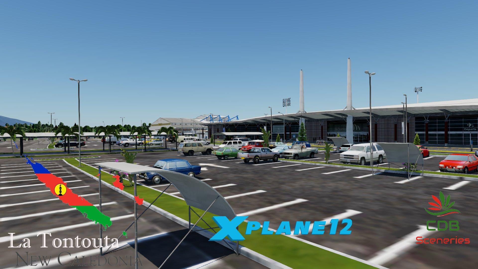
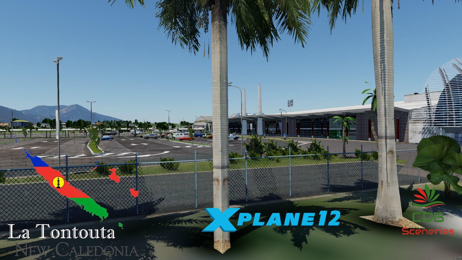
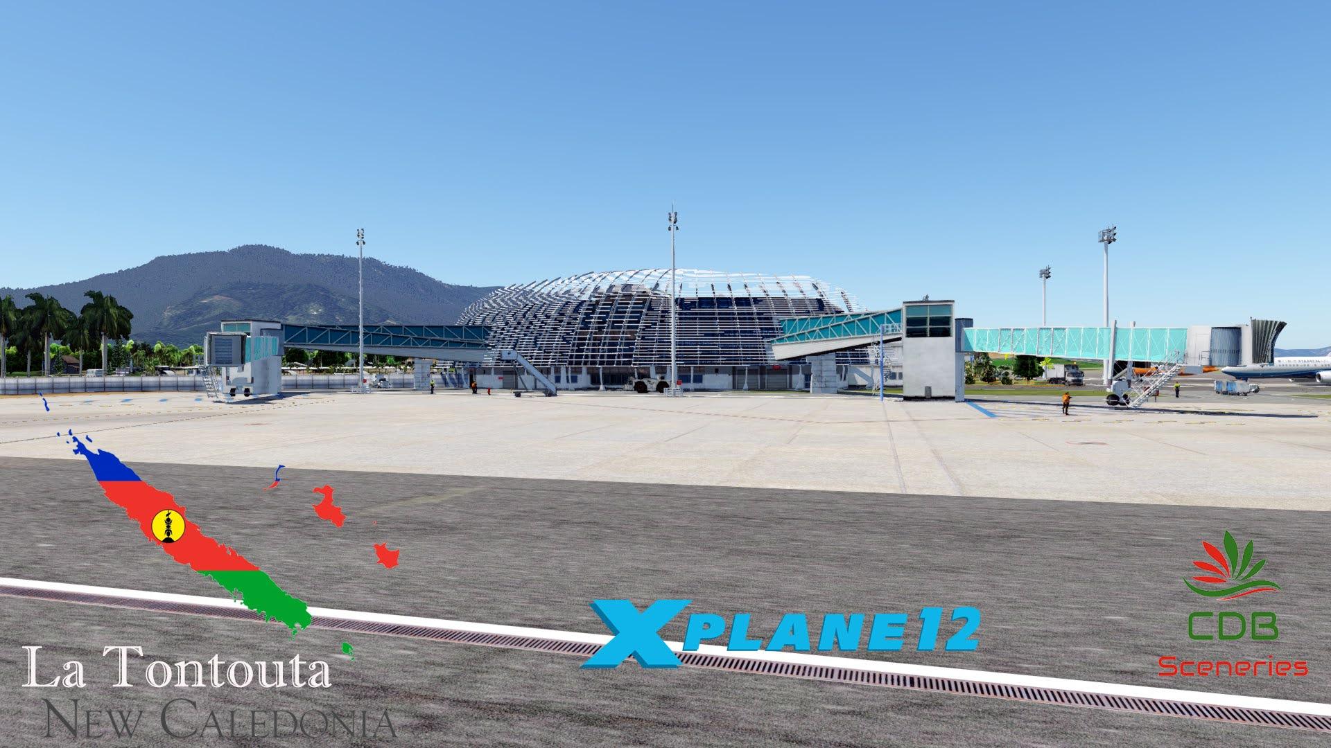
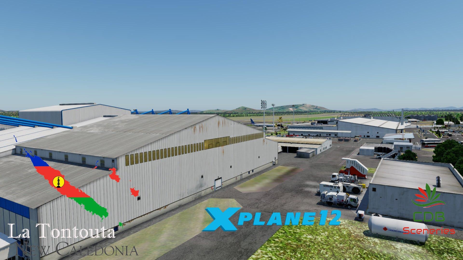
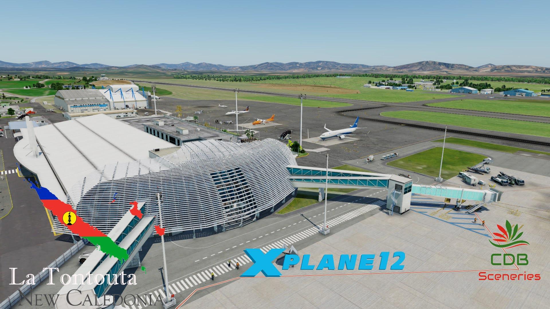
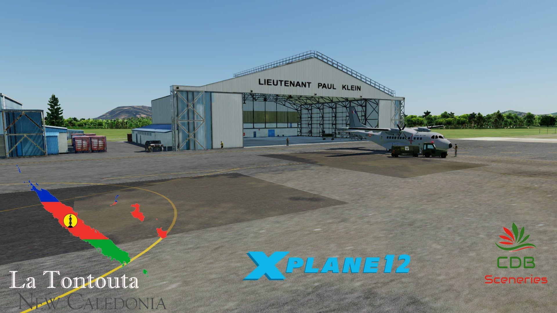
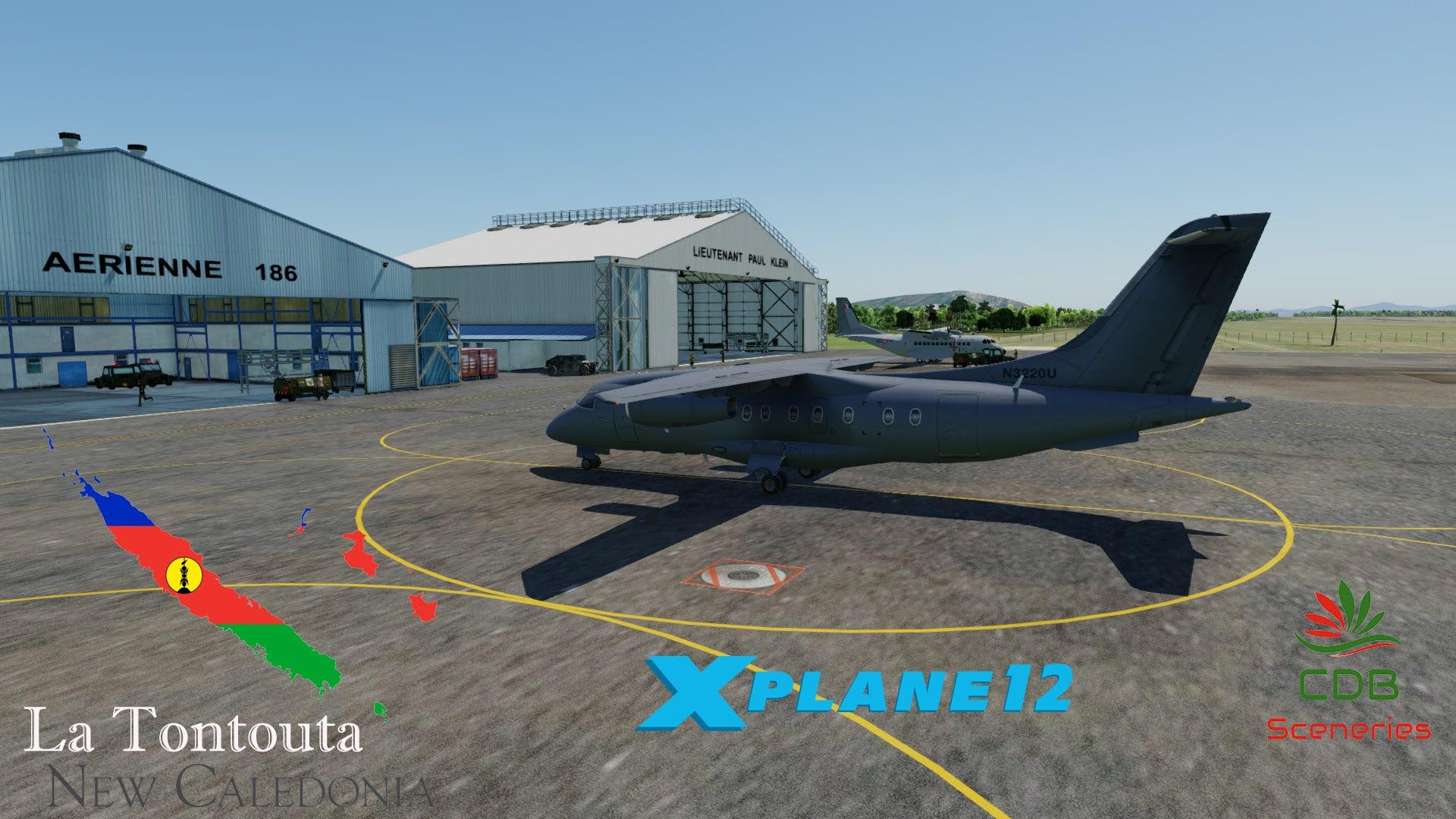
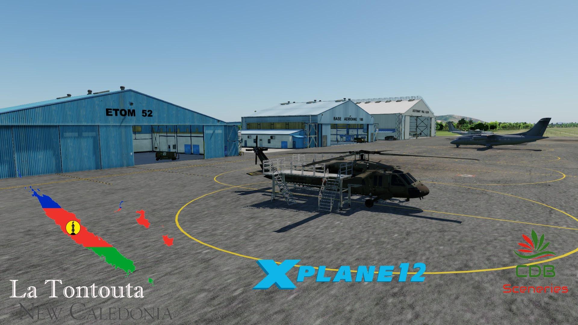
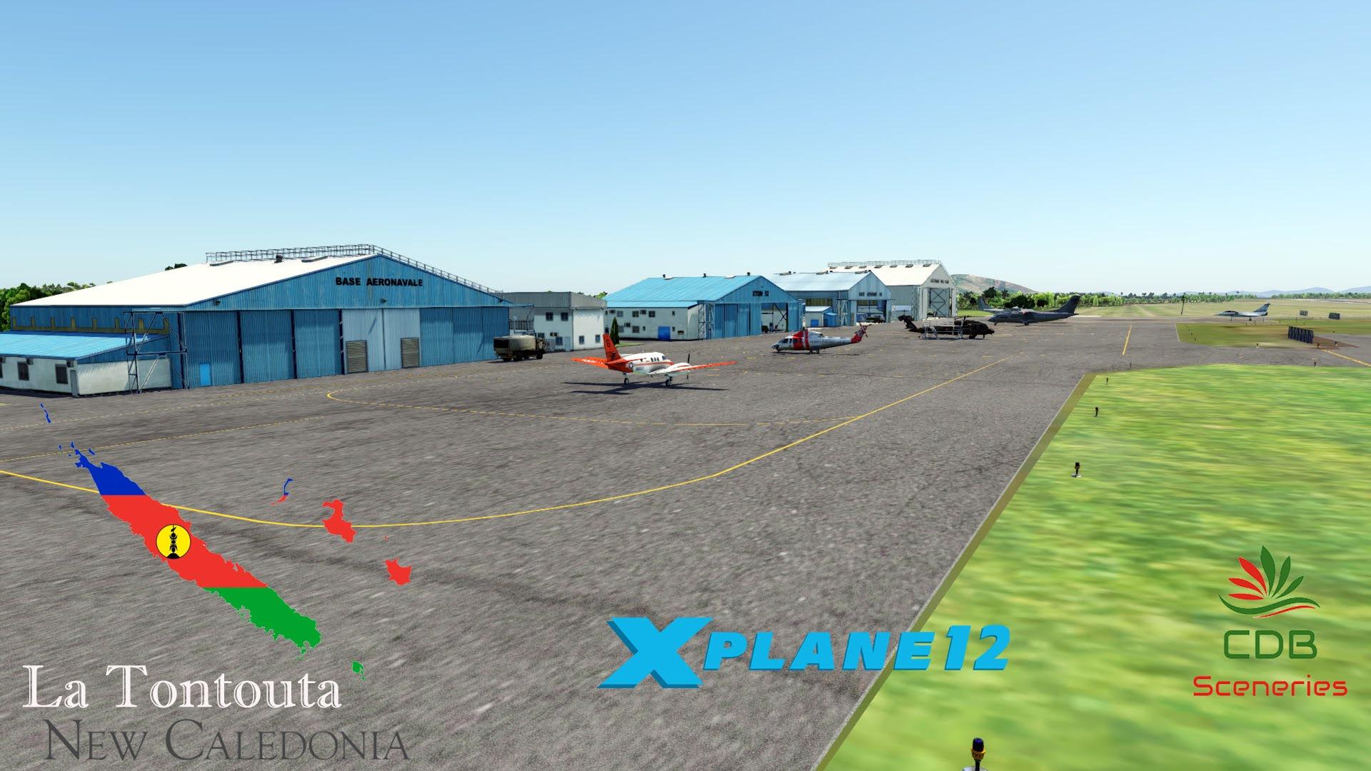
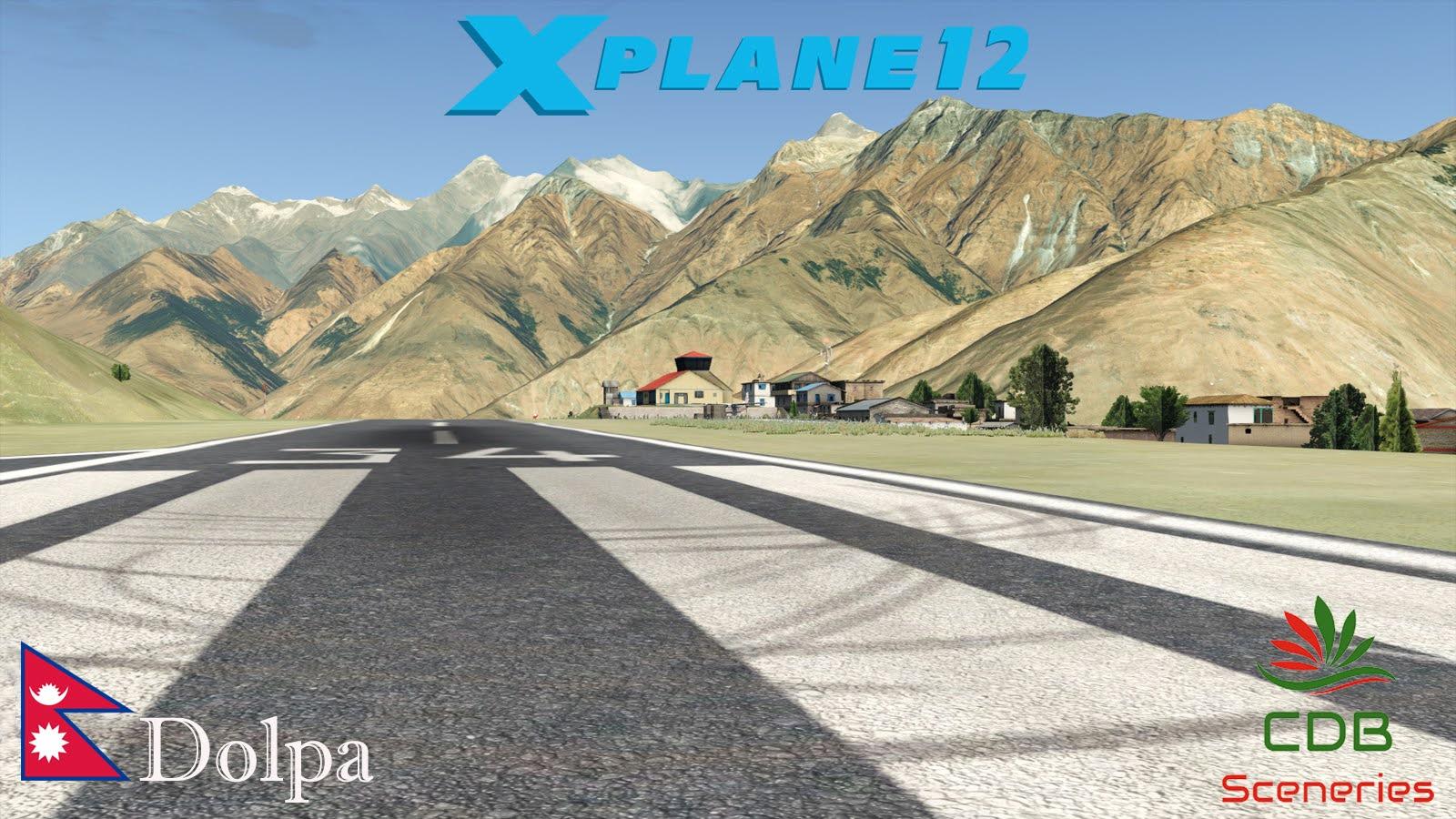
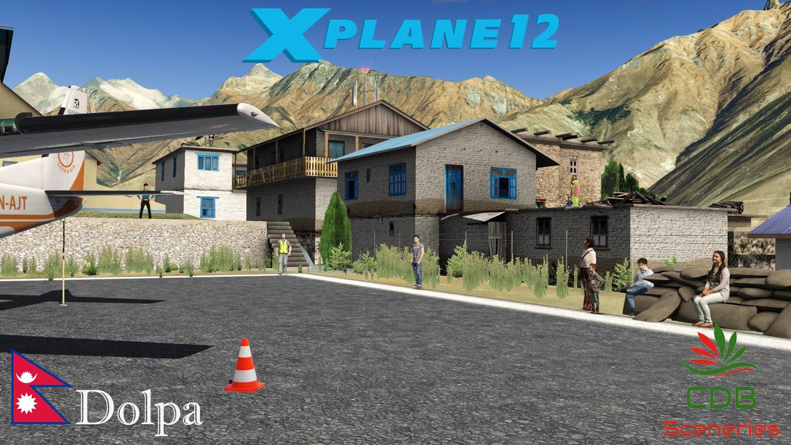
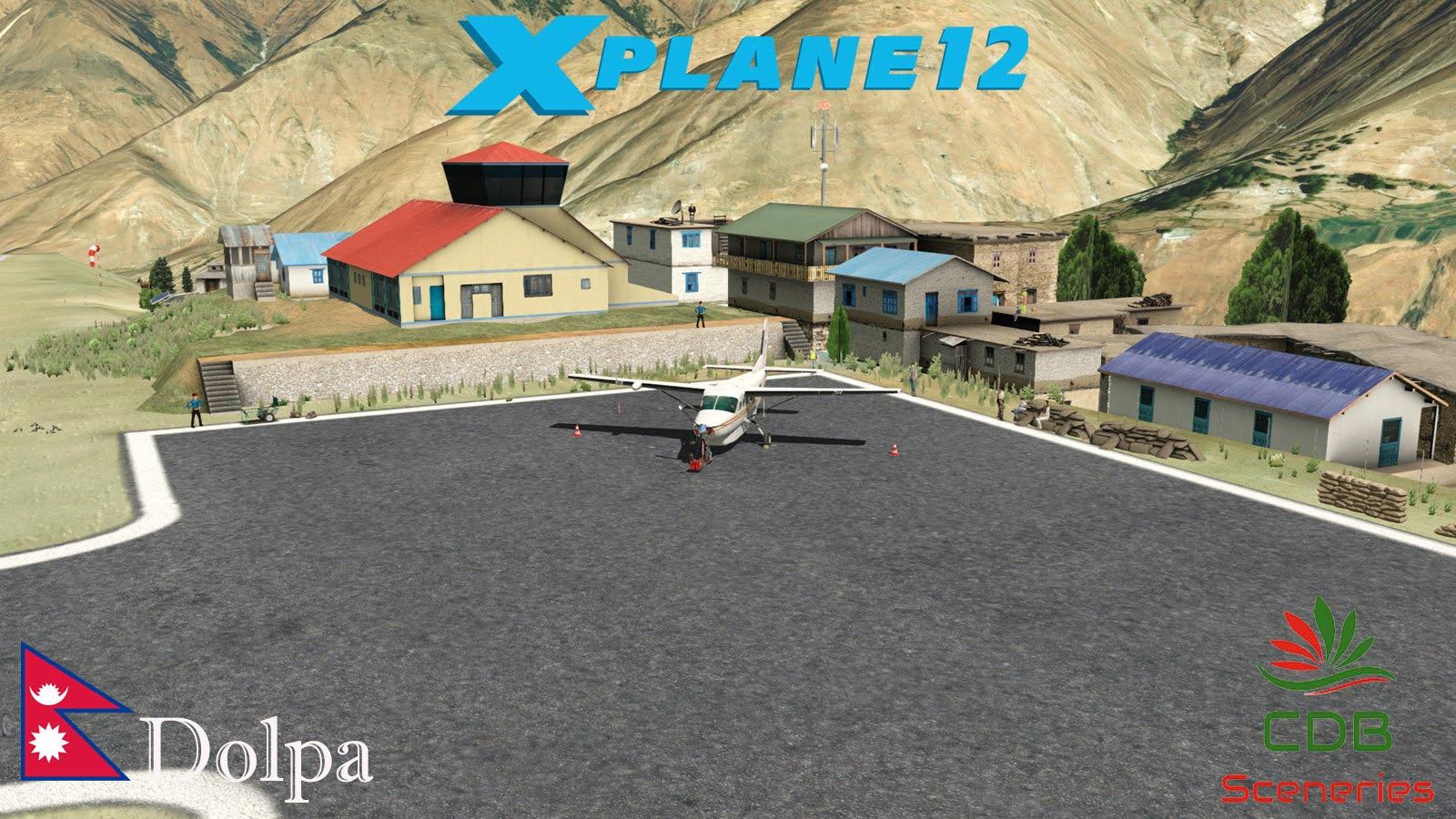
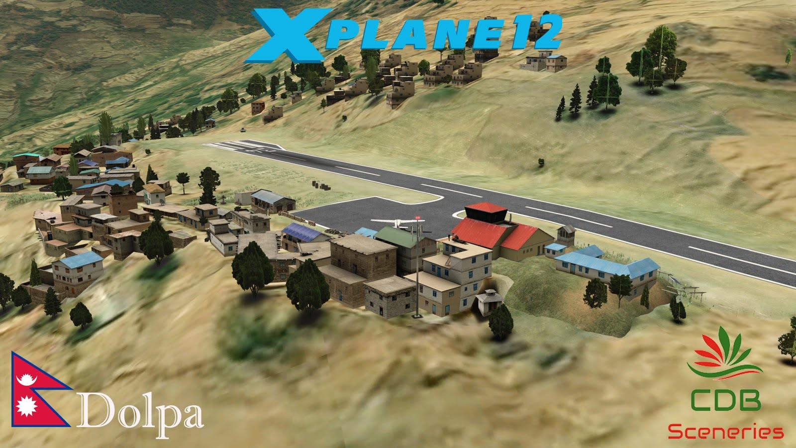
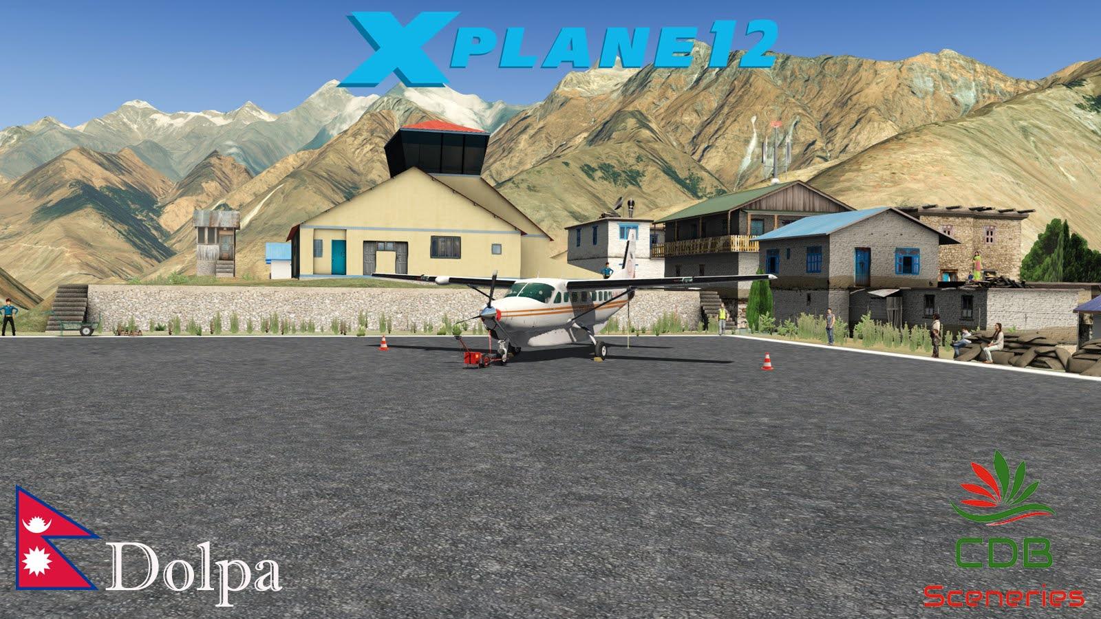
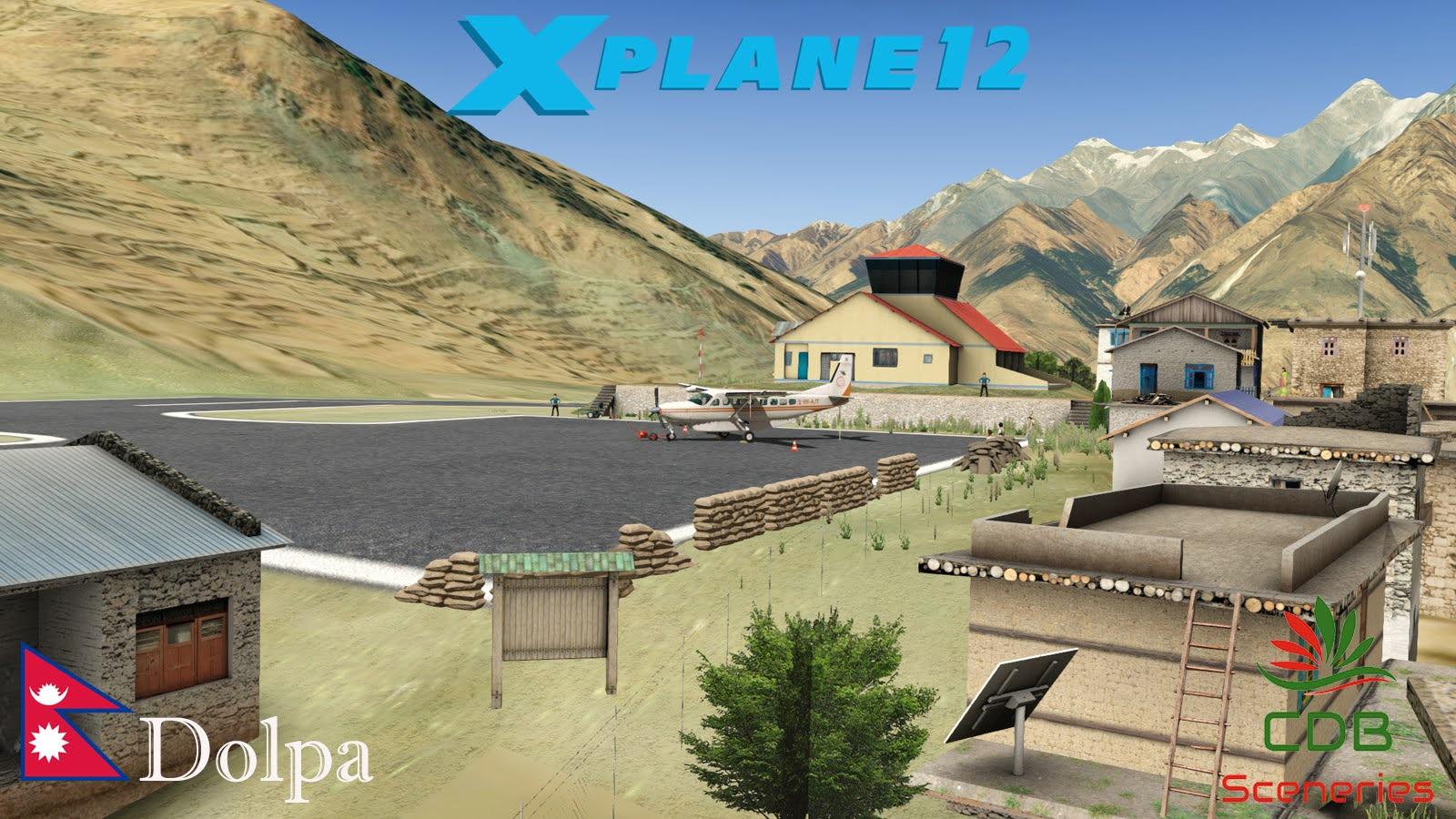
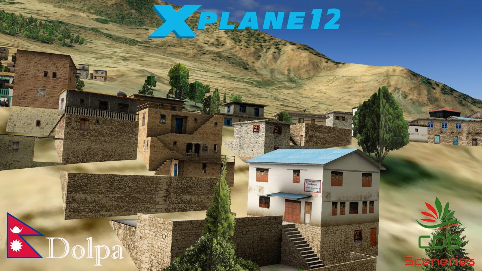
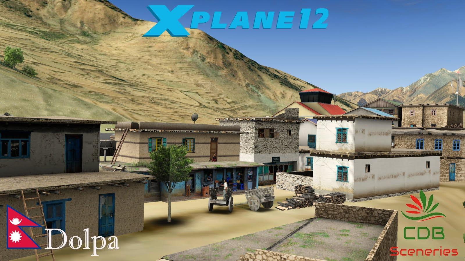

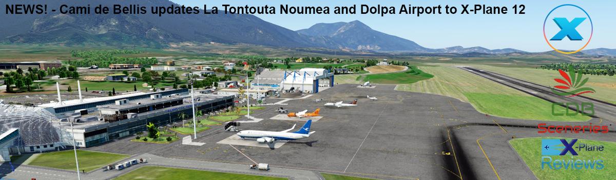

.jpg.e6895a27da14859ca65b7b09f054248f.jpg)
.jpg.ae3ef9ada1f84b7242a8aaad374e9dd1.jpg)
.jpg.e9e15b61251c708378cf517da0a0b2b7.jpg)
.jpg.19a47e7bb0a4328df71d43a289e58cca.jpg)
.jpg.27edc2ae8d5636f5be6e1e05ca5e1962.jpg)
.jpg.641b89efae19f5f30215da0468f50b3d.jpg)
.jpg.64775717a9a3c83e9c2fc67a63b796fe.jpg)
.jpg.ecc1baa341a1cd865ff6dceb403f9427.jpg)
.jpg.b2a938dff813400f1ffc9afc04f513cb.jpg)
.jpg.135e64d7e8d794a732011af62b0271e8.jpg)
.jpg.4ec6c88325f4a264deec5d283a45455c.jpg)
.jpg.20ead369b15e9aed98a31fc7fc54c538.jpg)
.jpg.f88768a40c675f29aaa76f183992f843.jpg)
.jpg.a451f3e9ae64a49341a7c7e866174b4c.jpg)
.jpg.6ee64a99b9ff46446ef1c308b316b7c3.jpg)