Search the Community
Showing results for tags 'scenery4xp'.
Found 3 results
-
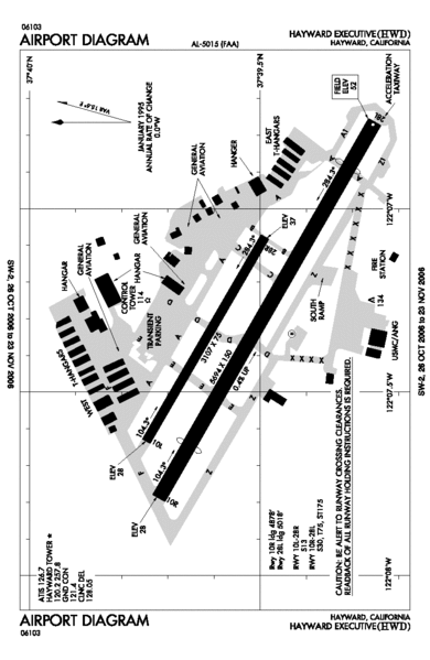
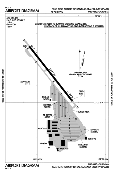
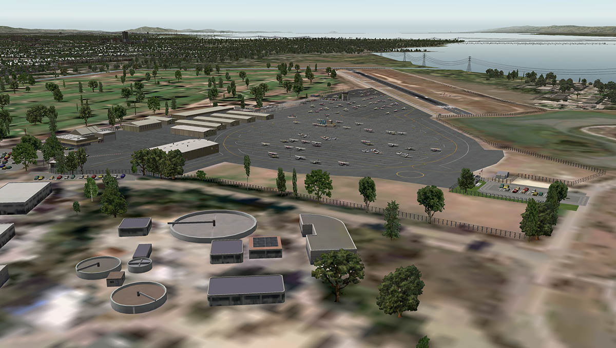
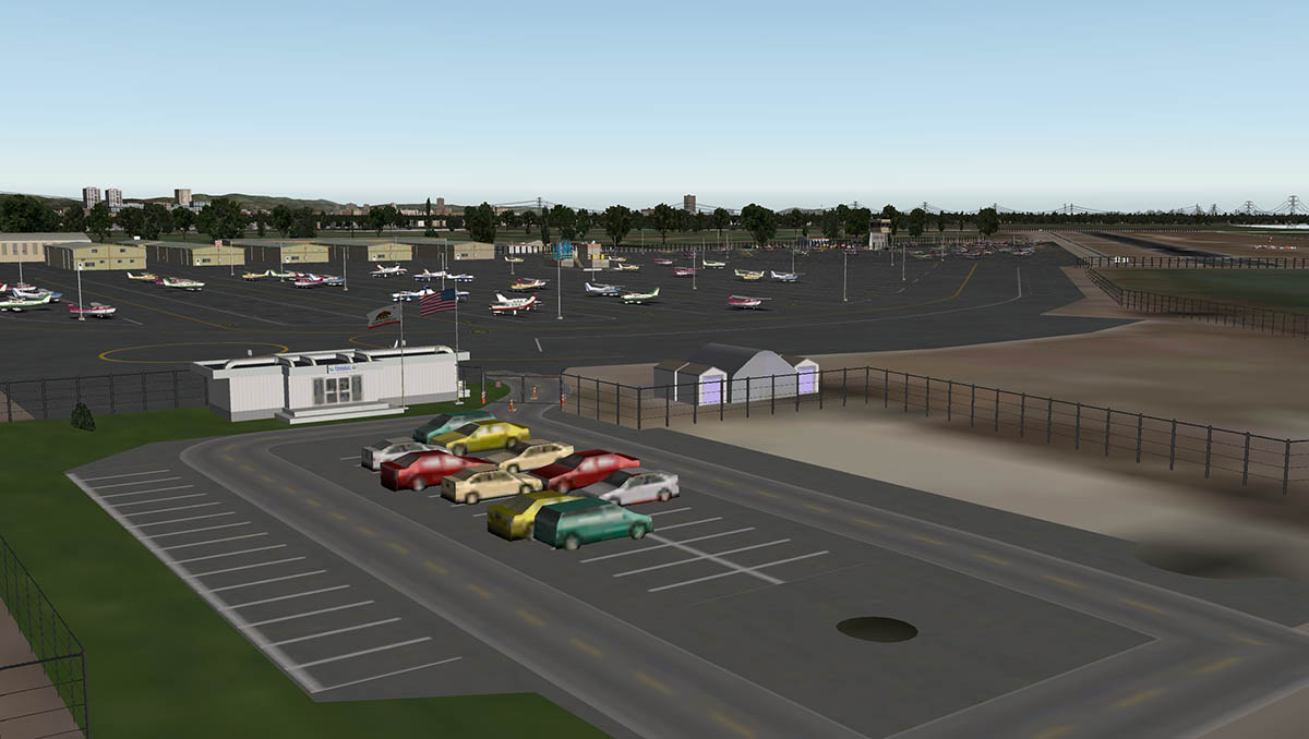
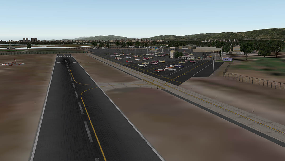
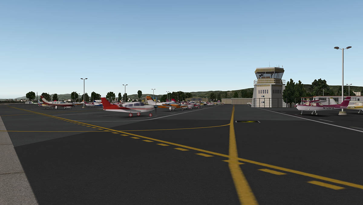
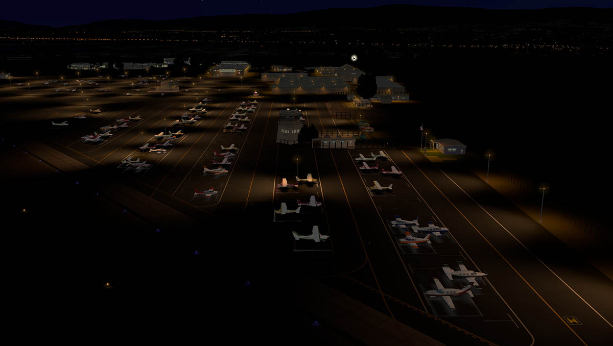
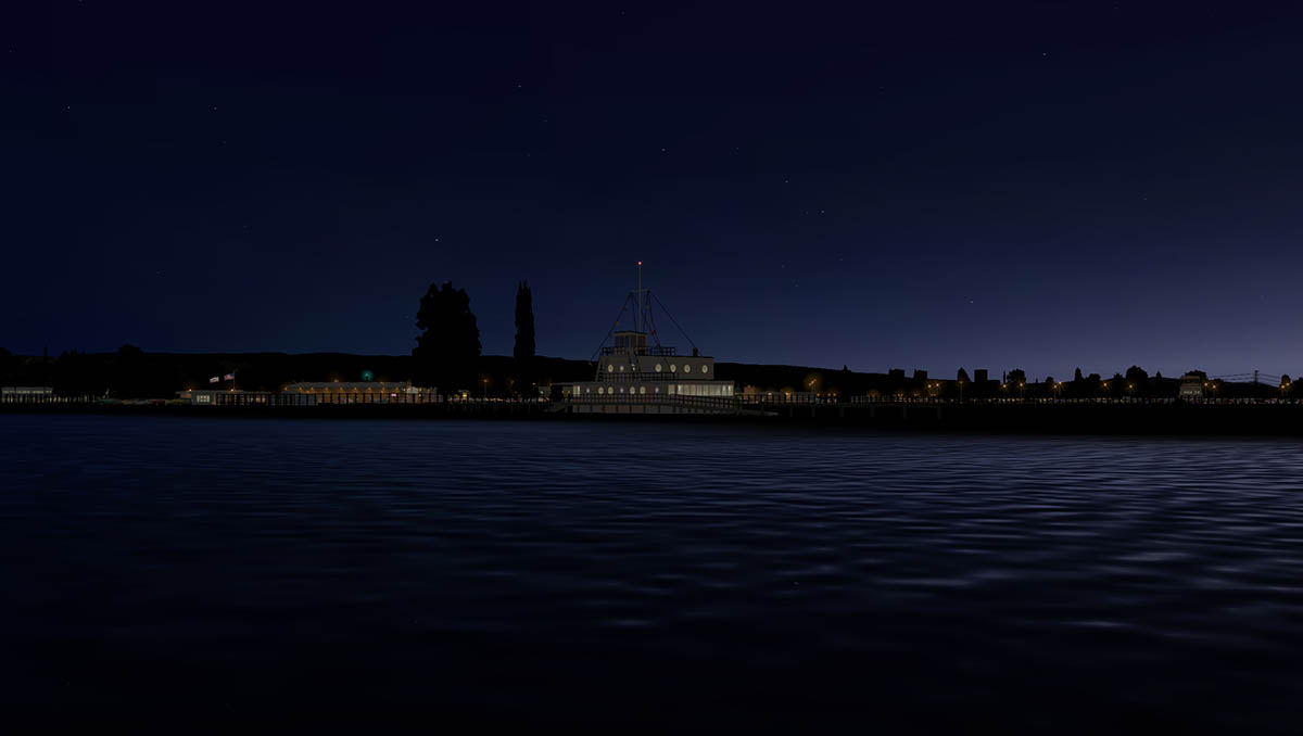
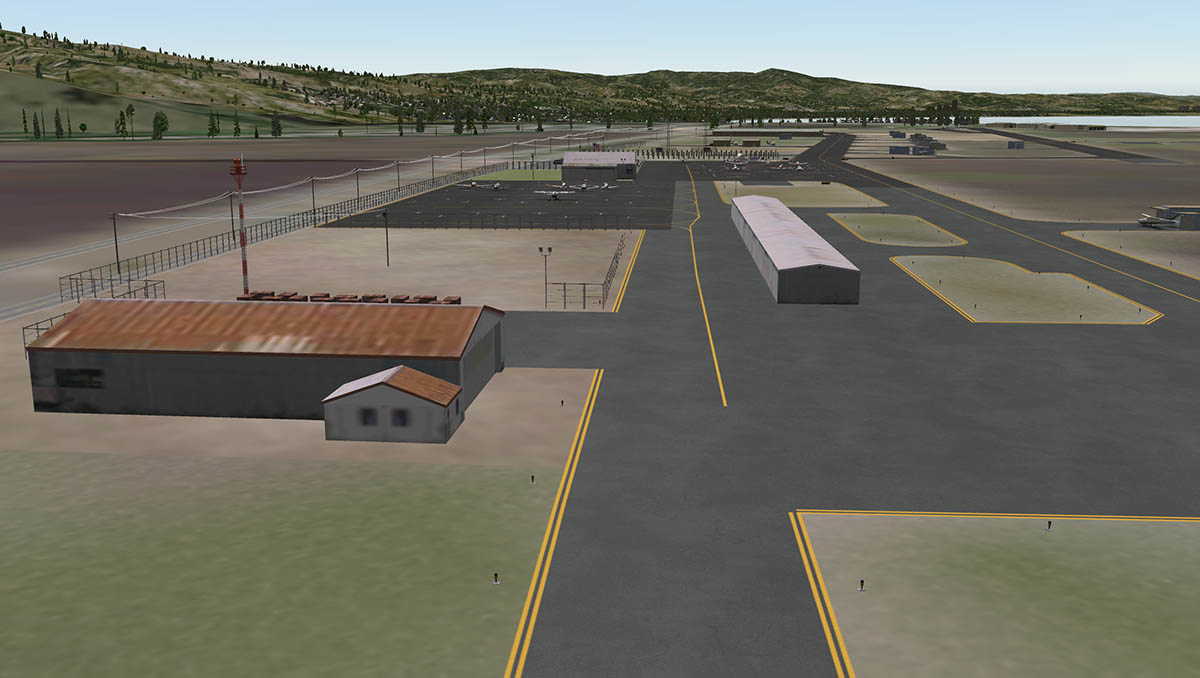
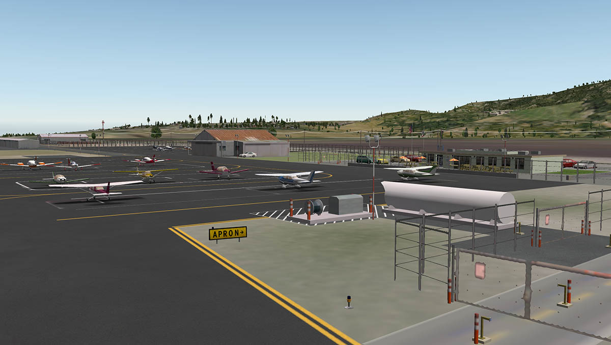
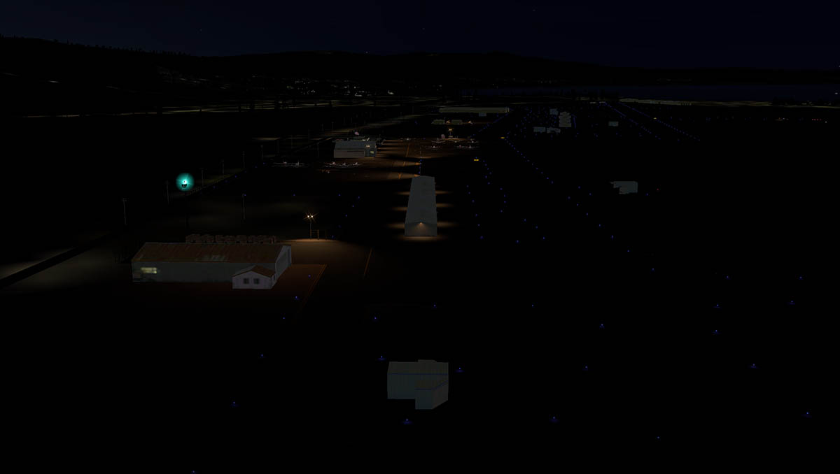
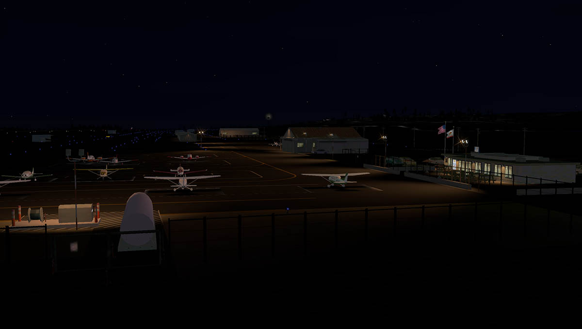
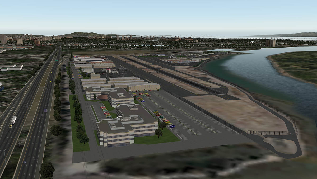
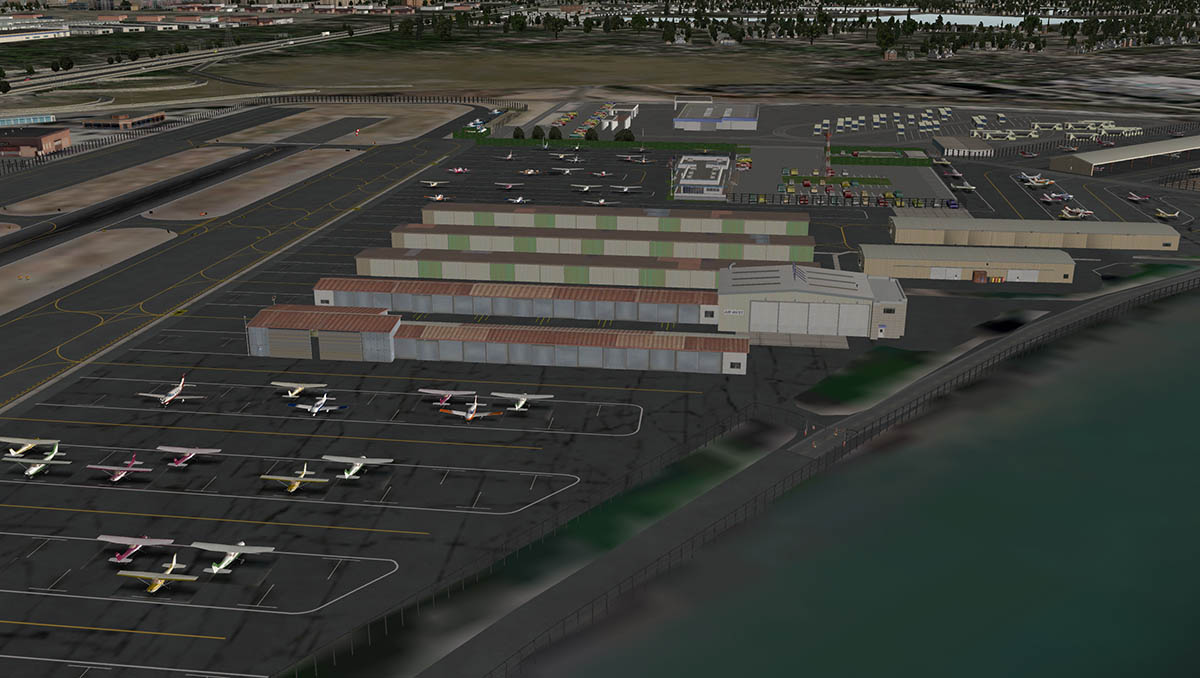
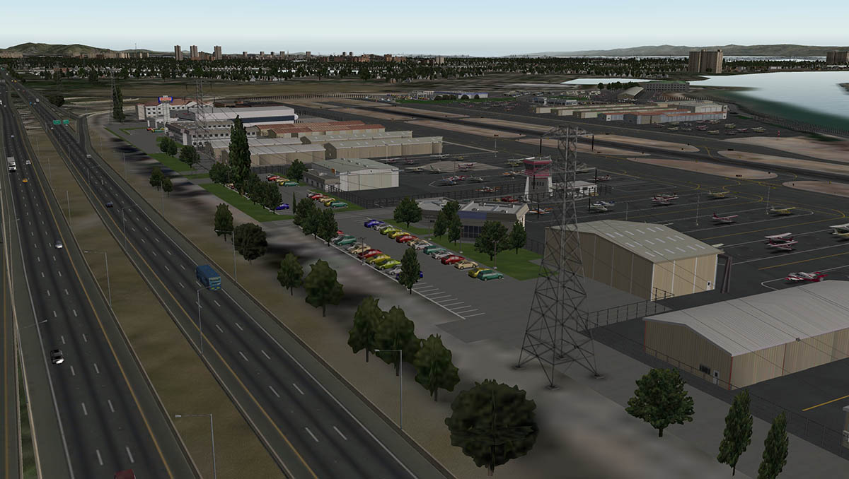
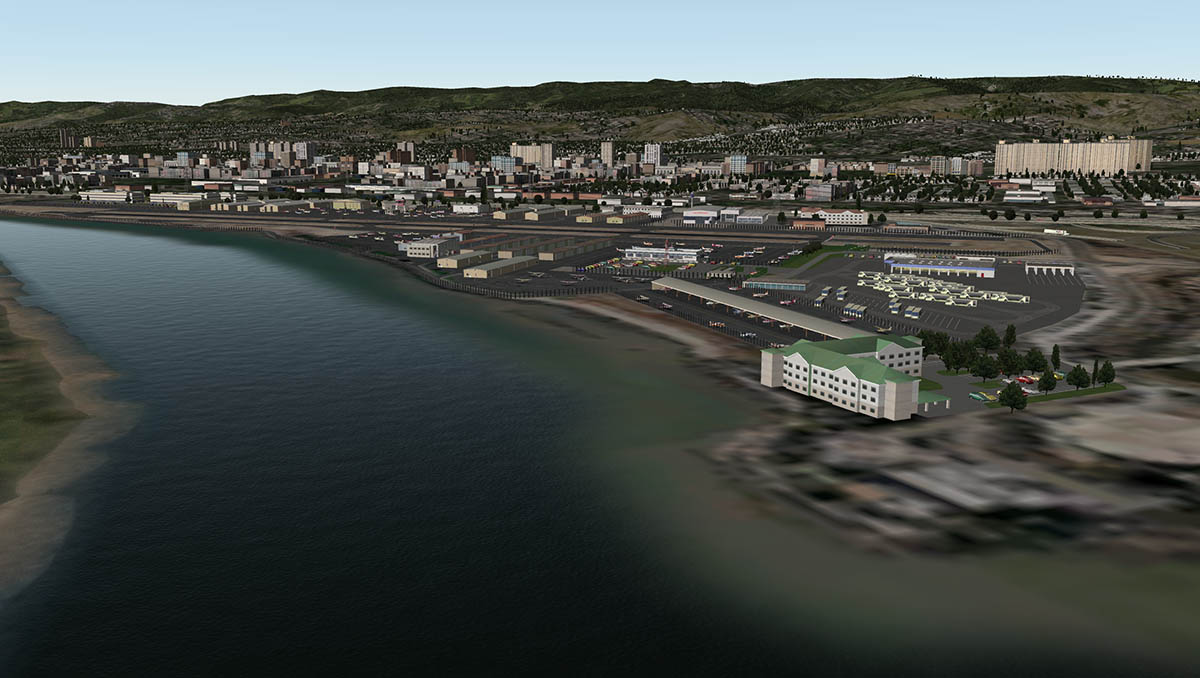
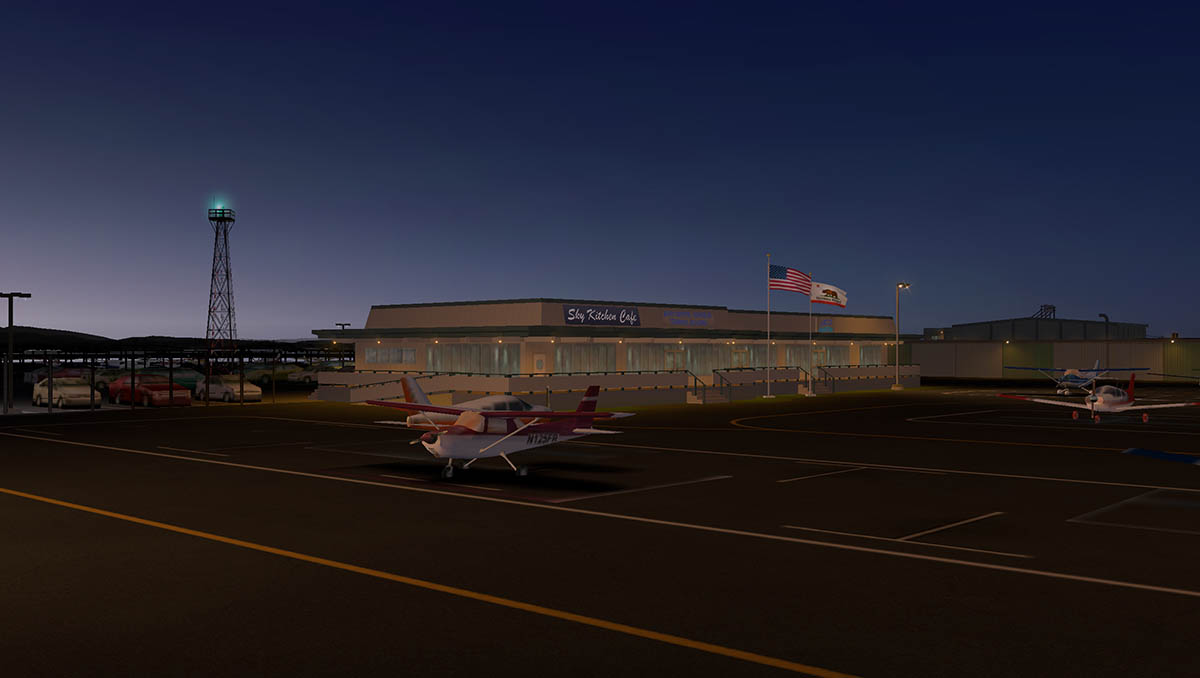
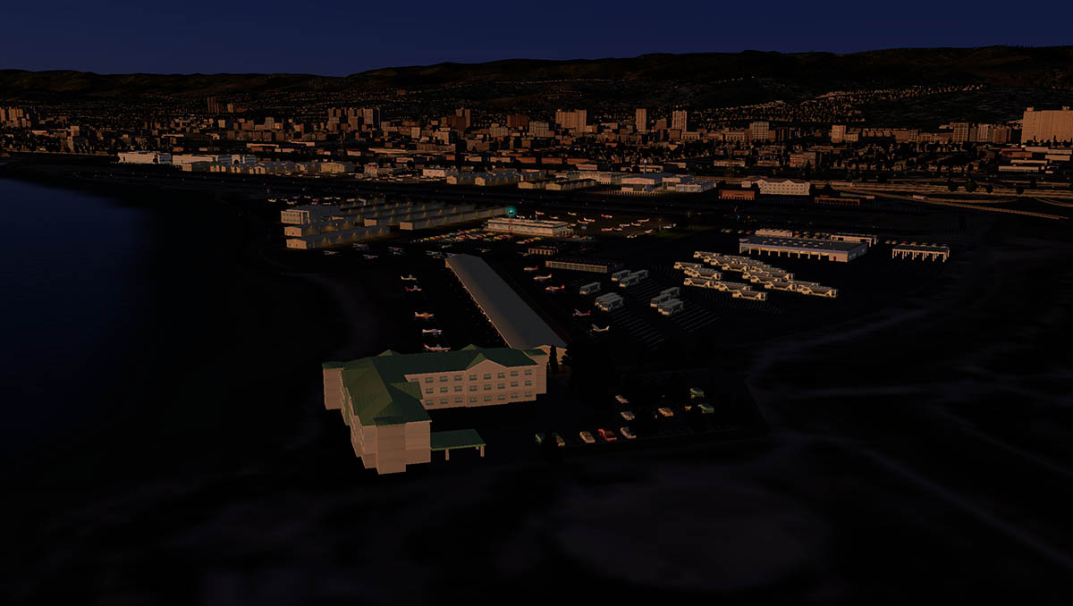
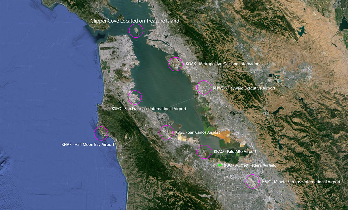
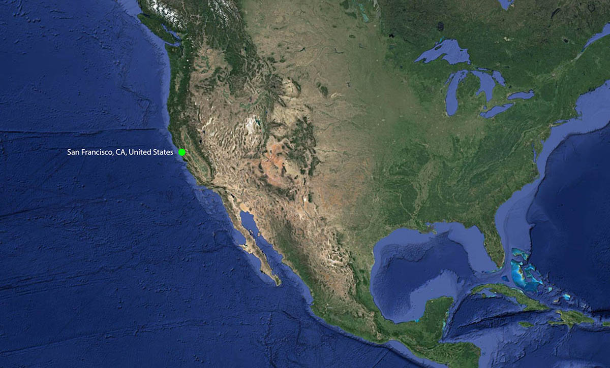
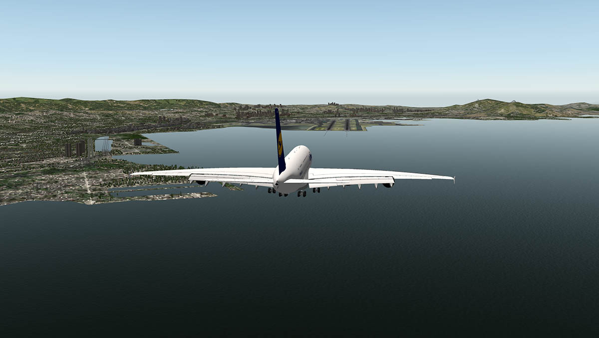
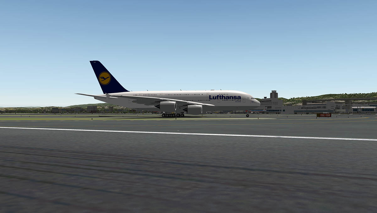
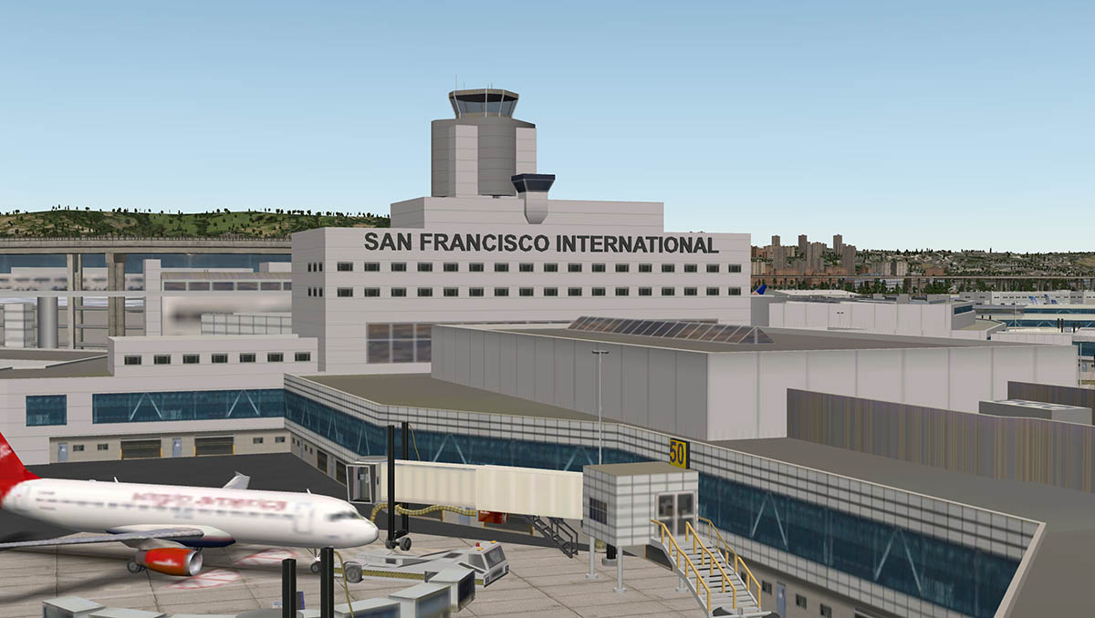
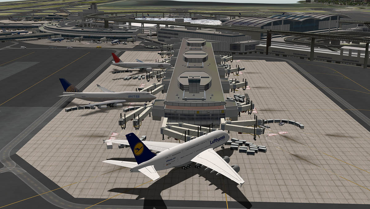
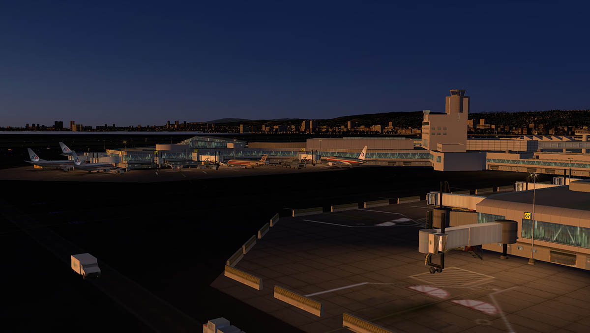
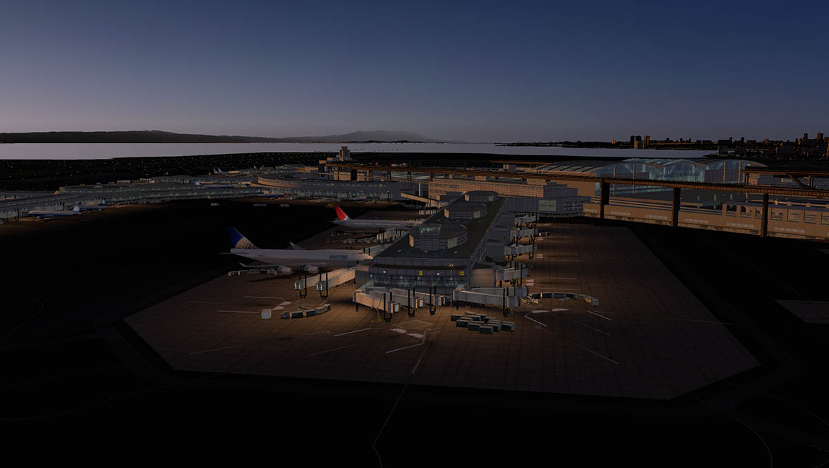
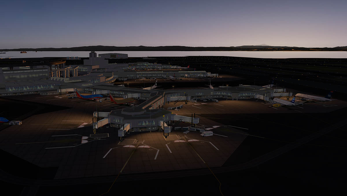
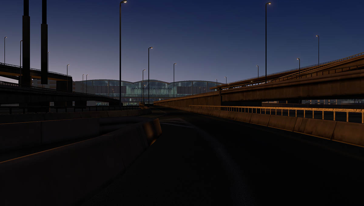
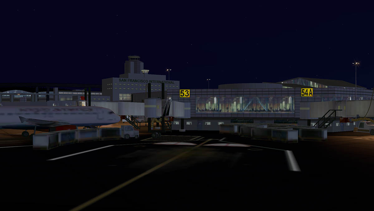
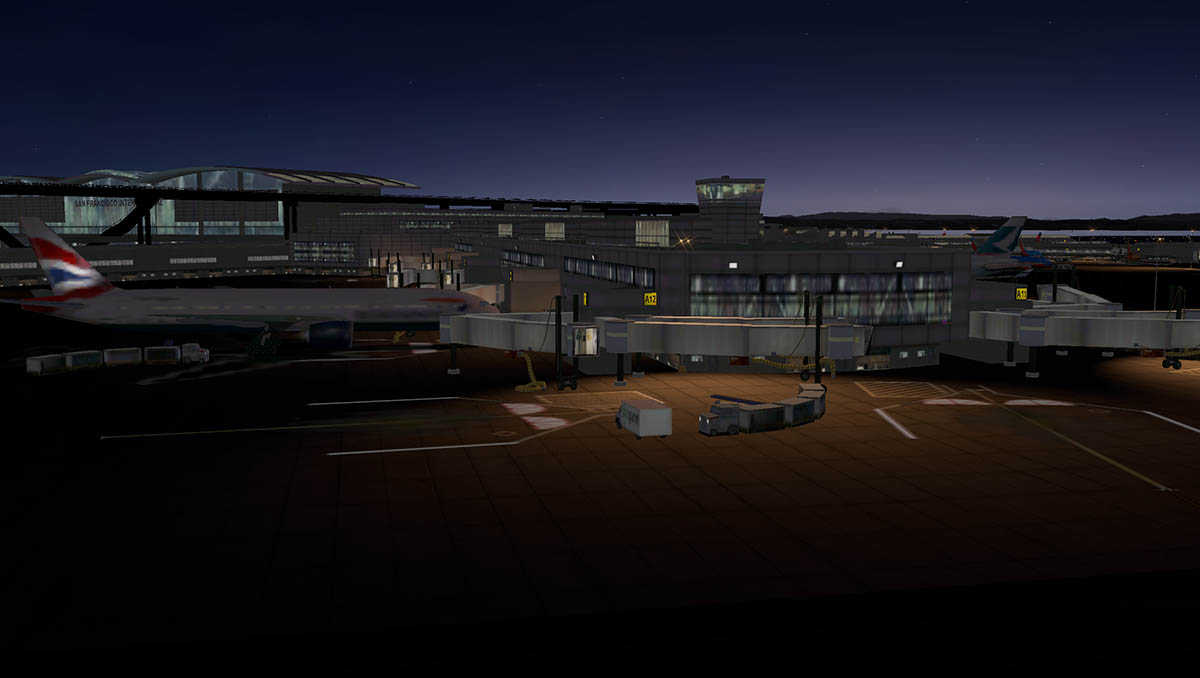
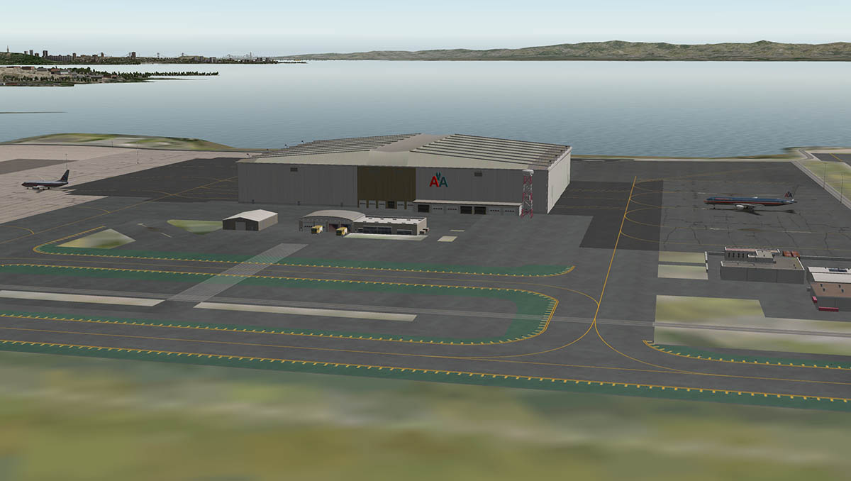
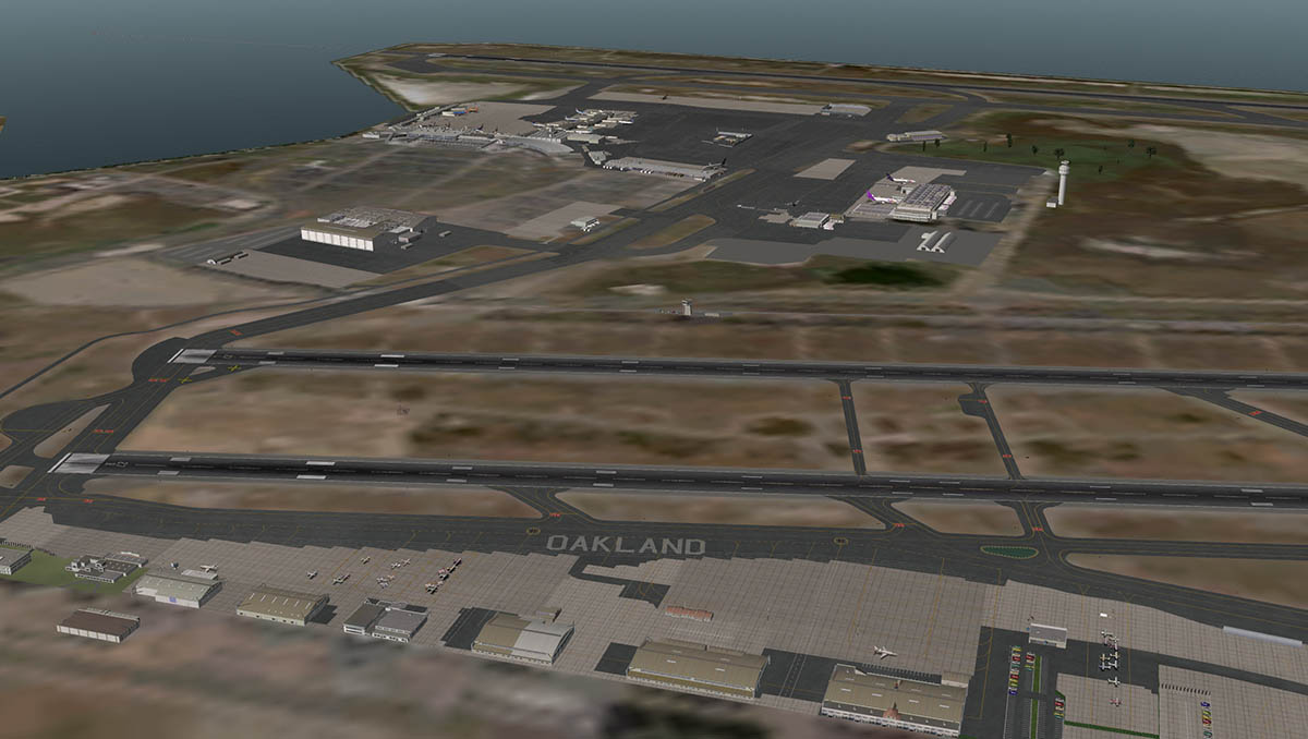
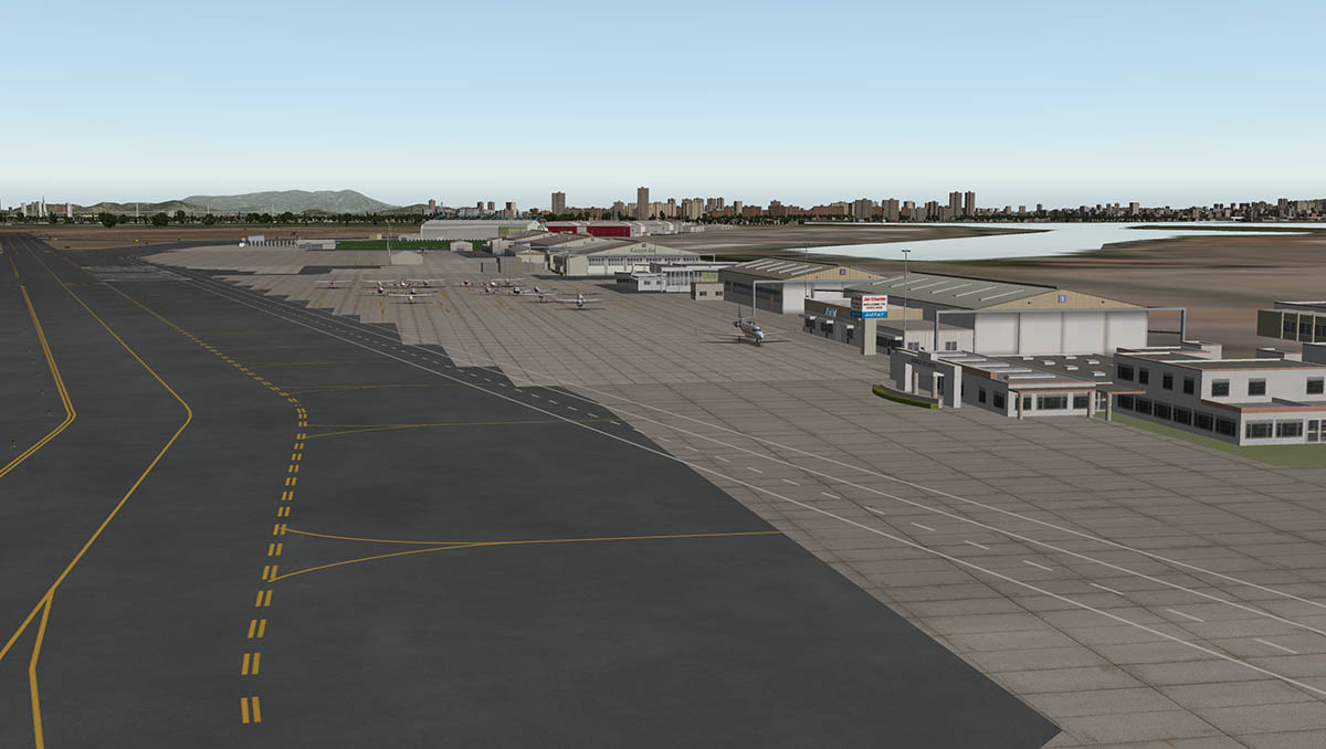
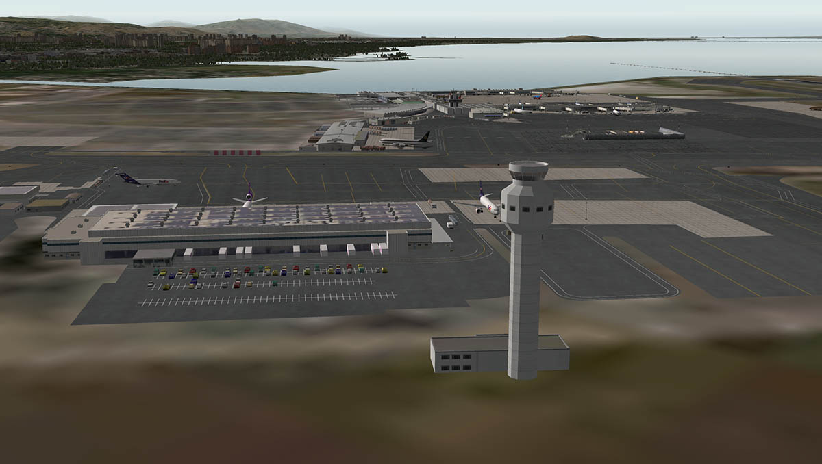
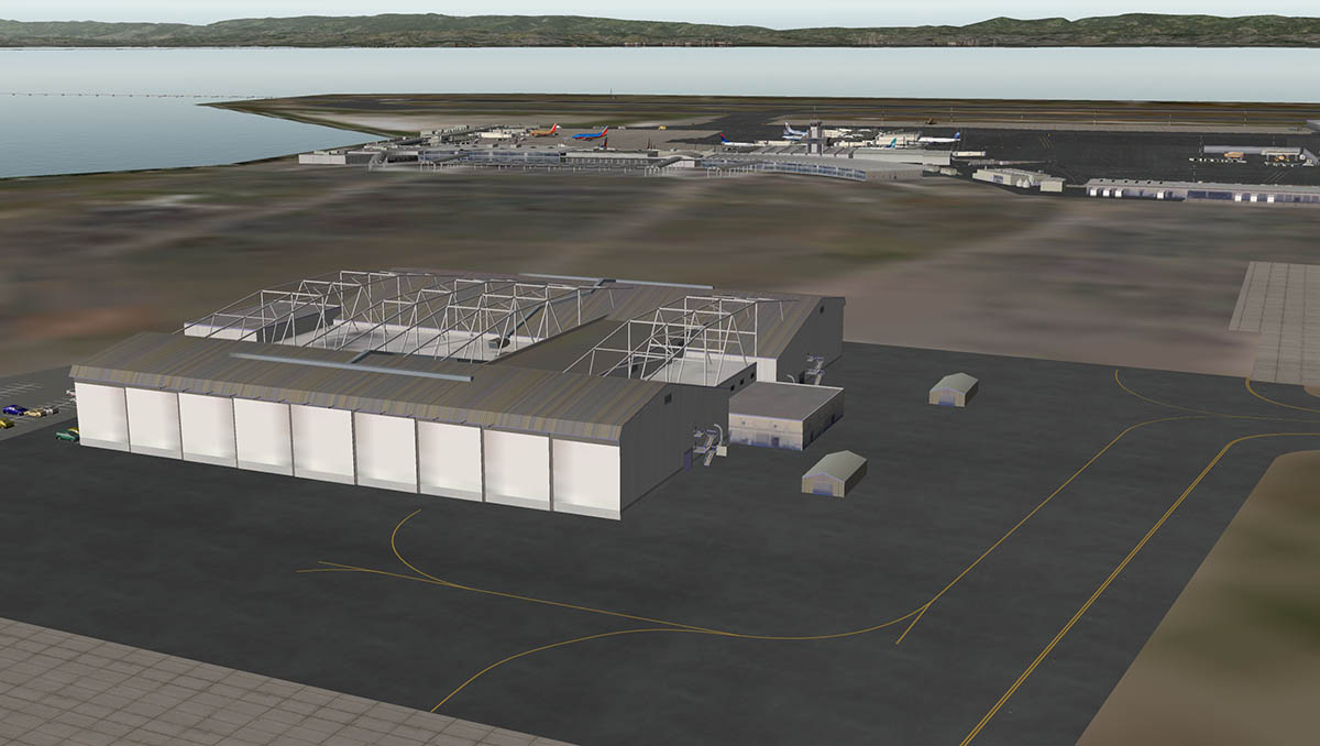
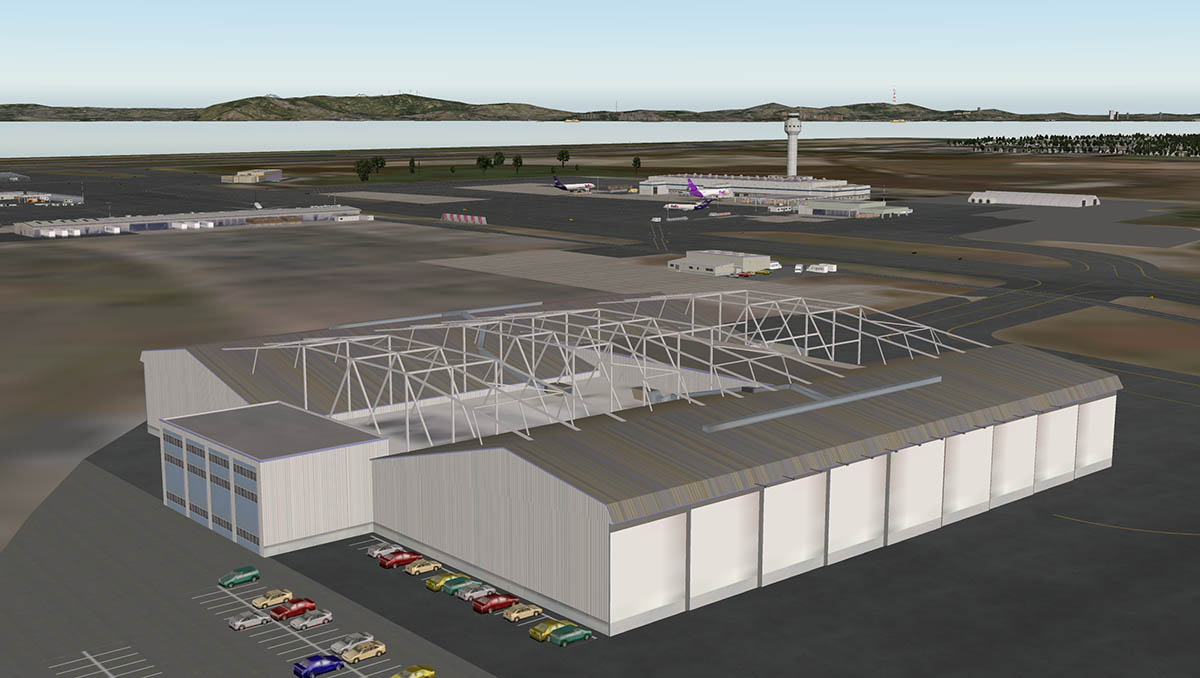
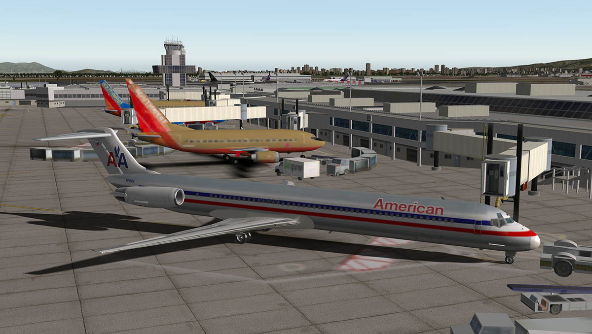
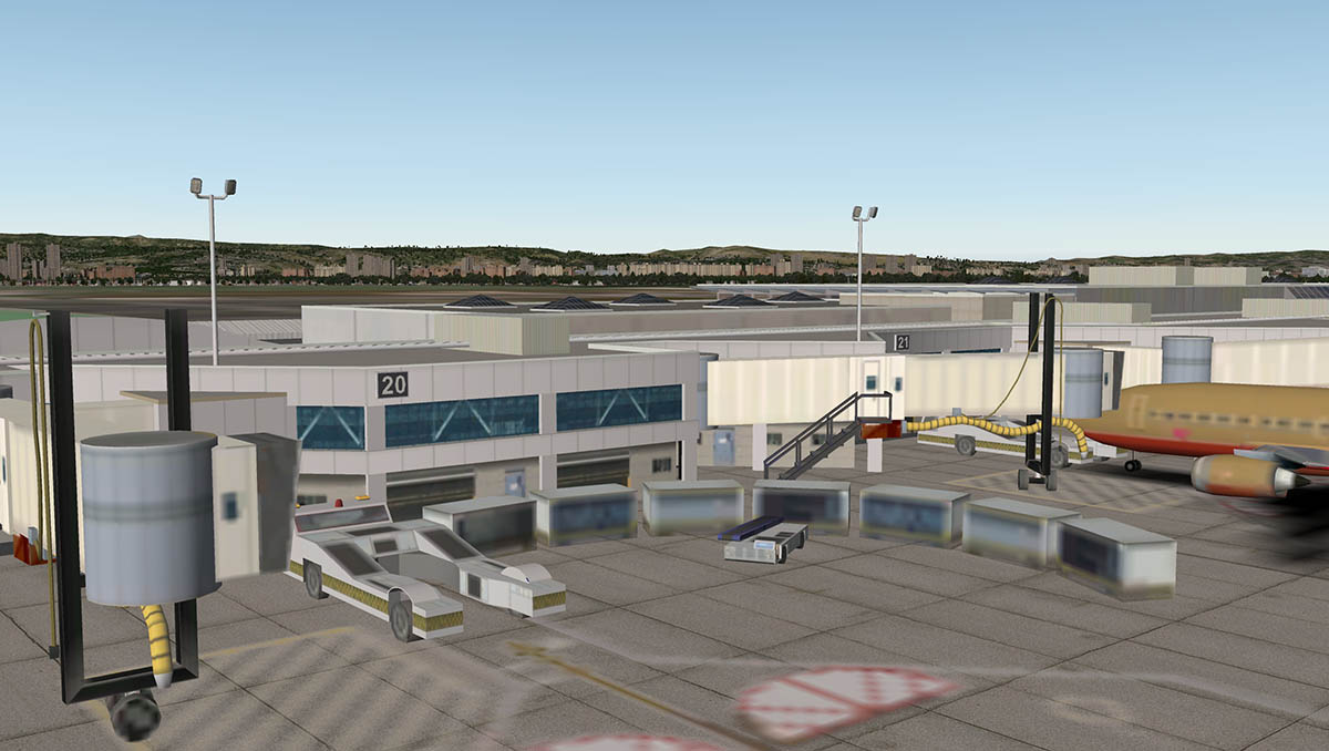
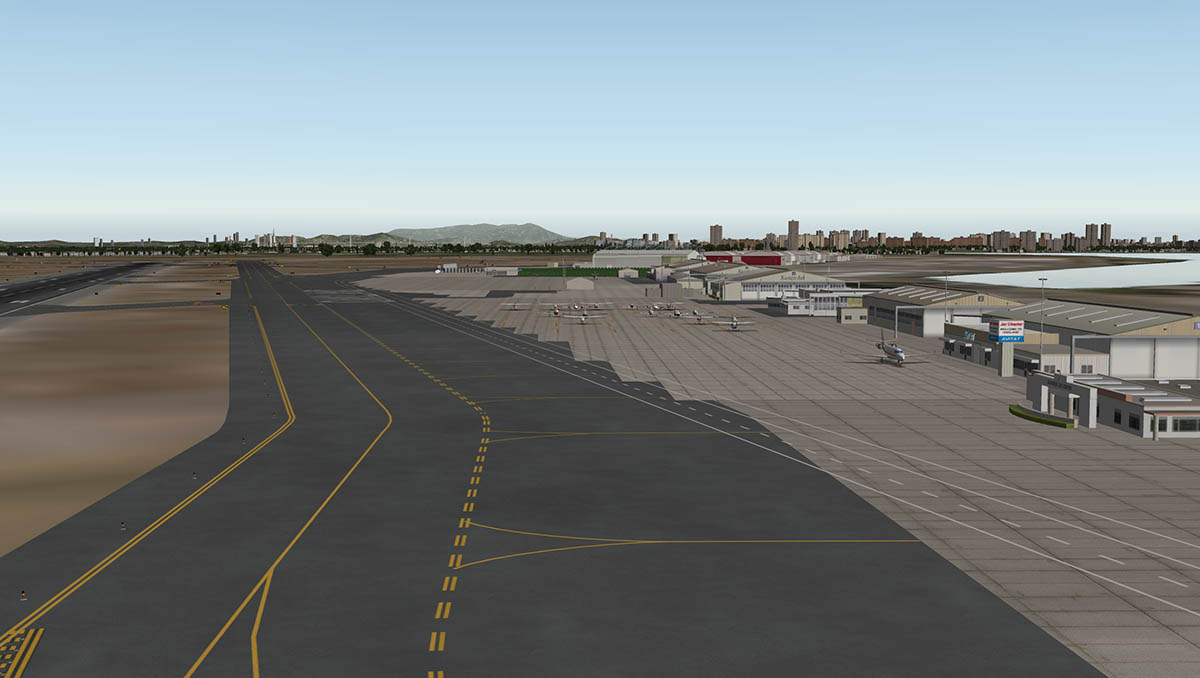
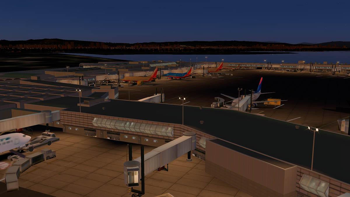
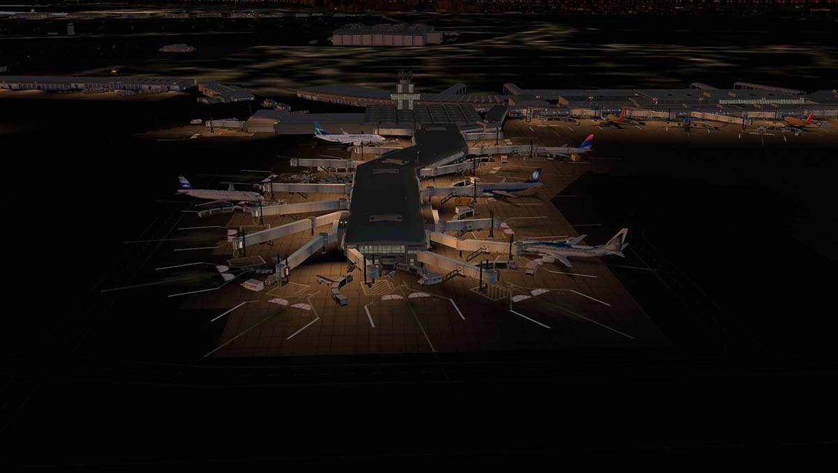
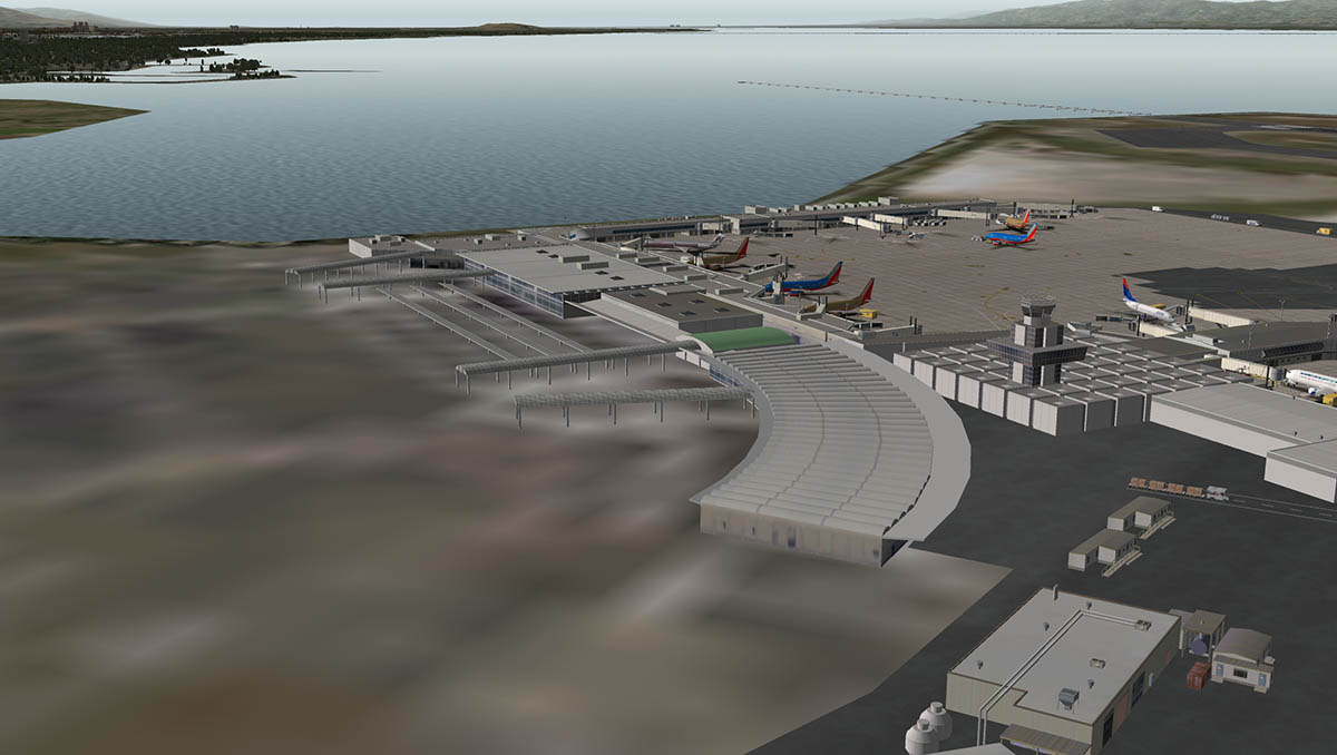
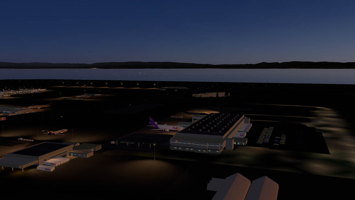
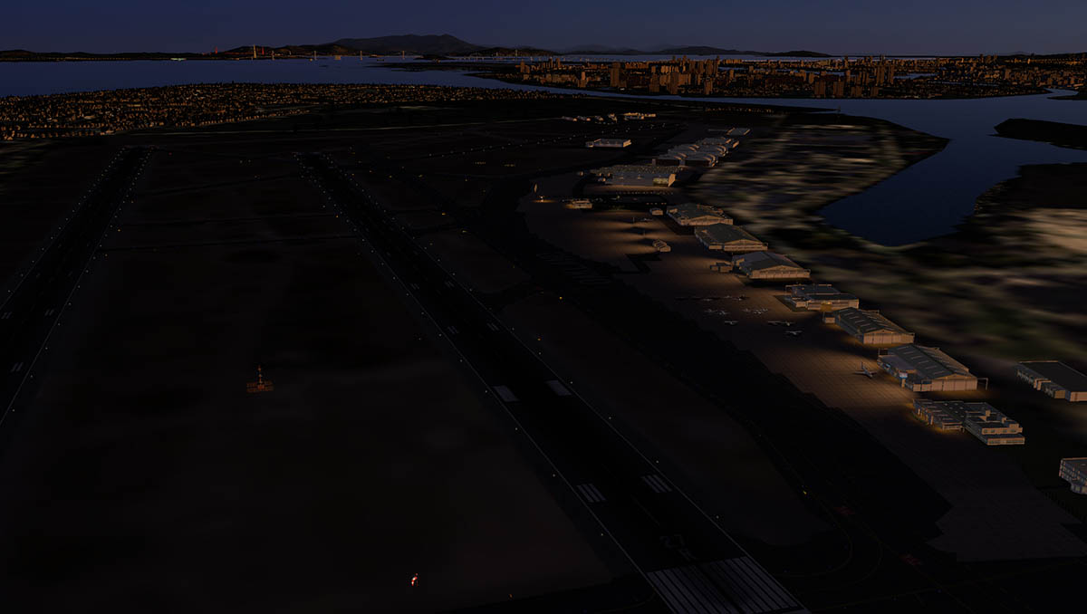
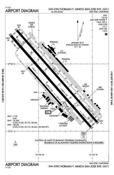
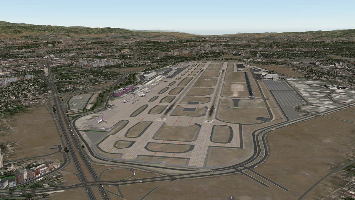
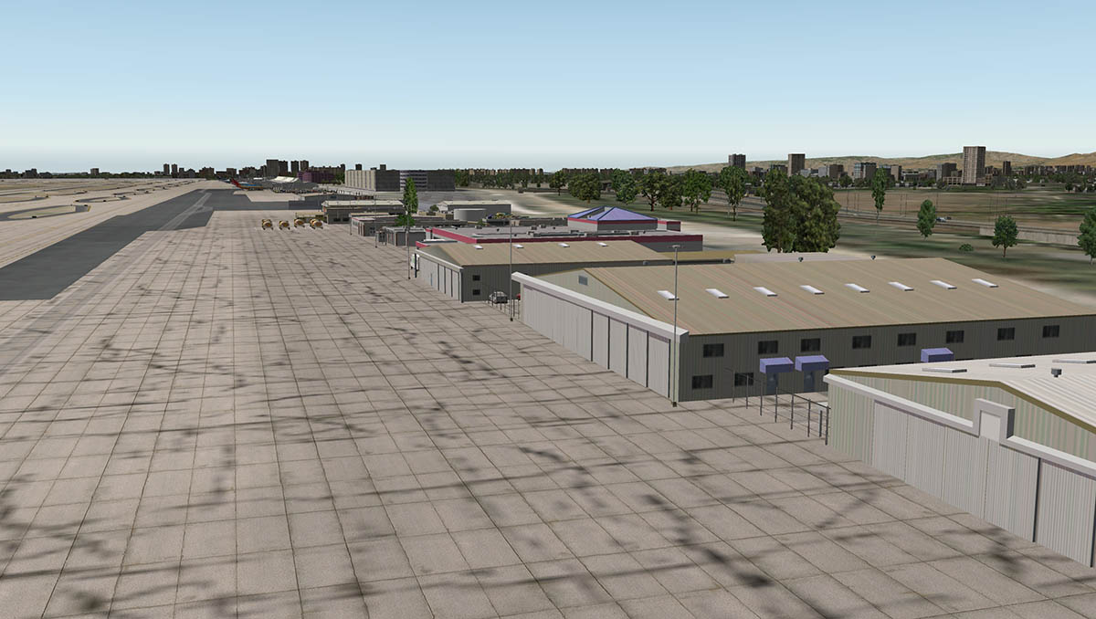
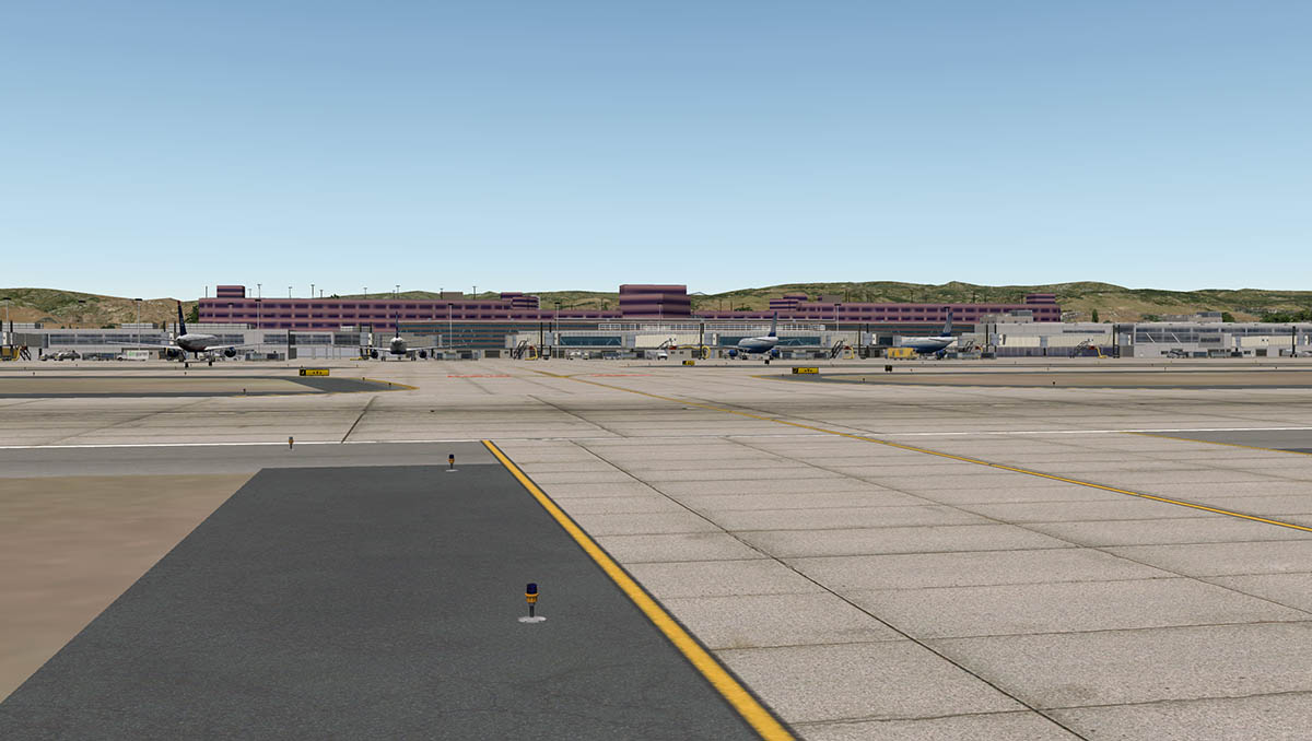
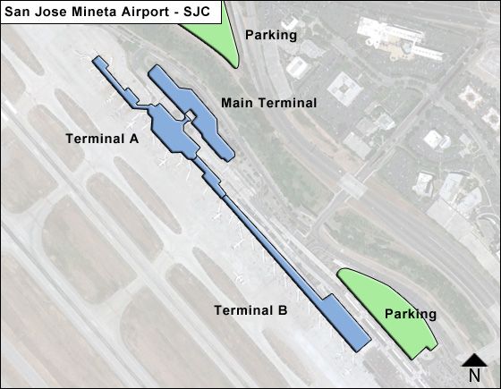
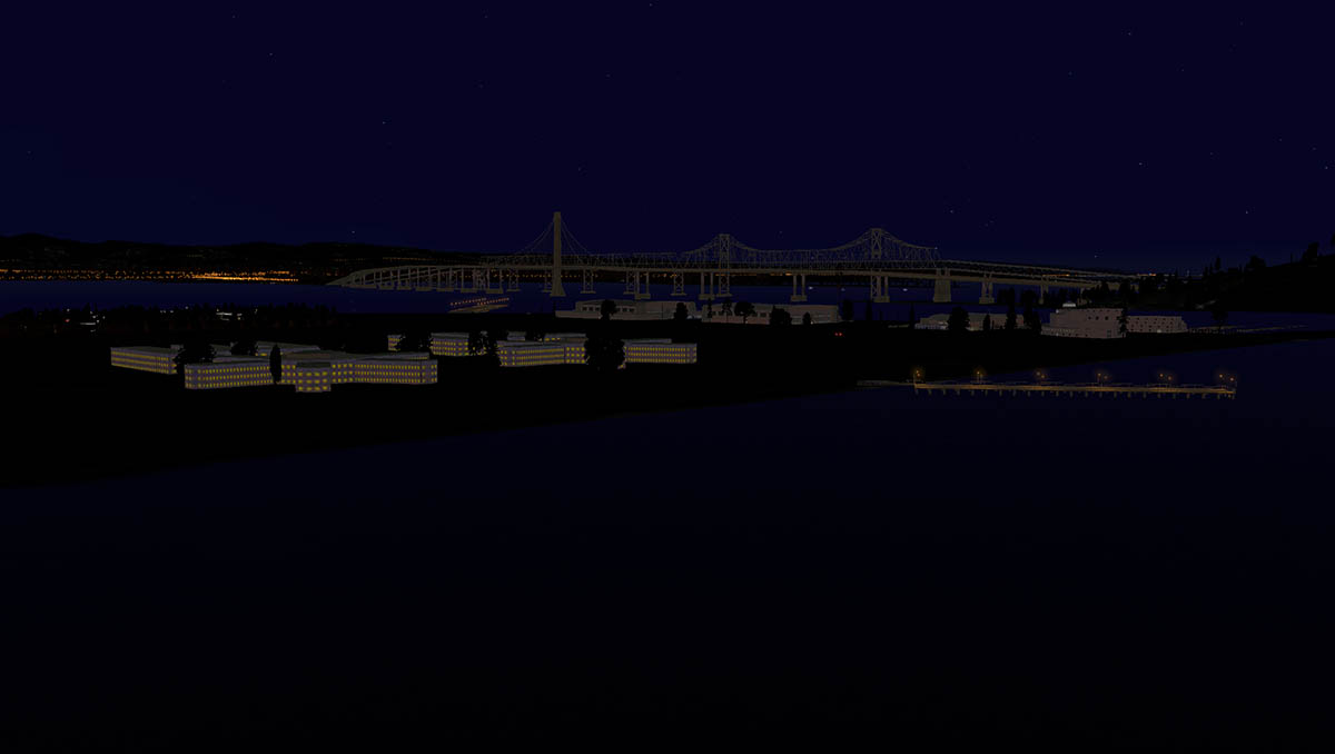
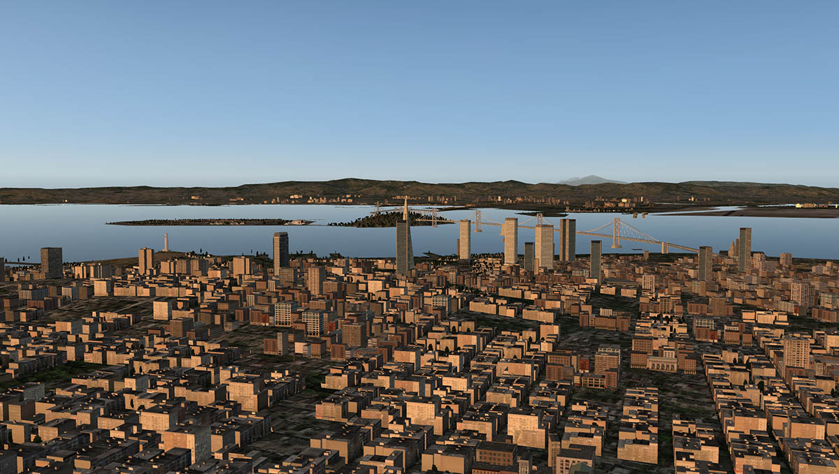
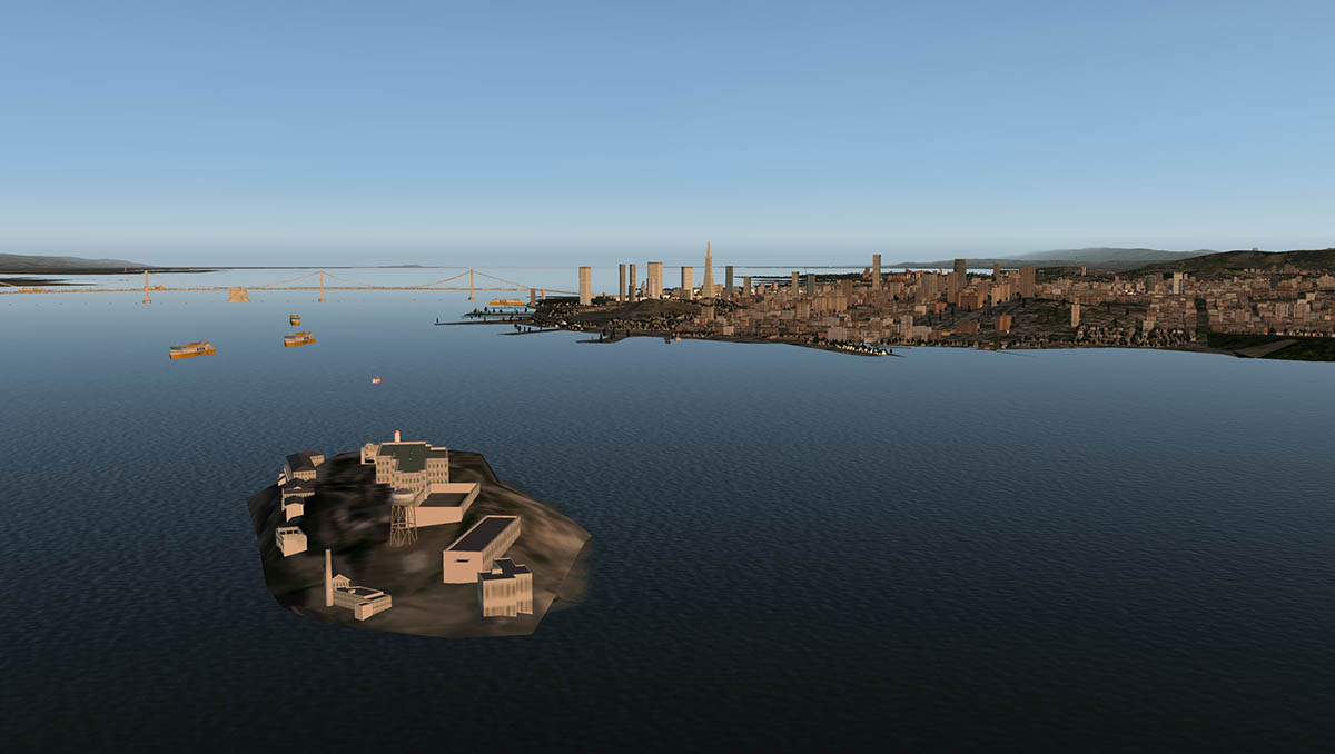
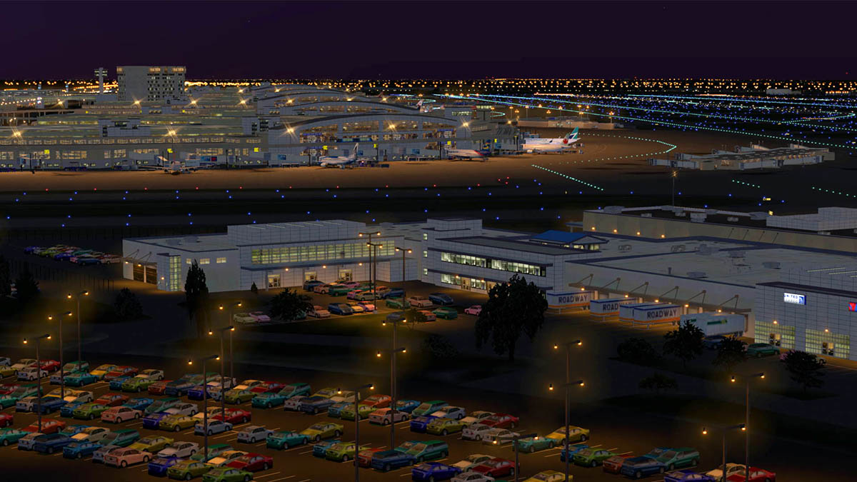
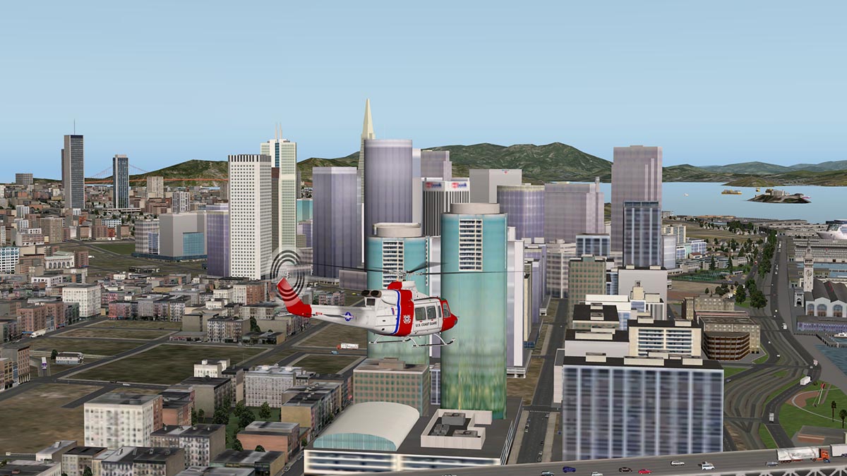
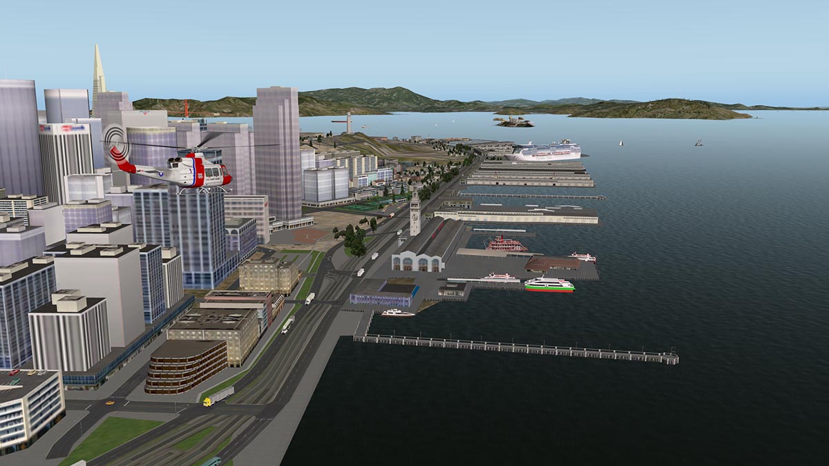
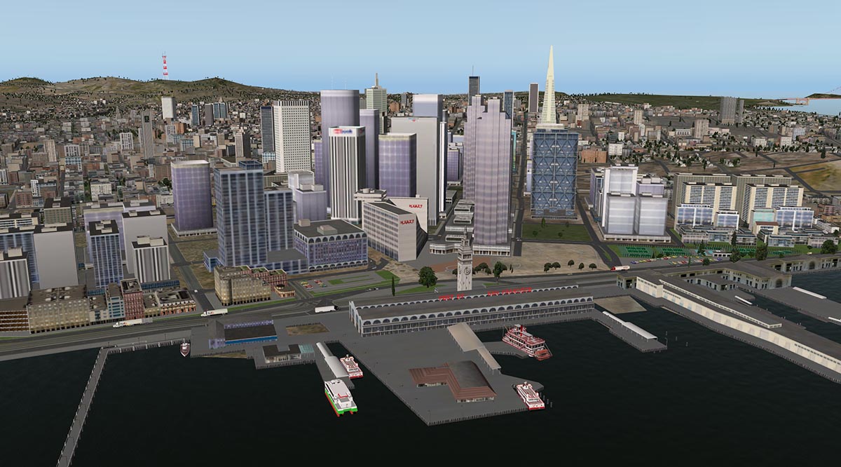
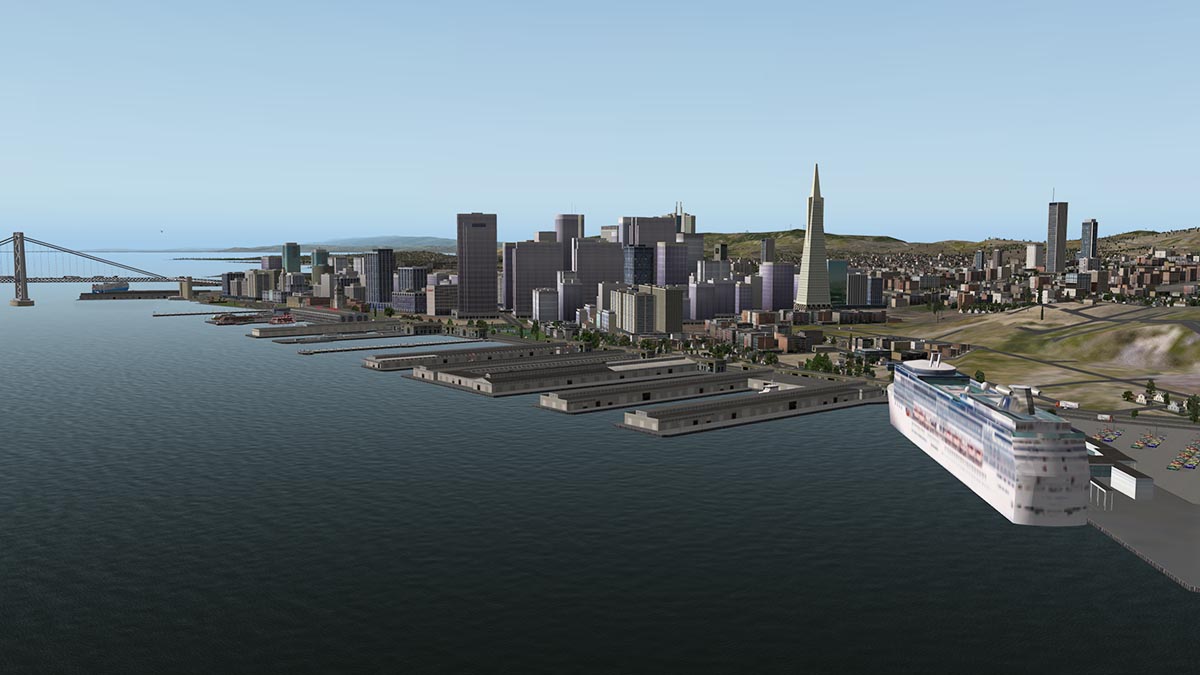
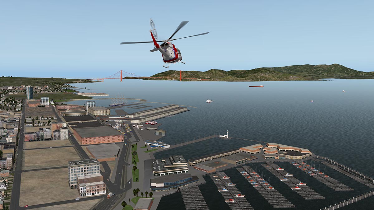
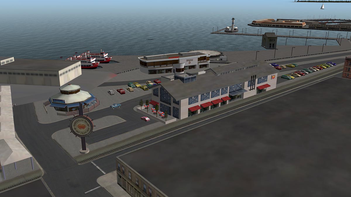
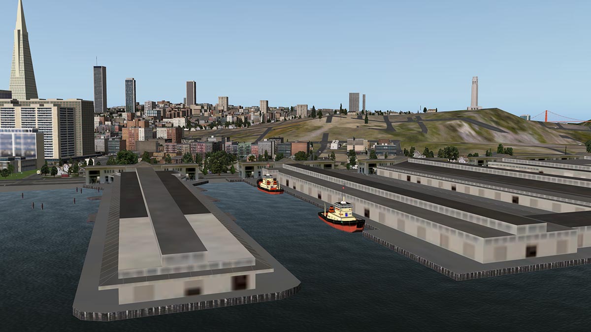
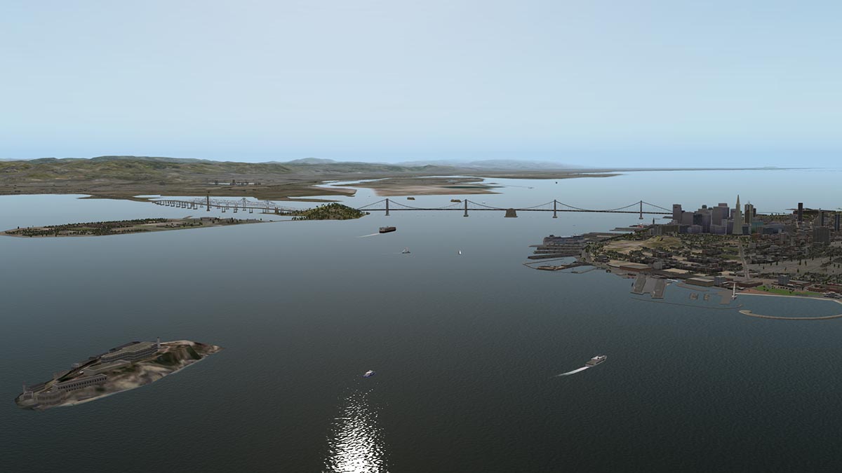
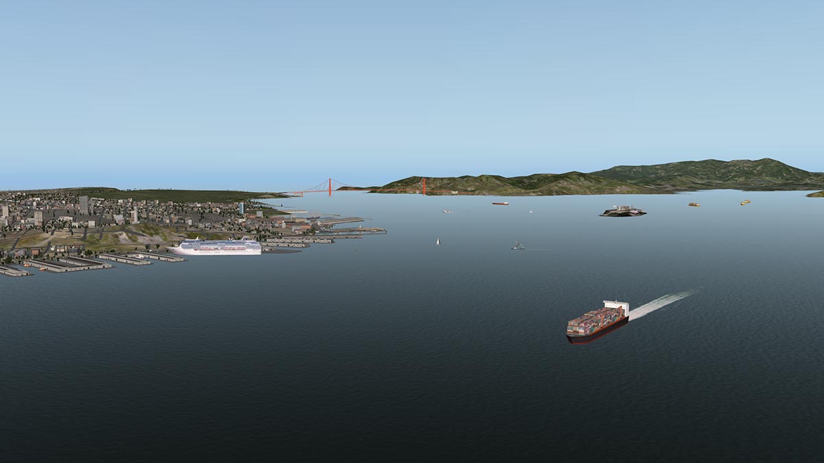
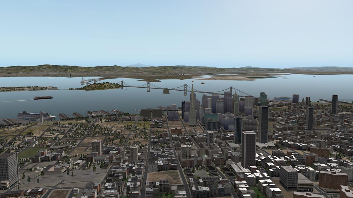
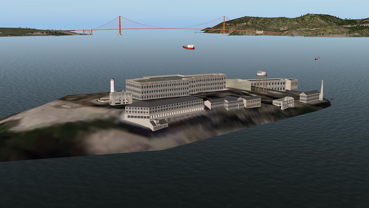
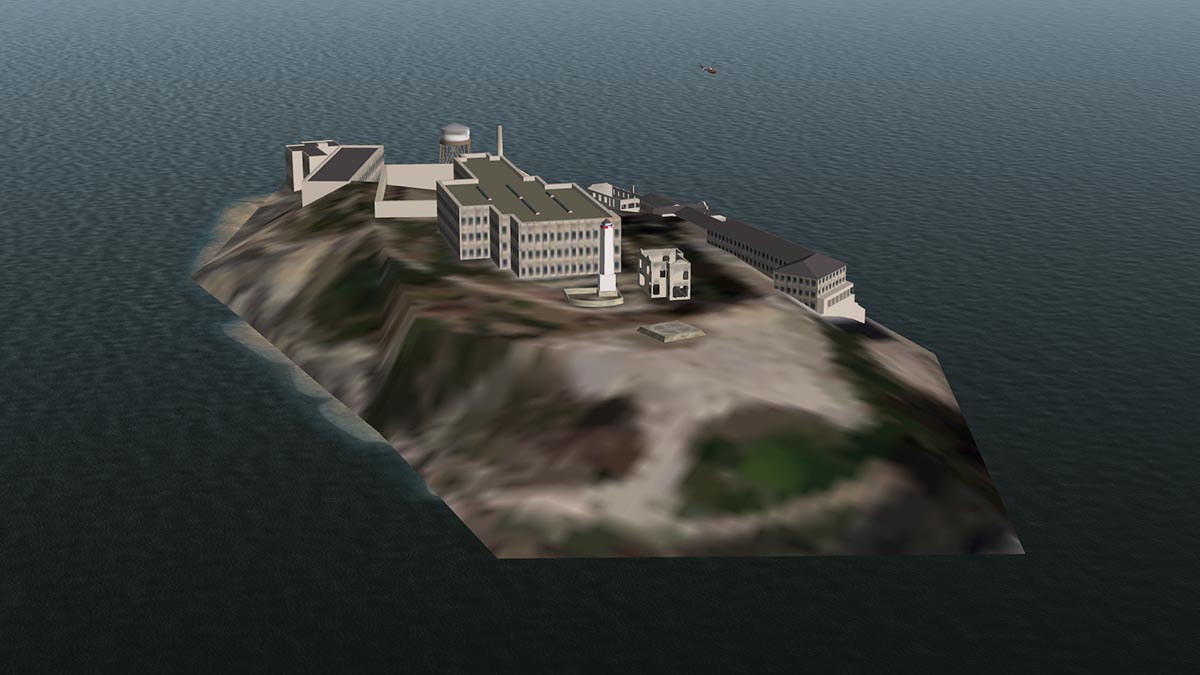
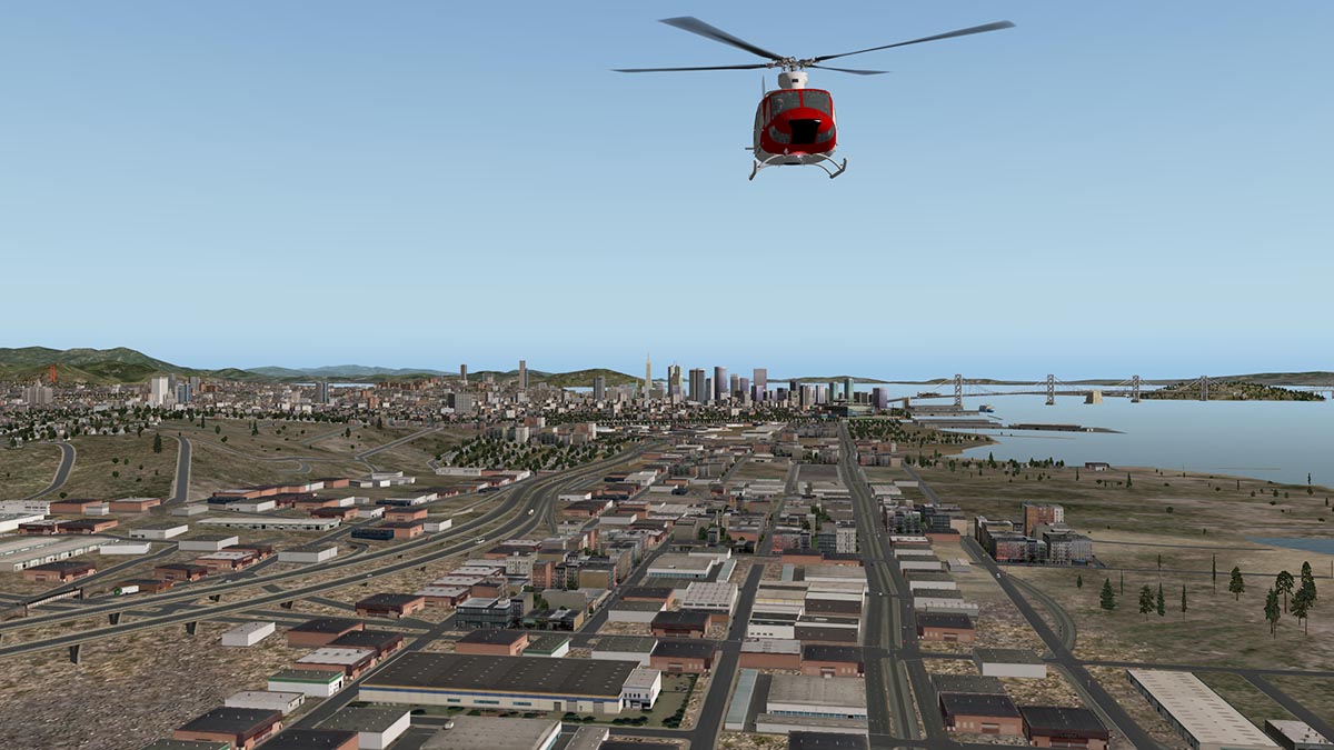
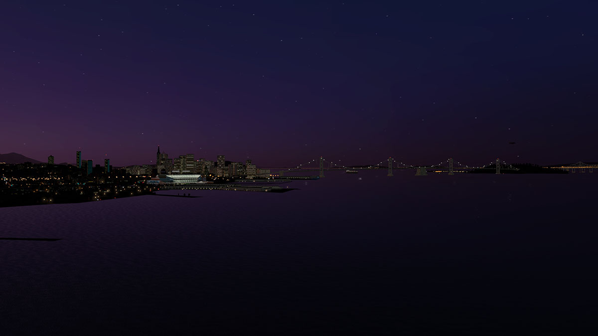
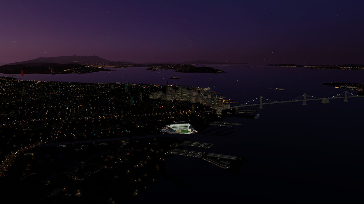
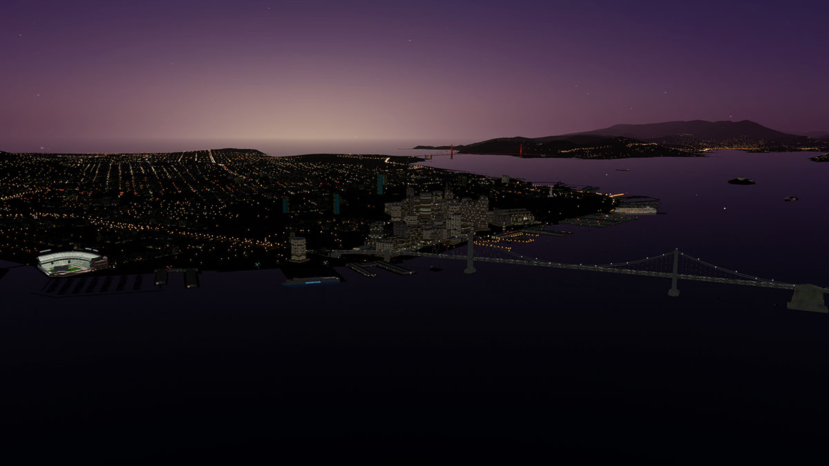
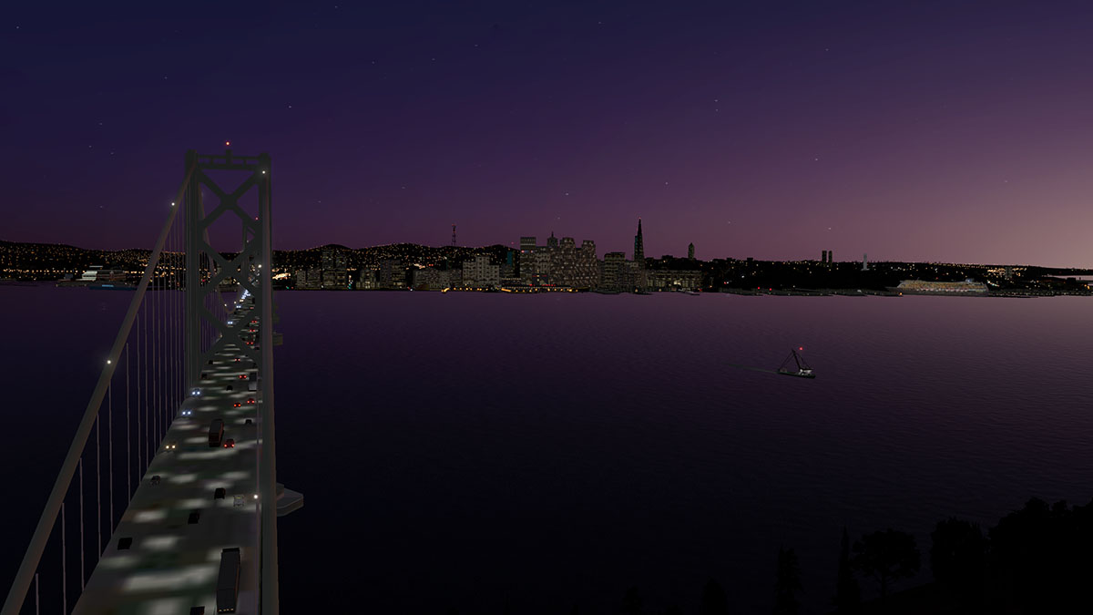
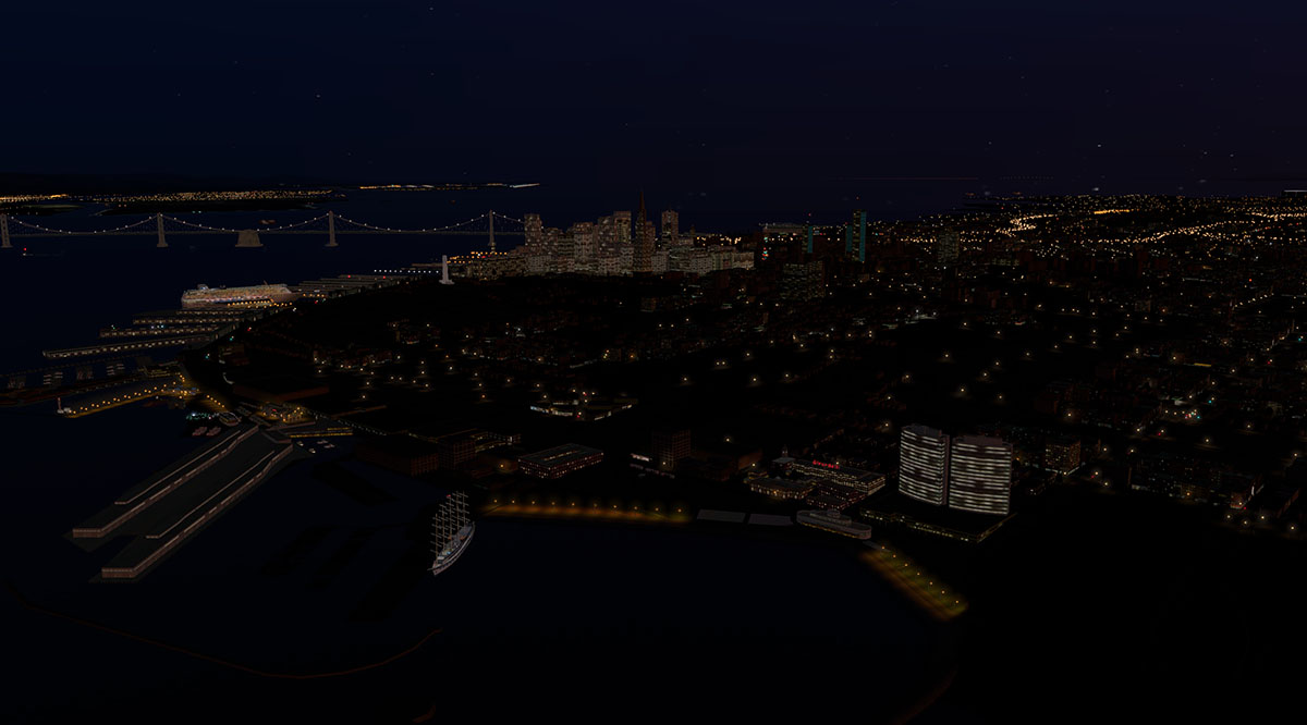
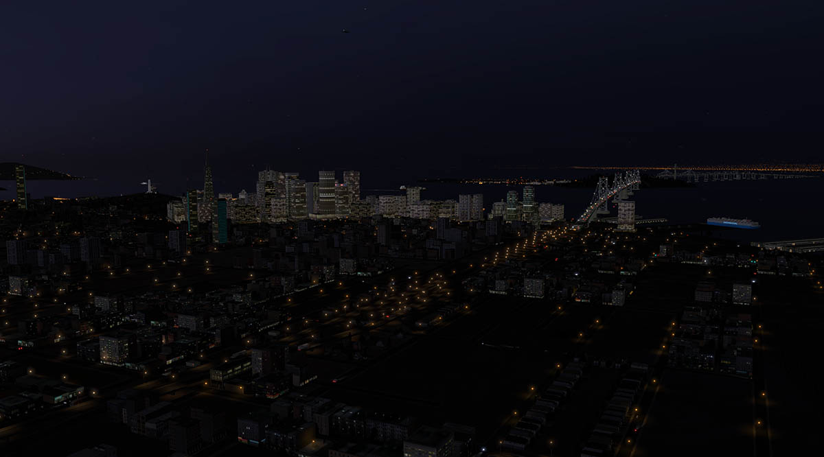
 Scenery Review : Golden Gate, KSFO and South Bay by Tom Curtis Tom Curtis's Golden Gate package of which includes KSFO (San Francisco International and Oakland International) now has two extra expansion packages of "South Bay" and "San Carlos" also added into the whole bay area package. First note is that this is a huge scenery. It now has eight airports listed in all: KSFO - San Francisco International airport and gateway to the Pacific Rim KOAK - Metropolitan Oakland International Airport KSJC - Mineta San Jose International Airport KHWD - Hayward Executive Airport KPAO - Palo Alto Airport - General Aviation KHAF - Half Moon Bay - General Aviation KSQL - San Carlos Airport GG01 - Clipper Cove, Located on Treasure Island And also GUQ Moffett Field also has a few items of note as well More items includes: Golden Gate Bridge, Oakland Bay Bridges, San Mateo Bridge and the Dumbarton Railroad bridges. Alcatraz Prison and the Nike Missile Site Museum. A few San Francisco landmarks are also visible like the Transamerica Tower. Maps by Google So where would you start?... Well my interest in this package was noted by a video. It is the "PilotsEYE" series of the first service by Lufthansa of the Airbus A380 on the Frankfurt - San Francisco route. What is interesting in the video is that it shows you all the landmarks and viewpoint in the landing and docking at Gate 101B at San Francisco International Airport: This being X-Plane I wanted to run that route and simulate that landing... Peter's Aircraft wonderful Lufthansa Airbus A380 allows you to easily indulge in your own fantasy. The point of this is that if the scenery works in this context then the scenery is good... Make no doubt as the Tom Curtis KSFO delivers here in spades, views and the background match the video to perfection. Frame-Rate was impressive at 24frames... not a lot of margin I admit, but this is serious scenery and Peter Hagar's A380 is no lightweight either - so the user number here is impressive. KSFO - San Francisco International Airport San Francisco International Airport (IATA: SFO, ICAO: KSFO, FAA LID: SFO) 10L/28R (11,870) 3,618m Asphalt 10R/28L (10,602) 3,231m Asphalt 1R/19L (8,648) 2,636m Asphalt 1L/19R (7,500) 2,286 Asphalt Elevation AMSL 13 ft / 4 m San Francisco International Airport (IATA: SFO, ICAO: KSFO) is an international airport 13 miles (21 km) south of downtown San Francisco, California. The airport opened on May 7, It was named Mills Field Municipal Airport until 1931, when it became San Francisco Municipal Airport. "Municipal" was replaced by "International" in 1955. The KSFO scenery is excellent in scale, There so much detail here it is overwhelming. So the best way to view it is to show the different Terminals. The odd thing to note here is the International Terminal is at the front (lower) and the domestic termnial is at the rear (upper). So we will start with the domestic arms and then show the International. Terminal One Gates 20 - 36 Boarding Area B _____________________________________________________________________________________ Terminal One Gates 40 - 48 Boarding Area C _____________________________________________________________________________________ Terminal Two Gates 50 - 59 Boarding Area D (formally the Central Terminal) _____________________________________________________________________________________ Terminal Three Gates 60 - 67 Boarding Area E (Now Closed) _____________________________________________________________________________________ Terminal Three Gates 68 - 90 Boarding Area F _____________________________________________________________________________________ International Terminal Gates A1 - A12 Boarding Area A _____________________________________________________________________________________ International Terminal Gates G91 - G102 Boarding Area G _____________________________________________________________________________________ All the main terminal infrastructure is excellent with almost every gate filled with ramp equipment or parked aircraft, One aircraft is an animation that pushes back and then returns to the gate. The parked aircraft textures are a little washy (even on a high texture setting).. . but otherwise it can't be faulted. (A note the United B747 at the United Terminal 3 gate is not in the correct position as in the scenery. I moved it so I could park a large aircraft next to the B747 original gate position). All ramp and taxiway markings are exceptional... taxiing around the terminals with the linage and runway signs is as perfect as you will ever need them. Tom is very good at night lighting and the SFO airport is excellent, The buildings have a slight whiteness about them but that is not really an issue here. All gates are well lit and the terminal windows are exceptional. Highlights away from the central area is the American Airlines Hanger and the United Airlines maintenance base. Both areas are excellent with great signage in both day and the night. There are a huge amount of offices, warehouses and the Coast Guard station situated around mostly the Northern boundary, nothing is missing here... as every building is accounted for. There is a small (for) FedEx cargo base and fuel depot and the only few items to note is the high rail line stops abruptly?, and a few of the underlying photo textures are a little washed out... I would like to have a few working (animated) gates and I understand that SFO now has a new control tower? - but again these are minor issues. Tom notes the ATC has been set up to run correctly.... As scenery with KSFO you can't fault it. KOAK - Metropolitan Oakland International Airport Almost directly across the bay from KSFO is Oakland International Airport. The approach to KOAK runway 11 is excellent with this scenery package, You cross over all the Oakland Bay Bridges with San Francisco City on your right (The Golden Gate bridge is viewable in the distance) and a few city icons are visible with the default autogen filling in the rest of the view... If you take away these few items like the bridges and the city icons you would certainly notice what makes a great scenery and what does not. It cannot be stressed more than here as this is the small difference of what makes this outstanding package work. Airports set out alone can not deliver the whole experience. Oakland International Airport (IATA: OAK, ICAO: KOAK) (Metropolitan Oakland International Airport) is a public airport five miles south of downtown Oakland, in Alameda County, California. Oakland is the focus city for Southwest Airlines and Allegiant Air. As of July 2013, Southwest has 108 daily departures on peak-travel days of the week.Alaska Airlines combined with sister-carrier Horizon Air is in distant 2nd with as many as 12 flights. The city of Oakland looked into the construction of an airport starting in 1925. In 1927 the announcement of the Dole prize for a flight from California to Hawaii provided the incentive to purchase 680 acres in April 1927 for the airport.The 7,020 foot long runway was the longest in the world at the time, and built in just 21 days to meet the Dole race start. The airport was dedicated by Charles Lindbergh September 17. In its early days, because of its long runway enabling safe takeoff rolls for fuel-heavy aircraft, Oakland was the departing point of several historic flights, including Charles Kingsford Smith's historic US-Australia flight in 1928, and Amelia Earhart's final flight in 1937. Earhart departed from this airport when she made her final ill-fated voyage, intending to return there after circumnavigating the globe. Oakland International Airport (IATA: OAK, ICAO: KOAK, FAA LID: OAK) 11/29 (10,000) 3,048m Asphalt 9R/27L (6,212) 1,893m Asphalt 9L/27R (5,454) 1,662m Asphalt 15/33 (3,372) 1,028m Asphalt Elevation AMSL 9 ft / 3 m The airport is split into two separate areas by runways 9R/27L and 9L/27R with the commercial Airport to the south along side RWY 11/29 and the executive and general aviation areas to the north. FedEx has a large facility here which is almost in the central position of the airport. A very large maintenance building is a big part of the airport as well. Oakland has Two terminals - One and Two. Terminal 1 has 17 gates (1, 3, 4–7, 8-8A, 9-9A, 10–12, 14-14A, 15, 17) and is also used for International services. _____________________________________________________________________________________ Terminal 2 has 13 gates (20–32) (mostly Southwest Airlines and Allegiant Air) _____________________________________________________________________________________ Detailing is excellent... all gates are covered with full ramp equipment. All the glass work is excellent and totally realistic. All taxi and runway linage is again of high quality as with noted at SFO. The Private executive and GA area is well covered as well. With items for the Business Jet Center, Kaiser Air and Flight schools Alameda Aero Club, Lou Fields Aviation, Oakland Flyer and Oakland Aircraft Maintenance other noted are Aerial Advertising Services, Oakland Aviation Museum, formerly Western Aerospace Museum and Pacific Aerial Surveys. Only slight eyesore is front of the main terminals is that there is a bit of washed out area with no real carpark. Night-Lighting is the same as SFO... Excellent. All the terminals are very well lit and the night textures are outstanding. The FedEx facility (above) is the standout in the area and the Executive and GA area (below) is very good as well with great lit signage. Oakland International Airport is a great supplement to the main San Francisco International... It has the same quality, but it is ideal for your Private Jet/GA movements and LLC (Low Cost Carrier) operations. With OAK I had no Frame-Rate issues (28-30fr). KSJC - Mineta San Jose International Airport Despite San Jose being the largest city in the Bay Area, SJC is the smallest of the three Bay Area airline airports (8.4 million annual passengers in 2011), with less than a quarter of the passengers of San Francisco International Airport (SFO), and fewer passengers than Oakland International Airport (OAK). Like Oakland airport it attracts Bay Area residents who find SFO too distant from their homes. SJC is noted as a "downtown airport", unlike SFO and OAK which are on opposite shores of San Francisco Bay. SJC's convenient location near downtown San Jose has drawbacks: it is surrounded by the city and had little room for expansion. The proximity to downtown causes limits on building heights in downtown San Jose as by FAA rules. Norman Y. Mineta San Jose International Airport is a city-owned public airport in San Jose, Santa Clara County, California. It is named for San Jose native Norman Yoshio Mineta. Norman Y. Mineta San Jose International Airport (IATA: SJC, ICAO: KSJC) 12L/30R (11,000) 3,353m Concrete 12R/30L (11,000) 3,353m Concrete 11/29 (4,599) 1,402m Asphalt Elevation AMSL 62 ft / 19 m Although there are two terminals. They are set out in one long lineup. With Terminal A which has 16 gates: 1–16. and Terminal B which has the North Concourse of Terminal B which has 12 gates: 17–28. A planned South Concourse has now been built as the other Terminal B, but it is to be noted that here in this scenery it is the older version and not the new curved building designed by Gensler... Across the runways are the General Aviation areas and the Control Tower. This area is well detailed with hangars and excellent aircraft parking. All the parking and taxi linage is exceptional. Night-Lighting at KSJC is again exceptional... The lighting around the terminals is expertly done. With this you will find SJC is as good with detail as the other two major airports. The surrounding OSM (Open Street Map) traffic is excellent here as the airport is heavily boxed in, so the traffic swarms around you as you approach or takeoff. I found SJC hit my frame-rate more heavier that SFO and OAK, my guess it is the heavier laid out default autogen. As it dropped down into the on the line 19's and 18's frames. Flying into SFO above SJC in the A380, caused a little stutter as well... but again the A380 is a very heavy file. That is the three very large airports in this package... we will now briefly look at the other smaller Executive and General Aviation airports and one large Ex-Flyingboat base that are dotted all around the bay area. KHWD - Hayward Executive Airport Hayward Executive Airport is just 8 miles south of Oakland International. Hayward Executive Airport (IATA: HWD, ICAO: KHWD, FAA LID: HWD) 10R/28L (5,694) 1,736m Asphalt 10L/28R (3,107) 947m Asphalt Helipad : H1 (110) 34m Asphalt Elevation AMSL 52 ft / 16 m Hayward Executive Airport is a city owned public airport two miles west of downtown Hayward, in Alameda County, California, United States. The airport was built in 1942 during World War II for use as a fighter base as an auxiliary field to Chico Army Air Field and was originally named "Hayward Army Airfield". The primary aircraft stationed at the field were Lockheed P-38 Lightning fighter aircraft. This post may have also been named "Russell City Army Air Field" for the unincorporated area outside of the Hayward city limits where it was located. In April 1947 the War Assets Administration quit-claimed the airfield, comprising some 690 acres (279 ha) and related buildings and equipment, to the City of Hayward. The airfield was then renamed the Hayward Municipal Airport. On May 1, 1980 the California Air National Guard units at Hayward were reassigned to NAS Moffett Field. It looks like an Ex-Army Field because that is what it was, mostly today it is a storage airport for small aircraft although the FAA (Federal Aviation Administration) have offices here. Tom has done a good representation of Hayward. The control Tower area with a large parking ramp is very good with waving flags and other great details... but mostly this airport is all about storage hangers, and all the various different types are represented, Night-Lighting is again very good with great spill lighting on the hangers and the Control Tower/Terminal windows. KPAO - Palo Alto Airport - General Aviation Palo Alto Airport of Santa Clara County is a small general aviation strip on the western edge of the bay. Palo Alto Airport of Santa Clara County (IATA: PAO, ICAO: KPAO) 13/31 (2,443) 745m Asphalt Elevation AMSL 7 ft / 2 m Facilities at this busy towered airport include multiple aircraft repair shops and a staffed terminal including West Valley Flight Club, Advanced Flyers, Peninsula Avionics, Sundance Flying Club, Stanford Flying Club, Rossi Aircraft, and Palo Alto Fuel Service. A small airport but it is filled to the brim with detail. Great small control tower and the entrance gate with a carpark is excellent (more flags!). The parking ramp is well completed and the night-lighting is simply excellent (mainly on the hanger down lights and signage). The Abundant Air Cafe, the Golf Course and the popular Ming's Restaurant are all represented... The Restaurant looks great at night down by the water.... KHAF - Half Moon Bay - General Aviation Out on the Pacific Ocean coast is KHAF - Half Moon Bay. (IATA: HAF, ICAO: KHAF) is a county-owned public use airport in San Mateo County. The Half Moon Bay Airport is located approximately 20 miles south of San Francisco. It was constructed by the California State Highway Department for the U.S. Army in 1942 as an auxiliary airfield for Salinas Army Air Base. On 1 June 1945, the War Department issued a five year permit to the U.S. Navy to operate the Site as "Outlying Field, Half Moon Bay". Half Moon Bay field became an outlying field for Naval Air Station Moffett Field, to furnish facilities for utility aircraft providing target towing service for the Anti-Aircraft Training Center, Point Montara, California. Following the end of World War II, San Mateo County acquired the airport from the Navy in 1947. The airport has served a variety of roles over the years and is currently an important business, transportation and emergency service asset to the community. Half Moon Bay Airport provides a variety of emergency service and response functions including: Air ambulance and Medivac flights; law enforcement and homeland security patrols and Coast Guard sea-rescue operations. KHAF - Half Moon Bay (IATA: HAF, ICAO: KHAF) 12/30 (5,000ft) 1,524m Asphalt/Concrete A well represented general aviation airport that is great for training or a fly around the coast go-to destination, the detail at the airport is again very good with the famous 3-Zero Cafe front and centre. The cafe looks really great at night with great detailing. Rusting hanger roofs show attention to detail and plenty of ramp parking and GA aircraft. KSQL - San Carlos Airport San Carlos Airport is a county-owned public use airport in San Mateo County. It is located two nautical miles (3.7 km) northeast of the of San Carlos.The FAA's National Plan of Integrated Airport Systems (NPIAS) classifies San Carlos as a reliever airport for San Francisco International Airport. The airport is home to Civil Air Patrol West Bay Composite Squadron 192. Adjacent to the airport is the famous Hiller Air Museum. San Carlos Airport (IATA: SQL, ICAO: KSQL) 12/30 (2,600ft) 792m Asphalt Elevation AMSL 5 ft / 2 m The San Carlos Airport is home to over 30 aviation related businesses. Facilities at KSQL include: Zanette Aviation Insurance, West Valley Flying Club, Bel-Air Aviation, Air West Aircraft Engines, Diamond Aviation, and the newly opened San Carlos Flight Center and most are represented here in this scenery. The Hiller Museum is prominently noted with a great (lit at night) sign. The standout item is the "Sky Kitchen Cafe" which has been wonderfully reproduced... There is supreme detailing in the rows of parked buses and of course the aviation museum with the Flying Tigers B747 forward fuselage sitting on the building. The OSM (Open Street Map) traffic is exceptional here as well giving the airport a great buzz. Night-lighting is very good as well with great signage and window textures. GG01 - Clipper Cove, Located on Treasure Island Treasure Island was planned for and used as an airport for Pan American World Airways flying boats. And the area was noted as Clipper Cove. Treasure Island itself is artificial island in the San Francisco Bay between San Francisco and Oakland. The original Pan American terminal is still there and well reproduced here and the two old aircraft Hangars 2 (Building 2) and Hangar 3 (Building 3) are also present. Today the hangars are used as Film Studio sound stages. The overwhelming feeling at Clipper Cove is of course the towering Oakland Bay Bridges. Would this scenery have the same clout and authenticity if these bridges had not been created by Tom Curtis... again as noted earlier before... I doubt that. They look splendid in this setting. Other items to note in the scenery are: GUQ Moffett Field. Tom here has created the iconic (Airship) hangars of which you note as you turn around to the southern SFO approaches. (an airship flies over Clipper Cove!) The city area has a few buildings like the Transamerica Tower. Alcatraz Island is here as well. And last but not least is the famous red San Francisco Golden Gate bridge. great in the daylight, but excellent at night... The only slightly visual item is all the bridges at night have a strange pattern on them. My guess it is to represent traffic but it doesn't work... Conclusions This scenery is big... huge in scale! It took almost 150 images to put this review together and I haven't touched everything in absolute detail. I could easily double the amount of images here and still not cover the full size of this package. So value is the big question? The Golden Gate + South Bay scenery is listed as US$34.95 of which for scenery is high price. But that would be missing the whole point. If you listed just KSFO as say US$19.95 (well worth that price) then all the rest (7 airports) of the Golden Gate scenery would cost you only an extra US15.00 and looking at it that way it is excellent value. Tom Curtis is one of the very best designers of these packages for X-Plane, and this is one of of his very best. The quality of the work here is simply outstanding. And the night textures and lighting are first rate. And it also needs to be specially noted is that the frame-rate is highly usable for such a huge amount of scenery in a relatively small area. Only slight negative is the photo underlay textures. They are not very detailed and the textures look washed out and flatten out the scenery unless you can run X-Plane in the very highest texture resolution setting of "Extreme Res". So the point is can you not have this scenery in your collection. The answer is simply no. This package is so complete (and I doubt that Tom hasn't finished yet) that not to have this scenery as a destination or to use as part of your North American network is simply doing yourself and X-Plane a disservice as it is one of the most complete city sceneries available for X-Plane at this moment. I will admit it is not total perfection because the scale here does not allow that. But like all of the very best scenery the Golden Gate + South Bay package is one of the very best investments you can do for yourself and for a lot of use with a wide variety of versatile flying around North America in X-Plane. TheScenery Review : Golden Gate , KSFO and South Bay by Tom Curtis is available now from the New X-Plane.org Store : Golden Gate KSFO + South Bay Price is US$34.95 Features: KSFO - San Francisco International Airport KSJC - Mineta San Jose International Airport KSQL - San Carlos Airport KOAK - Metropolitan Oakland International KPAO - Palo Alto Airport - General Aviation - 18 miles south of KSFO KHAF - Half Moon Bay Airport - 10 miles west of KSFO KHWD - Hayward Executive Airport - 8 miles south of KOAK GG01 - Clipper Cove Located on Treasure Island All airports include : All gates and terminal Global Night Lightning Custom ATC Frame rate friendly Golden Gate Bridge Detailed model of the world's most famous bridge Alcatraz Island The 'Rock'. Used to be home of a federal jail until 1963 Other landmarks All of the piers and other structures along the shoreline from AT&T (Baseball) Park all the way to the Presidio near the Golden Gate bridge. Transamerica Tower located downtown San Francisco Nike Missile Site Museum Bay bridges Oakland Bay Bridge, San Mateo Bridge and the Dumbarton Railroad bridge Developer Site : Scenery4XP _____________________________________________________________________________________ Documents and Installation : Download: 84mb : Installed as GOLDEN_GATE+SOUTH_BAY_150_XP-10 (295.00mb), and four animation files noted Banner Tow (1.5mb), GG Bridge (634kb), San Meteo Bridge (641mb) and SF Bay Bridge (639mb)Tom Curtis provides a full set of instructions on how to install the scenery under: "OPEN FIRST!" Golden_Gate+South_Bay_Open_Me. Internet is required for installation instructions as it is an address HTML link. GOLDEN_GATE+SOUTH_BAY_150_XP-10 is the main scenery file and four other files are noted under GND_TRAFFIC are - GG Bridge, Banner Tow, San Meteo Bridge and SF Bay Bridge are all to be installed in the "Custom Scenery" Folder (These are bridge traffic animations). Supplied also is the "Red Flag" flag animation plugin. Folder "CustomSBDatarefs004" is installed in the X-Plane Resources/Plugin Folder. _____________________________________________________________________________________ Technical Requirements: X-Plane 10 (any edition). - This scenery is now compatible with X-Plane 9 Windows XP or Windows Vista or Windows 7 / 8 (32 or 64 bit) or MAC OS 10.7 or Linux 1Gb VRAM - 2Gb VRAM Recommended. ______________________________________________________________________________Scenery Review by Stephen Dutton 24th August 2013 Copyright©2015: X-Plane Reviews Review System Specifications: Computer System: - 2.66 Ghz Intel Core i5 iMac 27” - 6 Gb 1067 Mhz DDR3 - ATI Radeon HD 4850 512mb Software: - Mac OS MountainLion 10.8.2 - X-Plane 10 Global ver 10.22 (final) - ExtremeSceneryMAXX Addons - Saitek x52 Pro system Joystick and Throttle Aircraft Airbus A380 - by Peter's Aircraft available at the (Lufthansa Airbus A380) X-Plane.OrgStore $54.95
-
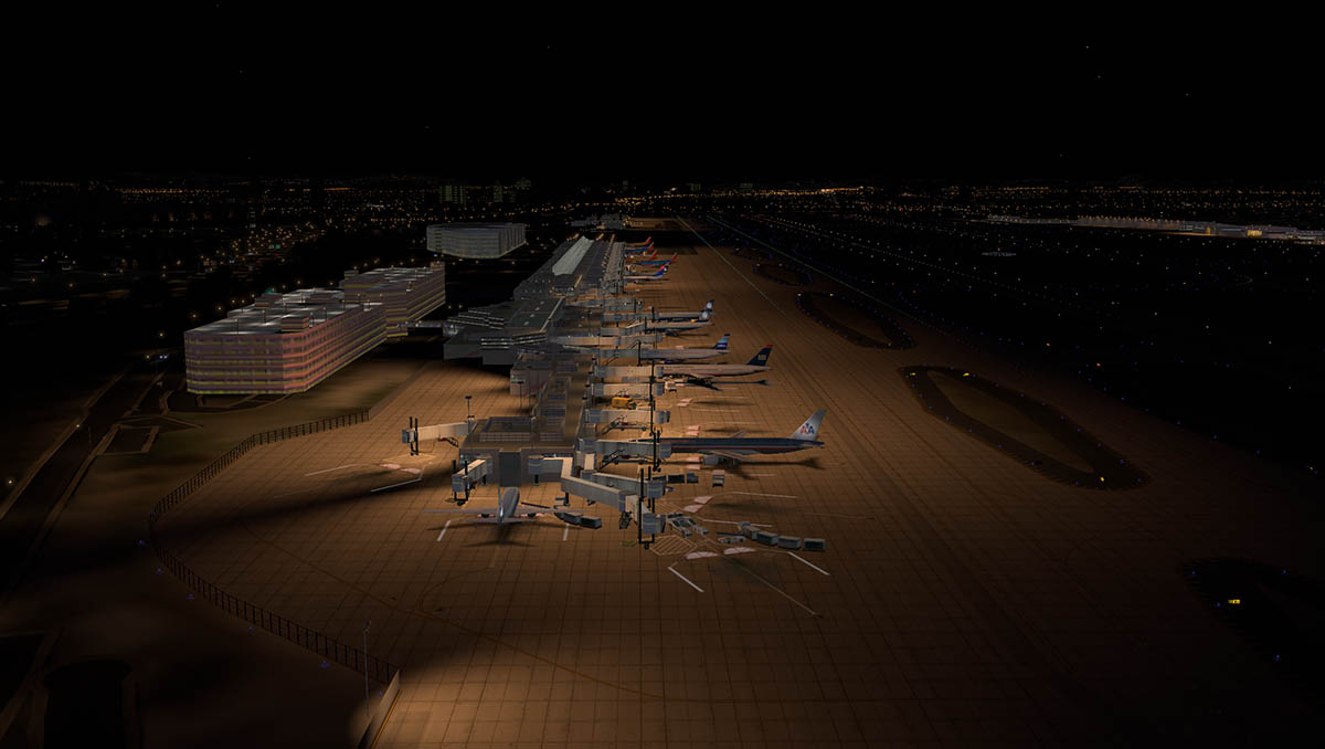
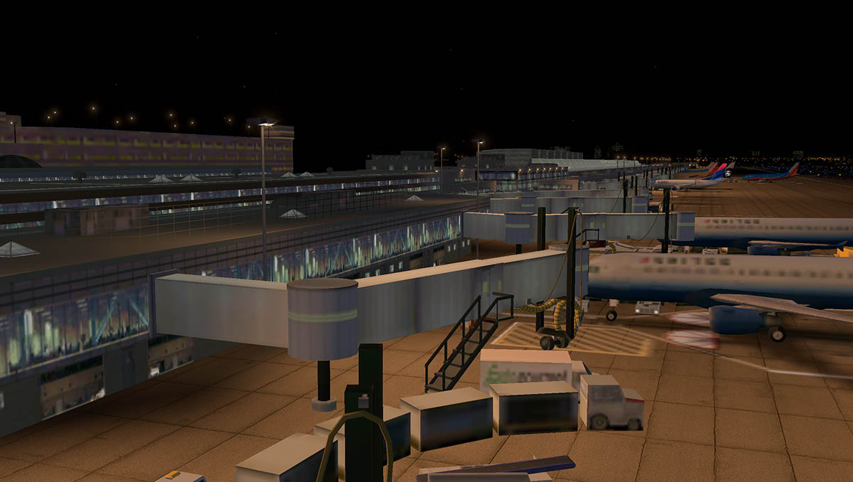
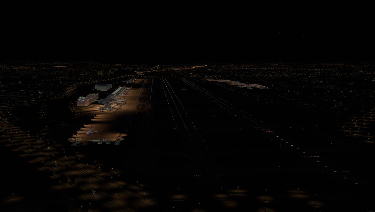
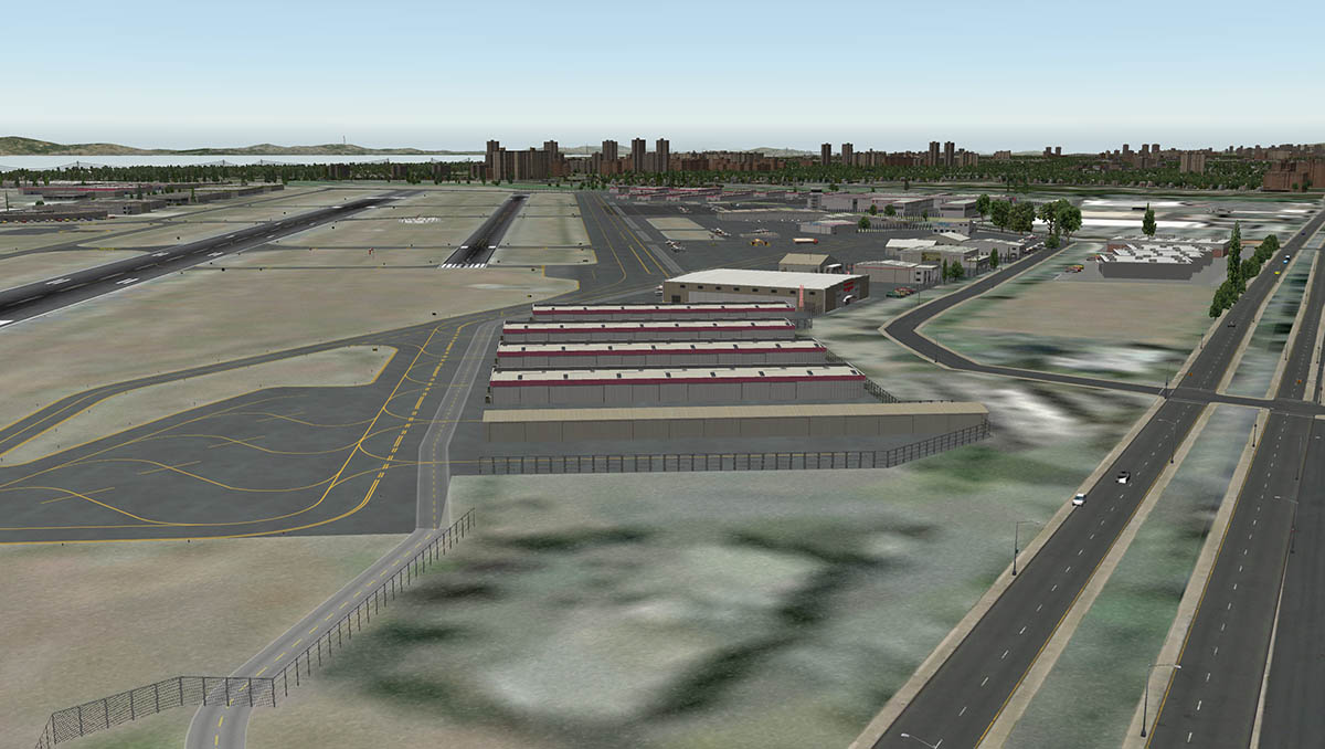
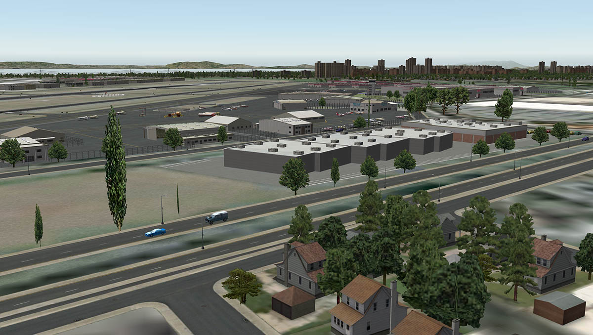
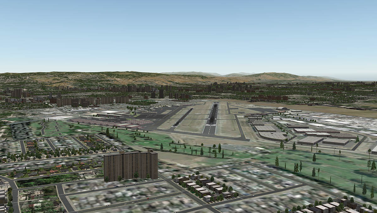
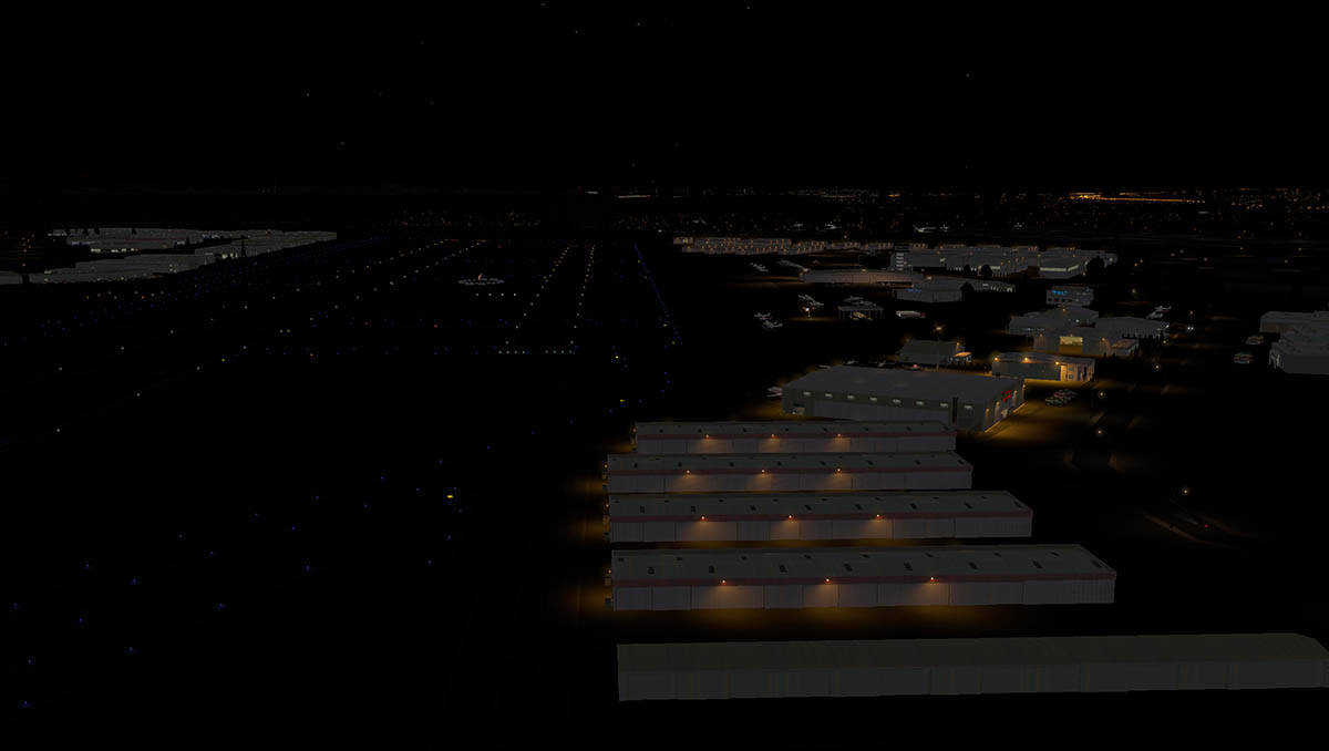
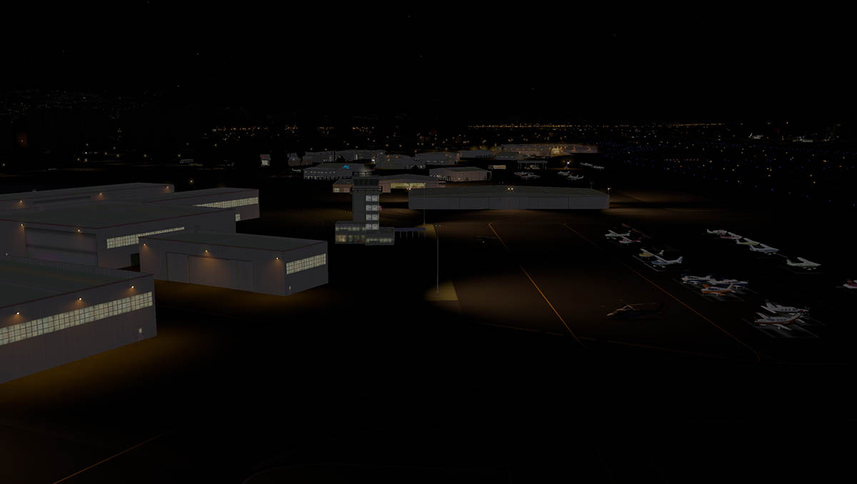
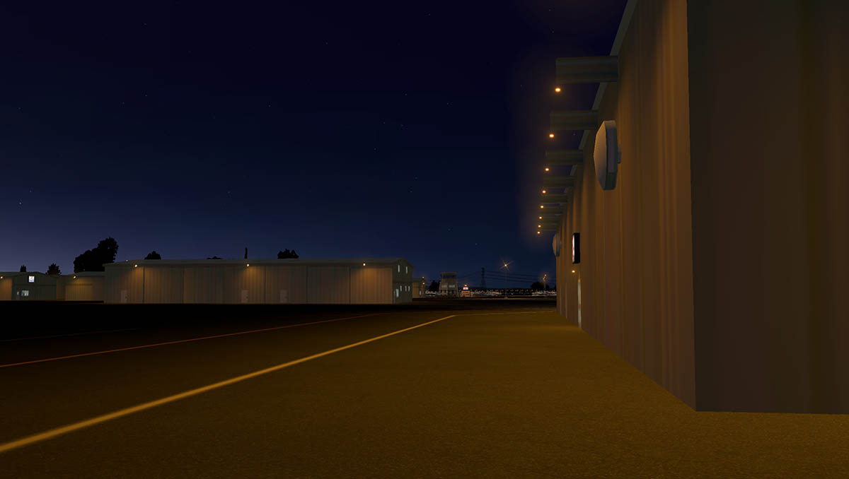
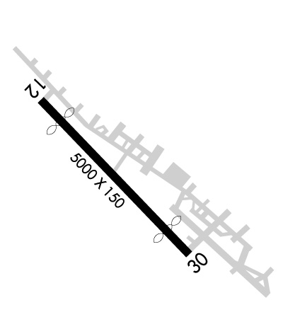
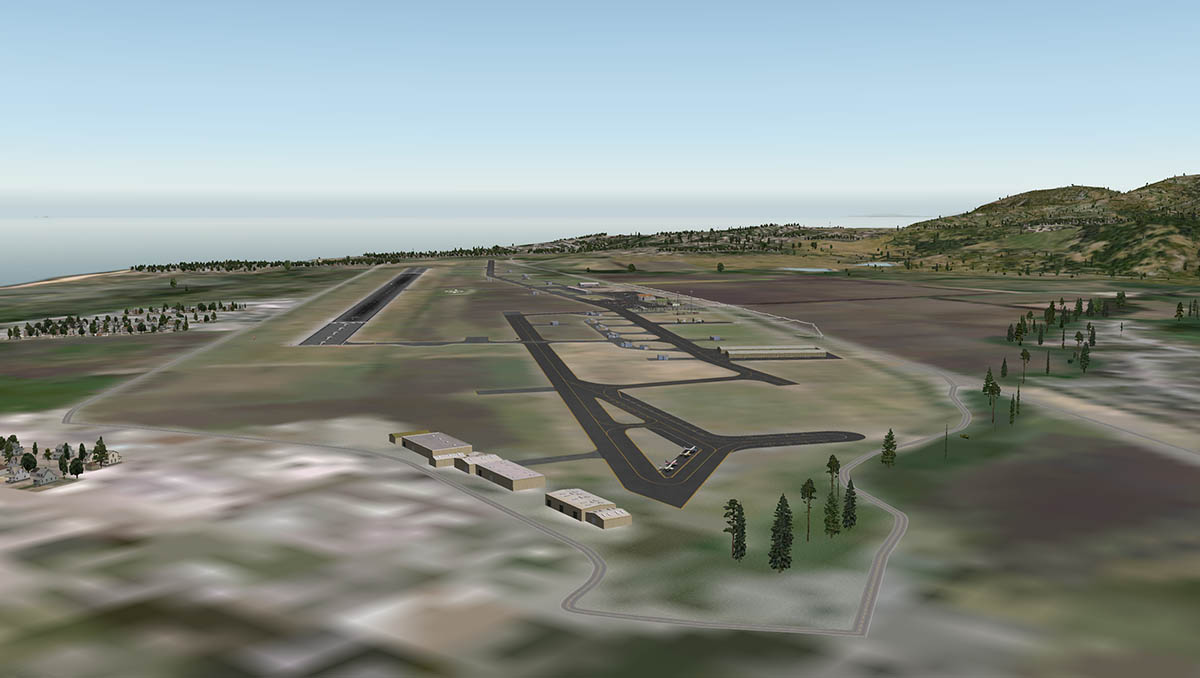
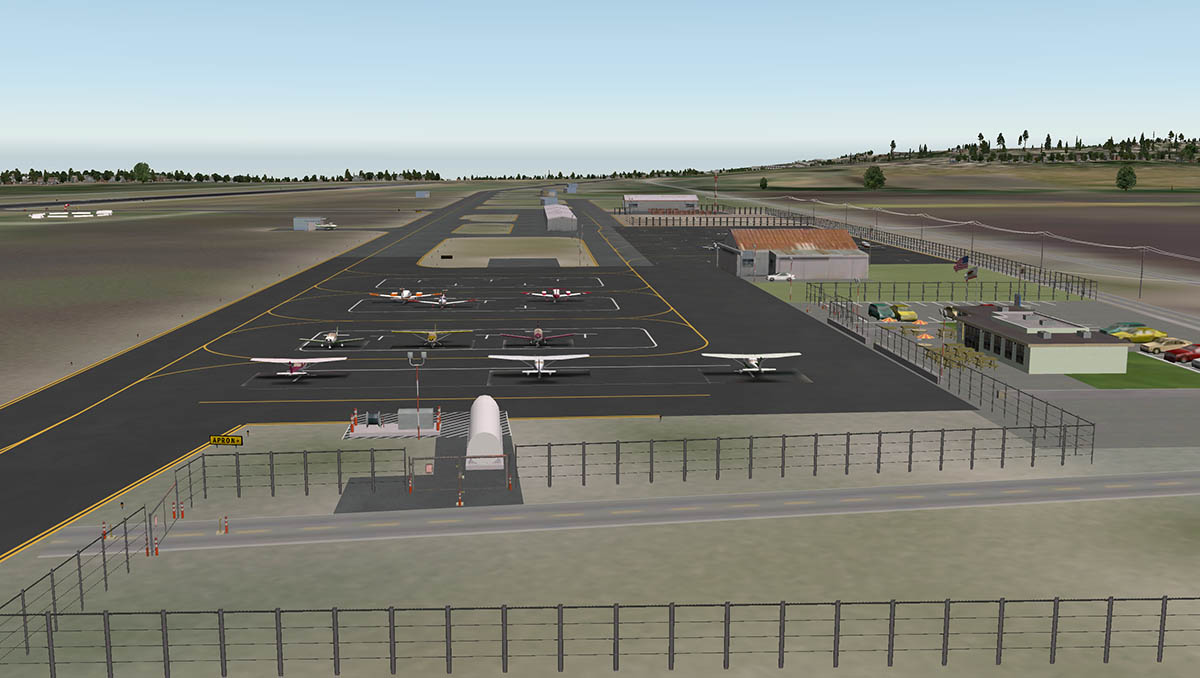
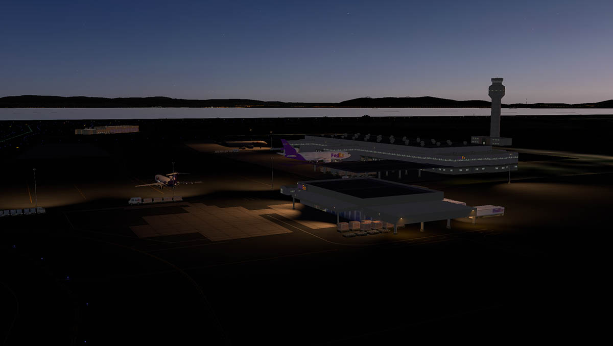
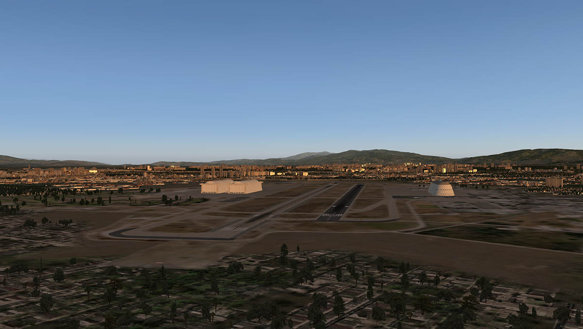
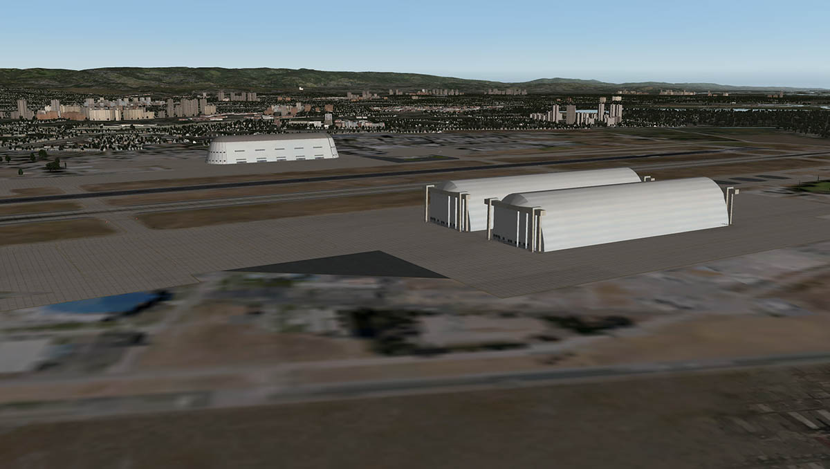
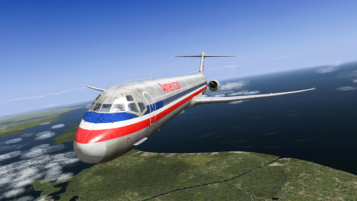
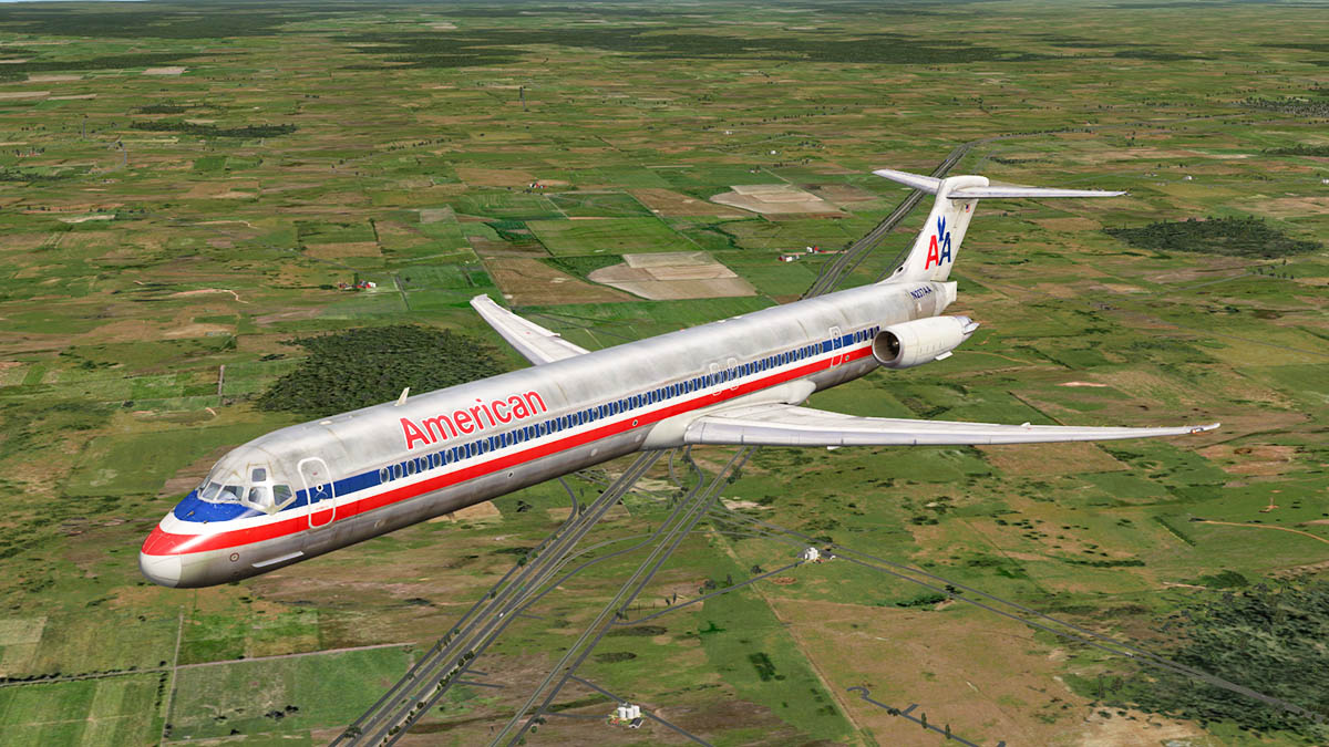
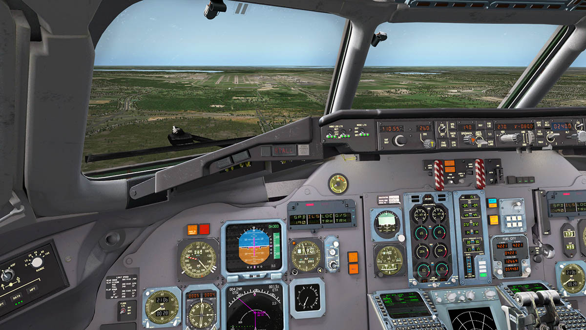
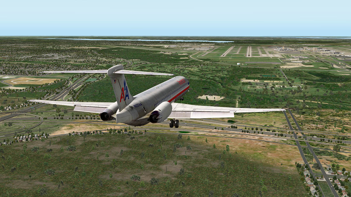
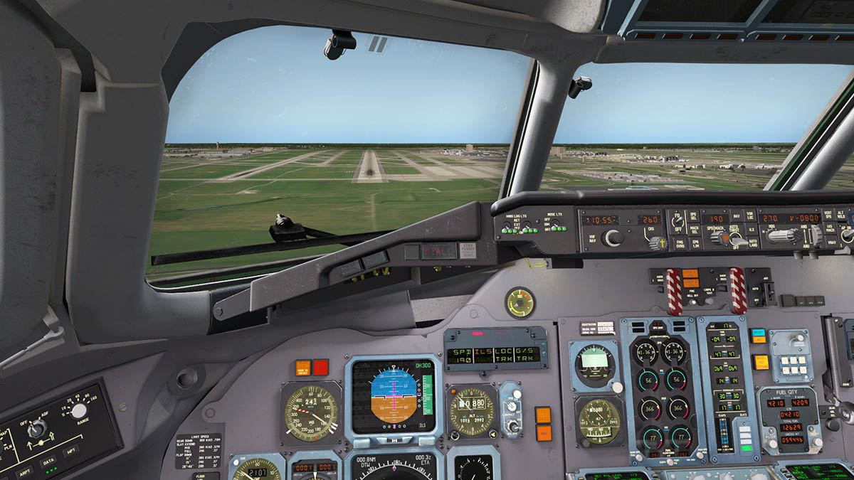
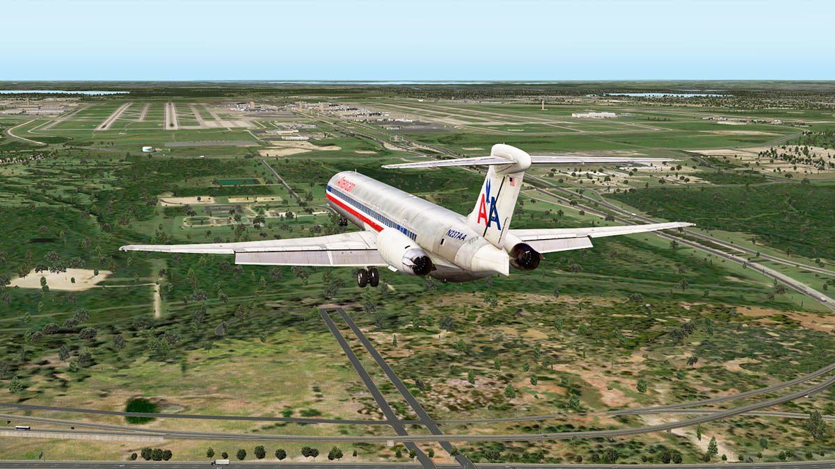
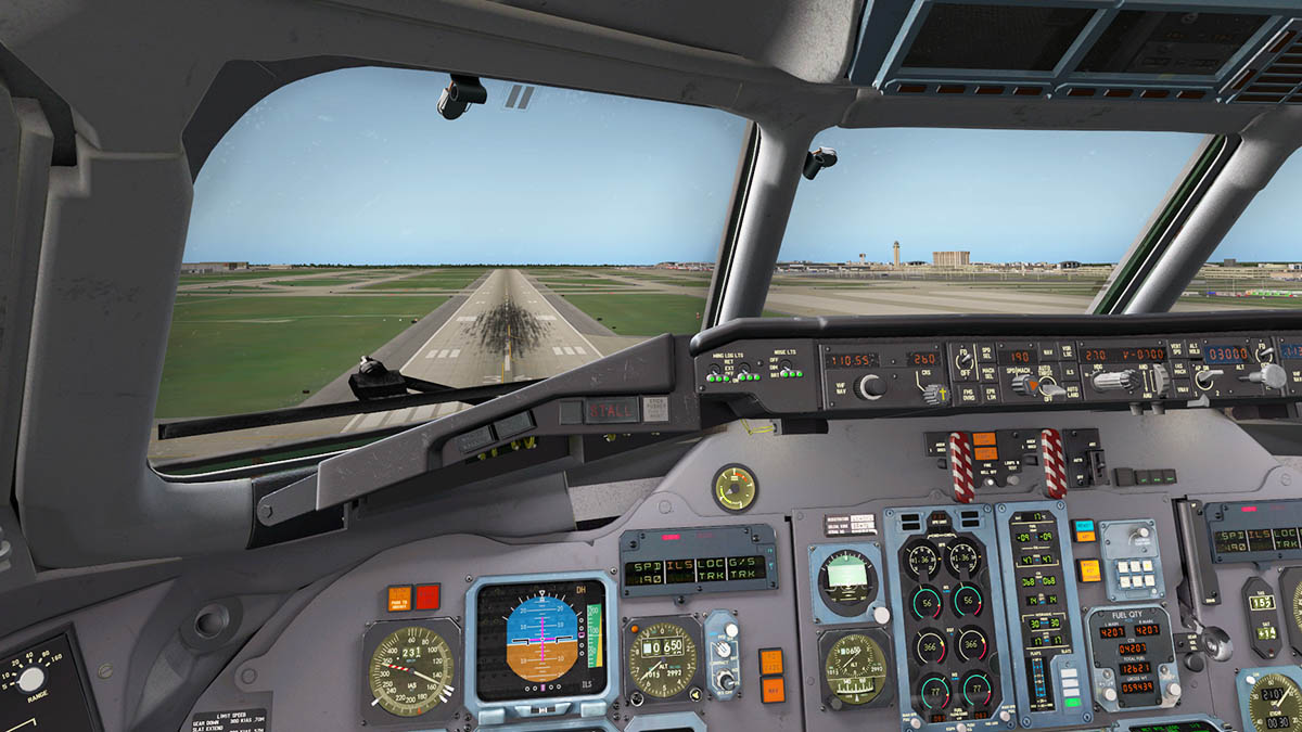
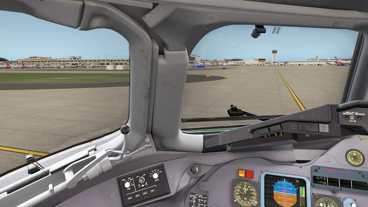
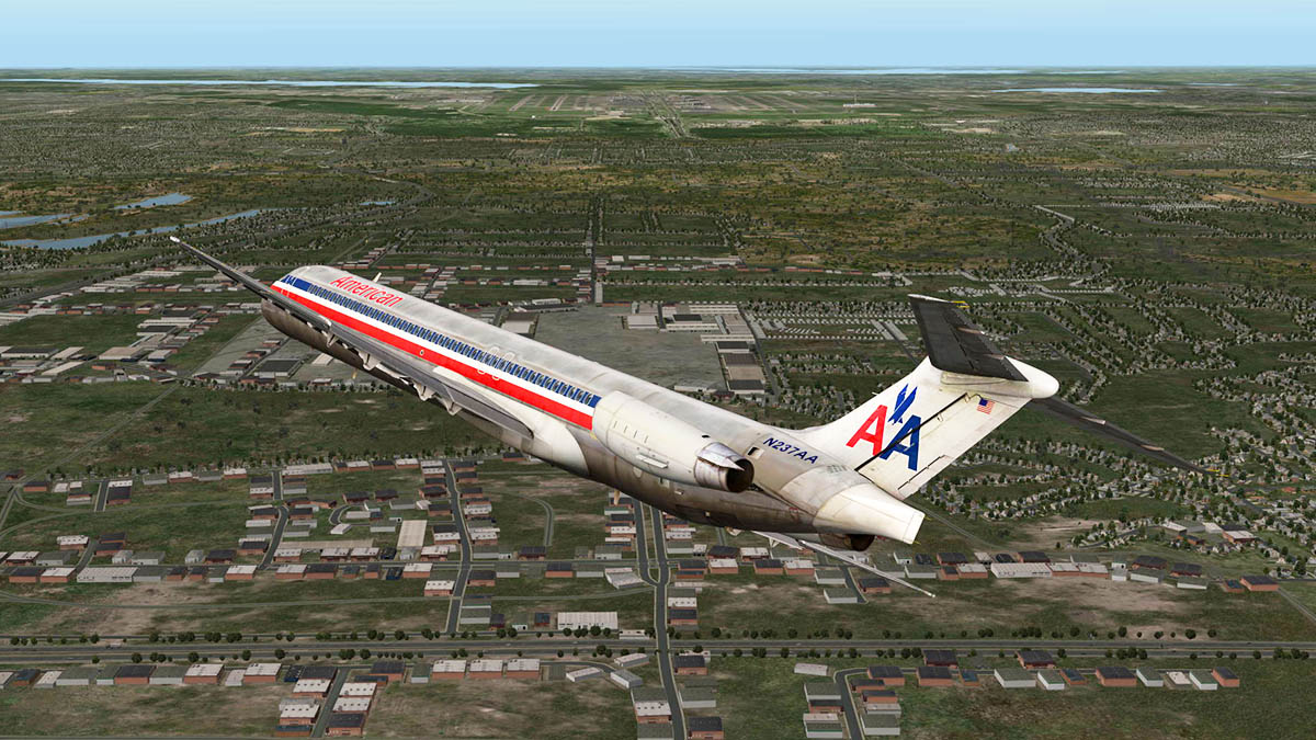
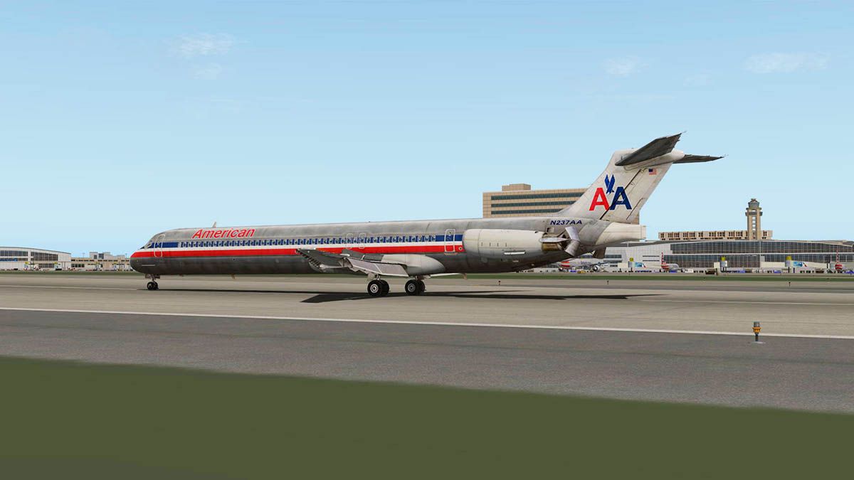
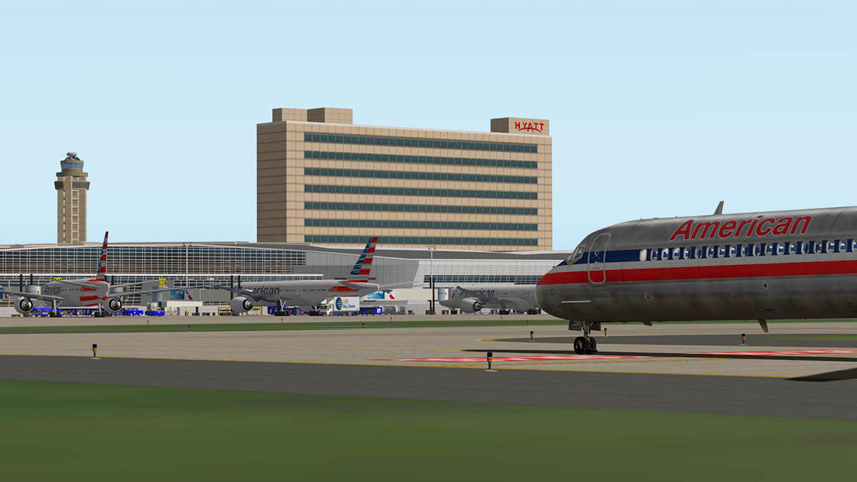
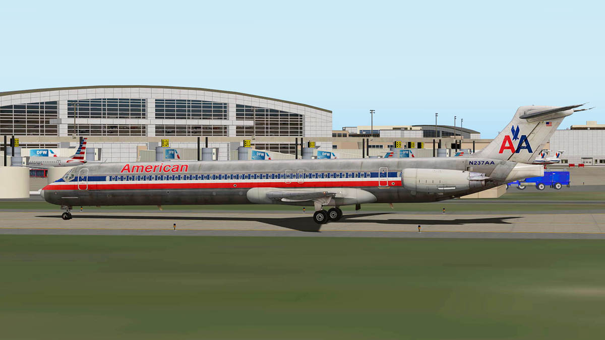
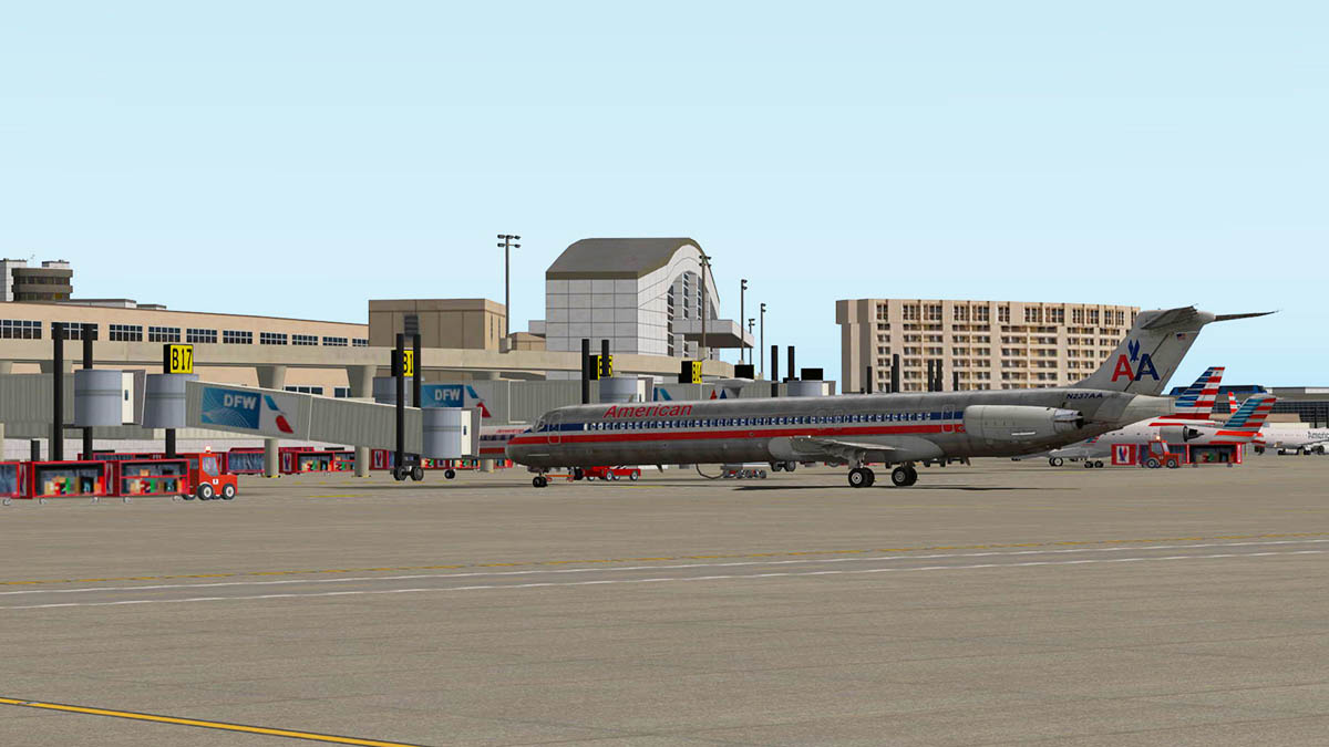
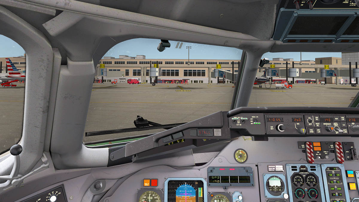
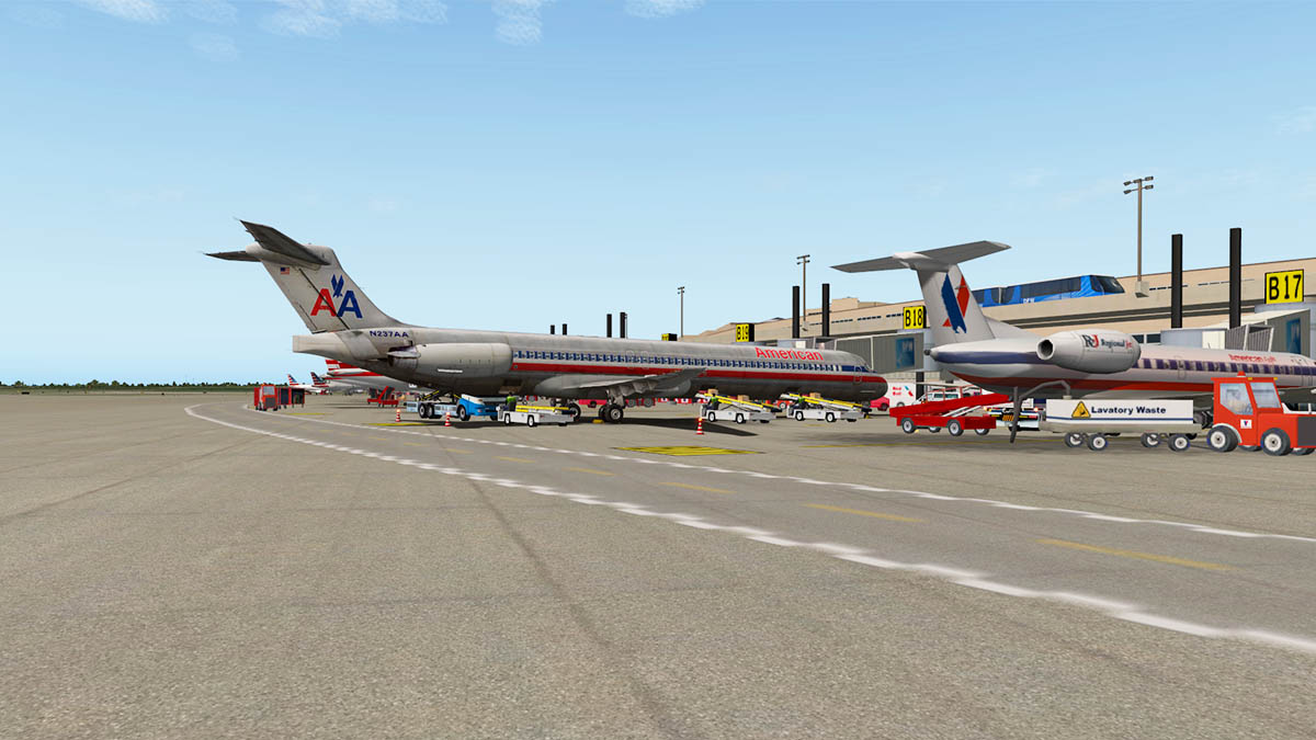
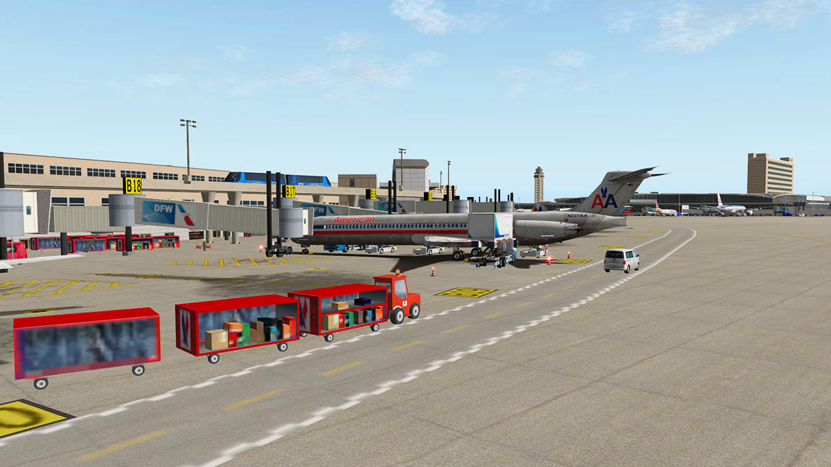
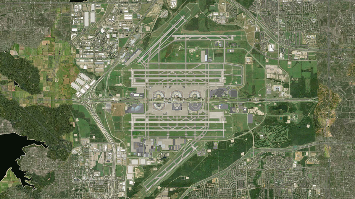
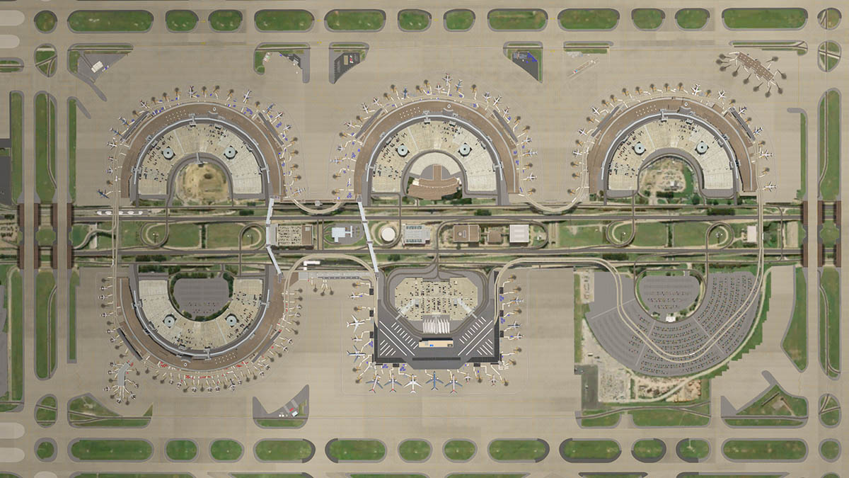
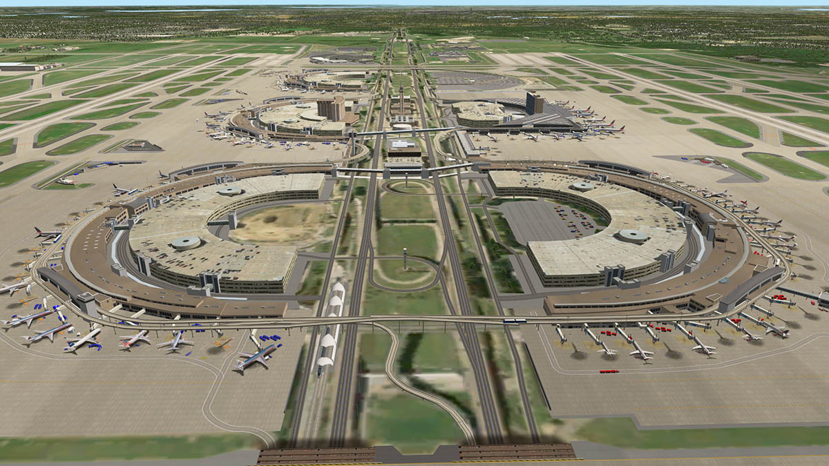
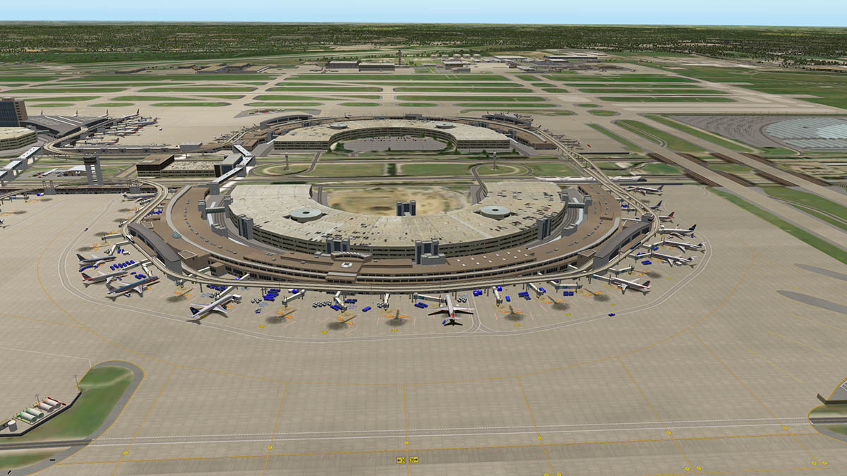
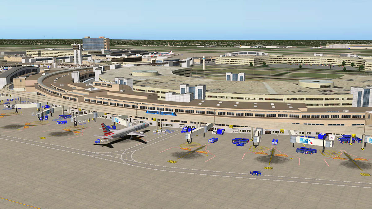
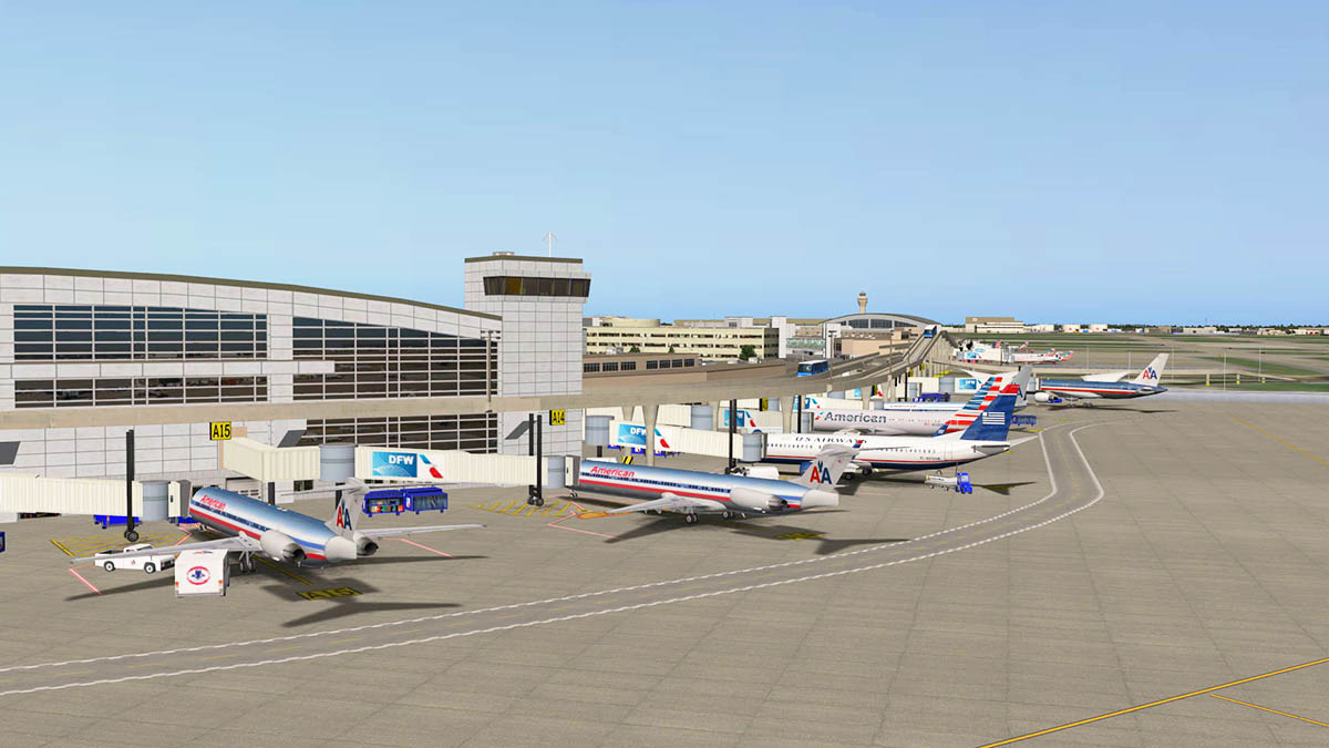
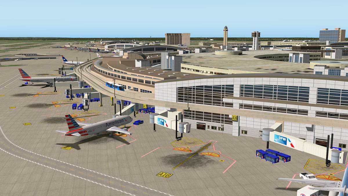
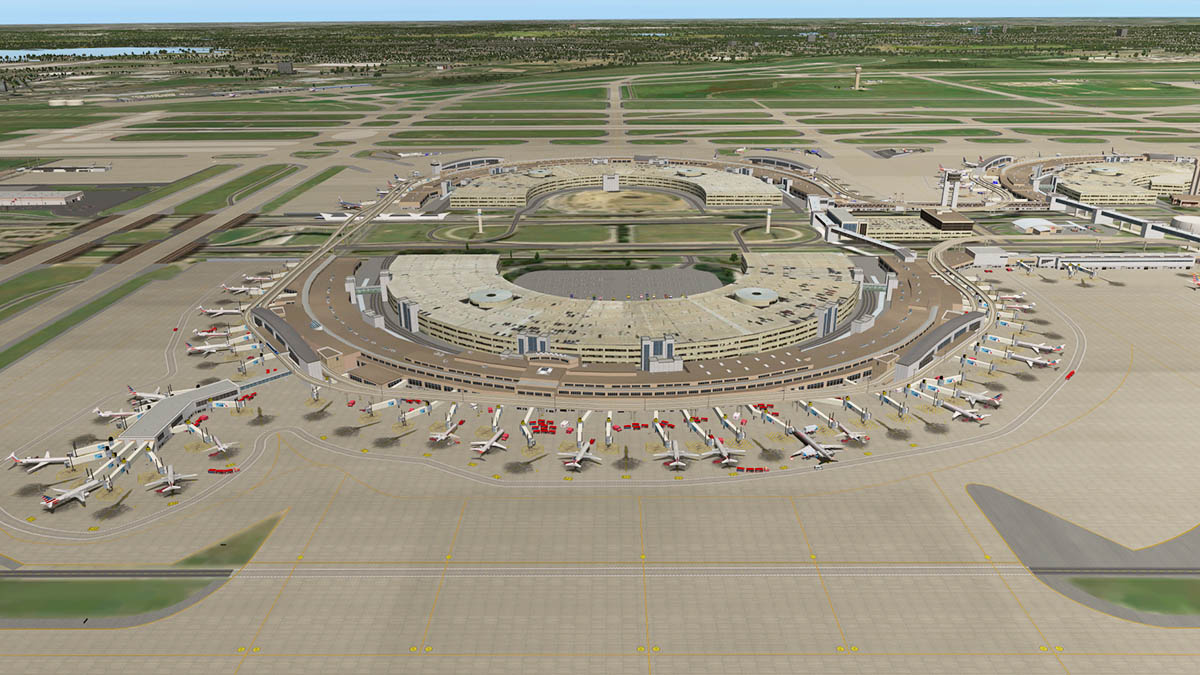
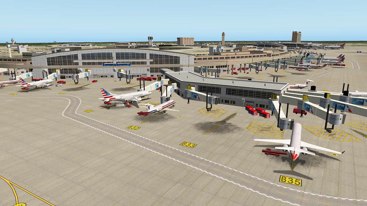
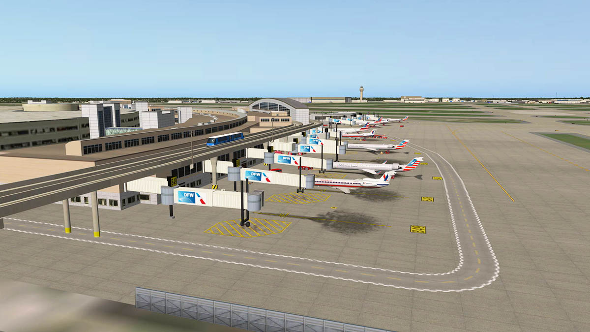
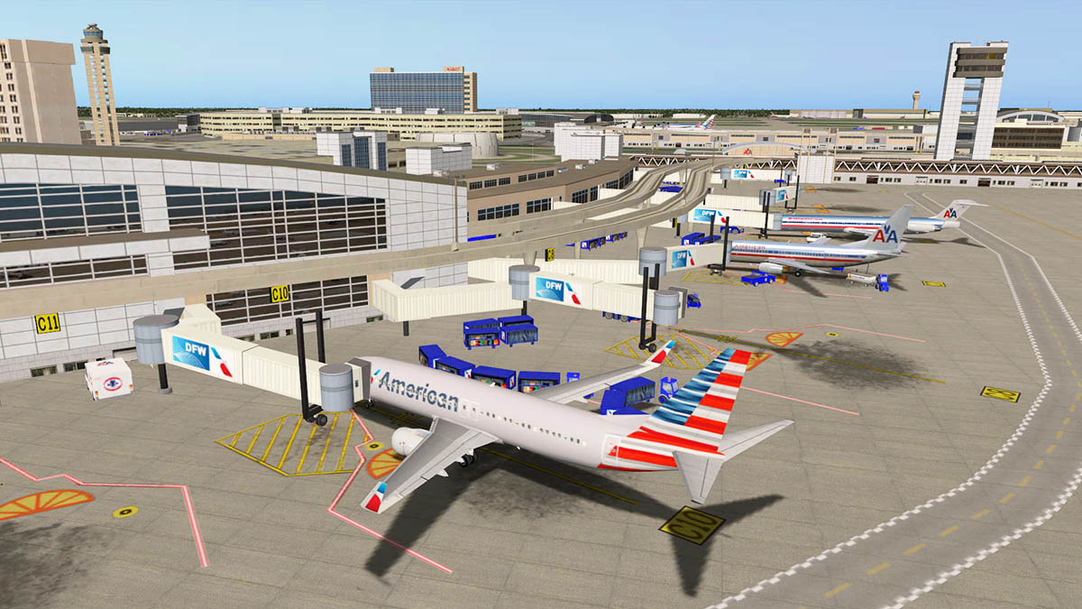
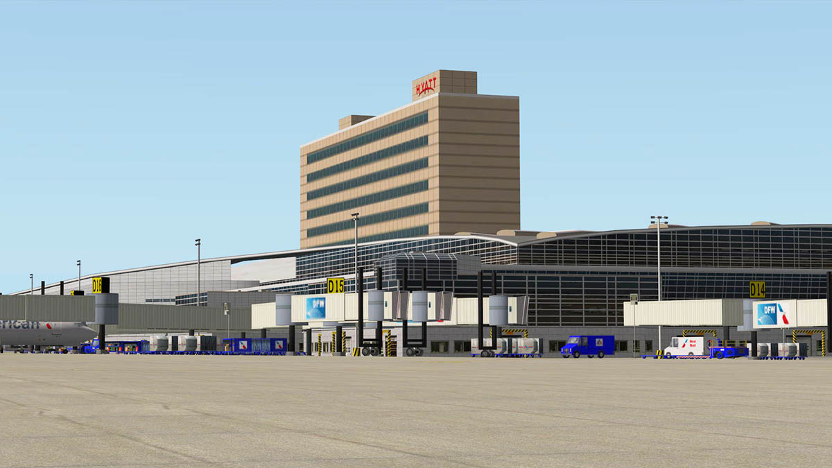
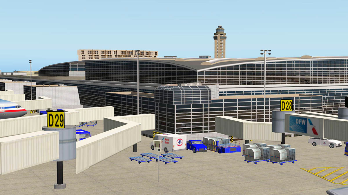
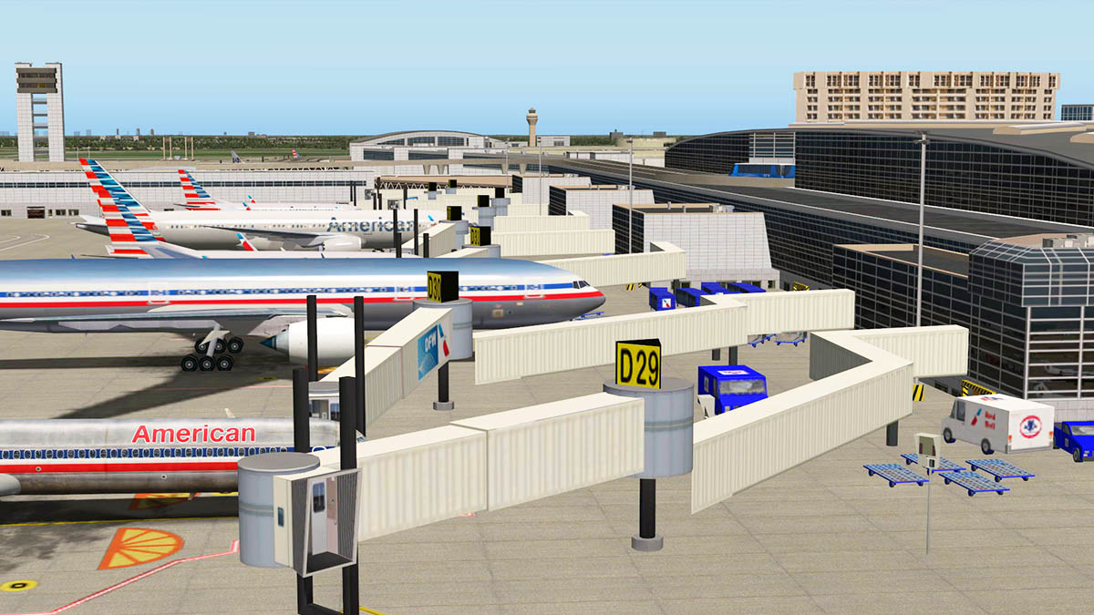
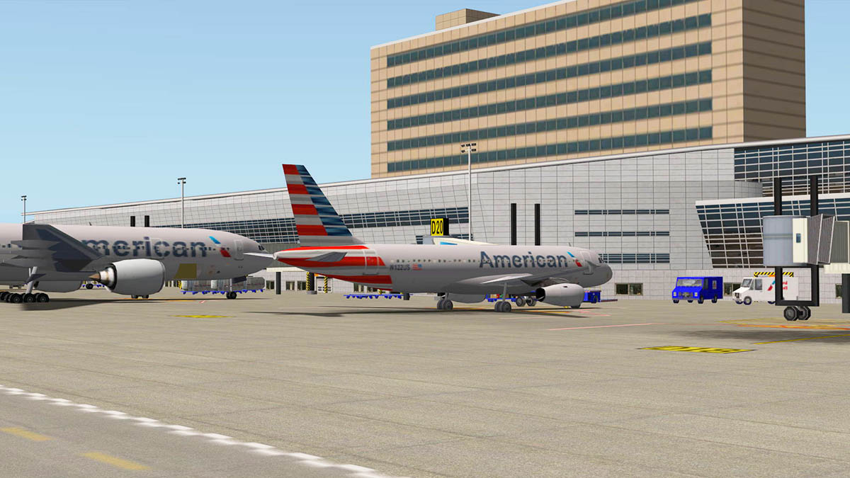
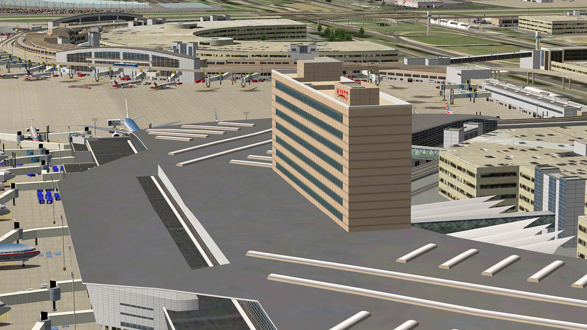
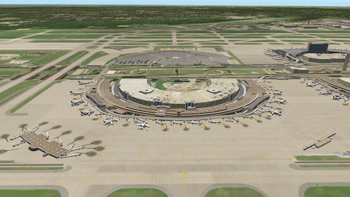
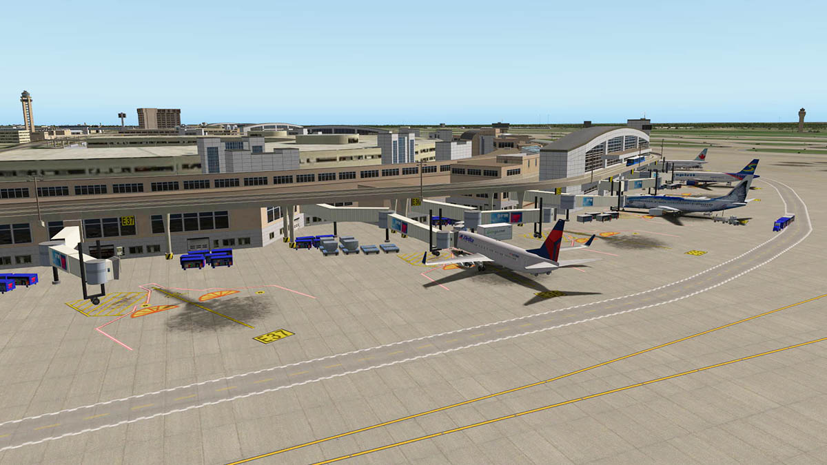
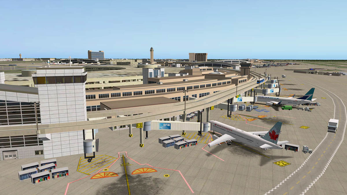
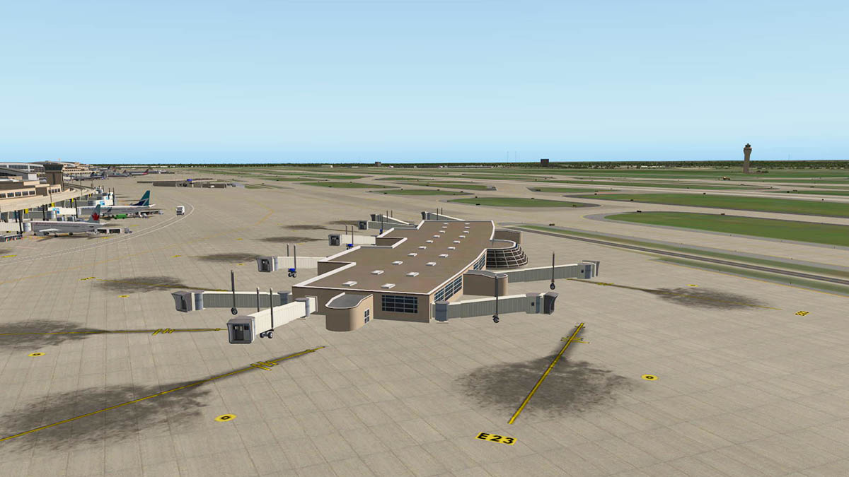
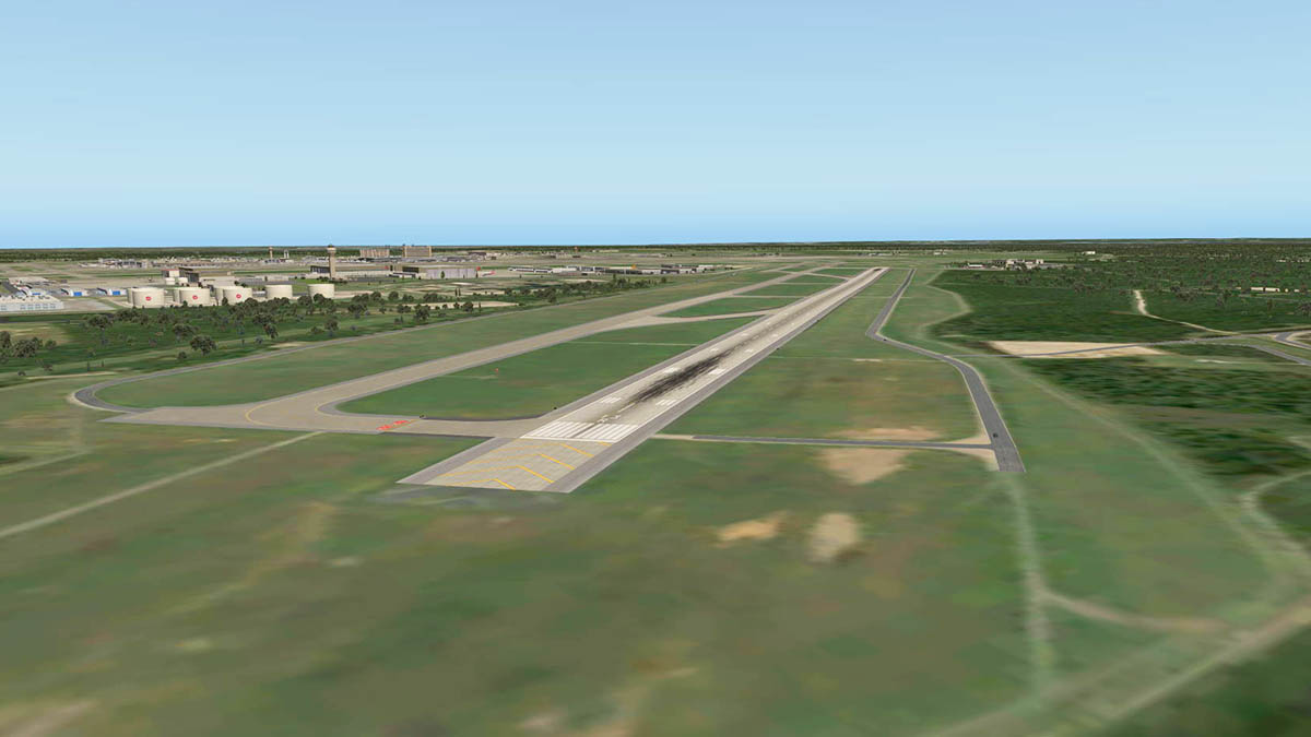
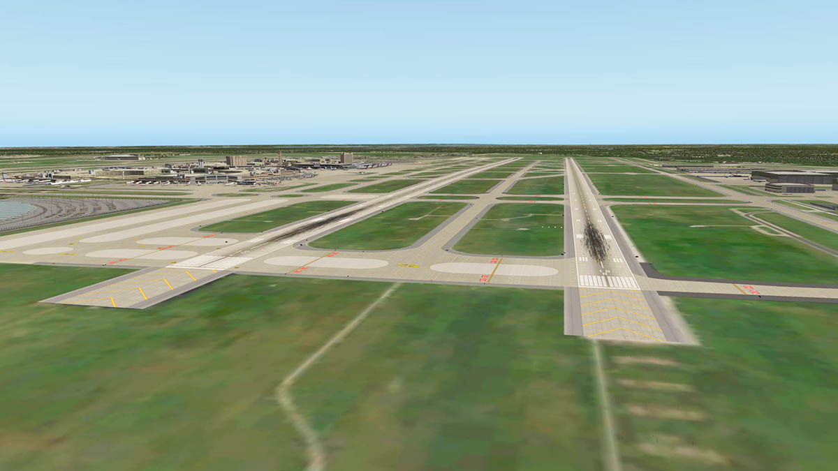
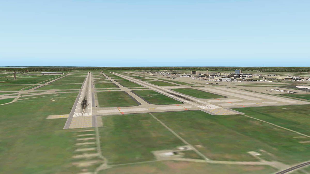
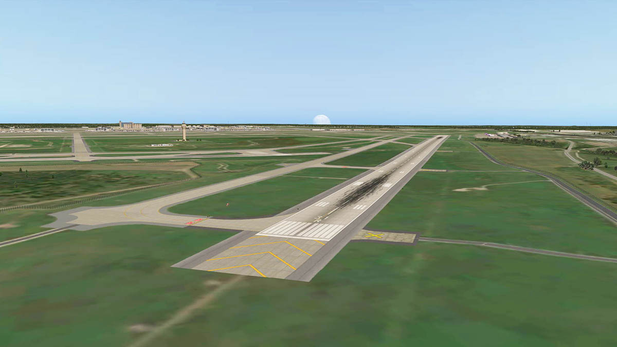
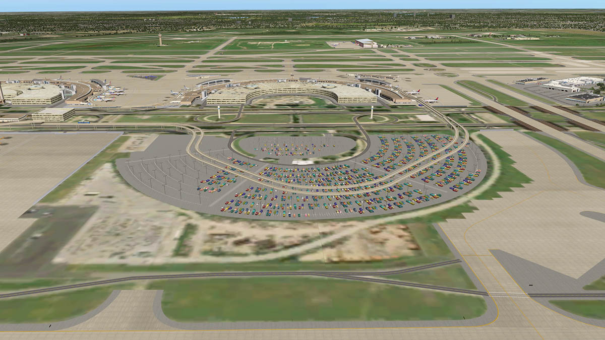
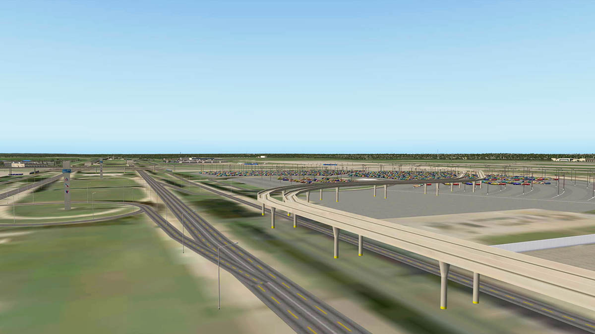
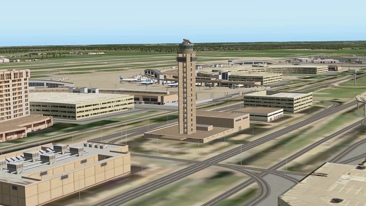
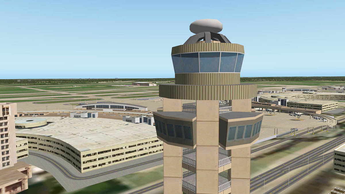
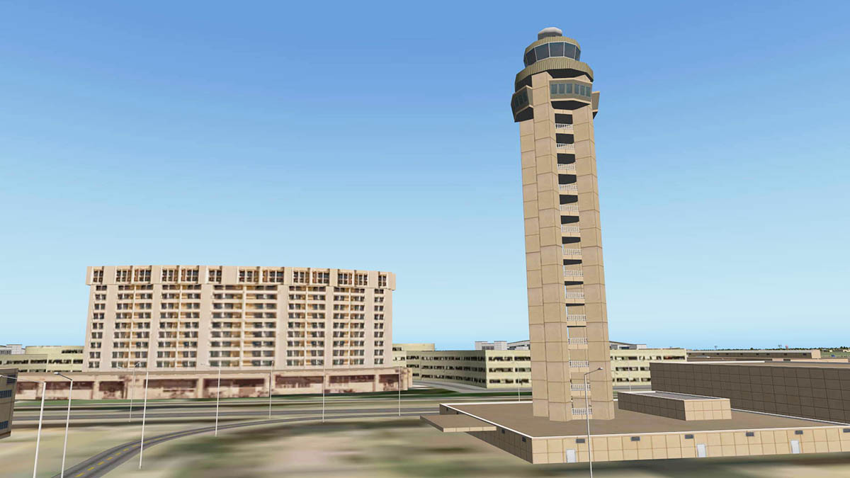
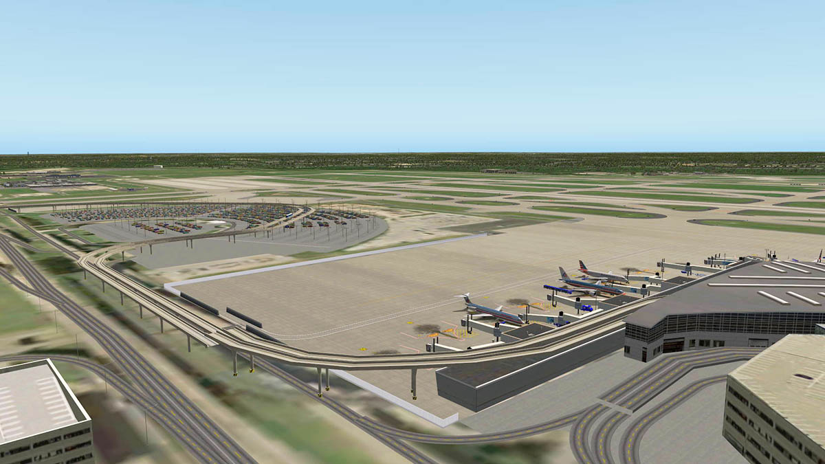
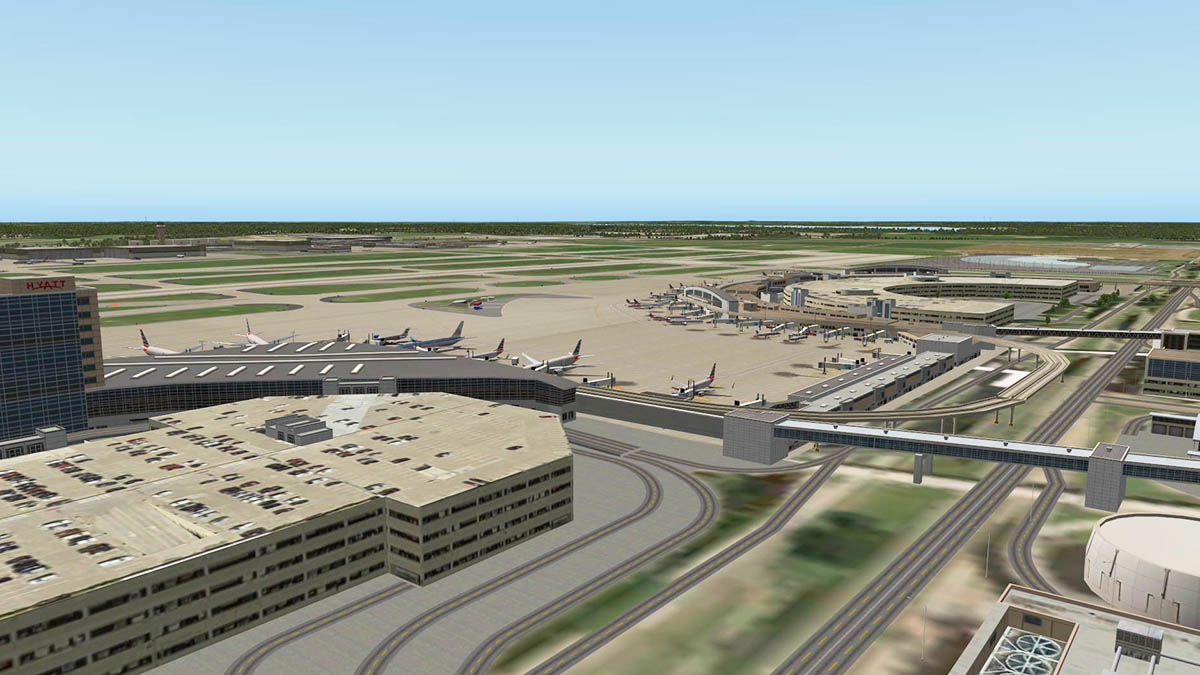
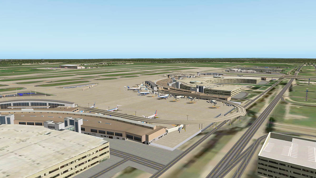
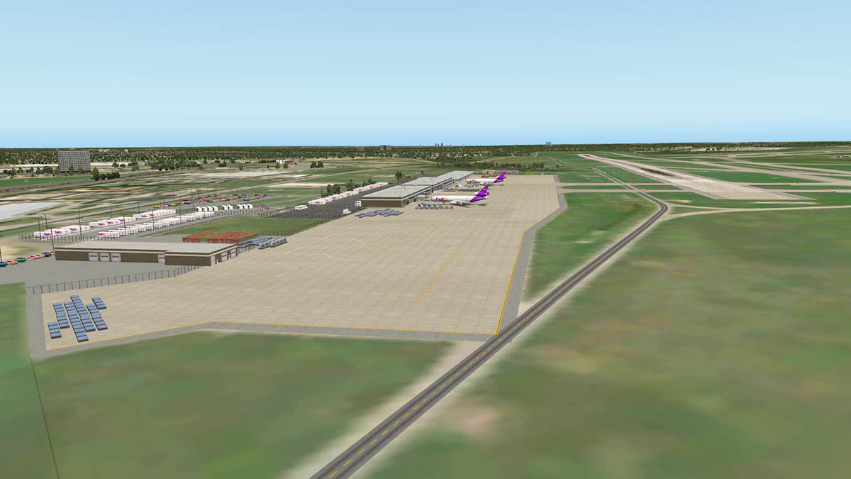
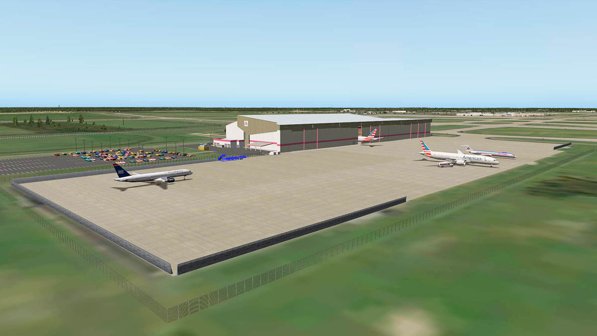
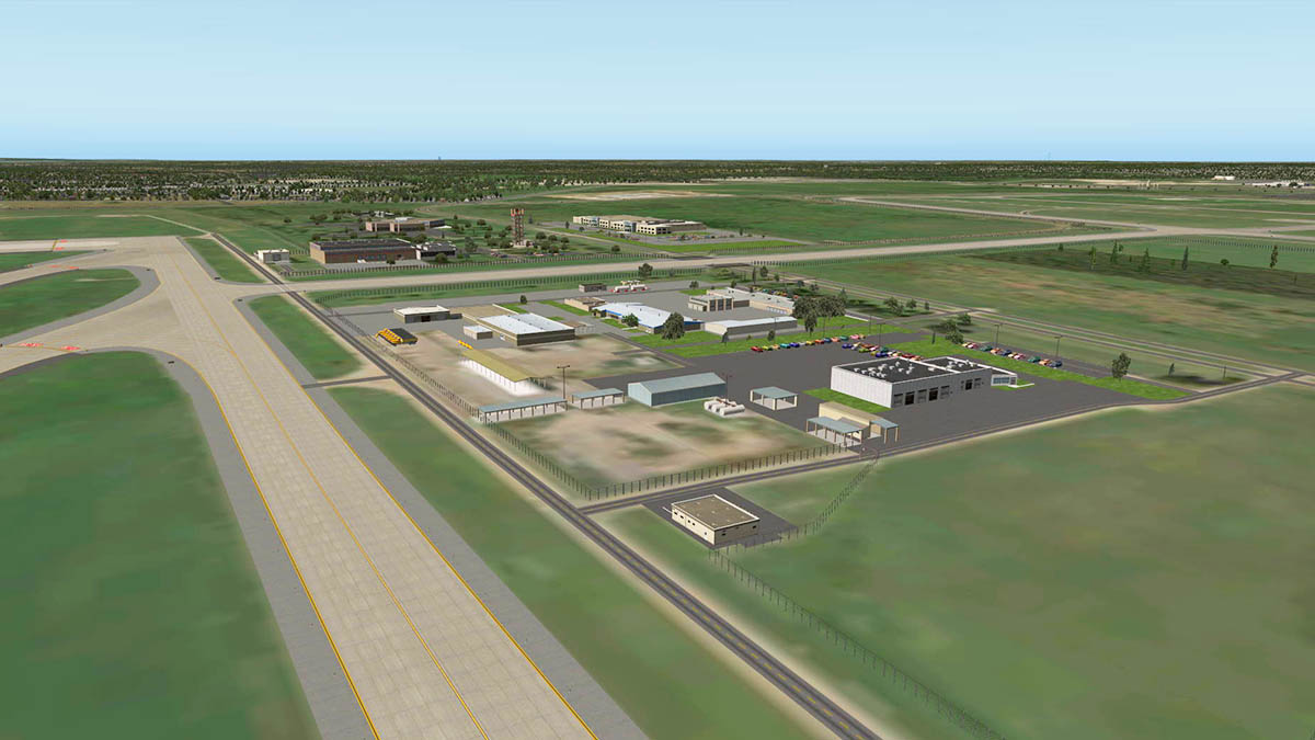
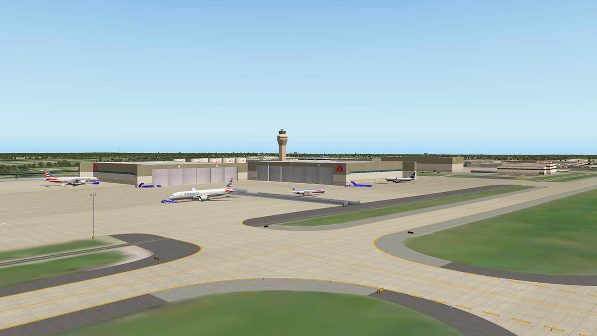
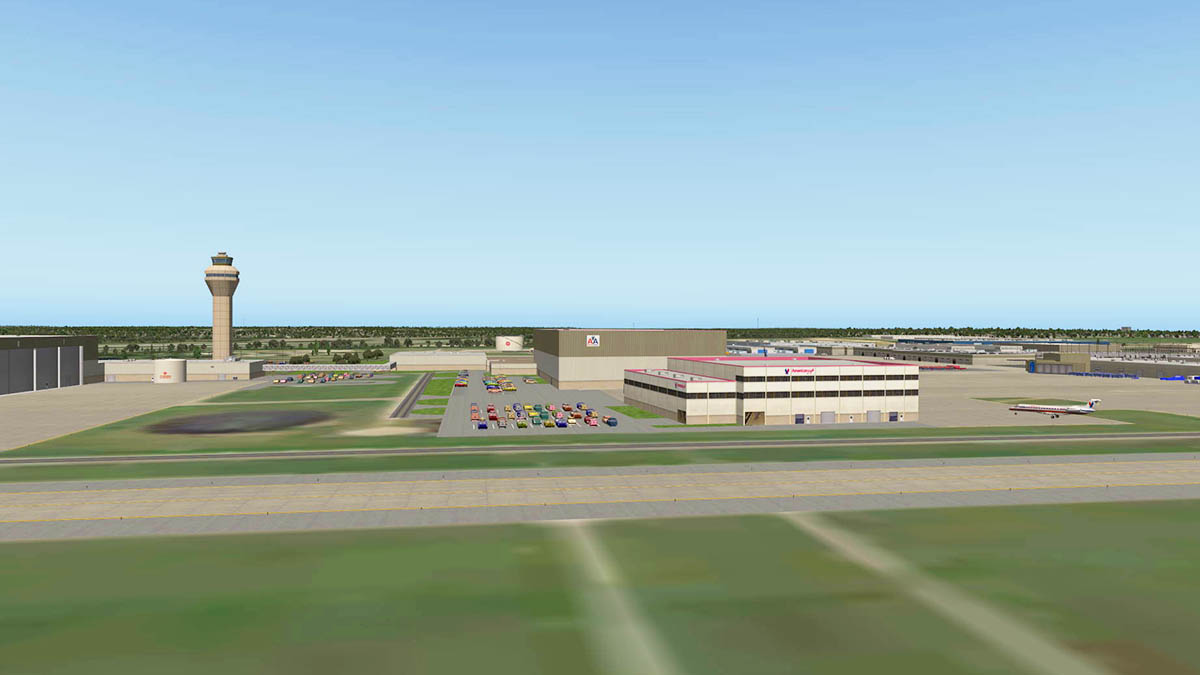
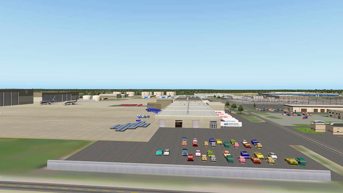
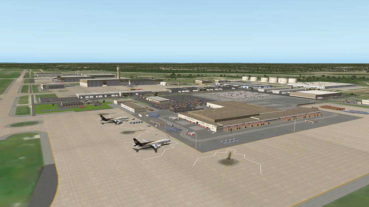
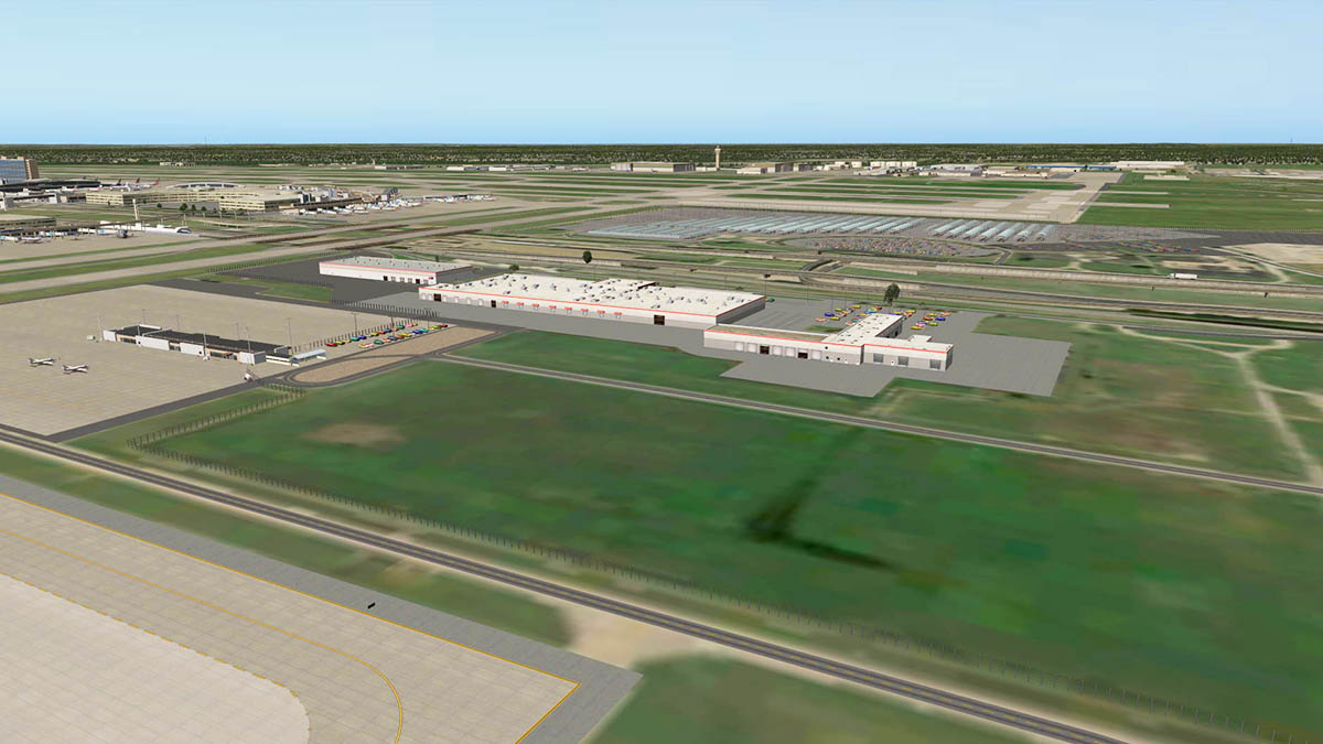
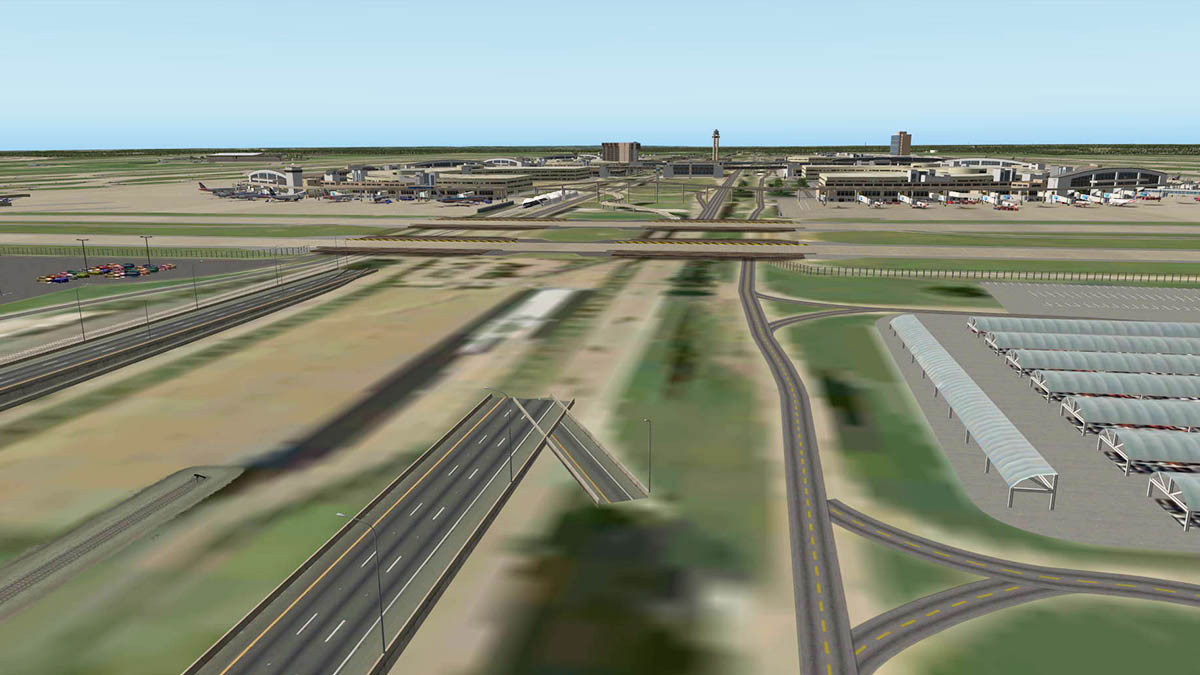
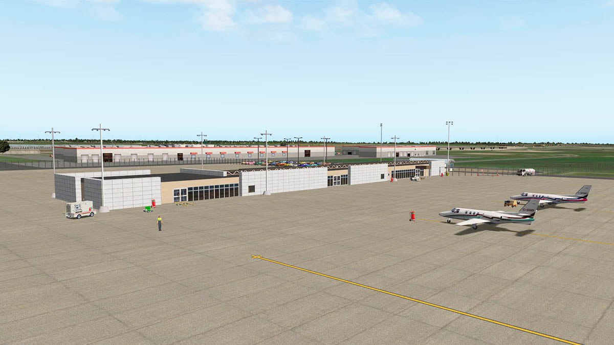
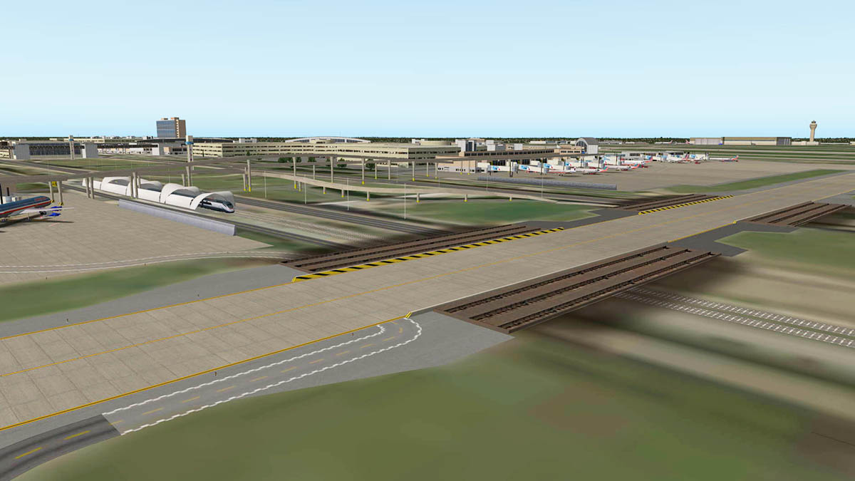
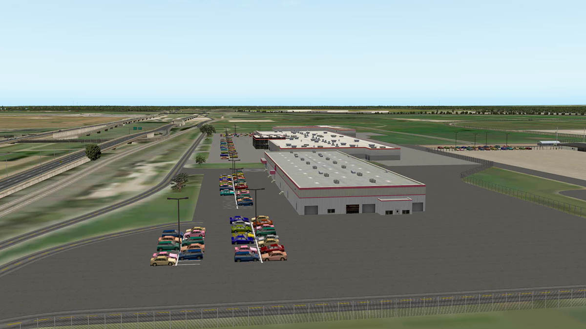
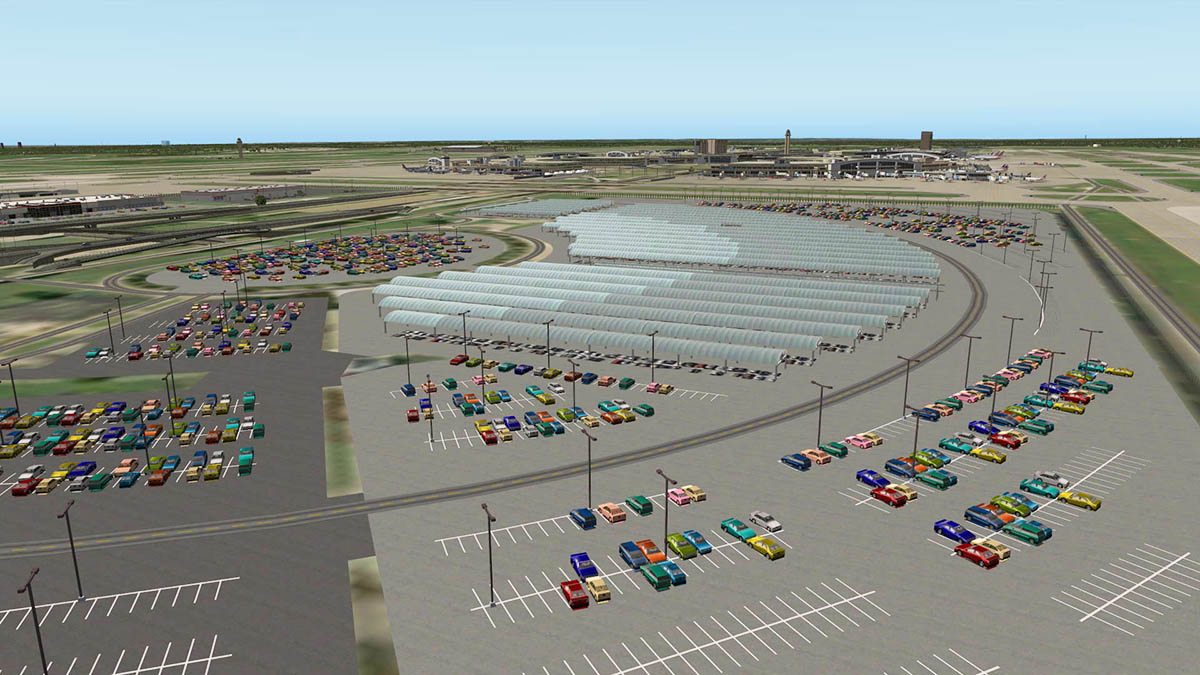
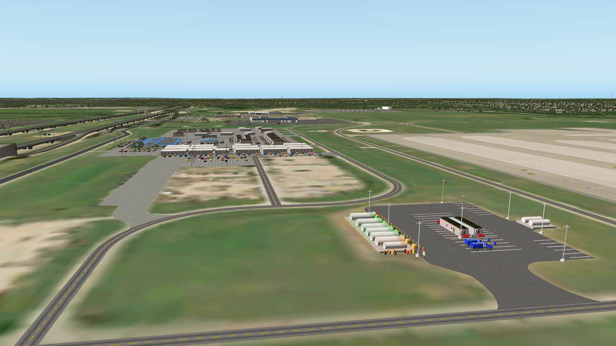
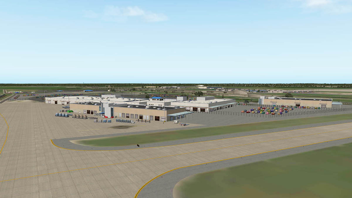
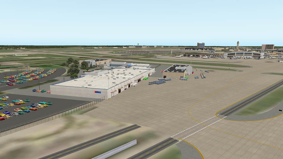
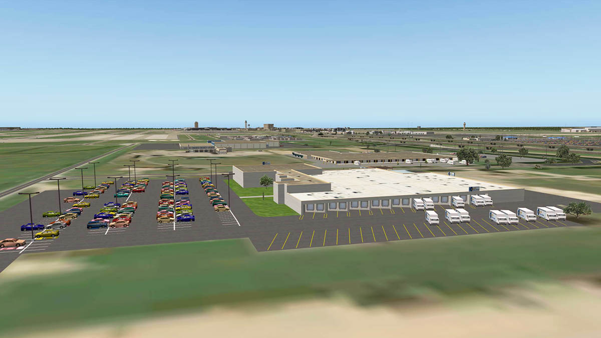
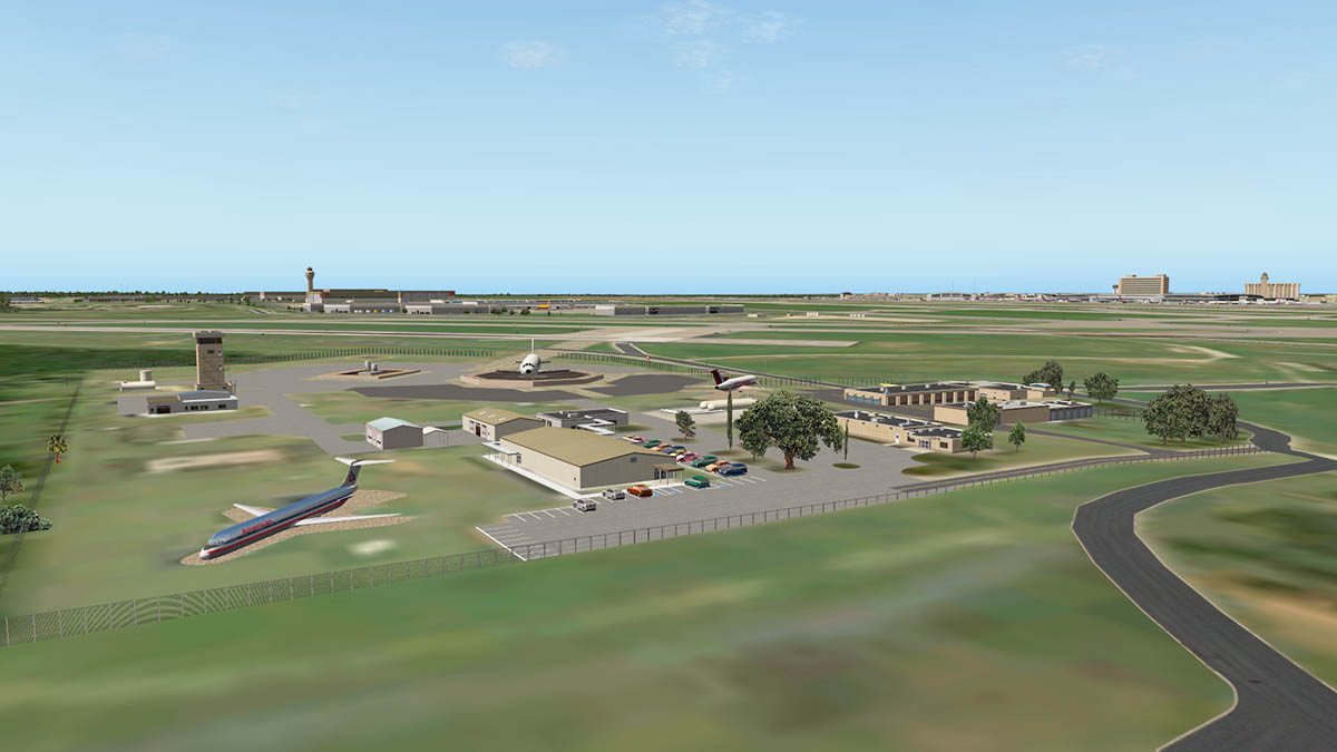
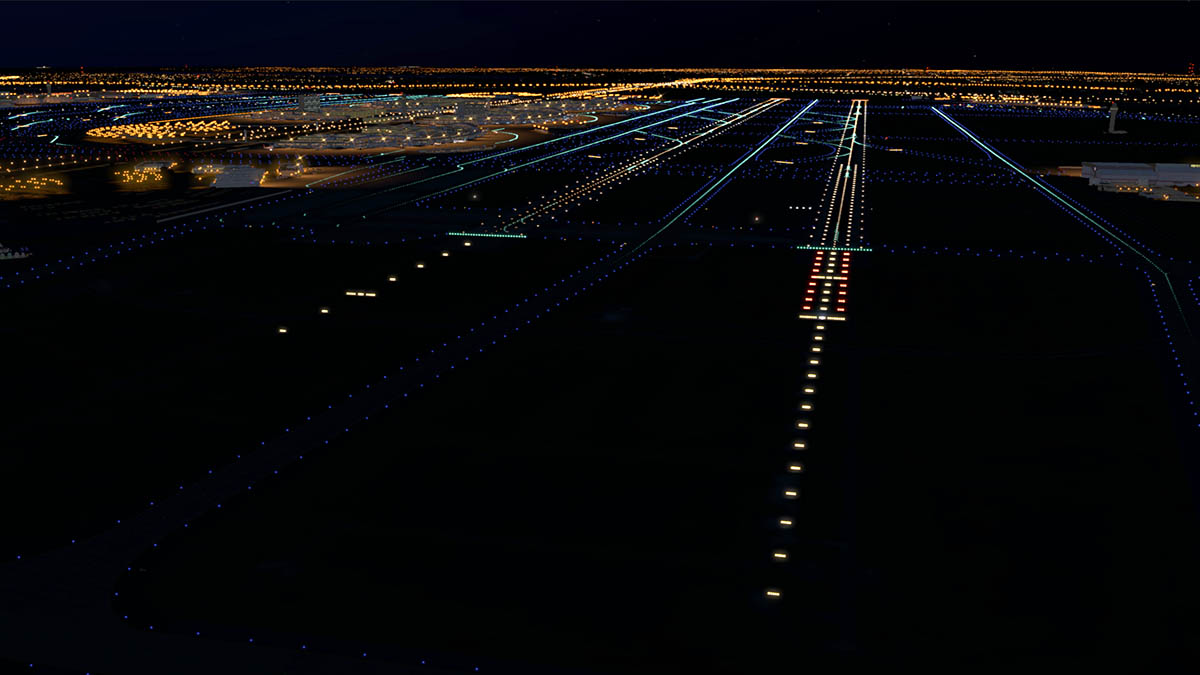
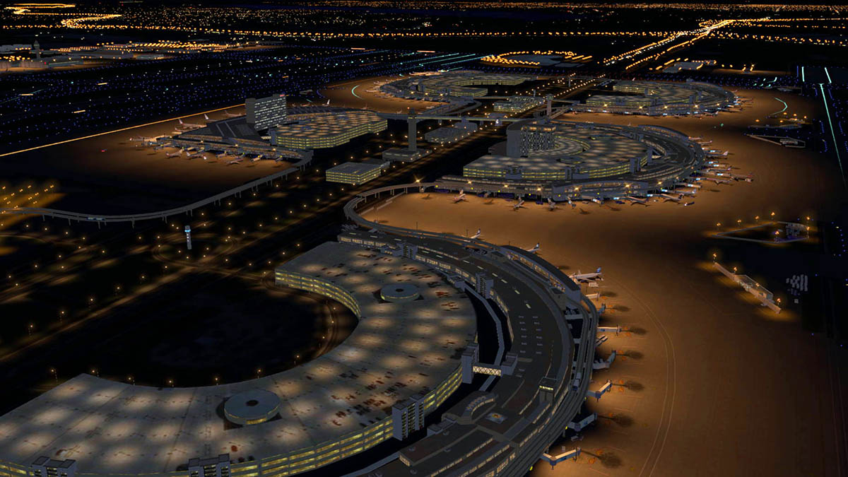
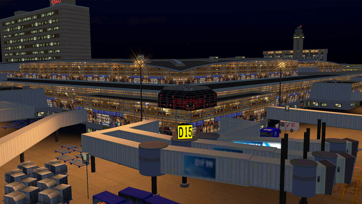
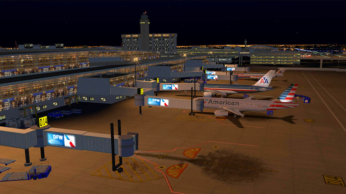
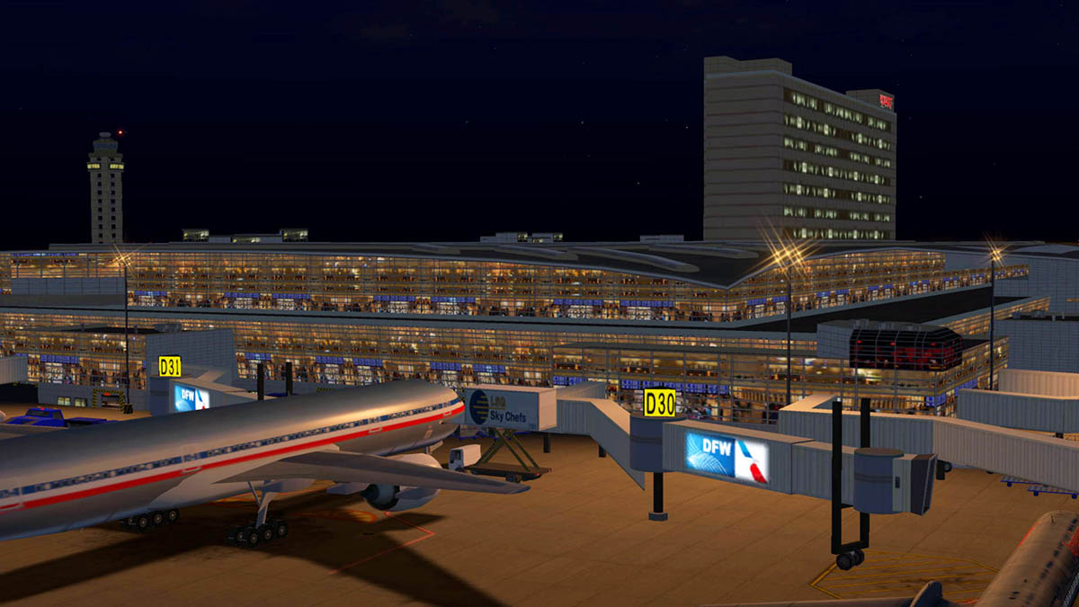
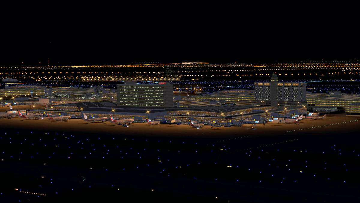
Scenery Review : KDFW - Dallas Fort-Worth by Tom Curtis Major mega airport hubs are today a way of your in transit flying life. But besides a way of crossing a country or going from a regional centre to a major metropolis they are also very important gateways into the country and in redirecting foreign passengers to connect easily onwards to their final destination. Take Qantas an Australian airline for example. The airline changed their main route into the United States from San Francisco to Dallas Fort-Worth (San Francisco has since been returned with a limited service) and the idea is that it puts their passengers not only further upcountry into the United States and not left on the coastal fringe, but to also allow the seemless transition to their code-share partner American Airlines to distribute them onward to their final destination... seemless, systematic and simple. And that sums up DFW (Dallas Fort-Worth), a mega import hub and a mega airline base for American Airlines... Welcome to American Country. Dallas Fort-Worth is in Texas, and let us not forget that when the Texas do big, they do really BIG... huge, monstrous, gargantuan... you get the idea. And Dallas Fort-Worth International lives up to that representation of the Texan way of doing things. 17,000 acres, seven runways (one helipad), 165 gates and a major hub for American Airlines, American Eagle and UPS Cargo... big. DFW by American Standards is not an old airport, it is quite modern and was only first initiated in the early 70's. Dallas was at the time well served by KDAL - Dallas Love Field (love that name) and Meacham Field, and that both airports had been around since the 1920's (1927). But Love field was feeling the strain by the late sixties and there was plenty of space around Fort-Worth to build a bigger mega airport, but Fort Worth didn't want a mega airport and the area only used 1% of the areas traffic, but finally the clear heads won out with the coming The Wright Amendment of 1979 increasing the pressure on the activities and restrictions of any more growth of Love Field. Dallas/Fort Worth Regional Airport opened on January 13, 1974, at a cost of $700 million. The name change to Dallas/Fort Worth International did not occur until later in 1985. At the time of its opening, DFW had four terminals, numbered 2W, 2E, 3E and 4E. During its first year of operations, the airport was served by American Airlines, Braniff International Airways, Continental Airlines, Delta Air Lines, Eastern Air Lines, Frontier Airlines, Ozark Air Lines, Rio Airways and Texas International Airlines. The Wright Amendment of 1979 banned long distance flights into Love Field (partially repealed in 2006, then fully repealed in 2014), leaving Southwest Airlines as Love Field's at the time only jet airline and operating solely as an intrastate air carrier in the state of Texas. Braniff International Airways was the original major operator at DFW in the airport's early years, operating a hub from Terminal 2W with international flights to South America and Mexico from 1974, London from 1978 and Europe and Asia from 1979, before ceasing all operations in 1982. Delta Air Lines also built up an early hub operation at DFW, which occupied most of Terminal 4E through the 1990s. The Delta hub peaked around 1991, when Delta had a 35% market share at DFW; its share was halved by 2004, with many former mainline routes downgraded to more frequent regional jet service in 2003.Delta finally closed its DFW hub in 2004, and relocated to Love Field it's remaining services. From then on American Airlines, which had already been one of the largest carriers serving the Dallas/Fort Worth area for many years, established its first hub at DFW on June 11, 1981 and from that point on became the airport's main tenant. Expansion was completed with a seventh runway which opened in 1996. The four primary north–south runways (those closest to the terminals) were all lengthened from 11,388 feet (3,471 m) to their present length of 13,400 feet (4,084 m). The first, 17R/35L, was extended in 1996 (at the same time the new runway was constructed) and the other three (17C/35C, 18L/36R and 18R/36L) were extended in 2005. DFW is now the only airport in the world with four serviceable paved runways longer than 4,000 metres (13,123 ft). Dallas/Fort Worth International Airport now has five terminals totaling 165 gates. The airport was designed with expansion in mind and can theoretically accommodate up to thirteen terminals totaling 260 gates. But there are no more plans for any more expansion in the foreseeable future. DFW is the third largest airport in size and the tenth in passenger movements with a record number 64,174,163 passengers in 2015. Tom Curtis Tom Curtis is a very well known X-Plane scenery developer. His scenery projects are not just standalone airports but mostly significant areas of aviation in the United States. Inside Passage, Final Frontier, Canadian Rockies, Seattle - Boeing Country, Golden Gate (San Francisco), Las Vegas - Glitter Gulch and KDEN - Denver International are all masterful projects available that have had a significant impact on the X-Plane simulator scenery collections. So if Tom Curtis focuses his attention on a new area and in this case Dallas, you know it is going to be another significant scenery to add to yor custom scenery folder. First Impressions I get into bubbles of flying routes between certain airports with different aircraft to see how the route responds to the various ways you can connect the two airports. KRSW (Florida South-West) is a favorite hub point at the moment and services to KATL (Atlanta) were fun and interesting, so I tried the same ideas to spread out further to KDFW (before I even knew this new DFW scenery was coming). It is an interesting route because you head straight out over the Gulf Of Mexico and pick up the southern US coast around New Orleans, then you follow the coast before going inland around Vermilion Bay (Louisiana) just south of Lafayette and fly up country over Nacogdoches until reaching Dallas, Texas. My equipment is Rotate's MD-88, and one aircraft I have flown on this route a few times already. One thing you are not short of at KDFW is the choice of arrival runways, with seven on offer it is a smorgasbord. Arrival is via 36R homing in on "Maverick" (113.10 VOR). STAR is DUMPY4 trans HERRI with an approach via SLOCO... got all that For such a very large airport KDFW does not stand out as much as you would think it would on approach, but once on finals for 36R DFW starts to become visible with the runways all well and correctly defined. On approach you have highways 360 and 161 left and right and you cross over HWY 183 on the southern airport boundary, giving you a lot of visual movement for any southern approach. A significant change with Tom Curtis's sceneries with KDFW is the way he has more intergrated the orthophoto textures into the X-Plane surrounding default scenery better, the infields are still flat, but the main surrounding areas are now really good compared to like his KDEN, which I really didn't like at all. So a big progress there. This change in design direction makes the approach into DFW now excellent. Visual runway textures are excellent and the huge amount of airport buildings and terminal infrastructure that make up DFW open up on your right, considering the amount of objects built in here the frame-rate is quite good. The visual aspect of so many terminals means there is a lot going on in your viewpoint, which is very satisfying in the context of arrival, this scenery is packed to gills with static aircraft and ground equipment (many are animated). DFW is a huge scenery and most approaches are interesting, however 13R/31L and 13L/31R - 17L/35R are very remote from the central terminal area, and you will require a significant taxi time to and from these runways with 31R and 13R with exceedingly a very long taxiing times that would require time and fuel to be accounted for, to a point 13L/31R is mostly used by the FedEx cargo hub which is connected directly to that runway. Because of the sheer number of gates (165) available at DFW it is recommended to locate your gate earlier and use an airport ground map to navigate yourself around the correct taxiway perimeters, if not you could find yourself taxiing around ramps for ages in locating a suitable berth. My assigned gate is B18 and you have a marshall to guide you in. If the aircraft is correctly set up then most active gates have the animated "marginal" jetway and docking guidance system ready to receive you. There are a lot of ground service vehicles (a lot animated) and colour coded red west and blue east. These vehicles are well done but a bit toy townish in design, no doubt to get around the copyright laws of payware scenery. They are created in very bright primary colours as well and that does make them stand out more than they should do. It is a "like them" or "not sure" about that idea overall, mostly I am not that crazy about the idea but a more subtle colouring would have made them work into the scenery better. As an experience of arrival at DFW, it is excellent. Great overall buildings and textures, great infrastructure including the three east - central - west control towers and other ramp towers, visually great with excellent taxiway and ramp markings to make navigation easy around this huge complex. KDFW - Dallas Fort-Worth KDFW - Dallas Fort-Worth International IATA: DFW – ICAO: KDFW – FAA LID: DFW 13L/31R 9,0002ft, (743m) Concrete 13R/31L 9,3012ft ,(834m) Concrete 17C/35C 13,4014ft ,(085m) Concrete 17L/35R 8,500ft, (2,590m) Concrete 17R/35L 13,4014ft, (085m) Concrete 18L/36R 13,4004ft, (085m) Concrete 18R/36L13,4004ft, (085m) Concrete H1 158ft (48m) Concrete Elevation AMSL 607 ft / 185 m Runways (clockwise) 13R/31L - 18R/36L 18L/36R - 17R/35L 17C/35C - 17L/35R - 13L/31R. All runways are excellent, in wear and textures. Taxiway signage and lineage areas are also to the detail expected of a scenery of this calibre, as are infields. But missing grass can make these areas look a little flat from ground eye level. Terminals Terminal A Terminal A has 30 gates: A8–A25, A28–A29, A33–A39. with Gates A34–A39 closed for renovations, as of March 2016. An American Airlines Admirals Club is located at Gate A24. The A terminal is a wholly an American Airlines terminal and is semi-circular in design. A major feature of DFW is the SkyLink terminal people-mover that commenced operations in April 2005 in replacing the notoriously slow original Airtrans APM (17mph). The large corner iconic terminal buildings are not actually part of the terminal, but are the Skylink stations that are sited around the extensive terminal loop that makes up the transport system. In this scenery the Skylink is excellently reproduced with constant movement rail-cars moving right around the system in opposite directions, the track breaks now and again but overall the system here is excellent and a really great visual feature with the blue cars moving in and and out of your line of view. All terminal construction and textures are first rate. This is very comprehensive scenery, beautifully done and large in scale. Only note is that some sections of the airbridges don't line up, but I do have 'runways to always follow terrain" tickbox on, so that may be the cause. Terminal B Terminal B has 49 gates: B2–B3 (FIS optional), B4–B29, B30–B39 (North Stinger), B40–B49. and Gates B18–B23 are closed for renovations, as of March 2016. North Stinger is a walk-on satellite terminal. Terminal B was originally the main Braniff Airlines complex, but it is now completely American Eagle territory as they now run all the gates. Terminal B is situated directly opposite Terminal A and has an American Airlines Admirals Club located at Gate B3 Terminal C Terminal C has 31 gates: C2–C4, C6–C8, C10–C12, C14–C17, C19–C22, C24–C33, C35–C37 and C39. And the The Hyatt Regency DFW hotel is part of this terminal complex. Originally Terminal 3E is is another wholly American Airlines terminal with an American Airlines Admirals Club located at Gate C20. This terminal is domestic. Note the excellent ramp tower situated between Terminal A and Terminal C. Terminal D Terminal D is the International terminal for DFW and it is a 2,000,000 sq ft (186,000 m2) facility capable of handling 32,000 passengers daily or 11.7 million passengers annually. The 298-room Grand Hyatt DFW Hotel is directly connected to the terminal. Terminal D has 30 gates: D6–D8, D10–D12, D14, D15–D16–D16X (A380 gate with three loading bridges), D17–D18, D20–D25, D27–D31, D33–D34, D36–D40. There is an American Airlines Admirals Club located at D24. A British Airways Lounge, a Korean Air Lounge, a Lufthansa Lounge and a QANTAS Business Lounge is located at D21. Both Emirates and Qantas use the A380 at this terminal. There is some nice texture and glass work on Terminal D that differentiates it more than the other semi-circle terminals, it is square in design as well. The white facades are really well done here as well. Terminal E Terminal 4E, was originally occupied primarily by Delta Air Lines until Delta closed its hub here in 2005 (still Delta does 50 flights a day from here). Now it serves U.S.- based carriers at the airport other than American Airlines/American Eagle and Sun Country, as well as Air Canada Express and WestJet USCBP that are precleared flights from Canada. Terminal E has 35 gates: E2, E4–E18, E20–E21, E22–E30 (Satellite Terminal), E31–E38. Delta and Alaska Airlines are the current occupants of the E satellite terminal, following the renovation project of gates E31–E38. Express South is a huge carpark opposite Terminal E. It is the site for any terminal expansion and is noted as Terminal F and planning is due soon. The Skylink is already in place and well represented here as the rail-cars move right around the the carpark boundary. Great 3d vehicles fill in the parking lots. International Parkway and central Control Tower East and West areas of DFW are separated by the airport's central north–south arterial road, Spur 97, also known as "International Parkway." that is the central backbone of the airport. The flat orthophoto textures do reduce the central spine to a more bland effect, but otherwise the area is well catered for. There is a large carpark for each terminal with a little detailing on each, but this area is more filler than detailed object filled. It does the job well, but nothing more. The main 232ft central control tower is excellent, and well constructed. Detailing is basic on the ground, but you get the feel of the tower. Top of the tower glass is transparent, but nothing inside. Tower view over the main central runways 18R/36L 18L/36R and 17R/35L 17C/35C is excellent with no obstructions. Outer DFW boundaries. DFW International is a huge area to cover. The main areas are divided into west and east and go out a fair way from the central terminal area. Eastern Boundary FedEx has a big cargo complex on the north-eastern boundary aligned with RWY 13L/31R known as "East Cargo". There is an adjoining Fire Station (no.3) complex as well. Cargo wise you could fly into and out of DFW via 13L/31R and not associate with the main area at all, it is that compact and distant from the central area. Infield between runways 17C/35C and 17L/35R there is the "East (control) Tower" and a big American Airline maintenance hangar (Hangar 5) and support aprons. Next to the AA maintenance complex is the main central Fire Station (no.1) buildings. Note the animated fire truck that does the rounds of the outer roadways. It is a shame in X-Plane you can't select which tower you want to view from, but that is part of the sim. The south-eastern boundary has a few notable facilities. A Procurement complex (or warehouses) and a Radar tower. Central to the area is an American Airline office complex and operations centre and the DFW (airport) Human Resources building. Over the other side of "East Airport Drive" is a large "Flight Safety International" training facility. These outer buildings are all of course notable because they are highly viewable from 17C/35C and 17L/35R and certainly from 34R threshhold in landing or taxiing past over to the main terminal area via taxiways Q to ER (link) and P. Western Boundary Infield between runways 13R/31L and 18R/36L west are large commercial airport areas. South-west is "West Cargo" but note as the DHL cargo aprons. American Airlines have another maintenance complex here with two hangars covering the site. The "West (control) Tower" is position behind the AA maintenance hangars. American Eagle has its offices and maintenance hangars central west with another cargo apron along side known as "West Air Freight". Still another cargo complex area is north-west and this time it is for UPS (United Parcel Service). Also set out west - west by RWY 13R/31L is the airport's comprehensive fuel depot and fuel tanks. And there are large storage warehousing buildings set behind the UPS aprons. The whole western area is very well filled in with vehicles and static aircraft. Cargo containers and various other ramp equipment is well placed and so the detail is as good as the central areas of DFW. Northern Boundary On the northern approach to DFW there is a large long term carpark to the west, which is well done with the car-cover screens looking very realistic. On the west side along taxiway K is a great corporate aviation ramp (Apron 1E) and reception terminal. With airport support warehouses next to the Parkway. Taxiways Y and Z go over the International Parkway motorway northern entrance, but they are not in 3d but flat to the ground. Many developers now and notable at KORD and SBGL have mastered the 3d taxiway bridge features to great effect, so you miss the same feature here at DFW, it would have looked good and great to use (which they are). The roads are messy leading up to the taxiway (flat) bridges and not helping in the effect. Notable here also is the curved roof rail-station which is well done. Southern Boundary On the southern section of taxiway K is the "SouthEast" Cargo area which is a multi-user facility for quick transit parcel movement. (my guess is regional). With a another long-term and car rental carparks set to the south. On the south-west side of the southern approach to DFW are mostly the catering facilities. A small fuel depot is well done with a large mobile-office (demountable) administration area set out behind. Nice feature are the roof placed solar - panels, on the biggest building. Further south are both the Gate Gourmet and SkyChef catering facilities. Outer boundary south-west there are two facilities including bombardier Aerospace/CAE buildings and a large Fire Station (no.4) with an extensive fire training area which is right on the RWY 31L threshold. So you are looking at a very large comprehensive area covered by objects that covers so much detail of this huge mega hub DFW airport. Not content with doing just the central DFW airport and terminals, you do get so much that any visual aspect is uniquely covered. Lighting There is great approach lighting with RAIL lighting animations on all the northern approach runways 17C/17R -18L/18R and 13R. There are a lot of central (green) taxiway guidance lighting, but not located everywhere including the cross east - west taxi routes, so you have to navigate via the outer blue taxi lighting and your on board aircraft side lighting. Ramp and area lighting overall is excellent, with a lot of of variations of different lighting for all the different areas. Great spot lighting covers carparks and all inner terminal areas, so the airport views at night are quite breathtaking with HDR on. And considering the huge amount of lighting covered in here it is quite framerate friendly if you are not too heavy with your HDR lighting settings. Terminal and building night textures are simply brilliant, just sensational. Totally absolutely realistic and with a huge amount of variation of all the various areas that are covered correctly. If you are a scenery developer then look here on how it is done by the master, great down lighting as well on the maintenance hangars. Services You can connect in the states with about everywhere from DFW certainly on any American Airlines/U.S Airways routes. So your choice is huge... top ten domestic routes are interesting with LaGuardia routes notably more used than JFK and no major Washington D.C. routes noted. Domestic 1. Los Angeles, California -1,199,000 - American, Delta, Spirit, United 2. Chicago–O'Hare, Illinois - 1,060,000 - American, Spirit, United 3. Atlanta, Georgia - 977,000 - American, Delta, Spirit 4. Denver, Colorado - 858,000 - American, Frontier, Spirit, United 5. New York–LaGuardia, New York - 787,000 - American, Delta, Spirit 6. Phoenix, Arizona - 693,000 - American/US Airways, Spirit 7. Las Vegas, Nevada - 672,000 - American, Spirit 8. San Francisco, California - 660,000 - American, United 9. Miami, Florida - 628,000 - American 10. Charlotte, North Carolina - 613,000 - American/US Airways International International routes are very interesting. You expect Mexico and Canada to be popular, but the British seem to really like Texas as well. Notable routes to the Far East (Toyko/Seoul) are surprising. Also surprising is the absence of the middle-east carriers, but with Emirates upping the Dubai - Dallas route EK221/EK222 to A380 services and other new connections then that absence won't be for too much longer. 1. Cancún, Mexico - 682,977 - Aeromexico, American, Spirit, Sun Country 2. London (Heathrow), England - 636,251 - American, British Airways 3. Mexico City, Mexico - 476,167 - Aeromexico, American 4. Tokyo (Narita), Japan - 305,321 - American 5. Frankfurt, Germany - 269,442 - American, Lufthansa 6. Monterrey, Mexico - 246,804 - American 7. Seoul (Incheon), South Korea - 245,514 - American, Korean Air 8. San José del Cabo, Mexico - 240,412 - American, Spirit 9. Toronto (Pearson), Canada - 221,385 - Air Canada, American 10. Vancouver, Canada - 200,460 - American Qantas currently operates the world's longest nonstop service route from DFW to Sydney. In August 2015, Emirates announced plans for a nonstop flight from Dubai to Panama City which will take the title of the world's longest scheduled nonstop passenger flight starting on February 1, 2016. Cargo With 22 cargo operators and with 578,906 tons of cargo handled annually, DFW is the world's 29th busiest cargo airport. If you have followed all the cargo areas in this review you would understand how big a cargo hub DFW is. So with plenty of choice in operators and destinations will keep any cargo hauler easily grinning from ear to ear. Summary As this "American Country" scenery covers the world's third largest area in airports. You can be forgiven that absolute detailing is not required or even possible without groaning out your computer. What there is in here at Tom Curtis's KDFW is however very substantial and covers not only the main elements of DFW, but a lot of the very wider open boundary areas of the scenery as well and it all comes with a very usable frame-rate. So overall this is really excellent scenery. Tom Curtis has intergrated his orthophoto textures far better than most of his sceneries from the past, and it all looks far better for the extra effort and certainly from an approach point of view. The textures are still quite flat from the ground perspective and in some areas blurry, but overall they are fine. It is debatable on the great effort to create specialized ground vehicles for his sceneries, but I don't think the idea works in context. X-Plane scenery development has moved on from 3d coloured objects and you now have great ground services vehicles like with the JARDesign "Ground Handling Deluxe" sets in your ramp areas, so these objects come across as old fashioned and in most cases they quite too garish and distracting from an otherwise excellent scenery. The missing Y and Z 3d taxiway bridges would have been a nice to have. Building quality and textures are overall really excellent, certainly the night lighting textures are overwhelmingly so good. There are so many variations and different objects to cater for here and most have been done with real skill and you have here a perfect realisation of DFW . Like DFW this is a big scenery and a really great big quality one at that. So great value and with excellent detailing you get a lot for your purchase and also a great major mega hub to fill in your X-Plane network for great routing and the sheer flexibility of cargo and passenger destinations not just domestically but internationally as well, just however fly mostly American, because Dallas is well... "American Country". ____________________________________________________________________________________ Yes! KDFW - Dallas Fort-Worth by Tom Curtis (Scenery4xp) is NOW available from the X-Plane.Org Store here : KDFW- Dallas Fort Worth - American's Country Price is US$24.95 Features: Gates and terminals accurately modeled Static Aircraft at gates Animated Aircraft Photoreal Ground textures Custom ATC Realistic night lighting Many custom starting locations Very large airport 5 terminals 7 runways 165 gates 3 control towers Animated Airport Ground Traffic (plugin by Marginal) All gates utilize 'Autogate' by Marginal Real Flags plugin Requirements: X-Plane 10 (any edition) Windows, MAC or Linux . 32 or 64bit 8GB RAM- 1Gb VRAM Video card Minimum (2GB+ VRAM Recommended) Installation and documents: Download is 111.60meg and the scenery is deposited in the "Custom Scenery" X-Plane folder at 247.00mb. Marginal's jetway and docking guidance system plugin is required for the animated jetways and Red flag animation plugin, both are supplied with the scenery. Both are deposited in your X-Plane plugin folder. Read the "read me", but installation is straight forward. ____________________________________________________________________________________ Review by Stephen Dutton 20th May 2016 Copyright©2016: X-PlaneReviews Review System Specifications: Computer System: Windows - Intel Core i7 6700K CPU 4.00GHz / 64bit - 8 Gb single 1067 Mhz DDR4 2133 - GeForce GTX 980/SSE2 - Samsung Evo 512gb SSD Software: - Windows 10 - X-Plane 10 Global ver 10.45 Addons: Saitek x52 Pro system Joystick and Throttle : Sound - Bose Soundlink Mini Plugins: JARDesign Ground Handling Deluxe plugin - US$14.95 Scenery or Aircraft - McDonnell Douglas MD-80 by Rotate ((Rotate MD-88 - X-Plane.OrgStore) - US$59.95
-
Update Scenery Review : Golden Gate, KSFO and South Bay v1.5 by Tom Curtis Golden Gate, KSFO and South Bay is a huge massive area of scenery that covers the San Francisco and South Bay area. There are already in this scenery a large list of the areas airports including: KSFO - San Francisco International airport KOAK - Metropolitan Oakland International Airport KSJC - Mineta San Jose International Airport KHWD - Hayward Executive Airport KPAO - Palo Alto Airport - General Aviation KHAF - Half Moon Bay - General Aviation KSQL - San Carlos Airport GG01 - Clipper Cove, Located on Treasure Island GUQ - Moffett Field And not to mention other items including Golden Gate Bridge, Oakland Bay Bridges, San Mateo Bridge and the Dumbarton Railroad bridges. Alcatraz Prison and the Nike Missile Site Museum. For a full cover review these areas and the above airports from X-Plane Reviews then go here: Scenery Review : Golden Gate, KSFO and South Bay by Tom Curtis (v1.4) This 1.5 version release of Golden Gate, KSFO and South Bay covers the extra inclusion of more detailing on the San Francisco city and port areas. To have a better view of the additions I flew the excellent X-Trident's Bell AB412 to get a closer look. Departure was from KSFO on the Coast Guard pad and flew north towards the San Francisco city area. My render setting are important here to relate what you see in what is part of the Golden Gate package and what X-Plane autogen scenery adds to the overall viewpoint... so the texture res is set at "Very High", number of objects is "Too Many" and the World Distance Detail is set at "High". At first glance the the package does not seem that much different except for a more densely populated city skyline. But standing out is the Candlestick Park Stadium on Candlestick point. It is the smaller additions that can add in visual detailing and you can see the many wharfs and finger maritime warehouses that are located around the shoreline. The Oakland Bay Bridges dominate the view as they stretch out over towards Oakland on the other side of San Francisco Bay. Traffic on the (all) bridges are animated and that adds into the vibrant movement that you require to bring bustling cities alive. Once past the Oakland Bay Bridge you are downtown. Tom Curtis has replicated most of the iconic buildings in this city area, there are too many to list here but the most important ones (or the highest) fill out the view including the Transamerica Tower and the Telegraph Hill-Pioneer Park monument "Coit Tower". The Embarcadero is the main frontage of the main wharf area of the city and the iconic "Ferry Building" is well modeled as well as all the wharf fingers. At Pier 27 is a luxury Liner. There is more items in vessels parked at wharf's (tugs), showboats, clippers and various ferries. Shipping is dotted around on San Francisco bay and many are animated. Famous "Fisherman's Wharf" is well replicated, but more a tourist attraction than a working Wharf. The cities bridges in the Oakland Bay Bridges, San Mateo Bridge and the Dumbarton Railroad bridges are not new to this release, but are significant to mention again in their detail and the added animated vehicle traffic. The "Golden Gate is of course a stand out, and the heavy Oakland Bay Bridges, San Mateo Bridge and the Dumbarton Railroad bridges and the heavily animated traffic is excellent. "The Rock' Is also the first lighthouse and US built fort on the West Coast besides its infamous past as a prison. And is always worth a flyover. So how much does the X-Plane autogen contribute to the scenery... quite a lot actually. I have always been a promoter of the fact that to engineer realistic sceneries quickly in X-Plane it is a great idea to use both angles in creating the basic icons of cities and then letting the autogen do the major point of filling in the surrounding areas. This way you get the very best of an efficient engine and can cover a large area without the large framerate hit you can get with a totally filled out 3d city. Yes I admit it is not building to building perfect, but all you are really requiring is a replica skyline of the city and this approach can deliver that with efficiency. With the autogen scaled back you can see the actual added scenery provided by the package, there is no hope to cover the whole area with efficient 3d buildings, yes there is the Open Street Map conversions and very good they are as well, but it is framerate at a premium we are looking for. Complex and realistic, with North American autogen, for once the San Francisco package works in your favour. Time to head back to KSFO. Nightlighting The San Francisco cityscape is very good in the low light. The city building textures are very realistic and from any angle including the excellent approach to KOAK RWY 09R is excellent. The autogen lighting does not match the package as it is darker... but overall it is pretty effective. The spot lighting on the bridges, doesn't really work, but the wharf areas are quite good. The highlight is the Candlestick Park Stadium at its full candle watt power, as it does look very realistic. Overall at night it is very impressive. Summary This scenery is already an extensive collection of airports and bridges and sharp details that go up to make the San Francisco Bay area. Full of great value and with excellent frame-rate. So it defies logic on why you would want it to be part of your scenery collection. Now there is the added bonus of the full San Francisco cityscape, and in a cohesive way v1.5 rounds off the scenery as the full complete package. Tom Curtis has a great reputation in X-Plane to deliver clever intelligent scenery that gives you a lot for your investment, and here Tom Curtis delivers again. Great scenery, Great package and now even better than ever in this new 1.5 version. TheScenery Review : Golden Gate, KSFO + South Bay by Tom Curtis is available now from the New X-Plane.org Store : Golden Gate KSFO + South Bay Price is US$34.95 If you have already purchased Golden Gate , KSFO + South Bay, Then check into your X-Plane.OrgStore account Features: KSFO - San Francisco International Airport KSJC - Mineta San Jose International Airport KSQL - San Carlos Airport KOAK - Metropolitan Oakland International KPAO - Palo Alto Airport - General Aviation - 18 miles south of KSFO KHAF - Half Moon Bay Airport - 10 miles west of KSFO KHWD - Hayward Executive Airport - 8 miles south of KOAK GG01 - Clipper Cove Located on Treasure Island All airports include : All gates and terminal Global Night Lightning Custom ATC Frame rate friendly Golden Gate Bridge Detailed model of the world's most famous bridge Alcatraz Island The 'Rock'. Used to be home of a federal jail until 1963 Other landmarks All of the piers and other structures along the shoreline from AT&T (Baseball) Park all the way to the Presidio near the Golden Gate bridge. Transamerica Tower located downtown San Francisco Nike Missile Site Museum Bay bridges Oakland Bay Bridge, San Mateo Bridge and the Dumbarton Railroad bridge Developer Site : Scenery4XP _____________________________________________________________________________________ Documents and Installation : Download: 84mb : Installed as GOLDEN_GATE+SOUTH_BAY_150_XP-10 (295.00mb), and four animation files noted Banner Tow (1.5mb), GG Bridge (634kb), San Meteo Bridge (641mb) and SF Bay Bridge (639mb)Tom Curtis provides a full set of instructions on how to install the scenery under: "OPEN FIRST!" Golden_Gate+South_Bay_Open_Me. Internet is required for installation instructions as it is an address HTML link. GOLDEN_GATE+SOUTH_BAY_150_XP-10 is the main scenery file and four other files are noted under GND_TRAFFIC are - GG Bridge, Banner Tow, San Meteo Bridge and SF Bay Bridge are all to be installed in the "Custom Scenery" Folder (These are bridge traffic animations). Supplied also is the "Red Flag" flag animation plugin. Folder "CustomSBDatarefs004" is installed in the X-Plane Resources/Plugin Folder. _____________________________________________________________________________________ Technical Requirements: X-Plane 10 (any edition). - This scenery is not compatible with X-Plane 9 Windows XP or Windows Vista or Windows 7 / 8 (32 or 64 bit) or MAC OS 10.7 or Linux 1Gb VRAM - 2Gb VRAM Recommended. Current version: 1.5 - Last updated October 14th 2015 ______________________________________________________________________________Update Scenery Review by Stephen Dutton 21st August 2015 Copyright©2015: X-Plane Reviews Review System Specifications: Computer System: - 2.66 Ghz Intel Core i5 iMac 27”- 9 Gb 1067 Mhz DDR3 - ATI Radeon HD 6970M 2048 mb- Seagate 512gb SSD Software: - Mac OS Yosemite 10.10.1 - X-Plane 10 Global ver 10.42 Addons - Saitek x52 Pro system Joystick and Throttle : Sound - Bose Soundlink Mini : WorldTraffic Plugin Addons - Saitek x52 Pro system Joystick and Throttle Aircraft Bell AB412 by X-Trident is available at the (Bell 412) X-Plane.OrgStore $35.95