Search the Community
Showing results for tags 'dainese and bellini'.
Found 1 result
-
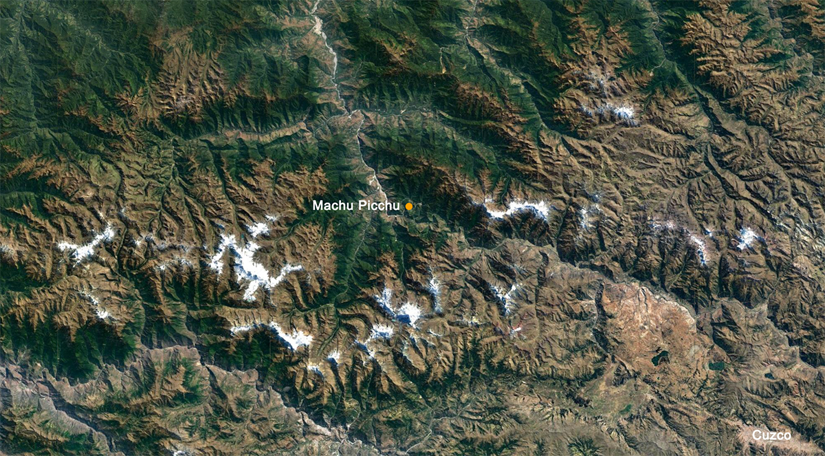
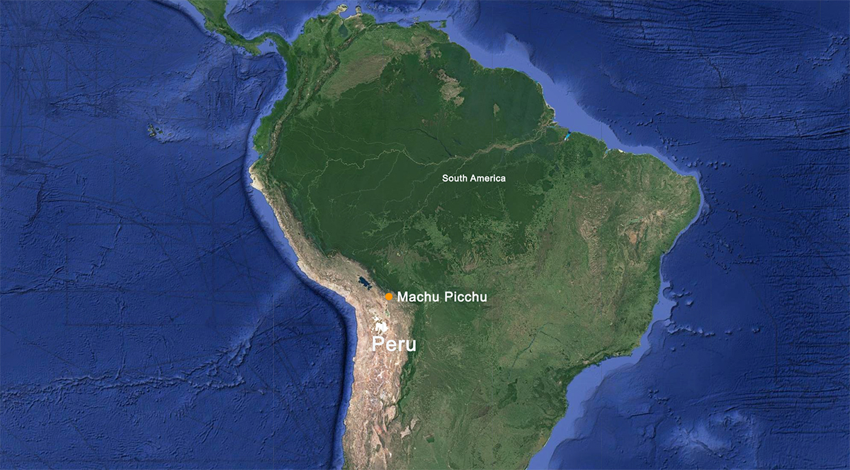
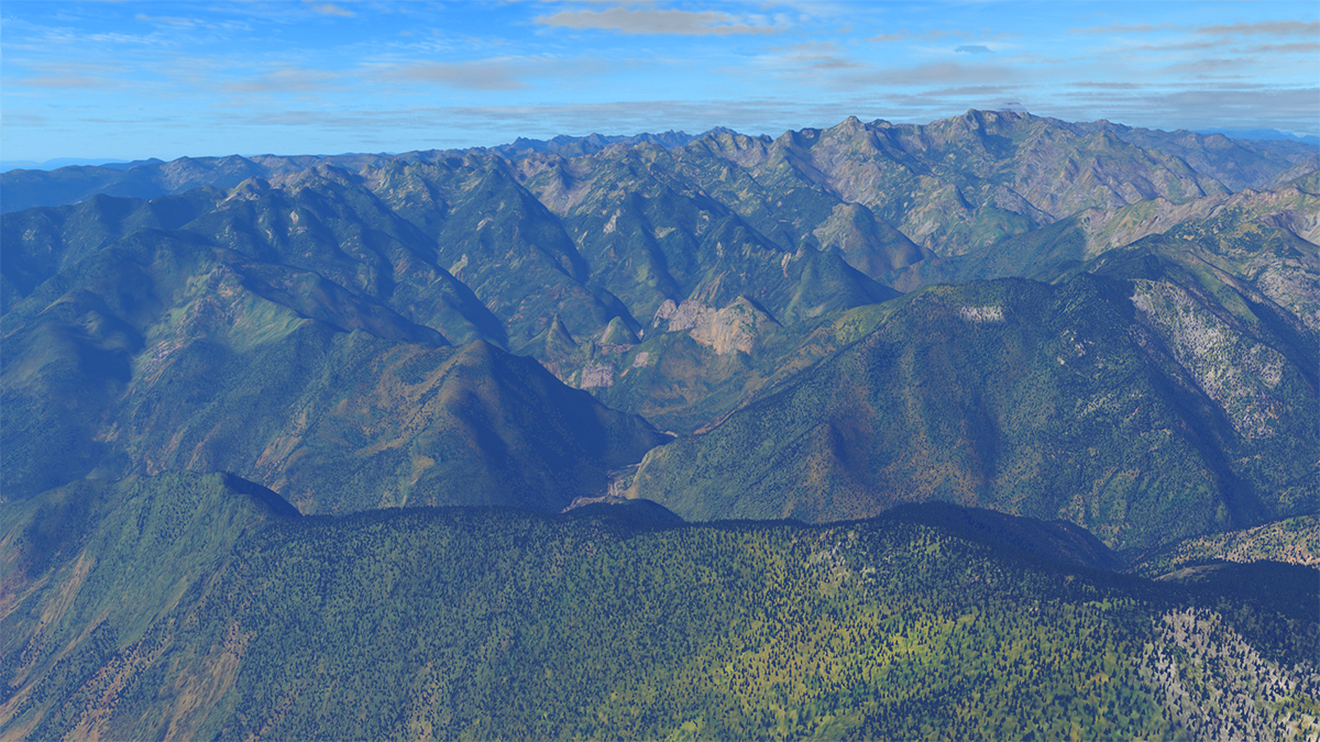
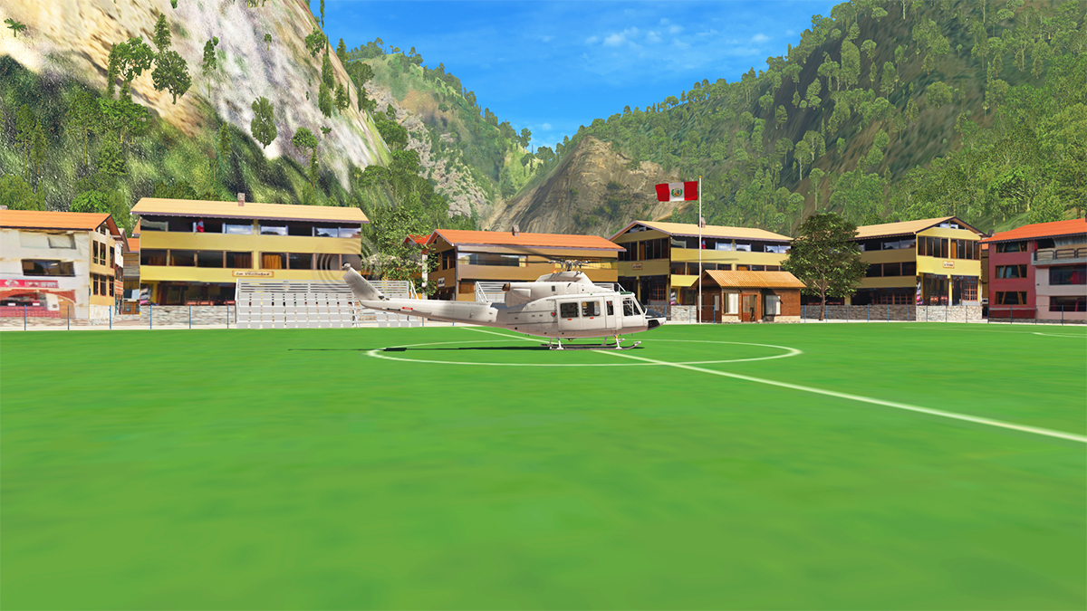
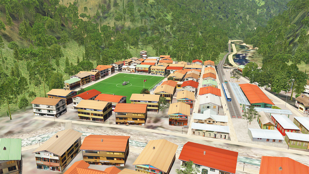
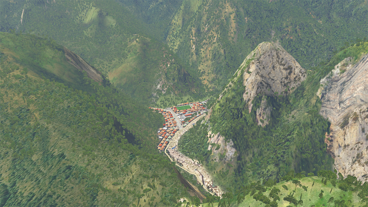
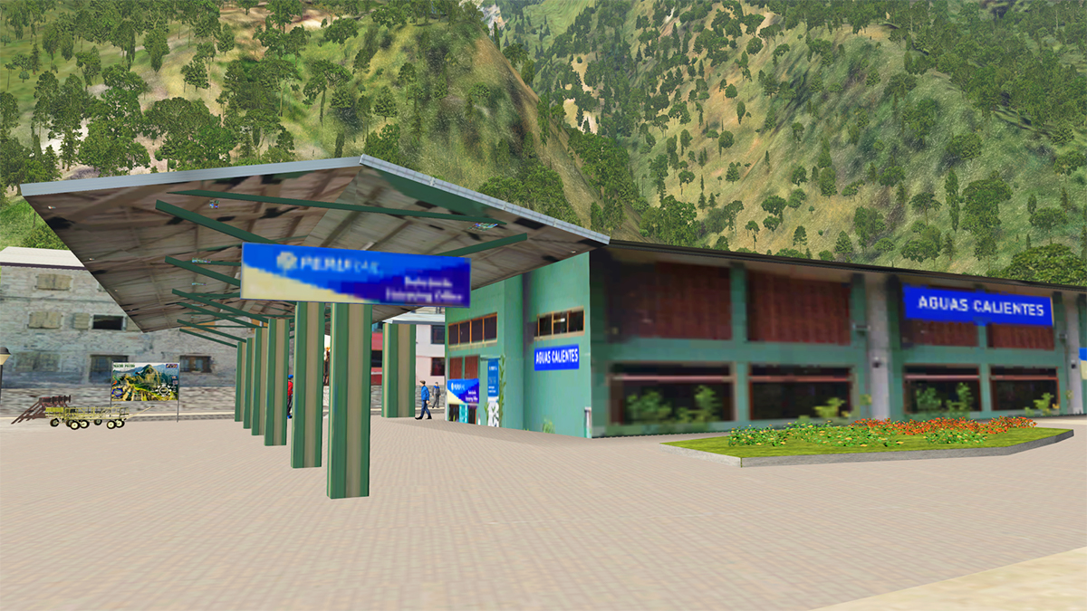
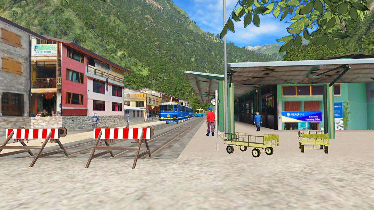
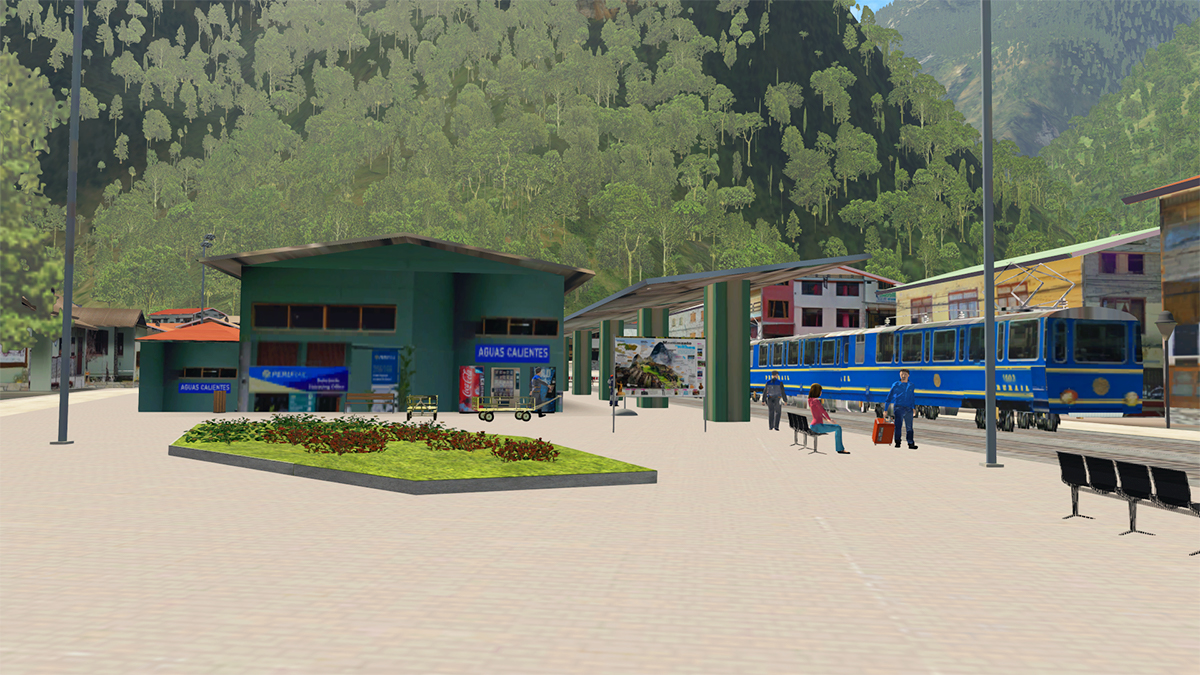
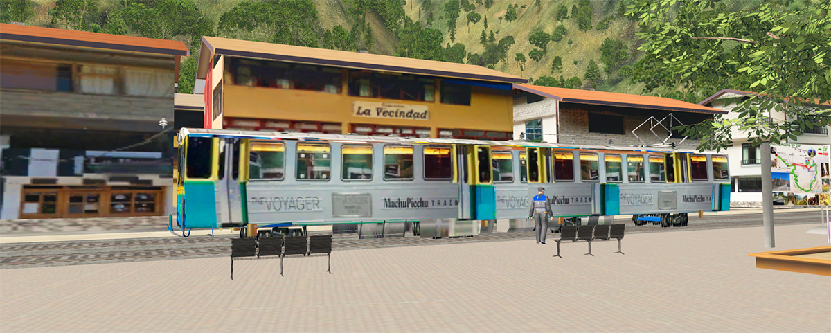
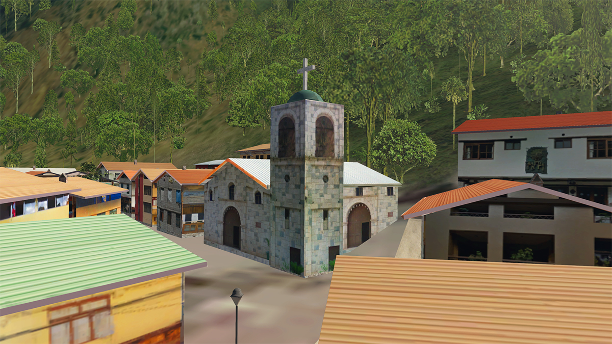
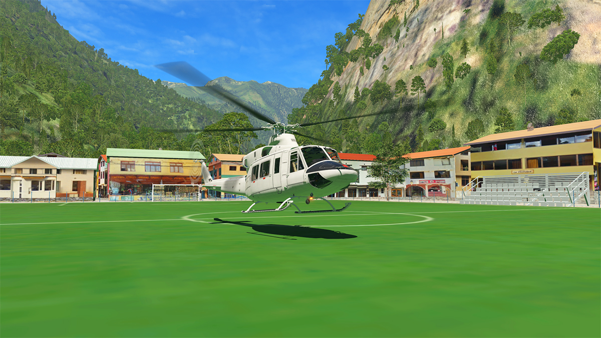
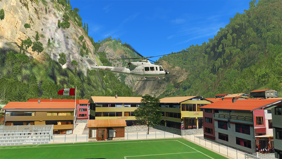
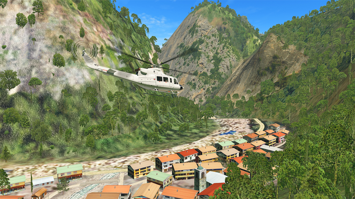
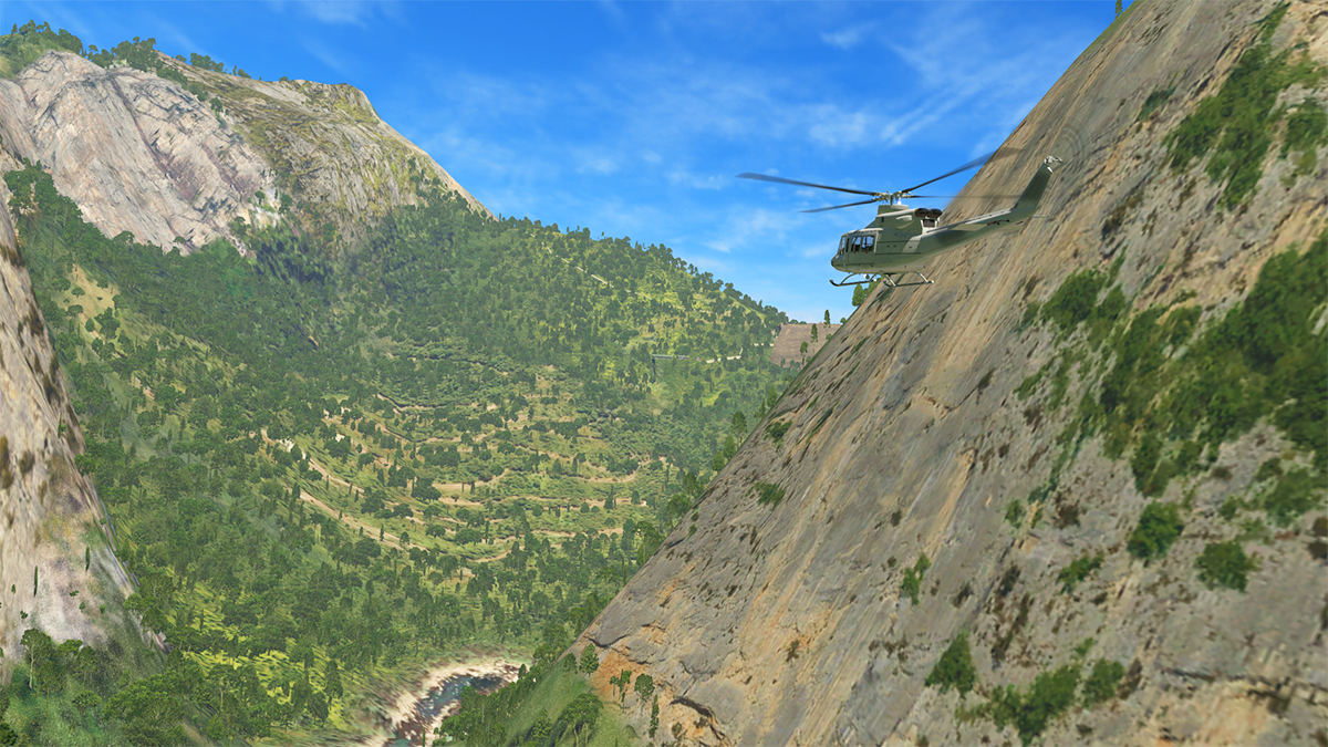
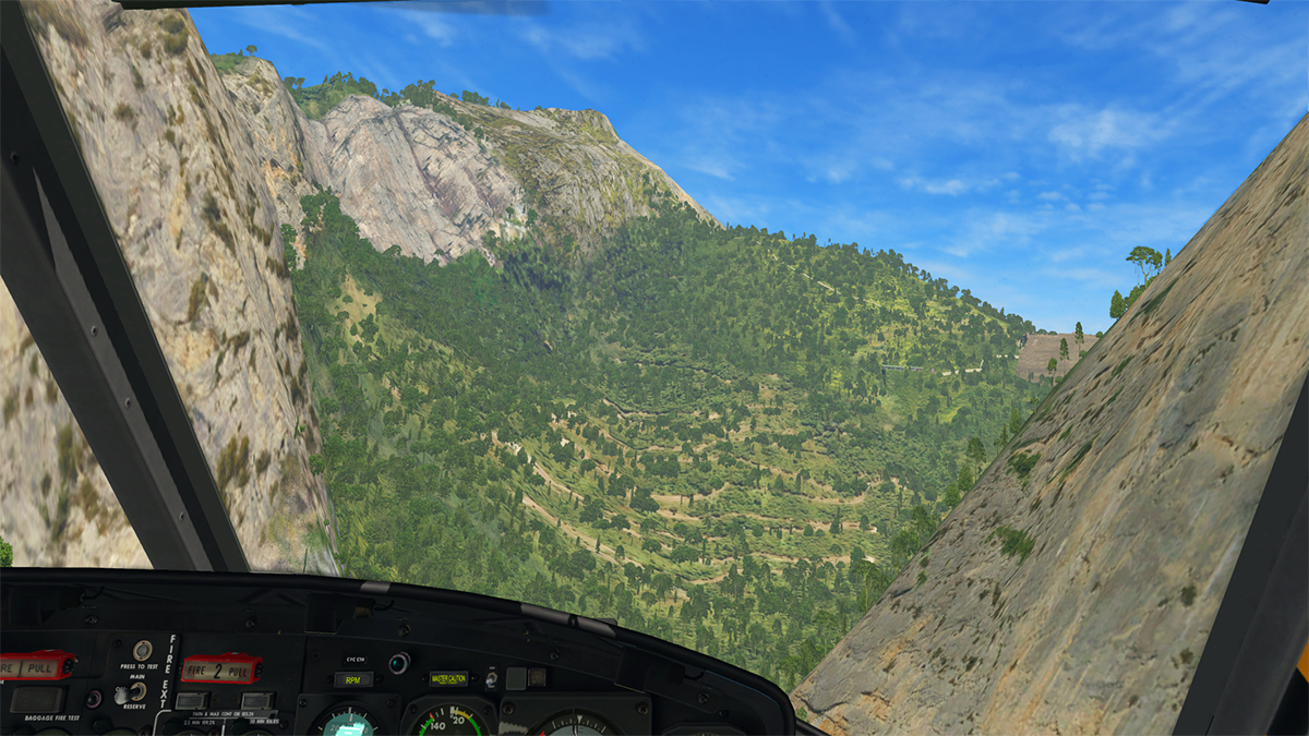
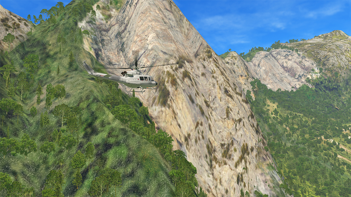
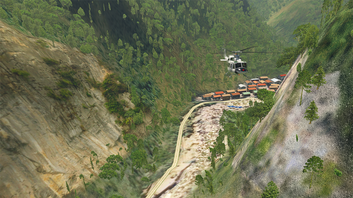
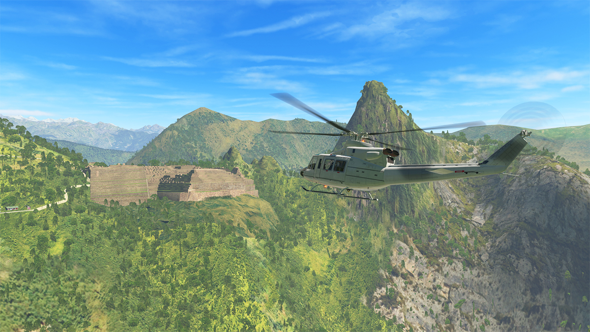
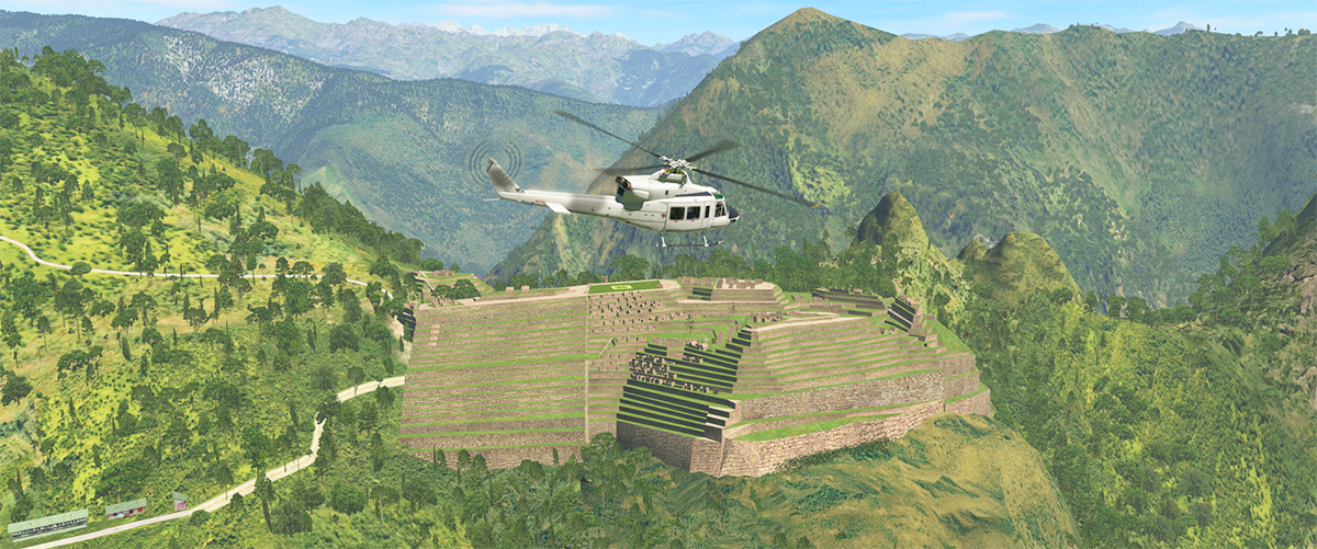
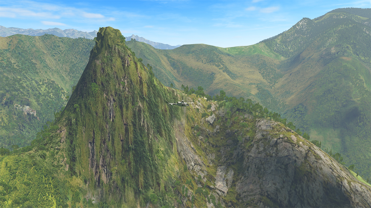
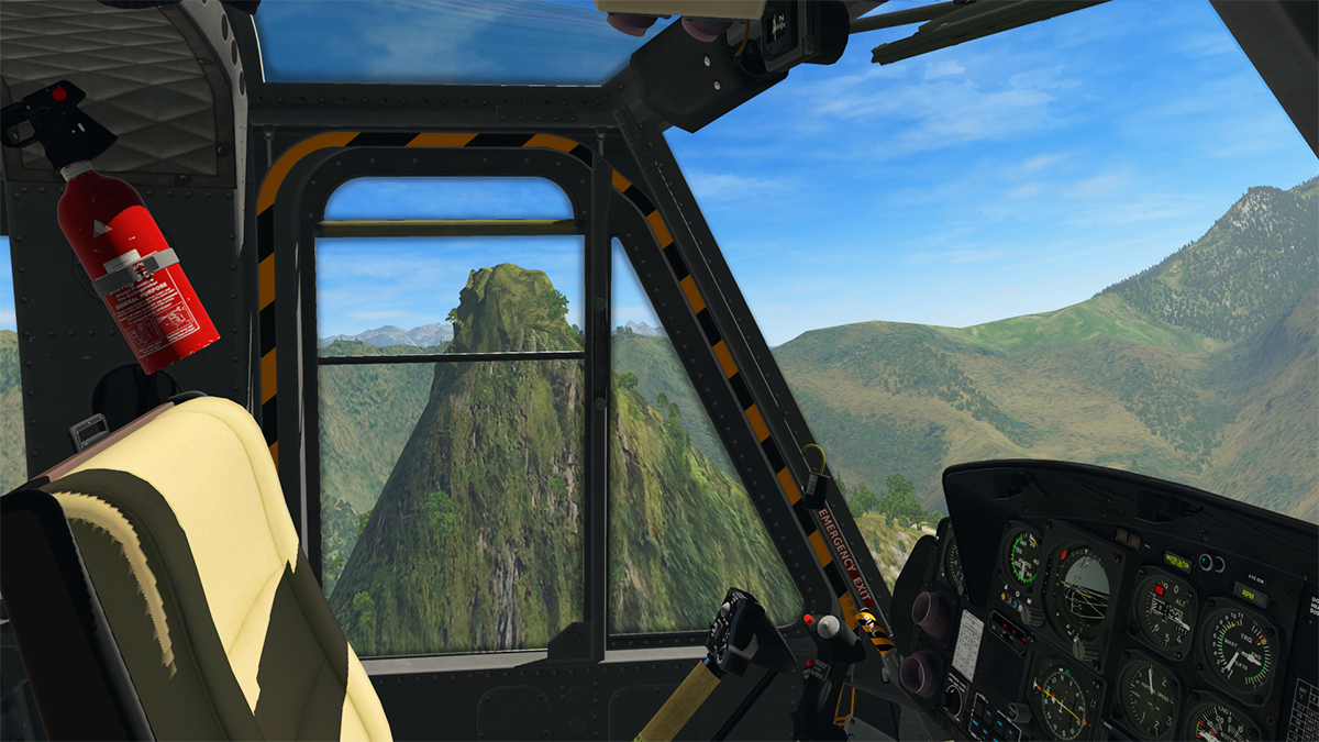
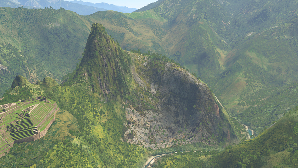
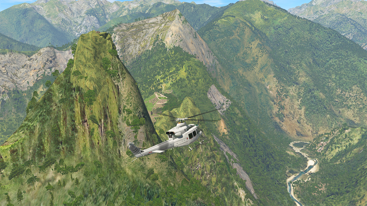
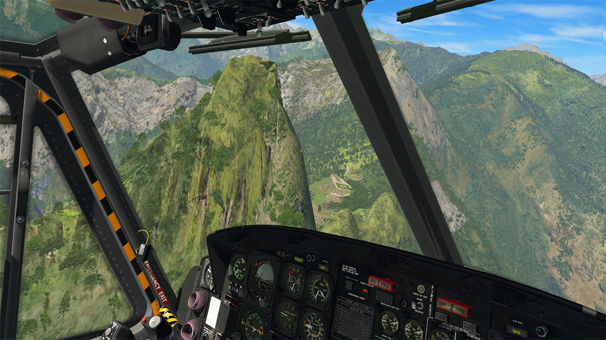
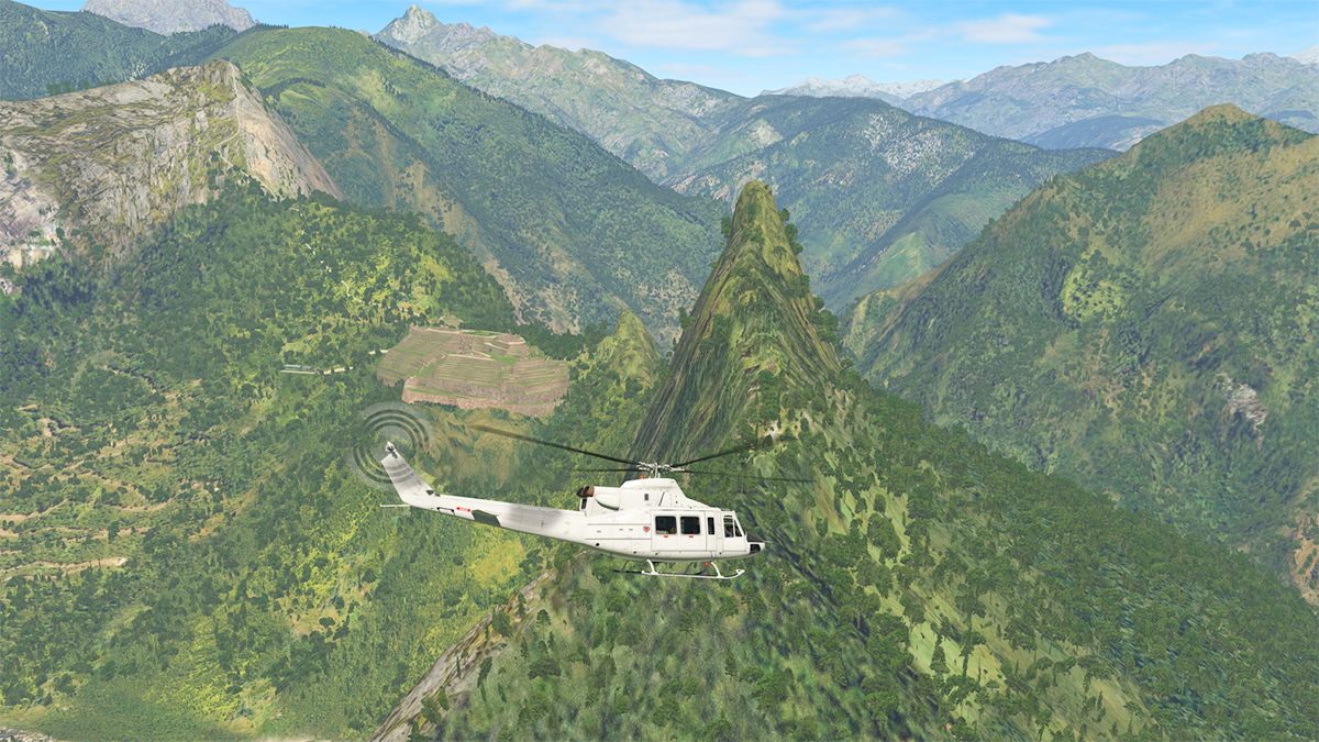
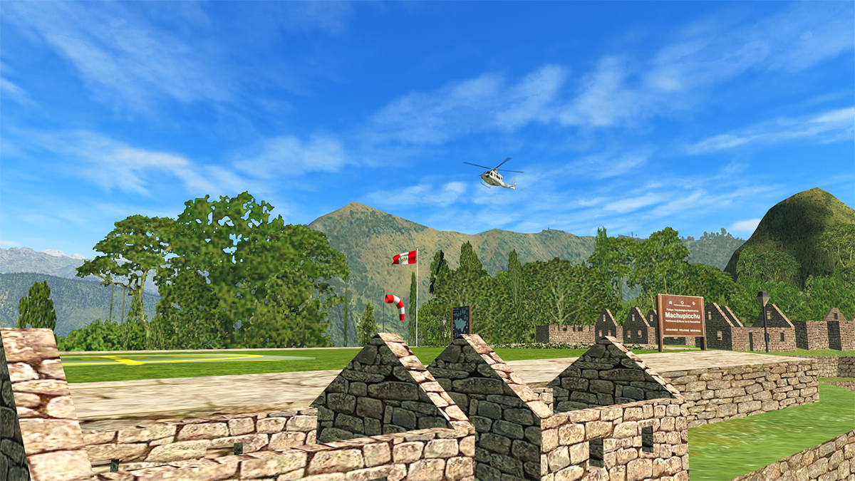
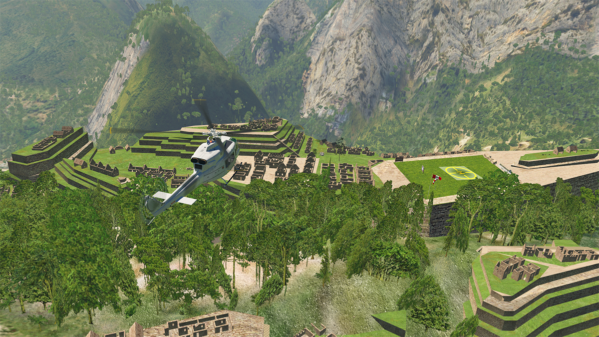
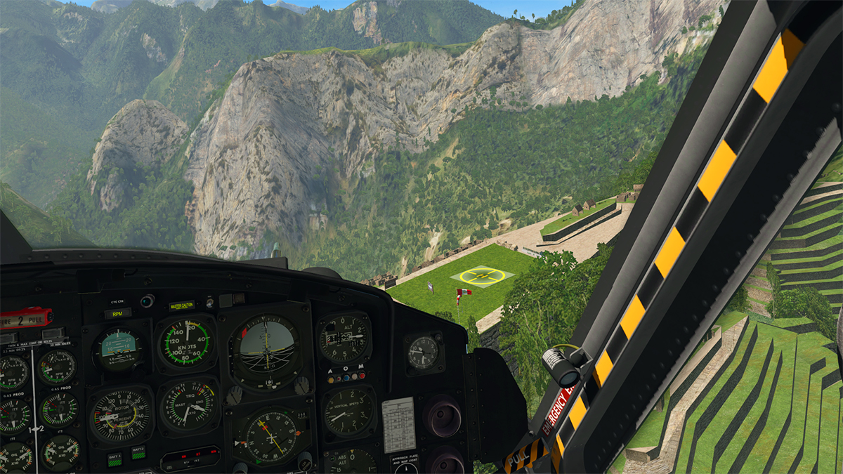
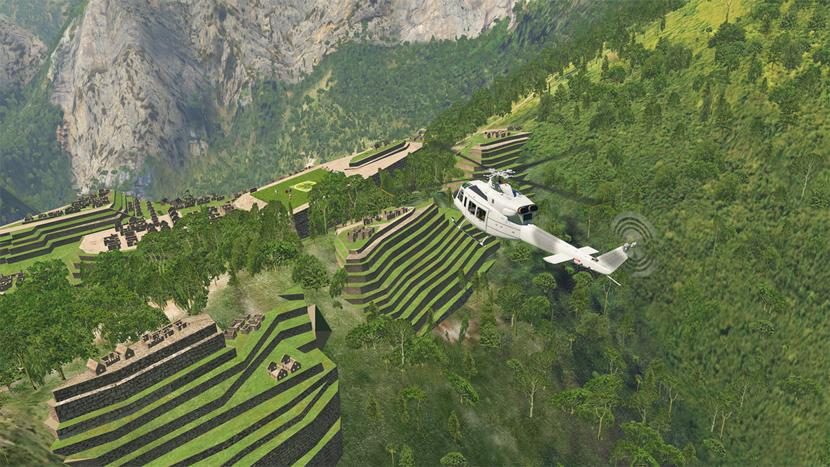
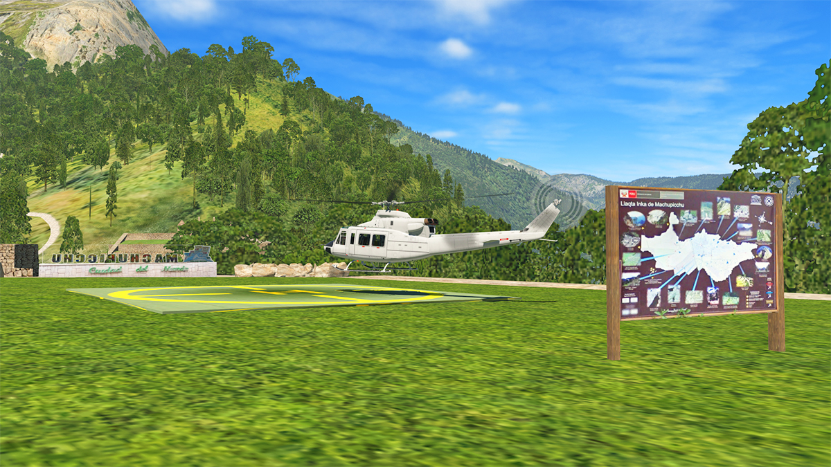
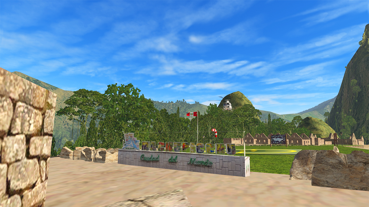
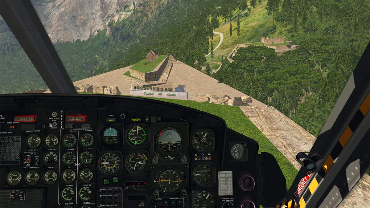
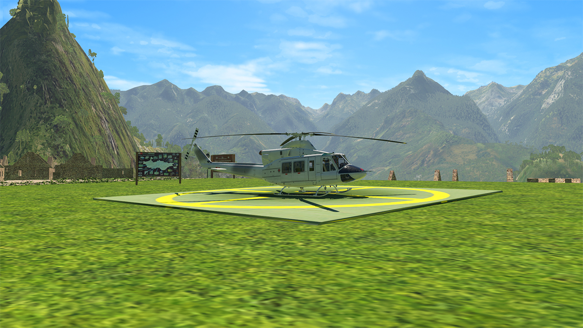
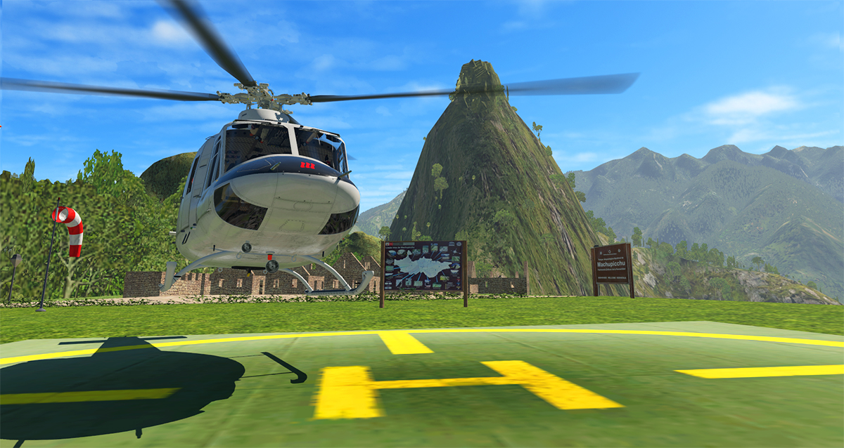
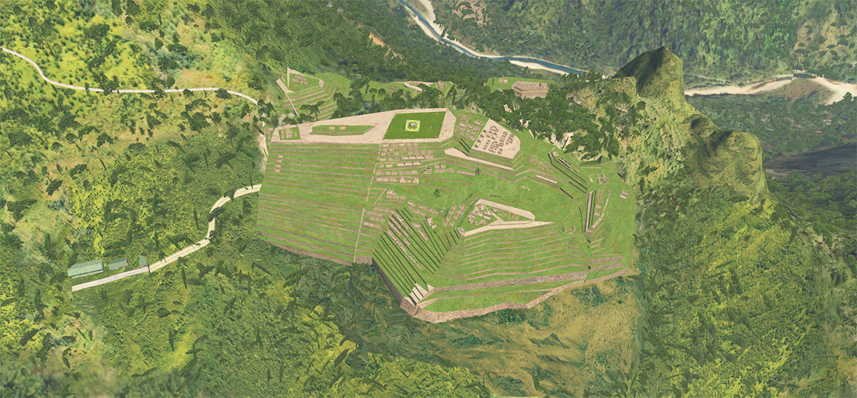
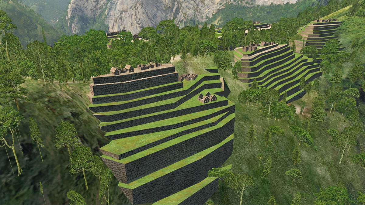
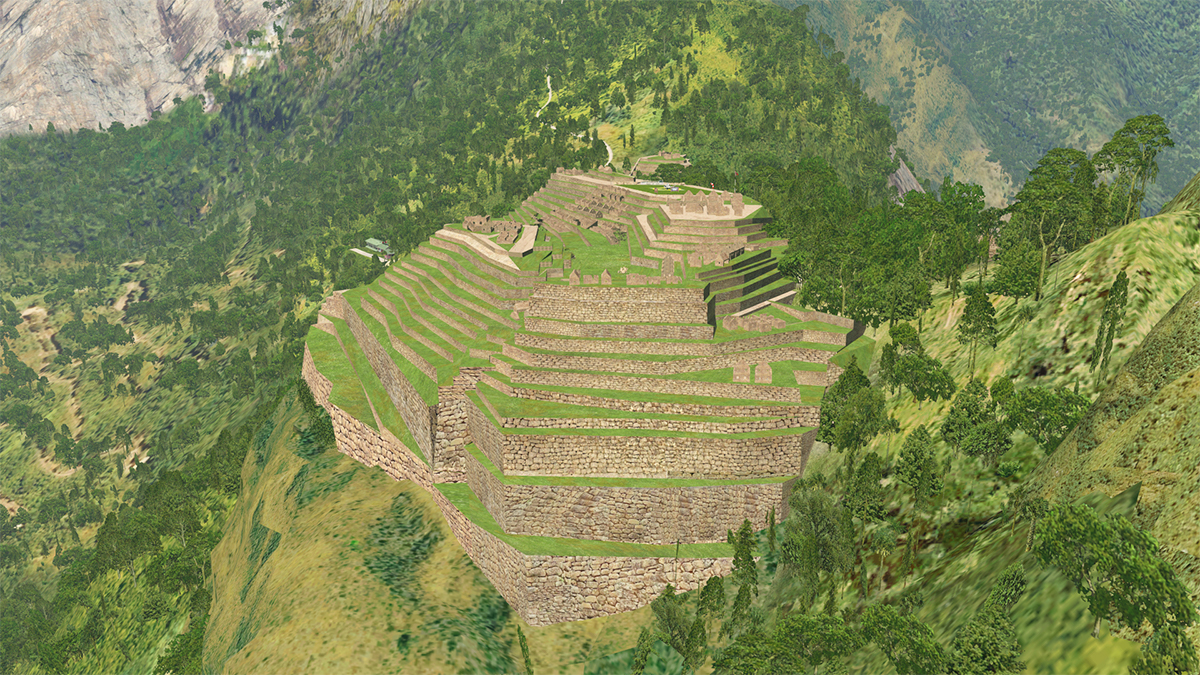
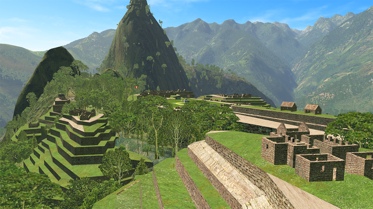
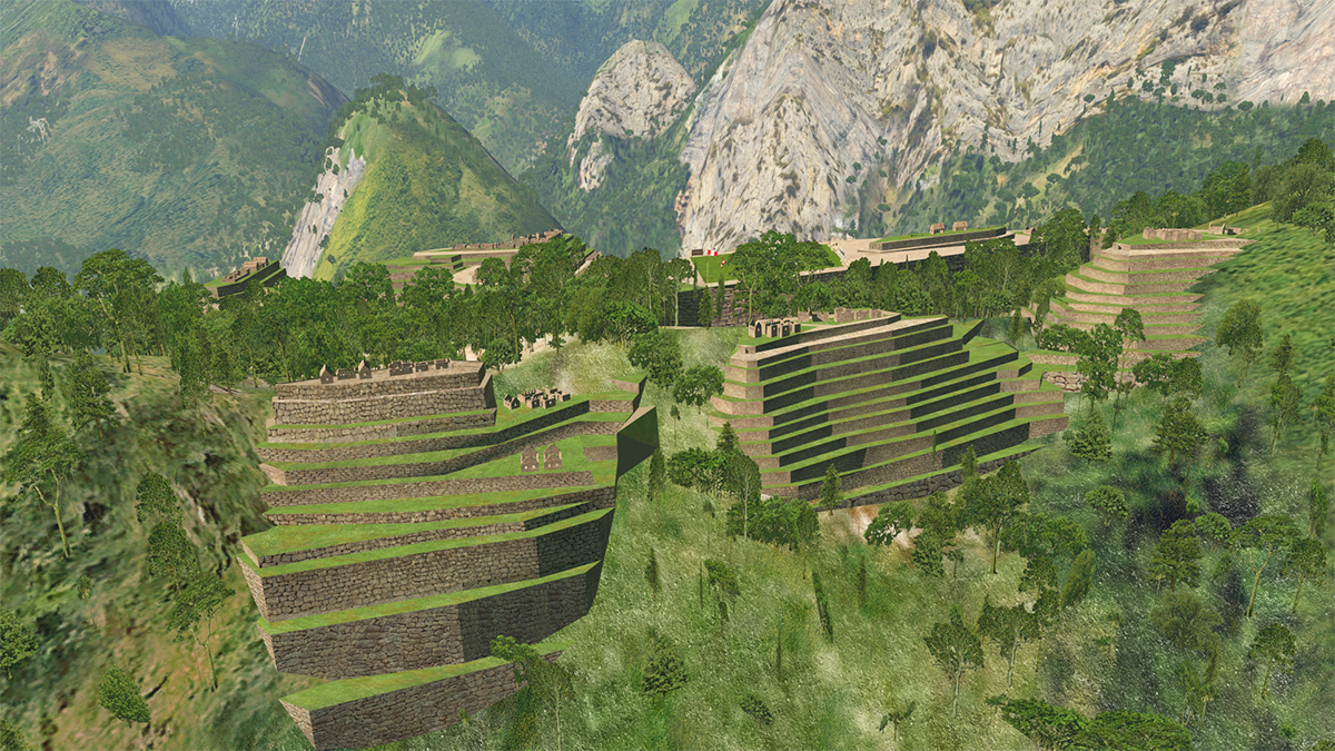
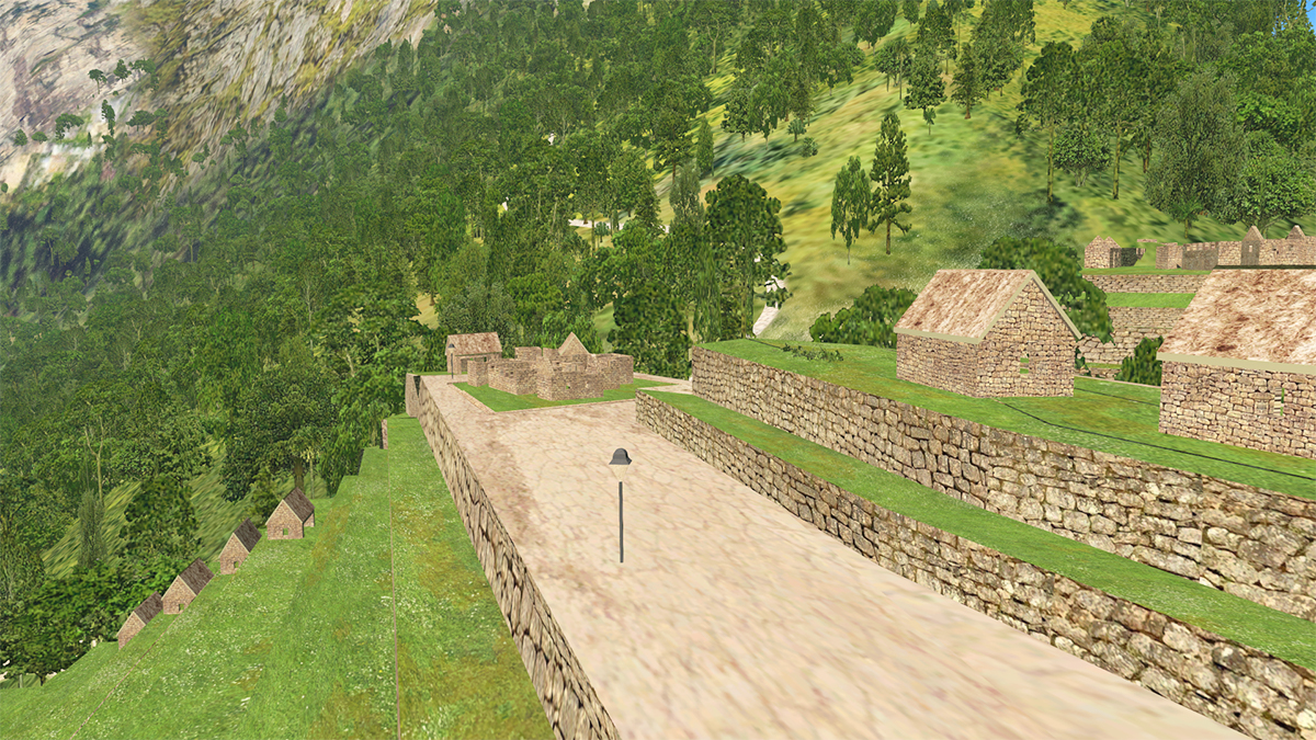
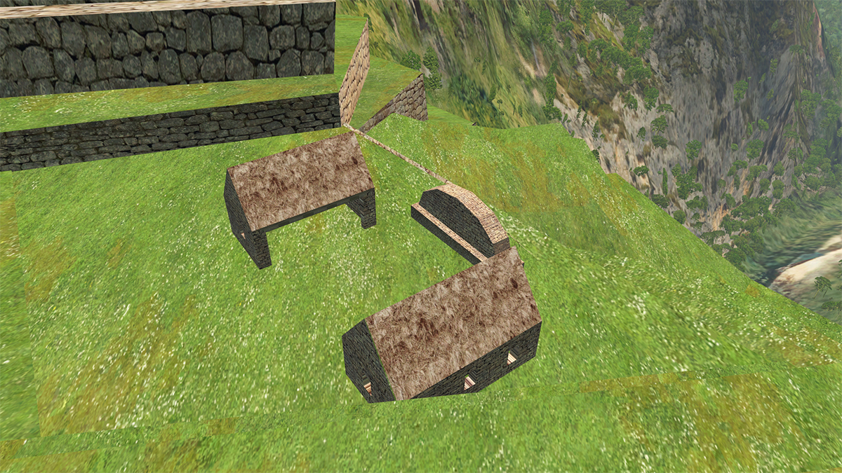
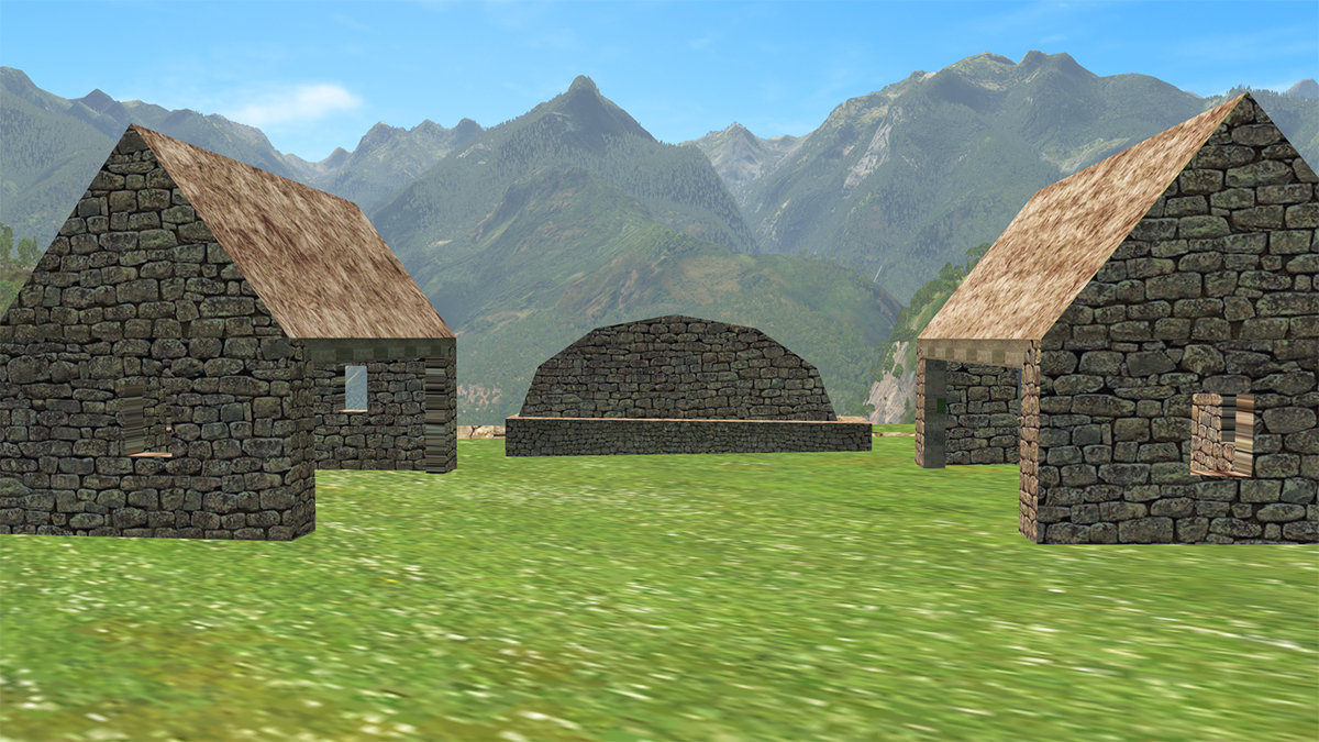
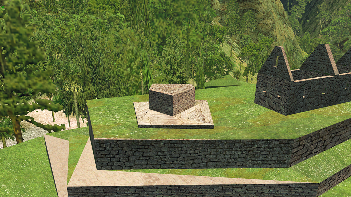
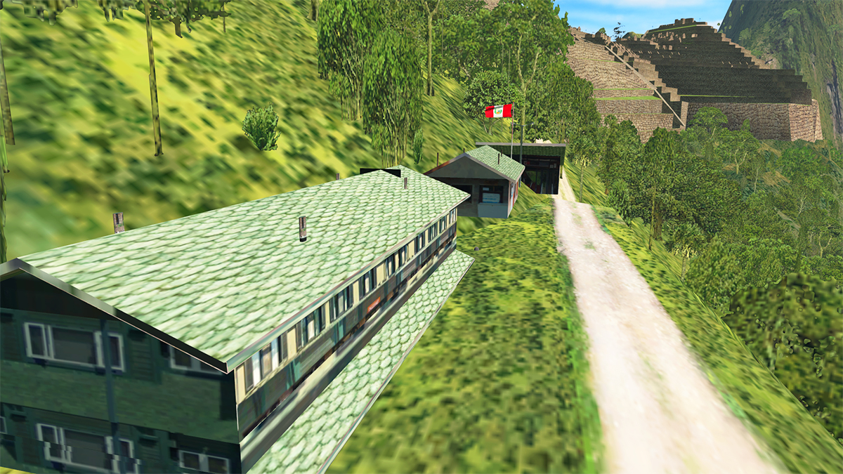
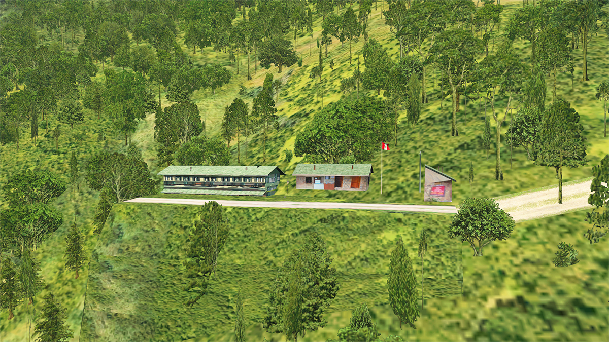
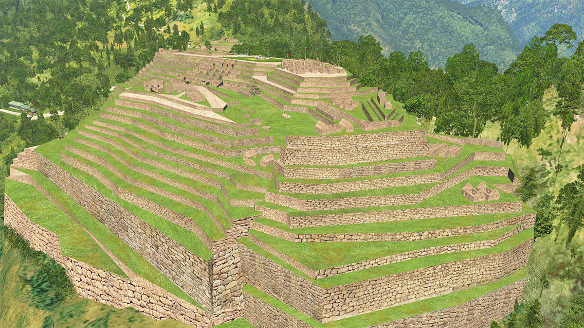
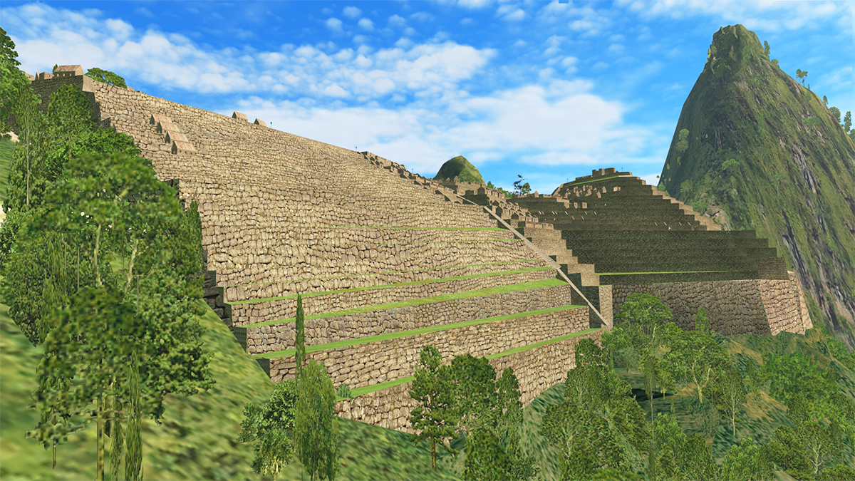
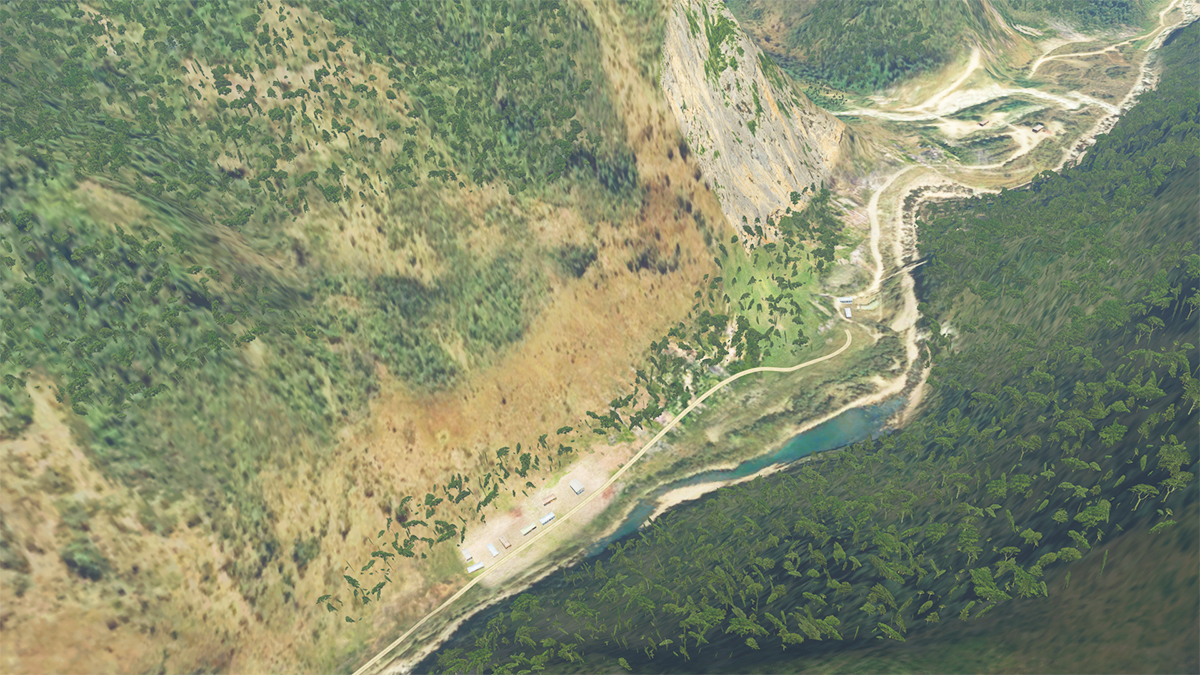
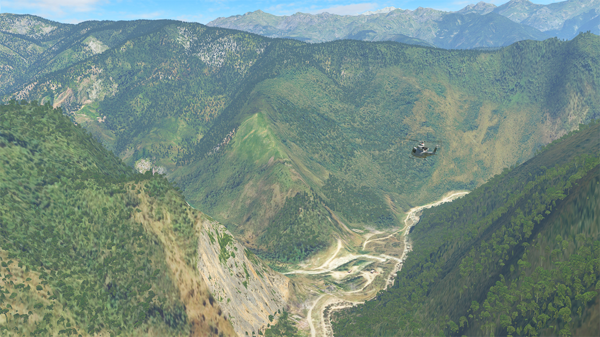
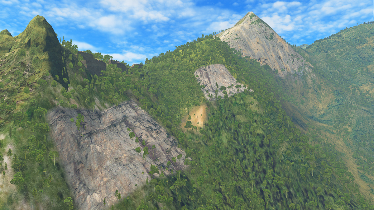
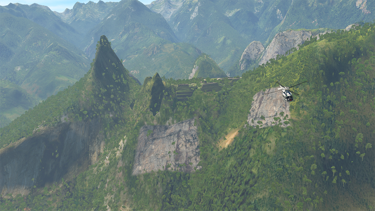
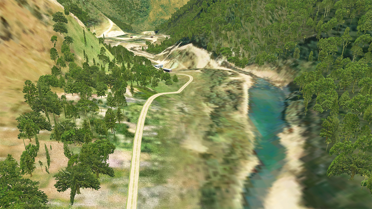
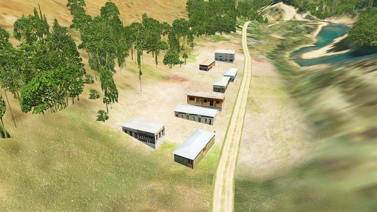
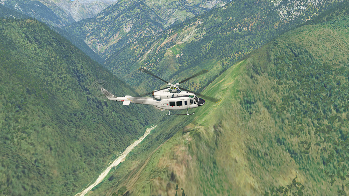
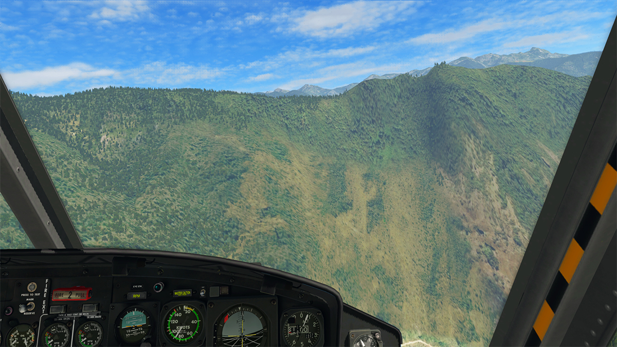
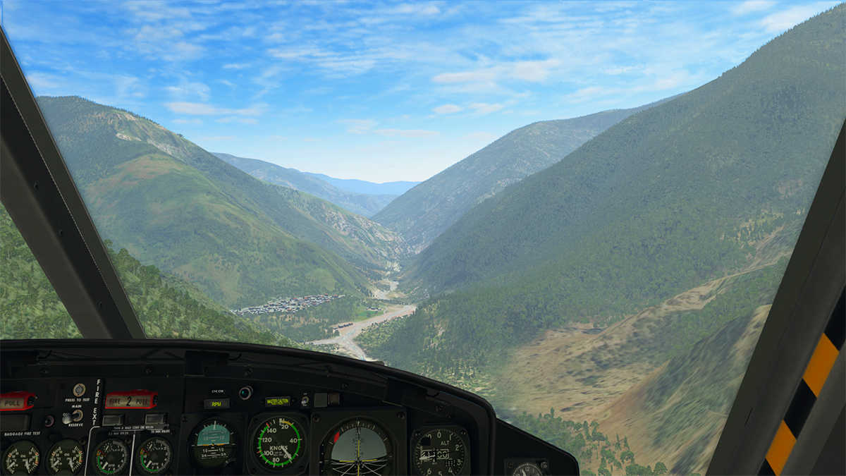
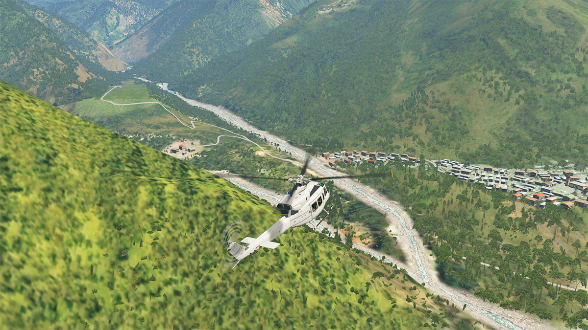
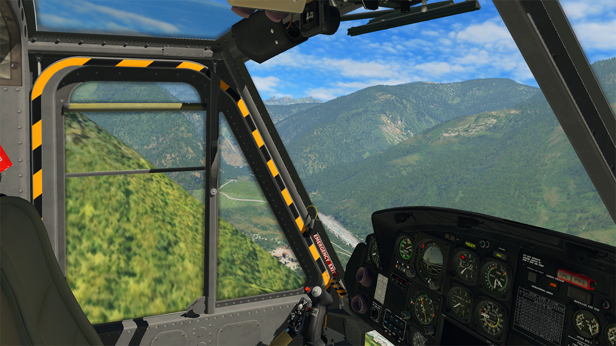
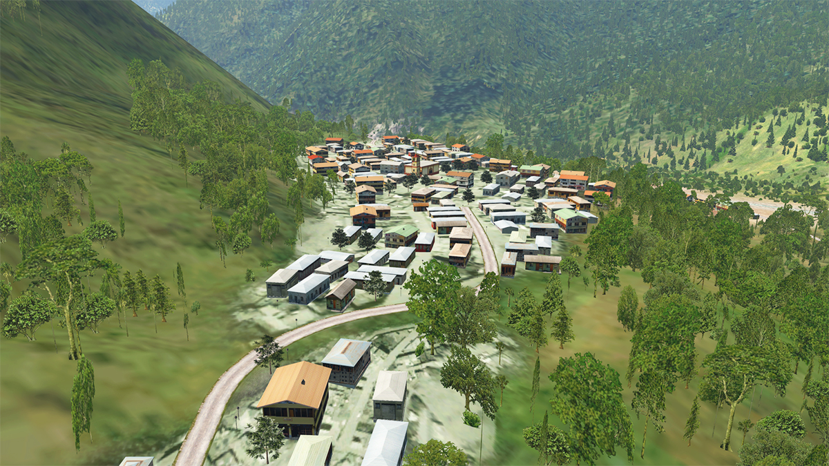
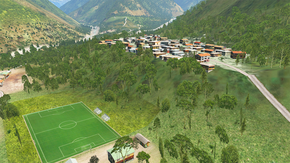
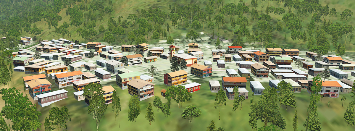
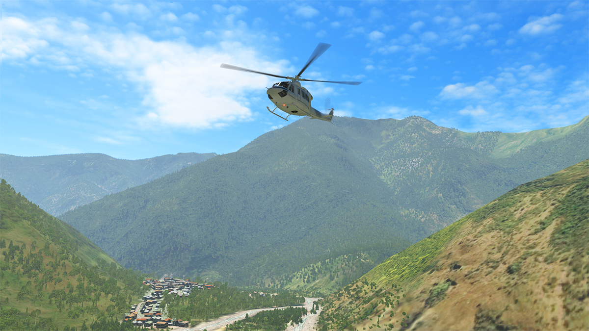
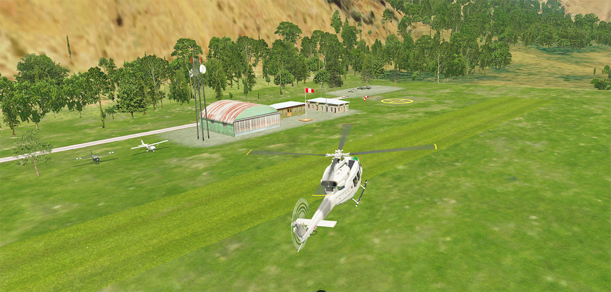
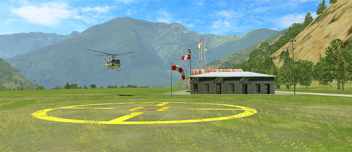
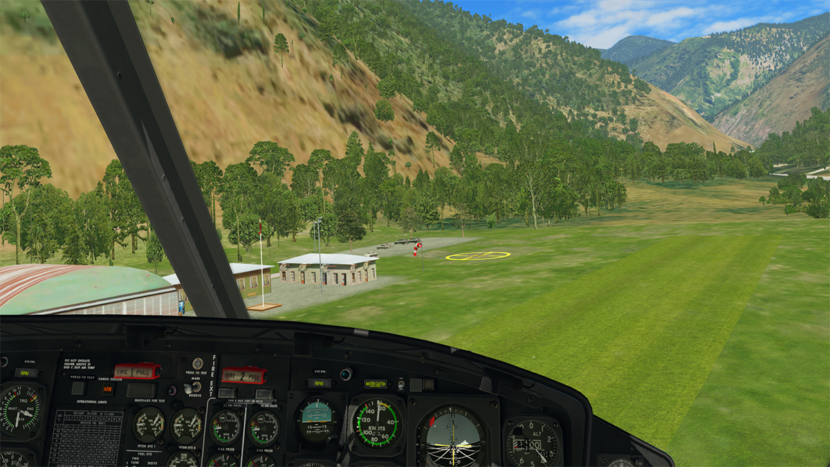
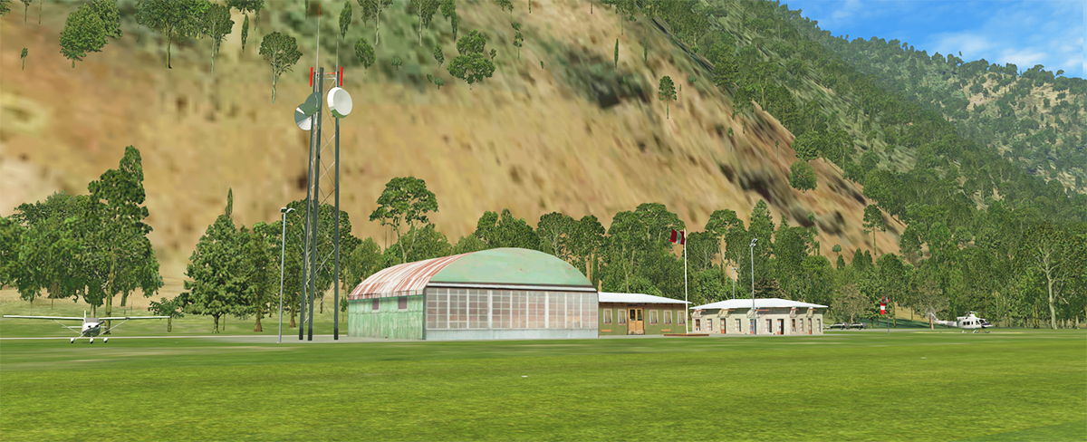
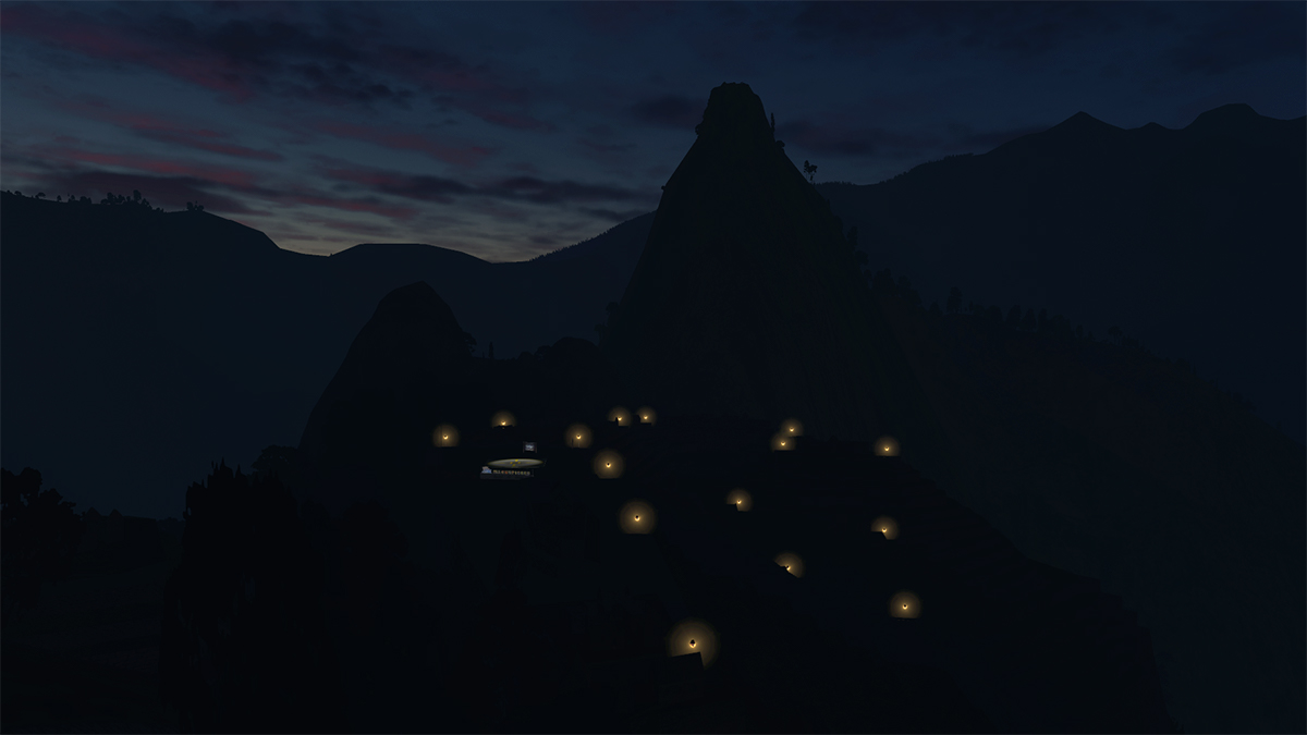
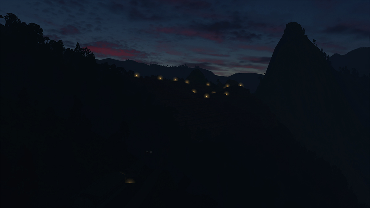
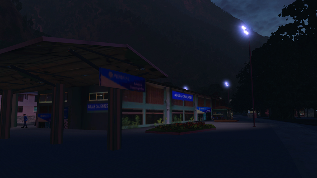
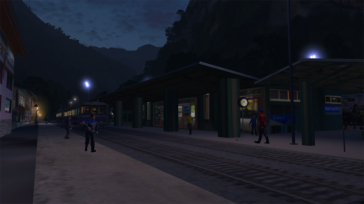
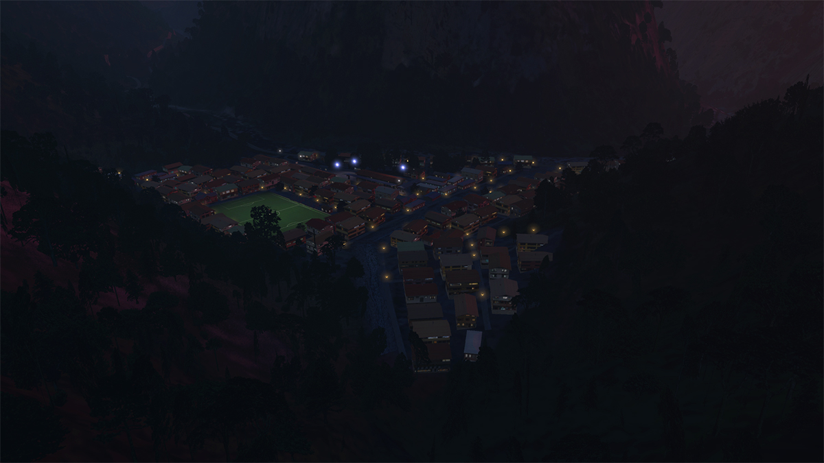
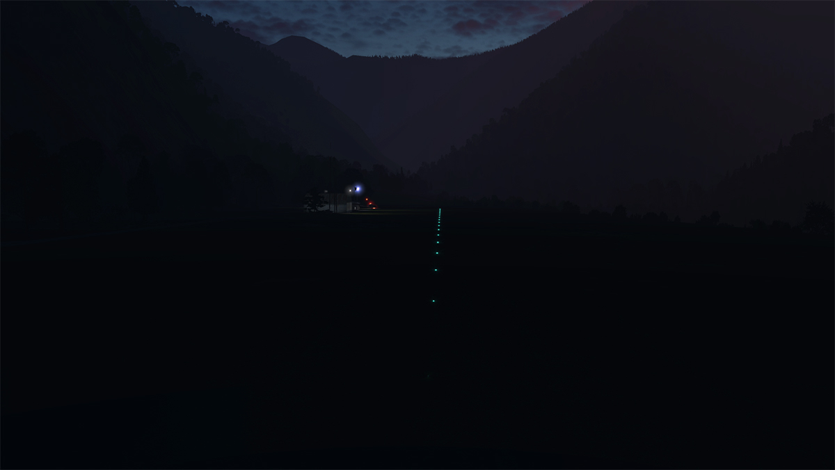
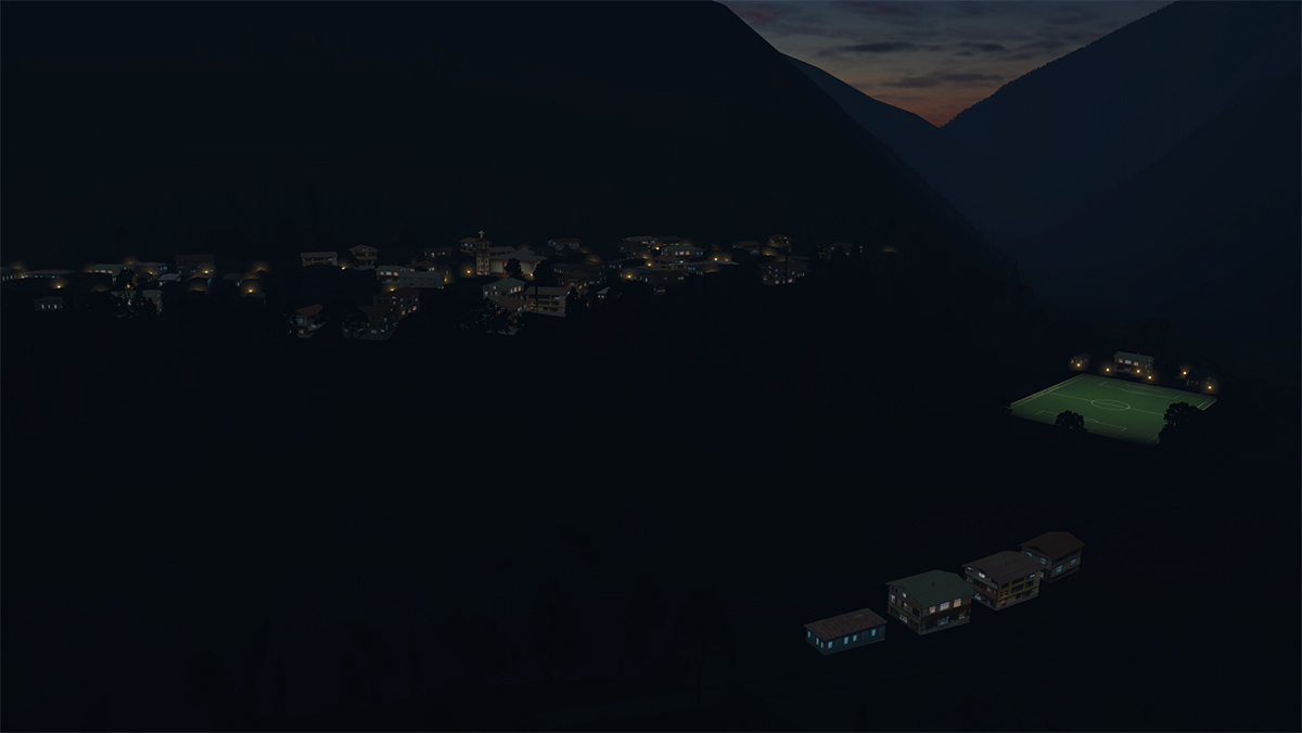
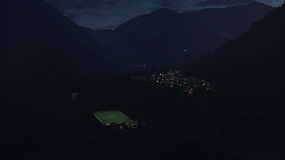
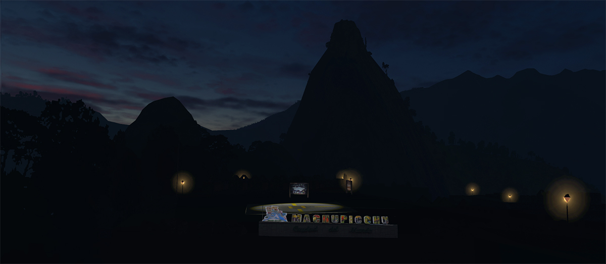
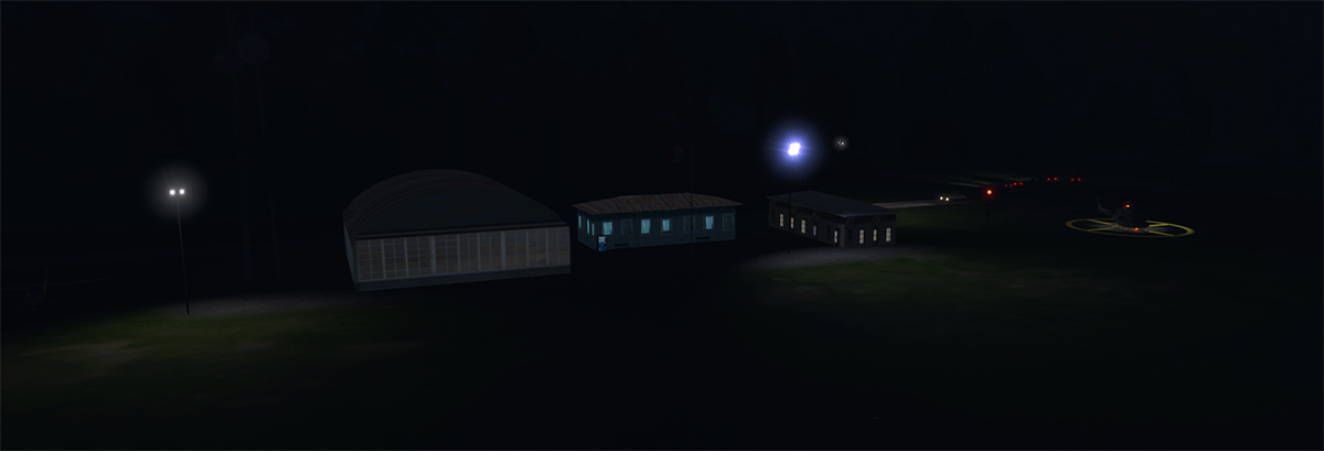
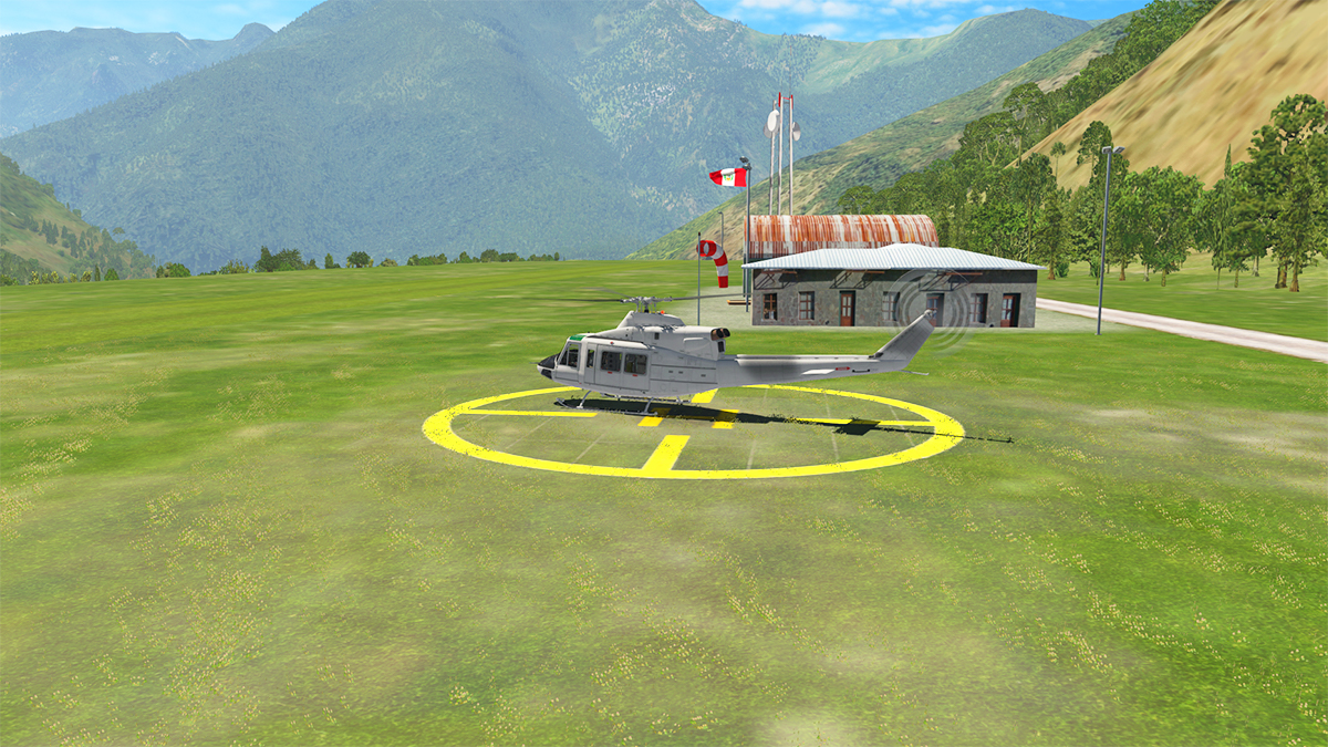
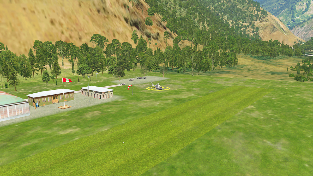
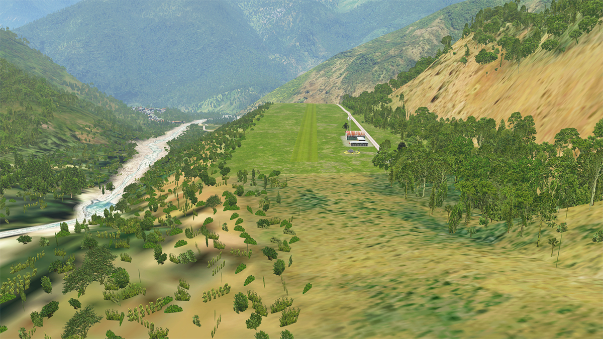
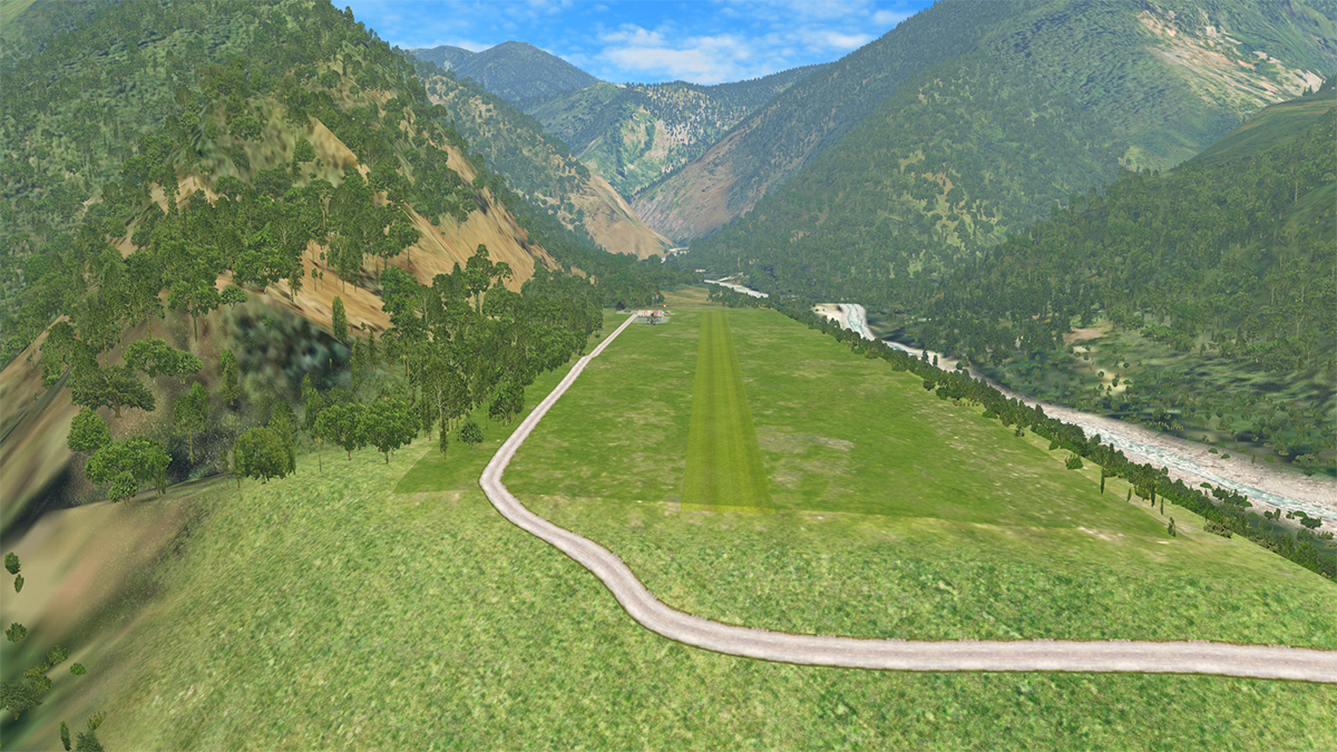
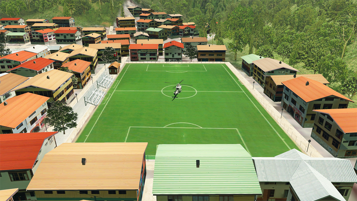
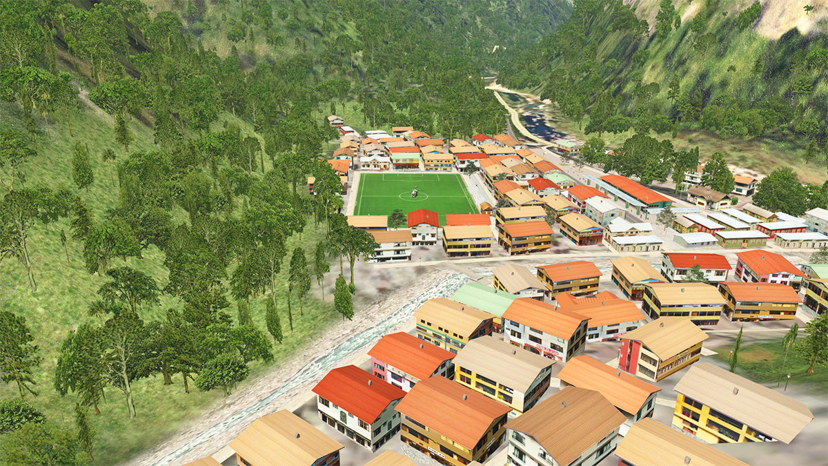
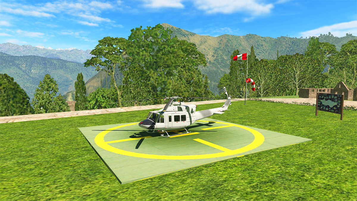
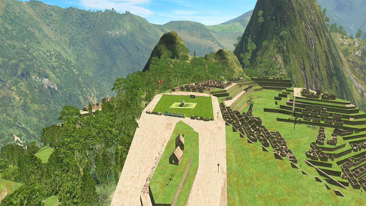
 Scenery Review : Machu Picchu National Park UHD by Dainese and Bellini Up in the darkest deepest Paddington Bear country there is an astounding 15th-century Inca citadel, located in the Eastern Cordillera of southern Peru. This is Machu Picchu and it was declared a Peruvian Historic Sanctuary in 1981 and a UNESCO World Heritage Site in 1983. Machu Picchu is located on a 2,430-metre (7,970 ft) mountain ridge in the Machupicchu District within the Urubamba Province above the Sacred Valley, which is 80 kilometres (50 mi) northwest of Cuzco. The Urubamba River flows past it or around the site, cutting through the Cordillera and creating a canyon with a tropical mountain climate. Most archaeologists believe that Machu Picchu was constructed as an estate for the Inca emperor Pachacuti (1438–1472). Often mistakenly referred to as the "Lost City of the Incas", it is however the most familiar icon of Inca civilization. The Incas built the estate around 1450 but abandoned it a century later at the time of the Spanish conquest. Although known locally, it was not known to the Spanish during the colonial period and remained totally unknown to the outside world until American historian Hiram Bingham brought it to international attention in 1911. The Inca Empire (Quechua: Tawantinsuyu, lit. "four parts together" are also known as the Incan Empire and the Inka Empire, was the largest empire in pre-Columbian America. The administrative, political and military center of the empire was in the city of Cusco, Peru. The Inca civilization arose from the Peruvian highlands sometime in the early 13th century (1438–1533), and it's last stronghold was conquered by the Spanish in 1572. Machu Picchu National Park UHD by Dainese and Bellini Only a month after their last impressive release of Banff National Park UHD. Frank Dainese and Fabio Bellini have again turned their talents to South America, but this time to Peru. If they are not anything lately then Dainese and Bellini are extremely prolific. Again this is another interesting release, and focused around the three sites of Aguas Calientes, which is the main tourist entrance to Machu Picchu, the Machu Picchu site itself, and Santa Teresa to the upper west, where there is an (virtual) grass landing strip and H-Pad. The Machu Picchu site is quite hard to see, but you can (slightly) see the well blended in areas of the custom textures to the default X-Plane surrounding textures, that highlights the scenery... overall the visual aspect is perfectly done. So our review today will start at Aguas Calientes, fly up and around the main Machu Picchu site and then fly on to Santa Teresa. Aguas Calientes This valley village of Aguas Calientes is very easy to locate... just look out for the large football (Soccer) ground, nothing stops football I suppose, even up here in deepest Peru. The Football field is also a H-Pad (HLPAC [H]) Aguas Calientes is in meaning "hot waters" or "hot springs". It was originally settled by a few farm families in 1901, the settlement was transformed into a busy railway worker's camp called Maquinachayoq (possibly from Quechua makina (a borrowing from Spanish máquina) machine / locomotive, train,[5] -cha, -yuq suffixes, "the one with a little machine, locomotive or train", Makinachayuq) during the construction of the railroad through there in the late 1920s. The town was the central hub for worker lodging and their equipment until the railway was completed in 1931. Obviously Aguas Calientes took off after the railroad opened in 1931 with foreign tourists started arriving to visit the Machu Picchu ruins. It came into existence because enterprising individuals set up businesses serving the tourists, primarily restaurants and small hotels. Not luxurious, and not expensive. Those who wanted luxury and whom could afford it stayed at the luxury hotel up by the ruins themselves. The highlight iofthe scenery is of course the central Machupicchu Railway Station... Machupicchu serves as a terminal for the PeruRail and the Inca Rail passenger train service from Cusco. Trains serve locals and tourists arriving from Cusco and Ollantaytambo to visit Machu Picchu. A sheltered souvenir market is adjacent to the train station. Avenue Pachacutec is the main and only thoroughfare of the town, connecting the baths to the town's main square. There are no cars in the town, as there is no road access. The Machupicchu Railway Station is really well done in creating a visual experience of being here, but the building textures are a little bit too low-res, and a bit blurry to be really and totally authentic, but that is the Dainese and Bellini style in keeping framerate light, most buildings are in the same box with graphic texture style, and if you are familiar with these sceneries, then you know the sort of visual aspect that you get from Dainese and Bellini, there is a nice semi-detail feel to everything, but overall it works very well from a sort of VFR perspective. The rest of the village is done in the same style, it is well done and includes the Parroquia Virgen del Carmen Church, but the main square of the Plaza Manco Capac is not represented. Follow the Urubamba River is basically the rule, but it is very easy to fly out and go down the wrong valley... You are already at 6800ft above sea level, and X-Trident's Bell AB412 is already struggling in the thin air... so it is up and to the left or to the west. The Urubamba valley is already tight, but you have to climb, as Machu Picchu is 6 kilometres (3.7 mi) away or about a 1.5 hours walk (which most tourists do), set at an altitude of 2,430 metres (7,970 ft)... so you basically fly up the more vertical than distance to the ruins. There is only this one short valley separating Aguas Calientes from the ruins. I had always thought that getting to Machu Picchu was a long arduous trek up from Cusco, that took several days or even a week to climb up there... I have seen footage of celebrities and guides, out of breath, climbing up steep trails, steeped in sweat and backpacks... yes there is a winding trail up to the Machu Picchu ruins called "Aguas Calientes Trail", but it is but only a short walk from a nice cosy hotel, so the reality as depicted here is quite different from the arduous trek to the "Lost City of the Incas" that they would have you believe... in fact there is also the "Hiram Bingham road", and a regular bus service to get up there! Flying almost directly west you easily see the winding (Aguas Calientes) trail up the mountainside... ... and one turn past the valley and there it is, the ruins of "Machu Picchu", or the backside of it. These steps are the "Cultivations Terraces", in fact all this eastern southern side is the industrial part of the complex. Significant is "Hauyna Picchu" the amazing mountain formation at the head of the ruins, and the detail of the formation by Dainese and Bellini here is exceptional, you see and really feel the shape and detail of the tall thin rock sculpture. Huayna Picchu is 2,693 metres (8,835 ft) above sea level, or about 260 metres (850 ft) higher than Machu Picchu. The Incas built a trail up the side of the Huayna Picchu and built temples and terraces on its top called the "Stairway to the Gods", mostly used by a high priest and his virgins. You do a complete 180º route around "Hauyna Picchu" following the set below Urubamba River, and then to see the ruins from the western aspect... ... the flying has to be tight, the turns sharp, and you are now at nearly 9,000 ft in altitude. And there is a H-Pad (called HLMPC [H] Machu Picchu Area archeologica) set centre of the ruins for you to land on. The approach to HLMPC is quite tricky? It is very windy up here so high, worse on the eastern side of the H-PAD there is a row of trees, a tall flagpole and a windsock... oh and a "Welcome to Machu Picchu" sign! The H-PAD approach is far easier from the west than the east, as that would be the usual normal approach path. I feel I am landing the wrong way around... not very professional, but a good landing is still a good landing in my books. Once up here you feel like you are on top of the world, and you are at almost at 8,000ft. Machu Picchu Machu Picchu was built in the classical Inca style, with polished dry-stone walls. Its three primary structures are the Intihuatana, the Temple of the Sun, and the Room of the Three Windows. Most of the outlying buildings have been reconstructed in order to give tourists a better idea of how they originally appeared. By 1976, 30% of Machu Picchu had been restored and the restoration continues. Huayna Picchu (within the citadel) is the main site and the entrance to the central area. If you are looking for an authentic look around of these interesting ruins, then this scenery is not it... it is a sort of visualised version. Oddly the H-PAD covers the main area were all the most significant buildings of the site are centrally placed? (in the 1980s a large rock from Machu Picchu's central plaza was moved to a different location to create a helicopter landing zone, but not here as depicted). Most notably sited in this central area is the significant Royal Palace and the very important Temple of the Sun... The temple has two trapezoidal windows, one facing 65°, called the "Solstice Window", and the other facing 132° is called the "Qullqa Window". The northwest edge of the rock platform points out the Solstice Window to within 2º of the 15th century June solstice rising Sun. .... the Central Plaza is sort of represented, and there is the space to include the "Room of the Three Windows", but they are all just normal houses instead of one larger one and a few outbuildings. Both the important Intihuatana stone, and Sacred Rock of Machu Picchu, are both represented, but both of the real stones are "Rock" singular not "Rocks" plural, as here they are both in the scenery created out of stones and not of one large single stone. Intihuatana is literally an instrument or place to "tie up the sun", often expressed in English as "The Hitching Post of the Sun". The Sacred Rock is postioned to view the Sacred River, set below this rock would be an altar, a central and important element in an area of worship, destined for the worship of the Apu”Yanantin“, not only would the Inca Civilization have a high knowledge of the cosmos, because for the cultures that have it at all timese, cosmology was a conception of the world, as to show where all beings lived. Information available describes human sacrifices at Machu Picchu, though many sacrifices were never given a proper burial, and their skeletal remains succumbed to the elements. However, there is solid evidence that retainers were sacrificed to accompany a deceased noble in the afterlife. Animal, liquid and dirt sacrifices to the gods were very common, and made at the Altar of the Condor. The tradition is upheld by members of the New Age Andean religion. Machu Picchu use was as a royal estate, it is estimated that about 750 people lived there, with most serving as support staff (yanaconas, yana who lived there permanently). Though the estate belonged to Pachacutec, religious specialists and temporary specialized workers (mayocs) also lived there as well, most likely for the ruler's well-being and enjoyment. During the harsher season, staff dropped down to around a hundred servants and a few religious specialists to focus on just the maintenance alone. There is a Sanctuary Lodge, called the Belmond Hotel accommodation, looking over the Sacred River (but to be noted as a Hotel would be pushing it as it looks more like a hostel with a good view). Santa Teresa Time to fly on... Leaving Machu Picchu you notice the excellent detailing of the rock formations below the ruins... a very distinctive Dainese and Bellini quality. You can easily see the areas that have the custom ortho-textures, as the detailed valley floors and water courses, easily they are very different from the X-Plane default textures... .... the textures look good even if they are Low-Res from altitude or close down with there with the rocky water beds. There are also custom placed buildings to bring out a sort of 3d effect from the flat images. The valley flying is very tight, and made worse in that you are now having to descend quickly deep down into the V, off to the side there are great valley views. Leaving behind now the elevated Machu Picchu, you then turn and descend down a long valley towards Santa Teresa, in time the town appears on your right by another left valley entrance. Finally you are over Santa Teresa, known as "the back door to Machu Picchu", Santa Teresa attracts budget tourists hoping to save a few soles. There are other worthwhile attractions based here, namely the Cocalmayo hot springs and the Cola de Mono zipline, both on the outskirts of the town... and another football field. The Iglesia Evangélica Menonita church is represented, but the town square and tall (six stories stands out here) building is missing, the large shed complex on the north side is also missing, so Santa Teresa is not really totally a VFR visual representation? The XLPMH "MachuPicchu Airport" is set too the left and slightly down a side valley... XLPMH has one long grass runway 33/51 at 5700ft altitude, so even in the final phase you are going almost flying vertically down from 9,000 ft at Machu Picchu, and down to this far lower elevation. There is also a H-Pad HLPMH [H] also at MachuPicchu Airport, placed at the far east of the airport by the Rwy 51 threshold. It is not very hard to get into the HLPMH [H] Pad, but obviously only from the runway side. I do like the 3d grass wildflowers around the pad, as it makes for a nice arrival. Final approach and a 180º turn around to land... There is a rusted out hangar and two buildings as part of the airport, and two static light aircraft to fill out the scene, overall very nice. I didn't try either 33/51 approach in a light aircraft (STOL would be my choice) but Rwy 51 would be a far, far easier way in than the rock wall compromised Rwy 33 Approach. The Santa Teresa Football field could also be used as another interesting H-PAD. Lighting The lighting in the Machu Picchu scenery is the usual that you expect from Dainese and Bellini, in an alpine village feel, or valley settlement. Aguas Calientes has the housing lighting and the street lights, the only bright area is the lit football field. Around the Railway Station it has the only focused lighting, but it looks and feels very nice in a soft glow, and bright clock face. The Machu Picchu ruins only has the sporadic street lights amongest the ruins, but the "MachuPicchu" entrance sign is well and truly colourfully lit up nicely, the H-PAD is also well lit. Santa Teresa is very similar to Aguas Calientes, with even the same brightly lit football field MachuPicchu Airport has a few building lights and area lighting, but the grass runway has only a set of green (taxiway) lights down the centre, and no runway boundary lighting. ICAO Noted Airports and H Pads There is one Runway and three H Pads in the scenery, and provided are: XLPMH MachuPicchu Airport HLPMH [H] Machu_Picchu Heliport HLPAC [H] Aguas Calientes HLMPC [H] Machu_Picchu Area archeologica XLPMH MachuPicchu Airport A grass runway 33/51 with tricky approaches, Rwy 33 is far worse than Rwy 51... only the centreline strip lighting at night. HLPMH [H] Machu_Picchu Heliport As part of MachuPicchu Airport and positioned on the far eastern side by the Rwy 51 Threshold, H-PAD is very clear, but approach only from across the runway is possible. HLPAC [H] Aguas Calientes Situated on the centre of the Aguas Calientes football field, it is an easy approach from all sides. Note there is no windsock! HLMPC [H] Machu Picchu Area archeologica THis H-PAD is a large pad, situated directly in the centre of the Macgu Picchu ruins, on the east side there are a few obstacles, in a Flagpole, Windsock and a row of trees, however the pad is quite large and so you can easily manoeuvre around the obstacles. _____________________ Summary Set high, Machu Picchu is located on a 2,430-metre (7,970 ft) mountain ridge by the Urubamba River in Peru. This area is sometimes noted as the "lost city of the Incas" or a familiar icon of Inca civilization. A famous tourist attraction Machu Picchu is both a cultural and natural UNESCO World Heritage Site. And this Machu Picchu scenery is the next mountain scenery from Frank Dainese and Fabio Bellini, both mountain scenery specialists for the X-Plane simulator. The scenery is centred around three areas; Aguas Calientes, which is the main tourist entrance to Machu Picchu, the Machu Picchu site itself, and Santa Teresa to the upper west. And there is one airport and three landing H-PADs as part of the scenery. Focus of any Dainese and Bellini is the natural versions of the landscapes, and mountain formations, in that aspect the scenery here is excellent, with the depiction of the Inca ruins set at the centre of the scenery. The custom photo-textures are extremely well blended in with the surrounding X-Plane default textures, and all the mountain formations are all photogragically recreated... what you get a real total 3d perspective of this famous area in Peru. The Inca ruins however are not recreated in detail, but a sort of visualised version of how they are represented. It is good but not exact to realism, the same can be said of Santa Teresa and Aguas Calientes, but the famous Railway Station is well recreated. By Dainese and Bellini standards it is a small scenery package, but still full of detail... only real comment is that I think that some more real recreation of custom objects of the town and village, and certainly of the Machu Picchu ruins could have been added in for a more of a VFR perspective on the size of the scenery, in areas it is just a little too generic and certainly around the ruins... Otherwise it is very good. Extremely difficult to do, These excellent representations of iconic mountain areas of the world are for exploration, sightseeing or just plain exploring... and you could throw in a bit of geography as well. All are very highly detailed of the areas they represent and the mountain ranges are of course the stars and the focal point of the scenery packages. Hugely popular and yes I seriously love these amazing and hugely detailed and now extensive sceneries that can change your perspective of iconic mountain areas and allow them to come to life in your simulation world, in this case it is the Inca Machu Picchu National Park, it comes... Highly recommended. ____________________________________________ Yes! The Machu Picchu National Park UHD by Frank Dainese and Fabio Bellini is NOW available from the X-Plane.Org Store here : Machu Picchu National Park UHD Price Is US$19.95 Features: included in the degree -14 -073. The whole territory was reconstructed on a photographic basis. The village (Aguas Calientes,S.Teresa) are reproduced with typical buildings, hotels, residences ... All the vegetation has been mapped and reproduced in 3D. 1 Airport grass-runways in S.Teresa distreect 3 heliports at the respective tourist sites and archaeological site. Reconstructed with 3D models the area archaeological (INKAS) with 4K textures processed from photos. This scenery is only suitable for VFR flight, only with a "visual flight". ICAO codes: XLPMH MachuPicchu Aiport HLPMH [H] Machu_Picchu Heliport HLMPC [H] Machu_Picchu Area archeologica HLPAC [H] Aguas Calientes WT3/Traffic Global: Your joking of course! no, you are on your own out here Requirements X-Plane 11 Windows, Mac or Linux 4GB VRAM Minimum - 8GB+ VRAM Recommended Download Size: 174 MB Release and Review version 1.0 (12th February 2021) Installation Download scenery file size is download 174mb and with the full installation installed in your custom scenery folder as there are only two install folders, that need to set in the order below in the provided .INI File... the mesh (XMesh) has to be set below the main scenery folders. MachuPicchu XMesh_MachuPicchu Total scenery installation (MachuPicchu) : 411.80mb Documents One manual with notes ______________________________________________________________________ Scenery Review by Stephen Dutton 17th February 2021 Copyright©2021 : X-Plane Reviews (Disclaimer. All images and text in this review are the work and property of X-PlaneReviews, no sharing or copy of the content is allowed without consent from the author as per copyright conditions) Review System Specifications: Computer System: Windows - Intel Core i7 6700K CPU 4.00GHz / 64bit - 32 Gb single 1067 Mhz DDR4 2133 - ASUS GeForce GTX 1080 8Gb - Samsung Evo 512gb SSD Software: - Windows 10 - X-Plane v11.51 Addons: Saitek x52 Pro system Joystick and Throttle : Sound - Bose Soundlink Mini Plugins: Environment Engine by xEnviro US$69.90 Scenery or Aircraft - Bell 412 XP11 by X-Trident (X-Plane.OrgStore) - US$35.95