Search the Community
Showing results for tags 'Aerosoft'.
-
NEWS! - Aerosoft updates Helgoland XP to X-Plane 12 Helgoland XP is a scenery for X-Plane that recreates Germany’s only island in the open sea at a high level of detail and with many new thrilling options. Forces of nature have reshaped the East coast of the side islet "Dune" over time. RWY 21 was previously blocked by a high sand dune that is now entirely gone. The southern end of the airport, however, is now a place where waves break around the tip of the runway. In the wake of "green energy" Helgoland is currently becoming an important maintenance hub for nearby offshore wind farms. The existing military SAR base has been extended by a offshore maintenance helipad with its own hangar. From here you can fly your chopper to transformer stations out in the sea. All of them have their own helipad and make for a thrilling experience when approaching when waves are high. For the wealthier visitors several airlines started to fly regular routes to Helgoland from Heide-Büsum, Nordholz-Spieka and Uetersen. Airlines serving the airport all use BN2-Islanders, the only multiple passenger aircraft that is allowed to land here on these extremely short runways. Features: • Up-to-date, detailed aerial images • 1 meter mesh resolution so you see the smallest dunes near the airport • Helgoland-Düne airfield with extremely short runways • Current airport buildings with restaurant terrace and transparent tower windows • SAR helicopter of the German Navy • German Navy frigate (landable) • Custom vegetation • Very good performance • Animated ship and ferry traffic • Many 3D people • Animated ground traffic and more animations • Offshore Southern harbour of energy group (landable) • 4 Offshore wind farms with 4 platforms with their own helipads (landable) New in the XP12 version: • Standalone, fully customized XP12 version • Revised lighting • Ground now includes PBR reflections • Revised orthophoto, color optimized for XP12, including autumn/winter version • Weather effects for wet, snow and ice • Full support for native XP12 seasons, with no additional add-ons or plugins • Adaptation of the animated wind turbines to XP12 (animation also without SAM plugin if not installed) • New, fully XP12 compliant mesh including soundscape, seasons and 3D waves Notable is that you have to use the "Aerosoft One" application to install (update) the Helgoland XP12 scenery... Installation of Helgoland XP12 is done through Aerosoft one installer: Aerosoft One Universal After you have installed Aerosoft One, click on ENTER PRODUCT KEY (under the Library Tab) enter the Serial Number provided in this order. This will give you the option to download the airport. Note the different X-Plane 11 and X-Plane 12 installations. __________________________ Yes! Helgoland XP12 XP by Aerosoft is now Available from the X-Plane.Org Store here : Helgoland XP Price Is US$24.95 Requirements: X-Plane 12 or X-Plane 11 Windows, Mac or Linux 8 GB+ VRAM Recommended Download size: 4.7 GB - Installation done via Aerosoft one and serial number Version 1.0.0 XP12 (March 20th 2024 ) 1.0.2 for XP11 ___________________________ News by Stephen Dutton 21st March 2024 Copyright©2024: X-Plane Reviews (Disclaimer. All images and text in this review are the work and property of X-PlaneReviews, no sharing or copy of the content is allowed without consent from the author as per copyright conditions) All Rights Reserved
-
Scenery Review : Society Islands - Leeward and Windward by Aerosoft Say Tahiti, or Bora Bora and the thoughts are always... "Exotic". French South Pacific plus it's amazing scenery makes this a destination in one of the absolute top hits of any one's bucket list. It has always been on my "most" desired destination. Actually I have been to Tahiti, but a long time ago, way back in the 1970's, but also just passing through en-route to Australia. Yes I have always wanted to go back... So what of Tahiti in X-Plane. Actually it was well serviced by the XPFR developers, but as usual you wanted a more overall detailed and extremely high quality package to bring out the best of the Simulator and the astonishing South Pacific area. This "Society Islands" is a set of two packages by the renowned Maps2X-Plane, the same developer house that created both the excellent Faroe Islands, Svalbard and Seychelles XP, all the sceneries reviewed here are Maps2X-Plane releases, but released under the Aerosoft banner. In so any installations are now through the Aerosoft One application, just add in the authorisation number, and the tool will do the install for you. As noted the Maps2X-Plane Tahiti series is in two different area packages, the first was "Society Islands XP - Bora Bora & Leeward Islands", released now back in September 2021 for X-Plane 11, of which you could call the "Western" area. This package was quickly updated to X-Plane 12 (v1.1) almost immediately. The second release is the new one "Society Islands XP - Tahiti & Windward Islands", and again what you would call the "Eastern" area, both packages together then covers the whole Society Island territory. Although the Leeward scenery was excellent as we shall see, it was slightly compromised in that it was only a regional scenery, with only local inter-island flying. This latest Windward package is significant because it adds in the main gateway or Faa'a International Airport, situated on the main island of Tahiti. This added aspect then connects all the Tahitian areas together, not only the international routes, but also the local domestic routes from the main gateway. The now combined area is also quite significantly wide to explore and to service. You could say French Polynesia is in the middle of nowhere, because it is, set deep into the central South Pacific Ocean. This makes connections hard and extremely expensive, as the area is a fair flight from any landmass. But there are direct flights from the U.S. West coast, Rarotonga and New Zealand, lately Hawaii was also added. I did an example flight from AKL (Auckland) to PPT (Papeete), it is a route distance of 2,242 nm, translated to 4h34m flightime, and right on the edge of the A321's endurance in fuel. Tricky as there are no alternative options out here. In this eastward direction, then maybe the Cook Islands (625 nm before Tahiti) as an option, but once past that point, then there are no other places to land. As we are going into NTAA - Faa'a International Airport, we will cover the "Windward" package first.. Society Islands XP - Tahiti & Windward Islands The Windward Islands are the eastern group of the Society Islands in French Polynesia, an overseas collectivity of France in the southern Pacific Ocean. These islands were also previously named the Georgian Islands in honour of King George III of the United Kingdom. The capital of the administrative district is Papeete on the island of Tahiti. Tahiti, Moorea, and Mehetia are volcanic islands. Tetiaroa and Mai'ao are outer coral Atolls... all these noted areas are available in the Maps2X-Plane Windward package. Faa'a International Airport Faa'a International Airport, also known as Tahiti International Airport is the international airport of French Polynesia, located in the commune of Faaa, on the island of Tahiti. It is situated 5 km (3.1 mi) southwest of Papeete, the capital city of the overseas collectivity. It opened in 1960. Regional air carrier Air Tahiti and international air carrier Air Tahiti Nui are both based at the airport. The focus and highlight of both sceneries is the Faa'a International Airport, and one very long runway 3420m (11,220ft). Faa'a International Airport Aéroport international de Tahiti Faa'a IATA: PPT - ICAO: NTAA 04/22 3,420m (11,220ft) Bituminous Elevation AMSL 2m/5 ft First views of Faa'a International are simply excellent, the vista has Moorea Island in the background. How far X-Plane has come with X-Plane 12... as finally we have realistic tropical reef water, and it is excellent here in surrounding the airport perimeters. In visiting South Pacific Islands, you sort of have to time travel back a few decades. Everything is not bright, shiny or new down here. At PPT, it feels like a past time, with an airport that has only basic facilities, no airbridges here, but certainly a nice South Pacific welcome. The Polynesian look and feel is very evident in the terminal building. Expertly reproduced here by Maps2X-Plane... Airport detail is quite exceptional, everything is covered both airside and landside with "Huge" detail... "dense" I call it... but there is a lot to admire and take in here. There is a fair bit of animated traffic airside (nicely done), but there is not much traffic movement on the ramps. A few regional connections and the odd International service is about it. But the majority of international aircraft moving in or out are significantly big long haul jets... the old Pan Am 707's in the 60's, then DC-10's and MD11's dominated in the UTA years, Boeing 747's and even A380's can get into here. Now it is the odd A340, B787, A350, but also now the long thin route single-aisle aircraft ETOPS, which are a common sight. Airport infrastructure is again excellent, with maintenance hangars and three (available) Heli pads, there is plenty of static aircraft and vehicles, but the detail in gates, ramp equipment and general clutter items is excellent. West side, is the Fire Station/Control Tower and administration buildings, an inter island area (Moorea & Tetiꞌaroa) is set over here as well. More helipads are also available. There is no 3d grass? but the field detail is excellent, with great drainage (including even drainage pipes) and fencing. Surfaces are also first rate, with wear/tear and filled cracks. PBR reflective (wet) active textures and burnt-in ambient occlusion is also available here, great for those summer tropical rainstorms. I have just been on a South Pacific cruise (talk about a coincidence)... The South Pacific has a certain look, lush vegetation and foliage, the bright vibrant colours and open sided tired buildings. It is the "feel" of the islands, and this scenery totally translates that "feel" into X-Plane. I could easily have been back in Nouméa (New Caledonia), Port Vila (Vanuatu) or Suva (Fiji )with this scenery. This Tahiti scenery is shockingly very good in translating that Pacific look and feel into the Simulator... Again the "dense" feel and infrastructure of the Faa'a locale is excellent, it fills right up to the airport boundary and even into it, creating a perfect diorama of the area... note the vista of Mount 'Orohena in the background. The capital Papeete is too the north of the airport. Again the density of the capital is really well replicated, extremely realistic and includes the extensive Papeete Port area for approach realism. This arrival area's aspects are all shockingly good, more real world detail than a simulator... you have to be impressed. There are two heliports (pads) on Tahiti... Taaone The heliport NTAA of Hôpital du Taaone, located about 8 kilometers east of Faa'a International. Again no expense was spared by Maps2X-Plane to create the authentic hospital for the Tahiti scenery. Taravao The heliport NTHV of Hôpital de Taravao, is located about 40 kilometers southeast of NTAA Let us not forget that Map2X-Plane's main speciality is terrain mesh with photo-realistic textures, for the landscape and the sea. Highly evident in their amazing Faroe Islands package. It is the same here for Tahiti and these same quality custom textures. In that they cover all the areas in both Windward and Leeward packages, plus create those excellent tropical water effects. They are dazzling to absorb. Moorea Airport Moorea Airport (NTTM, 1230 meters), also know as Moorea Temae Airport, is a regional airport on the island of Moorea, located 15 kilometers west of Tahiti. It is served by Air Tahiti, and can accommodate aircraft up to the ATR 72 in size. Moorea is a volcanic, mountainous island with the highest point Mount Tohivea at 1207 meters, and for its enclosed reef that surrounds the entire island. Moorea Airport is also known as Temae Airport (IATA: MOZ, ICAO: NTTM) or Moorea Temae Airport for its location near the village of Temae in northeastern Moorea. The airport is located 7.5 km northeast of Afareitu, the island's main village. It is set almost directly across from Papeete. The Moorean Polynesian style terminal has had a lot of attention, brilliantly done here by Maps2X-Plane, it is a genuine walkaround the area and be part of the scenery experience... almost photographic in detail. Airport infrastructure is first rate, with a small field tower, cargo and admin area, and housing for airport staff. Close by Temae is replicated, as are all the locales on the island with custom autogen, very realistic it is... highlight is the excellent water and realistic reefs. Moorea's coastline is excellent, with great vistas to explore, either by helicopter or seaplane... The Island's Hilton Luxury Overwater bungalows are also well replicated. Afareaitu There is one helipad NTHF on Moorea... it is sited at the Hôpital de Afareaitu, located about 8 kilometers south of NTTM. Tetiꞌaroa Tetiaroa Airport (NTTE, 770 meters) is a regional airfield on Onetahi, one of 12 islets of the Tetiaroa atoll, located 53 kilometers directly north of Tahiti. The islets are under a 99-year lease contracted by the famous actor Marlon Brando, and is home to "The Brando Resort". It is served by private flights by Air Tetiaroa, departing at a private terminal at Faa‘a International Airport. The islets (or motus), in clockwise order starting from the southwest corner, include: Onetahi (with regulated airstrip and site of The Brando Resort), Honuea, Tiaruanu, Motu Tauvini (Tauini), Motu Ahurea (Auroa), Hiraanae, Horoatera (Oroatera), Motu 'Ā'ie, Tahuna Iti, Tahuna Rahi, Reiono, Motu One (emerging sandbank) and Rimatu'u (with an ornithology reserve). Tetiaroa is extraordinary well done in realism, you could be really here, seeing Brando's dream... Marlon Brando "discovered" Tetiꞌaroa while scouting filming locations for the film Mutiny on the Bounty, which was shot on Tahiti and neighboring Moorea. After filming was completed, Brando hired a local fisherman to ferry him to Tetiꞌaroa. It was "more gorgeous than anything I had anticipated," he marveled. Society Islands XP - Bora Bora & Leeward Islands The Leeward Islands literally "Islands Under-the-Wind" are the western part of the Society Islands in French Polynesia, an overseas collectivity of France, in the South Pacific Ocean. They lie south of the Line Islands (part of Kiribati), east of the Cooks and north of the Austral Islands (also part of French Polynesia). Their area is 404 km2 and their population is over 36,000. The westernmost Leeward Islands comprise a three atoll group: Manuae (also known as Scilly Atoll); Motu One atoll (also known as Bellinghausen), the most northerly of the Leeward Islands; and Maupihaa atoll (also known as Mopelia) to the southeast. Bora Bora Bora Bora is part of the central island group of the Leeward Islands in the South Pacific. The main island, located about 230 kilometres (125 nautical miles) northwest of Papeete, is surrounded by a lagoon and a barrier reef. In the center of the island are the remnants of an extinct volcano, rising up to two peaks, Mount Pahia and Mount Otemanu; the highest point is at 727 m (2,385 ft). Bora Bora is part of the Commune of Bora-Bora, which also includes the atoll of Tūpai. The main languages spoken in Bora Bora are Tahitian and French. However, due to the high tourist population, many natives of Bora Bora have learned to speak English. "Mystic" is the word used with Bora Bora, or even "Bali Ha'i" which is a show tune from the 1949 Rodgers and Hammerstein musical South Pacific. The name refers to a mystical island, visible on the horizon but not reachable... a lot has been said that Bali Ha'i is not Bora Bora, but actually based on the real island of Ambae (formerly Aoba Island). Ambae is located in Vanuatu... but the images and the feel of Bali Ha'i is totally the Tahitian island. The peaks Pahia and Otemanu are excellent with the custom textures, as is the detail of the island's infrastructure, small ports and all the island's locales are very well done. But this is a review, not a travelogue... jumping from the latest Windward to the earlier Leeward packages, there is a difference? Also a time difference of 2½ years, and more significantly a different X-Plane era, Eleven not Twelve. Although the Leeward scenery was updated to XP12 (my guess the water)... a lot of the XP11 elements remain, like the + trees, no active textures or burnt-in ambient occlusion effects, and not the more modern 3d style XP12 foliage. It makes a slight, but significant difference to the look and feel of this earlier scenery. It feels more plainer, even slightly flat compared to the "lush" vibrant Windward... don't get me wrong Leeward is very good, but looks not as condensed or luscious with realism as the X-Plane 12 effects created in the eastern part of Tahiti. Bora Bora Airport Bora Bora Airport (NTTB, 1505 meters), also known as Motu Mute Airport, is an airport serving Bora Bora (Leeward Islands, Society Islands, French Polynesia) and handles about 300.000 passengers annually. The airport is located on the islet of Motu Mute and is served by Air Tahiti with ATR 42 and ATR 72 propjets Bora Bora Airport Aéroport de Bora Bora IATA: BOB - ICAO: NTTB 11/29 1,505m (4,938ft) Asphalt Elevation AMSL11 ft / 3 m Rustic and Polynesian, the excellent terminal building is not only for the air, but also a sea pier for servicing the hotels set out around the lagoon. The quaint Control Tower has housing and service buildings around it. Like at Moorea, there are a significant number of luxury Overwater bungalows at Bora Bora, and they are all set out around the lagoon areas, very evident, and the hotels existing here in Bora Bora are all replicated in detail. There are five Helipads set around the lagoon, mostly at the hotel sites. The one at "Tahiti Nui Helicopters Pago dropzone" is the base for the operations around the area. Tahiti Nui Helicopters Pago dropzone The hub of Tahiti Nui Helicopters on Bora Bora is located about 8 kilometers south of NTTB, XHNTTZ Four Seasons Helipad A helipad next to the Four Seasons Resort Bora Bora, about 6 kilometers south-east of NTTB, XHNTTF Saint Regis Helipad A helipad next to The St. Regis Bora Bora Resort, about 8 kilometers south-east of NTTB, XHNTTS Le Meridien Helipad A helipad is set next to Le Meridien Bora Bora, about 8 kilometers south- east of NTTB, XHNTTM InterContinental Helipad A helipad next to the InterContinental Bora Bora Resort, about 9 kilometers south-east of NTTB, XHNTTI Raiatea Airport Raiatea Airport, also known as Uturoa Airport, is an airport on Raiatea and handles about 245.000 passengers annually. Raiatea is the second largest island of the Society Islands, after Tahiti, and has an elevation of 1017 meters. In the north of Raiatea lies Tahaa, and the islands are enclosed by a single coral reef. Raiatea Airport IATA: RFP - ICAO: NTTR 07/25 1,200m (3,937ft) Asphalt Elevation AMSL6 ft / 2 m Set on the north coast of Raiatea, is Raiatea (Uturoa) Airport NTTR, the runway is actually on reclaimed land on the coral sea. Like all these Tahiti sceneries the airport quality is excellent. With very detailed South Pacific rustic buildings and feel... highly authentic. There is only one Helipad on Raiatea... Le Taha‘a Helipad A helipad next to the Le Taha‘a Island Resort, about 17 kilometers north-west of NTTR, XHNTTT Huahine Huahine measures 16 km (10 mi) in length, with a maximum width of 13 km (8 mi). It is made up of two main islands surrounded by a fringing coral reef with several islets, or motu. Huahine Nui (Big Huahine) lies to the north and Huahine Iti (Little Huahine) to the south. The total land area is 75 km2. The two islands are separated by a few hundred metres of water and joined by a sandspit at low tide. A small bridge was built to connect Huahine Nui and Huahine Iti. The Island's highest point is Turi, at 669 m elevation. Huahine – Fare Airport Huahine – Fare Airport is the airport serving the island of Huahine in French Polynesia. The airport is located in the northern part of the commune of Fare, on the Island of Huahine Fare, Huahine – Fare Airport IATA: HUH, ICAO: NTTH 07/25 1,500m (4,921ft) Asphalt Elevation AMSL7 ft / 2 m Unusually here it is a tiled roof not thatched on the Fare Airport terminal building, but still in a Polynesian style. Again the airport is extremely well done with separate tower and service buildings, it is easy to find from the air as well with it's position. Maupiti Maupiti is the westernmost volcanic island in the archipelago, 315 kilometres (196 miles) northwest of Tahiti and 40 kilometres (25 miles) west of Bora Bora. It has a population of 1,286 people. The largest town is Vaiea. The island is a "near atoll", consisting of a central volcanic peak surrounded by a lagoon and barrier reef with four motu: Auira, Pa'ao, Tuanai, Tiapaa and Pitiahe. The lagoon has an area of 27 square kilometres (10 square miles) and the central island has an area of 12 square kilometres (4.6 square miles) and a maximum elevation of 372 metres (1,220 feet). Maupiti Airport Maupiti Airport is serving the island of Maupiti and the airport handles about 23.000 passengers annually. It is positioned on the Northeastern coast of the island. Maupiti is the westernmost volcanic high island in the archipelago. The 3136 ft runway 08/26, sticks right out into the surrounding waters, the locale is really well designed (and detailed) to discover. Maupiti Airport IATA: MAU - ICAO: NTTP 08/26 956m (3136ft) Asphalt Elevation AMSL15 ft / 5 m Maupiti Airport is another great gateway to paradise. Last and interesting in the Leeward Islands is... Tupai Tupai is also called Motu Iti, is a low-lying atoll in Society Islands, French Polynesia. It lies 19 km to the north of Bora Bora and belongs to the western Leeward Islands. This small atoll is only 11 km2 in size. Its broad coral reef encloses a shallow sandy lagoon. There are almost continuous long wooded motus on Tupai's reef. Tupai has no permanent residents apart from some workers in its coconut plantations. Tupai is a low-lying atoll and consists of two larger and a few smaller islands surrounding the lagoon. Tupai Airport is a private airfield on Tupai, inaugu- rated in 2001, and its use is restricted. It is noted as NTTU ICAO designator, there are no charts for the airfield. Of course all atolls and small coral islands throughout both packages are also all represented and customised with realistic water and landmass textures. There is also a a lot of vehicle traffic, and animated water traffic that gives off a buzz to the sceneries.... it is a very comprehensive set of sceneries, the best you could imagine for this "Exotic" part of the South Pacific. Lighting Lighting in these sort of packages is not the focus of the scenery... here it is of course basic island lighting. There is another element in looking at the night images to consider. X-Plane (12) and it's current state has not very refined lighting. It is all very over-exposed and quite large at their sources with large flares. So it isn't really very realistic? Here are my arrival images into Faa's NTAA Rwy 04. The lighting looks like cascading lava down the mountainsides? The airport PPT was actually quite hard to make out? The Faa's NTAA International lighting is perfectly fine, maybe a a better tone of light would have been more realistic... but overall it was good, but the external lighting sorta overwhelms it. The arrival globe lighting at the terminal's entrances are however a masterstroke. Papeete lighting is autogen(erated) but looks okay, the port area is very good. Moorea's lighting gives a more generalisation of the lighting across all the Windward Islands... typical island lighting, with no highlights. In the Leeward Package the lighting is the older XP11 system, and it actually looks far better, as the heavy XP12 flare is more contained. Bora Bora Airport is bright and very nicely lit and the whites, whiter. Highlights are the eerie blue glow of the Overwater hotel bungalows, snaking themselves out into the Lagoons... My advice is to revisit the packages if Laminar Research refines the lighting of X-Plane 12, you may be pleasantly surprised, as the current night-lighting is way overdue for attention in the Simulator. Summary "Society Islands" is a set of two packages by the renowned Maps2X-Plane, the same developer house that created both the excellent Faroe Islands, Svalbard and Seychelles XP, all the sceneries reviewed here are Maps2X-Plane releases, but released under the Aerosoft banner. The first was "Society Islands XP - Bora Bora & Leeward Islands", released now back in September 2021 for X-Plane 11, of which you could call the "Western" area. The second release is the newer one "Society Islands XP - Tahiti & Windward Islands", and again what you would call the "Eastern" area, both packages together then covers the whole Society Island territory. The Leeward scenery was slightly compromised in that it was only a regional scenery, with only local inter-island flying. This latest Windward package is significant because it adds in the main gateway or Faa'a International Airport, situated on the main island of Tahiti. This added aspect then connects all the Tahitian areas together, not only the international routes, but also the local domestic routes from the main gateway. The now combined area is also quite significantly wide to explore and to service. Tahiti & Windward Islands XP Package, includes the Tahiti Gateway of Faa‘a International Airport NTAA, and Papeete the capital of Tahiti, other islands and airports include Moorea Airport NTTM and Tetiaroa Airport NTTE (Brando Island), and three Heliports; Taaone NTHP, Taravao NTHV and Afareaitu NTHF. Bora Bora & Leeward Islands XP Package, includes Bora Bora Airport NTTB, Raiatea Airport NTTR, Huahine – Fare Airport NTTH, Maupiti Airport NTTP and Tupai Airport NTTU, a private airfield on Tupai. Heliports are five on Bora Bora; Tahiti Nui Helicopters Pago dropzone (XHNTTZ), Four Seasons Helipad (XHNTTF), Saint Regis Helipad (XHNTTS), Le Meridien Helipad (XHNTTM), InterContinental Helipad (XHNTTI), and on Raiatea is a Helipad at Le Taha‘a Resort (XHNTTT). Maps2X-Plane are masters at creating extensive custom terrain mesh with photo-realistic textures for the landscape and the sea. And all the extensive land and tropical sea elements are all covered here. All land autogen is (South Pacific) custom, and significant areas and island locale's are covered like Papeete and port areas. Airport vehicle and sea (water) traffic is also extensive. All airports including the Tahiti gateway Faa'a Airport are all extensively modeled and created, and the unique "South Sea Island" feel in the X-Plane 12 Simulator is very evident. Notable is that the older Bora Bora Leeward, does have still a lot of the older X-Plane 11 elements (older + trees and water) that doesn't have that later X-Plane 12 density and quality, Leeward is very, very good, but Windward is still better in feel and look. Lighting is actually the opposite, X-Plane 12 non-refined lighting is worse than the older but more stable X-Plane 11 lighting on the Bora Bora package. Notable is that both XP12 and XP11 versions are all included in the packages. In your face is the price, $36.99 for the older Bora Bora, and $38.99 for newer Tahiti... together $75.98 for scenery! Obviously an investment, but you get a lot of scenery including tons of detail and extensive features for your hard earned dollars. It's a brilliant set of flexible packages to use as well... now with International Long Haul available, regional island services, helicopter inter-island and hotel services, and even just cruising around exploring the islands in your floatplane, every aspect is covered, and it all comes with a huge quality impact and the immense detail of custom terrain and noted photo-quality base mesh, as a travelogue it is all an explorers delight. Overall, it is the excellent "South Pacific" feel that is the immense drawcard to the Tahitian scenery, can a simulator recreate the realism of the real world, well almost and these sets of Tahitian Sceneries show off the immense talents of X-Plane 12, its all so close, you can now almost touch it with these packages.... Highly Recommended. ______________________ Yes! the Society Islands XP - Tahiti & Windward Islands, Society Islands XP - Bora Bora & Leeward Islands by Aerosoft is now available from the X-Plane.Org Store here : Society Islands XP - Tahiti & Windward Islands Price is US$38.99 Requirements X-Plane 12 or X-Plane 11 Windows, Mac and Linux 4 GB VRAM Video Card - 8 GB+ VRAM Recommended Download Size: 5.7 GB - Installation is done through Aerosoft One Current version: 1.1 (January 26th 2024) Society Islands XP - Bora Bora & Leeward Islands Price is US$36.99 Requirements X-Plane 12 or X-Plane 11 Windows, Mac and Linux 4 GB VRAM Video Card - 8 GB+ VRAM Recommended Download Size: 5.7 GB - Installation is done through Aerosoft One Current version: 1.1 (December 12th 2022) ___________________________ Installation Installation of Tahiti/Bora Bora XP is done through Aerosoft one installer: Aerosoft One Universal After you have installed Aerosoft One, click on ENTER PRODUCT KEY (under the Library Tab) ... enter the Serial Number provided in this order. This will give you the option to download the airport. Note the different X-Plane 11 and X-Plane 12 installations. The Tahiti/Bora Bora scenery is downloaded into a dedicated folder "Aerosoft One Library" on your system, under a file (gameDirectory) via a shortcut. Full Install size (both packages) is 15.34Gb. Documents Standard Aerosoft Manuals Tahiti (9 pages), Bora Bora (22 pages) are in both English and German. Review System Specifications Windows - 12th Gen IS1700 Core i7 12700K 12 Core 3.60 GHz CPU - 64bit -32 Gb single 1067 Mhz DDR4 2133 - PNY GeForce RTX 3080 10GB XLR8 - Samsung 970 EVO+ 2TB SSD Software: - Windows 11 Pro - X-Plane 12.07r1 (This is a Release Candidate review). Plugins: Traffic Global - JustFlight-Traffic (X-Plane.OrgStore) US$52.99 : Global SFD plugin US$30.00 Scenery or Aircraft -ToLiss A321 XP12 - (X-Plane.orgStore) US$89.99 - Cessna 172-1000 - X-Plane Default fleet - Free (with X-Plane 12) -ATR72-500 v1.2 - Riviere 1.2.0 - - (X-Plane.org) - Free Tahiti Scenery Review by Stephen Dutton 18th March 2024 Copyright©2024: X-Plane Reviews (Disclaimer. All images and text in this review are the work and property of X-PlaneReviews, no sharing or copy of the content is allowed without consent from the author as per copyright conditions) All Rights Reserved
-
NEWS! - Scenery Released : Airport Zürich XP12 by Aerosoft Whatever... I have just commented that since the release of X-Plane 12, then Aerosoft has been extremely slow in updating/upgrading their extensive scenery catalogue to the new X-Plane 12 format, but lo and behold, the first week into the New Year 2024, here comes an upgraded scenery of one of the very best from Aerosoft.... Airport Zürich! The scenery is noted as v2? but in reality this is a complete overhaul (the third) of this excellent scenery for the X-Plane 12 Simulator. The buildings and objects in this scenery were modeled with numerous 3D details and photo realistic textures; in some parts, even high resolution 2K textures were used. A multitude of animations for the radar systems, windsocks, airport traffic and more move this airport even closer to its real counterpart. The faithful signage and lighting of all taxiways and runways round off this impression. And thanks to baked textures in combination with X-Plane’s HDR rendering, Airport Zurich will shine at night as well with excellent effects. The new changes are... New in XP12 version: - Revised custom mesh (including Ortho4xp patch) - Revised orthophoto including summer, autumn, and winter versions and normal map - XP12 3D vegetation for trees and bushes - Volumetric grass and flowers - Ground reworker including aerial photo-based dirt map - Weather effects for wetness, ice, and snow on the ground (XP12 native) - Full support for seasons (XP12 native, no additional add-ons required) - Revised lighting - Additional static cars in the parking lots - Corrected roads and autogen buildings around the airport And the original outstanding features... - Newly created buildings and objects with lots of 3D details, partly high resolution 2K textures - New transparent boarding bridges with glass sides at every gate - Updated taxiways and parking positions - Parking position E67 at Dock E with a separate, elevated boarding bridge - Static Airbus A380 of Emirates Airline, parking at Gate E67 - Enhanced Apron P with additional parking positions - Jet engine test site with new, large noise absorption hall - Detailed representation of the airport - Photo realistic ground textures based on aerial images (0,5m/pixel) - All buildings and airport facilities - Photo real textures for buildings, vehicles etc. - Complete taxiway and runway signage - "High speed taxiways", allowing for exiting the runway at high speeds - Great night effects (baked textures + XPlane HDR) - Animated radar systems and wind hoses - Animated vehicle traffic at and around the airport - Animated De-icing Trucks east of Terminal E - VFR Helper - Gates A44, A47, A48, A49, A55 with animated Jetways (installed AutoGate Version is needed) - True to original runway and taxiway lighting - Traffic routes with ground traffic signage - Custom Mesh for the Airport Area - Optimized for good performance (frame rate) The Airport Zurich (previously Zurich-Kloten) is the largest airport of Switzerland, now in a brand new version for X-Plane. This completely new scenery is full of details, including every building and the entire airport environment, De-Icing and all features you would expect from a modern X-Plane scenery. Notable is that you have to use the "Aerosoft One" application to install (update) the Zurich XP12 scenery... Installation of Zurich XP12 is done through Aerosoft one installer: Aerosoft One Universal After you have installed Aerosoft One, click on ENTER PRODUCT KEY (under the Library Tab) enter the Serial Number provided in this order. This will give you the option to download the airport. Note the different X-Plane 11 and X-Plane 12 installations. How do you know what the correct version is installed? If the XP12 install says v1.0.0 it is the XP12 version, the XP11 version noted as v2.0.8, but it could be more clearer from Aerosoft, as the manual in the XP12 version is still the older XP11 manual... Images are courtesy of Aerosoft __________________________ Yes! Airport Zürich v2 by Aerosoft is now Available from the X-Plane.Org Store here : Airport Zürich v2 Price Is US$27.99 Requirements: X-Plane 12 or X-Plane 11 Windows, Mac or Linux 8 GB or higher is recommended Download size: 1.4 GB Current version : 2.08 (Download via Aerosoft One) ___________________________ News by Stephen Dutton 4th January 2024 Copyright©2024: X-Plane Reviews (Disclaimer. All images and text in this review are the work and property of X-PlaneReviews, no sharing or copy of the content is allowed without consent from the author as per copyright conditions) All Rights Reserved
-
NEWS! - Scenery Upgraded : Dortmund XP12 by Aerosoft Here is an upgrade to the Dortmund XP scenery to X-Plane 12 by Aerosoft. In the package you get both the older X-Plane 11 version and the newer X-Plane 12 version, with all the XP12 effects and quality detail. Besides the entire urban area of Dortmund in the center of the Ruhr region, Germany. The Airport Dortmund (EDLW) is included as well as the airfield Hengsen-Opherdicke (EO08) and its surroundings, which were created and all included in this very large scenery package. The helipad of the Hospital Centre North also completes the scenery. Both the airport and the city were modelled using photo realistic ground textures and offer highly detailed buildings and landmarks in addition to the autogen that was corrected by hand. Excellent lighting and night effects and animated objects top the appearance of the scenery off. Features: both XP12 and XP11 versions included Detailed rendition of the airport and its surroundings, incl. landmark objects Photo realistic ground textures based on aerial images (50cm/px) All airport buildings and facilities True-to-original navigation aids (ILS, VOR/DME, NDB, ATIS) Excellent night effects True-to-original runway and taxiway lighting Detailed 3D city model of Dortmund incl. colour-corrected 60cm/px aerial image covering the entire city area Authentic rendition of the airfield Hengsen-Opherdicke incl. colour-corrected 30cm/px aerial image The aerial images for Hengsen-Opherdicke can be turned off Autogen covering the area of the aerial image, corrected by hand Animated wind objects: wind turbines and windsocks specific to Hengsen-Opherdicke as well as the helipad the Hospital Centre North Ship traffic at the Dortmund-Ems Canal when using the Seatraffic plug-in by Marginal/Jonathan Harris Volumetric grass, toggleable PBR-based reflecting water surfaces Backup library – runs without add-ons Notable is that you have to use the "Aerosoft One" application to install (update) the Dortmund XP12 scenery... Installation of Dortmund XP12 is done through Aerosoft one installer: Aerosoft One Universal After you have installed Aerosoft One, click on ENTER PRODUCT KEY (under the Library Tab) enter the Serial Number provided in this order. This will give you the option to download the airport. Note the different X-Plane 11 and X-Plane 12 installations. __________________________ Yes! Airport Dortmund XP12 XP by Aerosoft is now Available from the X-Plane.Org Store here : Dortmund XP12 Price Is US$22.99 Requirements: X-Plane 12 or X-Plane 11 (both versions supported) Windows, Mac or Linux 8 GB+ VRAM Recommended Download Size: 4 Gb Current version : 1.0 (XP12, November 21st 2023) ___________________________ News by Stephen Dutton 22nd November 2023 Copyright©2023: X-Plane Reviews (Disclaimer. All images and text in this review are the work and property of X-PlaneReviews, no sharing or copy of the content is allowed without consent from the author as per copyright conditions) All Rights Reserved
-
Scenery Review - Airport Marseille XP by Aerosoft I've always had a strange relationship with Aerosoft Scenery. For one, on first glance they are in many ways quite basic sceneries, as you don't usually get a lot of frills with them... the really odd thing is on how much they have been used consistently over the years, even many from over a decade ago are still not to be beaten in quality and as a representation of the area. Notably a few are now showing the strain of only a few updates from Aerosoft, and so are struggling to be current in X-Plane 12. But don't take away the value here of an investment that has delivered for over a long period of time. That aspect is important, as you are getting a lot of value for your money. So here is one of the very few releases lately from Aerosoft in Marseille XP for X-Plane 12, an airport that is positioned in Southern France. As usual with a lot of Aerosoft releases. It is that in reality Aerosoft is only the host for the developers that create the scenery. In this case it is the Swiss developers of FSS or FlightSim Studios, in collaboration with ShortFinal Design. Marseille Provence Airport is an international airport located 27 km (17 miles) northwest of Marseille, on the territory of Marignane, both communes of the Bouches-du-Rhône département in the Provence-Alpes-Côte d'Azur region of France. The airport's hinterland goes from Gap to Arles and from Toulon to Avignon. Scenery Installation Installation is via the "Aerosoft One" application. You get a serial number when you purchase the scenery, and then you register the product in the app, which then adds it to your collection to download and install the scenery directly into X-Plane 11 or X-Plane 12. Note here the position of the Serial/Product Key Number box (lower left), X-Plane version (11/12, top left) and the product to install. The scenery is installed, not in your usual Custom Scenery Folder, but in a dedicated folder "Aerosoft One Library" on your system, under a file (gameDirectory) via a shortcut, Install size is 2.72Gb. Marseille Provence Airport Aéroport Marseille-Provence Advanced Landing Ground (ALG) Y-14 IATA: MRS - ICAO: LFML 13L/31R - 3,500m (11,483ft) Asphalt 13R/31L 2,370m (7,776ft) Asphalt Elevation AMSL70 ft / 21 m The airport's position is not set on a harbour, but on a lake, Étang de Berre. This was because in the early days of the 1920s and 1930s, Marseille-Marignane was one of France's main points of operation for flying boats. It even briefly served as a terminal for Pan American World Airways Clipper flying boats. Other flying boat operators were Aéropostale and Air Union, the latter moving over from Antibes in 1931. I really love French and Italian airports because they build their terminals like monuments, you know you are either in France or Italy, just by the architecture sitting outside the aircraft's windows, and so it is at Marseille-Provence. The original administration control tower complex has been added to with a new control taller tower built in front of the old. Sensational is the work here. I love the older elements of a legacy airport, blended in with the new, and you certainly get that here. The Terminal itself is an extension of the administration complex. The hosted added section behind the control tower is a visual focal point, its very well done and very realistic. The interesting part, and certainly well conceived here by FSS, is the old terminal has had extensions built not only in the front, but also behind the old earlier terminal, and in so sandwiching the original building in the middle. The main Terminal 1 is split between "Hall 1A" and Hall 1B"... The design and detail of the main infrastructure is simply excellent, HUGE detail and all very well executed, glass is highly realistic as well. Great as well are the Turrets design of the gates/airbridge, intricate front terminal modeling is also sensational... you can spend a lot of time exploring around these airside areas and feel like you are really there. There has to be a trade-off, and so there is. Clutter airside is excellent, every bay is full of service vehicles, and there is a lot of animated vehicles running around as well. Landside and carparks are also full of vehicles, but there are areas like in front of the terminals, and with the storied carparks that are empty of vehicles and landside clutter (i.e. bustop objects, signage, even the buses themselves). SAM3 is used as the interaction between the aircraft and the animated airbridges, and the design of the animated airbridges is again excellent and authentic, with lovely SIXT car rental (french) branding. SAM vehicles/SAM follow is also available in the scenery. With the expansion of LCC or Low Cost budget carriers, then Marseille-Provence opened in September 2006 a dedicated LCC terminal in MP2, or Terminal 2. Positioned northwest of the Tower/Terminal 1 complex, it is a simple walk-on/walk-off terminal with 8 stands. Nicely done and excellent for regional services. Landside is dominated with long and short term carparks, which are nicely filled in and come with branded rental car areas, but there are still small open areas of just the underlying ortho-photo images, overall it works fine. A small note are the trees, they are the new X-Plane 12 3d trees, that move around in the wind, and in so adding quality to the scenery. Cargo here is small with two heavy stands 60N -61N/62N and the rest small regional stands, dominated by DHL, Conair and UPS also have receiving warehouses. Along the lake and FedEx and TNT are also represented by their own facilites. Airbus Helicopters SAS (formerly Eurocopter Group) is the helicopter manufacturing division of Airbus, and they have to the southeast a massive Manufacturing and training complex at Marseille–Marignane (they still use the old name). It is the largest in the industry in terms of revenues and turbine helicopter deliveries. The complex is huge in size, even bigger in size than the commercial airport. All the building and plants are very well produced, but there isn't a lot of smaller clutter detail, even a few nice static helicopters of the huge but impressive flightline would be nice. There has been an airport on this site since 1922 (they celebrated the 100 year anniversary last year). There are the few older elements to be found. But like the huge double hangars in the southwest, most of the older facilities have been upgraded, and are still used for helicopter training or testing. Other infrastructure is well done to fill-in the far landside areas, but a lot is a slight delusion in using ortho-photo images to create a realistic scene og hotels and airport infrastructure, it works very effectively, but go low and the non-3d buildings show... overall it is not an issue. Ground Textures First a note.... On my earliest flight into LFML Marseille, I flew the ToLiSS Airbus A319. As you know you can create a route in Simbrief, then load it directly in the Airbus's MCDU. Problem was the loaded route was missing the LFML runway data, and you couldn't insert it either via the MCDU radio? My AIRAC data for both aircraft and airports are both up to the current date. The A319's system worked at other airports (routes) but not to Marseille. So it's an odd business. I was able however to land using the Runway 13L (110.30 ML) ILS by inputting the frequency directly into the main radio's on the console and I landed fine, in other aircraft it also worked fine on the same approaches? X-Plane is just plain weird sometimes. The ground textures at LFML are bit bland, not bad, but not brilliant either with a slight flat sheen, tarmac (asphalt) edges are however very good, but there is no grass, which is odd for Aerosoft as it is their speciality So all the areas in ramps and aprons come across as a bit flat and dull, very little, if any grunge or noticeable oil and rubber dirt isn't present either. Signage feels too large in scale, but it is correct to Google Earth, maybe it is because again it is too clean and not at all worn in or degraded. The rocky seawall around the 13L threshold is very good, if you don't get in to close. Made up of photo images it looks the part, but odd when inspecting very intimately, overall the idea works. The X-Plane 12 water effect and the lake side feel is excellent here. PBR reflective (wet) active textures and burnt-in ambient occlusion is excellent here, and actually transforms the bland textures in something of depth and realism, it brings out the surfaces far better than the dry feel and look, snow is possible here, but this is the south of France, and the cold and dry strong Mistral winds would usually keep the snow away. Lighting Aerosoft is not known for its excellent lighting in X-Plane, as mostly it is usually a Flight Simulator look and feel, it is the same here at Marseille. Approach lighting has to conform to ICAO standards, which it does here, as does the taxiway lights. You have to be at full darkness before the lighting really kicks in, then the ramps are very workable. But Landside is very poor, the 1B Hall carparks are in full darkness with no lighting at all with the lights placed, in leading to the question if the area is not actually finished... Terminals use an old idea of images behind the windows, it does look dated, but also effective, problem also it's not consistent, so there are many dark areas. Cross field hangars are very FlightSim, meaning boring, and the Airbus Helicopter complex is building lighting only, and no fills. Other buildings have some lighting including down lights, but overall I would rate the lighting about a poor four, as it is just passable and all quite dull. Navigation signage is good, bright but with no reflections... except if it is raining and the reflections then look brilliant. _______________ Summary Even though most Aerosoft scenery is branded under the house name, in fact the product is usually created by a wide and varied developer studio, sometimes several in cooperation together. This release is Airport Marseille XP, for LFLM Marseille-Provence in the south of France by FSS or FlightSim Studios, is in collaboration with ShortFinal Design. Generally all Aerosoft product has a familiar look and feel, modeling is usually highly detailed, but the smaller tighter detail is usually ignored, a lot of FlightSim elements in X-Plane are also used. In short that sums up this Marseille Airport scenery from Aerosoft. The main Tower(s) complex and twin terminals are brilliantly conceived and designed, and it has great airside clutter and animated traffic, also added here is the massive Airbus Helicopters SAS (formerly Eurocopter Group) the helicopter manufacturing division of the Airbus complex. Like said airside has loads, even tons of detail, but landside is not as complex or as finely detailed, granted it is still visually a filling viewpoint, with excellent carkparks, rental areas and buildings, but it also relies heavily on the underlay ortho-photo images to fill out the areas, creating blank areas Landside. SAM3 is well done and airbridges are SIXT branded with SAM vehicles/SAM follow also active. The scenery is well inserted into the X-Plane mesh environment and has a very good realistic element and feel. Ground textures and lighting however are here all very average, but oddly the ground textures come really alive with the PBR and burnt-in ambient occlusion effects of X-Plane 12, the lighting however is old-fashioned and dull, even with most being classically aged FlightSim windows. If you have invested a lot in Aerosoft sceneries, then you will know they deliver mostly were it counts. As a great representation of Marseille-Provence Airport is very good here, even excellent, as the scenery feels and looks very authentic, it will be a scenery that will be around and used for a longtime into the future (MRS has already seen and done a lot of services on my own network since it's release, which is a very good omen). So importantly the airport will fill in your collection very nicely if you like and use quality custom scenery, so that evaluates the excellent value here, and the LFML airport comes also with all the X-Plane 12 features and effects... sounds like a real winner to me. __________________________ Yes! Airport Marseille XP by Aerosoft is now Available from the X-Plane.Org Store here : Airport Marseille XP Price Is US$24.99 Requirements: X-Plane 12 or X-Plane 11 Windows, Mac or Linux 4GB+ VRAM Recommended Download Size: 2.6 Gb (Using Aerosoft One) Current Version: 12 (June 23rd 2023) Installation Installation of Menorca/Marseille XP is done through Aerosoft one installer: Aerosoft One Universal After you have installed Aerosoft One, click on ENTER PRODUCT KEY (under the Library Tab) enter the Serial Number provided in this order. This will give you the option to download the airport. Note the different X-Plane 11 and X-Plane 12 installations. The Marseille scenery is downloaded into a dedicated folder "Aerosoft One Library" on your system, under a file (gameDirectory) via a shortcut, Install size is 2.72Gb. Documents There are no documents Review System Specifications Windows - 12th Gen IS1700 Core i7 12700K 12 Core 3.60 GHz CPU - 64bit -32 Gb single 1067 Mhz DDR4 2133 - PNY GeForce RTX 3080 10GB XLR8 - Samsung 970 EVO+ 2TB SSD Software: - Windows 11 Pro - X-Plane 12.07r1 (This is a Release Candidate review). Plugins: Traffic Global - JustFlight-Traffic (X-Plane.OrgStore) US$52.99 : Global SFD plugin US$30.00 Scenery or Aircraft -No additions_ ____________________________ Scenery Review by Stephen Dutton 28th September 2023 Copyright©2023: X-Plane Reviews (Disclaimer. All images and text in this review are the work and property of X-PlaneReviews, no sharing or copy of the content is allowed without consent from the author as per copyright conditions) All Rights Reserved
-
- aerosoft
- flightsim studio
-
(and 1 more)
Tagged with:
-
NEWS! - Scenery Releases : Aerosoft releases Menorca XP and Marseille XP With X-Plane 12, Aerosoft have been quiet in releasing and updating their sceneries to the new X-Plane platform. There was the Faroe Islands and Savlbard Sceneries from Maps2Xplane under the Aerosoft banner, but really nothing else in ten months. As the Aerosoft catalogue is extremely large, and a lot of the back catalogue are as old as X-Plane 10, we hope the revival continues. Here now are two releases in succession, with Airport Menorca XP and Airport Marseille XP... Airport Menorca XP Menorca Airport LEMH, also known as Mahón Menorca Airport is an international airport serving the island of Menorca, one of Spain's Balearic Islands in the Mediterranean Sea. The airport is located 4.5 km (2.8 mi) southwest of the city of Mahón. The airport is primarily used by charter and seasonal flights and is busiest during the April-October season. In 2019, the airport handled over 3 million passengers, making it the fifteenth busiest airport in the country that year. Features: Airport Menorca with all buildings and service facilities High-resolution satellite images (ca. 0.5 m/px) covering the whole island Autogen buildings and vegetation for the entire aerial image area Numerous static vehicles like buses, baggage carts, etc. Detailed animated jetway models (using SAM plug-in) Detailed ground markings Dynamic lighting Custom Mesh ________________ Airport Marseille XP Marseille Provence Airport LFML, is an international airport located 27 km (17 miles) northwest of Marseille, on the territory of Marignane, both communes of the Bouches-du-Rhône département in the Provence-Alpes-Côte d'Azur region of France. The airport's hinterland goes from Gap to Arles and from Toulon to Avignon. Marseille XP is a custom replica of the LFML Marseille airport, extensively created to provide an authentic flight experience. In the scenery has been created with a collaboration with ShortFinalDesign, FSS AG has brought another important airport to the X-Plane 12 world. Features High quality 3D objects with PBR materials X-Plane 12 compatible Includes native weather effects Custom high resolution orthoimagery Individual realistic ground textures Accurate dynamic night lighting Optimized for good performance Scenery Animation Manager integration Custom animated jetways Compatible with SAM vehicles / SAM follow Notable is that you have to use the "Aerosoft One" application to install (update) both sceneries... Installation of Menorca/Marseille XP is done through Aerosoft one installer: Aerosoft One Universal After you have installed Aerosoft One, click on ENTER PRODUCT KEY (under the Library Tab) enter the Serial Number provided in this order. This will give you the option to download the airport. Note the different X-Plane 11 and X-Plane 12 installations. __________________________ Yes! Airport Menorca XP by Aerosoft is now Available from the X-Plane.Org Store here : Airport Menorca XP Price Is US$23.99 Requirements: X-Plane 12 or - X-Plane 11 Windows, Mac or Linux 4 GB VRAM Minimum - 8 GB+ VRAM Recommended Installation via Aerosoft One necessary Current Version : 1.01 (July 12th 2023) Yes! Airport Marseille XP by Aerosoft is now Available from the X-Plane.Org Store here : Airport Marseille XP Price Is US$24.99 Requirements: X-Plane 12 or X-Plane 11 Windows, Mac or Linux 4GB+ VRAM Recommended Download Size: 2.6 Gb (Using Aerosoft One) Current Version: 12 (June 23rd 2023) ___________________________ News by Stephen Dutton 14th July 2023 Copyright©2023: X-Plane Reviews (Disclaimer. All images and text in this review are the work and property of X-PlaneReviews, no sharing or copy of the content is allowed without consent from the author as per copyright conditions) All Rights Reserved
-
Scenery Review - Svalbard XP by Aerosoft/Maps2XPlane Svalbard... No never heard of that place. Spitzbergen, yes I heard of that, a port in Norway somewhere? Probably related to the battleship Tirpitz, that was once sent to attack the garrison and destroy the settlements there, or as the English call it Spitsbergen. Otherwise no clue. But Svalbard is a place, a Norwegian archipelago set high in the Arctic Ocean, north of mainland Europe. it lies about midway between the northern coast of Norway and the North Pole (500 miles). The islands of the group range from 74° to 81° north latitude, and from 10° to 35° east longitude of an area 62,045 km2. The largest island is Spitsbergen, followed in size by Nordaustlandet and Edgeøya. The largest settlement is Longyearbyen, but all up only 2,500 people live up here within the Arctic Circle. (google) Well now Svalbard is available in the X-Plane Simulator. The scenery comes from the same team that created still the best overall scenic scenery in the Faroe Islands in the Simulator called Faroe Islands XP by Maps2Xplane. This scenery is an absolute personal favorite. Maps2Xplane also did Seychelles XP as well, another scenery worthy of your investment. So they are the perfect choice to deliver Svalbard. A note says in reality the islands were never in X-Plane at all, as they are positioned inside the Arctic Circle... anything 73/74th north lines of latitude is not available in X-Plane unless you own an add on scenery, say Grand Arctic XP12 By HSimulators that covers above Greenland to the North Pole, so there is no conflict with this addon from Map2Xplane, but both situated together will certainly cover in (or fill) this expansive area. Can you walk to the North Pole from Svalbard? well no, but the Arctic Pack Ice (Shelf) starts not far from the Northern part of the Islands in the winter, so Svalbard is usually the first stop of a base for any Arctic Expeditions. Which brings us to the weather... If you are flying into Svalbard then the time of the year to go is highly important. The average summer temperatures on Svalbard range from 3 to 7 °C (37.4 to 44.6 °F) in July, and the winter temperatures from −13 to −20 °C (8.6 to −4.0 °F) in January.The highest temperature ever recorded was 23.0 °C (73.4 °F) in July 2020 and the coldest was −46.3 °C (−51.3 °F) in March 1986. That is -13ºC to -20ºC EVERYDAY... it's cold, and the weather is usually overcast low cloud. Then there is the light. A December night in Longyearbyen lasts almost 24 hours and the days start about 11 hours later, or from mid November to mid January there is no sunset (or sunrise). In May and June, the sun is in the opposite position and above the horizon all the time, or a Midnight Sun. Having fun yet... So any flight into Svalbard is going to be interesting, and a place to really test your flying skills. The major airport here is "Longyear" or ENSB/LYR. If you could call it an airport, at least there is an airport here, and thankfully one ILS system to get you in (also out). Up for a challenge, I (stupidly) thought, I'll fly into Longyear (ENSB/LYR) from Oslo (ENGM/OSL), "That'll be interesting". I'm flying the Zibo Boeing 737-800. The B738's do run into LYR, as SAS and Norwegian.com, both have regular services (weather permitting) and at 2hr,55min, Oslo to Longyearbyen, it is also the longest domestic flight on the SAS route map. Route distance is 1,122 nm, but that is not the issue here, your going out on a limb, and the nearest Alternate is ENAT/ALF at VAKKER, back on the Norwegian Mainland, or 595 Nm back again? so your carrying INRES+ALTN 4514 kgs extra fuel. You don't really want to do a missed landing.... do you. I really love these civilisation to remote nowhere airports. The hustle and bustle of a large mega airport to the one small strip in an outlying bleak place. That was the attraction of Vagar in the Faroes, mostly you flew from Edinburgh in Scotland or my usual route from Kalstop, Copenhagen, here with another Maps2Xplane scenery I'm doing the same again, going out on that limb, but here twice as far. Once clear of the SID, it is a turn to the north and a climb to 34,000ft... then settle in for the long haul (pun intended). It's an impressive flight, tons to look at while you skim over the top and the coast of Norway, X-Plane 12 can dazzle sometimes and here it does. I am not going to deny it, I'm very apprehensive. Not only being a fair way out into nowhere, but the weather concerns with a very low cloud forecast, which you could take as normal for Svalbard. Thankfully I'm going into LYR in the peak of the summer, I would hate to think what it is like from Nov to Jan, with no light and low dense cloud... I have to get the approach into ENSB perfect, spot on, but to be honest I don't know what I will be faced with until I get there. Time to descend, but I do a long slow descent to get a feel of the weather and to study over and over the approach charts, imprinting it into my mind. From waypoint INPAR, you turn 24º heading and below is the huge Fjord of Isfjorden, you can't see it until you drop out of the 2,015 ft cloud, but you do get some breaks through the clouds to see the landscape... yes it is all very Faroe in the approach. But Longyear is still covered in murky goo, nothing ahead to see. Then a bit of turbulence as well, "Why not", double scare me... Entrance to the approach is LALAD, and final turn to (95º) to LYR is at LOLVO, height 2,500 ft. I have set the Boeing up with full flap and gear down early, all my attention needs to be on the approach... the one I still can't actually see. I would love to take in the magnificent scenery, but there is no time, your busy, focused. I'm looking for the ILS beams (110.3 LB) for runway 10, the opposite approach in Rwy 28 has a RNP approach profile (but X-Plane notes an offset beam 109.5 LA)... the go-around notes are very specific, I hope I don't have to use them. As I start the ILS descent, suddenly the runway appears out of the murk, the airport is jutting out on a piece of land, hard to see. I follow the beams, but ready now to take manual control as I can now see the threshold, my heart is thumping, I need to get this right. On that note the width of the ILS beams are very narrow, you have be almost perfectly aligned to collect them, stray slightly out of the box and you will not engage, or a go-around procedure. 1000 ft and I take manual control... Steady, focus... slight flare. Main gear touches at 132knts, As soon as the nosegear touches, I hit the reversers and brakes, the runway length is 8127 ft (2477m), not that long, but enough for a Boeing 737. Runway surfaces are really well done, asphalt with a ribbed surface to help braking. Once the speed is arrested and everything is folded back up, I can finally look out of the window... before me are ships, and a port (Longyearbyen) is further away down the coast, the town is only 5 km (3.1 mi) northwest of the airport. If you are expecting a large international airport out here, then you are going to seriously disappointed, the facilities are small, but there is a terminal building... There is a lot of the same quality feel as Vagar (Faroe), so it all works quite handsomely, the feeling is of real authenticity, but you know you are also in a very remote place on the earth. Seriously impressed.... and totally relieved to be down and parked. Svalbard XP To install the Svalbard scenery you will need to use the Aerosoft One client installer. You get a authorisation number on purchase, and then you enter the Product Key lower left. Both X-Plane 11 and X-Plane 12 installations are available. Then the installer will check your storage space, and then start the install process.... it's a big install of 6.52 GB, so you have to have both the storage space, and the graphic card VRAM to run the scenery, it notes a 4Gb card will work, but I recommend at least a 8Gb graphic card. When the installation is completed, the installer has inserted seven files, five airports, XTRA folder and a large MESH file. It is important to note that this scenery is basically all about the textures. Because of the huge scale of the area, your not going to get the very high-definition of the Faroe Island detail. But the quality and detail here is still highly customised and scaled far higher than the X-Plane default textures, so the quality is somewhere in the middle between the two extremes, but more to the Hi-Def Faroe quality than the average X-Plane textures. Delivered here then is very high resolution mesh that creates a full landscape of detailed coast lines and the shapes of glaciers. __________________ There are five separate sceneries that cover the only airports/heliports on the islands... Svalbard lufthavn, Longyear (ENSB), Svea (ENSA), Ny Alesund (ENAS), Barentsburg (ENBA) and Pyramiden (ENPY). (google) Svalbard lufthavn, Longyear (ENSB) Svalbard Airport is the main airport serving Svalbard in Norway. It is 5 km (3.1 mi) northwest of Longyearbyen on the west coast, and it is the northernmost airport in the world with scheduled public flights. The first airport near Longyearbyen was constructed during World War II. In 1959, it was first used for occasional flights, but could only be used a few months a year. Construction of the new airport at Hotellneset started in 1973, and the airport was opened on 2 September 1975. It is owned and operated by state-owned Avinor. In 2014, the airport handled 154,261 passengers. Scandinavian Airlines operates daily flights to Tromsø and Oslo in mainland Norway. Lufttransport also provides services to the two other airports on Svalbard: Ny-Ålesund and Svea, using Dornier 228 turboprop aircraft. There are also regular charter flights. One runway 10/28 - 2,484m (8,146ft) Asphalt Jutting out on Isfjorden. Svalbard's main (and only) international airport is breathtaking, yes again I will compare it to Faroe, as it has the same feel and look as the southern neighbouring islands. The textures give great photo realistic detail, but because all of the islands are based on the same texture tones, there are no airport boundaries matching up to the X-Plane default, it is all in a pure and a perfect transition into all of the surrounding areas. Basically the airport consists of two large maintenance hangers, a control tower, admin and airport work facilities... dead centre is the small terminal. All the facilities are quite dark in dark-greys and matt-blacks, but the detail is in there with a feel of great realistic Arctic worn textures to the buildings. Internally the terminal is well modeled, with waiting passengers. When on the ramp it is highly realistic with the see-through glass. The control tower is mid-complex adjoining the terminal, again clad in very dark material, it also well done... tower view however puts you in-between all the aerials on the roof, but the approaches are clear. The biggest building and also the most seriously impressive here is the Luftthavn maintenance hangar, really authentic in detail, with a magnificent scenic view set out behind. There is a smaller (for the Dornier 228's?) hangar at the opposite end, again really well modeled and designed. North of the airport is a small port with a huge oil tanker in dock.... Longyearbyen (the capital) is just a bit north, again there is a well modeled cruise ship, and a few basic buildings on top of the photo ground textures. As per Maps2Xplane you are wanting more to cover the flat photo images, like Tórshavn in Faroe, it is all a bit bear and of wanting more fill. Svea (ENSA) Sveagruva or 'Swedish Mine', or simply Svea, was a mining settlement in the Norwegian archipelago of Svalbard, lying at the head of Van Mijenfjord. It was the third largest settlement in the archipelago (after Longyearbyen and Barentsburg). Around 300 workers living in Longyearbyen commuted to Sveagruva for work on a daily or weekly basis. The mine was operated by Store Norske Spitsbergen Kulkompani. There is no road to Longyearbyen or any other settlements. The airport featured a gravel runway measuring 800 by 30 meters (2,625 by 98 ft). Flights were operated about thirty times per week by Lufttransport using their two Dornier 228s. Magnificent and remote, Svea is a great destination... the site is very well modeled as the mining town with a very workmanlike feel to the place. Small tower and operations building is excellent in detail and realism. As is all the well modeled mining accommodation and main site... ... highlight is the very realistic gravel runway, great stoney textures as well. Seva is also the most southern airport in the scenery. Ny Alesund (ENAS) Ny-Ålesund Airport, Hamnerabben is an airport serving the research community of Ny-Ålesund in Svalbard, Norway. The airport is owned by Kings Bay, who also owns the company town. The only flights available are to Svalbard Airport, Longyear, operated two to four times a week by Lufttransport using Dornier 228 aircraft. The services are organized as corporate charters and tickets are only available after permission from Kings Bay. Between 1925 and 1928, Ny-Ålesund saw four air expeditions to the North Pole, two of which required the construction of an airship hangar and mast. The first proposal for an airport in Ny-Ålesund was launched in 1956 by Norsk Polar Navigasjon, who proposed an airport at Kvadehuksletta. Soviet protests against the airport caused the Norwegian authorities to oppose the plans, which were laid to rest in the early 1960s. Construction at Hamnerabben started in 1965 following the decision to build Kongsfjord Telemetry Station. ENAS has only one runway 12/30 - 808m (2,651ft)- Gravel. The same great gravel textures as Svea. Based here is the Kongsfjord Telemetry Station a satellite ground station. It was used between 1967 and 1974 as one of the four initial ground stations which were part of the European Space Tracking Network (ESTRACK) serving the European Space Research Organization's (ESRO) first generation of satellites. The station provided radio tracking, telemetry and commanding services as well as data download. Although owned by ESRO, the facilities were constructed and operated by the Royal Norwegian Council for Scientific and Industrial Research (NTNF), also represented is the Ny-Ålesund Geodetic Observatory. The dish here still works... and it will follow the sun as it changes direction in the sky. The central area of Ny-Ålesund is a company town that is owned and operated by Kings Bay, which provides facilities for permanent research activities by 19 institutions from 11 countries. The town is ultimately owned by the Ministry of Climate and Environment and is not incorporated (i.e. is not recognised as a town by the Norwegian government). Ny-Ålesund has an all-year permanent population of 30 to 35, with the summer population reaching 114. Barentsburg (ENBA) Barentsburg is the second-largest settlement in Svalbard, Norway, with about 455 inhabitants (2020). A coal mining town, the settlement is almost entirely made up of ethnic Russians and Ukrainians. The distance from Longyearbyen to Barentsburg is about 55 km (30 mi) but there are no roads connecting the two settlements. Most contact between the two is by boat, snowmobile, or helicopter. Basically this scenery is only made up as a large Heliport H.... 4 km (2 mi) north of Barentsburg, as the township itself is sadly not represented in the scenery as seen below. Pyramiden (ENPY) Pyramiden; literally 'The Pyramid') is an abandoned Soviet coal mining settlement on the Norwegian archipelago of Svalbard which has become a tourist destination. Founded by Sweden in 1910 and sold to the Soviet Union in 1927, Pyramiden was closed in 1998 and has since remained largely abandoned with most of its infrastructure and buildings still in place, the cold climate preserving much of what has been left behind. Since 2007, there have been efforts to make it a tourist attraction; the town's hotel was renovated and reopened in 2013. In summer there is a population of six caretakers. Here it is only another Heliport H At least at Pyramiden you have a custom if abandoned township, all nicely done right on the Sassenfjorden. __________________ Lighting As you spend three months of the year in total darkness in Svalbard. Lighting is important. Thankfully it is very good, even excellent. At Svalbard lufthavn the approach lighting is nice and bright, which conforms to the X-Plane 12 official standards. Not only do you have excellent tower lights (white and beacon red), but nice dropdown lighting on the buildings. Ramp lighting is absolutely brilliant, bright and effective. Longyearbyen is pretty basic, but still some nice fill lighting. Sadly the cruise ship is not lit up. Seva is obviously basic, but well done. Approach and runway lighting is all very good, highlight is the lit control tower/receiving building, the town is mostly just street lighting, as they usually are in these remote places. Ny-Ålesund is pretty similar to Seva, nice (with RAIL lighting?) approach and runway lights, lit apron area, and a nicely lit township... highlight here is the red lit receiving dish... glows nicely in the dark! Barentsburg has the Hangars and buildings lit, but Pyramiden is completely dark, and neither Heliports have any Pad lighting?... pretty basic. __________________ Seasons Like Faroe, you get all the seasons up here, X-Plane 12 has of course seasons. For X-Plane 11 you get the two different seasons in summer and a white winter in provided textures (Generic Mod Enabler). It's an odd feeling though... In reality there is the nice summer season which is seen mostly here throughout the review (June), But move only to October and your already in the snow and ice, you can't really see the full winter experience because it's hidden away in the dark? This is mid-September... a little more snow. Move to mid-October and the light is already fading, now with more thicker snow and ice coverage that highlights the valleys... Fly here to Svalbard anytime between March to October and then vary the dates around, and every flight will reveal a totally different feel, light and snow coverage.... Then fly around these huge islands for some extreme scenic vistas, there is so much to explore and discover. A bit of trivia... the Svalbard Global Seed Vault, is a secure facility built into the side of a mountain on Spitsbergen. This amazing project is built into the side of a mountain and is intended to safeguard the seeds of the world’s food plants in the event of a global crisis. The site was chosen for its cold conditions and permafrost deep in an old mine, which would help preserve the seeds in the event the vault’s cooling systems failed. Construction began in June 2006, and the vault was ceremonially opened with its first consignment of seeds on February 26, 2008. It is positioned just south of Longyearbyen just behind Svalbard lufthavn, a dot in this huge landscape, I don't know if Maps2Xplane modeled it, but it is worth a look and see where real seed bank is situated. These sceneries are what you call scenic vistas, but there is a realistic side to them as well. Svalbard has both, an exciting destination, with a lot of square mile exploration... Summary Svalbard is a set of islands, a Norwegian archipelago positioned high in the Arctic Ocean, north of mainland Europe. it lies about midway between the northern coast of Norway and the North Pole (500 miles). It is quite a bleak but exotic place that has three months of darkness in winter, and a Midnight Sun in Summer. The scenery comes from the same team that created still the best overall scenic scenery in the Faroe Islands in the X-Plane Simulator, called Faroe Islands XP by Maps2Xplane. This scenery is an absolute personal favorite of mine. Maps2Xplane also did Seychelles XP, so Maps2Xplane specialise in photo realistic landscapes, perfect for these sort of highly scenic sceneries. In the X-Plane Simulator anything north 73/74th lines of latitude is not available in X-Plane. So this scenery provides a complete set of photo realistic textures covering an area of 61000km² of high resolution mesh, that creates a full landscape of detailed coast lines and the shapes of glaciers, a landscape that comprehensively fills out this remote territory. Like Faroe XP this is exceptional scenery and visually amazing, highly realistic, it covers the main airport Svalbard lufthavn, Longyear (ENSB), single runway Svea (ENSA), Ny Alesund (ENAS) and two heliports in Barentsburg (ENBA) and Pyramiden (ENPY). All the settlements are well represented except the township of Barentsburg, where's there is only the Heliport... Svalbard lufthavn is exceptional with terminal interior and great lighting. Seasonal textures are provided, built in with X-Plane 12 and winter textures for X-Plane 11, used with the Generic Mod Enabler. Other extras include a custom Lufttransport livery for the Carenado B200. Granted Svalbard XP is not cheap for a scenery, but if you loved Faroe Islands XP, then you will know what a brilliant investment this scenery will be, it delivers in every area, scenic, incredible scenes to absorb, challenging flying with low light and extreme Arctic conditions, plus a huge massive area to explore... if you want the best in scenery then Svalbard XP is at the top, literally at the of the world and quality scenery. __________________ Yes! Svalbard XP by Aerosoft - Maps2XPlane is now Available from the X-Plane.Org Store here : Svalbard XP Price Is US$38.99 Requirements: X-Plane 12 or X-Plane 11 Windows, Mac or Linux 4GB+ VRAM Recommended Download Size: 2.6 Gb (Using Aerosoft One) Current Version: 12 (June 23rd 2023) Installation and documents: Installation of Faroe Islands XP is done through Aerosoft one installer: Aerosoft One Universal Svalbard XP is download of 2.6Gb download. There are seven folders as part of the installation; Svalbard4XPlane - MESH Svalbard4XPlane - XTRA Svalbard4XPlane - ENAS Svalbard4XPlane - ENBA Svalbard4XPlane - ENPY Svalbard4XPlane - ENSA Svalbard4XPlane - ENSB 6.52Gb is installed into your Custom Scenery folder (via designated drive) There are options with the scenery Supplied X-Plane 11 Winter Mesh Custom livery for the Carenado B200. Documents There is a supplied manual in both English and German. Also provided is a png Map with airport locations Manual_Svalbard_XP_de-en.pdf Map_Svalbard_XP_de-en.png __________________ Review System Specifications Windows - 12th Gen IS1700 Core i7 12700K 12 Core 3.60 GHz CPU - 64bit -32 Gb single 1067 Mhz DDR4 2133 - PNY GeForce RTX 3080 10GB XLR8 - Samsung 970 EVO+ 2TB SSD Software: - Windows 11 Pro - X-Plane 12.05r1 (This is a Release Candidate review). Plugins: Traffic Global - JustFlight-Traffic (X-Plane.OrgStore) US$52.99 : Global SFD plugin US$30.00 : RK Apps XPRealistic v2 - US$34.99 Scenery or Aircraft - ENGM - Airport Oslo XP by Aerosoft (X-Plane.OrgStore) - US$24.95 -Boeing 737-800X (ZIBO mod)- Free __________________ Scenery Review by Stephen Dutton 30th June 2023 Copyright©2023: X-Plane Reviews (Disclaimer. All images and text in this review are the work and property of X-PlaneReviews, no sharing or copy of the content is allowed without consent from the author as per copyright conditions) All Rights Reserved
-
NEWS! - Scenery released Svalbard XP by Aerosoft/Maps2Xplane There are two things that are extremely interesting about the X-Plane Simulator. One is that something will always pop up that will deepen your interest, the second is you learn something you didn't know before. This new release from Aerosoft, or the developers Stairport Sceneries/Maps2Xplane is a place or a set of islands called Svalbard... Svalbard? seriously after all my decades alive I have never heard of Svalbard, more odd I thought that Iceland was the Islands farthest north, except for Norwegian Islands. I'm half right as Svalbard is part of Norway, but set far higher than Iceland and positioned deep into the Arctic circle. Svalbard is also known as Spitsbergen, or Spitzbergen, is a Norwegianarchipelago in the Arctic Ocean. North of mainland Europe, it lies about midway between the northern coast of Norway and the North Pole. The islands of the group range from 74° to 81° north latitude, and from 10° to 35° east longitude. The largest island is Spitsbergen, followed in size by Nordaustlandet and Edgeøya. The largest settlement is Longyearbyen. Maps2Xplane have a huge reputation in X-Plane. To a point they created still the best overall scenic scenery in the Faroe Islands in the Simulator called Faroe Islands XP. This scenery is a personal favorite. Maps2Xplane also did Seychelles XP as well, another scenery worthy of your investment. So another island destination like Faroe is always going to be a great adventure in this extreme far northern Svalbard. As this area isn‘t covered by the XPlane default scenery. The Svalbard scenery package not only fills this gap in the X-Plane landscape but also includes all airports and heliports of this region: Svalbard lufthavn, Longyear (ENSB), Svea (ENSA), Ny Alesund (ENAS), Barentsburg (ENBA) and Pyramiden (ENPY). Features: for both X-Plane 12 and X-Plane 11 Highly realistic recreation of the complete islands group of Svalbard with an area of about 61000km². High resolution mesh with detailed coast lines and shapes of glaciers Customized local terrain details where reasonable, a.e. in the surrounding of the airports High detail models of all airport buildings and installations with customized objects Photo realistic generic ground textures Winter season included Realistic night time effects Compatible with World Traffic 3 Customized paintings of local airlines for several X-Plane aircraft Installation done through Aerosoft One Note that "Winter Season" textures are provided, but only required if you do the X-Plane 11 installation. Using the X-Plane seasons feature you actually have a more varied change of seasons, but to note, it is more winter here than even say the different seasons of Faroe. Longyear (ENSB) Svea (ENSA) Ny Alesund (ENAS) Barentsburg (ENBA) Pyramiden (ENPY) Several notes... this is a very big download (mostly textures) of 2.6Gb with an installation of a massive 6.52Gb. Notable is that you have to use the "Aerosoft One" application to install (update) the scenery... Installation of Faroe Islands XP is done through Aerosoft one installer: Aerosoft One Universal After you have installed Aerosoft One, click on ENTER PRODUCT KEY (under the Library Tab) enter the Serial Number provided in this order. This will give you the option to download the airport. Note the different X-Plane 11 and X-Plane 12 installations. A brilliant investment that rewards you whenever you fly to the north of Norway, well worth the challenge. And the Svalbard Islands XP12 scenery has a price of only US38.99. __________________________ Yes! Svalbard XP by Aerosoft - Maps2XPlane is now Available from the X-Plane.Org Store here : Svalbard XP Price Is US$38.99 Requirements: X-Plane 12 or X-Plane 11 Windows, Mac or Linux 4GB+ VRAM Recommended Download Size: 2.6 Gb (Using Aerosoft One) Current Version: 12 (June 23rd 2023) ___________________________ News by Stephen Dutton 27th June 2023 Copyright©2023: X-Plane Reviews (Disclaimer. All images and text in this review are the work and property of X-PlaneReviews, no sharing or copy of the content is allowed without consent from the author as per copyright conditions) All Rights Reserved
-
Scenery Update Review : Faroe Islands XP to X-Plane 12 by Aerosoft The interest usually is that when an update comes along and the update list is small, in this case just two lines? Then you would probably overlook, or not even bother with a download, certainly when it is big download of 1.3Gb. That is what on the face the Faroe Islands XP by Maps2Xplane (Matthias Seewald) looks like with this update to v2.2. But the notes are very deceiving in the detail. It actually looks like a correction, but again it is not, this is the excellent Faroe Islands upgrade to X-Plane12, not much in actual changes, but X-Plane 12 itself changes everything with this scenery... totally. Reviewers are supposed to be Impartial, unbiased, but with this scenery I will state front and forward, it is one of my most favorite sceneries in X-Plane. There are other various reasons for all that gushing here, but put simply it is a brilliant scenery. Oddly Faroe is nothing more than a collection of islands, or 18 islands about 540 square miles (1,400 km2) in size. Sited almost directly between Norway and Iceland, and 200 miles (320 km) north-northwest off the coast of Scotland, in the area known as the North Atlantic. The biggest feature here is the high resolution HD terrain mesh that is extremely detailed, and it covers the whole whole archipelago. We will look at that detail soon. Second biggest feature is actually the one you lose with the update, well lose is the wrong word, more changed... In X-Plane 11 we didn't have a feature called "Season's". So there was the clever setting that switched the textures to either a Summer (very green) or a Winter (very white) season. It was a huge attraction to pilot's (certainly in low visibility, slippery winter conditions) to try out your skills in getting into or out of the very hidden EKVG - Vágar Airport, Faroe's main Airport. With Faroe Islands XP v2.2, the Scenario is totally changed as the X-Plane 12 engine of seasons takes over from the more manual version. Add in a very new and different weather and lighting engine, and goes from already very good, to "Jesus, that's just brilliant". Yes this Update review is just going to be a lot of pretty images, but what images they are... also it shows you the immense potential of the X-Plane 12 engine on a very good detailed high resolution HD terrain mesh. So here are the three areas of seasons, Summer, Spring and Winter. Summer.. Then add in the X-Plane 12's new water engine... Wow! Then April (Spring), and half cast snow scenery... Finally Winter... Over the seasons it changes the feel from a lush summer to a very stark winter... Yes... I am ga ga over this, because it is all so very good. Just to note this is Vágar in January, then the island is only in daylight from sunrise at 9.41am to sunset at 3.26pm, that is barely six hours of daylight, and it is mostly just dull, but get a bit of sunlight... FAE EKVG - Vágar Airport No updates or changes to the Faroes main airport, not that it really needed anything changed, (better night terminal window textures would have been nice though). As the original modeling was excellent, and the detail here is first rate. The Terminal (old and new) and the iconic Atlantic Airways yellow maintenance hangar all stand out in quality and realism. Again X-Plane 12 adds in better water (wet) effects, and that runway 12/30 1,799m (5,902ft) is extremely icy and slippery in most conditions, again courtesy of X-Plane 12 effects, the runway is sloped and that aspect is well represented here... Faroe captial of Tórshavn is also well represented, but as noted in the past, more iconic larger buildings like the missing red building "Tinganes" is STILL not represented here, which is the historic location of the Faroese landsstýri (government), and it is an important focal part of Tórshavn. The name means "Parliament Jetty" or "Parliament Point". Come on guys! The prominent Skansin lighthouse however has been added. Floating around waters are many animated shipping, freighters, fishing boats and ferries, very good they are too, and a bit of an aerial game in finding them all... There are Faroe settlements, villages and townships that are dotted totally throughout the scenery on all islands with connecting active traffic. Besides the main airport at Vágar there are also eight helipads that are spread out all over the islands as in most cases it is only by air that is the main way (or the only way) to navigate the islands, all have this great infrastructure or buildings built around the pads and as they are not just plonked directly in there as most scenery developers usually do... the Heliport at Tórshavn is the standout. Top developer Albert Ràfols is the main contributor of the airport Vágar and all the helipads. Official notes of this Update v2.2 Version 2.2 (Feb 3rd 2023) Added XP12 support (i.e. compatibility-patch for XP 12.01r3) Hot fixes i.a. broken animations (caused CTD) and vegetation Note the "Aerosoft One" Application is now used to install or update Aerosoft Scenery. Live the dream and watch this real life approach to Vágar Airport's Rwy 30. How different from the X-Plane 12 approach, not as much as you would think it would be. I have also added in some arrival shots of the same EKVG Rwy 30 approach, thankfully a good day, weather wise, but more rare than the usual blizzard conditions... spectacular it is, but difficult to do right. Two X-PlaneReviews covers the original release of the scenery Faroe Islands XP January 2019, and an expansive update .v2.0 April 2019. _____________________ Summary Faroe Islands XP is landmark scenery in the vein of Frank Dainese & Fabio Bellini by Maps2X-Plane, distributed under the Aerosoft banner. Released in early 2019, Faroe Islands XP was the joint winner of the best landscape scenery of the year. And well deserved was that accolade as well. Situated between Norway and Iceland, and 200 miles (320 km) north-northwest off the coast of Scotland, in the area known as the North Atlantic. These are a collection of islands, or 18 islands about 540 square miles (1,400 km2) in size. This v2.2 update in actual details is very small, in reality just two lines in; added XP12 support and some hot fixes, but that is missing the point here. As in just supporting the scenery to be used in X-Plane 12, it transforms the scenery significantly. In all areas; Lighting, Seasons weather and water effects... the results are beyond spectacular! Good news is that the entrance price to the scenery has been reduced by US$10 to US$35.99, still expensive for a scenery, but the results are more than worth the investment. Personally I fly here a few times a month, usually from Copenhagen or Edinburgh, but also from Oslo and Keflavik in Iceland. Over the long X-Plane12 period, then it makes it great value, and the contrasting different seasons just make Vágar an attractive destination year round. Top of my list in X-Plane scenery and now spectacularly available for X-Plane 12, what is not to love... Absolutely recommended. _____________________ Yes! Faroe Islands XP X-Plane 12 by Aerosoft - Maps2XPlane is now Available from the X-Plane.Org Store here : Faroe Islands XP Price Is US$35.99 Features: Compatible with both X-Plane 12 and X-Plane 11 Realistic recreation of the complete Faroe Islands with an area of about 1.400 km² High resolution terrain mesh with various texture sets for a seasonal representation Customized local terrain details, e.g. realistically sloped runway at the Vágar Airport Detailed rendition of the Vágar Airport and the eight helipads spread over the archipelago Faroese themed autogen, navigation obstacles and dynamic traffic on the islands Hundreds of custom objects with PBR materials, 3D vegetation, night lighting Requirements: X-Plane 12 or X-Plane 11 Windows, Mac or Linux 4Gb VRAM Minimum Download size: 1.3Gb Current version: 2.2 (Feb 3rd 2023) Installation Notable is that you now have to use the "Aerosoft One" application to install (update) the scenery... Important: If you ordered Faroe Islands XP before it was on Aerosoft One and do not have a serial number, please contact [email protected] to get a serial number Installation of Faroe Islands XP is done through Aerosoft one installer: Aerosoft One Universal After you have installed Aerosoft One, click on ENTER PRODUCT KEY (under the Library Tab) enter the Serial Number provided in this order. This will give you the option to download the airport. Installed order is; Faroes4XPlane - Terrain Faroes4XPlane - Addition Faroes4XPlane - Airport Faroes4XPlane - Overlay Total scenery Install is : 2.67gb Documents Manual_Faroe_Islands_XP11_de-en_web (In German and English) _____________________ Review System Specifications Windows - 12th Gen IS1700 Core i7 12700K 12 Core 3.60 GHz CPU - 64bit -32 Gb single 1067 Mhz DDR4 2133 - PNY GeForce RTX 3080 10GB XLR8 - Samsung 970 EVO+ 2TB SSD Software: - Windows 11 Pro - X-Plane 12.01r3 (This is a beta review). Plugins: Traffic Global - JustFlight-Traffic (X-Plane.OrgStore) US$52.99 : Global SFD plugin US$30.00 : RK Apps XPRealistic v2 - US$34.99 Aircraft or Scenery - A319 - Airbus A319 XP12 by Toliss (X-Plane.OrgStore) - US$89.99 _____________________ Review by Stephen Dutton 8th February 2023 Copyright©2023: X-Plane Reviews (Disclaimer. All images and text in this review are the work and property of X-PlaneReviews, no sharing or copy of the content is allowed without consent from the author as per copyright conditions.
-
NEWS! - Scenery Upgrade : Faroe Islands XP to X-Plane 12 by Aerosoft The Faroe Islands XP scenery released in 2019 by Maps2XPlane (distributed under the Aerosoft banner) was a pronounced scenery that changed the quality of landscape scenery significantly in the X-Plane Simulator. It won X-PlaneReviews "Best Landscape Scenery" 2019 as well. The scenery is unique in many ways. There is 1.400 km² of hi-quality HD terrain that covers the entire set of islands that makes up the Faroe Chain, and back then (X-Plane11) you could also change the seasons from the stark white of winter to the bright green of summer, besides the impressionable Vágar airfield, there are also eight helipads that are spread out all over the islands. Positioned almost directly between Norway and Iceland, and 200 miles (320 km) north-northwest off the coast of Scotland are the Faroe Islands. This archipelago area of 18 islands is about 540 square miles (1,400 km2) with a general population of 50,322 and is part of the 1814 Treaty of Kiel that granted Denmark control over the islands, along with the two other Norwegian island possessions of Greenland and Iceland. The Faroe Islands have been a self-governing country within the Kingdom of Denmark since 1948. I reviewed the scenery twice, the release review in 2019; Scenery Review : Faroe Islands XP by Aerosoft - Maps2XPlane, then the extensive update Faroe Islands XP v2.0. That was followed again by a smaller update a month later, a touch-up release if you want to v2.1. Let me be clear, I love this scenery immensely. It is in the same visual scenic vista vein scenery, more of like the high-qualty detailed mountain scenery recreated by Frank Dainese & Fabio Bellini. But both Vágar airfield approaches, certainly in the winter season, are some of the most difficult and challenging as you can find... I have flown frequently both from Denmark and Scotland, and all the services to Vágar are my most favorite of simulations, and throw in some great island hopping as well. Here with this update v2.2, you get added XP12 support (i.e. compatibility-patch for XP 12.01r3 and Hot fixes i.a. broken animations (caused CTD) and vegetation. Not a lot new in detail, but bringing in the X-Plane 12 elements are a big deal for this scenery. Version 2.2 (Feb 3rd 2023) Added XP12 support (i.e. compatibility-patch for XP 12.01r3) Hot fixes i.a. broken animations (caused CTD) and vegetation Note, images here are still X-Plane11, I will replace them when I get access to the scenery. Notable is that you now have to use the "Aerosoft One" application to install (update) the scenery... Important: If you ordered Faroe Islands XP before it was on Aerosoft One and do not have a serial number, please contact [email protected] to get a serial number Installation of Faroe Islands XP is done through Aerosoft one installer: Aerosoft One Universal After you have installed Aerosoft One, click on ENTER PRODUCT KEY (under the Library Tab) enter the Serial Number provided in this order. This will give you the option to download the airport. A brilliant investment that rewards you whenever you fly to the north of Scotland, well worth the challenge. And the Faroe Islands XP12 scenery now has also a lower entrance price of only US35.99 __________________________ Yes! Faroe Islands XP v2.2 by Aerosoft - Maps2XPlane is now Available from the X-Plane.Org Store here : Faroe Islands XP Price Is US$35.99 Features: Compatible with both X-Plane 12 and X-Plane 11 Realistic recreation of the complete Faroe Islands with an area of about 1.400 km² High resolution terrain mesh with various texture sets for a seasonal representation Customized local terrain details, e.g. realistically sloped runway at the Vágar Airport Detailed rendition of the Vágar Airport and the eight helipads spread over the archipelago Faroese themed autogen, navigation obstacles and dynamic traffic on the islands Hundreds of custom objects with PBR materials, 3D vegetation, night lighting Requirements: X-Plane 12 or X-Plane 11 Windows, Mac or Linux 4Gb VRAM Minimum Download size: 1.3Gb Current version: 2.2 (Feb 3rd 2023) ___________________________ News by Stephen Dutton 6th February 2023 Copyright©2023: X-Plane Reviews (Disclaimer. All images and text in this review are the work and property of X-PlaneReviews, no sharing or copy of the content is allowed without consent from the author as per copyright conditions) All Rights Reserved
-
Scenery Review : DGAA - Accra XP by Aerosoft The Flightsim Development Group or FSDG, specialise in airports that are not within the normal North American and European routes, and with a focus on Africa. Three FSDG sceneries I have already reviewed in Casablanca, Durban and Nairobi. Admittedly it takes a long (flying) time to get there, in this case (EGLL - Heathrow to DGAA Accra) is 6h 34m, and well outside most the weekend fliers 2h limits. But again that is why we do these long-hauls, for the adventure and going somewhere really different. Ghana is about as different as you could get, in this case it is cooler in Ghana at the moment than what it is in London, which is really weird. Kotoka International Airport is an international airport in Accra, the capital of Ghana. The airport is operated by Ghana Airports Company Limited (GACL), which has its offices on the airport property. It is currently the sole international airport in Ghana. The airport was originally a military airport used by the British Royal Air Force during World War II. The facility was handed over to civilian authorities after the war. A development project was launched in 1956 by President Kwame Nkrumah to reconfigure the structure into a terminal building. The project was completed in 1958, turning the military base into an airport with a capacity of 500,000 passengers per year. The airport was originally named Accra International Airport. The airport was renamed Kotoka International Airport, in honour of Lieutenant General Emmanuel Kwasi Kotoka (1926–1967), a member of the National Liberation Council. Kotoka was killed in an abortive coup attempt at a location which is now the forecourt of the airport. This Accra scenery is not part or sourced of the older FSDG FSX/P3D collection and then redeveloped for X-Plane, but a brand new scenery in a collaboration with the same for MSFS (Microsoft Flight Simulator 2020). Which is great in that it could mean more dual creations for both MSFS and X-Plane of the same product. Some notes on installation of Accra XP. You don't use the One Aerosoft application for some reason. It is a download, then an older application by FSDG to install the scenery into your X-Plane/Scenery Folder. Another point was that I found missing scenery .dsf files, this I must stress is NOT caused by the imported Aerosoft scenery? Not normally interesting, but in this case I found a whole +00-010.dsf folder empty in my Global Scenery folder? In using the X-Plane Updater, it didn't fix or replace the missing dsf files either... I found some on my old X-Plane10 Global Scenery folder (2013!) and they worked. The offending tiles were +00-010/+04-002.dsf, but all of the +00-010 folder was missing or the files were blank. Something to be aware of. Departure from EGLL - Heathrow was in the excellent new FlightFactor Boeing 767-400ER. I was already in wanting to give this machine a though workout and this flight was perfect. You track across France to the south then Spain and then cross into the Mediterranean just above Barcelona, then across Mallorca, to cross the North African coast just east of Algiers... It is always so exciting to cross the boundary of the North African coast, as the wide open extensive land awaits, exotic destinations exist here. Distance is 3008 Nm, here at 37,000ft (The FMC complained, but I burnt off fuel for an hour then stepped up) .M82 was possible as well. The flight (route) will take you over Algeria, Niger, Burkina Faso, a touch of Benin territory, Togo and then into Ghana, it's a long, long way. But the new FlightFactor B764, is perfect to go a long, long way, this is simply a brilliant aircraft. Approach is via EREK1B into Rwy21. With this approach you hit the coast at Lome and the Gulf of Guinea is directly ahead of you, then you turn and head along the coast to Accra. African tiles are not known for their complex data, but it is pretty good here even for a decade old data set. The trick is to get your speed down and have the aircraft fully configured for landing, and before the last turn to final at Dodowa... ... I am surprised I do have a lot of ground detail. A lot of these distant and remote destinations in X-Plane can be quite bare, but it is pretty good here. Then the Kotoka Field shows up, it is far, far smaller than what you would expect with the only International Airport in Ghana to look like. There is only one runway 03/21- 11,165 ft (3,403m) and Rwy 21 has an extremely long overrun runway section (Stopways) 1030 ft, 03 does as well but at only half the length 341 ft. I was very impressed with the amount of detail, DGAA looks and feels very realistic, and a relief after flying so long and then having a very credible destination to fly into, the sign of a good scenery. You are aware of the older Kotoka airport area to the north, and the far newer $274 million Terminal 3 that was completed in 2018. Ground textures for both the hard runway and taxiway surfaces are excellent, as is the dirt side field areas. Taxiway A (south to north) takes you past the large Swissaport facility, then onto Apron B then C in front of the Terminal 3. Our assigned Gate is C3, and the detail keeps on coming... yes very impressed. There are options for "Static" aircraft ON or OFF, I do recommend on as there are very good with a lot of ground equipment detail. Bay detail is also very good, with logo ABAS airbridges. These are SAM3 suite animated and powered. And I am in the gate... Overall it was a very impressive arrival at Accra's Kotoka, that is biggest part of the investment here. In getting a very worthwhile destination. Kotoka International Airport Accra Air Force Station IATA: ACC - ICAO: DGAA 03/21- 11,165 ft (3,403m) - Asphalt Elevation AMSL205 ft / 62 m Terminal 3 Started in 2016, the new Kotoka Terminal opened to passengers on 15 September 2018. The new Terminal 3 will handle 1,250 passengers an hour, and is equipped with three business lounges, a large commercial and retail area and six boarding bridges C2 to C7, both C1 and C8 are stands only The design and modeling is very good, if not first rate from FSDG. It looks and feels the modern building it is, colourful as well. There is some very nice air-conditioning detail and the glass is semi-transparent. Noted already as SAM3 Suite (Plugin required) activated, and Gate C7 has twin boarding airbridges that can accommodate an A380, which are again with the walkways semi-transparent. Airside there are two levels that have been detailed internally. Nicely populated (but not many actual Africans?) it is well done and the aircraft can be seen externally. Landside is also well developed and detailed, and has a lot of animated vehicles with local (Ghana) branding. Look closely though and there are blank areas that could have had some nice clutter added, unfortunately from some angles it is highly noticeable. You notice also the low-res ground ortho textures, as per most Aerosoft style scenery. It's not too bad, but the whiteouts under the vehicles are again highly noticeable. Bang in the middle of the carpark is "La Tante DC10 Restaurant", which is a restaurant located inside a converted McDonnell Douglas DC-10 formerly used by the now defunct Ghana Airways. Overall Landside is well done, and there is a new commercial development set behind that fills in the rear of the scenery (more later), trees are however the cheap cross style, very old-fashioned now. Terminal 2 The airport consists of two passenger terminals, Terminal 2 and Terminal 3. Terminal 2 serves only domestic flights, while Terminal 3 serves regional, international and long-haul operators. Terminal 1 is presently no longer in use, and was redeveloped into an FBO or Fixed Base Operator. Terminal 3 we have seen, but Terminal 2 is the old Ghanaian facility. And well done it is. I really love the old terminals, as long as they relate their original legacy and detail. No problems here as the feel and look of old Ghana is well done. Notable is the upturned Arc roof structure, that gives the building that unique style. It's clever that part of the older section has a newer inserted wall of glass as the entrance. Part of the complex in the same style is the Kotoka Control Tower, and here a very well reproduced and detailed structure. The tower view is set, but slightly too low, so you get edges of the roof of the tower. However the field approaches can be easily seen. Ground clutter is very, very good, and as noted local Ghanaian branded. Animated Airside vehicle traffic keep the aprons busy, again all are well branded. Rear T2 is the entrance to the terminals, with again great local advertising boarding. infrastructure Landside behind the Terminals is a huge commercial park called "Airport City Accra". Not there only a few years ago, so the whole area are brand new developments. Mostly it is filled and well represented here by brand hotels (Ibis, Holiday Inn, Airport View) and the two major commercial properties in the Silver Star Towers Complex and Marina Mall... both really well represented here. The boundary of the scenery though is very easy to pick out? The blank X-Plane areas are very, very noticeable, not very pretty either. This issue is a big problem for X-Plane and been around for far too long as well, and Laminar should fix it, as it ruins a lot of quality scenery boundaries. South of the Terminals is a lot of very good and well branded airport related infrastructure. Highlights include; WFP.ORG, Ghana Post, DHL, Menzies Handling and a very large facility for Swissaport for cargo (Stands B1, B2, B3 are by the side). The facility has two sections, the massive cargo warehouse, and the offices behind, which are nicely done with great reflective glass. Also in this area is a very nice executive VIP terminal. GAF The Air Force Base, Accra, came into being soon after the Royal Air Force (RAF) had taken over the administration from the Indian and Israeli Air Force officers at the beginning of 1961. The station was housed at No 3 hangar at the Accra Airport (Kotoka International Airport) with hardly any aircraft. The GAF (Ghana Air Force) Unit had four main sub-units, i.e. the Administration Wing, Flying Wing, Technical Wing and Equipment Wing. The School of Technical Training was also located at this station. The Station moved from No 3 hangar to its present location in Burma Camp towards the end of 1965. Notable is that the U.S. Services also have a partnership to use the facility here. Besides the Military ramps, there is a very large Fire Station over here on the east side of the field. It also comes with some nice Ghanaian aircraft and helicopters. There is also a large work site to the north. Textures Ground, Runway and Taxiway textures are excellent. Great detail and surface detail. built in Burnt-in ambient occlusion effects and reflections are excellent, not too strong, but not too weak either. Bay ramp areas are not as soiled and grunged as they should be, but then this is a new area, so overall excellent. Aerosoft 3d grass is very evident and well done, but some areas are a bit blank on runway/taxiway intersections, and it shows. Old X trees are horrible, a left over from FSX. Lighting Like most of this impressive DDGA scenery, the lighting is up there in quality as well... Approach lighting and runway sectional lighting is first rate. Airside and Landside are split into two different lighting tones, and it looks excellent from the air and the ground. Aprons are beautifully lit. Bright enough to easily work on them, but not over glaringly bright to ruin the effect. FSDG note the lighting as "Dynamic", and that is what you get. Getting internal night lighting right is a nightmare. But FSDG have found the right compromise here. Externally looking in is very good, but internally looking out on the parked aircraft is brilliantly done, and very realistic, the lighting internally is very good as well. Landside lighting is exceptional. Certainly the Marina Mall zone and development area. All buildings are well signed and come with excellent logos (KFC anyone), other buildings are well lit, and the whole area looks dense and highly realistic. All advertising is also spectacularly lit. Navigation field lighting is excellent as well. All boards are beautifully crafted and have nice is perfect ground reflections. __________________ Summary Ghana, Africa only has one international airport in Accra, called "Kotoka International Airport". Again another old RAF base, it has over the decade had an extensive redevelopment with a new large terminal in T3, and a new development area set behind called "Airport City Accra". This scenery is from the Flightsim Development Group or FSDG, who specialise in airports that are not within the normal North American and European routes, with a focus on Africa, and are branded under the Aerosoft banner. This DDGA scenery is an X-Plane collaboration with the same for MSFS (Microsoft Flight Simulator 2020), so the source is not the older FSX/P3D objects and textures, but created brand new for modern simulators. Because of the limited resources in this part of the world. The scenery is an excellent destination of great quality and detail. Modeling is very good (Although there are a very side hidden blank areas), and so is the extreme detail and object count. SAM3 Suite active is another major feature. Ground textures are also very good with reflection and lighting effects, grass is 3d, but the trees are seriously dated. Lighting is exceptional, both in approach and ground, excellent tones for Airside and Landside and great detailed development zone lighting with current logos and advertising dominate the rear. Flying to Accra, say from Europe is a long haul 6+ hours. But an excellent scenery makes it well worth the effort. And that is what we have here. It is a bit sad that X-Plane itself is the weaker point here, but that is not the fault of the developers and the scenery. DDGA Accra also comes at a under US$20 price making it great if brilliant value as well. So excellent, highly recommended if you love long haul and remote destinations, even besides that this is a really well done scenery and worth adding to your X-Plane collection, the trick is to use it, and often, as it is well worth the ride. ___________________________________ Yes! the FSDG Accra XP by Aerosoft is now available from the X-Plane.Org Store here : FSDG Accra XP Price is US$19.99 Features Accurate and detailed rendition of Kotoka International Airport, Ghana (DGAA) Interior modeling with 3D humans Animated jetways (using SAM suite) Static aircraft for more realism (can be manually disabled) Latest X-Plane technologies like dynamic lights and ground materials Optimized for great performance and visual quality Compatible with all known addons Manual included Requirements X-Plane 11 (or XP12 when available) Windows or Mac (not compatible with Linux) 4 GB VRAM Minimum - 8 GB+ VRAM Recommended Download-Size Windows: 310 MB Download-Size Mac: 900 MB Current version: 1.0 (July 13th 2022) Installation and documents: ACC is download of 1.56Gb download that is translated into a 2.56Gb install in your Custom Scenery folder. FSDG-Accra_XP Installation is by a .exe installer (the older one) and not via the new ONE Aerosoft application, but the install is straight forward and easy. As noted in the review, I had problems with the Accra area +00-010.dsf, that were missing, even the X-Plane Installer refused to fix it, so be aware of that aspect. There are static aircraft options as well, and you change the Earth Nav Data and SAM data over for your preference. _Alternative_StaticAC_Version _Alternative_NoStaticAC_Version SAM3 Plugin - Scenery Animation Manager - Suite 3.0 is required for this scenery, Documents Couldn't find a manual or documents? ________________________________________ Scenery Review by Stephen Dutton 27th July 2022 Copyright©2022: X-Plane Reviews Disclaimer. All images and text in this review are the work and property of X-PlaneReviews, no sharing or copy of the content is allowed without consent from the author as per copyright conditions) All Right Reserved Review System Specifications: Computer System: Windows - IS1700 Core i7 12700K 12 Core 3.60 GHz CPU / 64bit -32 Gb single 1067 Mhz DDR4 2133 - ASUS GeForce GTX 1080 8Gb - Samsung Evo 1TB SSD Software: - Windows 10 - X-Plane v11.55 Addons: Saitek x52 Pro system Joystick, Throttle & Rudder Pedals : Sound - Bose Soundlink Mini Plugins: Environment Engine by xEnviro US$69.90 : Traffic Global - JustFlight-Traffic (X-Plane.OrgStore) US$52.99 : Global SFD plugin US$30.00 Scenery or Aircraft - Boeing 767-400 ER Professional by FlightFactor (X-Plane.OrgStore) - US$69.00
-
NEWS! - Scenery Released : FSDG Accra XP by Aerosoft FSDG under the Aerosoft banner have released their next scenery after EDDW Bremen last year, this time in a really different destination of Accra in Ghana, Africa. As you know I really love exotic destinations to explore, and anything in Africa will immediately go to the top of my list, and this destination certainly fills that criteria. Located in the middle of the Ghanaian capital, DGAA- Kotoka International Airport, Accra has been named "Best Airport in Africa" three years in a row. The GA and military aprons, the big cargo apron and the surrounding Airport City make this scenery a very interesting destination for every pilot. Flightsim Development Group are FSDG. Features: Accurate and detailed rendition of Kotoka International Airport, Ghana (DGAA) Interior modeling with 3D humans Animated jetways (using SAM suite) Static aircraft for more realism (can be manually disabled) Latest X-Plane technologies like dynamic lights and ground materials Optimized for great performance and visual quality Compatible with all known addons Manual included Installation is via the NEW "Aerosoft One" application, an Aerosoft account is required. So it looks like I'm going to Africa, excited already... watch out for the review! ___________________________________ Yes! the DGAA - Accra XP by Aerosoft is now available from the X-Plane.Org Store here : FSDG Accra XP by Aerosoft Price is US$19.99 Requirements X-Plane 11 (or XP12 when available) Windows or Mac (not compatible with Linux) 4 GB VRAM Minimum - 8 GB+ VRAM Recommended Download-Size Windows: 310 MB Download-Size Mac: 900 MB Current version: 1.0 (July 13th 2022) ___________________________ NEWS! by Stephen Dutton 15th July 2022 Copyright©2022: X-Plane Reviews (Disclaimer. All images and text in this review are the work and property of X-PlaneReviews, no sharing or copy of the content is allowed without consent from the author as per copyright conditions) All Rights Reserved
-
NEWS! - LIME - Bergamo XP by Aerosoft updated to v2 When Tailstrike Designs and Windsock Simulations released their original LIME - Bergamo under the Aerosoft branding. It was a ho-hum affair. It was of course a rehash of Aerosoft's original FlightSim Bergamo version for X-Plane, and sadly it showed. Mostly it was in the terrible textures, but there was some good points of were the X-Plane features were covered and some nice modeling in like with the iconic shaped control tower at Bergamo... the release review in early 2019 is here: Scenery Preview: LIME - Bergamo by Aerosoft. I really wanted to like it, but overall it missed the cut. So here is v2.0 or Version Two of LIME Bergamo. It comes with completely new version of the airport for the X-Plane 11 simulator. All the buildings and service facilities that have been implemented are now more true to life, including the terminals, animated jet bridges (SAM), and the scenery has newly redesigned surrounding details and thankfully gone are the shitty blurry satellite images. PBR (Physically Based Rendering) has also been added to the buildings for that more overall realistic feel. The huge Oriocenter (Shopping Centre) is also far better placed with the newer surrounding textures (ortho) and filled in carparks. The updated main terminal and apron are set to the 2021 layout, as is the newly done terminal Interior modelling with passengers, as well as a revised DHL Cargo Terminal. The new North Apron is now also represented. Changelog includes: Updated main terminal and apron with the last 2021 layout Interior terminal modelling with passengers New North apron Full surrounding details (no blurry satellite image) Animated Jetways (SAM3 plugin required) Custom signs Full Native PBR models FPS friendly LIME-Bergamo's price is set at US$23.95 ($5.00 cheaper than v1!), but if you already have purchased LIME v1.0, you can get this new v2.0 for another 50% off. The upgrade coupon code is in your original X-Plane.OrgStore Bergamo XP invoice. Install is also now via the Aerosoft One application. _______________________________ Yes!... LIME - Bergamo v2 XP by Aerosoft is Available from the X-Plane.Org Store here : Airport Bergamo V2 XP Price is US$23.95 Requirements : X-Plane 11 Windows, Mac or Linux 4 GB VRAM Minimum - 8 GB+ VRAM Recommended Installation via Aerosoft One necessary Download Size: 2.81gb : Install Size 3.51gb Current Version : 1.0 (July 1st 2022) If you already own Bergamo XP (v1), you can get this new v2 for 50% off. Please find the coupon code in your original Bergamo XP invoice ___________________________ NEWS! by Stephen Dutton 2nd July 2022 Copyright©2022: X-Plane Reviews (Disclaimer. All images and text in this review are the work and property of X-PlaneReviews, no sharing or copy of the content is allowed without consent from the author as per copyright conditions) All Rights Reserved
-
Scenery Review : EGCC - Manchester XP11 by Aerosoft After breakfast I did the usual bookmark rounds to see what had been released while I was still in the land of sweet dreams and the thoughts of Scarlett Ingrid Johansson doing nice things with me (I'm not married so I can have these thoughts). First up was a new version for X-Plane11 of EGCC - Manchester from Aerosoft... it was going to be a very good day! This scenery staple was originally created by the now split Icarius Studios : Scenery Review : EGCC Manchester Airport by Aerosoft/Icarius. Over the years this excellent Manchester scenery has been one of my absolute staple go to sceneries for not only reviews but also for a lot of my own simulation flying. It is an important scenery to me personally, as I was born only a few miles away just over the Welsh border, but also for the sheer quality of the scenery for realism in the simulator. This X-Plane10 EGCC is also part of my 10 ten best of sceneries in X-Plane.... so yes I like this Aerosoft/Icarius scenery and use it a lot. The Good So an upgrade to X-Plane11 is very welcome and certainly as Aerosoft have now included the SAM - Scenery Animation Manager plugin feature as well... the grin then got a lot bigger. First impressions were good as well... the new underlay and ground textures are nice... EGCC never looked better and looked gorgeous. Some of the original Icarius building modeling is still here, but updated with X-Plane11 dynamic glass reflections and PBR effects... Glass in the ramp and old control towers are now clear... but it all looks strangely odd? Runway and taxiways have PBR reflection dynamics for that wet surface look... and yes I like that wet surface look. ... so all the new ground textures are redone and X-Plane11 and the ground textures now have Full Orbx (TrueEarth) compatibility. The SAM - Scenery Animation Manager plugin has also been added and obviously it is a very welcome addition... but I am still a little perplexed to see that a lot of the airbridges still however don't match up correctly to the aircraft doorways... some aircraft like the FlightFactor A350 are still well out or even completely out of alignment? The ToLiSS Airbus A319 alignment is slightly too high as well... as these airbridges are manually configured by Stairport Sceneries and don't rely on the developers to do the alignment, which makes the whole point of the out of alignment issue a bit more of a head scratcher. There is also now a "Winter" MOD as well... the winter mode can be used with the various version from winter textures and colour corrections for Orbx sceneries, TerraMaxx with and the JSGME MOD, of which I used here.... ... the MOD works, but there are areas of joins that are (green and sharply) noticeable, trees and many buildings are white... whited out, so they don't look authentic alongside the default winter trees.... but any winter settings are always welcome. The bad and the Really Ugly To this point the new EGCC - Manchester in X-Plane11 form looks very good... but I was realising that the scenery was not showing a lot of the detail that was present on the earlier XP10 version, and then the more I looked at the detail then the more horrified I became in what I saw.... No I ❤️ MCR? (XP10 left, XP11 Right) Yes I know that the ❤️ logo is now a faded mess at EGCC, but I still like it... Taxiway J Blast wall is missing and you have the wrong warehouse design? The "Airport Hotel" pub detail is stripped bare? Oh the pain! "Oh my god what have they done to this scenery!" All the scenery fencing is missing and it is highly noticeable, certainly around the northeastern boundary, where the road networks are completely totally ruined as well... You get better detailed 3d vehicles, but the rest is simply a mess, there is no carpark lighting, no fencing, no entrance gates... well nothing? The quality detailed carparks have been replaced by crap flat versions, and again with no fencing or lighting? Airport approach road networks are totally ruined, they are just now a flat green not anything. Old MCR Control tower is missing the ground radar, the building textures are also different, and have lost their worn decades old feel? The filled in green tower windows look years better than the newer clear versions. The "Runway Visitor Park" has not been spared the murdering either? The Cafe/Museum with the internal Concorde that can now not be seen... all detail here is wiped away. ... no fencing... oh why not!... just let the kiddies play on the taxiways. Engine test area is missing the inner blast fence.... .... and the Runway 05L threshold radar tower is also completely missing.... "but oh who by now really cares anymore!" Lighting Obviously with so much detailed lighting removed, you knew beforehand that the EGCC XP11 lighting would be bad, and it is... (XP10 left and XP11 Right) Even if the lighting is slightly dated in the XP10 version, it is still world's away from the horrible lighting in the XP11 version... lovely lit carparks are rendered into black holes in the XP11 version? Nicely lit motorways are also replaced by a darkness of gloom... Summary Icarius Studios created one of the best loved and highly detailed sceneries of EGCC - Manchester for X-Plane10, this was of course in association (or branding) with Aerosoft. This is the newer X-Plane11 version from Aerosoft. With the upgrade to XP11 comes all the X-Plane11 dynamic features like reflective glass, taxiways and runways. Newer and better ground textures for use with Orbix TrueEarth compatiblity and AI Traffic and World Traffic 3 compatibility. Winter textures that will change with the seasons and of course the current scenery must have in the SAM - Scenery Animation Manager plugin. All very nice. The general idea with an upgraded project, either in an aircraft or scenery. Is that the newer version is usually a big step forward in quality and features than the older version it is replacing in line with the advancement of the simulator.... in most if not all cases that is usually the case or the deal. But this newer X-Plane11 version of replacing the Icarius Studios XP10 version is simply a devastating mess, 60% of the original detail is simply gone, road networks ruined, average modeling and textures, missing elements like radar (and their towers), no fencing, road, street and carpark lighting and all the original quality is now in tatters, file size is now enormous to the detail, Winter textures are over whited. Words like "Epic Fail", "Monstrosity" and any other thesaurus crap you lavish on this scenery is well deserved. God help us if Aerosoft do the same hatchet job on Icarius Studio's other sister scenery in EDIW - Dublin. If you already have the original XP10 EGCC from Icarius then simply don't replace it, you don't need to as you will be installing a far more inferior scenery... I would personally will pay anyone to install the SAM plugin on the XP10 older scenery to have that functionality, the rest shown here is simply not worth bothering with... Aerosoft's EGCC XP11 is certainly NOT Highly Recommended... Just keep the old one! ______________________________________________________________________ Yes! EGCC - Manchester XP11 by Aerosoft is Available (sic) from the X-Plane.Org Store here : Airport Manchester XP11 Price Is US$19.99 Features HD ground textures including PBR Custom HDR night lighting Custom static aircrafts HD vegetation Animated service vehicles Animated jetways/VDGS/marshaller (SAM plugin required) Full Orbx compatibility (Orbx TrueEarth required) Compatible with default AI Traffic and World Traffic 3 Requirements X-Plane 11 Windows, Mac and Linux 4Gb VRAM Minimum - 8Gb+ VRAM Recommended Current Version: 1.0 (April 2nd 2019) Installation Download scenery file size is download 1.30Gb and with the full installation installed in your custom scenery folder at a huge 5.05Gb One folder: Aerosoft - EGCC Manchester Replaces the original three install files: EGCC - Manchester Ground Traffic EGCC Manchester Airport EGCC Manchester Mesh OPTIONS Folder holds "Winter" files. They cover Orbix, TerraMaxx and JSGME MOD Colors + Seasons JSGME Mods SAM - Scenery Animation Manager Plugin - Free, is required for this scenery Documents One manual with notes in English and German Manual_Airport_Manchester_de-en.pdf ______________________________________________________________________ Review by Stephen Dutton 3rd April 2019 Copyright©2019 : X-Plane Reviews (Disclaimer. All images and text in this review are the work and property of X-PlaneReviews, no sharing or copy of the content is allowed without consent from the author as per copyright conditions) Review System Specifications: Computer System: Windows - Intel Core i7 6700K CPU 4.00GHz / 64bit - 16 Gb single 1067 Mhz DDR4 2133 - ASUS GeForce GTX 1080 8Gb - Samsung Evo 512gb SSD Software: - Windows 10 - X-Plane 11.31 Addons: Saitek x52 Pro system Joystick and Throttle : Sound - Bose Soundlink Mini Plugins: Environment Engine by xEnviro US$69.90 : JARDesign Ground Handling Deluxe plugin : US$19.95 : WorldTraffic 3.0 Plugin - US$29.95 : BetterPushBack - Free : SAM Plugin - Free (required) Scenery or Aircraft ToLiSS319 (A319) by ToLiSS (X-Plane.OrgStore) - US$69.00
-

Plugin Review : ProCam XP by Aerosoft
Stephen posted a topic in X-Plane Plugins and Simulator Addons
Plugin Review : ProCam XP by Aerosoft I remember back a long time ago, wouldn't it be nice just to see your aircraft arrive at the arrival airport. There are several built in view features in the X-Plane Simulator that can sort of do this... "Runway View", "Tower View", but if you use them then they jump from airport to airport (the view closest to the aircraft), until you finally got to the actual airport you were landing at. I hated that and wanted a static camera view where I wanted it. That said I do like the X-Plane view, the view (Linear Spot) that tracks your aircraft as the aircraft changes it's heading, and it curves away sweetly into the distance... spent hours watching that view in a flight. So views are important in getting the most out of your Simulation, also are handy tools for creating video sequences. But the overwhelming issue was always the complicated interfaces, mostly X axis,Y axis and Z axis angles and distances to place the camera, and some views took hours to set up correctly, I don't want to spend hours just setting up a camera. The default go to tool currently is X-Camera by StickAndRudder Studio's and that sells for US$15. And it is powerful, but also has a complicated X,Y and Z user interface, but there is a free version in that you can't save the settings for the advanced features, in meaning you can't save your views, which is a big handicap unless you buy the Pro version. There were however a few other camera/view tools available, DynamicCam, IZICam and lately ChaseView Deluxe. FSS-FlightSim Studio have now created ProCam XP, and it is being distributed under the Aerosoft banner, it is a more hands on and simpler way of creating specialist views than the older placement systems. Installation To install ProCam XP is via the Aerosoft One installer application. So if you haven't got the Aerosoft One installer installed, you will have to do that first, it will be to you supplied from the X-Plane.OrgStore. Note the ProCam XP is Windows and Linux only at this time as MAC OSX is not currently supported. On purchase of the product you should be sent via email the application "Product Key". This product key is entered into the authorisation window, found lower left of Aerosoft One. Then you enter in the supplied key and add the product to your Aerosoft product list. An account with Aerosoft is obviously required. Once added you can download and INSTALL the product via the library of which the product (ProCam XP) is now listed. It will check your computers specifications and see if you have enough storage space to install the product, if correct you can press CONTINUE to install the plugin... it will require 262.84 Mb of space to be installed and X-Plane must not be running to do the installation. Then Aerosoft One's app will download and install the ProCam XP plugin, and when done add ProCam XP to your product list as active. The current version of ProCam XP is also shown (Version 1.0.1.0)... and your now ProCam XP installed. Menu Starting X-Plane, you will find ProCam XP in the Menu/Plugin list... "Show/Hide Main Menu", but you can also set this to key command (recommended). On the first startup, you again have to authorise the key to "Unlock the Full Version". There is a "Demo" version you can download that runs for 10 Minutes, again you have to unlock the full version to get the use of the tool. You can't type in your details and key directly, but only indirectly by cut and pasting from your clipboard, when done and to authorise, you press the ✓ If authorised you should then have a clean menu bar, and the red dot at the right end hides the menu bar. There are four menu tabs; "Interior", "Exterior", "World" and "Cinema"... World shows options for; Tower and the Runway views available (RWY17, RWY35, RWY14, RWY32). Cinema gives you very snazzy custom aircraft circles and passes... Create a view There is nothing there to really use until you create a few viewpoints, Click the right arrow down to open the editor, then select first if you want an Interior view, or an Exterior view from the top banner... then Press the + to select a new view. Where is says "ENTER NAME" that is the title of your view. Oddly the first view is set up to name the view early, later however you do the view naming after you set your viewpoint? When you have created a "Name", here "Pilot" and enter, it will then display options for that view. There are three "View Types" in; Static, Human and Cam. We will look first at "Static" and "Human". "Static" is what is says it is, it is just a static viewpoint. "Human" adds in human movement elements in "Head Anticipation" and "Breathing", the same elements you would find in the XPRealistic movement plugin, personally I'm not a big fan of these exaggerated movements and here it also denies you of the left-right pan movements (the up-down movements do still however work). On the top-right is a trash can (UK Bin) to delete the current view. On the top-left is a tool logo to adjust the current view selection.... ... this brings up the "CAMERA CONTROL" panel that is modeled on a gaming console. Initially the console panel totally confused me? Originally I kept pressing the <> or ⌃⌄ arrow pads, but that didn't work? The trick is to use it like a game controller and move the centre stick around (circled) in the direction you want to go... personally I would have rather preferred to have just touched the easier <> or ⌃⌄ arrow pads to move the viewpoint around the screen... .... but the game stick controllers do however work in moving you around the screen and in finding the view you want with all the various axis via the two sticks, but they can be a bit tricky to use as they can move at points very fast on the right stick. ... additionally the right slider moves the viewpoint directly UP and DOWN, the left slider increases the movements SPEED on the screen. Missing is a "Reset", but you can sort of reset by going out of the controller by pressing the X, and then coming back in again. You can also set the same controller view movements by keyboard commands, which gives you actually more intuitive control than the game style knobs, a tool I prefer. The only other problem there is the commands then take up a lot of the keys for using the controls on your keyboard, but it helps. To SAVE the view you press the ✓ on the controller and this sends you back to title card to add in your view name (Pilot), then "Enter" to save the view... then it enters the view under the "Interior" menu list (or the Exterior view list if selected). A real time-saving trick is to use your X-Plane "Hotkey" commands to set up the view you want, then press + for a new view, that will take you straight to the Camera Control to press ✓, then to just name your view (here FMGS), and that way it saves you hours of twiddling the knobs or setting up key commands. This trick however works only on the X-Plane internal view, otherwise you have to use the console. Now you can build up your views quickly, and by clicking the up arrow it will take you out of edit mode. And now also have a banner of the views you have created under the selected menu title (Interior/Exterior). And at anytime you can go back into the selected/named view by pressing the down arrow, and reedit it, or remove it (trash/bin). Flipping between the views is extremely fast, unlike the "Hotkey" view movements that actually travel between each view, here it moves to the viewpoint instantly, so it very, very fast to switch around the various viewpoint internally (like the cabin views) and switching out to the exterior view. So you can build up a large assortment of internal and external views... ... but you can't rearrange the order on the menu... as they are only ordered in the line you create them or can you not even create group types into certain groups (say, instruments, windows or cabin)? So to fix that set list you will have delete them all, then create the new views in the order that you want, but otherwise it works well. Overlays You can create an "Overlay" to create invisible "Click Spot" regions that you can set to quickly move between views. First you press "Manage Overlays" and it creates a blue overlay in the view you want, that can be sized in any axis, when done you go through your set list and "Add Overlay", and then you can use these overlays in any view. Personally I was completely flummoxed on how this overlay feature works, pressing the hidden overlay didn't change the view, or the explanation in the manual on using keyboard short cuts to go to that view is not at all explained at all either, so I couldn't get it to work? The click spot idea is great, but doesn't work in practise. CAM The third selection is "CAM". Here you can create a camera view like with a GoPro camera. To create a (CAM) camera then press "Position" button centre. and this will display the GoPro camera for you to fix to attach to the aircraft. Again you have the (gamers) console to position the camera on the aircraft, which again is quite tricky, but you can attach the camera in almost any angle or degree, like upside down or on the slanting angle of the fuselage... ... to help if you have positioned the camera close to your set place, then go out via a save and then go back via the "Position" and you get a closer view of the camera to fine tune the view's position and angle. You can fine tune the Gimbal in the "Level Horizon", and "Level Roll", (these items are again not explained in the manual?) When done, you now have a 3d GoPro camera sitting on the aircraft, positioned here on the outer left wing, and very cool it is... But I don't think that the Jetstar management would be too happy about me putting a camera on the wing of their aircraft? But the CAM view is excellent! Note you can move the menu banner around the screen to where it does not interfere with your required screen view, but you can't scale it smaller. World You can also set views away from an Aircraft, in "World". You can create a ground based view like an aircraft view, but you will already have the automatically generated cameras for the Tower and the airport's Runway views available (At YBCG - RWY17, RWY35, RWY14, RWY32) set in the "World" menu. These are the X-Plane default Tower and Runway views. Open the editor (down arrow) then select "World", then press + for a new view, then name your new view in "Enter Name". This will bring up a new menu of the choice of either a; Static, Free or Follow Aircraft choice of views... "Static", is what it says it is, a none moving view, "Free" view is that the camera can be moved via your left click button on your mouse, or by your left/right keys, but as this is in Interior view the external movement is very slow. "Follow Aircraft', will follow the aircraft as it departs or arrives. Here "Gate Ramp" is set to "Follow Aircraft", and "Far Ramp is set to "Free", and I can move the camera view upwards. All the automatic views like here "Tower" and "RWY32" are set in "Follow Aircraft" modes. So yes, if I set up a camera at any of my arrival airports, I can now see my arrival from a long distance away or at any gate I choose to view. These view settings are all saved in your X-Plane/Preferences/ProCam folder, including the Aircraft and Airport camera locations. And as a scenery developer you can include your custom scenery presets within your scenery, with the link Custom Scenery/Scenery Name/ProCam/presets/ICAO. Set also are the 14 X-Plane11 default aircraft to use anytime. Cinema We have already covered that if you press "Cinema" you get nice tracking shots around your aircraft. But you can also create your own tracking shots via an Editor. To access the Editor you right/click on the "Cinema" title, and the banner turns red. You are given two choices for your views "WRLD" (World) and "ACFT" (Aircraft). you change them by clicking on the first menu option. To set the start of the tracking shot, you select "Slot1", then use your keys to create the tracking shot you want, when finished you select "Slot2" to end. You have the option to set the speed of the tracking shot in the fourth menu option (20 seconds)... to see your tracking shot you press left/mouse/key on Cinema. The tracking is easy and simple to use, but basically it is useless. Number one problem you can't save your tracking shots? go out of the editor and your work also disappears, worse is the the angles you created are different from the tracking version (aircraft too high in the frame). And overall all you can do is a left to right or in or out track... it is not very good. FSS note this effect is caused by using OpenGL, but I was in Vulcan all the time and it still did the wrong positioning of the aircraft? ProCam XP in use You can set commands keys to go back and forward between the views so you don't have to go through the menu each time. They are grouped in; Interior (forward/back), Exterior (forward/back) and World (forward/back). Another key command option is to display or hide the menu bar which I highly recommend to save you time going up to the X-Plane/plugins menu. Time to go... A quick check of my left front and rear doors says I am now loaded... the wing (GoPro) camera view makes sure the aircraft from that angle is loaded.... yes I like that! Time to go... first a section of images on me checking around the aircraft before pushback, easy peasy in flicking around the views. On pushback I could stay on the "Gate View" as the aircraft is pushed way back to the taxi line, really loved that as well... ... so you can flip around all the views instantly, but without being able to edit the list, then "PILOT" my main view forward is however at the end and not the start of the list which I found frustrating in it not being closer and more handy... Still my "Gate Park" view delivers, framing the departure. A flip around the external views sees the engine start and the aircraft configuration for takeoff... nice. Tower and Runway views are good, but they not part of the slideshow change via the key inputs, sadly as they are the usual X-Plane default views. The left wing view is exceptional when ready for the takeoff run. Better still is the view in the air. Once airborne I could rotate through the Internal cabin views of the climbout that like I usually do, but instead of being restricted to only a few views via the HotKey, I can now have as many as I like, the speed is brilliant between the different views as well. Then a few External views... The rotating "Cinema" views in flight are sensational... But not long enough (too fast may be?) or are out of position as the aircraft set too high in the screen, the idea still needs more work? Checking out the tail view Cam, I think it needed a bit of editing, of which you can do and even in flight by adjusting via the Games Console and then pressing the ✓ to lock the new viewpoint in. It looked a far, far better view with more forward sky. The GoPro style camera is still sitting out there on the wing which is a little cool... In flight I decided to add in adding another new view, a belly cam view from the low and rear to watch the gear go down and the approach... Approaching YSSY (Sydney) you can select the runway (16L) camera for the approach... This is still however the X-Plane default runway camera, so the runways and tower views change as you change airports to the default views... but if you want to, you can still place a ProCam custom view were you want for the next approach (the view will be saved under the airport's ICAO for next time), and that camera view will be more stable and give a deeper, longer view of the approach.. And you have to admit, this is a killer view of the landing... and it can be used also in the replay mode. Another click through the views while in the taxi... ... I was enjoying myself so much I decided to do another "World" custom view. This view is set at the arrival Gate 49. And I then watched my own arrival from the receiving gate perspective... and that was so brilliant! ________________ Summary The X-Plane Simulator comes with a set of programmable keys to set "Hotkey" view commands on your extended keyboard number pad. There is also available custom view tools with currently X-Camera by StickAndRudder Studio's being the most versatile, and DynamicCam, IZICam and lately ChaseView Deluxe as other options. But most have complicated interfaces, mostly X axis,Y axis and Z axis angles and distances to place the camera. So ProCam XP, has been created by FSS-FlightSim Studio and being distributed under the Aerosoft banner, with a much more easier interface and control panel, but to also note it is a more simpler tool as well. The Aerosoft distribution is via it's own client tool Aerosoft One. So with ProCam XP you can create Internal, External and World custom views, place GoPro cameras on any part of the the aircraft or in a ground position. All views are saved, not only for the individual aircraft but for the different airports as well. Notable is that the default X-Plane Tower and Runway views are changed from airport to airport, but custom airport views can also be created and saved under that airport's ICAO. Other features include Cinema tracking shots and an editor to create your own tracking shots, and overlay click points. The GoPro cameras are excellent and 3d realistic... all view and camera placement is via a Game Console style on screen tool. All views also come with movement elements (Head Anticipation and Breathing). So creating views is extremely easy, and there are no end of ideas on what views to create and place not only on the aircraft, but on the ground as well. Overall ProCam XP is really really good if you want to create great views to instantly go to... but there are a few drawbacks with this version. For one you can't reorganise your menu list, and you have to create the view lists in order, so if you want a particular order you would have to plan ahead. Editing after creating the view is hard as well (not the actual view though, that as can be done via the console). Too many views can also create long lists across your screen as there is no menu scaling. You can't do group views either. Cinema custom (edited) views are also very (if too) simple with only one tracking shot that can't be saved, which is useless for pro-video creators, and the custom tracking doesn't centre the aircraft correctly either when in replay mode. Overlays to create invisible Click Spots just does not work, but you can't work it out either because the manual is simply diabolically bad in providing any information and details on how to set up and use this tool correctly, there is no video either. I had a few CTD as well or Vulcan freezes while using the plugin. So more work is obviously needed for a few elements of this plugin. Mac OS is also currently not supported. Overall here ProCam XP it still needs some development. So what is the main attraction to this view tool plugin... Overall you still can't beat for it's sheer simplicity that is the default X-Plane HotKey view system, but that said you only really have a set of 10 numbered HotKeys. Which is far too few. So ProCan XP is brilliant in building far, far more bigger and extra sets views to use in the background to expand out your view options, plus the choice to add on really clever viewing angles via the GoPro cameras and siting views at airports for unique viewpoints to heighten your simulator experience. Once started I was creating views for everything, so that shows the idea works, and I had a huge amount of fun using it (once I had worked it all out) So overall ProCam XP in that context is a great addition to my plugin toolbox.... recommended? Yes highly. _____________________ Yes! the ProCam XP by Aerosoft is NOW available from the X-Plane.Org Store here : ProCam XP Price is US$$16.99 Features: Presets for cockpit, exterior and world category Optional 3D camera object in cockpit/exterior Presets for XP default aircraft included Different view types Cockpit: static Cockpit: human Cockpit: cam Exterior: static Exterior: cam World: fixed World: free World: follow aircraft Manual camera control Key combination / joystick / controller mapping are possible Various effects Head rotation based on control inputs Simulated breathing (pilot view) Gimbal control (horizon/tilt) Invisible clickspots Individual clickspot overlay setup Cinema Mode for each aircraft size category Presets can be included in add-on sceneries Cinema presets can be included in add-on sceneries Limitations: MacOs as operating system for the ProCam plugin is currently not supported If you are using OpenGL, there may be an offset when placing the 3D camera object Requirements X-Plane 11 Windows, and Linux. (MAC OSX not supported at this time) Serial Number sent in a separate email, a few minutes after order is placed Installation Download and installation is via the Aerosoft One application, the plugin is deposited into your X-Plane/Resources/Plugin Folder. Documents Provided are two manuals in English and German. Manual (15 Pages) is simply absolute crap for a plugin tool of this nature, they should hang their heads in shame. ProCam_Manual_EN ProCam_Manual_DE _____________________ Plugin Review by Stephen Dutton 4th June 2022 Copyright©2022: X-Plane Reviews Review System Specifications: Computer System: Windows -S1700 Core i7 12700K 12 Core 3.60 GHz CPU / 64bit -32 Gb single 1067 Mhz DDR4 2133 - ASUS GeForce GTX 1080 8Gb - Samsung Evo M2 2TB SSD - Sound : Yamaha Speakers YST-M200SP Software: - Windows 11 - X-Plane 11.55 Plugins: Global SFD plugin US$30.00 : Environment Engine by xEnviro US$69.90 : RK Apps XPRealistic v2 - US$34.99 Scenery or Aircraft - A320 Ultimate by FlightFactor Aero (X-Plane.OrgStore) - US$89.95, but currently on sale US$69.95 - YSSY - Sydney International Airport by Taimodels (X-Plane.OrgStore) - US$28.00 - Scenery Review : YSSY - Sydney International Airport by Taimodels - YBCG - Gold Coast International by Axonos (Disclaimer. All images and text in this review are the work and property of X-PlaneReviews, no sharing or copy of the content is allowed without consent from the author as per copyright conditions) All Rights Reserved -
NEWS! - Plugin Released : ProCam XP by Aerosoft The built in X-Plane (keypad) views system is quite powerful if you know how to use it, including some silly tricks to go through the wall boundaries with the internal view. But for video editors they require something far more powerful and a more flexible tool to use. The default go to tool currently is X-Camera by StickAndRudder Studio's and that sells for US$15. And it is powerful, but also has a complicated user interface, but there is a free version in that you can't save the settings for the advanced features, in meaning you can't save your views, which is a big handicap unless you buy the Pro version. There were however a few other camera/view tools available, DynamicCam, IZICam and lately ChaseView Deluxe. But the overwhelming issue was always the complicated interface. So now Aerosoft in association with FSS-FlightSim Studio's have released a new Camera plugin in ProCam XP that has a more accessible interface. You can create stunning tracking shots in and around your own aircraft or in the scenery of your choice, and also uses effects such as simulated breathing to create a realistic pilot view. For the developer, they can also create ready-made presets for custom scenery views and show customers the best spots in their product. In other words it is a global view system and not just restricted to Aircraft. Features: Presets for cockpit, exterior and world category Optional 3D camera object in cockpit/exterior Presets for XP default aircraft included Different view types Cockpit: static Cockpit: human Cockpit: cam Exterior: static Exterior: cam World: fixed World: free World: follow aircraft Manual camera control Key combination / joystick / controller mapping are possible Various effects Head rotation based on control inputs Simulated breathing (pilot view) Gimbal control (horizon/tilt) Invisible clickspots Individual clickspot overlay setup Cinema Mode for each aircraft size category Presets can be included in add-on sceneries Cinema presets can be included in add-on sceneries Notable is that ProCam is Windows only at this point as the MacOS operating system is currently not supported, and If you are also using OpenGL, there may be an offset when placing the 3D camera object. I really like the idea of putting your own GoPro camera on the aircraft, and anywhere you want to position it, clever! This is the simplified interface... If you are a ProVideo maker, it is probably worth checking out... _____________________ Yes! the ProCam XP Plugin by Aerosoft is currently available from the X-Plane.Org Store here : ProCam XP Price is US$16.99 Requirements X-Plane 11 Windows, and Linux. (MAC OSX not supported at this time) Serial Number sent in a separate email, a few minutes after order is placed Current Version: 1.0 (May 11th 2022) ________________ News by Stephen Dutton 12th May 2022 Copyright©2022: X-Plane Reviews Disclaimer. All images and text in this review are the work and property of X-PlaneReviews, no sharing or copy of the content is allowed without consent from the author as per copyright conditions) All Right Reserved.
-
Scenery Review : EGLL London-Heathrow by Aerosoft / SimWings When I was first indoctrinated into the X-Plane simulator (around early versions of X-Plane9) I was totally dismayed on how little was really available in the major areas of mega airports. There was a few, but most were converted 2004 FS sceneries done by devoted souls like Ted Davis. For the major London area it was really almost laughable, and the thought of not even a slightly decent London-Heathrow for the simulator was simply demoralising. If your British then Heathrow is the cornerstone of your route flying, in the same way that KORD (Chicago) is to the Americans. EGLL is in west London the single busiest airport in the United Kingdom and the busiest airport in Europe by passenger traffic. It is also the third busiest airport in the world by total passenger traffic, and in 2014, it handled a record 73.4 million passengers. The airport has a personal history for myself as well, as my father worked there as a chef in the central main airline and staff staff kitchens in the early 70's, and a few summers of my youth were not chasing skirt (oh come on!, those Air French stewies were WAY out of my league and I was to young anyway), but aircraft rego's from behind powerful binoculars perched up on the freezing cold Queen's Building terraces. It is Heathrow and that distinctive smell of everything British. The Heathrow of today is very different from the one of childhood memories, the Queens Building and most of everything else has I knew is gone or been replaced or renovated. In confined spaces the airport is changing to meet the modern demands of today's passengers, and there is more to come. But a few areas of old Heathrow are still there as I saw while creating this review, but for how much longer is debatable as committees usually get what they want in the end. Through the X-Plane simulator I was able to do something now I only could dream about on those cold terraces all those years ago, land and takeoff an aircraft at the airport... how great is that. But then another question came and haunted me, in? Will I be disappointed, can this scenery from Aerosoft live up to decades of memories and the feeling of a place that I have transversed through so many times over most of my life. First Impressions My BA699 route was from LOWW (Vienna) to EGLL (London), arrival was via RWY 09R with STAR (Weald) DETLING (DET 117.30) and EPM (EPSON 316). First sight of Heathrow is of not much. It blends in well with the default scenery as I pass due south of the airport. If you use Heathrow regularly then to the south and west of the airport then the huge seven reservoirs are your main visual focal points to your position to the airport and approaches to the runways 09L and 09R. Your focus soon changes on final approach as there is a then lot of buildings (if just blank objects) and a pass over the busy M25 that makeup the arrival view. The exceptionally large Terminal 5 looms on your left with the smaller T5B and T5C terminals in line just past and the distinctive British Airways cargo building is significant on your right. After landing and aircraft cleanup your now having to consult your charts as taxiing around Heathrow is quite a complex business, nothing is noted just as A or B taxiiways (they are there of course) but are all joined together by a multitude of "links"(noted by numbers "35") and short runoff points (off the runways) noted as like "N2", "S5" or "A10W". There are also multiple important ground holding points noted as "PLUTO", "RABIT" or "OSTER" were you have to note your position to the tower. If you are on the radio it is going to be a busy place in them directing you around. My runway departure point was "N4W" that put me directly in line with the new Terminal 2 building which was very impressive with its distinctive wavy roof. Besides the noted Taxiways A and B, there are two main sets of A and B taxiways on the north and south sides of the airport. "Link 32" then directed me to main taxiway "B" for my long trundle west to the T5 complex areas. You are extremely grateful then that Aerosoft have bundled in a full set of charts (73) with the scenery that includes the ground routes, SID, STAR, RNAV and SIDPT's (Standard Instrument Departure Procedure Text) significant also are the included ground route charts for Airbus A380 movements at the airport, you can only go certain routes in your movements to a certain runway or terminal gate position with this VLA aircraft. You will keep your printer working for quite a while to study the routes on the ground to make sure you follow the correct procedures and directions. Ground signage is excellent, not only are the directions clear on one side, but the actual signage boxes are well done in design with the back as detailed as the front... high detail on the infields is also excellent with a lot of various weather, ILS, stripy marker poles and even the many fire hydrants dotted around, but no grass? which is notable feature for an Aerosoft airport scenery? Runway, ramp and taxiway textures are excellent and so is all the taxi and ramp linage, with even great ground detailing like the drainage grates on the ramps. Heathrow is the United Kingdom base for its flag carrier... British Airways. And the flags are certainly flying here. You can download an optional comprehensive static aircraft file to fill EGLL out with a lot of static aircraft (OpenSceneryX is required) and very well done it is, but note that if arrive with your BA A380 you will be very hard pressed to find a gate to dock to? They are all filled up already, so a little editing is required to make a few gates available for use, even with the A320 I was taxiing, I was finding it hard even to find an open BA gate to berth in? Aerosoft's EGLL-Heathrow is extremely well populated with every imaginable piece of airport equipment you can think of, this airport is full, totally! You are surrounded by a perfect airport landscape and the detailing here is simply beyond believable, the surrounding areas are highlighted by the airports vehicle animated traffic, which is very expertly done, baggage carts dart, food trucks pass, buses bus, security survey in totally realistic surroundings, very impressive. My Gate is 523, nudged right up at the end of the most western southern end of the huge monolithic T5(A) Building. It is very impressive close up and when turning into the gate the full range of ramp equipment is waiting for me... the gate areas are extremely well appointed and the best replicated gate areas I have seen to date. You do have the "safedock" option, that will guide you in and on every gate or stand in the airport, but the airbridges don't actually dock with the aircraft? Just even a few working ones on each terminal would have been nice. Another feature is that every gate and remote parking stand is selectable via your X-Plane airport menu, that is a lot of choices! But the gates are well marked to select the one you want, notable is that there are very few gates that are without an airbridge? If you arrive with a regional aircraft and want your passengers to deplane via your stairs, then you will be taxiing around here forever trying to berth your aircraft... there are actually a few available and I will list them as well when we go through the different terminal areas, and I would note them down if you can. From the air Aerosoft's Heathrow looks a little empty from a distance but once into the scenery you will want for nothing in a visual sense. It is overwhelmingly good on the ground, but there has to be compromises, this is a very large area of airport to cover, if every single detail was covered your computer would simply grind to halt, so that is an issue to deal with first. EGLL-Heathrow Frame-rates Airports like EGLL-Heathrow get a triple killer whammy in simulation. First is that the airport scenery area to be covered is usually huge and complex with a lot of objects. The second hit is that usually the airport is surrounded by a dense city, in this case London and its suburbs, which translates to a lot of default "autogen" and even cityscape buildings, roads and god knows what else. The final whammy is that certainly in this case the airport requires a lot of very heavy metal, there are no GA or even private jets in here... it is all the really big stuff, A380s, B777s, B747s, A330s and even a lot of A320/1 and B737 series aircraft. And you want your serious (payware) heavy to work in here. My biggest concern when these huge airport sceneries are announced or released is not if they are any good, but can I actually run in them? Aerosoft's very good X-Plane EHAM (Schiphol - Amsterdam) is one in question, brilliant scenery no doubt but I can't fly there unless I am in a really light (note boring) aircraft and my texture resolution settings are set to almost zero, which defeats the whole idea of great scenery. So the biggest question of this review, is not if this scenery is very good scenery... but can I actually even use it without any serious compromises? My first impressions for Aerosoft's Heathrow were actually very good. Close to the line in around the low 20s (with Peters Aircraft A320), but with still with a high texture resolution setting is very impressive. Peters Aircraft A380 was very,very marginal at around 20-19 frames as was JARDesign's A330. So for my computer performance then EGLL is useable, but marginal. But still far, far better than EHAM, which I checked out by flying the A320 from EGLL - EHAM on the same settings and got a 12-13 frames there in contrast to EGLLs low 20's. For the power users then EGLL will be great and for the rest of us, it is actually still usable... there is a trick though to use! And I will show you how to later in the review on how run the most heavy of payware aircraft with no major compromises. EGLL London-Heathrow London's Heathrow airport is best visualised as three different areas. First is the Terminal 5 complexes of A, B and C. Then the (Older) central area with the new T2/T2B Terminals and finally the T4 Terminal on the south-east boundary of the airport layout. In fact Heathrow is three airports grouped around two runways. BA maintenance (or as the British say "Engineering") dominates the eastern area and Cargo is in the south. London Heathrow Airport (IATA: LHR, ICAO: EGLL) 09L/27R 3,902m (12,802ft) grooved asphalt 09R/27L 3,660m (12,008ft) grooved asphalt Elevation AMSL 83 ft / 25 m Heathrow Airport started in 1929 as a small airfield (Great West Aerodrome) on land south-east of the hamlet of Heathrow from which the airport takes its name. Heathrow area as a very big airfield started in 1944: it was stated to be used for long-distance military aircraft bound for the Far East. But by the time the airfield was nearing completion, World War II had ended. Croydon in South London was London's original aerodrome site, but when civil operations closed for WW2 and the airport was used as an RAF fighter base, Croydon was deemed to small for expansion after the war and so the title "London Airport" was moved to the new west London location in 1946 and then renamed Heathrow Airport in 1966. In the 1950s, Heathrow had six runways, arranged in three pairs at different angles in the shape of a hexagram (✡) with the permanent passenger terminal in the middle and the older terminal along the north edge of the field; two of its runways would always be within 30° of the wind direction. As the required length for runways has grown, Heathrow now has only two parallel runways running east–west. These are extended versions of the two east–west runways from the original hexagram. From the air, almost all of the original runways can still be seen, but incorporated into the present system of taxiways. North of the northern runway and the former taxiway and aprons is now the site of extensive car rental outlets and car parks. Aerosoft have created an extensive scenery over a wide area. Like most sceneries they can be confusing from a distance, but as we go through the various areas it is quite easy to see where and what is included into this scenery. Only portions of the original "mega" Flight Simulator scenery was actually used for the X-Plane release because there has been so many changes to EGLL - Heathrow since the original FS scenery was created for FS2004 with its release in Sept 2007. The current FS version is the "Extended" version of this scenery. If you were nosey enough to look closely at the X-Plane free inserted Aerosoft airports, then EGLL - Heathrow was quite limited and was quite an old layout with just really the central area in any actual form (not even T5?). So this extensive scenery here is totally different in context and even form. Listing of the Terminals and areas are noted by their location and not by their position in history. Terminal history is noted in the terminal area details. Terminal 5 Terminal 5 is a complex of one receiving terminal (A) and two island terminals (B and C). Leading architects the Richard Rogers Partnership designed the monolithic T5 Terminal from 1989, but construction didn't begin till September 2002 (with eight years of committees blathering in between). Queen Elizabeth II officially opened Terminal 5 in a ceremony on 14 March 2008. It is used exclusively by British Airways (and now IAG (Iberia)), the terminal opened for passenger use on 28 March 2008.... then abruptly in the following 10 days some 42,000 bags failed to travel with their owners, and over 500 flights were cancelled. British Airways was not able to operate its full schedule from Terminal 5 until 8 April 2008 and had to postpone the transfer of its long-haul flights from Terminal 4 to Terminal 5. The difficulties were later blamed on a number of problems with the terminal's IT systems, coupled with car parking problems. When finished I was not sure if this huge hen house deserved the accolades and awards that was thrown at the architects and engineers. I mean it is just really a big huge box like structure with a swoopy roof. Middle Eastern and Asian airport design was getting more stylistic and futuristic and all the British committees could come up with is four walls and a roof? The idea was how it looked from the inside and not out. It was to be big and airy and try to convince people that England didn't have the worse inclement weather on the planet. But to a point today the T5 Building has come to represent the iconic face of a modern Heathrow Airport, and with the other islands sections of Terminals 5B and 5C now completed there seems to be a more cohesion to the madness, but a pretty building or design I still don't think T5A is? Imposing however is a different perspective, as it is to be functional and not a statement of architectural prowness. At 396 metres (1,299 ft) long, 176 metres (577 ft) wide and 40 metres (130 ft) tall, It is the largest building in the Terminal 5 complex and is the largest free-standing building in the United Kingdom. There is no doubt that the Aerosoft version of T5 is simply outstandingly good. As we will find throughout this review, the one feature that is a really exceptional in this scenery are the glass textures (Day and Night). Not just in being glass but the way the depth is created and the internal structures are represented in the textures. This is what you pay for in payware scenery, great detail and realistic textures... and you really get your money's worth here as it is stunning. Gates A1–A23 internal and 501-523 external with 524-527 as remote stands. All stand fixures are absolutely perfect, about as real as you could possibly get. taxiiway and ramp signage is perfect, but you have to watch that some gates through out the T5 complexes have double usage, and that the same gate can be used for a single-aisle aircraft with one airbridge or as an twin-aisle aircraft with two or three airbridges, and usually noted by their L/Left or R/Right listing (548L). However the arrival side is well done but the ramps and smaller detailing are quite sparse, signage is good, but very little vehicle or passenger traffic. T5A is mostly used by single-aisle BA aircraft for local and European routes. Terminal 5B Terminal's 5B and 5C are satellite island terminals connected to T5A via an underground people-mover (not to be confused with the fast people-mover pods in the carparks) and long tunnels. The 5B design is similar to the T5A shape but a lot longer and smaller. Gates are noted internally as Gates B32–B47 internal and 531-548 (R/L) external. T5B is an international terminal with mostly twin-aisle aircraft. Externally in design T5B is very much the same as T5A with full fixtures and well prepared gates. the Terminal itself is faultless with excellent vehicle animations running all around the inbound areas. Terminal 5C T5C is set up almost identically as T5B, but it is the BA Airbus A380 terminal as well as the standard international routes. Gates C52–C66 Internally with 558-561 external. External 591 to 595 and 558 to 596 are all A380 stands. And the terminal like T5B comes with full fixtures and well prepared gates. To dock your A380 at this terminal you would need to remove a few A380's from the extra static aircraft feature. Terminal 5 Remote parking Part of the Terminal 5 complex is a central remote parking area. Remote stands 572 to 596 (13) are great for preparing or parking aircraft. A fuel storage area is on the north section, and a fire station mid-section. There is a significant admin BA building in the southern section and it is surrounded by well filled ramp and vehicle equipment storage yards. Great detailing is supplied here, and very realistic viewpoints if arriving and parking (passing through Heathrow for fuel) or aircraft flight preparation. Central area - Terminal One - Terminal 2 - Terminal 2B - Terminal 3 Terminal One Terminal One looks like the oldest terminal at Heathrow, it is not as that now is Terminal 3 and the older now demolished Terminal Two/Queens Building. Terminal 1 was opened in 1968 and was formally opened by Queen Elizabeth II in May 1969. At the time Terminal One was the biggest short-haul terminal of its kind in Western Europe, and this was the area the BEA Tridents and Viscounts flew their European routes from. Terminal One is the earlier Heathrow of my youth but it won't be there much longer as it will be closed on the June 30 2015 for the extension of the Terminal Two complex. But for now in this scenery it still lives on. A lot of Heathrow was like an added on jigsaw in the central area, The airport would call on some contractor and say "I do want another 8 gates going that way my good man" and the contractor would come in and say "No problems there guv'ner" and was simply added it all on in a none-orthodox fashion. Land at Heathrow and you went through long tunnels to places connected to other places until you came out the other end at a terminal building and sometimes not at the terminal building you actually gated at? Lovely place is Heathrow. The Central part of Terminal One has two piers in Pier 3 and Pier 4 which look now very old but very authentic Heathrow, situated off the north end of the terminal is a newer extension called the "Eastern Extension" or Pier 4A which was opened in 2005. Pier 3 Gates 16-21(Gate 21 is 21L/R) and stands 117-121R/L, Pier 4 Gates 5 (a-b/c-d) -8 (a,b,c,e and f) and are stands 101-110, The newer 4A concourse is Gates 74-90 with stands 174-192 (L/R). Stands 186 and 121L are none airbridge stands, and 121L is the best of the two for a regional arrival with walk off facilities. BA and TAM currently use T1 for mid-haul and long haul but that will all end soon You have a real mish-mash of styles in Terminal One in old, newer and modern, but all very reminiscent of an age now gone by. Detail work by Aerosoft is first rate as it really captures all the different building eras, for character then Terminal One stands out. Great animations flow around the different sections in one complete flow of passing vehicles. Arrival side of Terminal One is perfect, and just as I remember it, but the area is however quite blank of cars and people and no animations are activated in the central area so it looks totally boring including the central bus station (it does have a couple of buses). The main central iconic control tower is now gone (along with the central canteen), but everything else is still here and the maze of buildings and central carparks are very well recreated. The main ground radar is there as well, but it does not revolve? A real waste of an opportunity to give a great animation to the scenery... it is notably noticed from any view of the airport in its stationary position? Terminal 2 and Terminal 2B The original Terminal 2 opened in 1955 as the Europa Building and was the airport's oldest terminal along with the Queens Building which was the airport administration building. Terminal Two the building became increasingly decrepit and unserviceable and so a grand plan was created to build a brand new terminal to replace it (and the Queens Building) designed by Luis Vidal + Architects (LVA) and Terminal 2 opened on 4 June 2014. The new terminal does change the whole feel of Heathrow from the past to the future. Called the "Queens Terminal" it has a satellite island terminal attached like the T5 and T5B/T5C complex called T2B. T2 certainly compliments the T5 philosophy but moves it forward in design, it is a dark building but quite attractive in its own way and very distinctively modern in that British modern design. Again the outer building and glass textures are simply extraordinarily good. look at the glass panels and see the people set out behind the dark green tint of the windows, the dark panel facades are gorgeous and so is the waves of the distinctive roof, it is modelling at its best. Terminal 2(A) Gates are 3-26 internal and stands 216-226 external... stands 218 and 221 are L/R parking. Terminal 2 is Star Alliance operators with code shares Germanwings, Icelandair and Aer Lingus. Singapore Airlines and Thai Airlines use the A380 at gates 218/221. Gate 216 is a non-airbridge stand. Terminal 2B At this point access to Terminal 2B via a temporary "bridge" from Terminal 1 (and will continue to do so) until the T2(A) extension is completed, but the "bridge" is not shown in the Aerosoft scenery. Again the facade theme is like T2A, and it is again exemplary to look at. I have my texture resolution settings set on "very high" and the textures are perfect at that setting... some of the HSBC signage is slightly blurry, but otherwise it is all very good. Terminal modelling and airbridge links are perfect. And ground fixures and equipment is also as good as every other terminal area. Terminal 2B Gates are 28-49 internal and stands 231-249 external (the scenery positions are slightly different to the real stands because of the "bridge") Stands 233, 236, 243 246 and 247 have L/R Parking To the east of the Terminal 2B facility is a line of remote stands 251 to 258 with 253, 254 and 258 with L/R Parking. Terminal 3 Originally called the "The Oceanic Terminal" it was built to handle flight departures for long-haul routes and was opened on 13th November 1961. Renamed Terminal 3 in 1968, it was expanded in 1970 with the addition of a new arrivals building. Other facilities added included the UK's first moving walkways. The terminal was refurbished between 1987 and 1990 at a cost of £110 million. In 2006, the new £105 million Pier 6 was completed to accommodate the Airbus A380, and Emirates and Qantas now operate regular flights from Terminal 3 using the A380 aircraft. (stand 342 on Pier 5 will also accommodate a A380 aircraft) Terminal 3 is certainly an hodge-podge of various piers and areas, but no doubt it is well represented here in all its glorious forms. Basically the huge terminal had originally three piers in 5, 6 in a line and 7, until Pier 6 was redeveloped and turned east towards the new T2 complex. Terminal 3 is even if hidden below all that change is still the heart of Heathrow. It is today the base for the "Oneworld" carriers including American Airlines, Qantas, Cathay Pacific, Japan Airlines, Virgin Atlantic and many others. In most cases if you arrive at LHR from overseas then there is good chance you will pass through T3... from a simulation point of view then T3 will give you an authentic (meaning old) feeling to arrive at Heathrow from another far off continent. Note that all BA departures for the US will still depart from T3 and not T4 (from Oct 2015). Pier 5 are Gates 23-42 Internal and Stands 323 - 342 External with remote stands 351 - 355. (S342 is A380). Pier 6 (below) are the new gates 1 -11 Internal and Stands 301 - 311 with 305 and 303 L/R Parking (A380). Pier 6 was completed in 2006 for the introduction of the A380 aircraft, The building has the same sort of style as the newer T5 and T2 complexes in the evolution of creating the darker boxy design, and Aerosoft have been faithful in getting the details perfectly correct. Pier 6 feels new of which it is and again the ramps and stands are gloriously complete, and arrive here from a long-haul and you will get your achievement of an arrival in the UK. Pier 7 are Gates 13 - 22 Internal and Stands 313, 316 - 322 and 363 - 365. Arrival side of T3 is as it always was the face of Heathrow International. The area does have a few cars in the drop off area, but everyone knows that this area can be controlled chaos on most days. Again Aerosoft has done a superb job in representing this iconic terminal, it is a complex building, but it has been reproduced faithfully here. Control Tower To build the new Terminal 2 complex then the old original control tower building had to go. So this new modern Control Tower was built and completed and handled its first flight early on Saturday 21 April 2007. The tower is 87m high – the tallest tower in the UK. It is more than twice the height of the old tower which has served Heathrow for over 50 years. The tower was designed by Rogers Stirk Harbour and Partners and engineered by Arup. The tower was constructed on site at the world’s busiest airport. The 30m high cab at the top of the Tower is equivalent to six storeys and weighs more than a jumbo jet. It was built on the airfield perimeter, on the 29 October 2004 it was moved 2km overnight to its final location. Over a 12 week period, the structure was raised by jacks; six steel mast sections each 12m high and 4.6m in diameter were progressively slotted into place. The tower was finally anchored to the ground with steel cable stays. (There is cable Discovery show of the whole construction process). The new control tower was always going to be significant to the scenery, and no doubt here it is. The design is excellent and the tower looks and feels very realistic. Tower view is excellent as well, with all the areas and runways of the airfield covered with no obstructions. Terminal 4 Opened in 1986 on the site of a former farm or farms called Mayfields and Mayfield Farm, Terminal 4 is situated to the south-east of the southern runway next to the central cargo terminal and is connected to Terminals 1, 2 and 3 by the Heathrow Cargo Tunnel, and is now home to the SkyTeam alliance, as well as some unaffiliated carriers. Terminal 4 has recently undergone a £200m upgrade to enable it to accommodate 45 airlines with an upgraded forecourt including two new stands to accommodate the Airbus A380 with Malaysia Airlines and Qatar Airways now operating regular A380 flights. (Malaysia Airlines may soon with draw their A380's as they are leasing them to Turkish Airlines). Aerosoft have updated the scenery to take in the changes at Terminal 4 and so you get your A380 gates and updated lounges (as viewed from the ramp). In some ways T4 is a very conventional terminal with the arrival building central and a pier going out each end. On the northern end it goes into a large U section with a pier at the eastern point. The pier is not noted separately but as part of the northern extension. T4 Gates start south-east 1, 1a,1b, 2, 3 then loop around the front of the building to the north 4 -12 with 5a/5b and 6/6a being the A380 gates. At this point you go around the U infield with Gates 14 - 25. Stands follow the same course with 401 - 403 then 405 - 412 and in the U 414 - 429 there are three remote stands behind the U 430 - 432. Stand 406 is noted as 461 and Stand 429 is a non-airbridge stand close to terminal access. The terminal is again an excellent replication of the current buildings and piers, stands are full to brim with ramp equipment and vehicles and other areas are detailed well with used and stacked empty cargo containers. So authenticity is very evident while moving or parked in the areas. Carparks and all arrival areas are very well done with (not a lot of cars) positioned correctly. There is a Hilton hotel situated in front of the terminal, but it is quite average? Here it is represented just as an angled box with textures on each side, when in fact the front is a folded in design, and quite striking. To do the fold design was quite an easy thing to do? The south ground radar is as dead as the central one? Well designed though Terminal 4 Remote Stands and Royal Suite Directly opposite T4 is two remote stand/parking areas, in one central and one aligned along taxiway W. Both are good for refueling or aircraft flight preparation. There are a few FedEx aircraft here with the static feature, but these stands are too far away from the Cargo area to be really effective unless for parking. Central remote stands are 440 and 441, W taxiway stands are 449 - 456. There is a Royal Suite and VIP receiving centre that was run by that upper-crust snotty nosed woman in the reality show. So a great place to deliver your special guests or Royal charters as the ramp area and building is very authentic. The flags don't fly however? no flapping "Flags of the World" here? Cargo South and parallel to Rwys 09R/27L are Heathrow's Cargo areas. Central-south is the newer logistics buildings and further west are the older warehouse style piers. Most cargo today is not stored at the airport but transferred directly to the surrounding local large warehouses, so the area is mostly designed as an customs and shipping area. There is a large Royal Mail centre based here and noted in the scenery Stands 601 - 609 are on the main front aprons and 611 - 616 are in the older section The Heathrow "British Airways World Cargo" building is a very distinctive C - Curved design that was built in 2008, and Aerosoft have done a brilliant job in recreating it. And any landing or taking off on Rwys 09R/27L will love the view aspect of a pure Heathrow design. All the correct Heathrow cargo elements are set out correctly here and the cargo area is very detailed and well represented along the (very empty of vehicles) Southern Perimeter Road. Any serious hauler arriving or departing from the Cargo area would not be disappointed in their surroundings, it is here as good as it is going to be. The older warehouse style piers are noted by their building numbers 577 or 582 along Sandringham Road. And are very authentic with great worn rusted roofing and skylights and tired brick bases (very British) and very well done here, and there is a cargo fuel depot situated far west. British Airways Engineering and Maintenance All of the far eastern areas of Heathrow and the covers of the approaches of Rwys 27L and 27R is the large maintenance bases of British Airways and Virgin Atlantic. For many these areas are as famous as the airport itself, as most aircraft launches including the famous Concorde were done here. The BA base is huge, but once they were two areas for both BOAC and BEA, one area is still known as BEALINE Base even though the airline has been merged now into BA for decades. Aerosoft have recreated buildings that still look the same as passed by them everyday back in the 70's, certainly there has been a few new logo signs here and there, but mostly it is still the same. The buildings are very realistic and familiar which is the very point of good scenery. But the area feels very empty on the ramps around the buildings, There are few details but a few more items here would have not gone astray. Concorde BOAB is situated in the old Concorde engine test bed (tied down so it won't fly away or up) on the approach to runway 27L, the Old BEALINE engineering building is behind the aircraft. The iconic Virgin Atlantic maintenance hangar is well represented as here, with its distinctive shape. North Perimeter Road One of the biggest fears I had with any Heathrow scenery was not with the actual airport, but with the areas along the north of 09L/27R or the North Perimeter Road. Here we fear not, as any view when landing or taking off is well filled out to the north. The area mostly consists of car rental offices, car parks and hotels including the Renaissance London Hotel that rents room out for great views of Rwys 09L/27R. There is HM Customs house here as well with the main entrance to the airport. Most of the areas have been reproduced well including all the car rental offices and hotels, but the rental car parks are quite thinly filled. The area looks quite empty mostly because the underlying photo images cancels out the X-Plane traffic roads feature, as it does at other various areas around the scenery. So any movement or traffic activity around Heathrow except for the M25 in the west is mostly lost. There are basic building items in groups set out beyond the outer airport boundaries, they are not really anything of detail, but basic building forms, but they do go a long way in building up a complete picture of the airport area, and they are very good. But there is no interaction with the X-Plane autogen scenery and so you still get a blank area between the Aerosoft scenery and the default autogen and makes the outer areas slightly dead. Airport Night Lighting Lighting is good, but only a single tone. So although the areas are very well lit, there is not a lot of variation or very different types of light sources like you see in carparks and various off ramp areas. It is not boring, but could have been better. The Virgin Atlantic T3 entrance stands out from the single tone in a bright Branson style purple. Get in close to the terminals and the glass textures again shine brightly (sic) They are beautifully created to give a realistic feel to the airport. T5 mega building glows like a jewel with the new T2 looking great as well and the ramps are very well lit to work on. The T3 Pier 5 A380 gate area is excellent with a depth of the internal views that is highly realistic. All runway lighting and taxiway signage is first rate, landing at Heathrow at night can be a great experience. Frame-Rate Trick At the top of this review we talked about frame-rate and the triple-wammy effect that you get with heavy scenery like EGLL, a heavy aircraft and lots of surrounding autogen. Certainly you want to fly heavy aircraft like FlightFactor's B777 and the excellent JARDesign A330 out of LHR, but one I use quite regularly is Peter's Aircraft Airbus A380. Chances are my frame-rate with this aircraft is usually marginal at best here, and the average is just right on the margin of 18-19 frames. This makes the aircraft a bit of hard work and usually stuttering slowly around the airport is not much fun either. So try this... Most times to reduce your autogen you lower your "world distance detail" to get your frame-rate back up, but it is still marginal? but it is also messy in then X-Plane re-renders the full simulator to readdress the autogen outlay. A quicker way is too reduce your visibility distance on the Environment/Weather/Set weather uniformly for the whole world X-Plane menu, 6nm will still leave you with a slight blue sky, but 5nm or less can gain you more frame-rate by blocking out the autogen in the distance. In the A380's case 5-8 frames, not a lot you ask? but it still gets you off the borderline frame-rate stutter and makes the aircraft usable. out of the heavy frame-rate killing 3d cockpit and your frame-rate is 25 - 28 frames. It depends on the situation, but I have had as high as 30 frames in this mode and making EGLL and other very heavy scenery airports possible, and adjustment is instant as well with no rerendering. Yes you will get a very misty and foggy sort of view if you pull the visibility back to the lower numbers, but London-Heathrow is that sort of airport, days of bright sunshine and Heathrow don't really fit into the same sentence mostly. So LHR looks actually more authentic with this setting than it does on bright summers days... Departures can be breathtaking early in the morning as seen by this A388 departure to Hong Kong and with a very nice 43 frame advantage. Services Most airlines and routes run out of LHR, so to list them all would take pages of this review. So basically the terminal complexes are broken down into the alliances and their members, if you follow this guide you won't go far wrong. Terminal 2 Star Alliance (except Air India), Aer Lingus, Germanwings and Icelandair Terminal 3 Oneworld (except Malaysia Airlines and Qatar Airways), British Airways (some destinations and USA), Delta Air Lines (some destinations), Middle Eastern Airlines, Virgin Atlantic and a few non-aligned airlines Terminal 4 SkyTeam (except Middle Eastern Airlines and some Delta Air Lines destinations), Air India, Malaysia Airlines, Qatar Airways and most non-aligned airlines Terminal 5 British Airways (most destinations, except those at Terminal 3) and Iberia Domestic routes 1 Edinburgh - 1,472,812 2 Manchester - 876,597 3 Glasgow International 870,988 4 Aberdeen - 776,880 5 Belfast City - 674,889 6 Newcastle upon Tyne - 478,806 7 Leeds/Bradford -132,325 Dublin is noted as International International Routes 1 New York JFK 2,972,729 2 Dubai International - 2,437,889 3 Dublin - 1,650,675 4 Hong Kong - 1,563,714 5 Frankfurt - 1,506,705 6 Amsterdam - 1,486,995 7 Los Angeles - 1,354,610 8 Madrid Barajas - 1,274,707 9 Paris Charles de Gaulle - 1,247,665 10 Munich - 1,178,614 11 Newark - 1,168,357 12 Chicago O'Hare - 1,160,217 13 Singapore - 1,125,125 14 Delhi - 1,067,486 15 Zürich - 1,048,878 Cargo Cathay Pacific Cargo - Delhi, Hong Kong, Milan–Malpensa, Paris–Charles de Gaulle DHL Aviation - Amsterdam, Brussels, East Midlands, Frankfurt, Madrid–Barajas, Paris–Charles de Gaulle Emirates SkyCargo - Dubai-Al Maktoum Etihad Cargo - Abu Dhabi, Frankfurt Ethiopian Airlines Cargo - Lagos IAG Cargo (British Airways) - Madrid–Barajas, New York–JFK Korean Air Cargo - Seoul–Incheon Royal Air Maroc Cargo - Casablanca Royal Jordanian Cargo - Amman–Queen Alia Singapore Airlines Cargo - Abu Dhabi, Amsterdam, Copenhagen, Sharjah, Singapore Swiss WorldCargo - Zürich Turkish Airlines Cargo - İstanbul Summary EGLL London-Heathrow is a major hub not only for Europe and North America, but also the Middle East, Africa and Asia. And till this point X-Plane has not had a Heathrow scenery that can live up to the reputation to this quality of investment. This is a big scenery and it is not cheap either at US$27.56 From a distance it does not look as comprehensive as it is, but once inside this Heathrow you will want for nothing. Buildings, Terminals and the total infrastructure are simply awe-inspiring and the texture design is almost an art of perfection. You do look in and not out of Heathrow and in the areas that the aircraft are used you want or view for nothing, but an outward view is a little sparse like in the areas between the terminials and outer airport boundaries. To be fair, you can't install everything and choices have to be made to allow the scenery to be used, but carparks can be filled and more animations to cover blank areas would fill in a lot of space. The non-rotating radars are a noted oversight. Animated apron traffic is a highlighted feature, and you have "safedock" but no actual moving gates (just a few would have been nice) actual taxiway layout with new rapid runway exits and taxiway links is complex and very realistic. And London Heathrow with near airport surrounding areas is about 42 square kilometers in total. The airport is right up to date with all the T5 and T2 complexes available and great representations of the older and more familar terminals gives the airport users a great choice between old and new facilities. Overall EGLL London Heathrow Airport is a significant scenery, well delivered by the award-winning team sim-wings and a extremely good investment for the X-Plane simulator. If you run your routes and Europe is your hub, then you can't really not have this LHR missing from your collection, with a few extra updates to cover the few minuses, it could be one of the best large airport sceneries available for X-Plane... It is that good. EGLL - London Heathrow Airport is now available from the New X-Plane.Org Store here : EGLL London-Heathrow Airport and is priced at only US$27.56 Features: Airport London Heathrow with near airport surrounding (about 42 square kilometers in total) Fully detailed buildings at the airport Safegate and other dockings at all gates (only with AutoGate) Includes new T2 and T2B terminals Pre-rendered self shadowing and raytraced night lighting Fully customized high resolution aerial ground textures (about 30cm/pix) with custom detail textures for taxiways etc. Detailed ground markings Actual taxiway layout with new rapid runway exits and taxiway links Hand placed autogen Seamless integration of the ground to the Flight Simulator Animated Apron Traffic Requirements: X-Plane 10.30 / X-Plane 10 - Europe Edition / X-Plane Steam Version Windows XP/Vista/Windows7/8, Mac, Linux MultiCore Processor with 2.6 Ghz or faster 4 GB RAM 3D video card with at least 1 GB is required! Download-Size: 930 MB Installations-Size: 2.5 GB YOU MUST HAVE OPENSCENERYX INSTALLED FOR STATIC AIRCRAFT TO APPEAR. Current version: 1.0 (Last updated April 24th 2015) Installation : Download is 880.20mb and installed to 2.47gb and the scenery is placed in your Custom Scenery folder. "Static" aircraft add-on can be downloaded from the Aerosoft site - (Free Payware extension) EGLL - Statics a little editing is however required. and then deposited in your custom scenery folder (note: static aircraft "_DefaultStreets London-Heathrow" file must be placed above your Aerosoft - EGLL Airport London-Heathrow scenery in the "scenery_packs.ini" file to work!) Aerosoft provide their own installation application with the scenery and a serial number is required. The installer will insert the scenery into the main X-Plane "Custom Scenery" folder and remove the "Global Airport" default EGLL version. Note: To use the Autogate (safedock) you need the free AutoGate Plugin. You can download it for free under following link: http://marginal.org.uk/x-planescenery/plugins.html The "safedock" feature is off in the install. To activate the "safedock" align parking you have to switch over the supplied .dsf (tile) files. The image shows how your files should look when changed over and the safedock is activated. You take the installed +51-100.dsf and label it "+51-100.dsf.no_safedock" and remove it from the +51-100 tile folder... and the file noted as +51-100.dsf.safedock is then changed by removing the "safedock" text so it shows just +51-100.dsf and is then placed into the +51-100 tile folder. Once you run X-Plane the safedock pylons and system will guide you into the ramp areas. Documents : 1 Manual pdf, Charts (73) includes all the airport layouts, ground routes, SID, STAR, RNAV and SIDPT's _____________________ Review by Stephen Dutton 12th May 2015 Copyright©2015: X-Plane Reviews Review System Specifications: Computer System: - 2.66 Ghz Intel Core i5 iMac 27” - 9 Gb 1067 Mhz DDR3 - ATI Radeon HD 6970M 2048 mb - Seagate 256gb SSD Software: - Mac OS Yosemite 10.10.1 - X-Plane 10 Global ver 10.32 (final) Addons - Saitek x52 Pro system Joystick and Throttle - Bose - Soundlink Mini Aircraft - Airbus A320-214 CFM Engine by Peters Aircraft (X-Plane.OrgStore) US$54.90 - Airbus A388-841 Trent 970B-84 by Peters Aircraft (X-Plane.OrgStore) US$59.95
-
NEWS! - Scenery Released : Airport Menorca XP by Aerosoft The popular holiday island Menorca is now available for X-Plane 11 via developers Sim-wings and Windsock Simulation, and branded under the Aerosoft Banner. The Menorca scenery features dynamic lighting and satellite imagery covering the entire island, with the ground markings, markings and lighting which are also are up to date, as well as the state of development of Menorca Airport of 2016. Highly detailed, animated jetways are implemented using SAM. The mesh was also adapted in the airport area in order to remain as closes as possible to reality. An Ortho4XP patch is also included to match the mesh. Features: Airport Menorca with all buildings and service facilities High-resolution satellite images (ca. 0.5 m/px) covering the whole island Autogen buildings and vegetation for the entire aerial image area Numerous static vehicles like buses, baggage carts, etc. Detailed animated jetway models (using SAM plug-in) Detailed ground markings Dynamic lighting Custom Mesh (Ortho4XP patch included) Compatible with default AI Traffic and World Traffic 3 It is important note is that now you also have to use the new "Aerosoft One" application to install and manage your Aerosoft X-Plane scenery installations (You also have to create an account if you don't have one). It will also install the latest SAM v3.0 plugin as well. Images are courtesy of Aerosoft ______________________________________ Yes! the Airport Menorca XP by Aerosoft is now available from the X-Plane.Org Store here : Airport Menorca XP Price is US$23.99 Requirements X-Plane 11 Windows, Mac or Linux 4 GB VRAM Minimum - 8 GB+ VRAM Recommended Installation via Aerosoft One necessary Current Version : 1.0 (November 3rd 2021) ___________________________ News by Stephen Dutton 6th November 2021 Copyright©2021: X-Plane Reviews (Disclaimer. All images and text in this review are the work and property of X-PlaneReviews, no sharing or copy of the content is allowed without consent from the author as per copyright conditions) All Rights Reserved
-
NEWS! - Scenery Released - Saint Croix XP by Aerosoft There is a lot of scenery currently being released by Maps2Xplane and CDB (Renowned Cami De Bellis) Design, but branded under the Aerosoft banner. This one is a small island in the Caribbean Sea... Saint Croix. As per usual for Maps2Xplane (of Faroe Island fame) in that there is a full custom Photo-Terrain-Mesh covering of Saint Croix and of all the surrounding islets, with also a custom overlay of the scenery in Vegetation, Road Networks and Autogen Buildings. Saint Croix is an island in the Caribbean Sea, and a county and constituent district of the United States Virgin Islands (USVI), an unincorporated territory of the United States. St. Croix is the largest of the islands in the territory. However the capital, Charlotte Amalie, is located on St. Thomas. The island's highest point is Mount Eagle, at 355 meters (1,165 ft). St. Croix's nickname is "Twin City", for its two towns, Frederiksted on the western end and Christiansted on the northeast part of the island. Henry E. Rohlsen Airport (TISX) is a public airport located six miles (10 km) southwest of Christiansted. The airport is named after Henry E. Rohlsen, a St. Croix native who was one of the Tuskegee Airmen during World War II. It is a small international airport that hosts mainly inter-Caribbean flights. The airport, which was a hub for Aero Virgin Islands in the 1970s and 1980s, has the capability to receive jets up to the size of the Boeing 747s. Prior to 1996 the airport was known as "Alexander Hamilton International Airport", and was renamed that same year. Features: Highly detailed rendition of Henry E. Rohlsen Airport on Saint Croix Accurate models of terminals, hangars and other buildings and objects Custom ground textures, taxiway signage, static aircraft and vehicles Detailed ground markings based on recent airport diagrams and charts Realistically sloped terrain profile for the runway and entire airport Custom Photo-Terrain-Mesh covering Saint Croix and surrounding islets Custom Overlay-Scenery: Vegetation, Road Network and Autogen Buildings Renditions of Christiansted and Frederiksted incl. selected landmarks Rendition of the Christiansted Seaplane Base incl. selected buildings Images are courtesy of Aerosoft ______________________________________ Yes! the Saint Croix XP by Aerosoft is now available from the X-Plane.Org Store here : Saint Croix XP Price is US$24.95 Requirements X-Plane 11 Windows, Mac or Linux 4 GB VRAM Minimum - 8 GB+ VRAM Recommended Current Version : 1.0 (October 27th 2021) ___________________________ News by Stephen Dutton 29th October 2021 Copyright©2021: X-Plane Reviews (Disclaimer. All images and text in this review are the work and property of X-PlaneReviews, no sharing or copy of the content is allowed without consent from the author as per copyright conditions) All Rights Reserved
- 2 replies
-
- aerosoft
- maps2xplane
-
(and 1 more)
Tagged with:
-
Scenery Review : LLBG - Airport Ben Gurion XP by Aerosoft I have never flown to Israel, flown over it at 40,000ft... but never actually landed there. X-Plane has been slowly migrating closer though. In the last few years a lot of Mediterranean ports have been popping up in Greece, Turkey and Cypress, but not actually in Israel itself... head of the eastern Mediterranean push has been Aerosoft, in fact in their last release was actuall Turkey with the mega LTFM Airport Istanbul XP which is basically in your own Israeli backyard. The Israeli release for X-Plane is a direct conversion of the PrePar3D David Rosenfeld creation. But still updated with the Terminal 3 and the old Terminal 1 buildings (expansion of Terminal 1, which has a new dedicated domestic flights terminal, and a major expansion of Terminal 3), the SAM (Scenery Animation Manager) plugin is also used to replace the SODE animated jetway system in P3D. An important note is that now you also have to use the new "Aerosoft One" application to install and manage your Aerosoft X-Plane scenery installations (You also have to create an account if you don't have one). It will also install the latest SAM v3.0 plugin as well... but it doesn't work correctly? I had to reinstall v2.0 to get the gates to (work and) line up correctly with the aircraft? Ben Gurion Airport is commonly known by its Hebrew acronym as Natbag (נתב״ג), and the airport is the main international airport of Israel and the busiest one in the country. The airport is located on the northern outskirts of the city of Lod, about 45 km (28 mi) northwest of Jerusalem and 20 km (12 mi) southeast of Tel Aviv. Originally named Lod Airport, it was renamed in 1973 after David Ben-Gurion, Israel's first Prime Minister. Notable is that here I am using the SFD (ShortFinal) Global object addon. It creates (in this case) Middle-Eastern bright white autogen to replace the American/European default autogen... and here it works brilliantly (The default autogen US look is below as a comparison), so it is a well worth considering addition. The airport began during the British Mandate for Palestine as an airstrip of two unpaved runways on the outskirts of the town of Lydda (now Lod), near the Templer colony of Wilhelma. It was built in 1934, largely at the urging of Airwork Services. The first passenger service at the new airport was the Misr Airwork route Cairo—Lydda—Nicosia, inaugurated on 3 August 1935. Subsequently, Misr flew via Lydda to Haifa and Baghdad. The first continental European airline with a regular service to Lydda was LOT Polish Airlines since 4 April 1937. Ben Gurion Airport נמל התעופה בן-גוריון مطار بن غوريون الدولي IATA: TLV - ICAO: LLBG 03/21 - 2,772m (9,094ft) Asphalt 08/26 - 4,062m (13,327ft) Asphalt 12/30 - 3,112m (10,210ft) Asphalt Elevation AMSL 134 ft / 41 m The airport layout is really in two separate areas, the newer Terminal 3 (28 October 2004) and the older original Terminal 1 (1958). Other areas are in Terminal 2 which was inaugurated in 1969, but later incorporated into Terminal 1... Also Terminal 4 was built in 1999, which was meant to handle the crowds expected in 2000, but it was never officially opened. Terminal 3 Terminal 3, which opened on 28 October 2004, replaced Terminal 1 as the main international gateway to and from Israel. The building was designed by Skidmore, Owings & Merrill (SOM) - Moshe Safdie & Associates - TRA (now Black and Veatch) and was designed as a linking structure with the Airside departure areas and gates in a central hub and concourse spoke arrangement. The hub (and the icon of the airport) is dominated by a rotunda, with an inverted dome on top, which is pierced by an oculus through which a waterfall flows down into forming a fountain into the open terminal and shopping area space below. Each Concourse is noted by a letter... B (Stands B2-B9), C (Stands C2-C9), D (Stands D2-D9) and E (Stands E2-E9) Concourse B Concourse C Concourse D Concourse E In reality each concourse and gate/airbridge layout is identical, so there are no differential points or areas to highlight. The only difference, is that Concourses B, C and D all have the covered logo "Bank Hapoalim" airbidges, were as E has the open glass airbidges, and note the excellent airbridge layout arrangements.... all airbridges are SAM - "Scenery Animation Manager "powered and active. All glass is excellent with lovely green tinted see though glass on the concourses. The interior is basic, but again well done visually from the external. All ground clutter is local, EL-AL and Israeli branded, and really well done... there are a few animated vehicles but they are certainly not overwhelming, but there is movement around the ramps. Landside The main arrival terminal is well done, and is connected to two large carparks by overhead walkways. Certainly not ultra detailed, the landside is a bit bland in an overall sandy stone colourless feel... the roads don't help in being photo based but not as washed out as most Aerosoft branded landsides, but a few dark coloured roadways and signage would have certainly helped in the visual department. Main terminal glass is not see-through, but it is still well done to be very realistic and match well in with the other area see-through glass installations (important). Part of the main Terminal 3 complex is the Ben Gurion Airport Air Traffic Control Tower which is an 18-story airport tower set at 100 meters height. A visually nice design the main tower has been nicely and perfectly recreated here. The control work area looks nice, but on closer inspection there are no internals, and you can still see the airport through the floor of the control room? The X-Plane tower view as per usual Aerosoft is not set correctly, but it is positioned away on the frame of a (working) radar tower? At TLV there are three towers altogether, the main one here and the two smaller ramp towers, one between C and D concourses, and one on the end of the unfinished Terminal 4 complex (both arrowed below). Terminal 1 The original Lod Airport Terminal, was closed in 2003 and then re-opened in 2007 as a VIP and domestic terminal following extensive renovations to cater for summer charter and low-cost flights. The older terminal area sits at the cross position at the threshold of runways of both RWY 03 and RWY 30, and both hold points can be accessed directly from the Terminal 1 aprons. The original classic building has been almost totally swallowed up by the larger new external structures, but the old control tower designates were it is positioned in context to the later extensions. The old walk on-walk off layout has been replaced by buses to ferry passengers out to the remote stands, notably Apron N (Stands N11-N24), Apron L (Stands L1-L6 with L4A,L4B and L5A) - note stands K1, K3 and K5 (wrongly numbered in the scenery?) are used with the EL-Al Maintenance area, and Apron J (Stands J1 - J13). Prominent is the VIP (Masada Lounge) and Elite (Fattal Terminal) building on the western end of the Terminal Complex. The EL-AL maintenance facility is very big, with one major maintenance hangar and two medium sized hangers and facilities, internal detail of the hangers is all very good and the hangers are highly usable. Cargo is not a big facility here at TLV (Swissaport Cargo), but just a few warehouses on the N Apron... the stands are incorrectly numbered in the B category, not the official chart N category, which shows the age of the original scenery. Notable that behind the Cargo centre on the main entrance to the Terminal 1 zone is the Memorial Monument to Khativa 8. Terminal 4 This terminal, built in 1999, and was meant to handle the crowds expected in 2000, but it was never officially opened. To date, it has only been used as a terminal for passengers arriving from Asia during the SARS epidemic. Another use for the terminal was for the memorial ceremonies upon the arrival of the casket of Col. Ilan Ramon after the Space Shuttle Columbia disaster in February 2003 and the arrival of Elhanan Tannenbaum and the caskets of 3 Israeli soldiers from Lebanon in January 2004. The apron is Apron EHS, but the designations are A (Stands A1-A9 with B options). Overall the modeling is excellent, and the form of the building in it's non-completed state is also very authentic, there is a powerplant facility at the rear of the Terminal. Parallel east on RWY 03/21 is Taxiway T that morphs into a remote stand area called V2, this adjoins another remote stand area V1, mostly both for aircraft long-term parking... the Yellow hanger is a very visual point of reference of the airfield, certainly for RWYs 03 and 21. To the far east of the field are several off airport Infrastructure zones... both are very good in giving the area a fill out the look and feel of the airport (which is basically the job of these Infrastructure style objects)... one area is situated directly behind the V1 and V2 aprons... .... and a lot of Infrastructure coverage is provided, however the orthophoto underlays runs out quite early and exposing the buildings to a blank textured area, and it is quite noticeable.... the second Infrastructure zone called the "Airport City Business Park" is positioned on the main entrance to the Terminal 1 zone, which includes the Avenue Conference Center, Hevel Modiin Cultural Hall, DHL and AT&T Israel with others which are all represented here... again however the orthophoto textures runs out early and that visual aspect is highly visible on the Rwy 30 approach. Lighting Overall the lighting looks good, but there is a lot of the original boring FlightSim window lighting that again shows the original age of the scenery. Areas were the X-Plane lighting has been added in is actually very good... and it is nice and bright down on the ramps, and the carparks are well lit in a lighter tone... ... however two areas do stand out. The Landside area in front of the arrival terminal is a black hole, odd because most areas including the inverted dome is nicely lit. Another annoyance is the control tower windows are lit, not brightly thank god, but still highly visible. Terminal 1 is again very early FlightSim in lighting, but the signage is good... ... Infrastructure lighting is basic, but the EL-AL hanger looks good especially with the well lit internal areas. Navigation signage is bright and clear, but not ground reflective. Ground Textures Textures are good, but are a bit Lo-Res, there is not that sharp detail, but a sort of slight blurriness that says "formulaic" more than detailed quality. Join lines are a but a bit too straight and harsh to be realistic, but overall you are not going to notice it all too much. Ditto the textures in wet reflection, the PBR is there, but not very active and reflections were very hard to create, with still a sort of flatness and no realistic concrete or asphalt grooves... passable again. The famous "Aerosoft Grass" is widely used, but some and mostly the inner areas are only pure textures, unfortunately you notice it? ATC Routes Not refined are the X-Plane ATC routes. (Global Traffic) the developers note; "The X-Plane Default AI Traffic is not supported", so aircraft are popping their tails up in the air, aircraft are appearing through buildings, and Cargo aircraft are sitting at passenger terminals and vice-versa? not at all very realistic! ___________________ Summary There are not many Israeli sceneries in X-Plane. Now Aerosoft has released Airport Ben Gurion XP, which is situated close to both Tel Aviv and Jerusalem, and it is the largest airport in Israel. This scenery is a conversion of the PrePar3D David Rosenfeld version. The airport is named after David Ben-Gurion, Israel's first Prime Minister and the Hebrew acronym as Natbag (נתב״ג). The airport is basically two areas in one with the new Terminal 3 and the older Terminal 1 complex now a LCC and VIP terminal. Modeling is very good, certainly the hub and concourse spoke Terminal 3, with the inverted dish as a central focus, glass is also exceptional with modeled interiors on the end of the spokes. SAM active airbridges are available at each terminal stands and all are nicely Israeli logoed or clear. All the auxiliary areas are well covered, with the semi-built Terminal 4, the EL-Al Maintenance area, Apron N Cargo area and all surrounding Infrastructure... detail wise the scenery is very good, and very well done. But the original FlightSim source material does show, being typical Aerosoft, as usual they miss the finer areas of X-Plane. Night Glass is and looks old, blank texture areas (some with placed objects on top). Ground textures are good but not exceptional, and the ATC routes are not at all refined. A lot of the stand lettering and numbering is also wrong to current ground charts. The SFD (ShortFinal) Global object addon is however highly recommended here at TLV. First time in Israel, and I really like what I see... this is a typical but very good Aerosoft scenery, yes a few FlightSim foibles do show through and they are noticeable, but overall this Tel Aviv scenery is well worth adding to your collection as an excellent destination from any European port... yes highly Recommended. ___________________________________ Yes! the LLBG - Airport Ben Gurion XP by Aerosoft is now available from the X-Plane.Org Store here : Airport Ben Gurion XP Price is US$24.99 Features: Accurate Terminal 3 and the old Terminal 1 buildings, Concourse, hangars, towers, and airport layout Dynamic Lighting Detailed animated jetway models (using SAM plug-in) Detailed ground markings High resolution (7cm-30cm pixel) photoreal ground textures Thousands of accurate hand-placed autogen objects Fully optimized for smooth simulation experience Requirements X-Plane 11 Windows, Mac or Linux 4 GB VRAM Minimum - 8 GB+ VRAM Recommended Current and Review Version : 1.0 (September 20th 2021) Installation and documents: Installation is via the NEW "Aerosoft One" application, account is required. Scenery uses an Alias (zero bytes) pointer file. Hard disk: 2 GB of free disk space is required, Installed version is 1.95Gb Aerosoft - LLBG Ben Gurion Airport SAM Plugin - Scenery Animation Manager - Suite 2.0 is required for this scenery (SAM Version 3 is available but it didn't work with the scenery?) Documents Manual is provided (20 Pages) in German and English. Manual is available in a pdf download though the Aerosoft One" application. Manual_BenGurion_XP_de-en_web ________________________________________ Scenery Review by Stephen Dutton 14th October 2021 Copyright©2021: X-Plane Reviews Disclaimer. All images and text in this review are the work and property of X-PlaneReviews, no sharing or copy of the content is allowed without consent from the author as per copyright conditions) All Right Reserved Review System Specifications: Computer System: Windows - Intel Core i7 6700K CPU 4.00GHz / 64bit -32 Gb single 1067 Mhz DDR4 2133 - ASUS GeForce GTX 1080 8Gb - Samsung Evo 1TB SSD Software: - Windows 10 - X-Plane v11.55 Addons: Saitek x52 Pro system Joystick and Throttle : Sound - Bose Soundlink Mini Plugins: Environment Engine by xEnviro US$69.90 : Traffic Global - JustFlight-Traffic (X-Plane.OrgStore) US$52.99 : Global SFD plugin US$30.00 : Scenery Animation Manager - Suite 2.0 - Free Scenery or Aircraft - None-
-
Scenery Review : Seychelles XP by Aerosoft - Maps2XPlane I love to be surprised. The biggest surprise scenery wise in 2019 was the release of Faroe Islands XP by Aerosoft, but created by Maps2XPlane. It was by all accounts an extraordinary scenery and even with some high quality competition against it, it still won my best "Scenery of the Year 2019" accolade. Basically the scenery had everything including a picturesque airport at Vágar, but overall it was the stunning high quality mesh landscapes were simply out of this world in detail and realism. I loved the scenery and to back up my love for Fareo, the scenery was then a frequent visitor on my routings for the rest of the year.... in other words I flew there a lot, and loved being in Fareo every single time. For any scenery to be that good, then it creates an even bigger issue, in that how can you top such an achievement, well we are about to find out with Maps2XPlane and with their next release in "Seychelles XP". In reality then although both sceneries are islands, then the Seychelles are about as black and white in context as you could get to the Faroe Islands. The Faroes are cold, wintery and bleak, were as the Seychelles is all tropical kaleidoscope waters, palm lined beaches and expensive huts over looking lagoons. Faroe, could be noted as remote in being situated high up in the North sea, but compared to the Seychelles they could be a set of islands just off shore with easy connections to Scotland, Denmark and Norway... and even Iceland at a push. (Navigraph) The Seychelles however are a very different set of islands. Positioned in the western Indian ocean, Seychelles consists of an archipelago of 115 islands. Its capital and the largest city is Victoria situated on the island of Mahé, which lies 1,500 kilometres (932 mi) east of mainland Africa. Other nearby island countries and territories include Comoros, Mayotte (territory of France), Madagascar, Réunion (territory of France), and Mauritius to the south; as well as the Maldives and Chagos Archipelago to the east. The Seychelles in X-Plane terminology is really in being "absolutely nowhere". You are at least a 3 to 4 hour flying time to the nearest decent X-Plane scenery and Madagascar is the closest, but how many X-Plane sceneries do you have in Madagascar, I don't think I have one. Best choices are either Dubai or Johannesburg, I picked Jo'Burg, but that airport is still 2081 nm or 4h.38m flying time from Mahé near the capital city of Victoria. So for X-Planers then the quick hop or short flight to the Seychelles is not going to be a simple morning or afternoon flight, I know because I am now flying that long route, and it is a full day's flying to get to the central part of the Seychelles. Air Seychelles flies to only 4 international destinations direct in Johannesburg, Mumbai, Mauritius & Antananarivo (Madagascar) using Airbus A320-200 equipment. Range of the A322 is 3,300 nmi (6,112 km), but the issue is that if you get into trouble and want to divert, then you don't have a lot of choices of diversion airports with Dzaoudzi–Pamandzi International Airport (IATA: DZA, ICAO: FMCZ) the closest... when you fly over Dzaoudzi, you really then feel exposed going out and into the expanse of the open Indian Ocean in only a A320. But you have to admit in being this far out, and in so far from anywhere else it does create a sort of excitement, a hope the travails to get all the way out there is worth the trip... but that does also create a certain expectancy of the scenery to live up to as well... in other words "it had better all be worth it". First sign of the custom scenery was actually about 230nm before getting to main group of islands, this is Alphonse Island, and about 30nm before waypoint OKLAB... ... the significant point here is the tropical reef view from above, and it looks excellent even from 35,000ft. As the cloud cover clears you can see quite a few of these excellent reef islands... here is Desroches Island, D’Arros Island and a lot more.... and I admit I was serious impressed by the scale of the scenery as the most remote scenery provided is Assumption Island, and this island is located 1.135 kilometers southwest of the capital on Mahé, the main Seychelles Group. A full map of the scenery coverage is provided by Maps2XPlane. A note is required here in that the scenery does require you to insert new mesh data in the X-Plane/Resources/map data/water/ folder (This is the MAIN X-Plane resources) folder, so be aware that it can be overwritten if you do an X-Plane update. It also begs the question in why Laminar Research don't provide the same tropical reefs as part of the default scenery, this would be a huge enhancement to the simulator world wide from the aspect of that view of Alphonse Island,? Finally after a flight time of 4h 30m we get our first look at Mahé, and the main Island itself... Seychelles International Airport (FSIA) or Aéroport de la Pointe Larue in French, is the main international airport of the Seychelles and it is positioned on the northeast of Mahé, and it has one 13/31, 2.997 m, Concrete runway. The Approach to SEZ is excellent, with the coral reefs and the tropical mountainous regions are spot on, I live in Queensland, Australia which is also a tropical zone and the feel here is exactly that we have in the far north (Qld) and Pacific Islands. 13/31 runway is worn concrete with asphalt headers and is also perfect... very impressive. After all those hours in the air, I was very, very happy to feel the wheels touch that concrete. Runway and taxiway surfaces are really good, and dynamic PBR reflective as well, great for those tropical storms that you would get way out here. Guiding me in is a SAM (Scenery Animation Manager, Plugin required) Marshaller... ... but it didn't feel quite right? he guided me right when I was dead straight on the line, and parked me up very nose forward and even past my ground parking marker... my nose was slightly more forward than the other parked aircraft as well? Seychelles International Airport / SEZ By international airport standards then SEZ is very small, very islander in design and detail. With just one terminal building with six gates, and three to the side for domestic services (i.e. small prop aircraft). ... I love the fuel depot and high quality detail on the storage tanks, and they do dominate the scenery. Airside and Landside detailing is very good as so is the local buildings, airport infrastructure is also well detailed with fine detail and local signage. Note the satellite dishes on the runway edge. There are two other general aviation areas at SEZ, one about a third down the runway and another with an open hangar at the threshold of runway 31 for the Zil Helicopter base... All round FSIA's detail is very impressive, but note also the quality mesh with the rocky outcrops above the airport... There is another remote parking area by the runway 13 threshold, and it has a few static aircraft, but it is a great area to park away from the main ramp areas for both large, private jets and local general aviation... ... Seawalls and grass on the field are also well done, so as an airport scenery by itself then SEZ is really, very, very good. Victoria and Mahé The Seychelles capitol in Victoria is 11 kilometres (6.8 mi) northwest of the airport. And between the airport and Victoria is a large tourist resort. The Seychelles rely heavily on tourism as it's main income, so you will find a lot of tourist focused areas all thoughout all of the scenery. This is the Eden Island resort and the replication of the resort and marinas is very good and highly detailed. Overview of Victoria will see a load of custom buildings, there are no default autogen here as every building is custom made for the local area. And not just in Victoria as the objects are placed completely all over the island of Mahé in a lot of detail. The highlight is the port of Victoria... ..... The port is well modeled with ships docked, but also with animated shipping (large and small) that transverse around and in and out of the port. Huge pylon wind generators also dominate Victoria's seafront. So city detail overall is very good, but don't look for local detail like the Victoria Clocktower as it isn't there, but overall this is very good VFR flying scenery in the locales in being a good representation of the area and it's capital. Maps2XPlane are first and foremost a mesh scenery developer, and they don't disappoint with the island of Mahé. For the scale we are dealing with here, the vistas are extraordinary, as you have about the best island scenery yet with the quality available here... .... not just in the overhead long views, but also in the small detail of rocky coastlines and outcrops, this is a very good if not a perfect coastline and no space has been spared for creating the realism of the detail available here. The Faroes was very, very good, but so are these terrains but in a very different tropical context. Praslin Island One of the most popular tourist islands of the Seychelles is Praslin Island, situated just northeast of Mahé. To get there though, we are going to go the long way around via clockwise circuit of Mahé before going to Praslin Island and our equipment today is the C208 Caravan from Carenado. Departure is from Seychelles International Airport runway 13, and then tracking south past Pointe Au Sel and finally down to the southern most point in the Pointe Du Sud, a hard bank back northwest covers the Pointe Lazare and the bay of Anse A La Mouche. This flying very much reminds me of the same feel and look as the exquisite Sint Maarten - Princess of the Caribbean scenery by AWD, so if you liked that sort of flying experience then this Seychelle scenery would certainly be a very good companion... ... the coastline along the western side here is exceptional and the islands of Therese and Conception at almost the top of the island with the aptly named Silhouette island is also framing the windscreen in the distance. Another bank to the right at Cap Ternay and you are now almost on a direct course to Praslin Island... ... once clear of L'ilot Island at the most northern point of Mahé it is then a 44km flight straight out into the Indian Ocean that connects together the two major islands of the main Seychelles group. Praslin is the second largest island (38.5 km2) after Mahé of the Seychelles, and Praslin has a population of around 7,533 people living in two administrative districts of Baie Sainte Anne and Grand' Anse that is split directly down the centre of the island. Finding the Praslin Island Airport - FSPP is actually quite hard as it is well covered from the seaward approach angle in the Grand Anse, I needed to take an overview flight to find the correct runway angle 15/33 and the correct position and the layout of my landing approach... .... the runway is 1,405m long but also has large approach stopway lengths on each end, and a very long 222m section on the RWY 15 approach. Airport reconnaissance done I decided to do another full clockwise island circuit around Praslin and first up is the famous Lemuria Golf Course and the course is noted here in the scenery. On the northern side of Praslin there are a significant number of big and small islands that stretch far to the east of the main island. Curieuse is the first and I got quite close (down to 500ft) to have a good look at the great rocky detail... .... in the distance are the Grand Soeur, Felicite and Marianne islands and remember single every island in this scenery is all custom mesh and highly detailed. One thing you have in this Seychelles scenery is a lot of areas and islands to explore or do sightseeing trips, by fixed wing or helicopter activities you can spend hours flying around and finding these great views and areas, as there are loads of secluded beaches, fantastic reefs and the water colours are brilliant... ... Praslin is split between the main island and another major tourist island area of La Digue is just to the east, here I slipped between them and headed back to the airport FSPP which also known as Iles des Palmes Airport. From 500ft and the correct 330º angle you could say that this time I had a decent shot at landing on FSPP's 1,405m runway. I really love the concrete dirty runway look, the concrete is all very weathered and very realistically done, and again it reminds me of our local airport conditions. Praslin Airport terminal is very South Pacific in design, this could be either Fiji or Tahiti, and not the western Indian Ocean. The detail of the terminal and its surroundings is simply outstanding, and in a very walk around and to be in the place of pure realism... ... every detail is covered from the ramp to the landside fauna, it is probably the best regional terminal scenery I have seen for a long time, certainly one of the best regional terminals in X-Plane currently. From the exceptional steel roof, to the balcony detail, and the reflective and again lovely detailed windows, it is all modeling art. The township of Praslin and the across the runway the control tower/fire station are also presented and detailed. That is the central focus of the Seychelles in Mahé and Praslin Islands, but as we noted on the flight into the Seychelles there is a lot more in destination islands as well, so let us quickly go through them from the closest to the most outward of the islands. __________________________________ Frégate Island Airport - FSSF, (Grass, 502 meters) is an airstrip serving Frégate Island. It is the easternmost of the granitic Inner Islands and located 55 kilometers east of Victoria, the capital of the Seychelles on Mahé. The runway is located along the northeast shore of the island next to the Frégate Island Private resort. A nice little getaway island that is not far from Victoria, and well worth the short flight as the island has some very nice rock and rock wall detail. Denis Island Airport - FSSD (Grass, 775 meters) is an airstrip serving Denis Island. It is the second north-easternmost island in the Seychelles, located 60 kilometers north of Mahé. It lies at the northern edge of the Seychelles bank, along with the nearby Bird Island. The runway is located next to the Denis Island Resort and is served by Zil Air. Denis is a perfect tourism island and is also the closest Seychelle Island to Victoria, and although the strip is only grass you have microwave and radio towers, solar farm and lovely little bungalows with the same steel roofs of the terminal at Praslin. Bird Island Airport - FSSB (Grass, 920 meters) serves Bird Island. It is a small and the northernmost island in the Seychelles archipelago, 20 kilometers northwest of Victoria, the capital of the Seychelles. The airport is served by Air Seychelles and Zil Air which both have chartered flights from Seychelles International Airport on Mahé. The runway is located next to the Bird Island Lodge. Bird Island is small walkaround in an hour island, with some nice bungalows, but the runway is small and grass. Platte Island Airport - FSPL (Concrete, 1.000 meters) is an airstrip serving Platte Island. It is part of the Southern Coral Group of islands that are part of the Outer Islands, the island is positioned 130 kilometers directly south of Mahé. Platte is fairly typical of most of these Islands with an extensive reef and inner lagoon and one concrete runway, vegetation is very lush and has a few custom buildings to make up the housing. Coëtivy Airport - FSSC (Concrete, 1.400 meters) is an airport serving Coëtivy Island. Coëtivy Island is located 290 kilometers south-southeast of Mahé. Along with Platte Island above is the nearest neighbor 171 kilometers northwest, it comprises the Southern Coral Group of the Outer Islands. Coëtivy is very long with a very extensive and beautiful coral reef, the airport strip is directly across the central section of the island. Desroches Airport - FSDR (Concrete, 1.372 meters) is an airport serving Desroches Island. It is located 227 kilometers southwest of Victoria, the island is measuring 5,5 kilometers long and 1,5 kilometers wide. The island is one of the few to have (expensive) tourist facilities along the beaches, and the airport is angled on the western point of the island. Again there is an extensive coral reef and an extensive lagoon vista to enjoy. D’Arros Island Airport - FSDA (Grass, 975 meters) is an airstrip serving D’Arros Island. The airport is located 255 kilometers west-southwest of Mahé. The island is not far and 50 km to the northwest from the nearby Desroches Islands. D'Arros is not one island but along with St Joseph Island a cluster of islands with some pretty extensive lagoons, D'Arros is the most western island of the group and the only one with the runway, note the animated golf cart that will meet your aircraft. Remire Island Airport - FSSR (Concrete, 478 meters) It is a small circular island and is located 245 kilometers southwest of Mahé, at the northern extremity of the Amirantes Bank and is 31.5 km directly north of D'Arros Island. A very small and round island that has a few houses, but it has a good concrete landing strip across the middle. Marie Louise Island Airport - FSMA (Concrete, 770 meters) is an airstrip serving Marie Louise Island. It is located 308 kilometers southwest of Victoria, the capital of the Seychelles. The runway is located along the eastern shore of the island. Mary Louise is a lovely little island but it is so small that you have to park on the beach, at least the welcoming is nice. Alphonse Airport - FSAL (Concrete, 1.220 meters) Alphonse Island is the sole island of the Alphonse Atoll. It is a small triangular island barely 1,2 kilometers wide, and is located 400 kilometers southwest of Mahé. The runway is located next to the Alphonse Island Resort and served by Zil Air. Alphonse Island is the island I saw from the A320 in flying to Mahé earlier, and of all the outer islands the one with the most facilities. There is a solar farm for electricity and quite a few nicely detailed waters edge bungalows. Alphonse is worth the long distance to get here with its world-class fly fishing and Scuba Diving/Snorkelling which are the main attractions. Farquhar Airport - FSFA (Concrete, 1.179 meters) Farquhar Atoll is part of the Farquhar Group of islands in the Outer Islands and is 770 kilometres (478 miles) southwest of Mahé. The airstrip is located on North Farquhar. The concrete runway length includes a 130 meters (430 ft) displaced threshold on Runway 31. Farquhar Atoll is huge as the total area of the atoll including the large massive lagoon is 170.5 square kilometres (65.8 square miles), and the airport is positioned tight on the end of the north island. There is settlement here and a few animated golf buggys. Astove Island Airport - FSSA (Concrete, 640 meters) is an airstrip serving Astove Island. It is a raised coral island, a single stretch of land, that measure just 1,4 kilometers at the widest part. The island is located 1.041 kilometers southwest of the capital on Mahé. Lovely coral island, but that runway is mighty short at 640m, so you need to pick the right aircraft to go out this far and be able to land on a dot in the ocean. Assumption Island Airport - FSAS (Concrete, 1.210 meters) is an airport serving Assumption Island. The island is located 1.135 kilometers southwest of the capital on Mahé, and is part of the Aldabra Group. If you are going to assume there is a lot out at Assumption Island then don't bother, there isn't really anything here except an island. ______________________ Helicopter Pads There are four Helicopter pads, but only three H Pads. Zil Air Base - FSIA The Zil Helicopter base is positioned by the threshold of RWY 31, there no H Pads are noted here which means you can't just jump to the start point? Naval Base - XHFSNB Mahé. Located on Perseverance Island, an artificial island lying 2 kilometers from the capital Victoria. Hilton Labriz - XHFSSL Silhouette Island. Silhouette is located 20 kilometers northwest of Mahé from where it is clearly visible on the horizon. It is the third largest granitic island in the Seychelles. La Digue Helipad - XHFSLD La Digue. Located 43 kilometers from Mahé and 6,5 kilometers from Praslin. Lighting Overall the lighting in the Seychelles scenery is excellent. SEZ looks great at night, but the lighting is not minutely detailed, but however still good for a scenery of this scale. The green taxiway lights can be lost in the displaced threshold approach lighting, but the aprons are excellent as is the landside lighting. Again the fuel depot tanks are the attraction at night as they are beautifully lit. Victoria The lighting in Victoria is also quite extensive. Eden Island resort is well lit and so is the port with again some nice lighting on the fuel depot. Housing and office building lighting is however a bit boring and bland, very old school flight Simulator of which is a look I don't particularly like as it doesn't look overall very realistic... but in the wide view Victoria looks very good. Praslin Island Once you get away from a major centre island communities, then there usually not a lot of island lighting... ... however the runway is lit, so you can at least fly to Praslin at night and the waiting terminal is very nice as well with a very well lit apron, landside is creative and also good, but once you move away from the airport the lighting is gets sparse except from some odd areas like football (Soccer) fields. We can't cover every island's lighting here as they are mostly the same in context and all quite dark. All runways concrete and grass are not lit, so night flying operations are not available anyway. But there are some nice details set out in the different islands that doesn't make them all look or feel exactly the same, porch lighting, tennis courts and cabins are all nicely lit as are the radio and microwave towers. But most buildings (houses) are the same one dimensional grey window colour. __________________________________ Summary We had big expectations after the last scenery of the Faroe Islands XP by Maps2XPlane (Aerosoft) as the scenery was extraordinary in scale and mesh detailing, it was easily my best choice for scenery of the year in 2019. This Seychelles scenery is the follow up and it certainly does not disappoint in any way, not in scale nor in detail to the Faroe Island experience, but compared to Vágar it is vastly different as the scale here is mega, in fact for thousands of kilometers across the Indian Ocean to cover entire archipelago of this extensive package. Central area of the Seychelles is Victoria situated on the island of Mahé that lies 1,500 kilometres (932 mi) east of mainland Africa, so you are looking at least a 3 to 4 hour flying time to get there, but it is certainly well worth the effort for what this scenery delivers. Seychelles International Airport : SEZ/FSIA is very well represented in the Seycelles scenery with an excellent and detailed airport with dynamic runways and surfaces and SAM marshaller activity. And so is the capitol of Victoria with its port and tourist resorts, Mahé lighting overall is again excellent, but most housing lighting is one dimensional and old fashioned. The other significant area is Praslin Island and the airport there is simply the best rendered and detailed regional terminal I have seen for years. Also significant is the multitude of islands and detailed reef and lagoon features, There are thirteen islands altogether spread out to a distance of 1.135 kilometers from Mahé. All are hugely well created and detailed with distinctive features to each island, most runways are concrete but many are also grass as well. Maps2XPlane are known for not the their scenery but excellent and detailed mesh, and that is the basis of all the scenery in this package. Not only is the mesh highly realistic, but rocky outcrops, rocks and all coastline detail is excellent and there is a lot of coastline in this scenery to cover with such quality and detail and those coral reef and lagoon vistas which are exceptional. The price in a scenery context is high, but you also get a huge scale and a high quality return for your money with a lot of adventure and exploring that will keep flyers happy for long periods of time, so overall there is a lot of value in the Seychelles scenery package. I have spent almost a full week in the Seychelles scenery package, and it is a very, very good experience. So much to explore across the entire archipelago and so much to even just absorb, so you have to give credit to the developers in creating a scenery on this scale. For you and me though it is just a matter of installing the scenery and getting involved with the experience, and then you just dream of if the rest of X-Plane in mesh and detail was just simply as good as this.... highly Recommended! ______________________________________________________________________ Yes! Seychelles XP by Aerosoft - Maps2XPlane is NOW available from the X-Plane.Org Store here : Seychelles XP Price Is US$49.99 Features Custom terrain mesh with photo-realistic textures and vegetation Highly detailed rendition of the Seychelles International Airport Highly detailed rendition of the Regional Praslin Island Airport Renditions of thirteen additional airfields and four heliports Hundreds of custom objects and landmarks all over the islands Custom autogen with country-specific buildings and objects Road-network and sea-routes with animated, dynamic traffic Custom static aircraft and liveries by Pedro van Leeuwen Implementation of the “Scenery Animation Manager” (SAM v2) Requirements X-Plane 11 Windows, Mac or Linux 4Gb VRAM Video Card. 8Gb+ VRAM recommended Download Size: 3 GB Current version : 1.0 (Feb 17th 2020) Installation Download scenery file size is 3.07gb and with the full installation installed in your custom scenery folder as there are nine install folders in order below: Seychelles4XPlane - Overlay Seychelles4XPlane - Airports Seychelles4XPlane - Additions Seychelles4XPlane - Terrain Total scenery installation is a huge : 7.31gb There is the requirement that the scenery does require you to insert new mesh data (provided in the Additions folder) in the X-Plane/Resources/map data/water/ folder (This is the MAIN X-Plane resources) folder. The developers note you need to adjust the X-Plane "scenery_packs.INI" so the loading order is correct. Documents One extenisve manual in German and English with notes, and one scenery area map. Manual_SeychellesXP_Xplane_de-en Map_SeychellesXP_Xplane_de-en ______________________________________________________________________ Review by Stephen Dutton 13th March 2020 Copyright©2020 : X-Plane Reviews (Disclaimer. All images and text in this review are the work and property of X-PlaneReviews, no sharing or copy of the content is allowed without consent from the author as per copyright conditions) Review System Specifications: Computer System: Windows - Intel Core i7 6700K CPU 4.00GHz / 64bit - 32 Gb single 1067 Mhz DDR4 2133 - ASUS GeForce GTX 1080 8Gb - Samsung Evo 512gb SSD Software: - Windows 10 - X-Plane 11.31 Addons: Saitek x52 Pro system Joystick and Throttle : Sound - Bose Soundlink Mini Plugins: Environment Engine by xEnviro v1.13 US$69.90 Scenery or Aircraft - A320 Ultimate by Flightfactor (X-Plane.OrgStore) - US$89.95 - C208B Grand Caravan HD Series XP11 by Careando (X-Plane.OrgStore) - US$34.95
-
Scenery Review : LTFM - Airport Istanbul XP by Aerosoft To understand the importance and the major relocation of Istanbul's major airport from the former Atatürk Airport to the newer mega airport at Arnavutköy, is to look at not only the major updating of the facilities and the use of the more airport and runway space than with the overcrowded older ISL. As the new development is much more in a strategic positioning and a significant major change of the world's routing to capture a bigger, if not the biggest world passenger traveling market. East to West and vice-versa and to ultimately accommodate 200 million passengers a year traffic at a cost of €7 billion. That is a lot of money even for an airport, so let us understand why the Turkish Government are so willing to invest in such an extravagant project. Well it is for a purely strategic reason, but one even important for X-Plane users if you do a lot of medium to very long haul routes. The story really goes back to Qantas and British Airways, or the very lucrative "Kangaroo Route". These were a set of hops from the United Kingdom to Australia, and even to the other colonial routes such as Singapore, Hong Kong and Bangkok. It was basically all two-way traffic for decades, but this was also an age through the 70's and 80's when the other Asian ports were not quite as developed as they are today. The Arab States were the first to want to change the olde world order, the idea was for the UAE and surrounding Emirates, with a focus on Abu Dhabi and Dubai, in that to be future major global hubs between the now growing if huge Asian markets and connecting them through to the African and European markets. The idea was to fly say from Asia to Abu Dhabi/Dubai, then reconnect onto an African or European hub, and in so bypassing the nasty reverse routes that were built in solidly by the Kangaroo Route hub into London. These older routes required backtracking, if say you wanted to fly to Rome... a route from say Seoul to Rome would be now Seoul-Dubai-Rome and not the old sectioned route of Seoul-Singapore-London-Rome, that routing added in not only a lot of extra mileage but also the longer time traveling, but also in a wasted flying distance as well. So the Emirates built mega hubs, but they also made one fundamental mistake in their planning... they made the transition from one flight to the next extremely expensive in and around their hubs as to recoup their huge expenditure, plus the serious heat of the deserts. These aspects just turned passengers off in droves of these Middle Eastern hubbed routes. But the basic idea of connecting the west directly to the newly growing east was correct. The biggest growing area of aviation at the moment is in the empty space between Europe and Asia, and spreading one of the borders of these two continents is literally Turkey, and its hub at Istanbul. This strategic position of Istanbul totally changes the game, certainly with economic reasons for airlines. With the UAE hubs you will always required a large twin-aisle aircraft to fly in and out on each section from the Middle East, so the UAE is dominated by B777s, B787s, A350s and of course the huge fleet of Emirati A380 aircraft. But Istanbul's position changes the game a little in that any of the European hubs can instead use a single-aisle (even better the newer long range XLs) from any European/Eastern Europe capital straight into Istanbul and then use the medium wide-bodies to go the rest of the way to Asia, again in reverse in that a wide-body from Asia and then a single-aisle aircraft to cover the mass of segments directly to really any airport in Europe and fly even as low as North Africa and as high as Scandinavia. The game plan is quite perfect, certainly if like me you are traveling say to Budapest from Australia, or even directly to Rome, as it would be only one stop and direct all the way. IST will be the hub of hubs in the centre of the routing world universe... and that is why they spent their €7 billion So to a point this LTFM Airport Istanbul XP scenery is important to X-Plane if you are into serious routing, as IST will give you loads of options, either if you want your jollies from a short European sector to Istanbul, or to do full European to Asia routes. Istanbul to Singapore is only 4688 nautical miles and also and well within a standard A330 range, and to that end then note how many A330-300 Turkish Airlines have bought over the last few years... as it is currently 40 aircraft and the fleet is still growing daily. So Turkish Airlines don't need mega sized or even extremely expensive aircraft to cover Asia from Turkey, or from Europe for that matter. Paris to Istanbul is only 1198 nautical miles with an estimated flight time of 3 hours 6 minutes and well within an Airbus A320s range, so at both ends you can get a lot of routing in and out of a very good Istanbul scenery... do you see where I am coming from. There was a freeware LTFM that was very good, but totally diabolical to install, in the end I pulled it out with the consistent crashing CTD the scenery caused... disappointed. But then I got wind that Stairport Sceneries were also doing a payware LTFM, and that certainly got me very excited. It is released under the Aerosoft banner, but this is totally a Stairport Scenery project. It is very hard to get a grasp on the size of Istanbul's new airport, it is simply HUGE, massive and the nearest airport I can think of in the same scale and the spread out in layout terms is KDEN-Denver. The airport currently has only the one terminal in service for domestic and international flights and four runways that are currently in operation. The two 17/35 runways are both 4,100 metres (13,451 feet) long, while the 16/34 runways are both 3,750 metres (12,303 feet) long. Runways 17L/35R and 16R/34L are 60 metres (197 feet) wide, while 17R/35L and 16L/34R are 45 metres (148 feet) wide. All runway surfaces are asphalt. Istanbul Airport İstanbul Havalimanı IATA: IST - ICAO: LTFM 16L/34R - 3,750m (12,303ft) Asphalt 16R/34L - 3,750m (12,303ft) Asphalt 17L/35R - 4,100m (13,451ft) Asphalt 17R/35L - 4,100m (13,451ft) Asphalt 18/36 - 3,060m (10,039ft) Asphalt & Concrete Elevation AMSL 99m / 325ft Notable is that there are two more runways coming to the east of Rwy 18/36 adding up to a total of seven by 2025, in the scenery five of the seven are noted and currently active. (Navigraph) The opening ceremony of Istanbul Airport took place on 29 October 2018, and scheduled so as to coincide with the 95th anniversary of the proclamation of the Turkish Republic. The airport had been unofficially known as 'Istanbul New Airport' during construction - and the new official name of 'Istanbul Airport' was announced at the opening ceremony. The first flight from the airport was Turkish Airlines flight TK2124 to the Turkish capital Ankara on 31 October 2018. On 1 November 2018, five daily flights began to arrive and depart from the airport: from Ankara, Antalya, Baku, North Nicosia, and İzmir, followed by Adana and Trabzon starting in December. Before the full transfer, all flights were operated exclusively by Turkish Airlines. Regularly scheduled flights to all of the new airport's destinations continued to depart from Atatürk and Sabiha Gökçen airports alongside these trial flights. It was originally planned that on 31 December 2018, all equipment from Atatürk Airport would then be transferred to the new airport via the O-7 Motorway. As of 17 January 2019, then transfer phase was set to start 1 March 2019. However, on 25 February, the transfer phase was moved a fourth time to 5 April 2019. The full transfer of all scheduled commercial passenger flights from Istanbul Atatürk Airport to the new Istanbul Airport took place on 6 April 2019 between 02:00 and 14:00. Hundreds of trucks carried more than 10,000 pieces of equipment, each weighing about 44 tons were moved to the new airport over 41 hours. Istanbul Atatürk Airport's original IATA code IST was also transferred to the new airport. The new mega main terminal at IST will have an annual passenger capacity of 90 million and an area of 1,440,000 m2 (15,500,000 sq ft) – making it the world's largest airport terminal building under a single roof, despite Dubai International Airport Terminal 3 having a larger floor area at 1,713,000 m2 (18,440,000 sq ft) but only due to tunnels connecting its two concourses. The mammoth terminal has been really well recreated here, with some very good and authentic modeling... detail out front of the main terminal is that lo-res photo-ortho look, as you know I am not a big fan of such low resolutions in priority areas like with the immediate Landside environs, however there is something interesting and to keep in mind for the scenery overall... as the original area that covers the airport boundaries are actually old open-pit coal mines, which were later filled in with soil, ultimately it is still also an ongoing building site, so open rough areas like this are correct when viewing the scenery, but the open visual mosaic aspect is still not good to the eyes... ... the İstanbul Havalimanı Camii (Istanbul Airport Mosque) positioned in front of the terminal is however excellent and highly detailed, but the join to and the surrounding Lo-Res ortho images are really awful. The IST Terminal's modeling is very good, and the highlight is the lovely well done canopies in a Islamic and ottoman design pattern, very Turkish in design. Overall though four architects worked on the airport's design, but three of them were UK-based in Grimshaw Architects, Scott Brownrigg, and Haptic Architects. The four huge carparks fronting the terminal look like they are still under construction, but they are completed, with only the 3d cars on the top floors, the roof skylight domes also are very significant in the design pattern.... but overall the terminal and landside environs looks and feels empty, or even totally deserted, with no intimate detail or even advertising... this is carried on with the glass, which very good and see-through, but inside it comes also with blank areas that again make the terminal look closed and not fitted out or even half developed in context. Glass however is very good, and nicely reflective.... but one word sums it up as "empty". The gate layout is deceptively simple. Each side of the Terminal are two concourses built together with a single long concourse on the front. A and B Concourses are on the west, and F and G are on the east, with the north single Concourse D. Four each C and E gates are position directly on to the terminal between obviously B and D and D and F. Gate or bay detail is excellent, in detail and modeling. Obviously being Stairport Sceneries, the built in SAM functionality is first rate, and it is all wrapped up with great HSBA Banking advertising. There is a huge remote parking area directly opposite the main Terminal, this is Apron 1 (stands 109 - 149) but also there are the H Stands for Deicing in Aprons (Deicing) 3 and 4... In time Apron 1 will front a new satellite terminal and then incorporating this now remote standing area. The airport's main Fire Station is set on the end to the west of Apron 1, and there are also two ground radars to watch the aircraft movements, but the radars are surprisingly not animated, which is usually something in their detailing that Stairport do. Airport infrastructure is still in it's infancy here, but already there is a large column area to the west of the terminal zones that is already quite built up. Included in this zone is the Control Tower and Cargo facilities. The control tower is noted to be in the shape of the Turkish national flower, the Tulip. it is 90 meters (295.28ft) high over an area of 6,085 m². To me though it doesn't look like a flower but more of a King Cobra snake... or I'm missing (or hissing) something in the transition. Tower view is perfectly set, with views over all of the airfield, however the threshold of Rwy 36 is partially obscure by the main Terminal building, there is a smaller tower on the western side of the field to cover this abnormality, but you can only have one tower view setting. Cargo Currently there are two major cargo areas and four cargo aprons at IST, and the main one is set near the base of the control tower. This is the growing Turkish Cargo operations centre, totally new and very large and created for growth and expansion. The modeling and detail of the significant Turkish Cargo facility is very good and covers the Cargo Aprons of 2 and 3, and this includes the Ptt or Posta ve Telgraf Teşkilatı the Turkish Postal service also has a huge facility here... like noted all buildings are really good, but everything set around them is sadly not... .... a lot of the layouts on this central zone corridor is basically extremely low res images with a bit of facade bases, with the custom buildings placed on top, and in areas the layouts are really quite ugly and not even at all authentic to any realism... ... if you do use these brightly coloured underlays, then at least cover them with something feasible, but that is certainly not the case here, and worse they are all highly visible from the aprons or the aircraft cockpits. Cargo Aprons 5 and 1 are on the corner of the DHL facility, with the MNG Kargo facility fronting Apron 1. The position of this cargo zone is directly between the 34L/16R - 34R-16L and 35L/17R - 35R/17L runways and you have direct access to all of them via a short taxi and taxiway A1 connects them together, again to the south is another deicing area Apron (Deicing) 2. Cargo Apron 4 is directly opposite the Turkish Cargo areas fronting taxiway A, a smaller four stand (K50-K53) apron and it serves Celebi, FedEx, TNT, UNSPED and Fevzi Gandur logistics. Airport Infrastructure To the far north of the central control tower, there is another deicing area Apron (Deicing) 1 and stand parking on Apron 4 (not to be confused with Cargo Apron 4)... here there are nine stands 401-409. Set on Apron 5 is one huge Turkish Technic facility and a smaller hangar sized one, and another Fire Station (West) opposite. There is another major Turkish Technic facility at the southern boundary on the entrance to the airport... noted as the THY (Turkish Airline) facility. This is a very imposing hangar that can be seen from most of the southern approaches and the detail is excellent, but Stairport certainly missed an opportunity to show off their SAM door opening feature, as the doors set here would have been perfect for animation? Highly noticeable though is the detail, in that there is no fencing and the photo-image lines are clearly there to separate the highways and roads from the airfield I am a fencing nazi, no fencing is a big deal in not covering even the basics of doing good scenery, and most of the fencing and hence the good detailing is certainly missing here at IST. The fencing point is not for just show? If you are taxiing around taxiways and areas of the airport, and missing fencing gives you a view that is totally unrealistic, as it does here at IST, the fencing breaks down the view between the flat surfaces and the far open flat surface that looks and is horrible, no one wants this view out of an aircraft window. South of the central corridor, is mostly a commercial industrial estate dominated by the new Turkish Airlines impressive "Turkish Airlines Operations Center" and most associated THY operations and food catering. Again the simply layout of (very) lo-res photo textures, facade bases and custom modeling tiered above each other is about the best way to fill in a large area, but that doesn't mean it looks very realistic, as it comes across as just quick cheap fill-in modeling. Notable on the eastern south side is the VIP Terminal with a very nice four stand parking area (316 -319) that can take large twin-aisle private jet aircraft, and the smaller VIP jets as well. There is a secondary VIP Terminal (the same custom building) placed over on the western airport boundary, and accessible by the same A1 Taxiway, this is noted as Apron V. Behind there are some animated Wind Turbines, but the wind needs to strong enough to make them turn. Textures The taxiway and runway surfaces are excellent. Obviously this is a very, very new airport and the surfaces are going to be very new and clean as well, without a lot of dirty grungy areas... but Stairport have been able to add in some nice rubber wear and surface details... so it is all very good, linage is excellent as well. Nice and well done also are the joins between the asphalt and concrete aprons, no straight lines here, but a realistic join. Burnt in ambient occlusion effects are excellent and bring out the best in the HDR surfaces, which again are highly realistic. Reflection and surface sheen is also first rate. Stairport Sceneries include a "Seasons" pack for their SAM Plugin (Seasons are a separate SAM install). It gives a full winter coverage (and thankfully covers over the mosaic mess), but the track and runway/taxiway wear is not all defined in the fallen snow, so overall it is pretty average. Notable is using the Traffic addons with Aerosoft's Istanbul. Here Traffic Global is working very hard to cover the sheer numbers of flights departing and arriving at IST. At first I thought the long queues were because of faulty built in taxi flows, but no... finally the sheer numbers slowly but surely sorted themselves out to depart or go their assigned gates, great to watch if you have the time to do so, it also means when arriving, it could take a fair while to get to your gate if you arrive at a busy timetable period. Also the default X-Plane Global Airports, do a good job of replicating the old Atatürk Airport on any of the southern approaches. Lighting Overall pretty average is the lighting at Istanbul International. Approaches and runway/taxi lighting is very good, as are the huge array of navigation boards, which they need to be, as it is a complicated place to taxi around at night, but the Nav boards are not ground reflective. The problem with using clear glass, is it looks great in the daylight, but is really dull and flat at night, as it does here on the Main Terminal building, the only bright aspects are the excellent under the roof support lighting which is very impressive... ... down on the aprons it is not toooo bad, but the dull towering terminal and gate towers however don't give you much in the way of detail, but at least it is bright down here to work on the aircraft, but overall dull is the word. The THY Maintenace Technic hangar and operation centre both look good on the southern approaches, but that is about it. Control Tower is nicely lit, and there is a a lot of building branding that does look great in the dark, but there are also a lot of dark patchy areas. __________________________ Summary Istanbul's modern new mega airport at Arnavutköy, replaced the older and outdated Atatürk Airport on 29th October 2018, it cost (or is costing) a staggering €7 billion to build and is when finished expected to cater for 200 million passengers a year. Both very big numbers. Important is the strategic position of Istanbul of not only in it's formal line of being the crossroads between the east and west continents, but also in air routes of being a mega hub between the now impressive number of Asian hubs to connect over to the major European and North Africa ports. This scenery is a Stairport Scenery airport development released under the Aerosoft banner, and big in every way it is. I need this to be clear. Airports at this huge scale don't deliver the finer details and intimate quality textures of the smaller scenery airports, it is just not possible to do that aspect in delivering an airport of this size as your framerate would crash, or take the fun out of using the scenery in the simulator... and anyway the developer would never finish the product. However the basics should also still be delivered in a quality fashion. Another point is that the IST airport is brand new, and built over old open-pit coal mines, so don't expect a pretty surrounding landscape. The massive current terminal building (second largest currently in the world after Dubai) is really well modeled and designed, certainly the gate towers and bay areas, there is nice clear tinted glass but sterile empty innards that can be clearly seen. The Airport Mosque is also a great focus point, as is the THY (Turkish Airlines) Technic and operations areas. The Control Tower is very stylish (if Snakeish) as well and there are a lot of great Cargo aprons to choose from. Runway and taxiway surfaces and linage is also first rate, and overall it is a great and well done layout. SAM is implemented on every gate and works fine, as expected as Stairport created the plugin themselves, SAM seasons are also available if required. Negatives concern the over use of very low density orth-images, and in places they are quite noticeable and jarring... not helped by the missing of important aspects like fencing, 3d grass (there is a little grass, very little) and even basic working animations like radars on the many field towers. Placed elements of buildings on top of facade bases is also quite evident with no creative input for realism. Night lighting (with the clear glass) is dull and flat, but apron, runway/taxiway and brand lighting is very good. In areas overall the detail could be far better, of course within reason. Make no mistake that this new Istanbul International airport is a very important airport to X-Plane, it's positioning globally is very important for your routing and hubbing in going from the west to east or vice-versa, or even doing a European or Russian domestic to the airport. Overall I found the flights into and using Stairport's IST very good, but in many areas it certainly it could also be significantly better, as it is a major airport to use regularly... and a needed destination of significant value, very useful at the moment, but also currently requires more development to realise it's full potential, is that like the real world's newest of world's major hub in Istanbul International... maybe it is as again that X-Plane parallels the real with the simulation... overall currently great, but could be in the future sensational. ___________________________________ Yes! the LTFM - Airport Istanbul XP by Aerosoft is now available from the X-Plane.Org Store here : LTFM - Airport Istanbul XP Price is US$29.95 Features: Highly detailed virtual replica of the airport buildings and its surroundings Photorealistic textures on airport buildings and vehicles Custom high resolution ground textures, detailed markings and full PBR Custom 3D Taxiway signs Animated jetways, VDGS and marshaller (SAM Plugin required) Custom animated vehicles (SAM AirportVehicles required) HDR night lighting Custom surroundings with hand placed autogen and water Realistic static aircrafts included Custom road layout Seasonal texture adaptions (SAM Plugin required) Compatible with Ortho4XP Navdata AIRAC 2104 included Requirements X-Plane 11 Windows, Mac and Linux 4 GB VRAM Video Card - 8 GB+ VRAM Recommended Download Size: 2.3 GB Current and Review version: 1.01 (June 16th 2021) Installation and documents: Download consists of; AS_AIRPORT-ISTANBUL_XP11.zip (2.38Gb) Install in your X-Plane Custom Scenery folder includes two folders; SceneryTR - LTFM Istanbul - 01 - Airport (2.58Gb) SceneryTR - LTFM Istanbul - 00 - Seasons (1.93Gb) Full Installation in your Custom Scenery folder is: 4.21Gb Note Nav data: In order for the newer nav data to be recognized by X-Plane, the “Custom Data” folder in the “Custom Scenery / SceneryTR - LTFM Istanbul - 01 - Airport / NAVDATA_AIRAC_2104” folder must be copied into the X-Plane main directory. If newer Nav data are already installed, this step is not necessary. I use Navigraph data, and it is noted as up to date for the use with LTFM. SAM Plugin - Scenery Animation Manager - Suite 2.0 is required for this scenery Documents Manual is provided (11 Pages) in German and English Manual_Istanbul_XP_de-en_web ________________________________________ Scenery Review by Stephen Dutton 15th July 2021 Copyright©2021: X-Plane Reviews Disclaimer. All images and text in this review are the work and property of X-PlaneReviews, no sharing or copy of the content is allowed without consent from the author as per copyright conditions) All Right Reserved Review System Specifications: Computer System: Windows - Intel Core i7 6700K CPU 4.00GHz / 64bit -32 Gb single 1067 Mhz DDR4 2133 - ASUS GeForce GTX 1080 8Gb - Samsung Evo 1TB SSD Software: - Windows 10 - X-Plane v11.55 Addons: Saitek x52 Pro system Joystick and Throttle : Sound - Bose Soundlink Mini Plugins: Environment Engine by xEnviro US$69.90 : Traffic Global - JustFlight-Traffic (X-Plane.OrgStore) US$52.99 : Global SFD plugin US$30.00 : Scenery Animation Manager - Suite 2.0 - Free Scenery or Aircraft - B 747-8 Series Anniversary Edition by SSG (X-Plane.OrgStore) - US$54.90
-
Scenery Released : LDZA - Airport Zagreb XP by Aerosoft Under the Aerosoft banner, Stairport Sceneries have released Airport Zagreb XP. Zagreb Franjo Tuđman Airport is an international airport serving Zagreb, Croatia. It is the largest and busiest airport in Croatia. In 2019, it handled 3.45 million passengers and some 13,000 tons of cargo. It has already been a busy year for Stairport, with already both the Split and Airport Istanbul airports of which have already been released for the X-Plane Simulator, and here is the third in Zagreb. Stairport Sceneries are the original developers of the SAM plugin, so you can expect a lot of SAM related features included in their sceneries, and here at LSZA this includes; Custom animated jetways, Custom VDGS system, Animated radars, Custom FollowMe vehicles - Custom AirportVehicles textures, and the custom all seasons tool is also implemented. Features Include: "Franjo Tuđman Airport" (LDZA) with all the buildings and service facilities, translucent detailed new terminal buildings with interior designs, complete military area with hangars and buildings as well as TV tower "Sljeme" and old ruins of "Medvedgrad" are included Custom orthophoto covers airport and surroundings Detailed ground markings based on recent charts of parking stands and new taxiway layouts including recent changes of taxiway layout Custom taxiway signage Custom HDR lighting Complete PBR + normal texturing of all objects and ground Most models and textures based on photos taken at the airport Custom static aircraft and vehicles Customized road networks and autogen Including patch for optimized X-Europe integration Full SAM compatibility (SAM Plugin required) Custom animated jetways Custom VDGS system Animated radars Custom AirportVehicles textures All seasons implemented Custom FollowMe vehicle Also included is a lot of little details around the LDZA airport which are all animated, e.g. the windsocks, flash lights, apron traffic, and jetways. In the distance, you can also spot the TV tower on the hill at Sljeme and the ruins of the medieval fortified town of Medvedgrad. Images are courtesy of Aerosoft/Stairport Sceneries ___________________________ Yes! Airport Zagreb XP by Aerosoft is available from the X-Plane.Org Store here : Airport Zagreb XP Price is US$17.99 Customers who own the v1 can get this new v2 for 60% OFF. Get the coupon code in the original Berlin Brandenburg invoice Requirements X-Plane 11 Windows, Mac or Linux 4 GB VRAM Minimum - 8 GB+ VRAM Recommended Download Size: 1.2 GB Current Version : 1.0 (July 9th 2021) ___________________________ News by Stephen Dutton 10th July 2021 Copyright©2021: X-Plane Reviews (Disclaimer. All images and text in this review are the work and property of X-PlaneReviews, no sharing or copy of the content is allowed without consent from the author as per copyright conditions) All Rights Reserved
-
News! - Scenery Upgrade : Berlin-Brandenburg XP v2.0 by Aerosoft How about the situation that you bought a mega airport scenery, but couldn't actually use it? well you couldn't use the new mega terminal and it's new layouts, but was restricted to the smaller older terminal set far out in the corner of the airfield... this scenario would also cost you nearly US$30 to do this? So you were buying actually an airport you couldn't physically use, but it happened, and X-PlaneReviews also reviewed it; Scenery Review : Berlin-Brandenburg XP by Aerosoft Certainly the fiasco of the Berlin's Brandenburg Airport "Willy Brandt Airport" is at the top of any infrastructure category stuff up list of all time. But they finally got there. When on the 31st October 2020 Germany's new airport for the capital region – Berlin Brandenburg Airport Willy Brandt (BER) finally started its operations. So here is the follow up and "Open" version of Aerosoft/LimeSim/Stairport version of Berlin-Brandenburg. This is an upgrade, not an update, so you have to repurchase the scenery all over again to use it... But if you have purchased the original (practically useless BER) v1, customers can get this new v2 version at 60% OFF, or US$11.95. For this you get not only the original airport details, but also a lot of changes and fixes to relate to the now operational airport, SAM is also more intergrated, with not only the original (non) working gates now working, but the SAM seasons is also available... Schönefeld (SXF) is still included in the scenery (SXF is now cancelled, amalgamated into BER) and the Schönefeld section is now noted as Terminal 5, with its sections renamed to K, L, M and Q. Features: Highly detailed rendition of Berlin Brandenburg International Airport "Willy Brandt" (BER) Includes the older Schönefeld (SXF) airport (north of BER) with the same level of detail Includes two configs to switch between SXF and BER operation Custom animated approach lights (SAM Plugin required) All jetways animated (SAM Plugin required) Custom ground service vehicles (SAM AirportVehicles required) Compatible with SAM Colors & Seasons Numerous dynamic objects like apron vehicles High resolution day and night textures Extensive coverage of over 100 km² with high resolution aerial imagery (0.2-0.4 m/px) Realistic 3D grass and vegetation Compatible with default AI-Traffic and World Traffic 3 New in V2: Brand new highly detailed government terminal with reception area for the German Capital ‘s government VIP ‘s including presidents, premier ministers, kings and queens Updated several buildings & textures at SXF area like noise barriers, Bundespolizei-building, floodlights, Northgate car park, taxi lights, wigwags and more New Terminal 2 and other buildings recently constructed New orthophoto (2020) Reworked grass and vegetation Updated taxiway, apron and stands layout (including the brand-new taxiway G, taxiway C extension, apron 3B and more) Reworked pavement textures quality Updated taxiway signage Optimized road networks and surrounding autogen (incl. X-Europe compatibility option) Updated ATC frequencies Many small tweaks and fixes The original BER LimeSim/Stairport release under the Aerosoft banner was now over two years ago (March 2019), so this is a timely update for Berlin anyway. Certainly a great addition to your European network, and now a working one as well... well worth the update, or purchase. Images supplied courtesy of Aerosoft ___________________________ Yes! Berlin-Brandenburg V2 XP by Aerosoft is available from the X-Plane.Org Store here : Berlin-Brandenburg V2 XP Price is US$29.90 Customers who own the v1 can get this new v2 for 60% OFF. Get the coupon code in the original Berlin Brandenburg invoice Requirements X-Plane 11 Windows, Mac or Linux 4 GB VRAM Minimum - 8 GB+ VRAM Recommended Download Size: 4 GB Current Version : 2.0 (June 22nd 2021) ___________________________ News by Stephen Dutton 25th June 2021 Copyright©2021: X-Plane Reviews (Disclaimer. All images and text in this review are the work and property of X-PlaneReviews, no sharing or copy of the content is allowed without consent from the author as per copyright conditions) All Rights Reserved
-
Scenery Review : EDDW Bremen by FSDG With the recent addition to the X-Plane world of the A300-ST (Beluga), there is perhaps a renewed interest in real-world routes that this unique aircraft flies to. Since Airbus have a facility in Bremen, it seems only right that this airport gets more attention. From Airbus's website it states: "In Bremen, approximately 2,500 people work at the second-largest Airbus Commercial site in Germany – where they are responsible for the design, manufacture, integration and testing of high-lift systems for the wings of Airbus aircraft. This site is unique for Airbus, as it brings Commercial Aircraft activities together with those of the company’s Defence and Space business, as well as Airbus’ TESTIA company and Premium Aerotech subsidiary". Bremen, in the northwest of Germany, also develops and builds the integrated fuselage assembly for the A400M military transport aircraft, including the cargo loading system. Additionally, Bremen is a centre of competence for space transportation, manned space flight and space robotics. Its highly-skilled employees work on key programmes such as the Ariane 5 launch vehicle and the human-rated Orion Multi-Purpose Crew Vehicle – a joint project between the U.S. National Aeronautics and Space Administration (NASA) and the European Space Agency (ESA). Bremen is responsible as well for operation of European components on the International Space Station (ISS)." So there is a lot of scope for this airport, which might have been otherwise overlooked. As per usual, here is a "Before and After" series of screenshots so you can see what you are getting. Installation: The download file is a zipped file for either Windows, or Mac, which are named FSDG-BREMEN_V1.0_XP11_WINDOWS.exe - a 1.1 GB file in the case of Windows, and 4.7GB .dmg file in the case of MacOS. FSDG-BREMEN_V1.0_XP11_MAC.zip respectively, for which you need a product key to complete the installation. (the key is supplied in the the "download item" link . Once entered, you specify the location of your X-Plane 11 folder and continue. The Company field is optional and does not need to be filled out, and just click Start to start the installation script. You will then get an notice to say the scenery is installed successfully. In your X-Plane "Custom Scenery" folder, you will then see 3 additional entries. 1) FSDG\docs (Containing the documentation) The documentation is not directly viewable from the download file, but extracted to the X-Plane 11\Custom Scenery\FSDG\docs\Manual_FSDG-Bremen_XP.pdf location. 2) FSDG-Bremen_XP (containing the airport scenery, orthos and navigational files, along with an OPTIONS folder which contains the optional seasonal textures for Spring,Autumn and Winter files. 3) fsdg-bremen-xp (no contents) I tried to follow the instructions for the winter season, but I was getting scenery errors in the log file whenever I switched using the Generic Mod Enabler. After reading the errors, I managed to find out that the documentation was not complete and that the The Winter textures should go in: - folder number 3 "fsdg-bremen-xp" - X-Plane 11\Custom Scenery\fsdg-bremen-xp\(all folders beginning with Winter) - FlyAgi_Vegetation_Seasonal\all folders beginning with Winter) - ground\ - objects\winter - orthos\Winter After I pasted these files from the FSDG-Bremen_XP folder, the scenery loaded correctly with the Winter textures. NB: This option only covers the airport area. If you wish the surrounding area to be covered too, you can use SAM Seasons Plugin, which can be installed from the SAM Suite. There is also a AS_SCENERY-ANIMATION-MANAGER_XPLANE11_WINDOWS-MAC-LINUX.zip file, but if you already have SAM Suite installed, this is not necessary. (available here: https://forums.x-plane.org/index.php?/files/file/59782-scenery-animation-manager-suite/) On loading the scenery, and selecting the Beluga A300-ST, I noticed there was sadly no dedicated parking for the Airbus area, but I did find a way around this. What I did was to load the Beluga at one of the available starting points, and manually taxi to the Airbus section, and save the X-Plane situation where I desired the aircraft to be. You can see the default available selections below, and my created saved situation which I created, which results in the below starting point. You can then select your saved situation from the "File" menu and load up the situation. By default, it names the file in a format which includes the name of the aircraft saved, this is handy for reference. More information on saving and loading situations can be found here. https://x-plane.helpscoutdocs.com/article/45-saving-and-loading-flights#:~:text=To save a flight%2C go,-Plane 11%2FOutput). I did check on the forums to see if there was any plans for an update for this scenery, but none planned at the moment. You can then load your cargo as desired, as per the below example. (this gets called from the Beluga Menu from the EFB). The airport gates are animated and controlled by the SAM Plugin menu. This can be installed as above, or downloaded as part of the SAM Suite available here: https://forums.x-plane.org/index.php?/files/file/59782-scenery-animation-manager-suite/ You will notice that the gate to the left is currently closed, this is controlled by the SAM Plugin menu, this can be reached via the X-Plane Menu, -> Plugins -> SAM Plugins -> Airport Operation System. There are two gate options, one for the GA area, and the other for the Airbus area. You simply click on the button on the right-hand side of the menu to open/close the gates. Along the taxiway, they have a nicely mown grass area with the Werder Bremen Football team, and further along, the German Post Office block, although good at first glance, could improve the texture quality on the signage, but since this is peripheral building, they can be forgiven for that. They did do quite a nice job on the Holiday Inn and industrial buildings though, and the texture resolution is quite good for an area not normally visited for takeoffs or landings. The Hangar areas are quite good too, I half-expected to see animated advertising boards here, but the static is pleasing enough. The snowploughs for the winter season are a nice touch for this scenery, considering that North Germany does get some cold and snowy winters. Regarding the control tower, the view brings me to the building on the right - easily missed if you are not looking for it. It's tucked away behind the office buildings out of sight. The radar tower looks good from every angle, and the building itself looks good with weathering on the roof and sides of the structure - very nicely done indeed. The ground textures,tress and shrubs add realism and ambiance to the airport too. The fire-station has good resolution and detailed brickwork, and the Airbus area has detailed warehouses and storage and plenty of car spaces. I like the surrounding areas details such as the fences and ground details, and the vegetation in particular is pleasing to the eye. There is vegetation throughout the scenery grass areas with flowers and wild shrubs abundantly placed, not sure if this would go down well with the health and safety department regarding birds in the area though. The runways even have a dedicated displaced threshold area for the Beluga (A3ST). No wonder there's a smile on her face. I really love the texturing on the Germania Hangar, the roof, decals and entrance doors are crisp and excellently done, and of high resolution and quality. The Lufthansa Aviation Training Centre in Bremen also uses similar textures (although in real-life, this area is much more transparent, but a limitation of the tools available, but still a good effort. Another nice touch is the vehicles and aircraft used (although a bit odd to see a G- registered aircraft there),but the taxiway markings are really nice, and the dividing fence is really well done and a lot of attention to detail is given here. The terminals and jetways are of good quality resolution and extra items such as baggage trolleys and passenger buses are plentiful, suggesting a busy airport with lots of activity. Even the barriers, traffic cones and cars are detailed enough to pass muster with the most discerning user. The transparencies are a particular favorite of mine, and they are rendered to good effect here. as are the airport markings and signage and even the waste bins are depicted here. Definitely no complaints in this department. The airport at night-time on the terminal side, is rather dark and subdued and is difficult to pick out all the details. I tried several different angles and time of day, to get some decent screenshots of nighttime to give you some idea of the lighting differences. As I remarked earlier, after my initial difficulties with getting the seasons to work, I have a few illustrations to show how nice it looks. I think the snow effects on the roof over the advertising looks very effective, and the wheel tracks along the apron are nicely done,although health and safety might have a few complaints about it. _________________ Summary: I really love this scenery with it's quaint charm and it's not hard on frames. Despite the installation instructions not being 100% accurate, I managed to get the scenery working by reading the error log files and brute-force. I know this should not be the case, as reading the error logs takes practice to know what's really happening. I raised a ticket with them highlighting this issue and requested that they update the documentation to show this. The price is about what you expect to pay for this addon and it's good value for money. This is a nicely rounded airport and you will have lots of destinations to choose from if you fly real-life routes as I tend to do. Bremen caters exclusively for European destinations, but ironically, Ryanair, (Ireland's second airline) doesn't even fly from Dublin to Bremen which you might expect. It also covers some of the Bremen city area, famous for it's Bremen Musicians sculpture near the town-hall. It is a member of the Hanseatic league which extended across Northern Europe in the middle-ages. Scenery files are getting larger and larger (not only with X-Plane,but this shown in the quality of textures and the added features such as the animated gates,and alternative winter textures. It's a versatile airport which caters for passenger, cargo, and the Airbus facilities and the Lufthansa training centre, so no shortage of possibilities exist for this destination. I find it an ideal destination if you are short on time to fly and it's got an enjoyable approach with lovely views of the city. Performance-wise, I get about 36fps with the Zibo 737-800 as a benchmark which is about what I expect from my system. With the Flightfactor A320, I get 30fps. ____________________ Yes! Bremen EDDW by FSDG is NOW available from the X-Plane.Org Store... You can find Bremen here: FSDG - Bremen XP Price is $26.99 Features: Fully accurate rendition of Bremen Hans Koschnick Airport and surroundings (EDDW) Outstanding level of detail with fully customized airport vehicles and facilities High resolution aerial imagery and ground textures Optimized for great performance and visual quality Working jetways (SAM plugin needed) Realistic CAT II/III lighting Dynamic apron objects Various animations (SAM plugin required) including animated Tram, approach lights, jetways, marshaller XP11 technology with PBR ground materials and enhanced lighting AI traffic routes and flows Winter version (optional) TerraMAXX seasonal textures (optional) Compatible with Ortho4XP Manual included NOTE: In order to use the airport you need to install the free SAM-Plugin. Requirements X-Plane 11 Windows or Mac ( not compatible with Linux) 4GB VRAM Minimum - 8GB+ VRAM Recommended Current version: 1.0 (Sep 23rd 2019) Review System Specifications: Computer System: Windows - Intel Core i9-9900K CPU 5.00GHz / 64bit - 32 Gb DDR4 4300 RAM - EVGA GeForce GTX 2070 8Gb - Samsung Evo 1Tb SSD Software: - Windows 10 - X-Plane 11.53 Addons: Saitek Throttle and Yoke : Sound -Soundblaster Audigy Fx Plugins: : BetterPushBack - Free LiveTraffic - Weather ActiveSkyXP https://hifisimtech.com/asxp/ ________________________ Scenery Review by Jude Bradley 22nd April 2021 Copyright©2021 : X-Plane Reviews (Disclaimer. All images and text in this review are the work and property of X-PlaneReviews, no sharing or copy of the content is allowed without consent from the author as per copyright conditions) - All Rights Reserved Release Date:2019 Version:V1.0 Platform:X-Plane 11.30+ Operating System:Windows XP,Windows VISTA,Windows 7/8/10 (64-Bit Recommended),Mac OSX GPU Requirements:3D Graphics Card With Min. 1GB Memory CPU Requirements: 3,0 GHz Processor (Dual Core Processor Recommended)


.thumb.jpg.ecde23168a7716018d89489c6a31e58b.jpg)
.thumb.jpg.98c31ab032c646eeedbd8c5afad17337.jpg)
.thumb.jpg.1bc9d248e176804383fea41b9024e7b9.jpg)
.thumb.jpg.6c02ae03da737b0c39a5f25896a05178.jpg)
.thumb.jpg.3e6c04533c23f4e0053e846b8d7f6051.jpg)
.thumb.jpg.4d577f209d89b2e6f7718bcc925c8bef.jpg)
.thumb.jpg.15df138cc4a3029c446763ab170a8b07.jpg)


.thumb.jpg.f278a265a91cc1d5b82845cfeee48e5e.jpg)
.thumb.jpg.88075d220a907d4675b7f83e71ab7de7.jpg)
.thumb.jpg.8557cf8a11bc1b52c97ca6339f9e7fd0.jpg)
.thumb.jpg.c4c683fde3d8154706ee9c8ff6b72065.jpg)
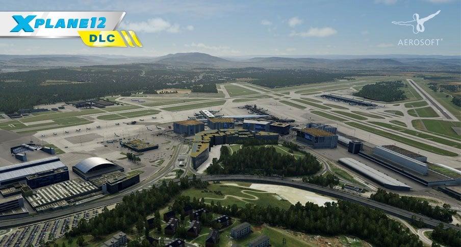

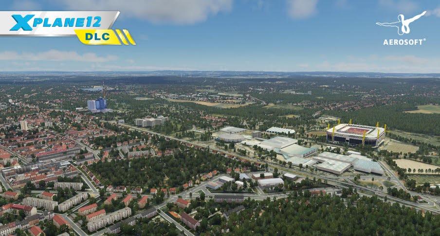
.thumb.jpg.77d1058afaaf483a5f4a6ab2d1d3d93b.jpg)
.thumb.jpg.eb22604489cc1de75663ada12259b376.jpg)
.thumb.jpg.dccbff856495abb9829cdfec8b122a96.jpg)
.thumb.jpg.0a4b378b605dd6e9b98dd502a0fcced6.jpg)
.thumb.jpg.abc275648e65bb08dccb48272df52c6a.jpg)
.thumb.jpg.90aa390e464930f8405b17caa5d27a6b.jpg)
.thumb.jpg.b77084b008a691d33bbdc75ac172a9d2.jpg)
.thumb.jpg.3ee1df67874d4f97672784cdca633574.jpg)
.thumb.jpg.4c55a8131d9744d12a5900bdbf879fdc.jpg)
.thumb.jpg.bb6c95b393a7eb9a9f26091645ca697b.jpg)
.thumb.jpg.5bb561c12c1897f379d4af494ef6ef89.jpg)
.thumb.jpg.243a2a452d7f316d902c2e924b62d1dc.jpg)
.thumb.jpg.f70b246b284e5faf3ba1675094ee1de3.jpg)
.thumb.jpg.e8047ced5afa0d9b65c6676515b9f67d.jpg)
.thumb.jpg.e352094e9a041c10c20e98b9405d36c6.jpg)
.thumb.jpg.44c74e31966d4b071e06579336efc4d1.jpg)
.thumb.jpg.dac9fb9558f1aeae54c5f1256f1ee388.jpg)
.thumb.jpg.bb612bb8c9e1dc98bf77c0adf0c87c63.jpg)
.thumb.jpg.40c332fb1f752c13f0572efcfe7df631.jpg)
.thumb.jpg.fcd8e7ce75f77c7a09e6a9f6b3492444.jpg)
.thumb.jpg.504b66c493e4faabae07470821c31345.jpg)


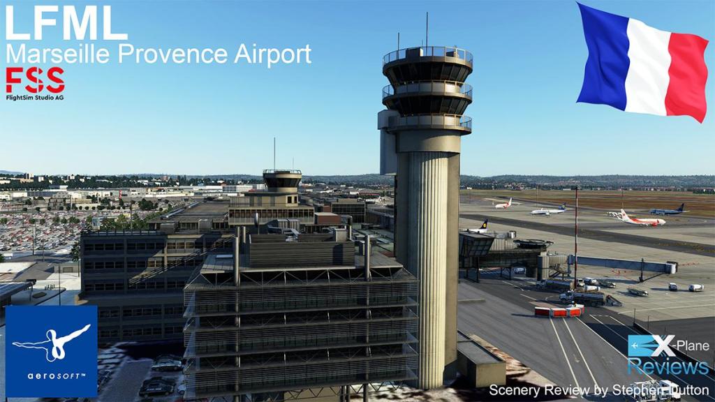
.thumb.jpg.88e9cd75cfa0078ef896a8c856ffcd4f.jpg)
.thumb.jpg.ce32e3a3dd4fe035b81176b26a9fc506.jpg)
.thumb.jpg.369e06e3bb8168bd229cf4eed31491cf.jpg)
.thumb.jpg.d6a5b7f3a43a13bd4878238d34d45d44.jpg)
.thumb.jpg.66448120ce929cae782f04258a3ab9d1.jpg)
.thumb.jpg.b2d83b2cf0a9b40f1d5edf6736e78e74.jpg)
.thumb.jpg.0c27efb7132fabf9c9638c26bdea8be7.jpg)
.thumb.jpg.d5dfdf3ee5d9d9d964445b189fe16573.jpg)
.thumb.jpg.dccfbd9b00fb5d528926ff883d199816.jpg)
.thumb.jpg.f02c2ebeb3ee803639ab5739285ddd55.jpg)
.thumb.jpg.7e0f966edcb9939930ea6765aa686fa2.jpg)


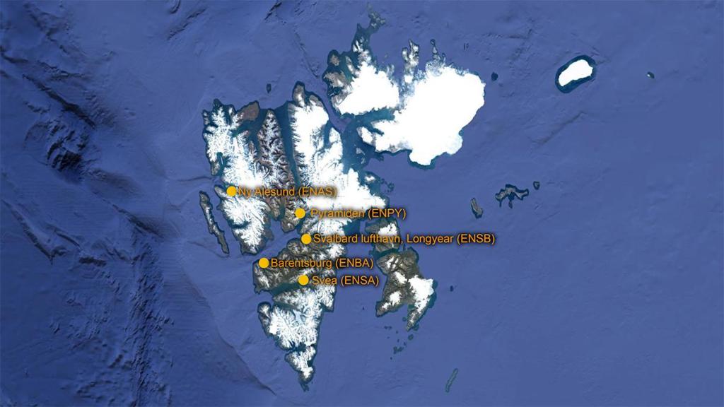


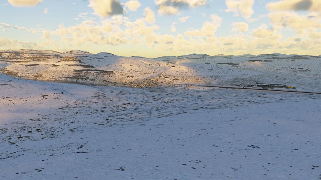


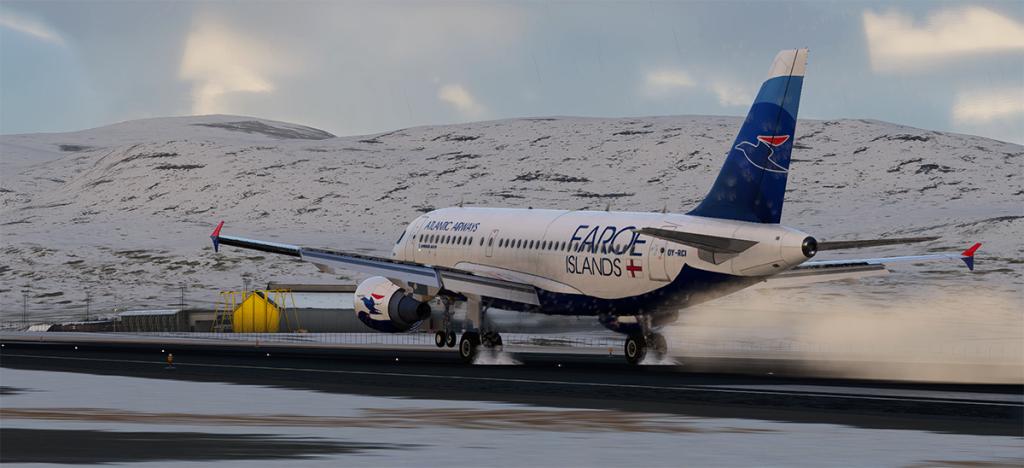


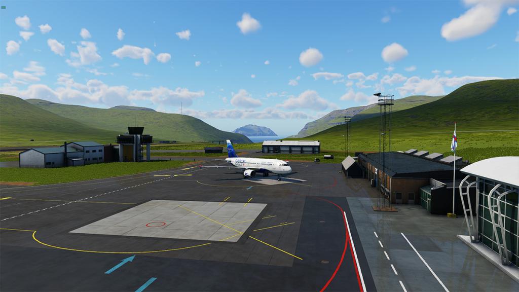


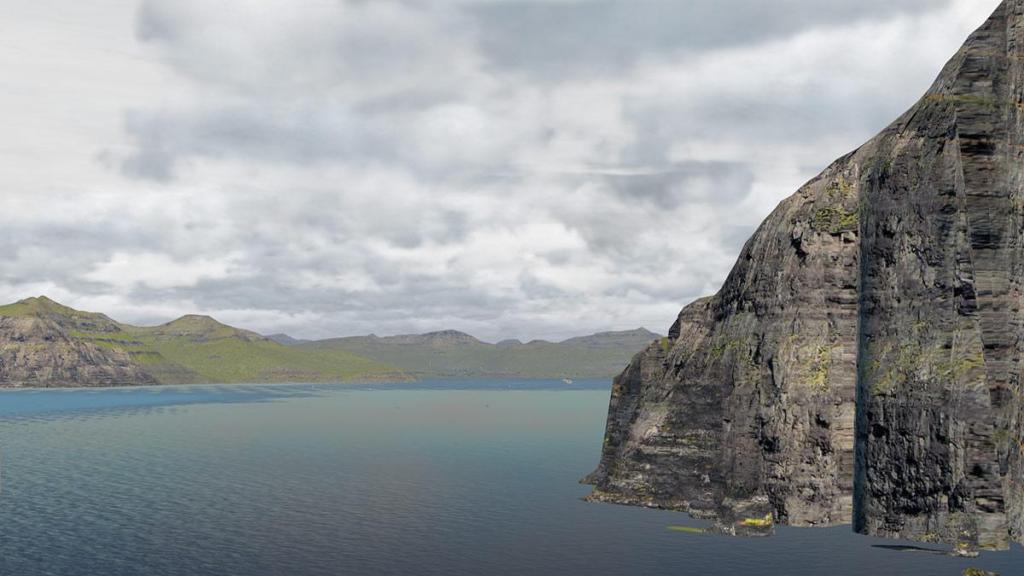


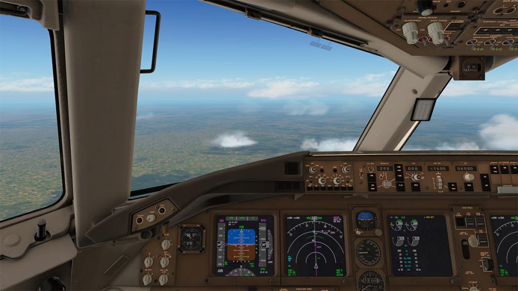


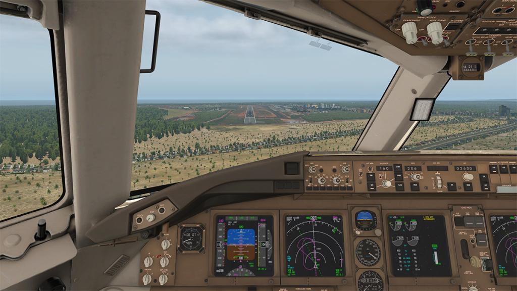


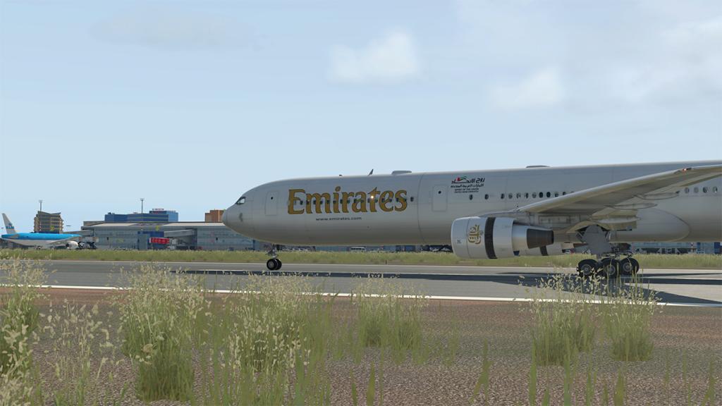


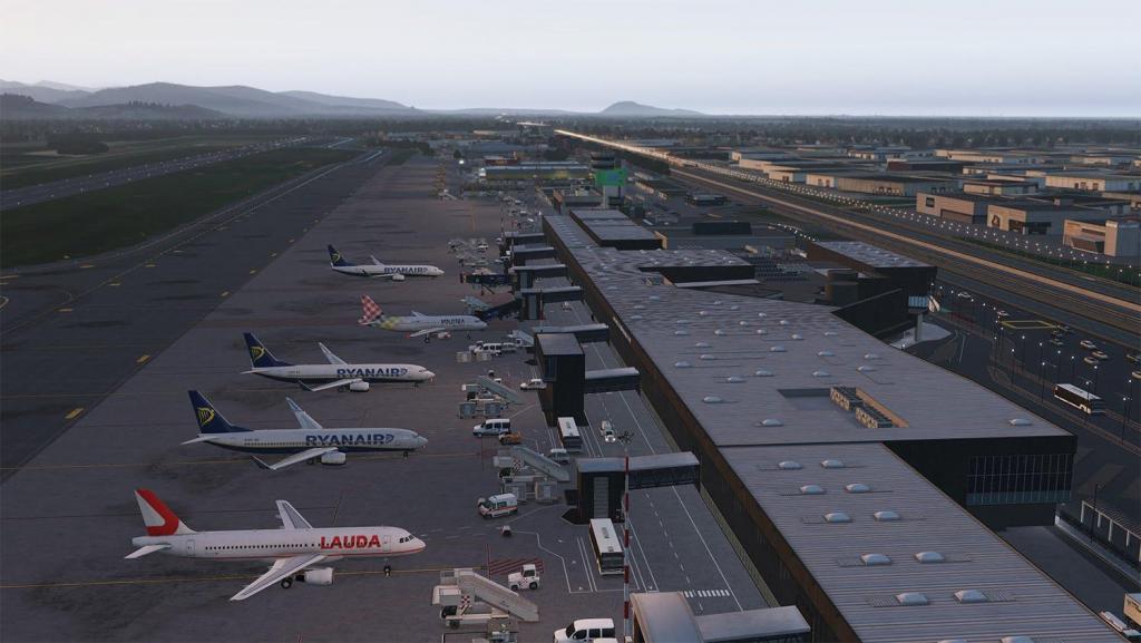


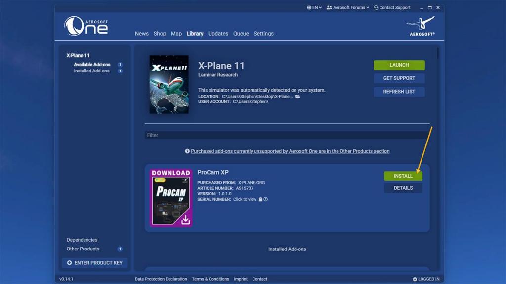


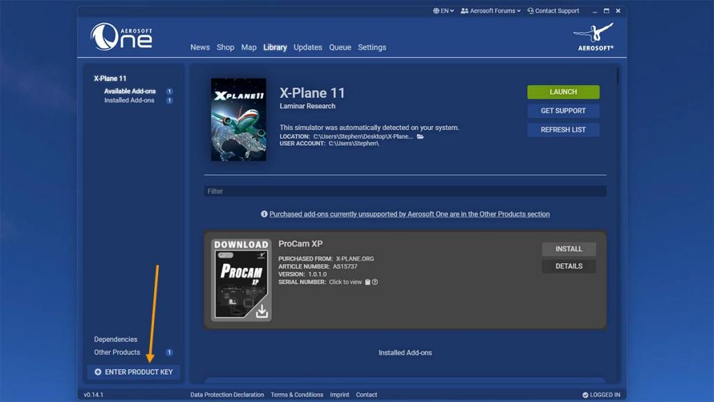


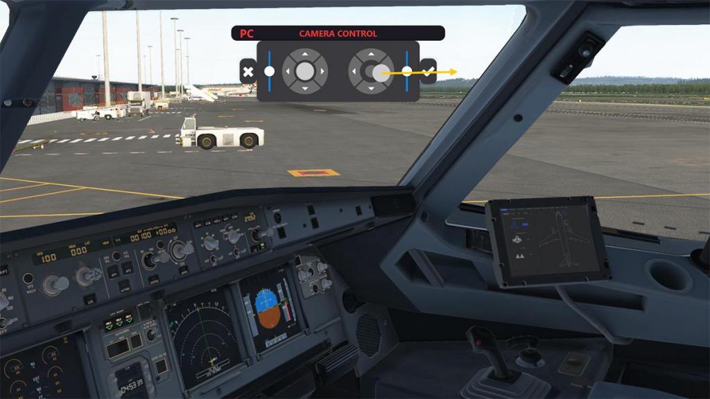




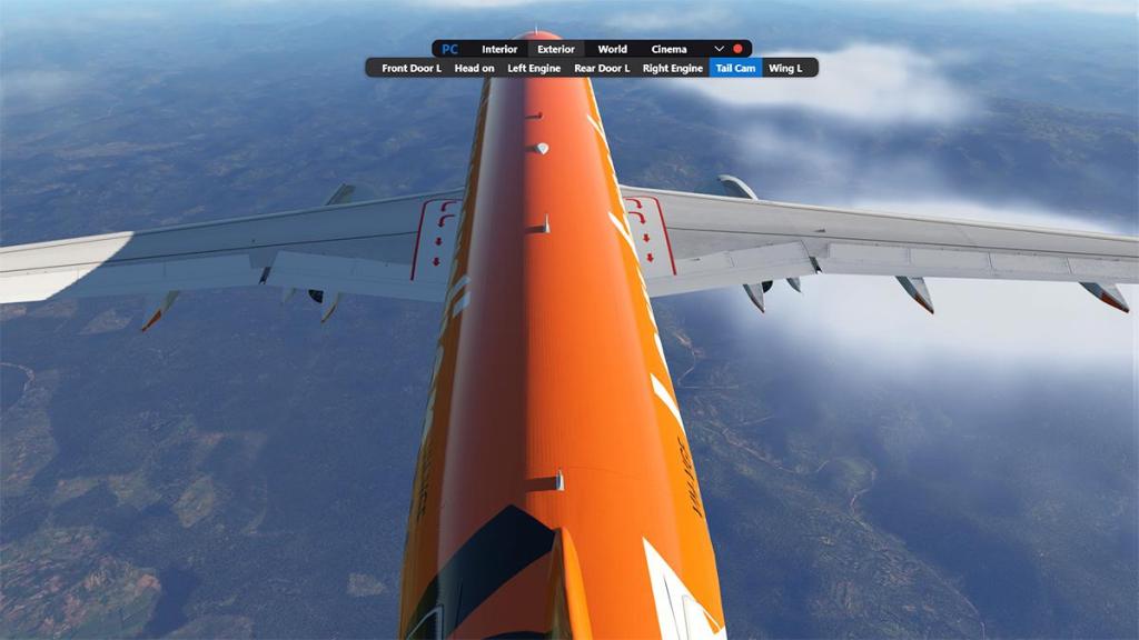




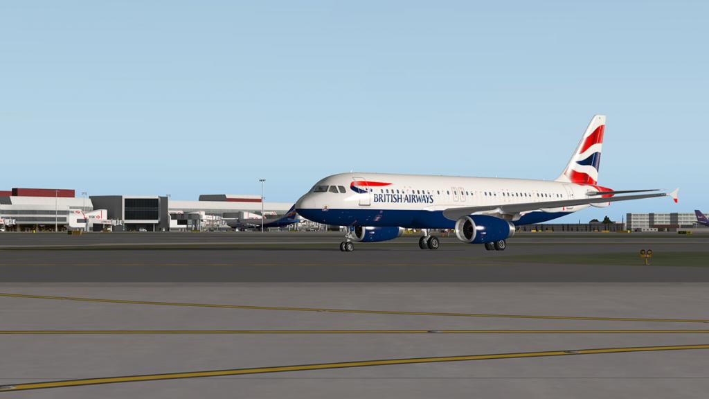


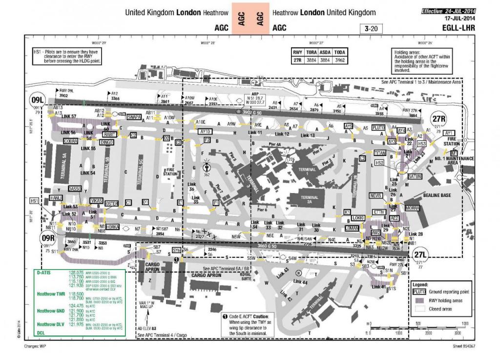


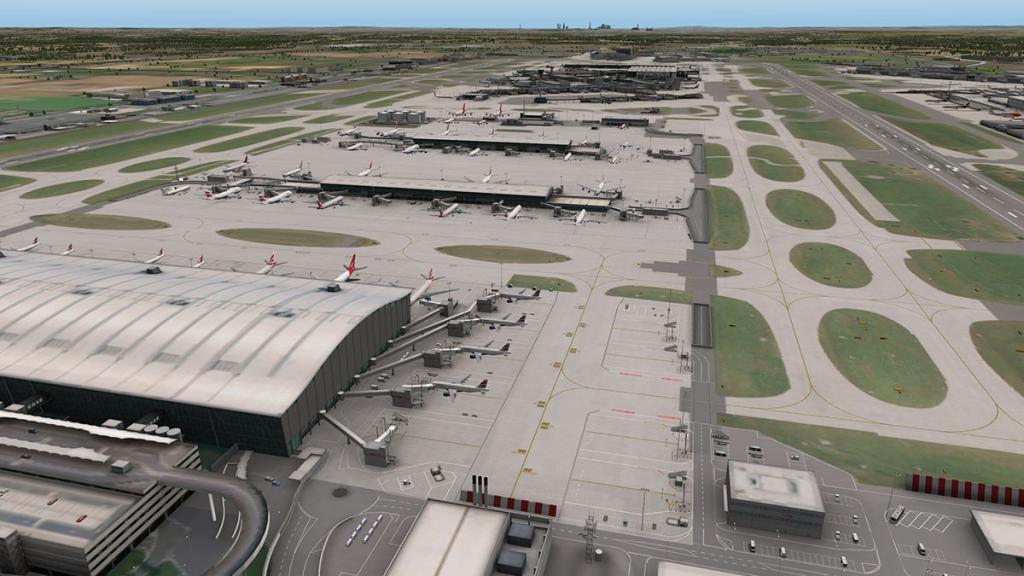




.thumb.jpg.a8cd90e8098091ca909042e94e5cbe0b.jpg)
.thumb.jpg.cecf2f8027b39a083afdcd9bd83a8b28.jpg)
.thumb.jpg.38f0d88612800f2a8d5754b1b8d04dad.jpg)
.thumb.jpg.d7d830dd66ccf9787fb9242bf26efb28.jpg)
.thumb.jpg.1123e2d274b6659996ca8242f1502f35.jpg)
.thumb.jpg.186d6fba694ef480497bd42cb14a38ac.jpg)
.thumb.jpg.ce6b7900543c0de3abf38cafb8671e2f.jpg)
.thumb.jpg.ef890ae6c407738472c2e4a684182390.jpg)
.thumb.jpg.1755e90dd5910c3d6c289290cbf324b0.jpg)
.thumb.jpg.6452029d7462444e96678c5ee1c172cc.jpg)
.thumb.jpg.4477a402cce391e27b9e425b342d54d3.jpg)
.thumb.jpg.3b74bf5e50ee2a462fa11e2057429579.jpg)
.thumb.jpg.6f29340845bbee3cb52304510d039d9d.jpg)
.thumb.jpg.df23dac7041c92a6a2b45d39b2910b88.jpg)
.thumb.jpg.b21dd222039f80b699d02b42e283858c.jpg)
.thumb.jpg.848482a0dd077df49429a1a10c2a2090.jpg)
.thumb.jpg.2b746cde13c4a684ed972f70ece351e3.jpg)
.thumb.jpg.c5a1f0015c6c7daaa219c74f58fb528f.jpg)
.thumb.jpg.6f5129aaf2c05e118c6d790ac76f95db.jpg)
.thumb.jpg.b2f7352118baff14208570005cafd7a5.jpg)
.thumb.jpg.85906fac602b8d05a9ea55e6ba297c43.jpg)
.thumb.jpg.77342e897b723e5e4c0761bb23d4035e.jpg)
.thumb.jpg.576fdc807b56345727feb50ebaa1db51.jpg)
.thumb.jpg.4d486e7a723355052a3fb7c59a5ab52d.jpg)
.thumb.jpg.99608ad85eb286f05180ce61552d17b5.jpg)

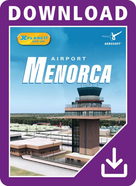
.thumb.jpg.a10188d2f202369c9793eb5578485d50.jpg)
.thumb.jpg.23c21d13f70994cf5c80422cdebe25c9.jpg)
.thumb.jpg.789a2fc598853271a4a6f57c73806d2d.jpg)
.thumb.jpg.0c322bf6634ea38b37ace2a15760191b.jpg)
.thumb.jpg.7679bbc229df1d95c41db26768d1f06d.jpg)
.thumb.jpg.cdbd61a52c7278da061de423b996899f.jpg)
.thumb.jpg.ffff2ca22804dbaa0d05705f3d62c8d0.jpg)
.thumb.jpg.15aeae64850a9e75058e603e1981a05e.jpg)
.thumb.jpg.99a93d048857b18261049299b738ccc8.jpg)
.thumb.jpg.fa5f42428b6cb59c62acf551a8b1a8d6.jpg)
.thumb.jpg.aeaf6f28ce3efddead8702a2f9c0eef4.jpg)
.thumb.jpg.bba3ee7527515a6108056d0988899a9a.jpg)
.thumb.jpg.372dac37b5bc4d8ce1b32d1cd3f3641a.jpg)
.thumb.jpg.a11616e74011b8d675db9bf9f7a10bee.jpg)
.thumb.jpg.7da18c6ba2598bc384038be2df33ac86.jpg)
