Leaderboard
Popular Content
Showing content with the highest reputation on 03/18/20 in Posts
-
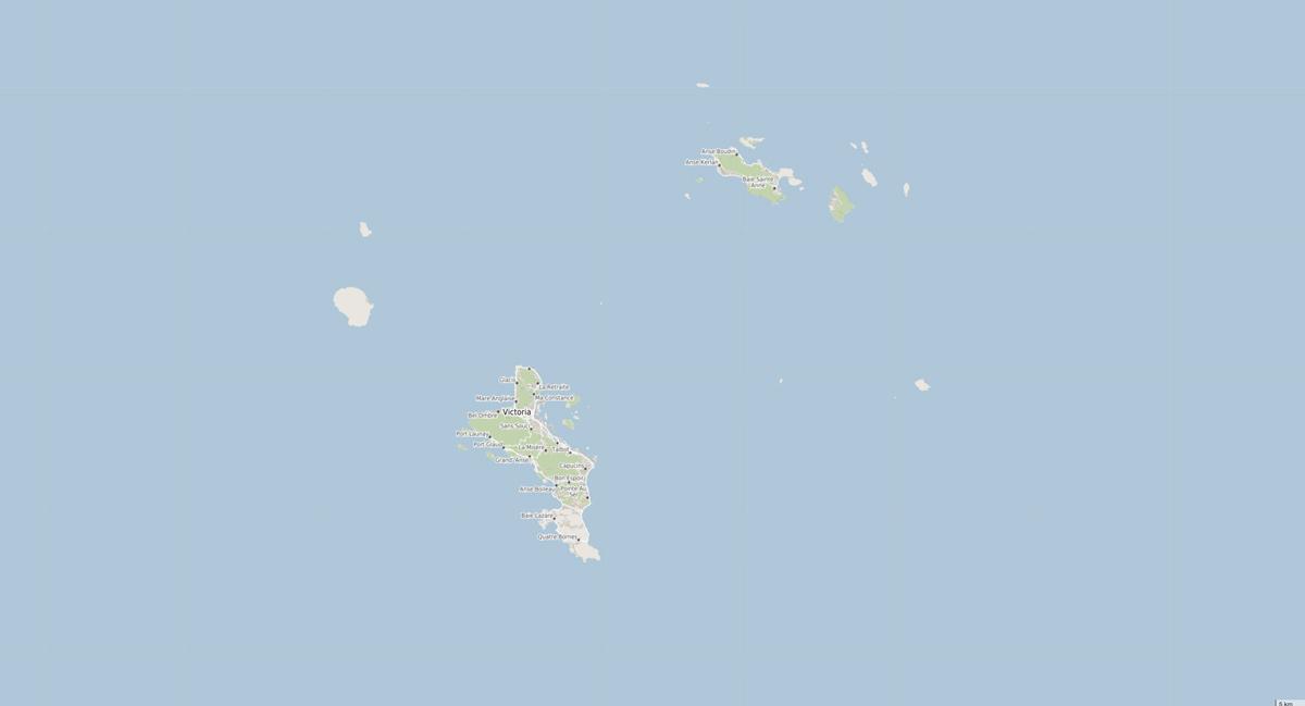
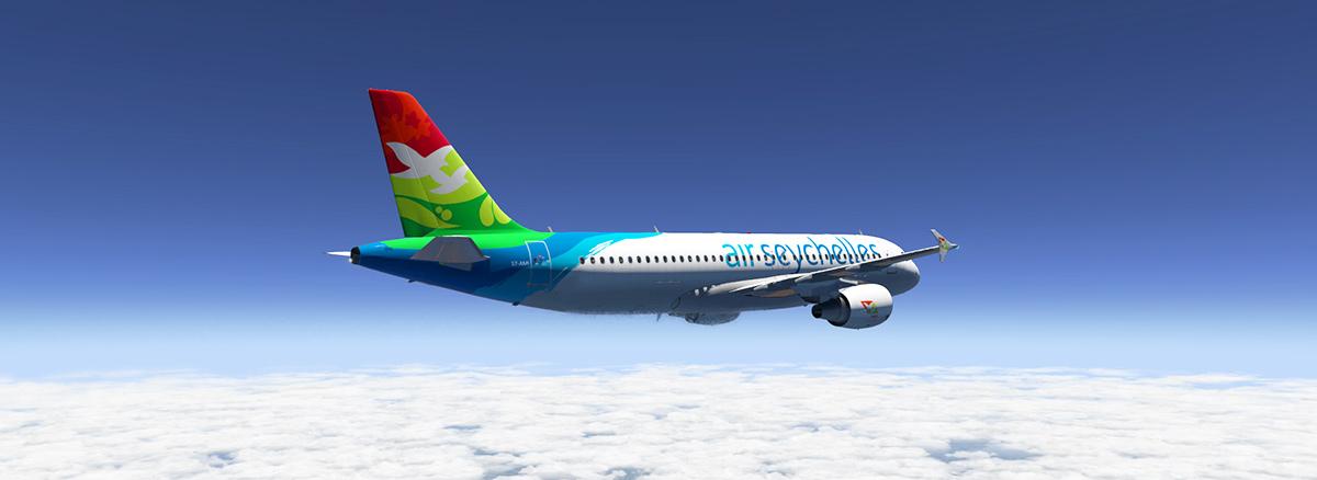
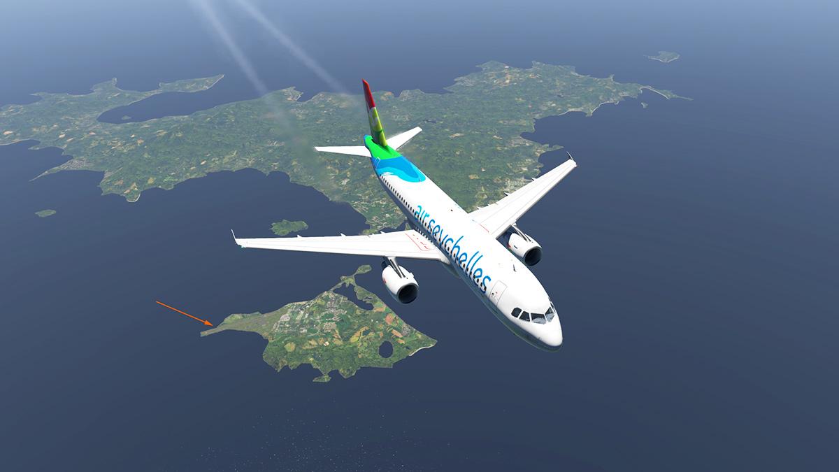
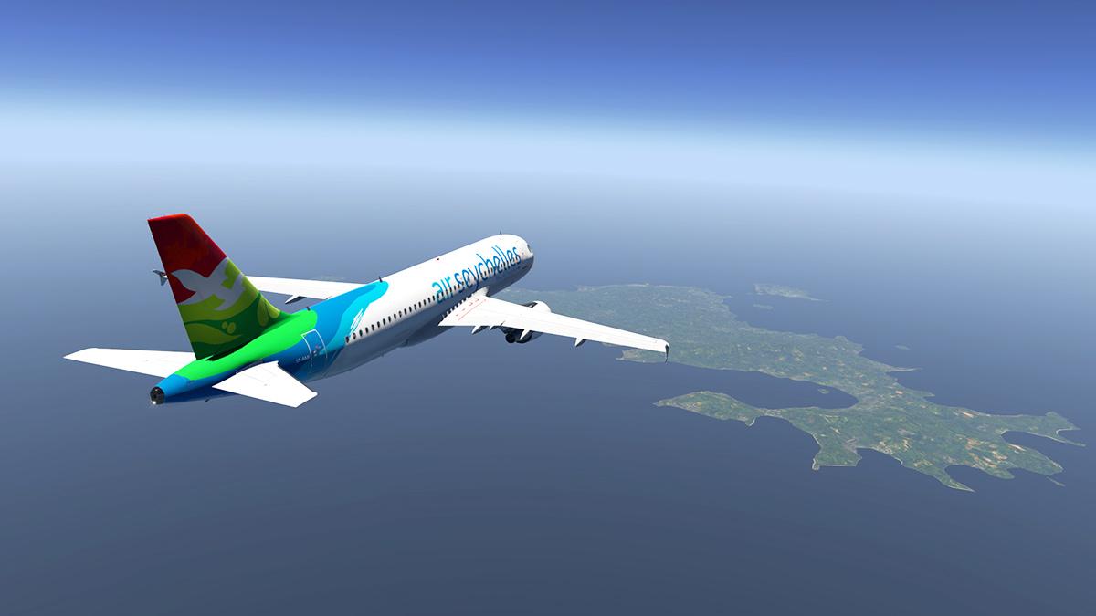
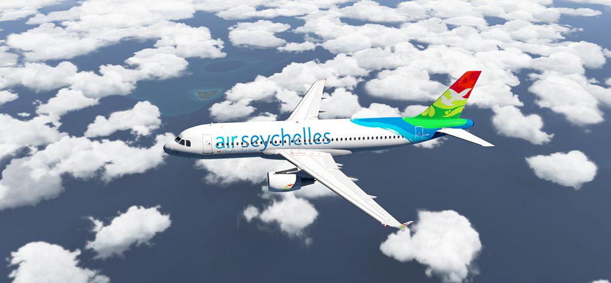
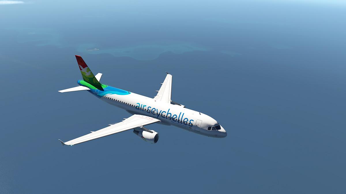
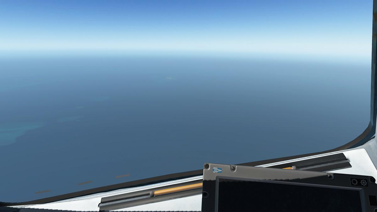
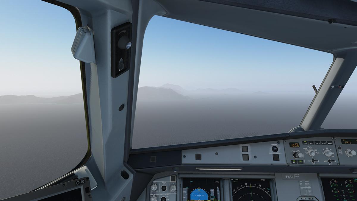
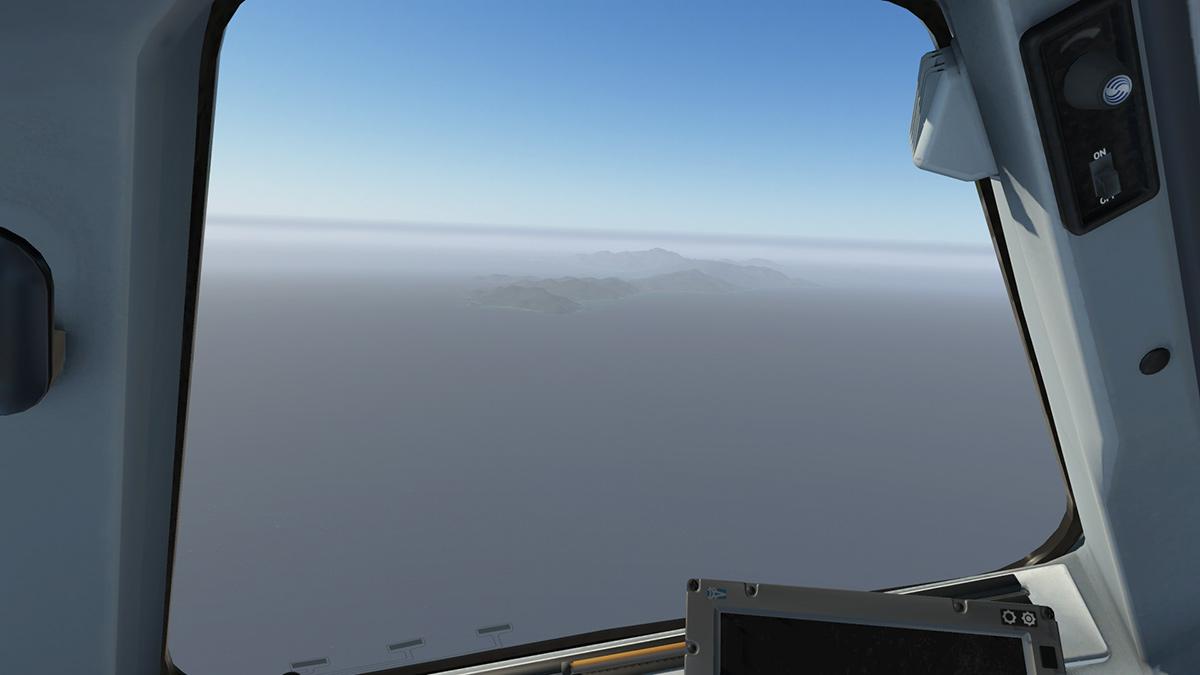
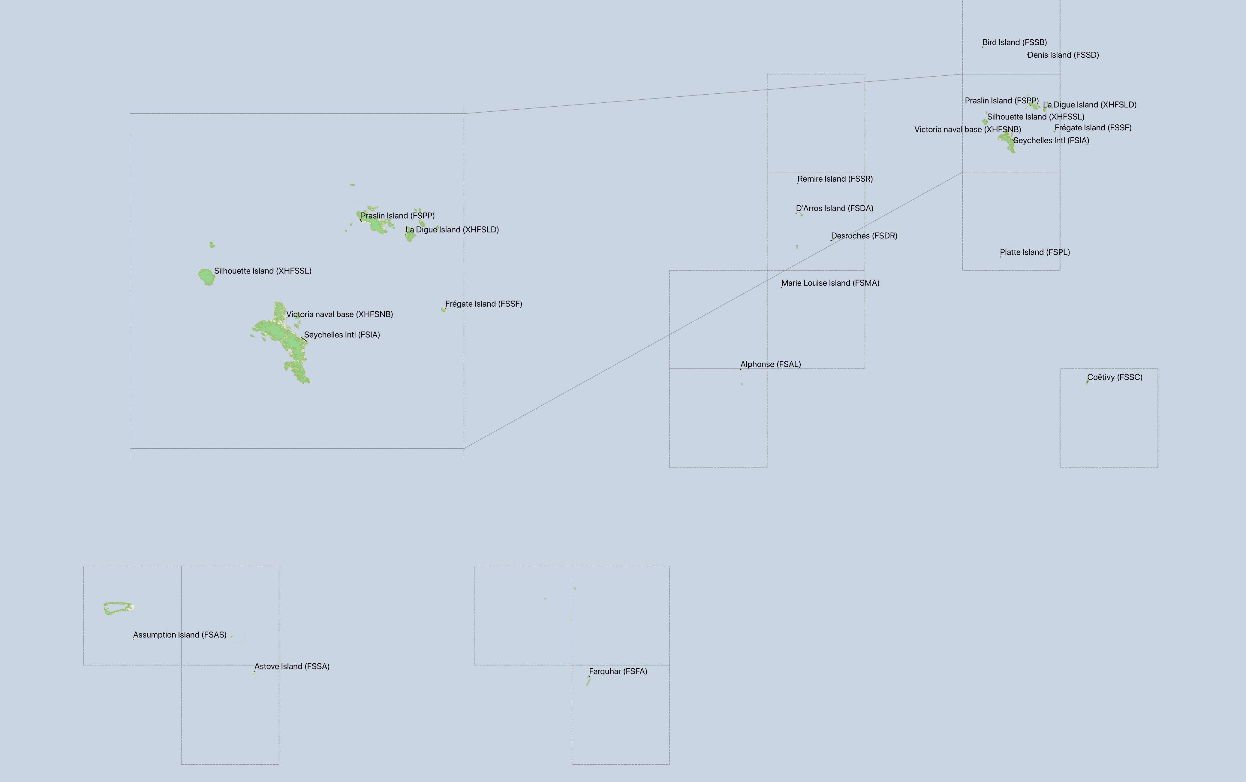
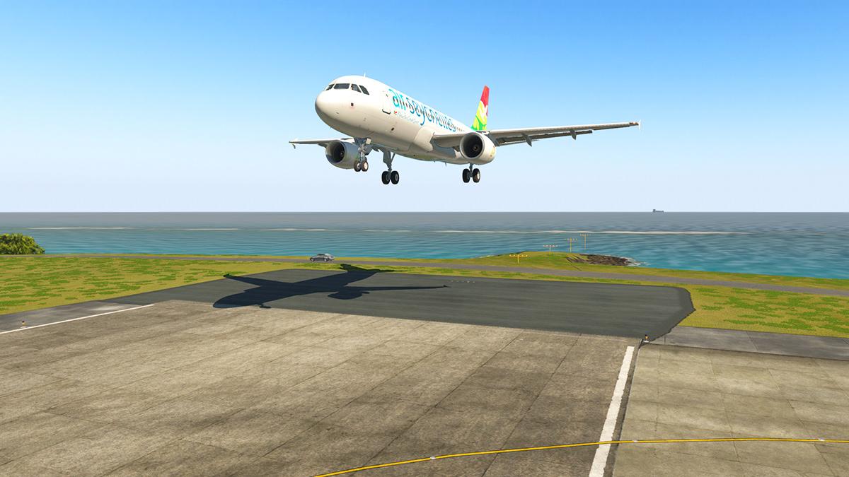
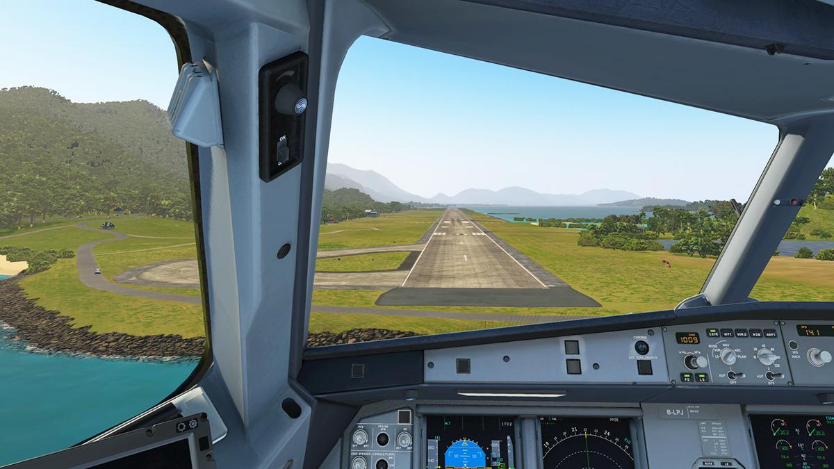
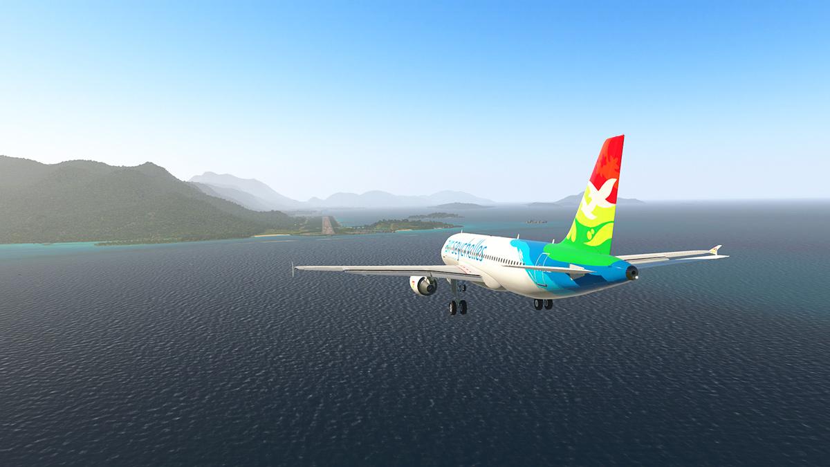
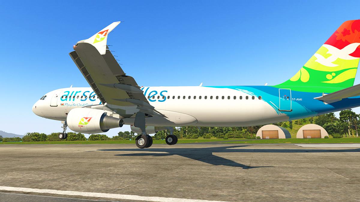
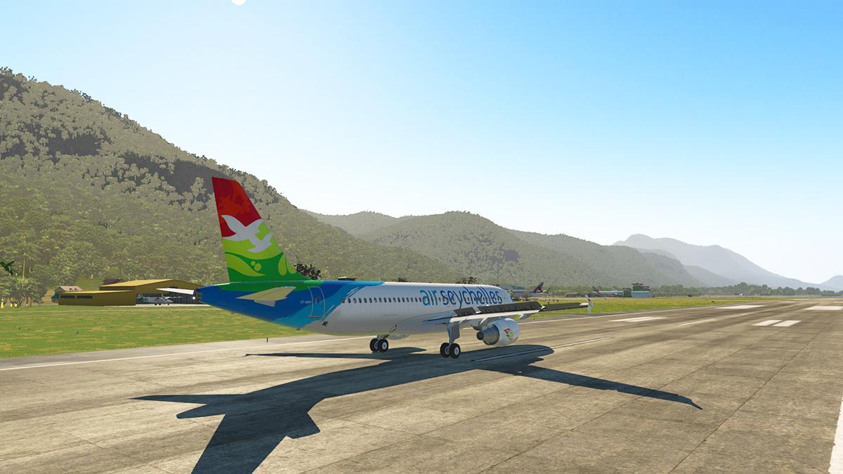
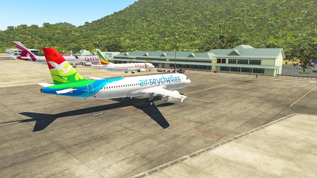
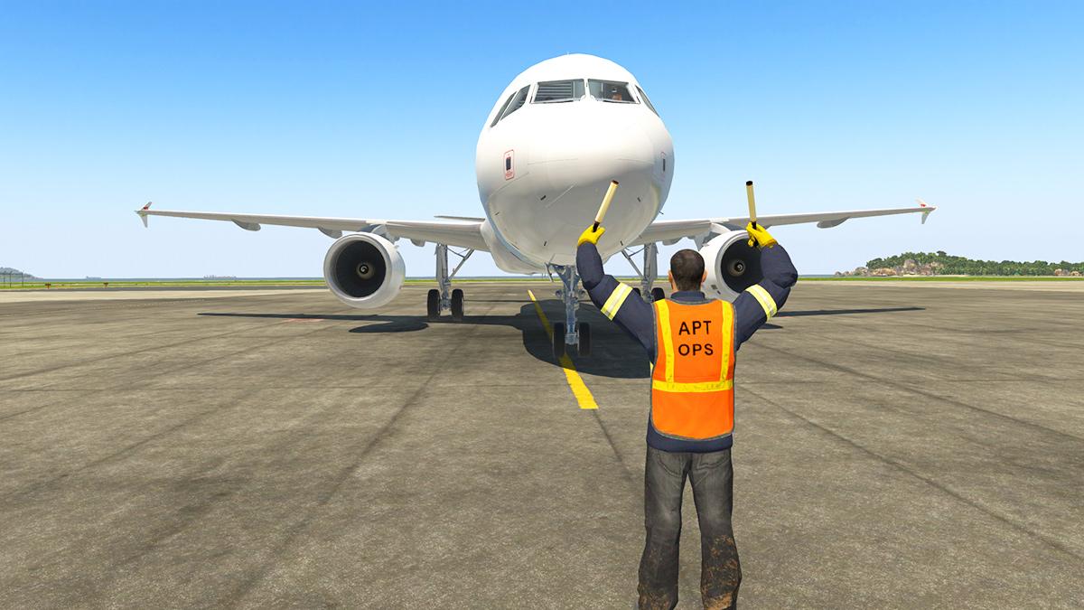
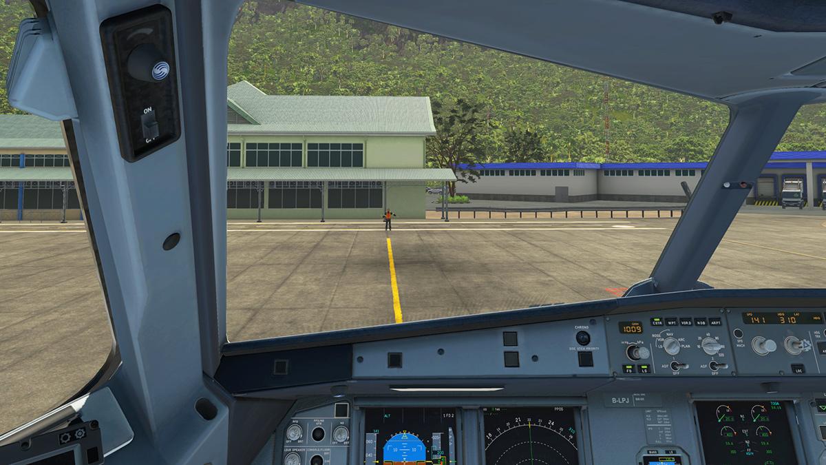
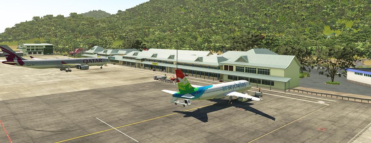
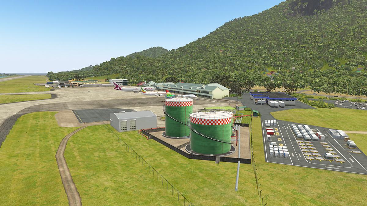
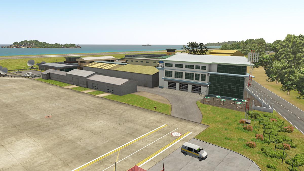
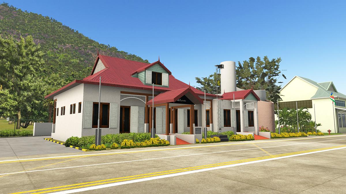
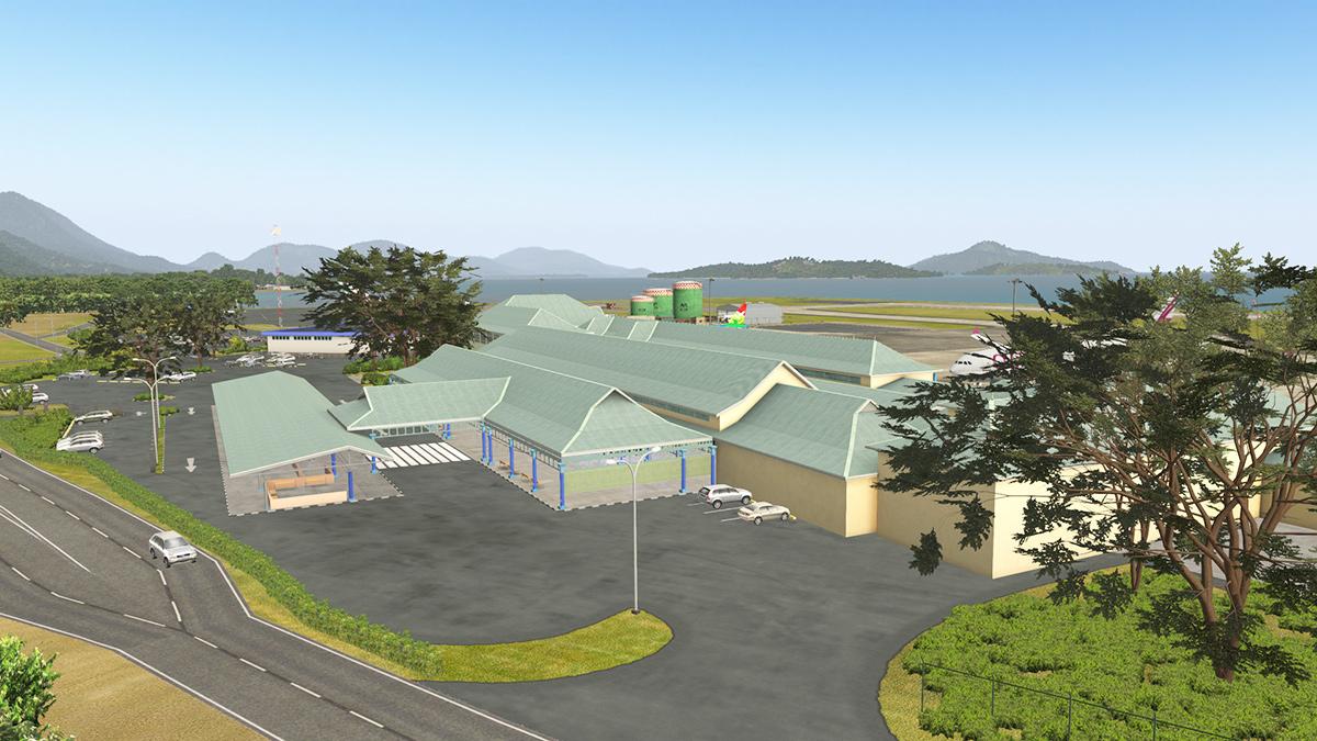
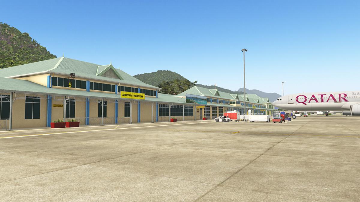
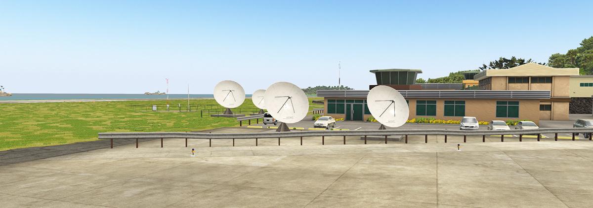
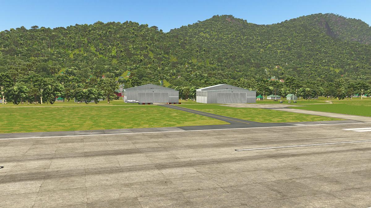
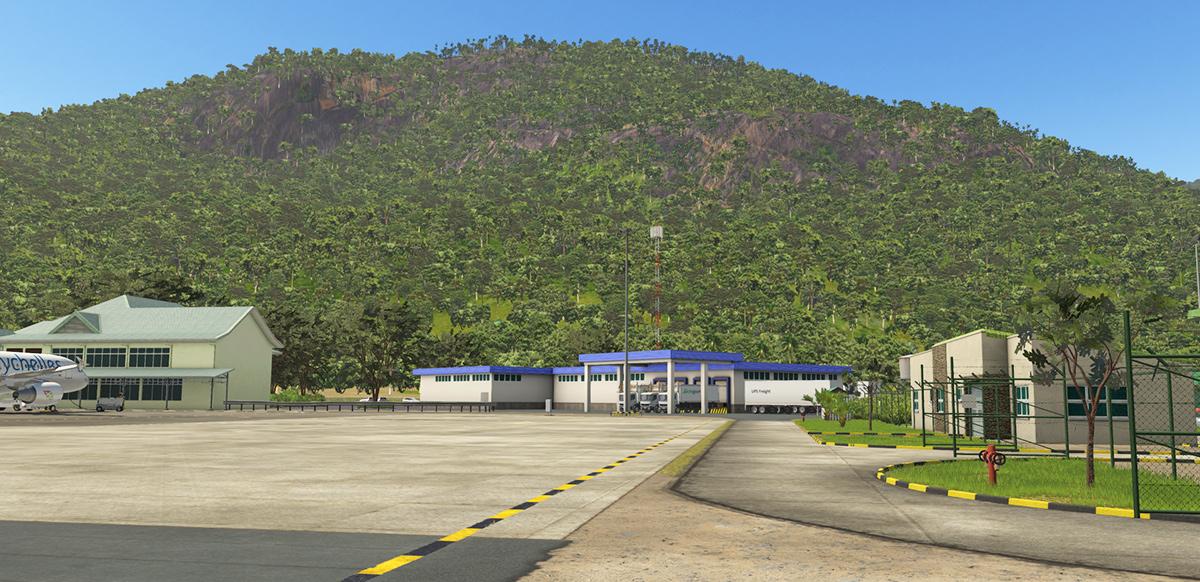
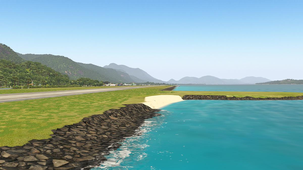
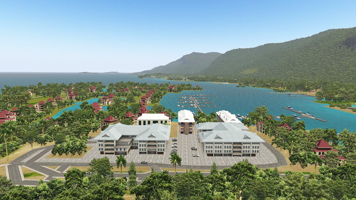
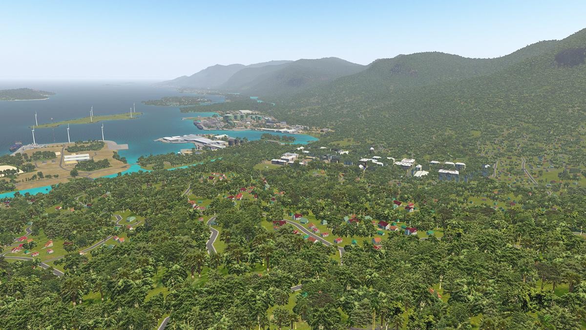
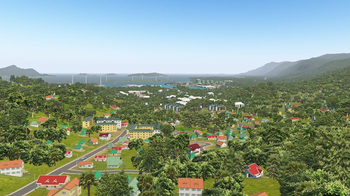
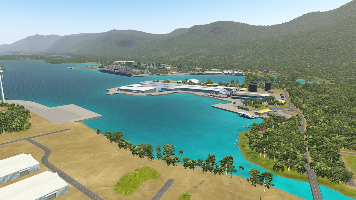
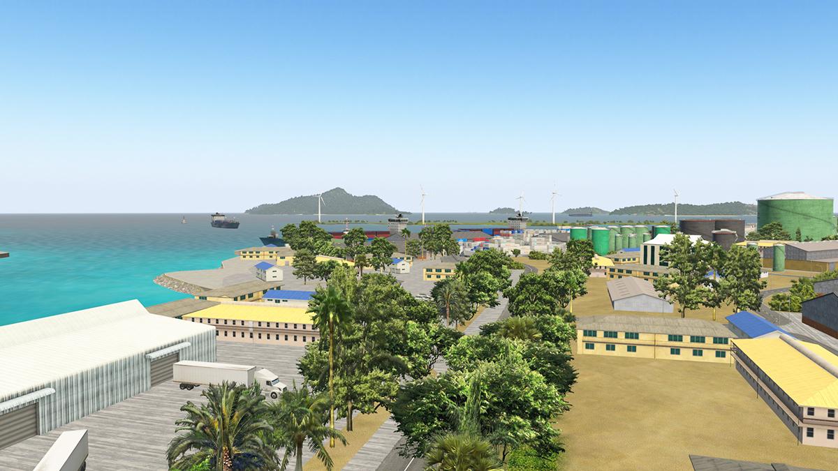
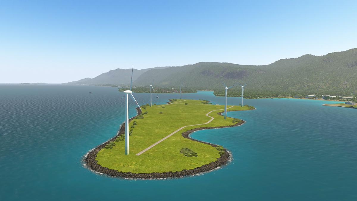
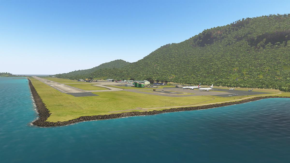
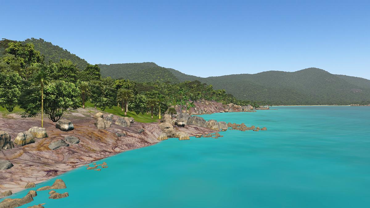
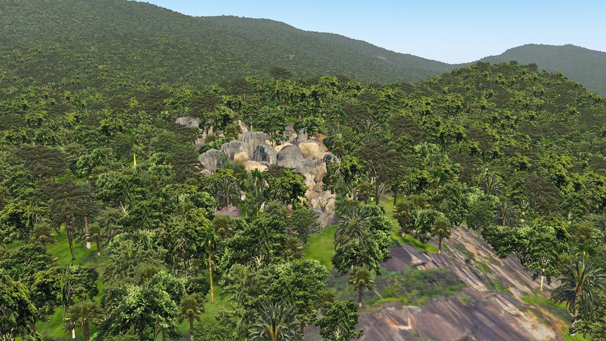
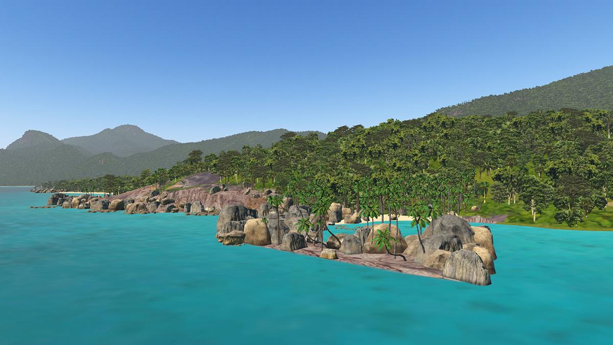
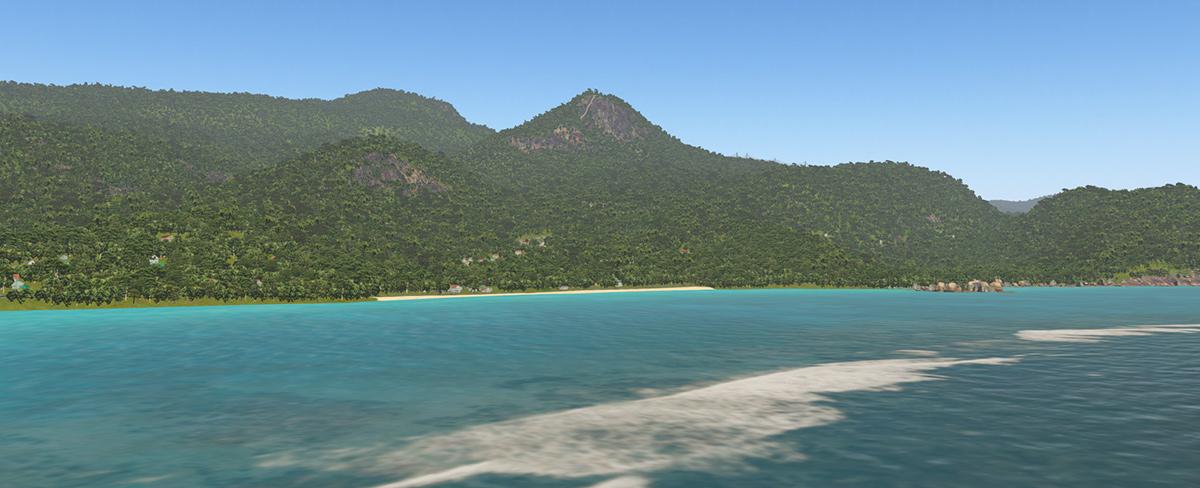
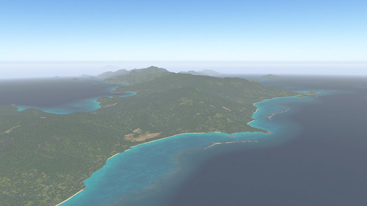
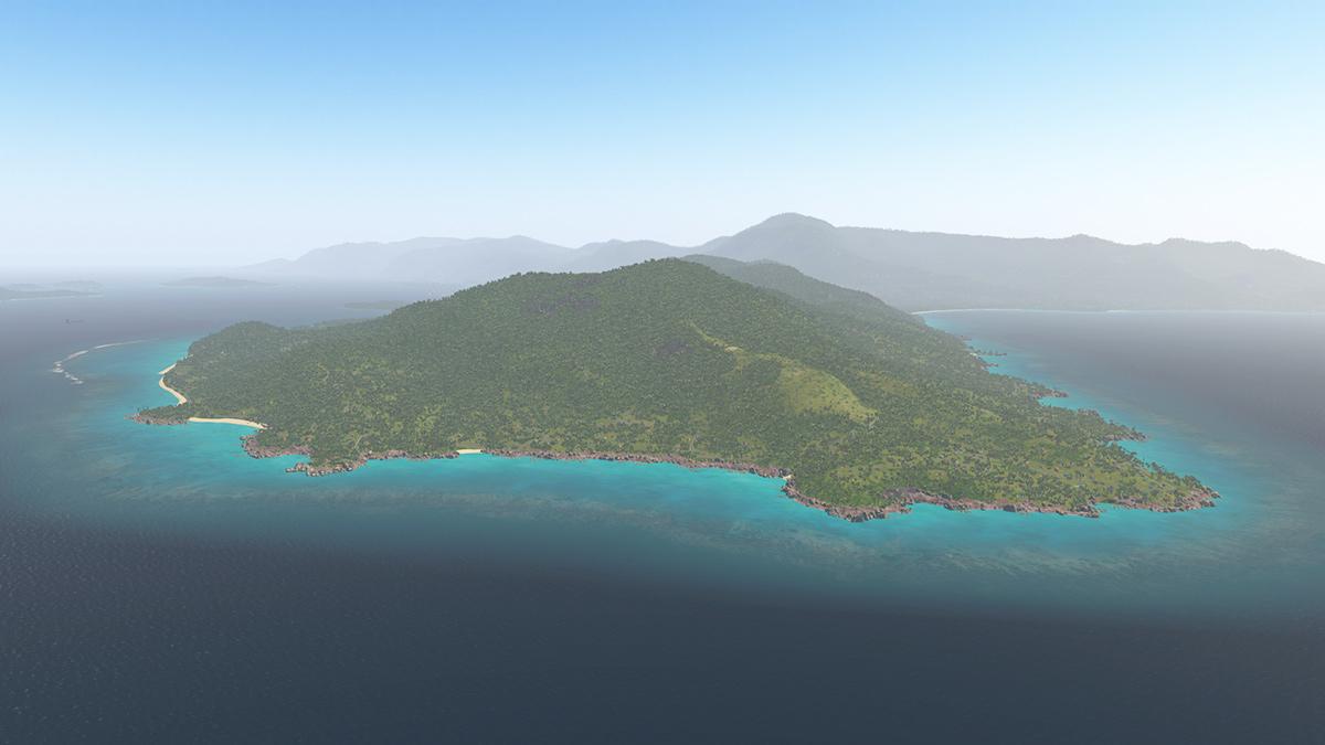
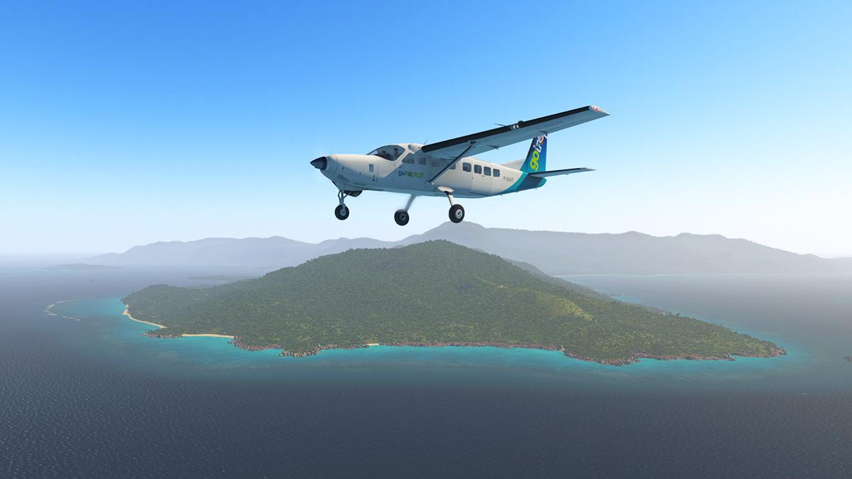
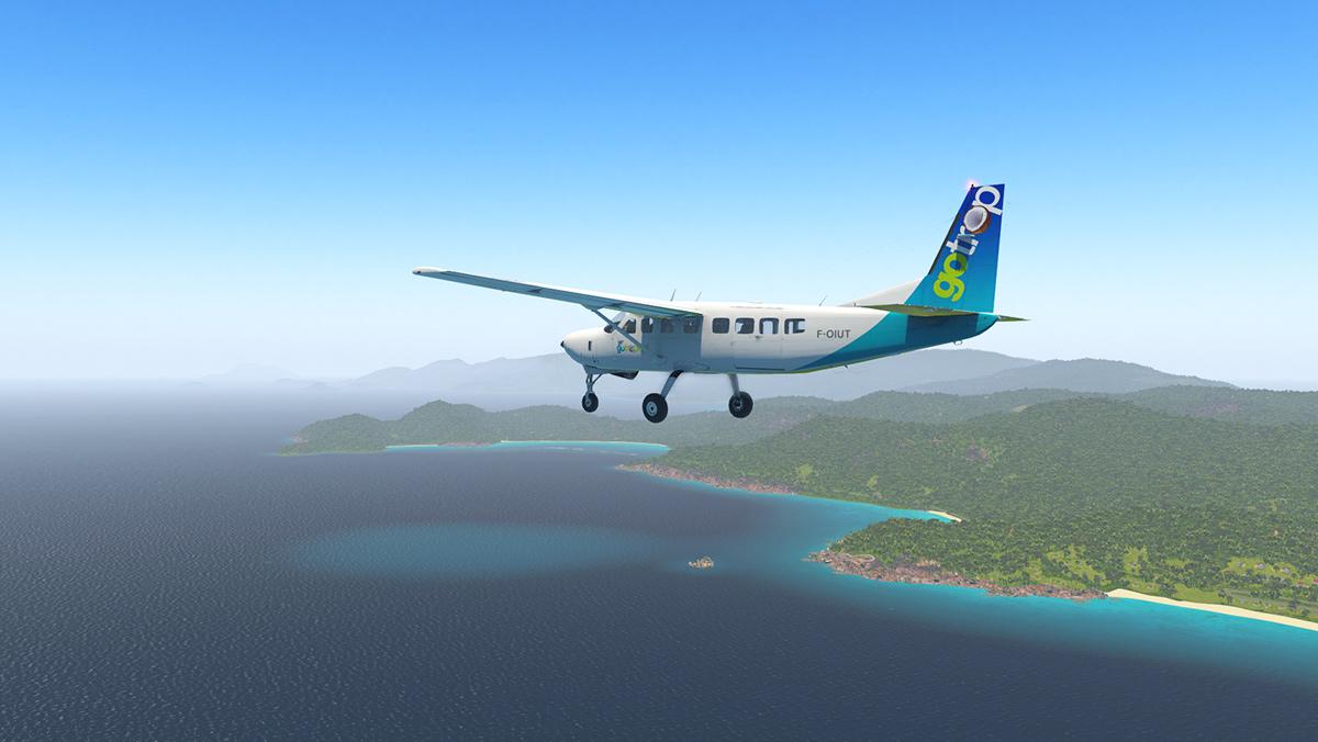
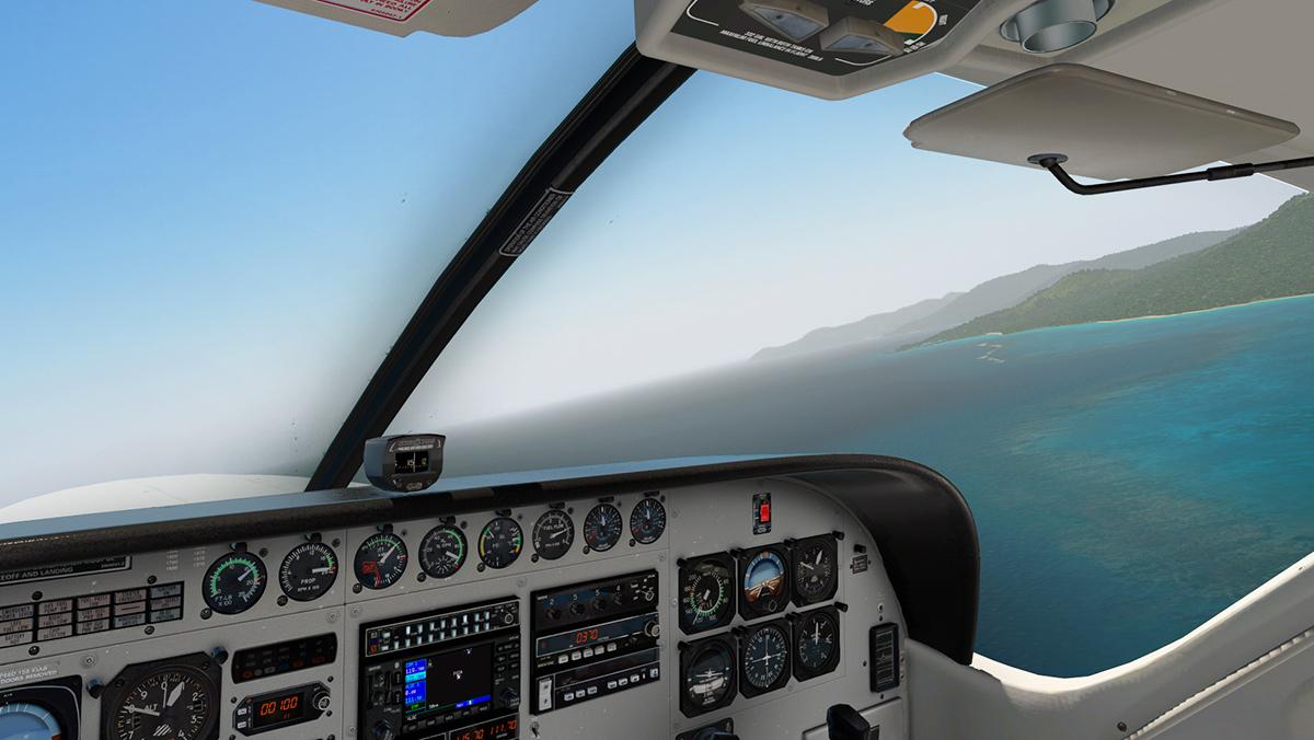
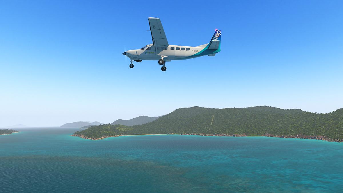
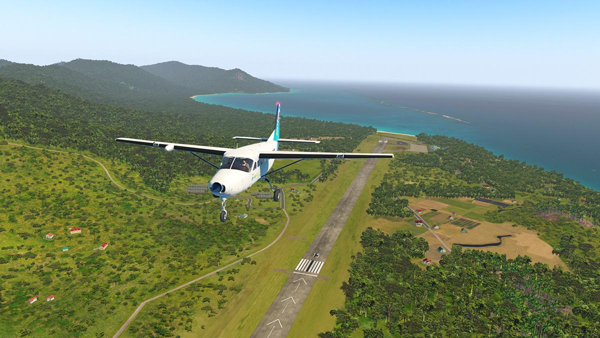
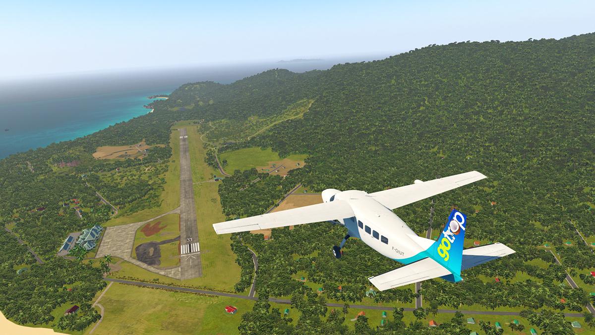
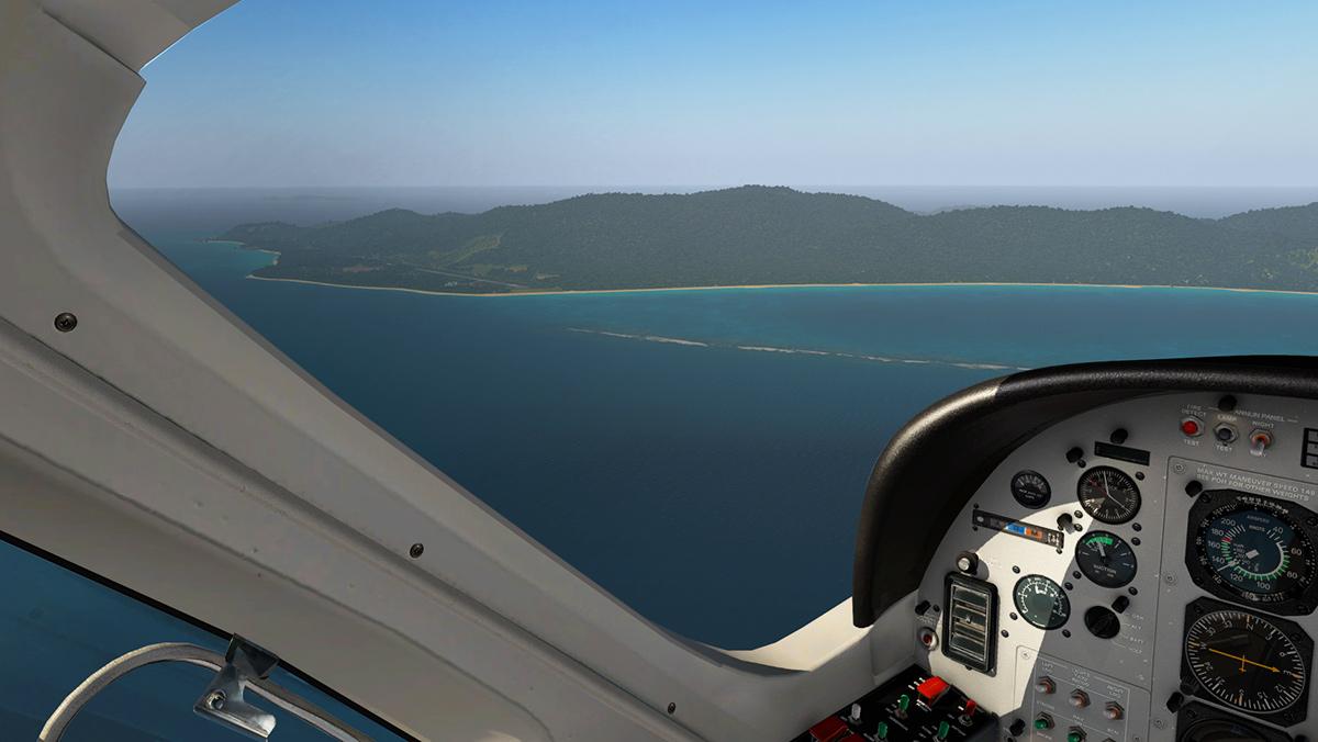
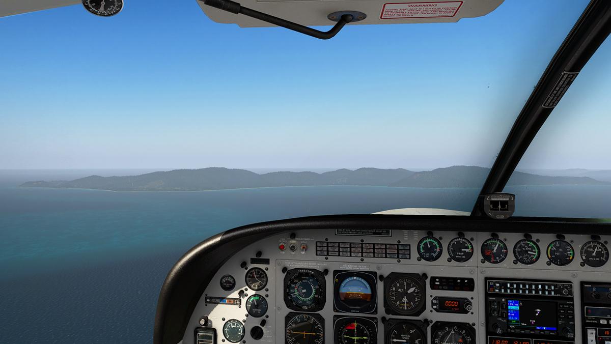
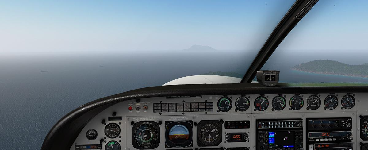
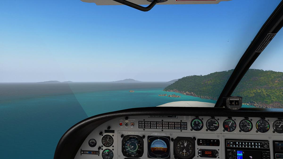
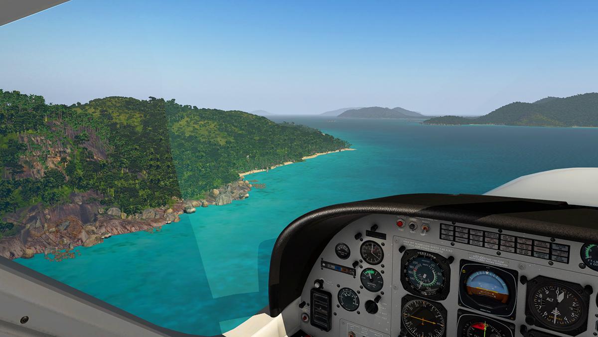
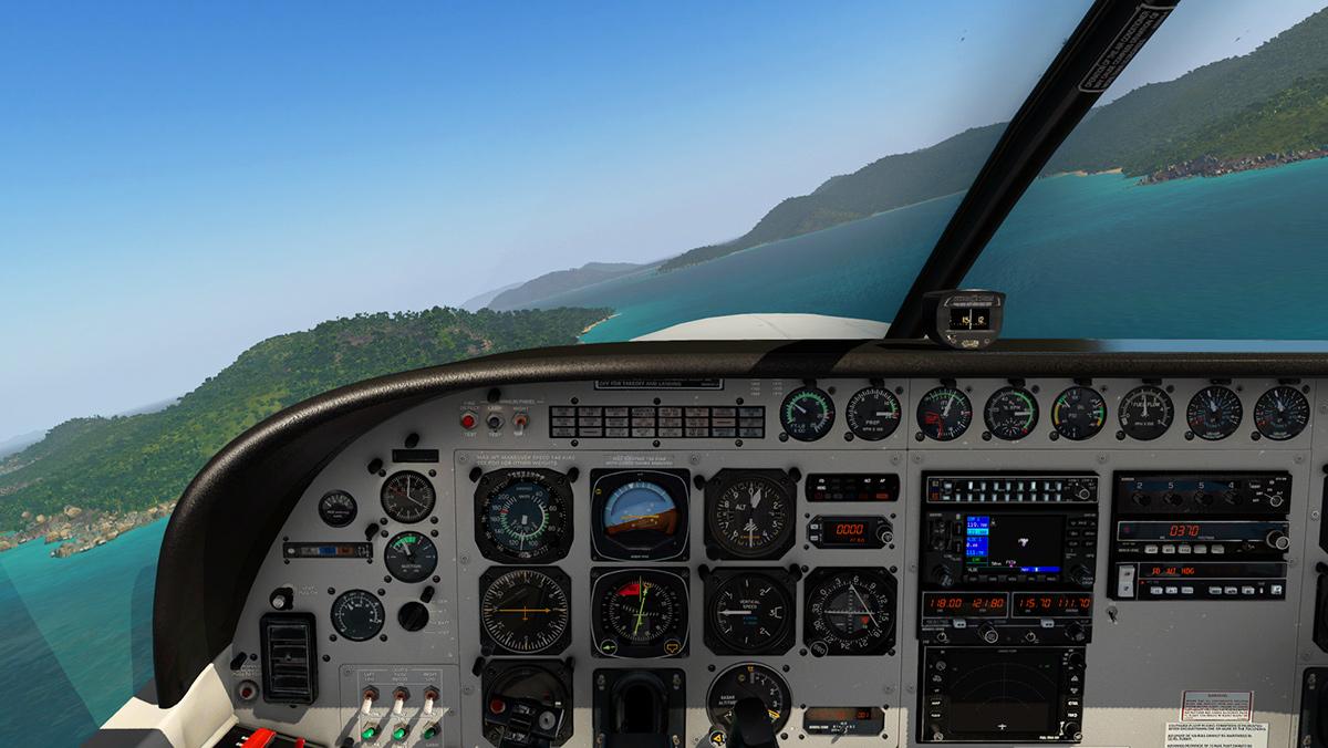
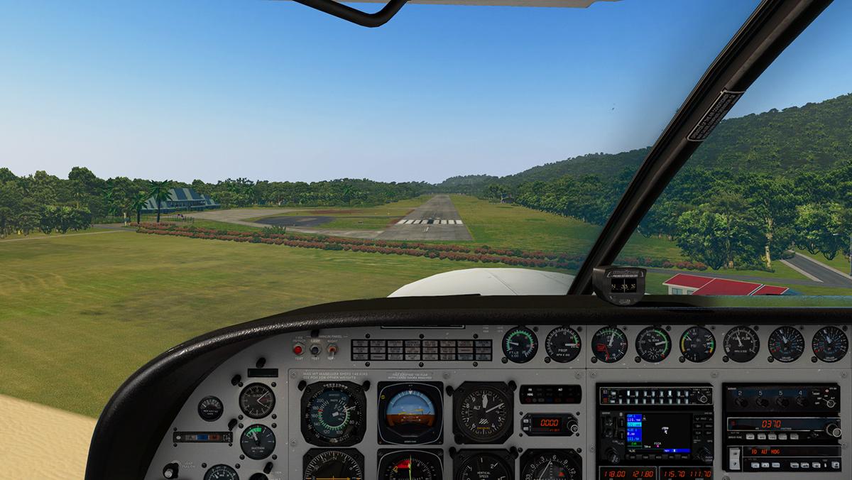
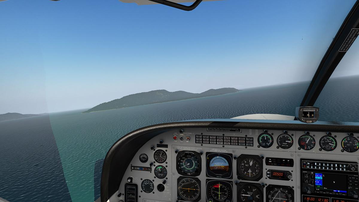
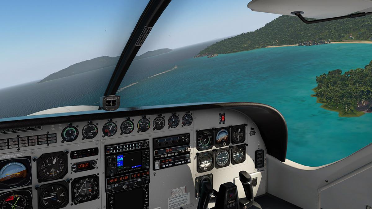
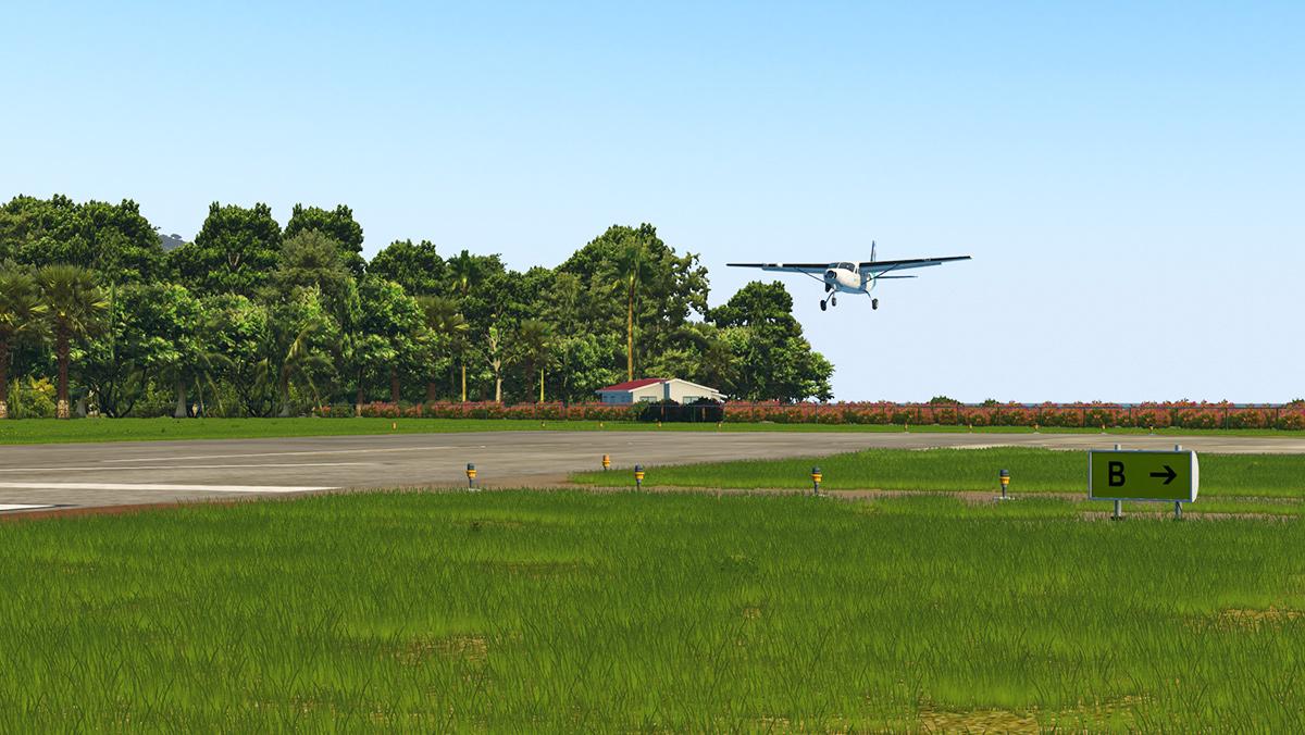
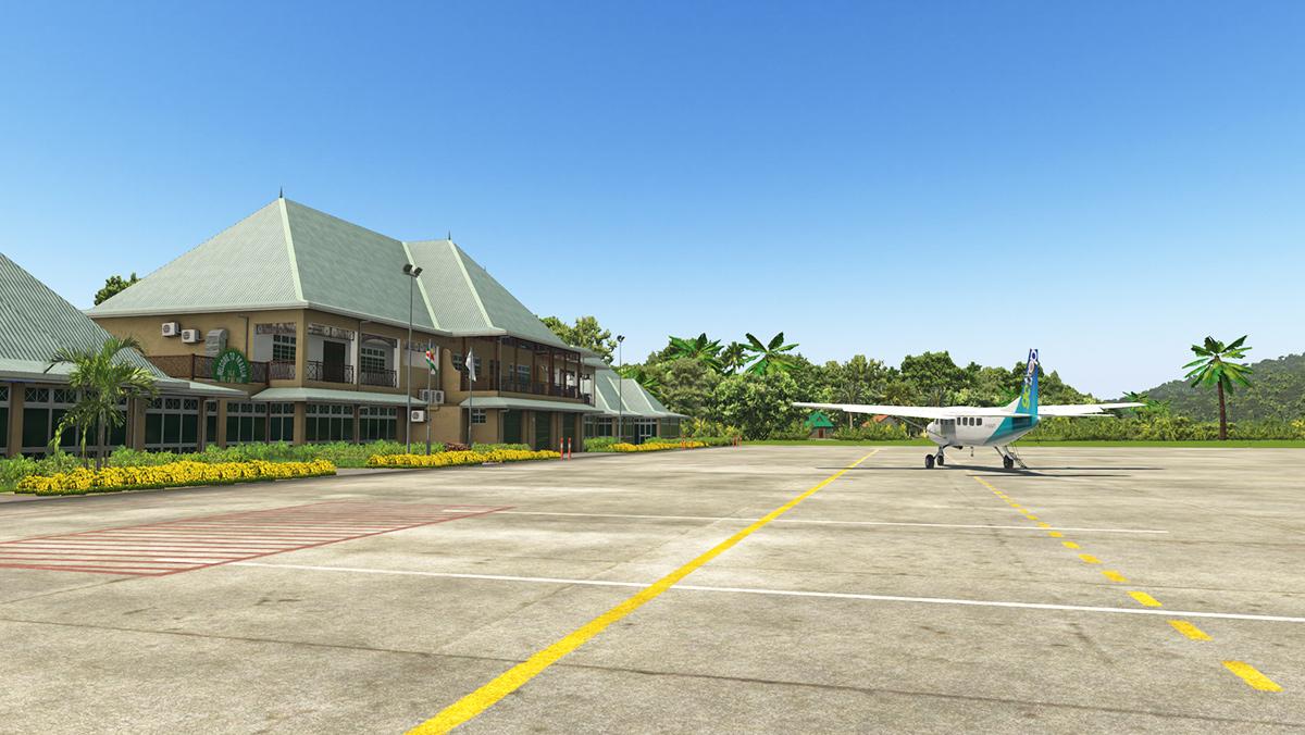
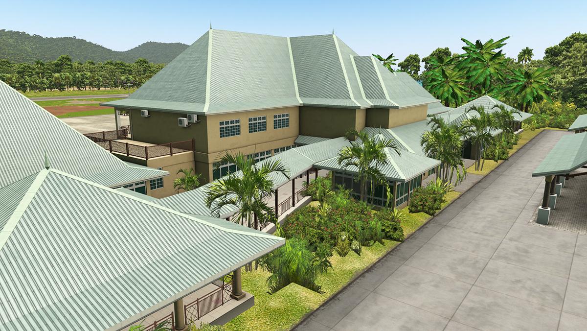
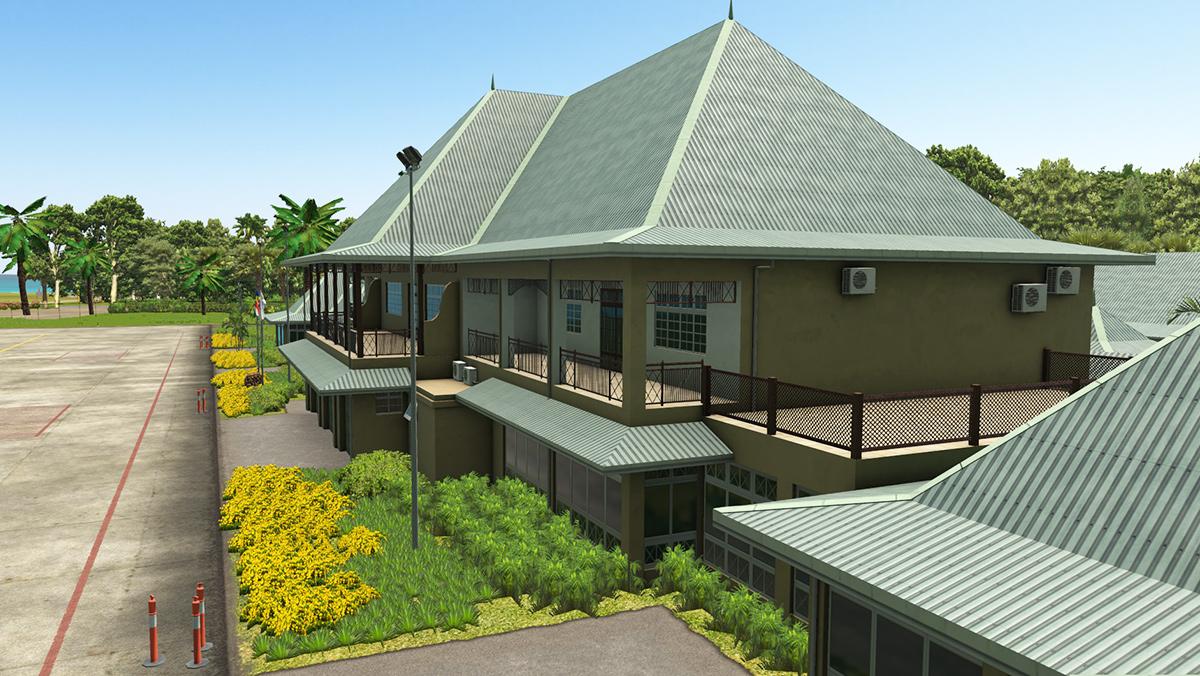
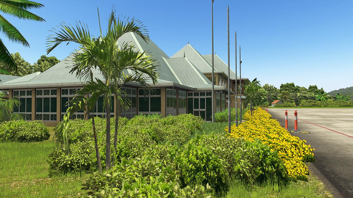
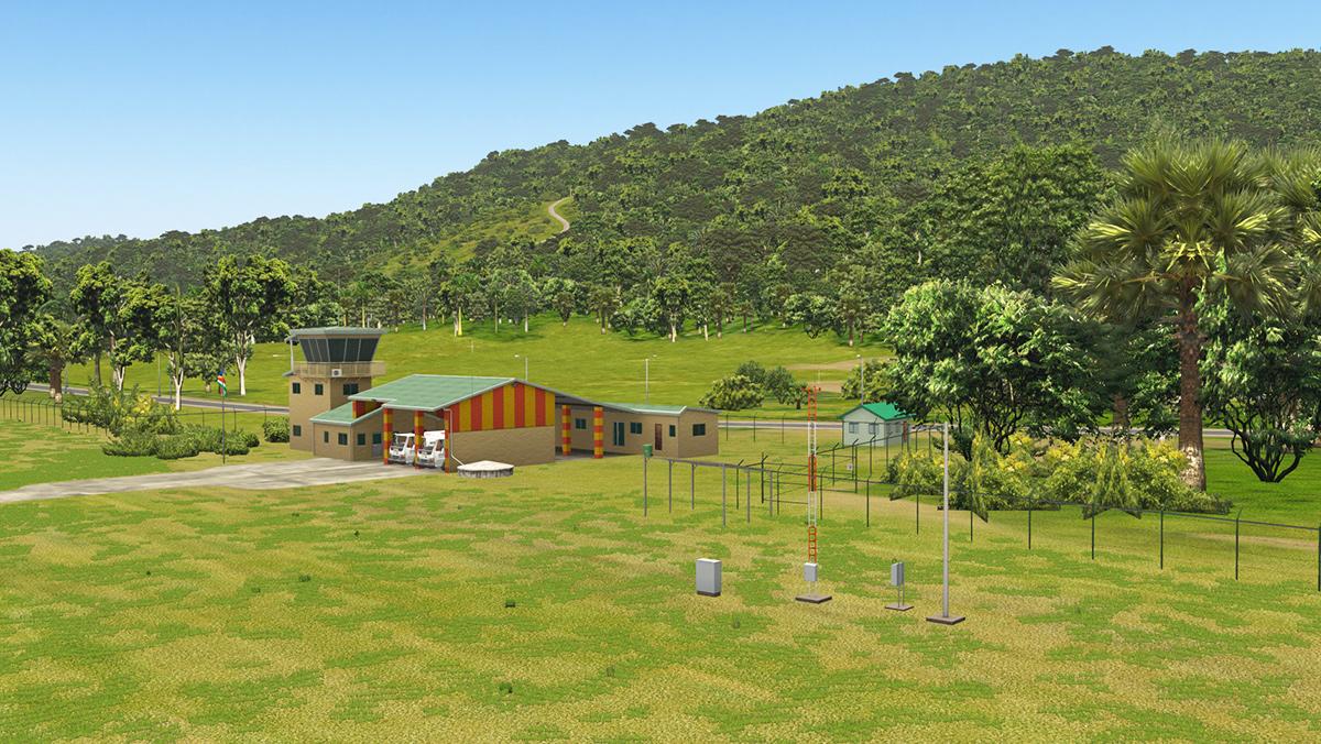
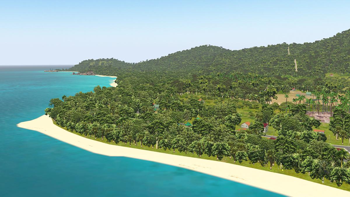
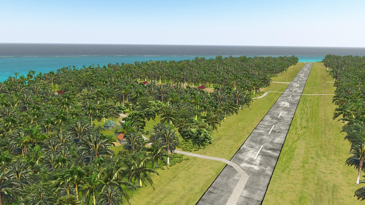
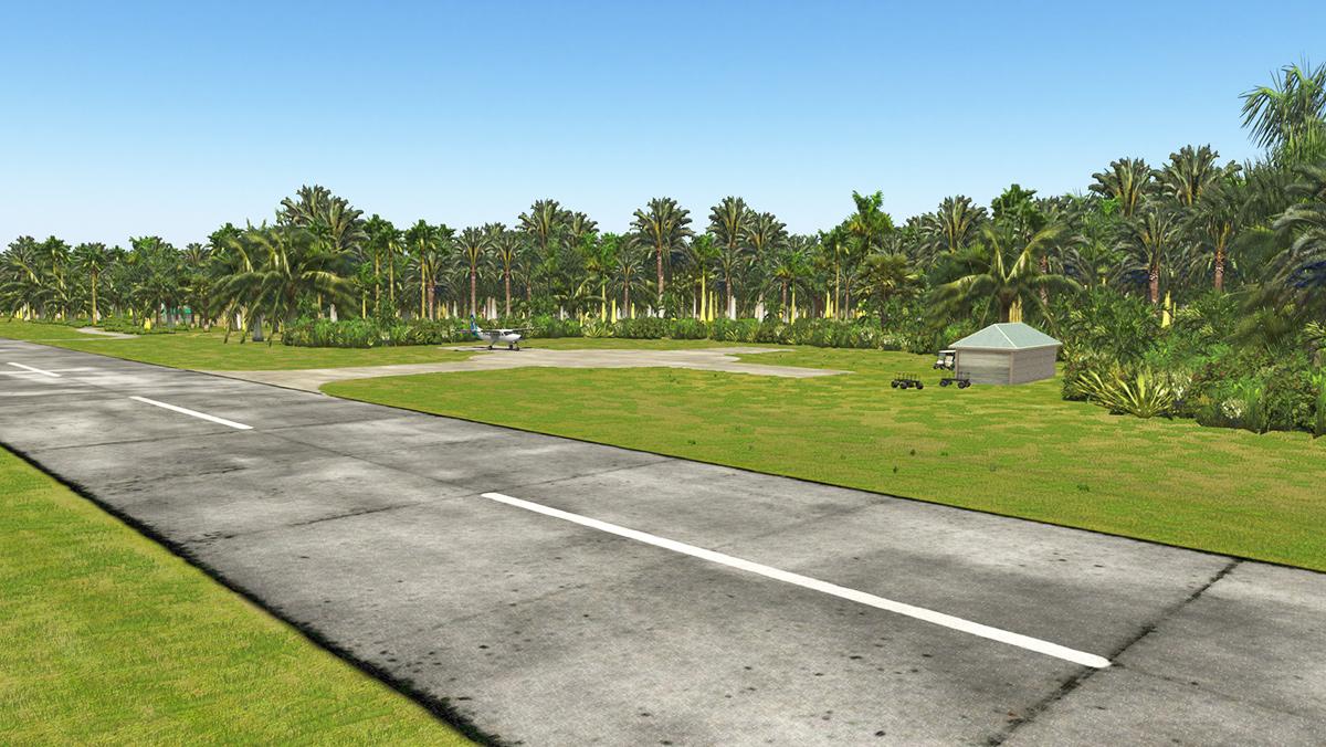
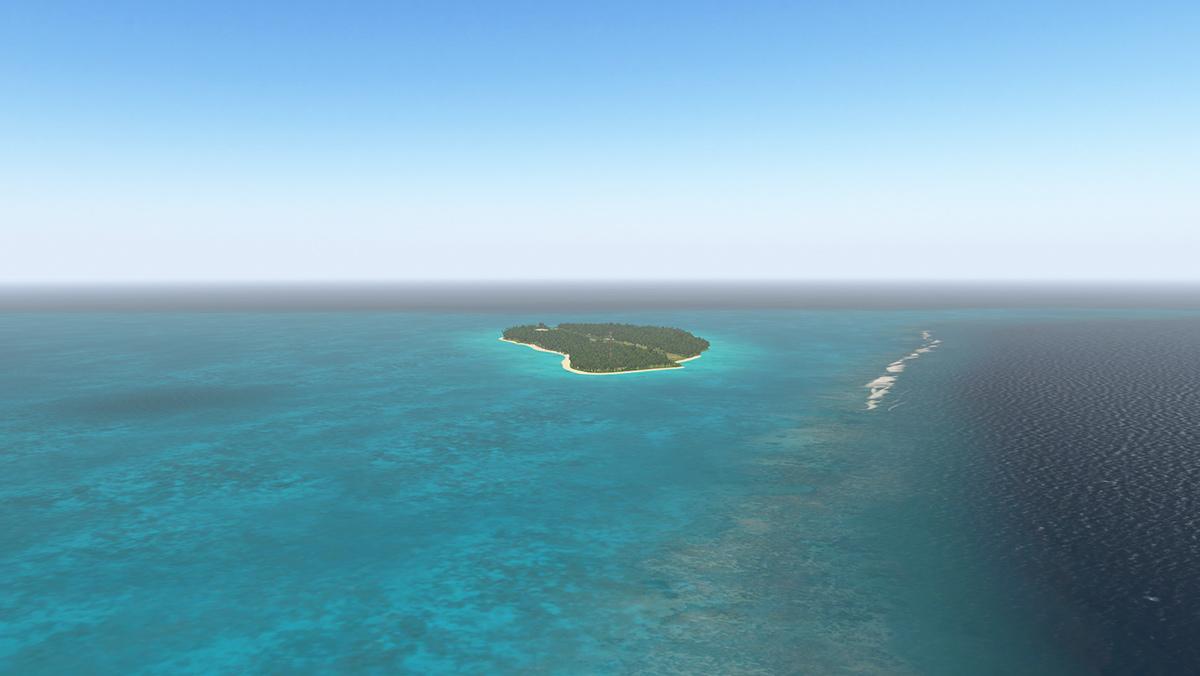
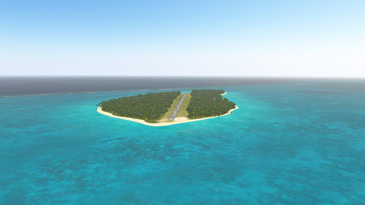
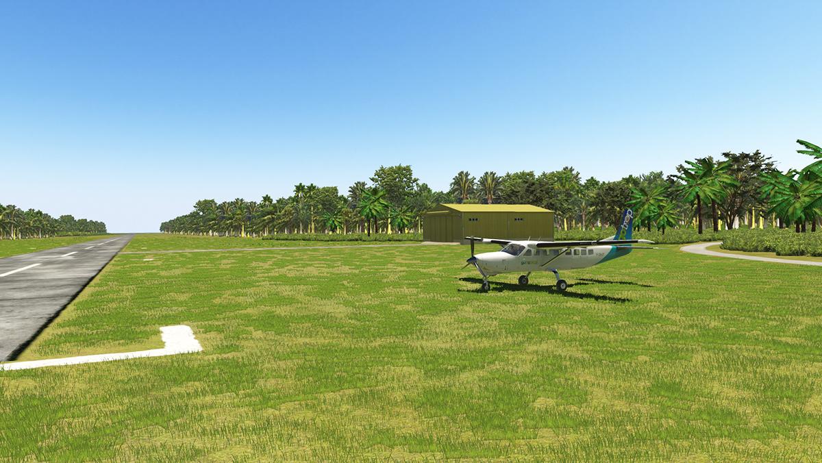
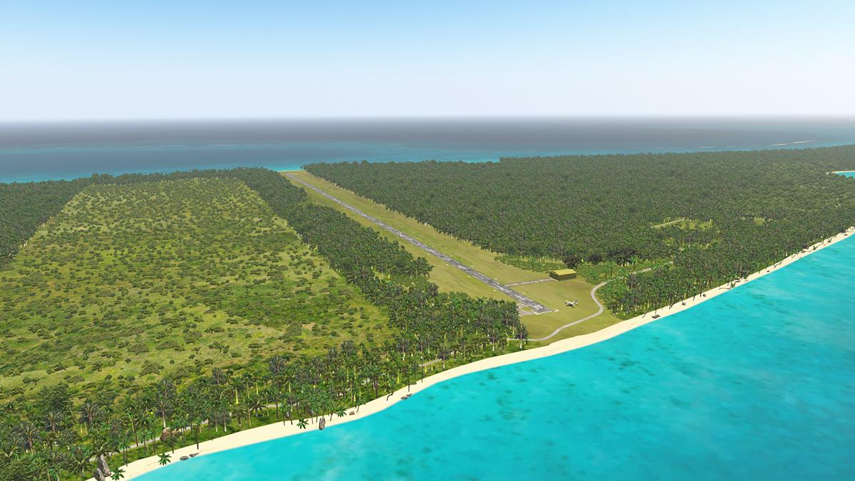
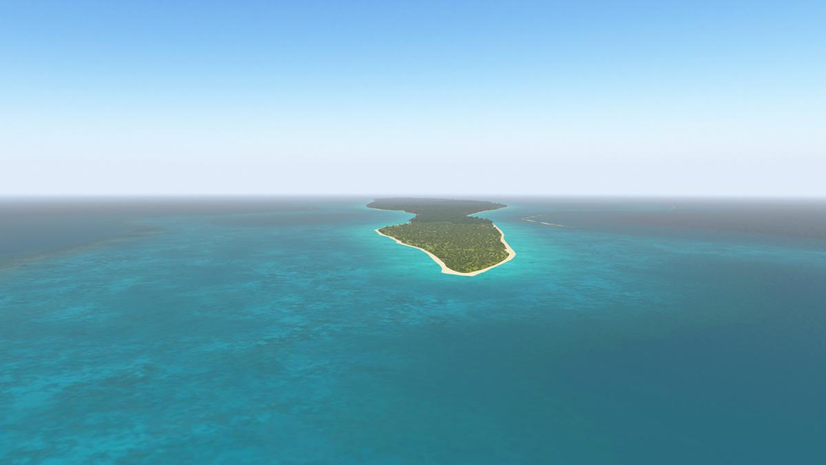
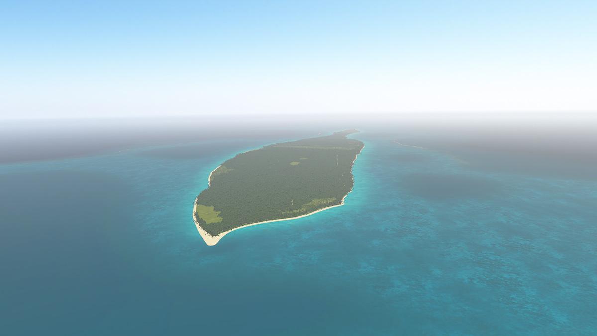
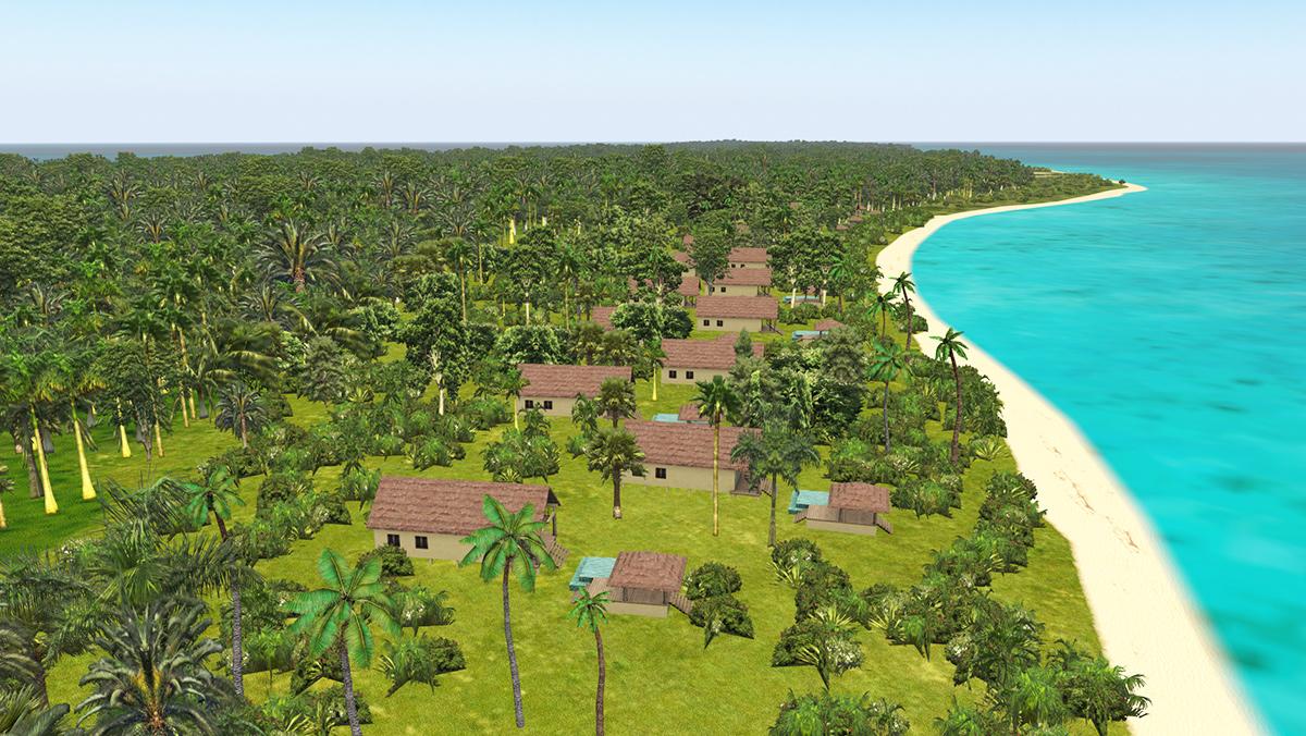
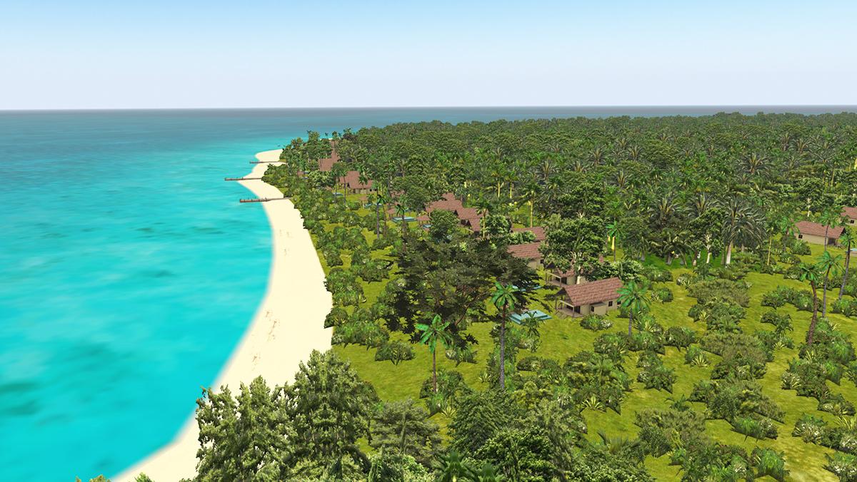
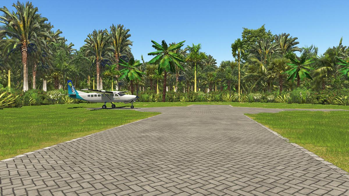
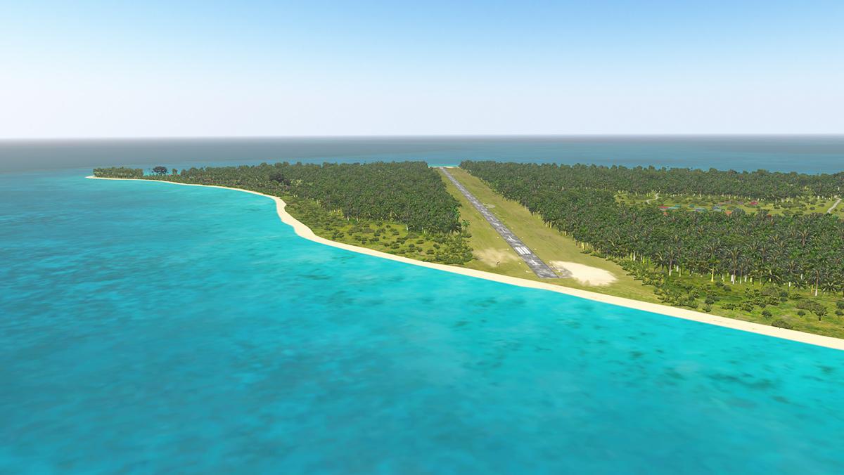
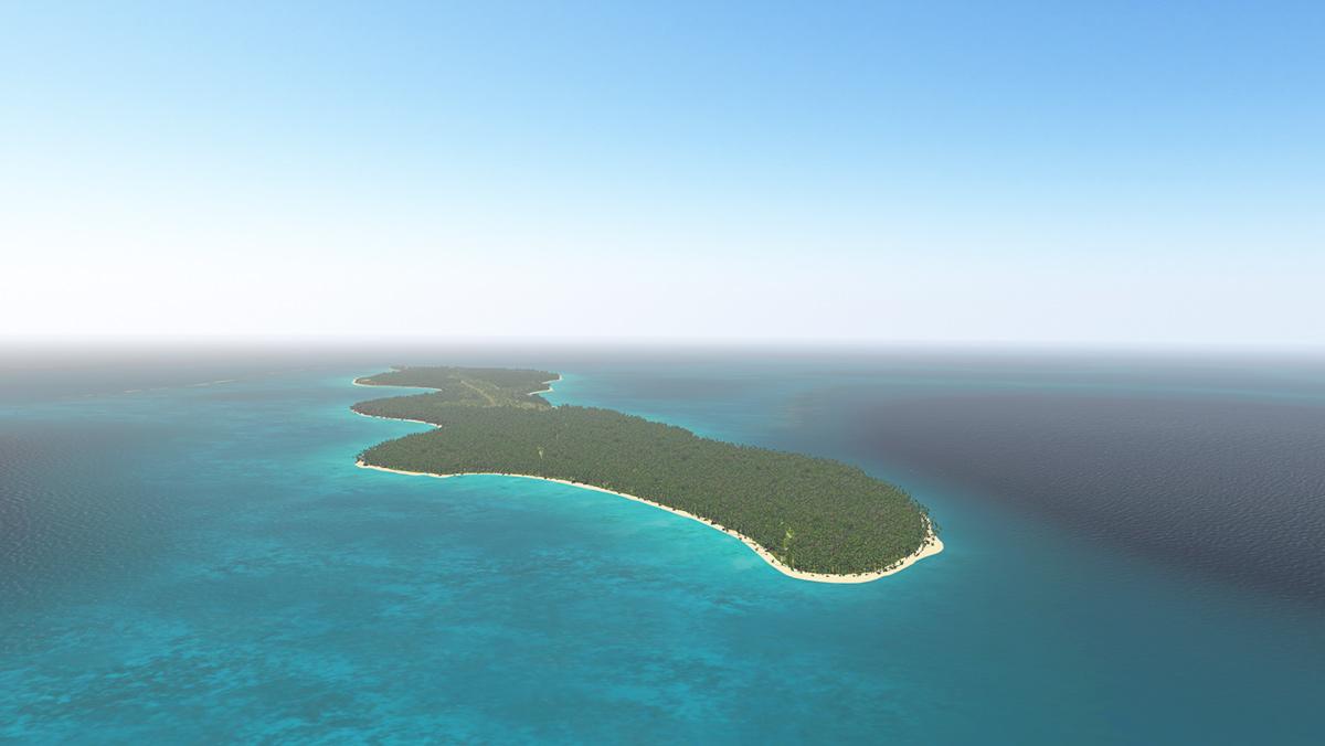
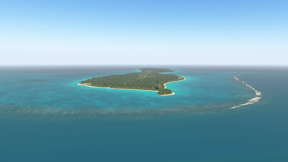
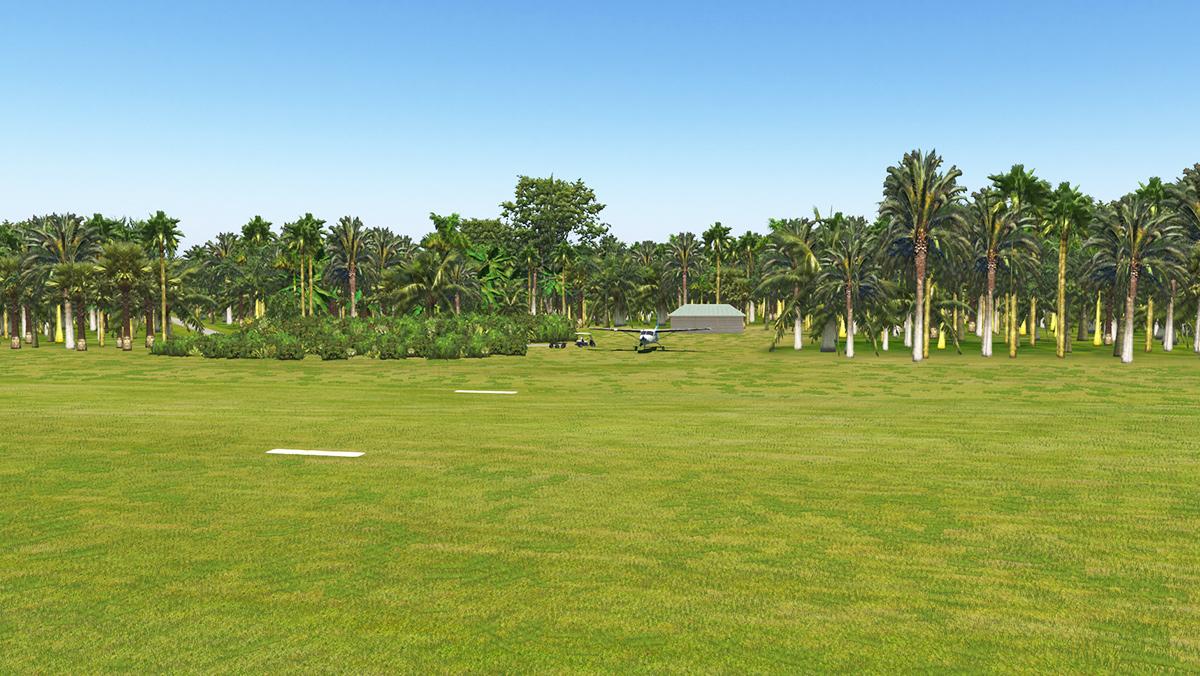
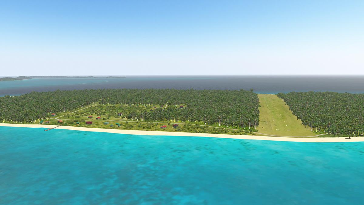
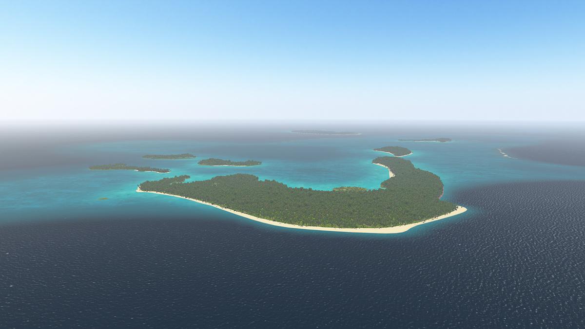
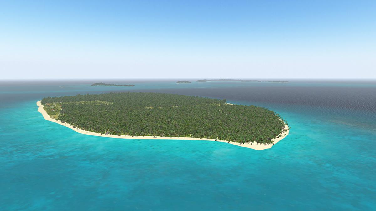
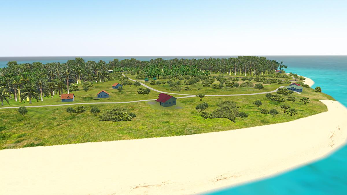
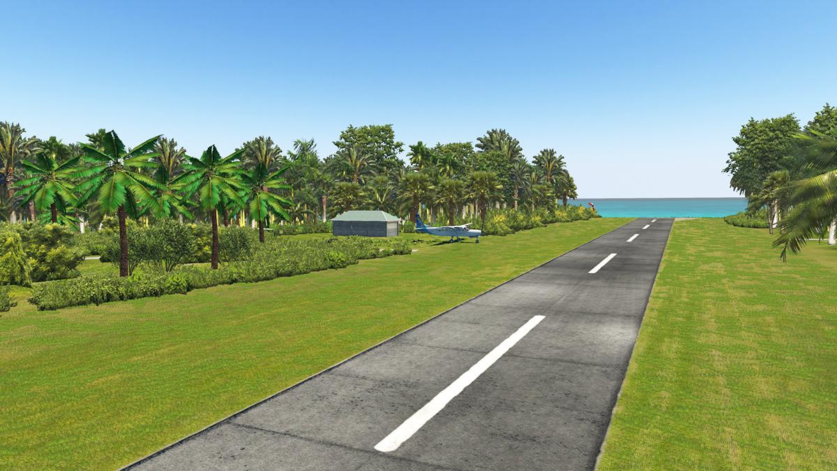
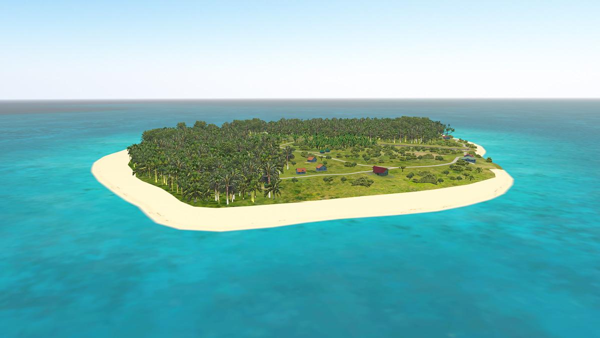
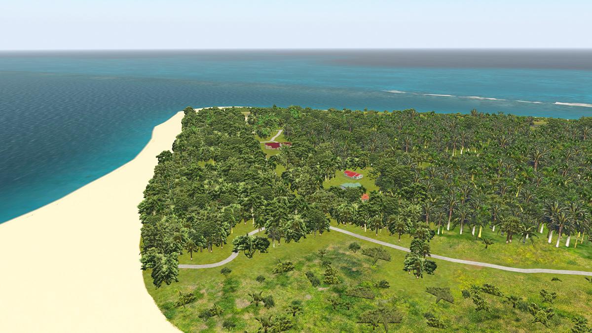
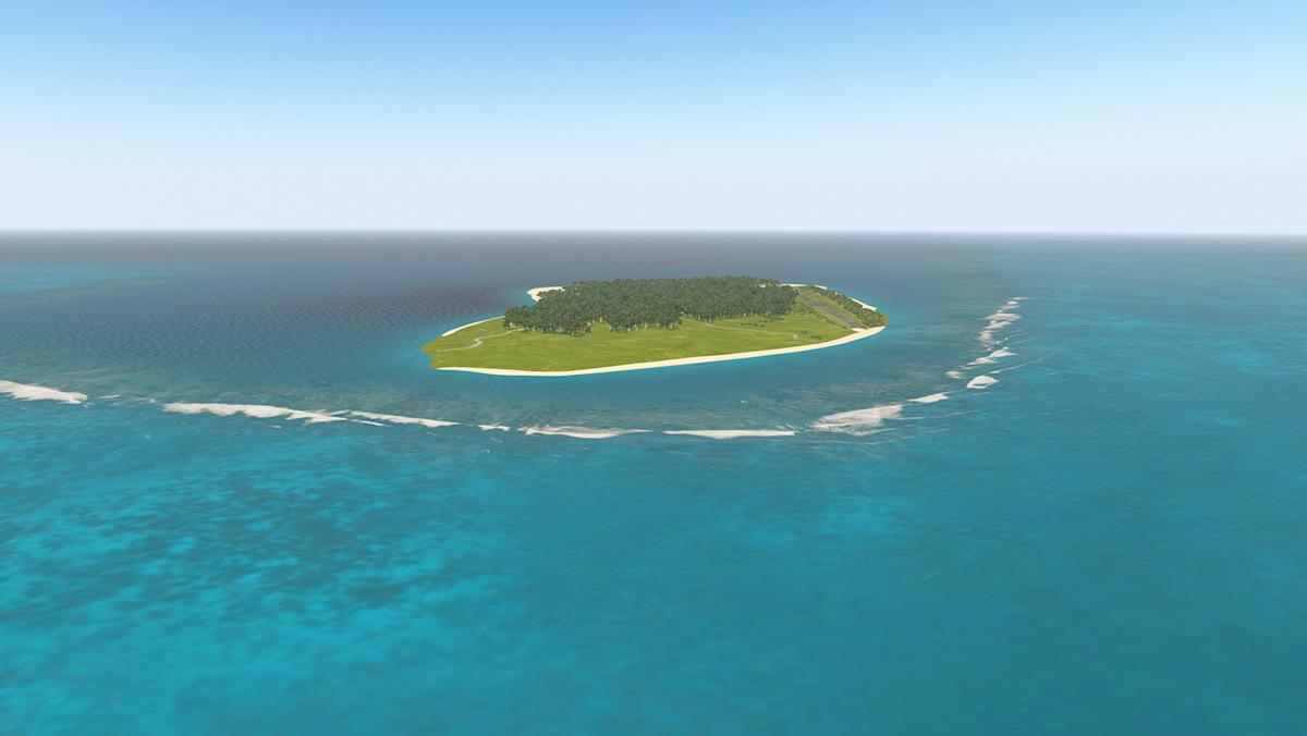
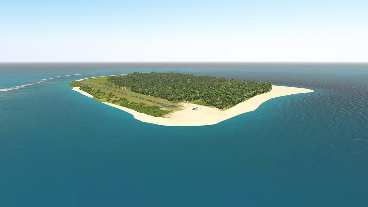
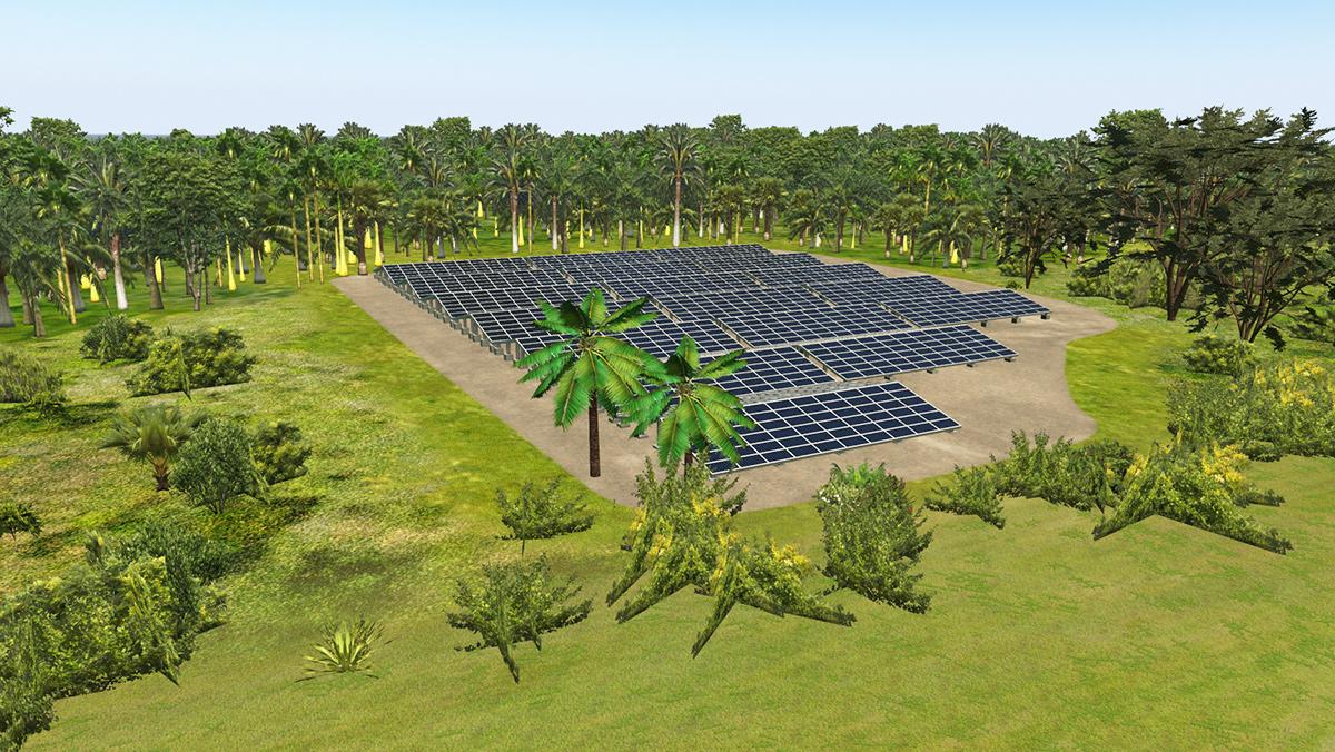
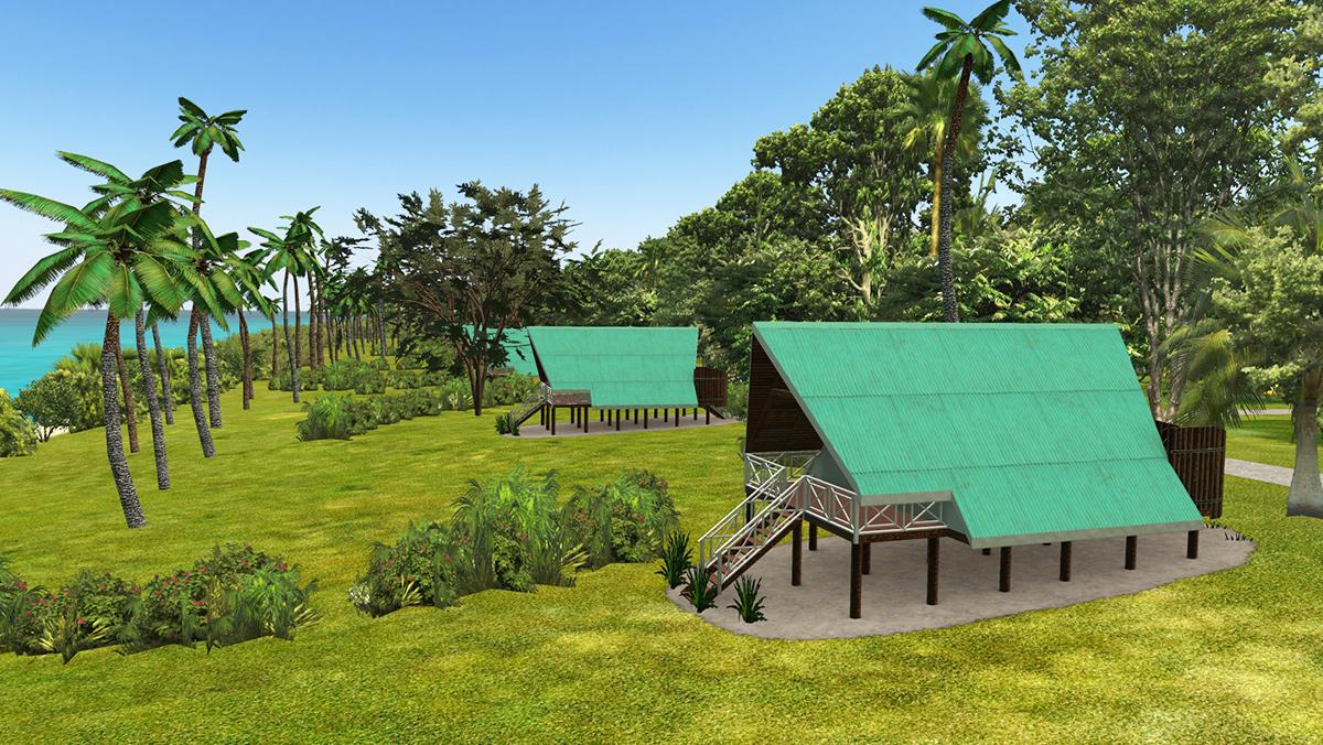
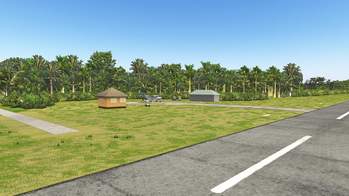
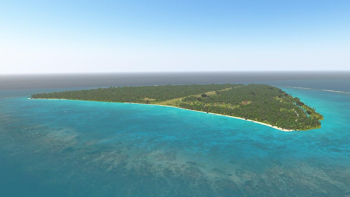
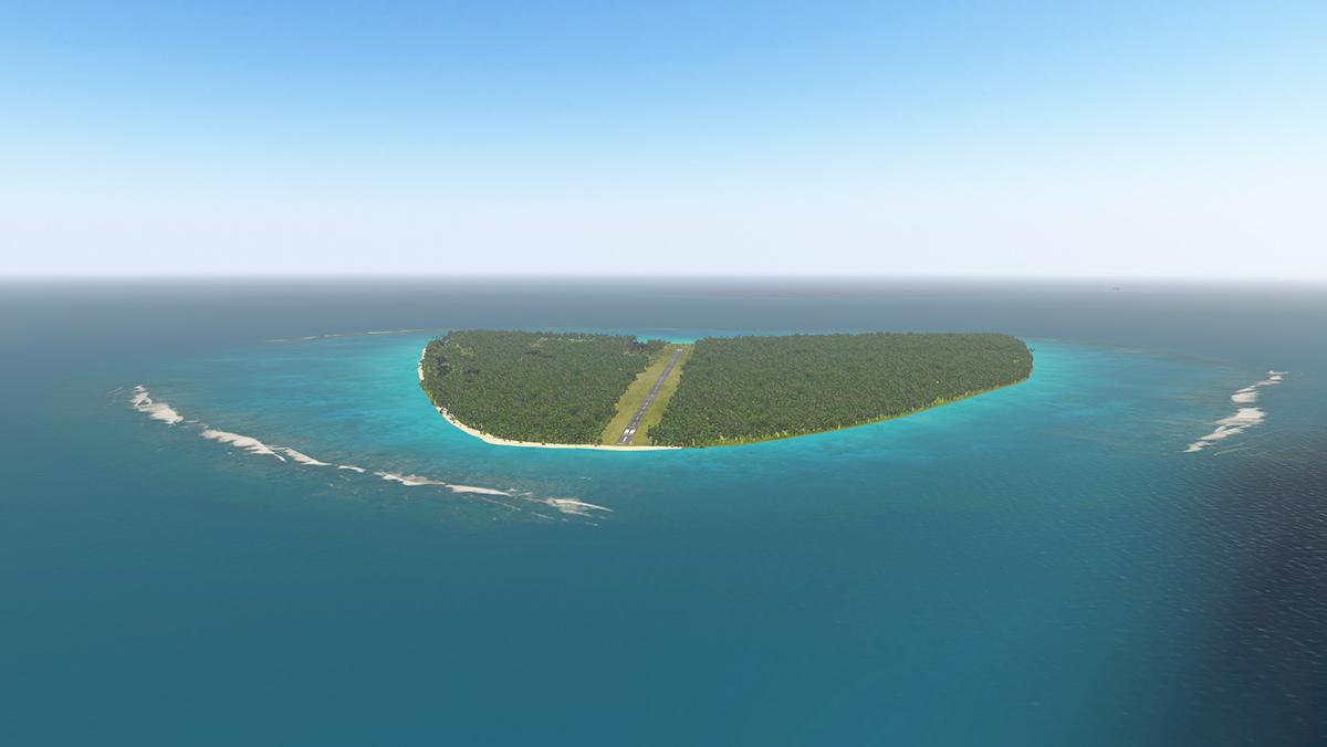
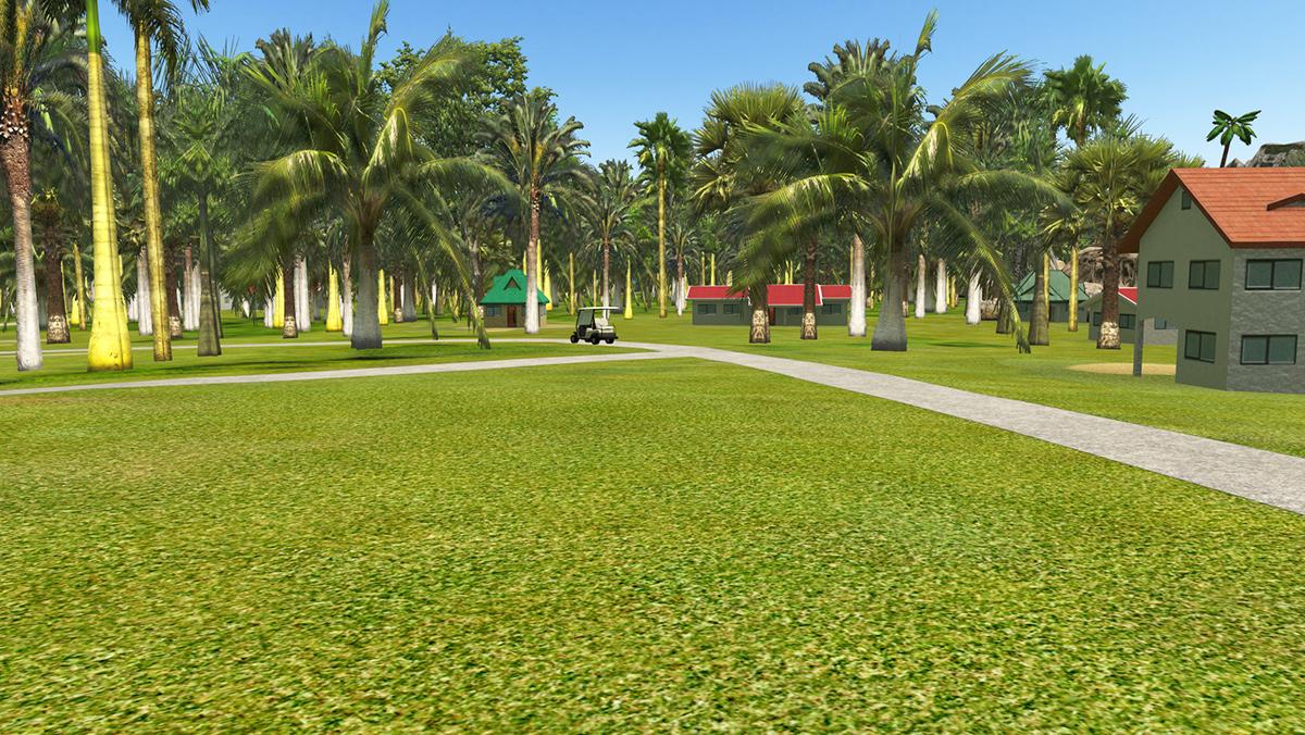
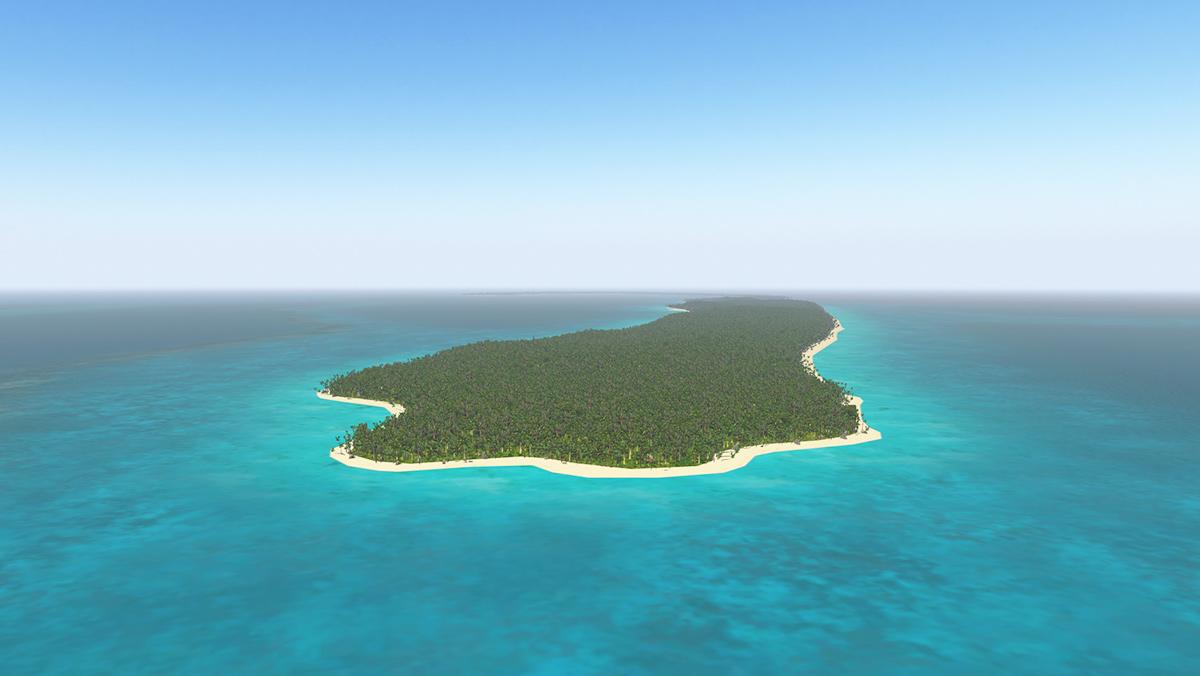
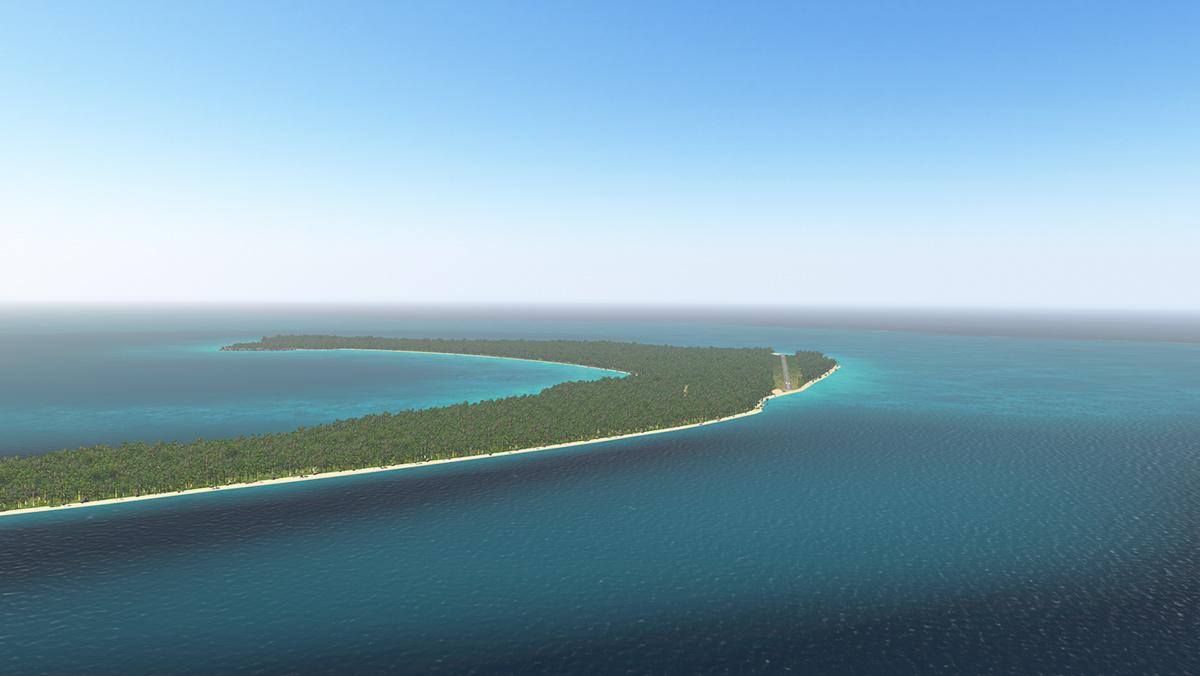
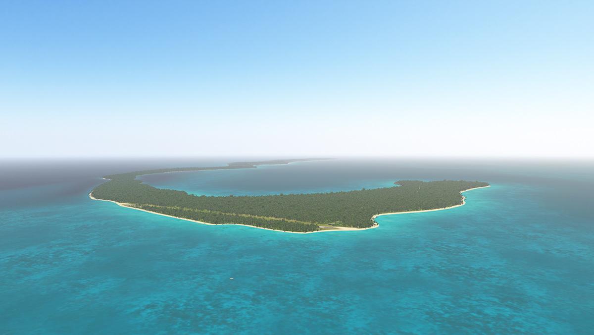
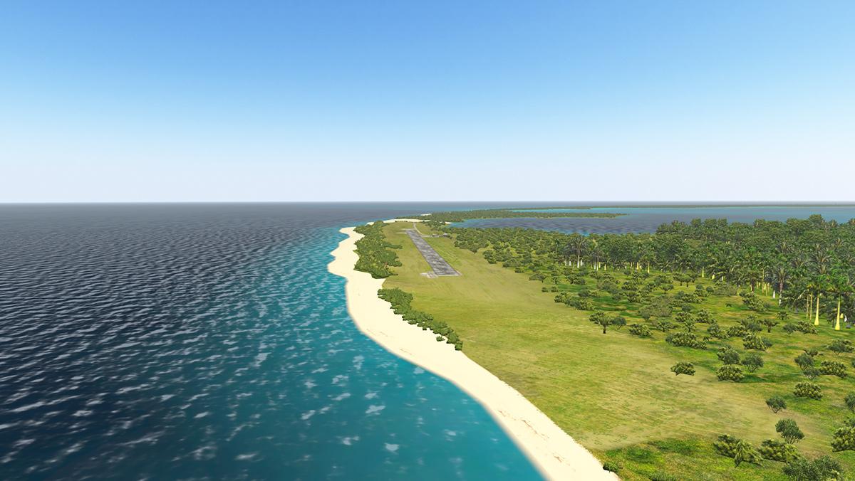
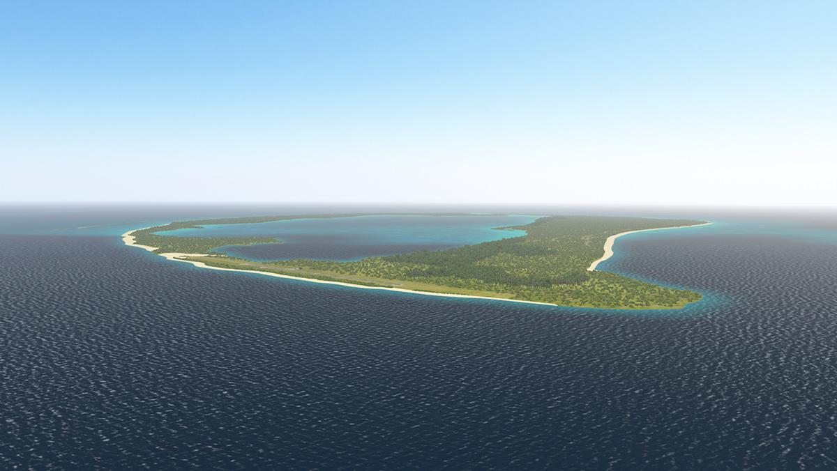
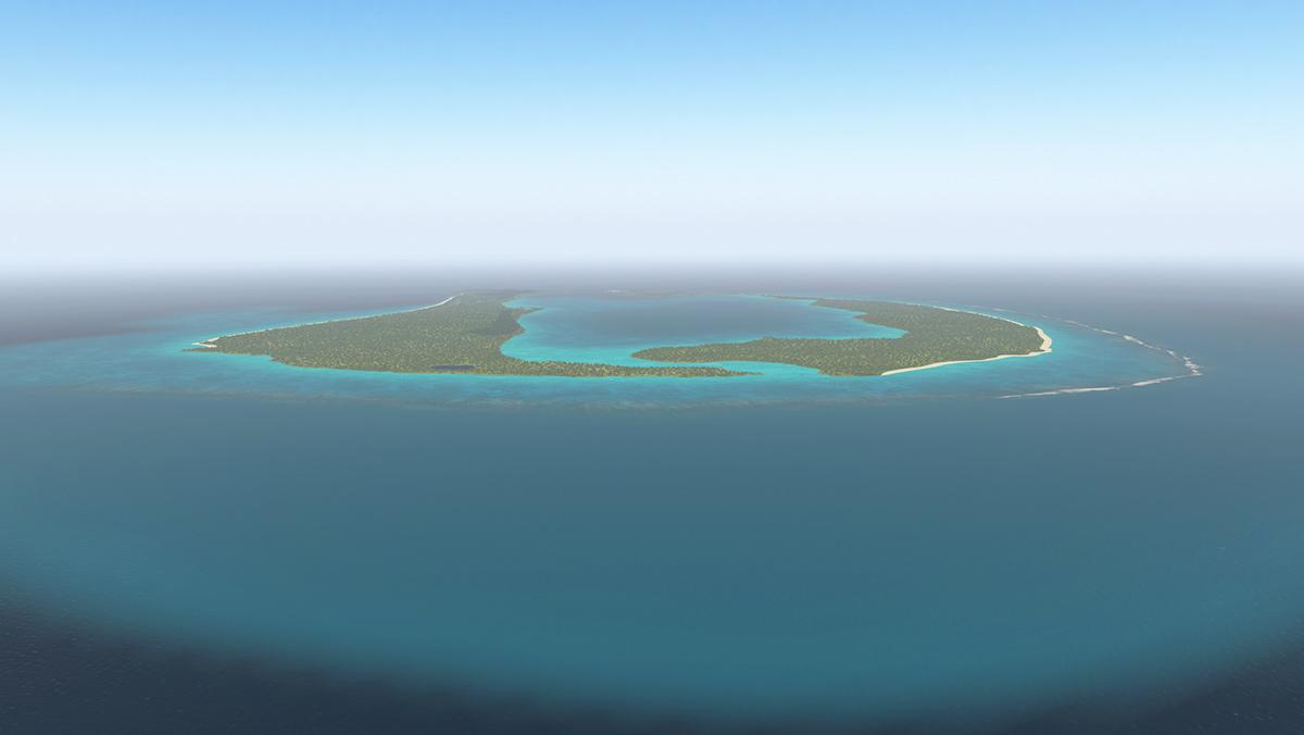
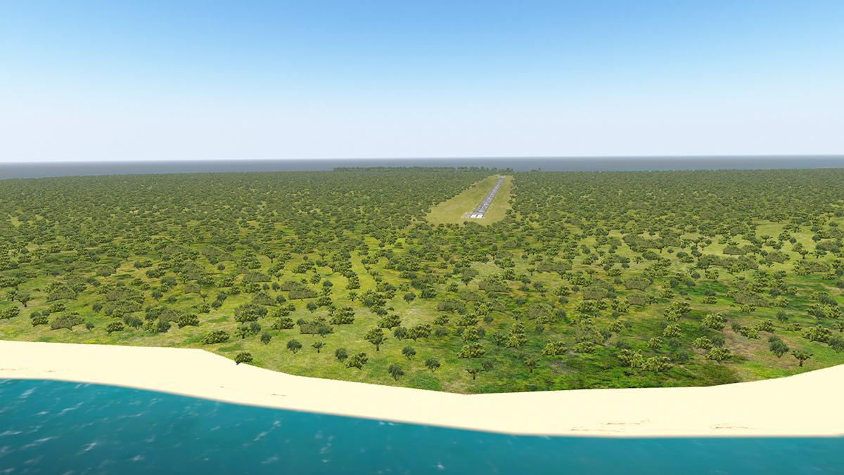
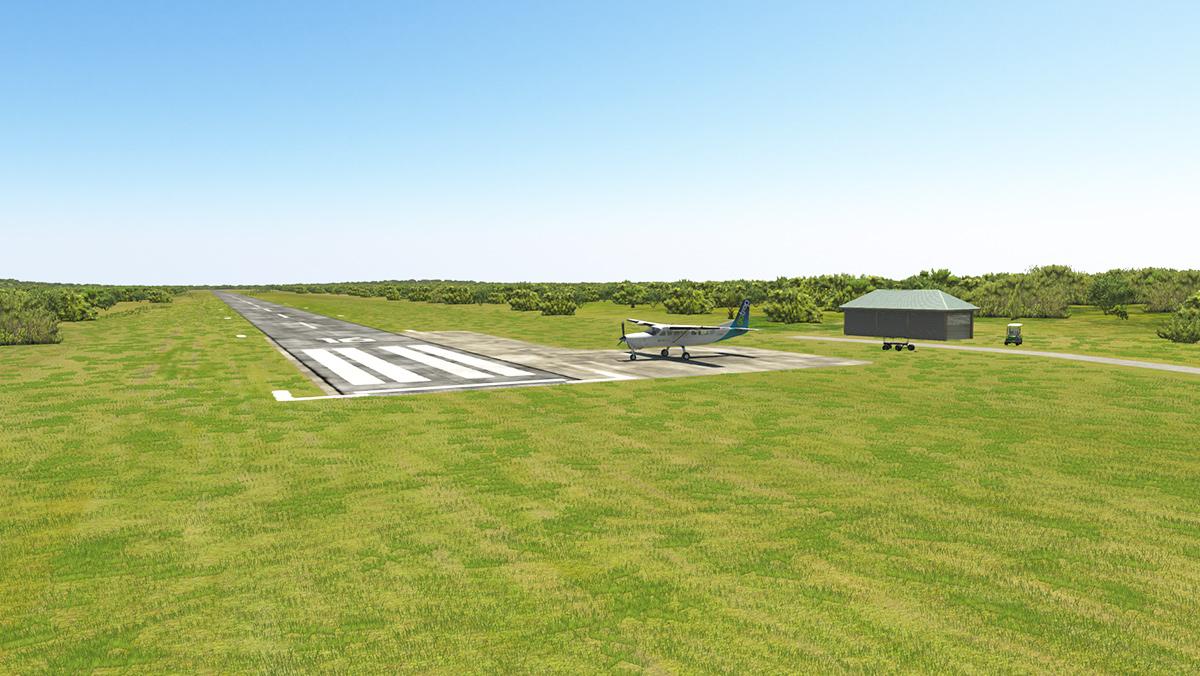
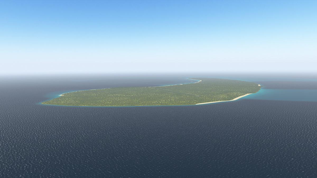
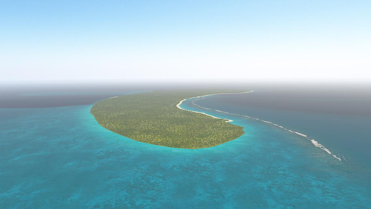
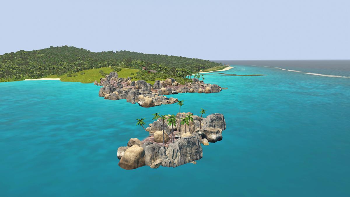
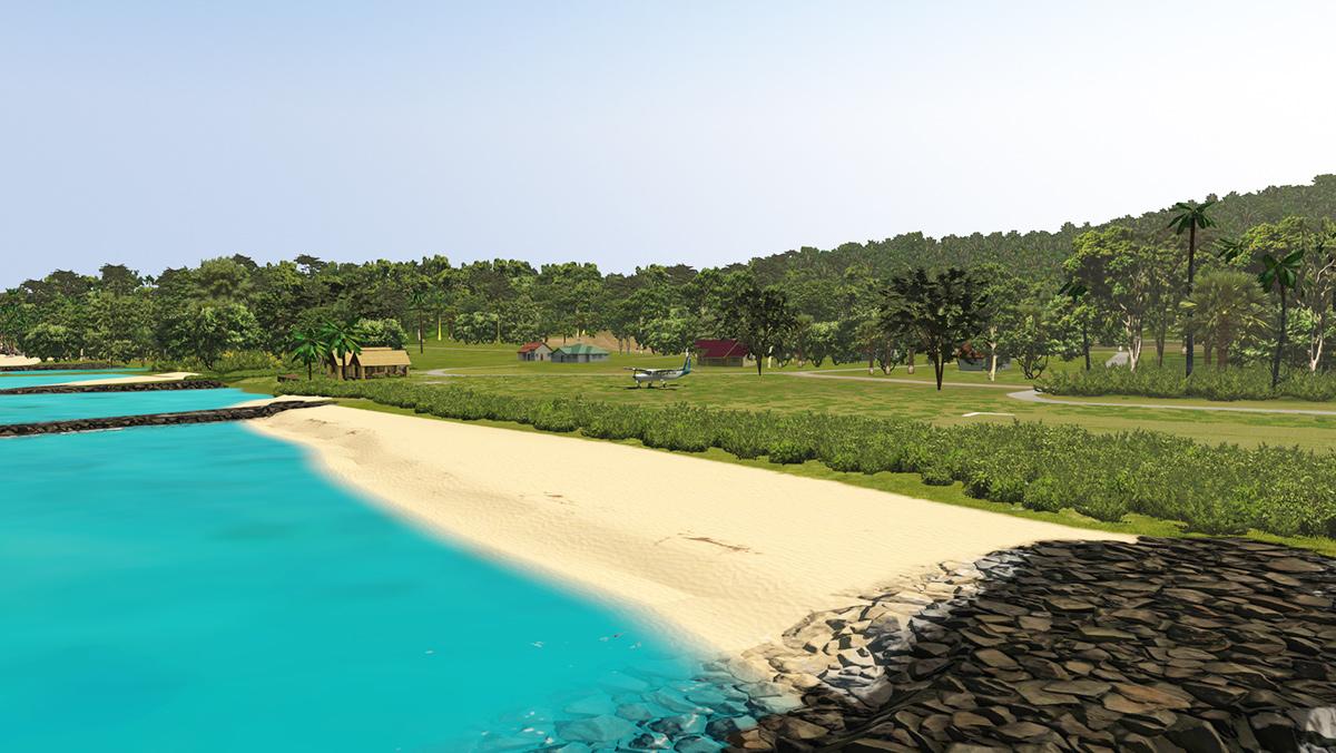
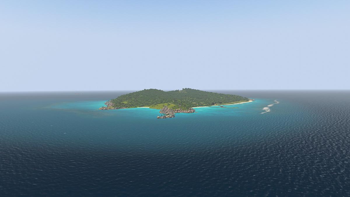
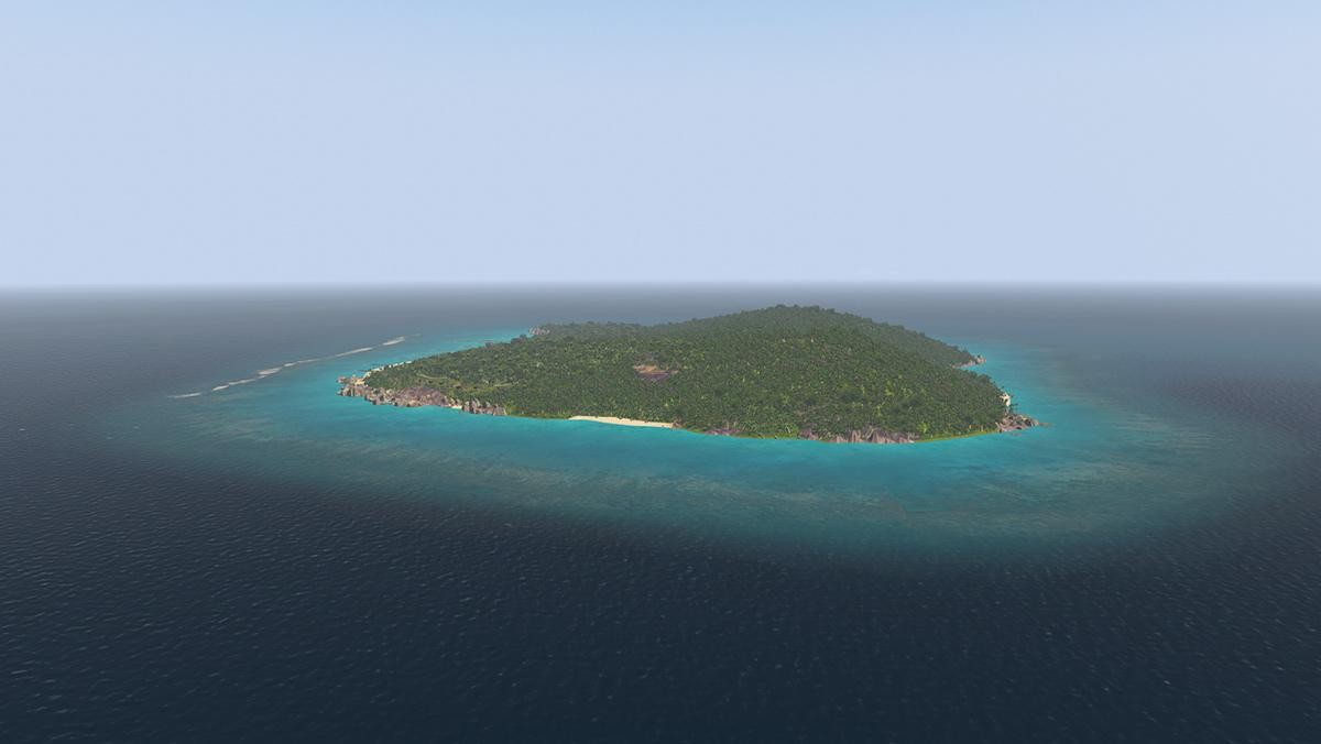
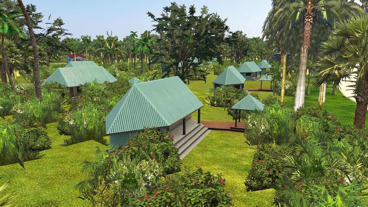
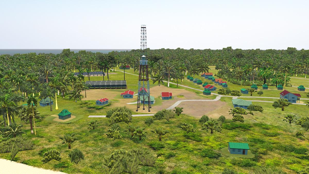
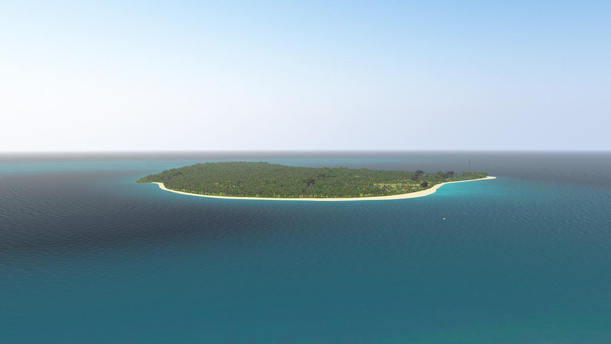
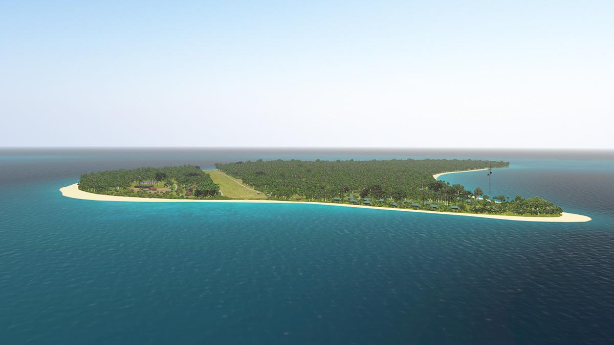
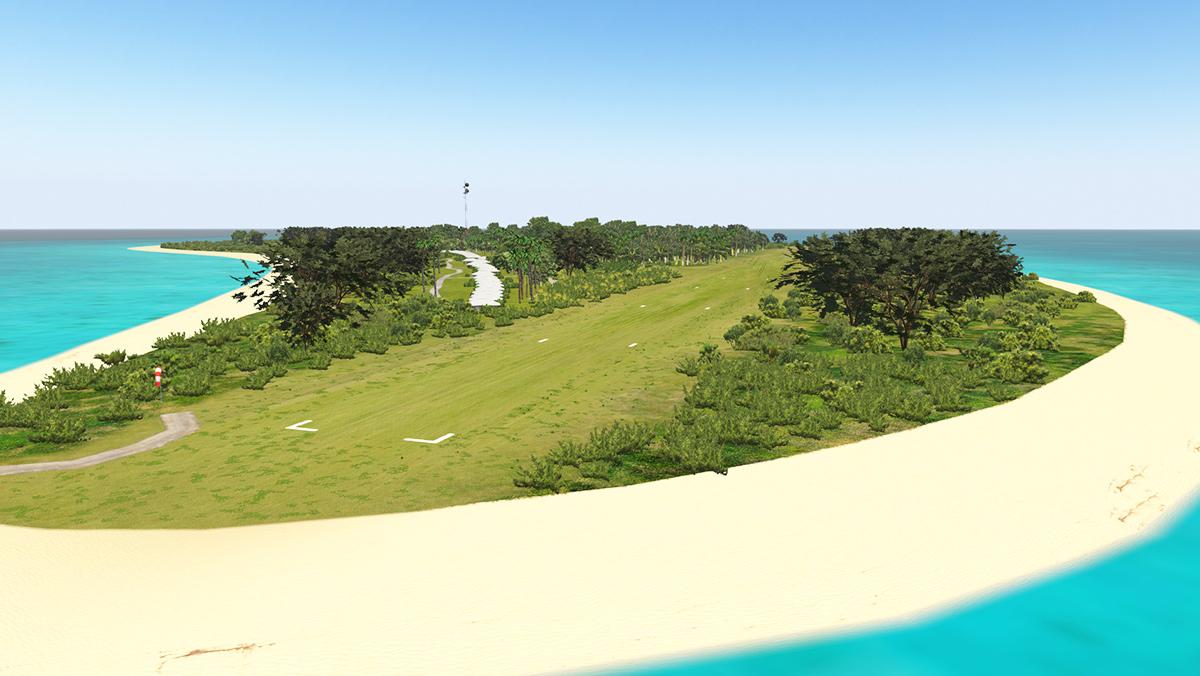
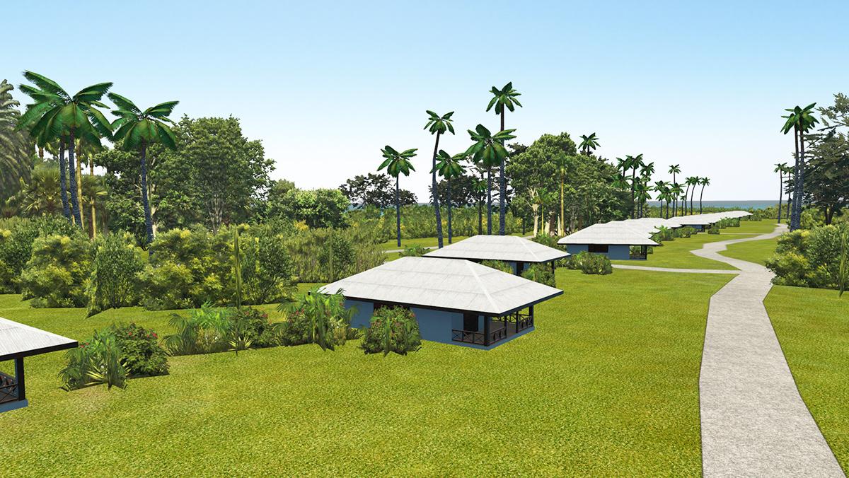
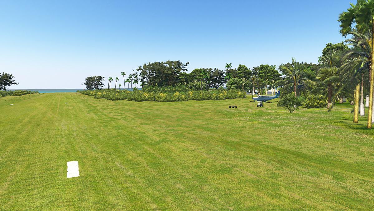
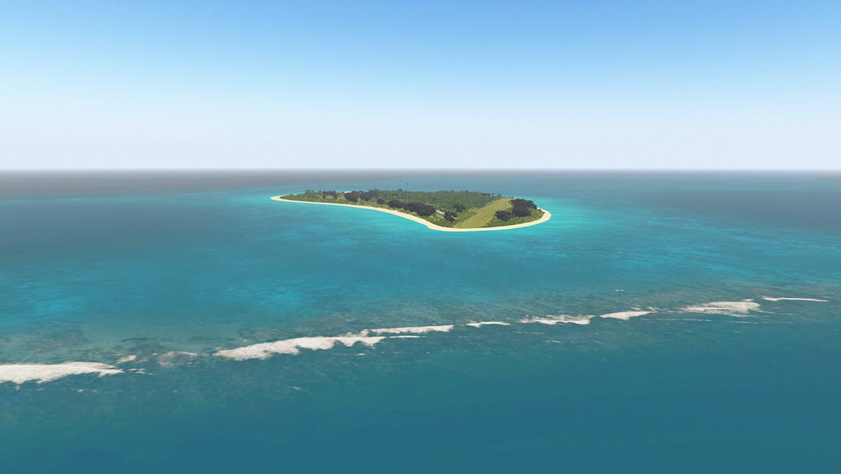
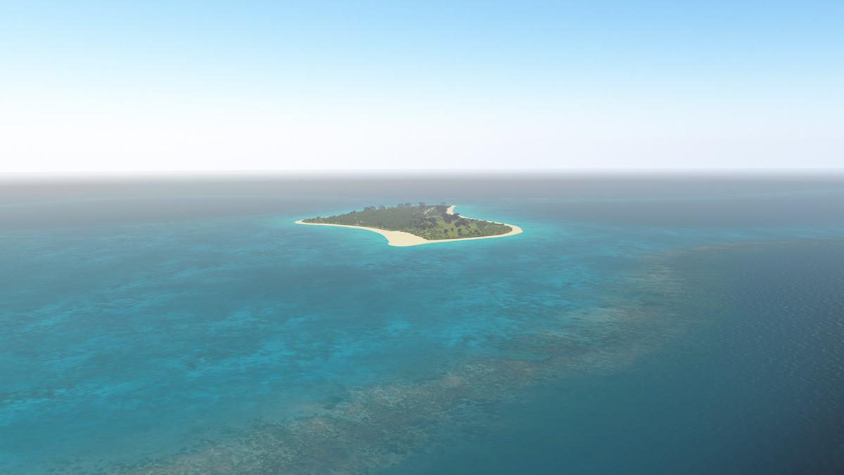
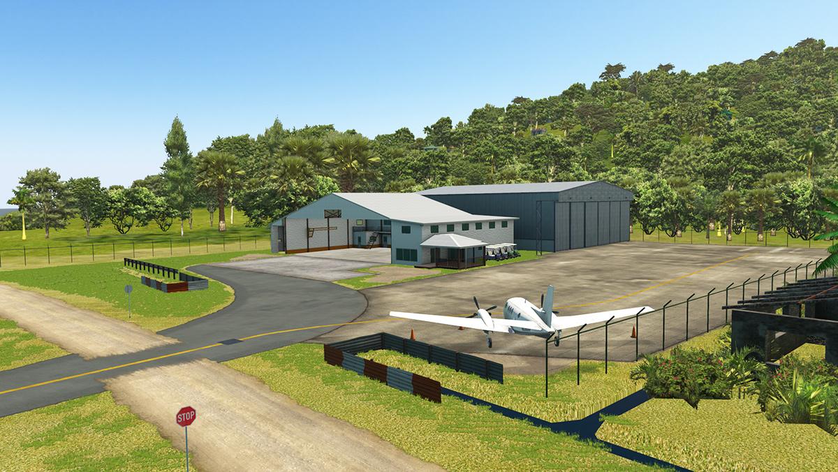
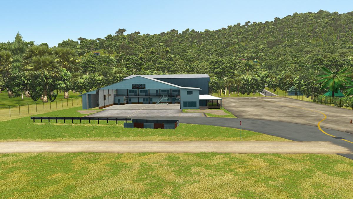
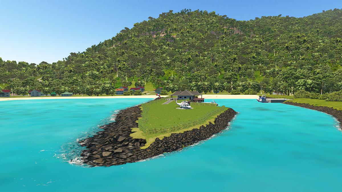
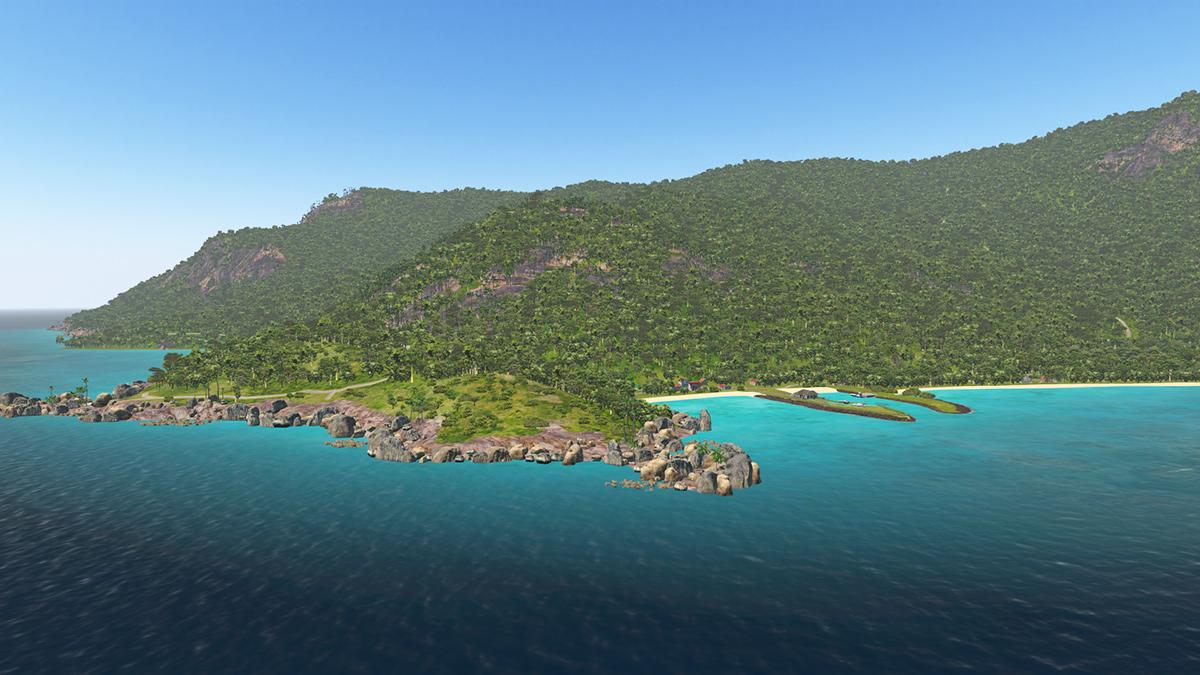
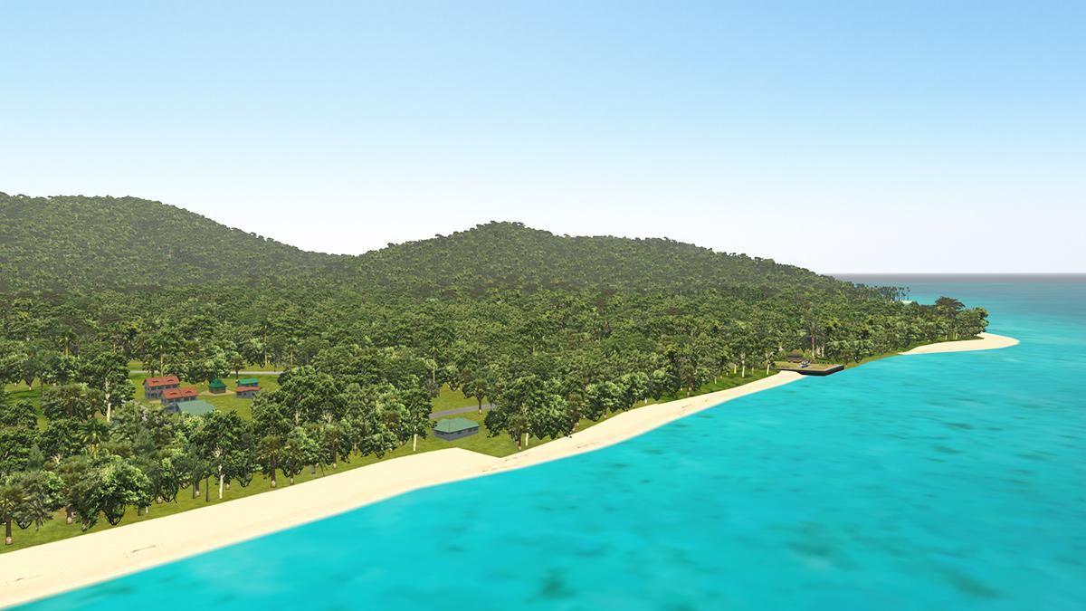
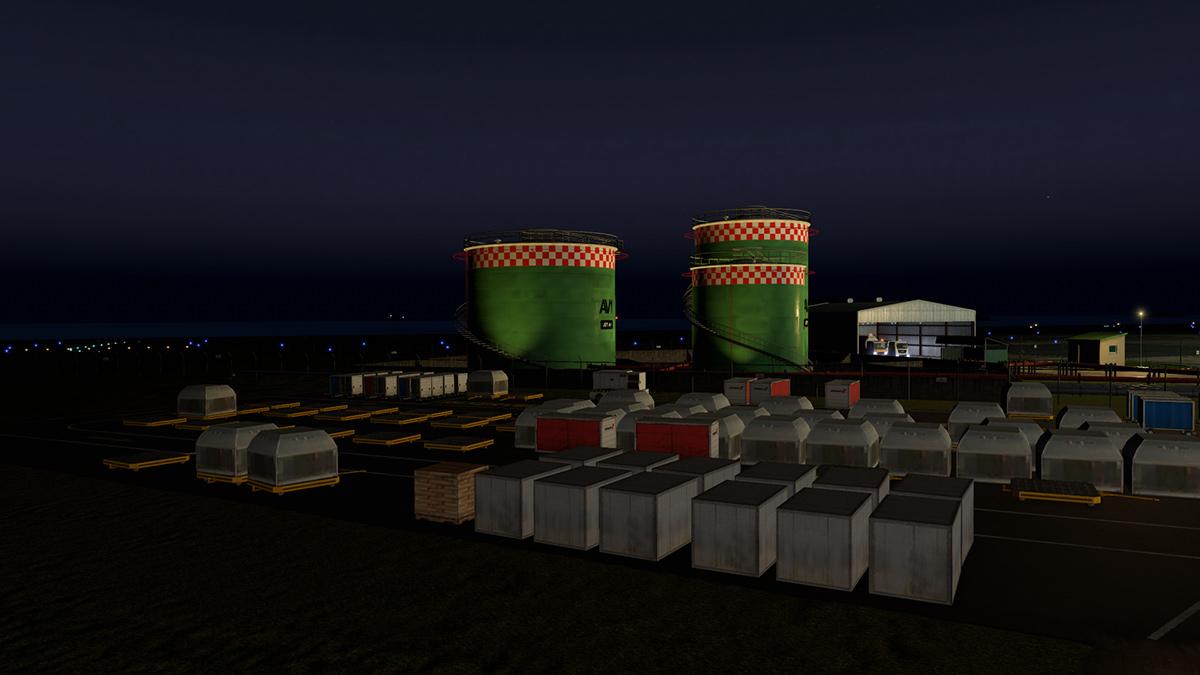
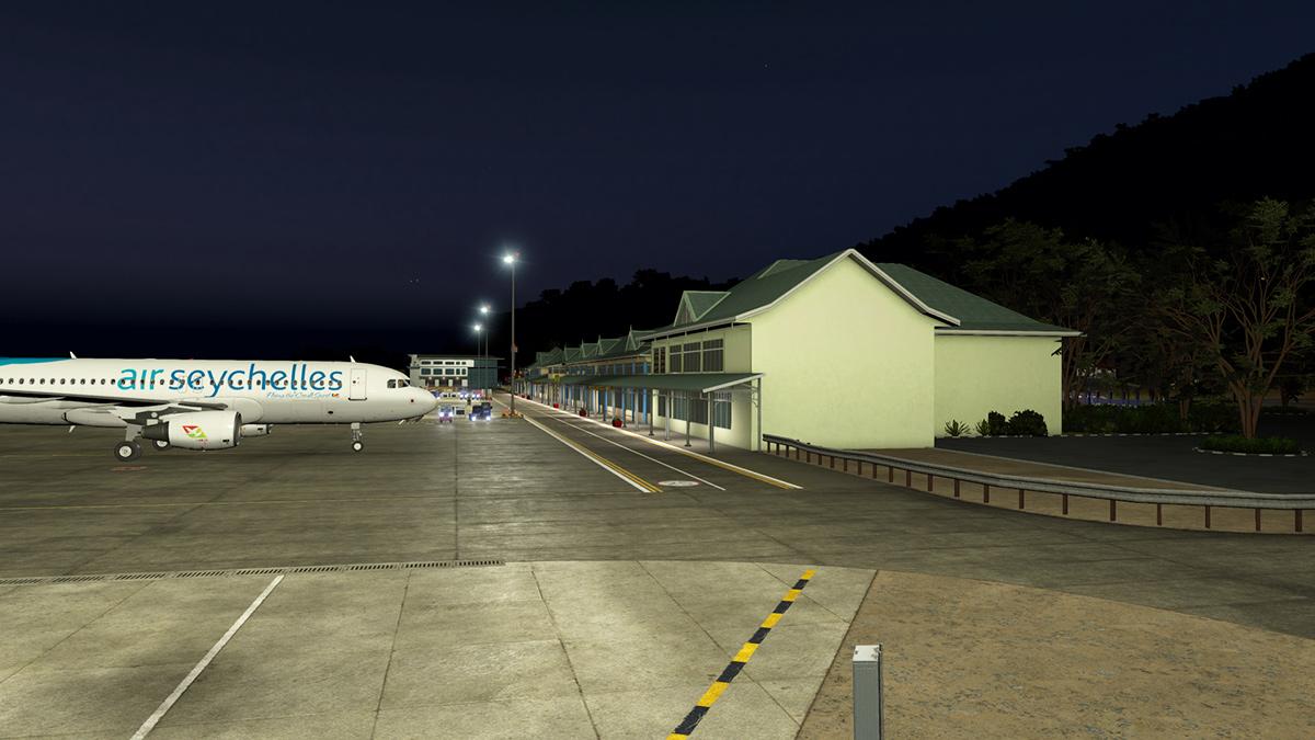
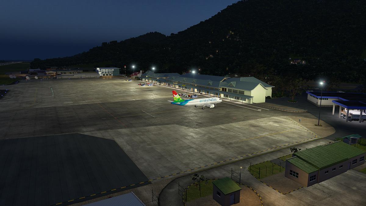
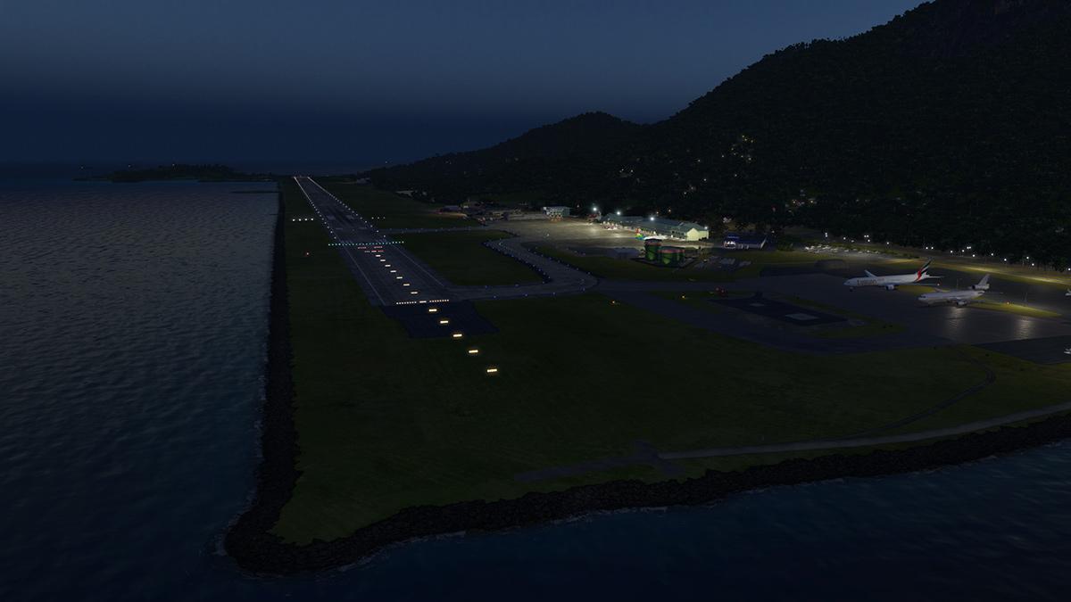
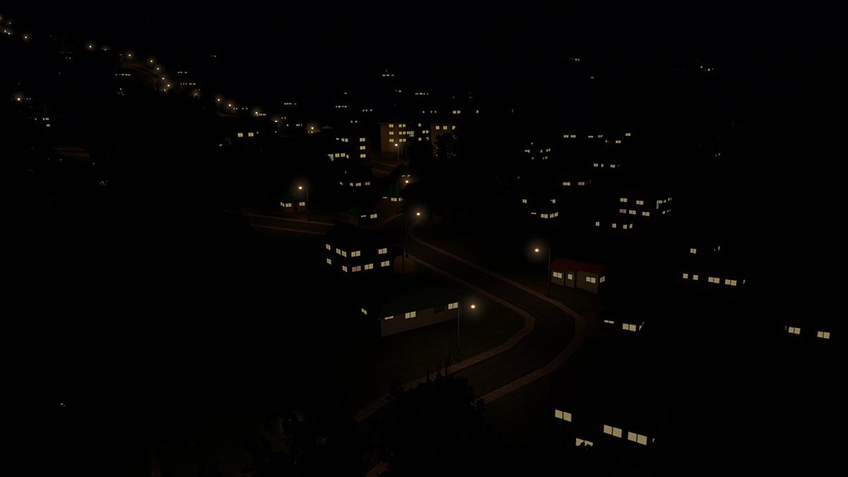
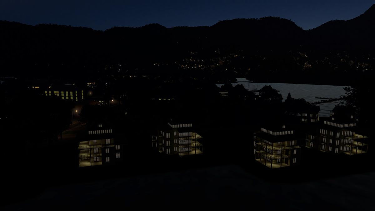
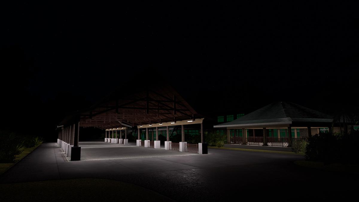
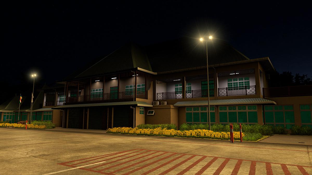
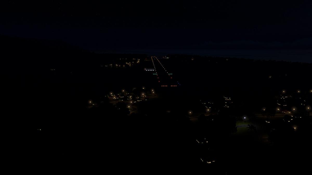
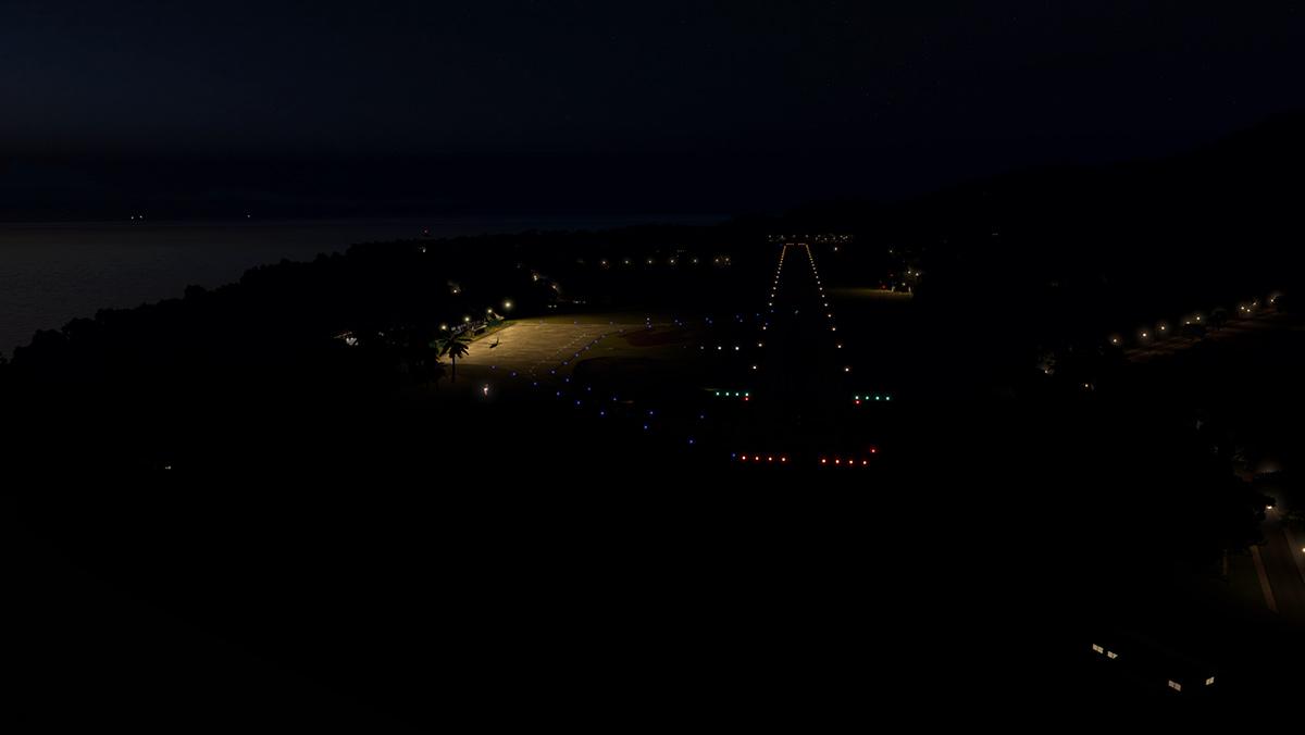
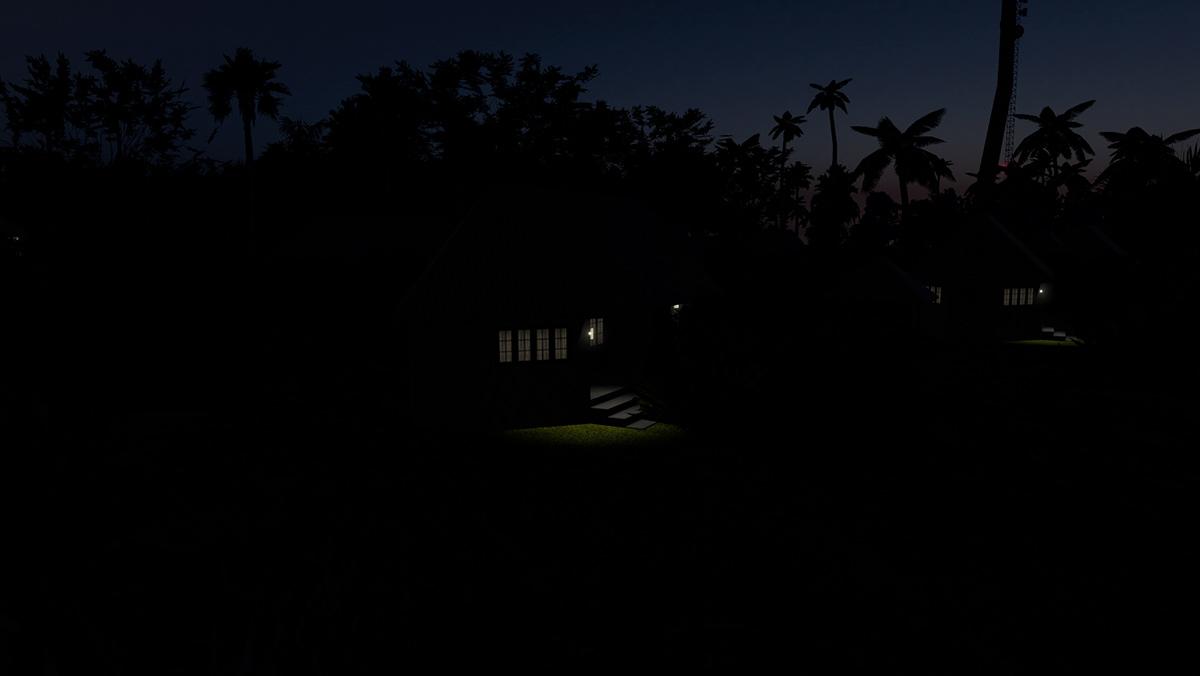
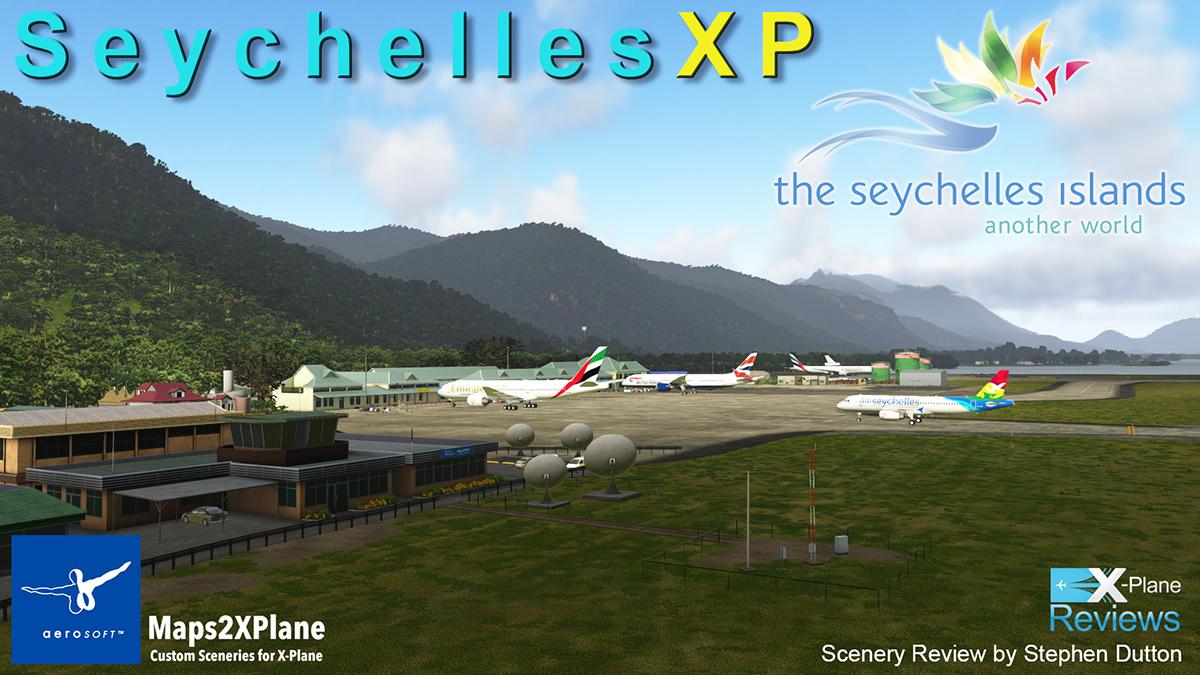
Scenery Review : Seychelles XP by Aerosoft - Maps2XPlane I love to be surprised. The biggest surprise scenery wise in 2019 was the release of Faroe Islands XP by Aerosoft, but created by Maps2XPlane. It was by all accounts an extraordinary scenery and even with some high quality competition against it, it still won my best "Scenery of the Year 2019" accolade. Basically the scenery had everything including a picturesque airport at Vágar, but overall it was the stunning high quality mesh landscapes were simply out of this world in detail and realism. I loved the scenery and to back up my love for Fareo, the scenery was then a frequent visitor on my routings for the rest of the year.... in other words I flew there a lot, and loved being in Fareo every single time. For any scenery to be that good, then it creates an even bigger issue, in that how can you top such an achievement, well we are about to find out with Maps2XPlane and with their next release in "Seychelles XP". In reality then although both sceneries are islands, then the Seychelles are about as black and white in context as you could get to the Faroe Islands. The Faroes are cold, wintery and bleak, were as the Seychelles is all tropical kaleidoscope waters, palm lined beaches and expensive huts over looking lagoons. Faroe, could be noted as remote in being situated high up in the North sea, but compared to the Seychelles they could be a set of islands just off shore with easy connections to Scotland, Denmark and Norway... and even Iceland at a push. (Navigraph) The Seychelles however are a very different set of islands. Positioned in the western Indian ocean, Seychelles consists of an archipelago of 115 islands. Its capital and the largest city is Victoria situated on the island of Mahé, which lies 1,500 kilometres (932 mi) east of mainland Africa. Other nearby island countries and territories include Comoros, Mayotte (territory of France), Madagascar, Réunion (territory of France), and Mauritius to the south; as well as the Maldives and Chagos Archipelago to the east. The Seychelles in X-Plane terminology is really in being "absolutely nowhere". You are at least a 3 to 4 hour flying time to the nearest decent X-Plane scenery and Madagascar is the closest, but how many X-Plane sceneries do you have in Madagascar, I don't think I have one. Best choices are either Dubai or Johannesburg, I picked Jo'Burg, but that airport is still 2081 nm or 4h.38m flying time from Mahé near the capital city of Victoria. So for X-Planers then the quick hop or short flight to the Seychelles is not going to be a simple morning or afternoon flight, I know because I am now flying that long route, and it is a full day's flying to get to the central part of the Seychelles. Air Seychelles flies to only 4 international destinations direct in Johannesburg, Mumbai, Mauritius & Antananarivo (Madagascar) using Airbus A320-200 equipment. Range of the A322 is 3,300 nmi (6,112 km), but the issue is that if you get into trouble and want to divert, then you don't have a lot of choices of diversion airports with Dzaoudzi–Pamandzi International Airport (IATA: DZA, ICAO: FMCZ) the closest... when you fly over Dzaoudzi, you really then feel exposed going out and into the expanse of the open Indian Ocean in only a A320. But you have to admit in being this far out, and in so far from anywhere else it does create a sort of excitement, a hope the travails to get all the way out there is worth the trip... but that does also create a certain expectancy of the scenery to live up to as well... in other words "it had better all be worth it". First sign of the custom scenery was actually about 230nm before getting to main group of islands, this is Alphonse Island, and about 30nm before waypoint OKLAB... ... the significant point here is the tropical reef view from above, and it looks excellent even from 35,000ft. As the cloud cover clears you can see quite a few of these excellent reef islands... here is Desroches Island, D’Arros Island and a lot more.... and I admit I was serious impressed by the scale of the scenery as the most remote scenery provided is Assumption Island, and this island is located 1.135 kilometers southwest of the capital on Mahé, the main Seychelles Group. A full map of the scenery coverage is provided by Maps2XPlane. A note is required here in that the scenery does require you to insert new mesh data in the X-Plane/Resources/map data/water/ folder (This is the MAIN X-Plane resources) folder, so be aware that it can be overwritten if you do an X-Plane update. It also begs the question in why Laminar Research don't provide the same tropical reefs as part of the default scenery, this would be a huge enhancement to the simulator world wide from the aspect of that view of Alphonse Island,? Finally after a flight time of 4h 30m we get our first look at Mahé, and the main Island itself... Seychelles International Airport (FSIA) or Aéroport de la Pointe Larue in French, is the main international airport of the Seychelles and it is positioned on the northeast of Mahé, and it has one 13/31, 2.997 m, Concrete runway. The Approach to SEZ is excellent, with the coral reefs and the tropical mountainous regions are spot on, I live in Queensland, Australia which is also a tropical zone and the feel here is exactly that we have in the far north (Qld) and Pacific Islands. 13/31 runway is worn concrete with asphalt headers and is also perfect... very impressive. After all those hours in the air, I was very, very happy to feel the wheels touch that concrete. Runway and taxiway surfaces are really good, and dynamic PBR reflective as well, great for those tropical storms that you would get way out here. Guiding me in is a SAM (Scenery Animation Manager, Plugin required) Marshaller... ... but it didn't feel quite right? he guided me right when I was dead straight on the line, and parked me up very nose forward and even past my ground parking marker... my nose was slightly more forward than the other parked aircraft as well? Seychelles International Airport / SEZ By international airport standards then SEZ is very small, very islander in design and detail. With just one terminal building with six gates, and three to the side for domestic services (i.e. small prop aircraft). ... I love the fuel depot and high quality detail on the storage tanks, and they do dominate the scenery. Airside and Landside detailing is very good as so is the local buildings, airport infrastructure is also well detailed with fine detail and local signage. Note the satellite dishes on the runway edge. There are two other general aviation areas at SEZ, one about a third down the runway and another with an open hangar at the threshold of runway 31 for the Zil Helicopter base... All round FSIA's detail is very impressive, but note also the quality mesh with the rocky outcrops above the airport... There is another remote parking area by the runway 13 threshold, and it has a few static aircraft, but it is a great area to park away from the main ramp areas for both large, private jets and local general aviation... ... Seawalls and grass on the field are also well done, so as an airport scenery by itself then SEZ is really, very, very good. Victoria and Mahé The Seychelles capitol in Victoria is 11 kilometres (6.8 mi) northwest of the airport. And between the airport and Victoria is a large tourist resort. The Seychelles rely heavily on tourism as it's main income, so you will find a lot of tourist focused areas all thoughout all of the scenery. This is the Eden Island resort and the replication of the resort and marinas is very good and highly detailed. Overview of Victoria will see a load of custom buildings, there are no default autogen here as every building is custom made for the local area. And not just in Victoria as the objects are placed completely all over the island of Mahé in a lot of detail. The highlight is the port of Victoria... ..... The port is well modeled with ships docked, but also with animated shipping (large and small) that transverse around and in and out of the port. Huge pylon wind generators also dominate Victoria's seafront. So city detail overall is very good, but don't look for local detail like the Victoria Clocktower as it isn't there, but overall this is very good VFR flying scenery in the locales in being a good representation of the area and it's capital. Maps2XPlane are first and foremost a mesh scenery developer, and they don't disappoint with the island of Mahé. For the scale we are dealing with here, the vistas are extraordinary, as you have about the best island scenery yet with the quality available here... .... not just in the overhead long views, but also in the small detail of rocky coastlines and outcrops, this is a very good if not a perfect coastline and no space has been spared for creating the realism of the detail available here. The Faroes was very, very good, but so are these terrains but in a very different tropical context. Praslin Island One of the most popular tourist islands of the Seychelles is Praslin Island, situated just northeast of Mahé. To get there though, we are going to go the long way around via clockwise circuit of Mahé before going to Praslin Island and our equipment today is the C208 Caravan from Carenado. Departure is from Seychelles International Airport runway 13, and then tracking south past Pointe Au Sel and finally down to the southern most point in the Pointe Du Sud, a hard bank back northwest covers the Pointe Lazare and the bay of Anse A La Mouche. This flying very much reminds me of the same feel and look as the exquisite Sint Maarten - Princess of the Caribbean scenery by AWD, so if you liked that sort of flying experience then this Seychelle scenery would certainly be a very good companion... ... the coastline along the western side here is exceptional and the islands of Therese and Conception at almost the top of the island with the aptly named Silhouette island is also framing the windscreen in the distance. Another bank to the right at Cap Ternay and you are now almost on a direct course to Praslin Island... ... once clear of L'ilot Island at the most northern point of Mahé it is then a 44km flight straight out into the Indian Ocean that connects together the two major islands of the main Seychelles group. Praslin is the second largest island (38.5 km2) after Mahé of the Seychelles, and Praslin has a population of around 7,533 people living in two administrative districts of Baie Sainte Anne and Grand' Anse that is split directly down the centre of the island. Finding the Praslin Island Airport - FSPP is actually quite hard as it is well covered from the seaward approach angle in the Grand Anse, I needed to take an overview flight to find the correct runway angle 15/33 and the correct position and the layout of my landing approach... .... the runway is 1,405m long but also has large approach stopway lengths on each end, and a very long 222m section on the RWY 15 approach. Airport reconnaissance done I decided to do another full clockwise island circuit around Praslin and first up is the famous Lemuria Golf Course and the course is noted here in the scenery. On the northern side of Praslin there are a significant number of big and small islands that stretch far to the east of the main island. Curieuse is the first and I got quite close (down to 500ft) to have a good look at the great rocky detail... .... in the distance are the Grand Soeur, Felicite and Marianne islands and remember single every island in this scenery is all custom mesh and highly detailed. One thing you have in this Seychelles scenery is a lot of areas and islands to explore or do sightseeing trips, by fixed wing or helicopter activities you can spend hours flying around and finding these great views and areas, as there are loads of secluded beaches, fantastic reefs and the water colours are brilliant... ... Praslin is split between the main island and another major tourist island area of La Digue is just to the east, here I slipped between them and headed back to the airport FSPP which also known as Iles des Palmes Airport. From 500ft and the correct 330º angle you could say that this time I had a decent shot at landing on FSPP's 1,405m runway. I really love the concrete dirty runway look, the concrete is all very weathered and very realistically done, and again it reminds me of our local airport conditions. Praslin Airport terminal is very South Pacific in design, this could be either Fiji or Tahiti, and not the western Indian Ocean. The detail of the terminal and its surroundings is simply outstanding, and in a very walk around and to be in the place of pure realism... ... every detail is covered from the ramp to the landside fauna, it is probably the best regional terminal scenery I have seen for a long time, certainly one of the best regional terminals in X-Plane currently. From the exceptional steel roof, to the balcony detail, and the reflective and again lovely detailed windows, it is all modeling art. The township of Praslin and the across the runway the control tower/fire station are also presented and detailed. That is the central focus of the Seychelles in Mahé and Praslin Islands, but as we noted on the flight into the Seychelles there is a lot more in destination islands as well, so let us quickly go through them from the closest to the most outward of the islands. __________________________________ Frégate Island Airport - FSSF, (Grass, 502 meters) is an airstrip serving Frégate Island. It is the easternmost of the granitic Inner Islands and located 55 kilometers east of Victoria, the capital of the Seychelles on Mahé. The runway is located along the northeast shore of the island next to the Frégate Island Private resort. A nice little getaway island that is not far from Victoria, and well worth the short flight as the island has some very nice rock and rock wall detail. Denis Island Airport - FSSD (Grass, 775 meters) is an airstrip serving Denis Island. It is the second north-easternmost island in the Seychelles, located 60 kilometers north of Mahé. It lies at the northern edge of the Seychelles bank, along with the nearby Bird Island. The runway is located next to the Denis Island Resort and is served by Zil Air. Denis is a perfect tourism island and is also the closest Seychelle Island to Victoria, and although the strip is only grass you have microwave and radio towers, solar farm and lovely little bungalows with the same steel roofs of the terminal at Praslin. Bird Island Airport - FSSB (Grass, 920 meters) serves Bird Island. It is a small and the northernmost island in the Seychelles archipelago, 20 kilometers northwest of Victoria, the capital of the Seychelles. The airport is served by Air Seychelles and Zil Air which both have chartered flights from Seychelles International Airport on Mahé. The runway is located next to the Bird Island Lodge. Bird Island is small walkaround in an hour island, with some nice bungalows, but the runway is small and grass. Platte Island Airport - FSPL (Concrete, 1.000 meters) is an airstrip serving Platte Island. It is part of the Southern Coral Group of islands that are part of the Outer Islands, the island is positioned 130 kilometers directly south of Mahé. Platte is fairly typical of most of these Islands with an extensive reef and inner lagoon and one concrete runway, vegetation is very lush and has a few custom buildings to make up the housing. Coëtivy Airport - FSSC (Concrete, 1.400 meters) is an airport serving Coëtivy Island. Coëtivy Island is located 290 kilometers south-southeast of Mahé. Along with Platte Island above is the nearest neighbor 171 kilometers northwest, it comprises the Southern Coral Group of the Outer Islands. Coëtivy is very long with a very extensive and beautiful coral reef, the airport strip is directly across the central section of the island. Desroches Airport - FSDR (Concrete, 1.372 meters) is an airport serving Desroches Island. It is located 227 kilometers southwest of Victoria, the island is measuring 5,5 kilometers long and 1,5 kilometers wide. The island is one of the few to have (expensive) tourist facilities along the beaches, and the airport is angled on the western point of the island. Again there is an extensive coral reef and an extensive lagoon vista to enjoy. D’Arros Island Airport - FSDA (Grass, 975 meters) is an airstrip serving D’Arros Island. The airport is located 255 kilometers west-southwest of Mahé. The island is not far and 50 km to the northwest from the nearby Desroches Islands. D'Arros is not one island but along with St Joseph Island a cluster of islands with some pretty extensive lagoons, D'Arros is the most western island of the group and the only one with the runway, note the animated golf cart that will meet your aircraft. Remire Island Airport - FSSR (Concrete, 478 meters) It is a small circular island and is located 245 kilometers southwest of Mahé, at the northern extremity of the Amirantes Bank and is 31.5 km directly north of D'Arros Island. A very small and round island that has a few houses, but it has a good concrete landing strip across the middle. Marie Louise Island Airport - FSMA (Concrete, 770 meters) is an airstrip serving Marie Louise Island. It is located 308 kilometers southwest of Victoria, the capital of the Seychelles. The runway is located along the eastern shore of the island. Mary Louise is a lovely little island but it is so small that you have to park on the beach, at least the welcoming is nice. Alphonse Airport - FSAL (Concrete, 1.220 meters) Alphonse Island is the sole island of the Alphonse Atoll. It is a small triangular island barely 1,2 kilometers wide, and is located 400 kilometers southwest of Mahé. The runway is located next to the Alphonse Island Resort and served by Zil Air. Alphonse Island is the island I saw from the A320 in flying to Mahé earlier, and of all the outer islands the one with the most facilities. There is a solar farm for electricity and quite a few nicely detailed waters edge bungalows. Alphonse is worth the long distance to get here with its world-class fly fishing and Scuba Diving/Snorkelling which are the main attractions. Farquhar Airport - FSFA (Concrete, 1.179 meters) Farquhar Atoll is part of the Farquhar Group of islands in the Outer Islands and is 770 kilometres (478 miles) southwest of Mahé. The airstrip is located on North Farquhar. The concrete runway length includes a 130 meters (430 ft) displaced threshold on Runway 31. Farquhar Atoll is huge as the total area of the atoll including the large massive lagoon is 170.5 square kilometres (65.8 square miles), and the airport is positioned tight on the end of the north island. There is settlement here and a few animated golf buggys. Astove Island Airport - FSSA (Concrete, 640 meters) is an airstrip serving Astove Island. It is a raised coral island, a single stretch of land, that measure just 1,4 kilometers at the widest part. The island is located 1.041 kilometers southwest of the capital on Mahé. Lovely coral island, but that runway is mighty short at 640m, so you need to pick the right aircraft to go out this far and be able to land on a dot in the ocean. Assumption Island Airport - FSAS (Concrete, 1.210 meters) is an airport serving Assumption Island. The island is located 1.135 kilometers southwest of the capital on Mahé, and is part of the Aldabra Group. If you are going to assume there is a lot out at Assumption Island then don't bother, there isn't really anything here except an island. ______________________ Helicopter Pads There are four Helicopter pads, but only three H Pads. Zil Air Base - FSIA The Zil Helicopter base is positioned by the threshold of RWY 31, there no H Pads are noted here which means you can't just jump to the start point? Naval Base - XHFSNB Mahé. Located on Perseverance Island, an artificial island lying 2 kilometers from the capital Victoria. Hilton Labriz - XHFSSL Silhouette Island. Silhouette is located 20 kilometers northwest of Mahé from where it is clearly visible on the horizon. It is the third largest granitic island in the Seychelles. La Digue Helipad - XHFSLD La Digue. Located 43 kilometers from Mahé and 6,5 kilometers from Praslin. Lighting Overall the lighting in the Seychelles scenery is excellent. SEZ looks great at night, but the lighting is not minutely detailed, but however still good for a scenery of this scale. The green taxiway lights can be lost in the displaced threshold approach lighting, but the aprons are excellent as is the landside lighting. Again the fuel depot tanks are the attraction at night as they are beautifully lit. Victoria The lighting in Victoria is also quite extensive. Eden Island resort is well lit and so is the port with again some nice lighting on the fuel depot. Housing and office building lighting is however a bit boring and bland, very old school flight Simulator of which is a look I don't particularly like as it doesn't look overall very realistic... but in the wide view Victoria looks very good. Praslin Island Once you get away from a major centre island communities, then there usually not a lot of island lighting... ... however the runway is lit, so you can at least fly to Praslin at night and the waiting terminal is very nice as well with a very well lit apron, landside is creative and also good, but once you move away from the airport the lighting is gets sparse except from some odd areas like football (Soccer) fields. We can't cover every island's lighting here as they are mostly the same in context and all quite dark. All runways concrete and grass are not lit, so night flying operations are not available anyway. But there are some nice details set out in the different islands that doesn't make them all look or feel exactly the same, porch lighting, tennis courts and cabins are all nicely lit as are the radio and microwave towers. But most buildings (houses) are the same one dimensional grey window colour. __________________________________ Summary We had big expectations after the last scenery of the Faroe Islands XP by Maps2XPlane (Aerosoft) as the scenery was extraordinary in scale and mesh detailing, it was easily my best choice for scenery of the year in 2019. This Seychelles scenery is the follow up and it certainly does not disappoint in any way, not in scale nor in detail to the Faroe Island experience, but compared to Vágar it is vastly different as the scale here is mega, in fact for thousands of kilometers across the Indian Ocean to cover entire archipelago of this extensive package. Central area of the Seychelles is Victoria situated on the island of Mahé that lies 1,500 kilometres (932 mi) east of mainland Africa, so you are looking at least a 3 to 4 hour flying time to get there, but it is certainly well worth the effort for what this scenery delivers. Seychelles International Airport : SEZ/FSIA is very well represented in the Seycelles scenery with an excellent and detailed airport with dynamic runways and surfaces and SAM marshaller activity. And so is the capitol of Victoria with its port and tourist resorts, Mahé lighting overall is again excellent, but most housing lighting is one dimensional and old fashioned. The other significant area is Praslin Island and the airport there is simply the best rendered and detailed regional terminal I have seen for years. Also significant is the multitude of islands and detailed reef and lagoon features, There are thirteen islands altogether spread out to a distance of 1.135 kilometers from Mahé. All are hugely well created and detailed with distinctive features to each island, most runways are concrete but many are also grass as well. Maps2XPlane are known for not the their scenery but excellent and detailed mesh, and that is the basis of all the scenery in this package. Not only is the mesh highly realistic, but rocky outcrops, rocks and all coastline detail is excellent and there is a lot of coastline in this scenery to cover with such quality and detail and those coral reef and lagoon vistas which are exceptional. The price in a scenery context is high, but you also get a huge scale and a high quality return for your money with a lot of adventure and exploring that will keep flyers happy for long periods of time, so overall there is a lot of value in the Seychelles scenery package. I have spent almost a full week in the Seychelles scenery package, and it is a very, very good experience. So much to explore across the entire archipelago and so much to even just absorb, so you have to give credit to the developers in creating a scenery on this scale. For you and me though it is just a matter of installing the scenery and getting involved with the experience, and then you just dream of if the rest of X-Plane in mesh and detail was just simply as good as this.... highly Recommended! ______________________________________________________________________ Yes! Seychelles XP by Aerosoft - Maps2XPlane is NOW available from the X-Plane.Org Store here : Seychelles XP Price Is US$49.99 Features Custom terrain mesh with photo-realistic textures and vegetation Highly detailed rendition of the Seychelles International Airport Highly detailed rendition of the Regional Praslin Island Airport Renditions of thirteen additional airfields and four heliports Hundreds of custom objects and landmarks all over the islands Custom autogen with country-specific buildings and objects Road-network and sea-routes with animated, dynamic traffic Custom static aircraft and liveries by Pedro van Leeuwen Implementation of the “Scenery Animation Manager” (SAM v2) Requirements X-Plane 11 Windows, Mac or Linux 4Gb VRAM Video Card. 8Gb+ VRAM recommended Download Size: 3 GB Current version : 1.0 (Feb 17th 2020) Installation Download scenery file size is 3.07gb and with the full installation installed in your custom scenery folder as there are nine install folders in order below: Seychelles4XPlane - Overlay Seychelles4XPlane - Airports Seychelles4XPlane - Additions Seychelles4XPlane - Terrain Total scenery installation is a huge : 7.31gb There is the requirement that the scenery does require you to insert new mesh data (provided in the Additions folder) in the X-Plane/Resources/map data/water/ folder (This is the MAIN X-Plane resources) folder. The developers note you need to adjust the X-Plane "scenery_packs.INI" so the loading order is correct. Documents One extenisve manual in German and English with notes, and one scenery area map. Manual_SeychellesXP_Xplane_de-en Map_SeychellesXP_Xplane_de-en ______________________________________________________________________ Review by Stephen Dutton 13th March 2020 Copyright©2020 : X-Plane Reviews (Disclaimer. All images and text in this review are the work and property of X-PlaneReviews, no sharing or copy of the content is allowed without consent from the author as per copyright conditions) Review System Specifications: Computer System: Windows - Intel Core i7 6700K CPU 4.00GHz / 64bit - 32 Gb single 1067 Mhz DDR4 2133 - ASUS GeForce GTX 1080 8Gb - Samsung Evo 512gb SSD Software: - Windows 10 - X-Plane 11.31 Addons: Saitek x52 Pro system Joystick and Throttle : Sound - Bose Soundlink Mini Plugins: Environment Engine by xEnviro v1.13 US$69.90 Scenery or Aircraft - A320 Ultimate by Flightfactor (X-Plane.OrgStore) - US$89.95 - C208B Grand Caravan HD Series XP11 by Careando (X-Plane.OrgStore) - US$34.95
 1 point
 -
CX looks good on the B777-200LR, yes the -300 would be nice, but it depends on how much you would use it... You do however get the CX B777F with the extended pack as well?
1 point